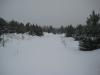
Snowy Drive Down the Peshekee Grade
Katie and I woke up at a small Ishpeming motel to find the ground covered in snow. This was more than a little surprising, as it was the second week of May, but the Upper Peninsula likes to misbehave in the late spring. We packed up the car with Logan and headed west on US-41 towards the Peshekee Grade to find the remains of the Iron Range & Huron Bay Railroad.
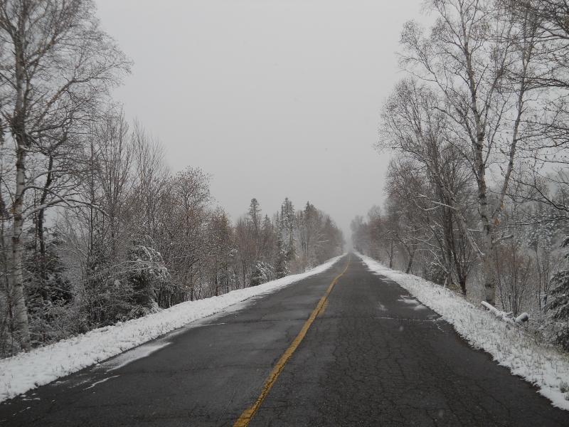
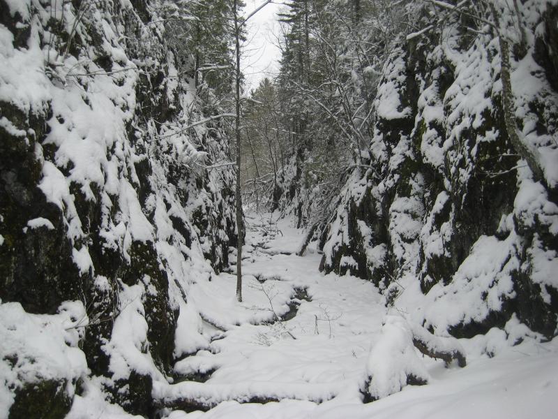
Straight portion of the old grade
During the turn of the century, when the Champion-area iron was first discovered, an ambitious plan was made to build a 36 mile-long railroad to Huron Bay, MI. The track would go through the Huron Mountains and involved deep rock cuts, woodland trestles, a huge ore dock, and a dangerously steep northern grade. Because of the grade and the poor quality of work it was torn up, never to be used. $2.2 million was spent with only vague remnants of the grandiose plan.
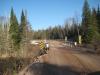
We turned north on the Huron Bay-Peshekee Grade Road, which follows the railroad's route fairly close (at least the southern portion of it). The first section of the road was paved until the McCormick Tract, a large chunk of land in the Ottawa National Forest. Ignoring a few sudden zigs and zags where the road avoids crossing a swampy section of the Peshekee River (which the tracks hugged for most of its length), the road had long straight sections and wide, sweeping turns, giveaways that we were on the old grade.
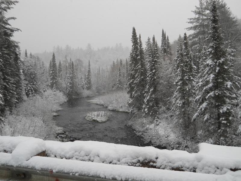
Wintery view of the Peshekee River
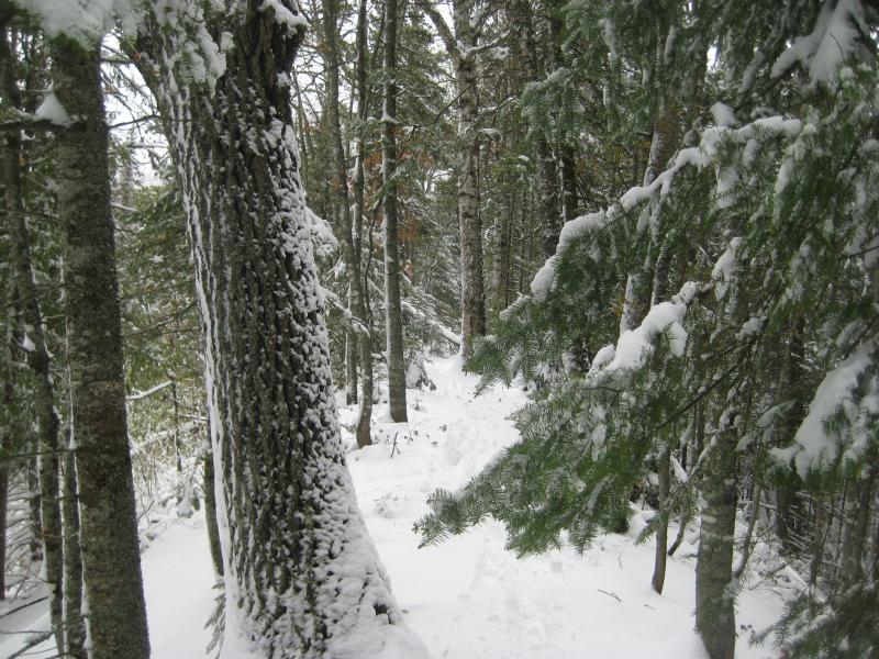
After passing the McCormick Tract the road became dirt, though it was still well kept and easy to drive on. Rock cuts started to crop up, increasing in size as we headed north. We passed at least four of them, with the largest one around 15 feet deep. The road started to get a bit confusing, with numerous forks that look good both ways, but we stuck to the left and stayed on the track.
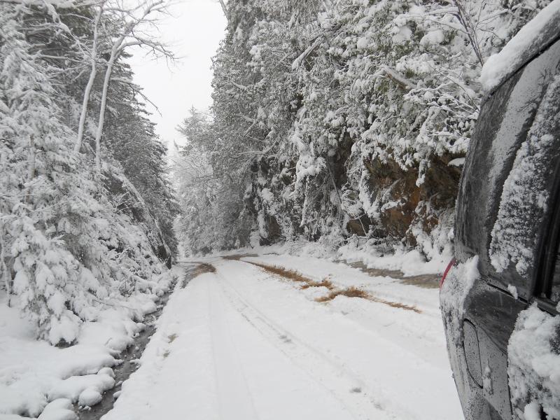
One of the smaller cuts for the road
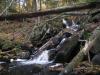
Near one of the cuts, just south of the fork to Roland Lake, we parked at a small pull-off on the right side and I headed down a path with Logan. I had heard rumors of a waterfall on the Pesheeke River near this cut called Haypress Dam Falls. The guess turned out correct, with the river cutting a deep channel into dark rock while dropping from one swamp to the next. A well-trod path from the road and a small clearing made this an easy place to visit.
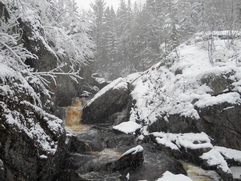
Haypress Dam Falls
Continuing north, we came to a fork in the road where it was obvious the train continued straight through a sudden dirt trench. This was the spot of the deepest cut on the line, or Summit Cut. Heading right would give us easier access, though we ended up getting confused with some recent logging near the cut and wandered around for a long chunk of time before stumbling on the southern edge of it.
The cut is at the end of a long dirt trench and I had a hard time getting down to the bottom of it. Walking through it was incredible: the walls soar up over 50 feet on each side and are mere yards apart. The snow emphasized the rugged cuts through the rock on each side. It's hard to imagine how difficult it was to make this cut in the late 1800s without modern machinery.
Summit Cut
After exiting from the north entrance I found the proper path to the cut, which leads back to the road we came in on. Continuing north took me on an elevated grade that leads out over the swamp the train had to cross. This grade was very high, made of the fill from the cuts behind me, and I could see glimpes of tree tops to the side. It suddenly ends where a trestle once began, so I headed down the end to the swamp, hoping to find more remains. I managed to find some old rotting timbers from the trestle near the water's edge but no upright structures.
The high grade north of Summit Cut
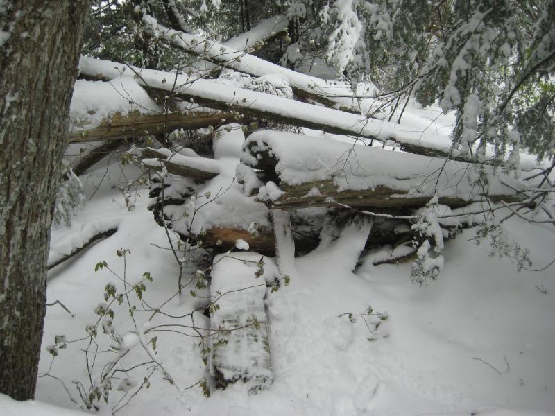
Railroad ties from the swamp trestle
I headed back to Katie and the warm car quite happy about finding the cut. We headed out and promptly lost the grade, ending up on Silver Road. I've tried several times to stick on the grade up past Mt Arvon with no luck. Silver Road is relatively rough compared to the grade we were on, especially with the wet snow, and we were both glad when we finally made it to Arvon Road.
Our last railroad stop was at the Arvon Slate Quarries. Passing by Black Slate Falls we headed up to the first pit on Slate River for lunch. The quarries were amazing to see, with piles of broken slate surrounding the peaceful water-filled pits. There's more pits further east and south, but we stopped at the first one we saw. They were easy to find, being the only two-track that continued along the river by the upper falls led through a fruit orchard to them.
The railroad continued from the quarries to Huron Bay down Arvon Road. This is the section that has the steepest grade and was one of the primary reasons why the venture failed. The large ore dock started where the road turns to end at Skanee Road, towering over the town and shoreline of Huron Bay. Only pilings remain here, though you'll need a boat to view them legally.
The Iron Range & Huron Bay Railroad led from Champion to Huron Bay through the heights of Arvon mountains. The Huron Bay-Peshekee Grade is a very easy way to visit most of the route and the Summit Cut is the most impressive feature of the railroad. If you're interested in the history, I'd recommend buying Robert Dobson's 'The Railroad that Never Ran' from an Upper Peninsula bookstore. The book contains historic pictures, information, and some excellent directions to find even more remains of this route.
-
Jacob Emerick
Aug 3, '10
True - cutting through that logging area was... fun :P
-
Kay Huey
Jul 5, '11
Your photos are great!Way back when, my Dad used to take us all to "L'Anse the Hard Way," following your path. I tell myself that it was easier then, because there were fewer, very confusing logging roads. I've tried it myself and only once made it all the way. Congratulations!
-
Jacob Emerick
Jul 6, '11
The Peshekee Grade is a real fun drive! Do you remember what roads you took (well, what named ones, that is)?
-
Al Beck
Nov 7, '11
How far north of the Haypress road fork is the Summit Cut? I really want to make it to the Summit Cut next year. Thanks
-
Jacob Emerick
Jan 20, '12
Hi Al! About four miles north of that fork you'll bump into another fork where the railroad grade continues straight. Peshekee heads to the left, a dead end logging road heads right. I went to the right here for another 1.5 miles. There was some recent logging here so it might be hard to pick out the right one, but there is a two-track that goes straight to the bottom of the cut. Good luck!
Add to this discussion-
Jacob Emerick
Jan 20, '12
Double true that Kay - AAA gets real scary west of the Yellow Dog. It's not easy to get from L'Anse to Big Bay. I took it in a Taurus one evening... still not sure how I didn't get stuck in some of those mud holes.
Add to this discussion-
Jacob Emerick
Apr 13, '14
Ah, thanks Michael. Didn't mean to portray that, just meant to pinpoint the highlands south of the old town of Arvon.
Add to this discussion-
Jacob Emerick
May 16, '15
On Google Earth? If you don't mind, John, I can send you a KML that should have what you're looking for. Should be able to load/view that in Earth with no problem.
-
Jacob Emerick
May 21, '15
Ah, apparently Google Maps and Google Earth don't like each other. Anyways, here's the route I drove: https://goo.gl/maps/JqlESAt the end of the drive is a two-track that leads west. Follow this for a few hundred yards until a creek cross the path and an obvious trail leads off to the left. The trail should be straight and obviously man-made - the old railroad line. The rock cut is right up the trail, visible from the track, and should be easy to find.
Add to this discussion