Yellow Dog River
The Yellow Dog River has recently gained media attention as one of the two waterways endangered by the proposed Eagle Project sulfide mine. This mine would be located on the Yellow Dog Plains near the headwaters of the Salmon Trout River and Yellow Dog River, potentially threatening two pristine rivers of the Huron Mountain area. The river was well known before the proposed mine, though, as it has ample recreational potentials along its length.
Yellow Dog River's route
Starting with two main branches in the McCormick Tract, southwest of the Yellow Dog Plains, the river begins as a series of lakes and swamps that once hosted the famous island fortress of the Bentleys and McCormicks. Because of these swamps, the river has a yellow/brown color during spring melt or heavy flow. The branches flow north, almost parallel, out of the highlands and fall over a hundred feet. These waterfalls, West Branch Falls and Bulldog Falls, are located on West Branch Yellow Dog and Yellow Dog respectively and are within walking distance of the Triple A road.

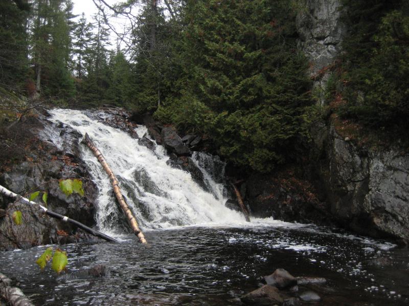
Bulldog Falls in the McCormick Tract
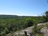
After the waterfalls, the branches join and start to head east along the southern edge of the Yellow Dog Plains. This area is all swamp - called the Yellow Dog Swamp, but the river slowly begins cutting a deep gorge after passing the small Wylie Dam Falls. Rapids intersperse the river after these falls, and it begins to drop in elevation again. By the time it reaches Pinnacle Falls, a well-known and impressive waterfall with marked trails, the sandy gorge is over a hundred and thirty feet deep. This deep river valley cuts a nice southern border for the Yellow Dog Plains, with the pine-covered sandy plateau to the north and rocky mountains of the Peshekee Highlands and Mulligan Swamp to the south.
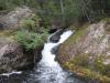
Pinnacle Falls
Continuing east, the river meanders slowly out of the plains and into the mountains until it hits County Road 510. The deep gorge shallows out a few miles from Pinnacle Falls, though the river carries a good amount of sand downstream to form sandy banks. An interesting change in the river starts a mile after crossing under 510 - rock. The hard bedrock of the Huron Mountain area forms a series of seven waterfalls with little to no gorge. These drops are fairly east to get to, though the trail disappears before the last falls. The last drop is located at the mouth of Bushy Creek, and the river begins meandering slowly north calmly to enter Lake Independence, then Lake Superior.
The series of waterfalls, called Yellow Dog Falls, is the most visited and familiar area of the river. Hikers can easily visit the first drop along a well trod path, with camping spots and fire pits along the route. Kayakers will take all seven drops during the spring melt, as there is a road near Bushy Creek's convergence for easy pickup. One of the most interesting uses of the area is panning for gold - either from the sediments carried from the Yellow Dog Plains or the tributaries (Bushy Creek, Big Pup, Little Pup, etc) has been known to hold gold traces.
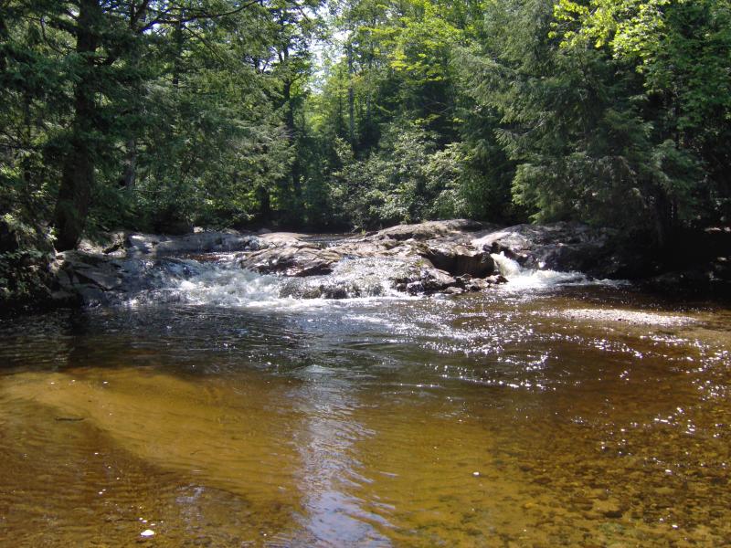
Yellow Dog River below some falls
The Yellow Dog River, located along the Yellow Dog Plains and Huron Mountains, is an accessible and enjoyable river for many types of visitors. To visit the waterfalls and lakes at its headwaters, you'll need to do some research about the McCormick Tract and the regulations and area there. The Yellow Dog Swamp can be found on the southern two-tracks off of the Triple A road, though cabins and private property dot its perimeter. Pinnacle Falls is located at the end of a small maze of two-tracks with an easy path. The series of waterfalls can be reached right off of County Road 510, with a parking area next to the bridge over the river.
Comments (1)