Bald Mountain
On several adventures east of Skanee, MI during the summer of 2008 I noticed a large mountain near the mouth of the Huron River. It wasn't until I started looking at geocaching websites for interesting hiking spots that I learned its name, Bald Mountain, or noticed that it was the easternmost point of the Huron Mountains. There are several rocky peaks closer to the Huron Mountain Club property, offering potentially great views of their rugged landscape, but Bald Mountain offered three rocky outcroppings, an altitude of 1,184 feet, and a good view of the Huron River and Keweenaw Peninsula. So I decided to climb it.
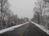
Hoping for good weather, Cory, Logan and I headed over Big Erick's bridge around 9am on a cold Saturday morning. While the weather wasn't bad during the drive, it was snowing lightly for the entire way down. We were surprised to see that the roads were plowed past Huron River all the way to our planned entry route, allowing us to park several dozen yards from the snow covered two-track leading north to the mountain.
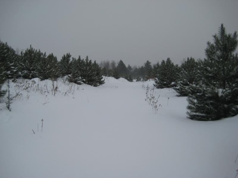
Trail through the Mead Forest
Neither Cory nor I had snowshoes; we didn't think the hike was long enough to warrant renting them, especially since Katie had made it very clear that we were to be back by 1 pm so she could take the car to work. We did bring along basic survival gear (knives and matches) and were quite bundled up against the low-teen temperatures. Besides, after a quarter mile of trudging through knee deep snow, we were both quite warm from exertion.
The first bit of the hike was merely along a two-track that is probably suitable for driving during the summer. After meeting with a small tract of pines, managed by Mead Paper Company, the road split in half. It appeared that both roads would take us to the mountain (they just make a loop), but we took the right one to get better views of the upcoming climb. The road split again and we took the left fork, as the right one led down to a swampy creek.
During the hike through the managed forest, we were surprised by the depth of the snow protected by the small trees. While our path was only about knee- to thigh-deep, four foot drifts in the midst of the trees were only yards away. If there hadn't been the two-track, it would have been impossible to force our way through the drifts and branches.
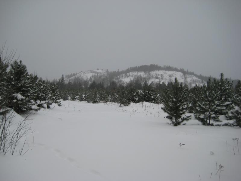
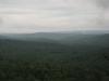
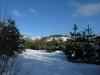
First view of Bald Mountain
After twenty minutes of hiking, we finally saw our goal - a forbidding snow-covered bulge in the distance. We were aiming for the southwest peak, which appeared to be the tallest and steepest of the three. The mountain disappeared as we continued out of the Mead forest and into the older forest that surrounded the base. Luckily, when we cut off the road towards the mountain, we missed the swamp on the southern side and only had to cross a tiny, frozen creek before heading uphill.
The hill rose quite quickly before us. Numerous large rock outcroppings forced us to wind our way forward, but we were able to make good time up the small canyon between the two southern peaks. We took a small pause about two-thirds of the way on a large ledge to catch a sweeping southern view. Though the snow was falling thicker now, we could make out the nearby swamp and also see a steep peak to the southeast near our road.
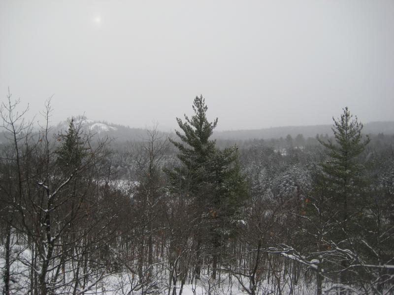
View from midway up Bald Mountain
Logan was having a fun time in the snow, and both he and I got excited when we saw a blue, icy formation that looked similar to a frozen waterfall. I had taken him on the majority of my waterfall hikes, and he learned that flowing waters or frozen falls usually meant the trip was half over. When we continued past it, though, he didn't seem too upset that we were spending more time in the snow.
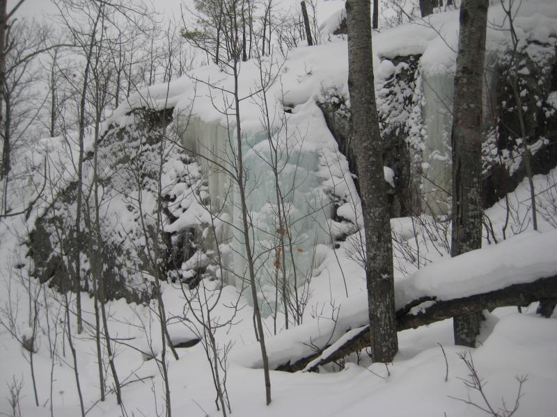
Frozen blue waterfall
The hardest climb was at the end. There were few trees up here to provide handholds and we were forced to crawl on our hands and knees through the steep, fluffy snow. The peak had surprisingly deep snow, and the only stone we saw up there was a small, snowy cairn. The wind was quite cold and the snow had picked up during the climb, so our visibility was limited to less than a mile. Unable to see Lake Superior or even the road where our car was parked, we headed down the mountain a bit disappointed.
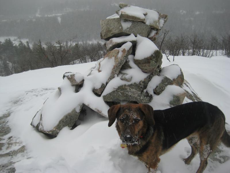
Snow covered Logan on Bald Mountain
The trip back was much easier for Cory and me, with the slope allowing us to trot most of the way. Logan, however, was getting quite cold by this time without any extra gear on. By the time we made it to the managed forest, he was running ahead of us so he could sit and hold his paws up out of the snow. I ended up carrying him on and off for the last half mile - though he did jump out of my arms and start running around again when he saw the car. When we got home, the first thing I did was look at dog boots for him so we could make these longer hikes without worrying about frostbite on his paws. Several weeks later we bought Bark'n Boots from Ruffwear for winter hikes, which help quite a bit with his endurance in cold temperatures.
Overall, the hike was about 3 miles and we were able to make it there and back in two hours without snowshoes. We may not have seen much on the peak, but the views promise to be better on a clear day and the climb wasn't bad for a mountain. I'd recommend this hike to anyone with a good sense of direction and willing to climb a few hundred feet.
-
Jacob Emerick
Dec 13, '09
The road is hard to find for the first time. This wasn't the first time I had been looking for Bald Mountain - right around the third or fourth. Tick Mountain is quite a way to start out in the area! I was smart on the last trip and approached it by heading up the western side, but the first few times were up the southern cliffs. Bald Mountains is really quite easy if you take the southern gorge up. Cory and I managed to get up and down it w/o snowshoes in a pretty reasonable amount of time. Haven't been on those knobs, either. An absolutely horrible hiking idea that I've been playing with is to make a full circle that includes Raven's, Superior, Cliff Lake, Cliff Mountain, Tick Mountain, and Bald Mountain in one go. These knobs would be right in the path of that loop. Alternately, a shorter triangular loop from Bald Mountain down to the shoreline would hit up several of the knobs in a sub-five mile hike.
-
Joel Schuett
Dec 15, '09
That full circle hike hitting all the local high spots would be sweet, but to do it all in one day would be absolutely insane (if even possible!?!) I would think it would take a weekend to make that trek!! Maybe start at Raven's Nest, SE to Superior, SW to Tick, E to Cliff Mtn., SE to Cliff Lake (camp for night on shore of Cliff Lake), NW to unnamed peak near Bald Mtn., NW to Bald, N over summit of Bald to knobs on northern slope of range, E back to Raven's Nest. That would be a HELL of a loop!!!!!!!!
-
Jacob Emerick
Dec 18, '09
But it would be an awesome one :D It's actually only about 14 miles, along bare rock and some two-tracks. Ignoring the height changes and stopping for the views, about five hours of hiking. But those (plus detours around the cliff faces) are some pretty big assumptions... Camping on the shore of Cliff Lake would be epic and taking extra time to wander Mt Benison might make it worth splitting over two days. Depending on where HMC property lines are, there's Mink Creek I'd like to view on the east side of Benison. Also, still depending on their property, one could climb up Mount Ida and view Mountain Lake from Tokiahok Point. I know they own a good chunk to the north (Howe Lake, Lake Ann), Mountain Lake, and almost all of Cedar Creek to the south, but I don't know where Mt Ida falls.
-
Joel Schuett
Dec 20, '09
Yeah, it would be really awesome!! 14 miles is totally do-able, but there would be a LOT of up & down along the route to add considerable distance!! What is Tokiahok Head/Point?? I've seen it marked on maps, but have no idea what it is! As for Mt. Benison, check this site out, http://uphiking.blogspot.com/2009/11/preserve-at-mt-benison.html then follow the link to the Nature Conservancy website. It looks like there are some limited views from Mt. Benison, including a sweet one of Mountain Lake! Mink Run is also included in the Conservancy property! I am definitely going to try scheduling a guided trip, not only to check out Mt. Benison and Mink Run, but also to legally travel and hike through the HMC on the way out to Mt. Benison!
-
Jacob Emerick
Dec 21, '09
Awesome find! Do you think that picture is of Cliff Lake or Mountain Lake? And double awesome on Mink Run! I'm really quite intrigued... I didn't think the Huron Mountain Club owned the land west of Mount Benison. Even if they don't, driving on their property would be beyond amazing. Oh, and Tokiahok Head just looks like an southeastern point of Mount Ives. I haven't been able to find any additional info on the name.
-
Joel Schuett
Dec 23, '09
He mentioned that they spotted a lake to the south that he thought was Mountain Lake, so I just assumed that is what the picture was of... Looking at it, it looks like it could be the southern end of the lake, where it widens back out again after going through a narrower, slightly river-like area in the middle. Of course, it could be Cliff Lake too... I think the Nature Conservancy should attempt to purchase the parcel that contains Tick, Superior,& Cliff Mtns. and the other area outcroppings and combine it with the Mt. Benison Preserve keeping access open for us "common folk". Plum Creek currently owns this land, and I worry that some day the HMC (or, worse, some private developer) will buy it and prohibit access to these beautiful, scenic areas..
-
Jacob Emerick
Dec 27, '09
I agree! There's not that much of the Huron Mountains for us to enjoy as it is... Few knobs outside of Big Bay, Sugarloaf/Hogback, and these peaks. I can easily imagine the Club eating up the rest of the land east of Little Huron River, as most locals are focused on the Salmon Trout River area... Surprised that Plum Creek owns it, though. I thought they gated off the roads on their land, guess I was wrong on that.
-
Joel Schuett
Dec 29, '09
I'm pretty sure when I checked a plat book (which was a while ago..) it said Plum Creek for that particular section of land. I really could use a Marquette County plat book, but they aren't cheap, and also about 4 years out of date!
-
Joel Schuett
Jan 1, '10
Check this link out! http://www.miningjournal.net/page/content.detail/id/537308.html I don't know what the "Huron Mountain deeryard" is, but 1,280 acres is two full sections of Plum Creek land in the NW corner of Marquette County. I'm really hoping this parcel encompasses the rock knobs that we know and love!! This purchase would make them public land and preserve access to this portion of the Huron Mountains!!
-
Jacob Emerick
Jan 5, '10
Interesting! I wonder where this parcel is... Hoping you're right on the knobs. That would be nice to keep it public and away from the Club's reach.
-
Joel Schuett
Jan 9, '10
I haven't been able to find out much more info on that parcel, they probably won't say much about it until it is a done deal...I saw they have 2009 Marquette Co. plat books available now, so I went ahead and ordered one, maybe that will help to figure out where these parcels of land are located! Either way, this parcel is 2 square miles in area, located in NW Marquette County, so it HAS to have some good stuff located on it! Also, I remember looking at the 2006 plat a while ago, and thinking that there was some pretty interesting CFA land along the south edge of the HMC that I had thought was a part of the club, so I cannot wait to check the new plat and see if those properties are still enrolled! I'll let you know once the book shows up in the mail...
-
Jacob Emerick
Jan 11, '10
Cool on the Marquette Plat book... I might pick one up too. One area south of HMC that I've been interested in for quite some time is near Canyon Lake and Burnt Mountain. If there's a chunk of that mountain that is on CF land, it'd be great to climb up 'er... It would look straight up Mountain Lake and at a good number of surrounding hills.
-
Joel Schuett
Jan 14, '10
OK, I received my plat book, if the parcel the DNR wants to purchase is in the very NW corner of Marquette County, there are only 4 640-acre sections of land that Plum Creek owns in the area, and two of those four sections are the ones containing the knobs that we hike! The article said the acres to be purchased are contiguous, so it is all one big chunk, and the knobs are located in the sections that are right in the middle of the four potential sections that could be purchased! So it seems like the odds are pretty good that at least some of the knobs will be included in the land purchase!! Keep your fingers crossed!!
-
Joel Schuett
Jan 14, '10
I would highly recommend purchasing a plat book, they are good map books, and are large enough that I mark waterfalls, mountains, old RR grades, etc.. in them, sort of making my own custom atlas to use! As far as the HMC, there is a lot of interesting CFA land to the south (owners are "Caroll Paul Forest" & "Longyear Realty Corp."). You really need to see the book, but I will try to give a rough description...just about all of Elm Creek is CFA land, there is a portion before it empties into Ives Lake that is HMC land. A portion of Fisher Creek is CFA land. Ives Hill is mostly CFA land, Lily Pond and Florence Pond are CFA land. The shores of Ives and Mountain Lakes are HMC, but CFA land extends from Northwestern Rd. north all the way to the west of Mount Ives (in between Ives and Mountain Lakes)!!! The south side of the Breakfast Roll looks to be CFA land, and CFA land extends all the way from Bald Hill (another lookout I haven't been to yet) north of Big Bay all the way north to the shore just to the west of Salmon Trout Point!! It looks like we have alot of cool exploring to do!!!!
-
Joel Schuett
Jan 14, '10
Also, there is a large chunk of CFA land between Northwestern Rd. and Burnt Mountain (pretty much all the land between NW Rd. and Burnt Mtn. is CFA, actually), so that area you are interested in for the views of Mountain Lake may be accessible....
Add to this discussion