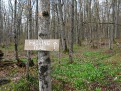
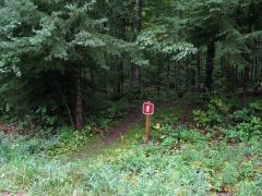
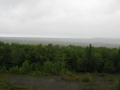
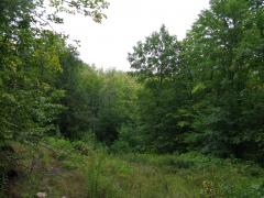
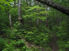
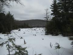
Lookout Mountain

Emily and I had just finished a long hike along Norwich bluff which left us soaking wet, cold, and tired, but there was still several hours of light left in the day. We drove down the bumpy Victoria road east from Norwich Road to the start of the houses near Victoria Dam, parking at a small gravel turn off by an unoccupied white house. Lookout Mountain was south of here, along a section of the North Country Trail. North of us looked a bit interesting, though, so we took a short detour to the top of a large poor rock pile.

Cloudy view from the poor rock pile

Cloudy view from the poor rock pile

The Victoria area is built around the ruins of a large, profitable copper mine from long ago. A historic town, some old names, and a large dam are all that remain here today, though. I am not sure where the exact shafts are located, though I did hold a small hope that Emily and I would find one today. We stood atop a large poor rock pile that cascaded down the hill below us, clearing a view of the Ontonagon River valley and some rain-shrouded hills in the ...

read more »

Norwich Bluff

A cold, misty morning wrapped around Norwich road like a tunnel as I barreled south from Ontonagon. I was meeting a friend at the North Country Trail parking area near FR630 and was running late. It turned out that Emily was also behind schedule, and we met at the small parking area at the same time. We both donned extra clothes in hopes of keeping dry through the slow drizzle before jumping into my car and driving up Victoria Road.

Misty two-track on the way to Gleason Falls

Misty two-track on the way to Gleason Falls

The Norwich Bluff hike had been on my radar for several years. Most of my hikes tend to be circular - I dislike backtracking and usually have access to a single vehicle. This adventure was a bit too linear to make a good circle. Starting at Gleason Creek, we were going to follow the the edge of a south-facing bluff over hilly terrain to Norwich Road. If there was a single vehicle, I'd have to either walk along Victoria Road for three miles or retrace my hike over the rough terrain. Thanks to Emily and her truck parked on Norwich, we could cut out several extra miles of ...

read more »

Cascade Falls

The parking lot for Cascade Falls was surrounded by a warm green mugginess after the morning's rain. It was easy enough to find, just off a well-maintained forest service road, mere minutes from Norwich Road. I stepped out and quickly put on a jean jacket and baseball cap in anticipation for the black flies that love this area and weather. A well defined and blazed footpath led away from my car into the deep green woods.

Early fork on the Trail to Cascade Falls

Early fork on the Trail to Cascade Falls

I didn't do much research on this hike beforehand and was surprised to find a fork in the path after a few minutes of walking. A sign for 'Bluff Trail' pointed to the left. Unable to turn around from a promising name like that I headed left. The climb was short and steep and I soon found myself on top of a rocky outcropping with views to the south and west.

Trap Hills to the West

Trap Hills to the West

Green Ottawa Forest stretching to the South

Green Ottawa Forest stretching to the South

The views of the Trap Hills to the west were pretty amazing. I've heard good things about this rocky area of the ...

read more »

Haystack Mountain

Of the three volcanic plugs in the Ottawa National Forest (see an earlier post aboutOttawa volcanic plugs), I enjoyed Haystack Mountain the most. It's relatively remote, virtually unknown, and involves a short but challenging hike. A recent trip to the Upper Peninsula brought me close enough to the mountain to stop by for a quick climb.

South from Haystack Mountain

South from Haystack Mountain

Parking my car at the gated two-track off of Lake 13 Road, I quickly hopped the steel gate and waded through the tall grass. There were a few raspberries scattered along the track to sweeten the trek and none of the thistles that had plagued previous visits. Familiar with the area I took the right fork without referencing my GPS. According to older topo maps this fork in the road eventually loops around but I knew from my last visit that the right fork simply ends after a short distance.

The summer undergrowth was very thick in the woods. I struck a bearing roughly 30° to ...

read more »

Cookout Mountain and the Hidden Falls

There is a small mountain and tiny lake located on the western end of the Trap Hills right off of M-64. A blazed trail leads up from the road to the mountain, passing near the lake, before it heads south to the North Country Trail. Known by locals as Cookout Mountain and Weidman Lake, this area first drew my attention during a winter waterfalling adventure.

Snow covered Weidman Lake

Snow covered Weidman Lake

Starting in a muggy mid-morning summer day, I climbed the trail from the road and soon came to a tiny trickle of a creek. White rectangles nailed on the trees continued across the creek and up the next hill, but I turned away from this path and started heading upstream. The undergrowth was not particularly thick, but the creek had a most annoying twisting route within a tiny valley that forced me to repeatedly cross stagnant pools of water and mossy rocks. Attempting to cut straight paths parallel to the creek quickly led me astray, as it was difficult to make it out the creek's path from more than ten feet away. so I continued upstream along and ...

read more »

Volcanic Plugs of Ottawa Forest

The Ottawa National Forest includes almost one million acres of lakes, rivers, waterfalls, and forested hills of the Western Upper Peninsula. Stretching from the Peshekee Highlands north of Champion to the Michigan-Wisconsin border, the forest contains the Sturgeon River Gorge, McCormick Tract, and Sylvania Wilderness Area. Among its treasures are some unique geologic features to Michigan - three volcanic plugs.

Google image of three Volcanic Plugs

Google image of the three Volcanic Plugs

A volcanic plug is the remains of an ancient volcano. Once a volcano becomes dormant and succumbs to the powers of erosion, ...

read more »

McCormick Tract

Located north of Champion, the McCormick Tract is a 16,850 acre wilderness in the Peshekee Grade. Originally owned by Cyrus McCormick, inventor of the reaping machine, the land was donated to the USDA Forest Service in 1967 and is now available for the public to enjoy. In July of 2009 I visited the south west corner of the tract along a historic route to the old camp on White Deer Lake.

Starting from the Peshekee Grade, which follows the old Iron Range & Huron Bay railroad grade from Champion up to Mount Arvon, I parked at the access area with some fellow hikers. The small parking spot had a restroom as well as some informational signs and maps. There is no trail markers allowed on the McCormick Tract, so it was nice to get a short refresher from these maps. After crossing the bridge over the Peshekee River, we followed a well-worn path northeast towards White Deer Lake.

Trailhead sign for the trail

Trailhead sign for the trail

While the trail was easy to follow, the rain-covered, thick undergrowth soon had us soaked. For the first mile or two, ...

read more »

Ontonagon River

As the largest river in the Houghton area and a distinctive brown hue, the Ontonagon River is a well known river. Many of its branches are simply named as sub names under Ontonagon - West Branch Ontonagon, Middle Branch Ontonagon, etc. With its huge watershed, the Ontonagon is the primary drainage for most of Ontonagon and parts of Houghton County.

Google Image of Ontonagon River

Middle Branch and Main Branch of the Ontonagon River

Starting from the southeast, the East Branch Ontonagon River starts from a series of marshes and ...

read more »

Sturgeon River

Winding through Baraga and Houghton County, the Sturgeon River is a large, well-known river system. Driving from Marquette to Houghton on US-41 brings drivers over the river twice, first at Canyon River Falls and then at the Sturgeon River Sloughs. These two spots, combined with the Sturgeon River Gorge, are popular hiking and adventuring locations for tourists and locals alike.

read more »

A Few River Gorges

The Western Upper Peninsula has a unique geology compared to the rest of Michigan. Ancient bedrock creates surprisingly tall mountains and highlands that trap lakes, swamps, and wetlands hundreds of feet above Lake Superior. Throughout the geologic history of the area, glacial and volcanic events have both carved deep channels and helped confine the waters, eventually leading to rivers draining the land through gorges and over waterfalls. Here is a short list of the major gorges of the area, at least the ones I've had the opportunity of visiting.

Looking across Sturgeon River gorge

Looking across Sturgeon River gorge

Sturgeon River cuts one of the more well-known gorges of this area through the flat, sandy Baraga Plains southwest of L'Anse. This gorge is heavily forested, and good lookouts over it are hard to find. The two highlights of this area include Silver Mountain, an ancient volcanic plug, and Sturgeon River Falls, both located in the Ottawa National Forest. Most of the gorge is simply a deep river valley (three hundred feet near the falls), though there ...

read more »