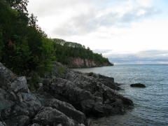
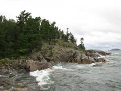
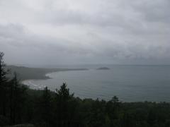
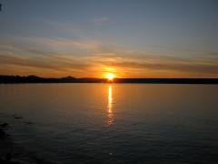
Wetmore Hike Part B - Wetmore Beach

After climbing Sugarloaf Mountain, just a few miles north of Marquette, I headed down the eastern flank towards Lake Superior. With Wetmore Beach to the north and Partridge Bay to the south I stepped out of the cold, soaked woods and was greeted by an amazing view of waves pounding against huge, black rocks.

Waves crashing on the rocky shoreline

Waves crashing on the rocky shoreline

I carefully crept out on the slick boulders until I could feel the spray of the waves as they crashed onto the shore. My hike had been rushed to this point... I woke up early, quickly packed up my campsite, and scrambled up a mountain. This was a great time to catch my breath and really enjoy the scenery.

Cloudy skies loomed angrily over Lake Superior, with a few whitecamps visible far off to the east. I was on a bit of a point, and I could make out both Presque Isle and Little Presque Isle along the shoreline (in opposite directions). The black rocks I were sitting on were ancient, with lichen-covered crags and deep, worn grooves. Some of the waves barely curled over before ...

read more »

Wetmore Hike Part A - Sugarloaf Mountain

Just a few miles north of Marquette is a small collection of interesting locations that I had ignored for far too long. Casting them to the bottom of my list as 'easy tourist' stops, I've driven past the Wetmore area to more appealing remote locations beyond Big Bay numerous times. I rolled into the Sugarloaf Mountain parking lot on a cold, damp morning with an ambitious plan to visit several of these locations in one fell swoop.

Looking north towards Wetmore Beach from Sugarloaf

Looking north towards Wetmore Beach from Sugarloaf

My first destination was an easy climb up Sugarloaf Mountain. It had been a rough night camping near Diorite, with high winds and freezing temperatures robbing any chance of a restful sleep, and I was thankful for the wide paths leading up the mountain. There are two trails leading up the mountain, an 'easy' and 'difficult' route, and I took the difficult route uphill (I'm pretty sure it's shorter). Both trails were well-trod and easy to follow with stairs built on the steeper sections.

The air was cold and damp with a thin fog clinging to ...

read more »

Weekend on Mulligan Part B - Silver Lake Basin

The air felt uncomfortably hot as I walked down the trail, away from my campsite, in the early afternoon. My first Mulligan Plains hike seemed pretty easy, a simple trek around the Silver Lake Basin. There would be little bushwhacking with the lake levels still below normal from the burst of 2003. I carried a single water bottle with me, thinking that the hike would be easy and I'd be back at camp well before dark.

Uninviting upper Dead River landscape

Uninviting upper Dead River landscape

After crossing Mulligan Creek I continued south until I hit some recent logging activity. I headed right, westwards up the hill, wandering around the piles of brush and avoiding the ankle-twisting traps left by the loggers. They only made it a short distance up the hill but I was surprised to see even more logged-out areas at the top. A recently widened two-track from the south gave them access to the entire area at the top. Disappointed by the lack of untouched woods, I headed down the sandy road.

The hill I was on is one of the tallest points on the west side of ...

read more »

Salmon Trout Point

Just north of Big Bay the shoreline makes a final reach north before curving westwards into Huron Mountain Club property. The land here is strangely flat, with an elevation of 120 feet above Lake Superior. Instead of rolling gently down to the water, the forest abruptly stops at cliffs that plunge straight down to the shallow water. Only a few cabins and roads dot the area, making it a large, flat, and empty area jutting into Lake Superior. I probably never would have visited it if it hadn't have been for a fellow hiker who pointed me towards an amazing hiking adventure.

Looking south from Black Rock Point

Looking south from Black Rock Point

My first visit to this area was with Katie and Logan. We had been out all day and were more than a little tired by the time we reached Big Bay. Parking where Sullivan Creek begins to turn left, we headed east to the water at Black Rock Point. A gated two-track took us right to a small camping spot near the small point. This point is really just a small dimple sticking out from the otherwise straight shoreline with ...

read more »