Gold Mine Hills near Birch Creek
Way back in the early years of Marquette's iron years there were other metals that people hunted for, silver and gold and more. There were traces of these precious materials found in creeks and veins throughout the Huron Mountains. One of the more promising finds was along Birch Creek. These explorations didn't last that long, a few years at best, though placemark names and legends remained after the shafts were closed down.
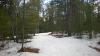
I parked on the side of Gold Mine Road and eyed the woods carefully. There wasn't a lot of snow. Maybe, just maybe, I could try this hike without snowshoes. It'd be the first time today they would stay in my car during an adventure. There were patches of snow scattered around, surrounded by wet grasslands, that could be either avoided or skipped over. It was worth a try. I headed east into the woods, towards the hills on the far side of Birch Creek, pouncing through the woods with renewed energy on bare boots.
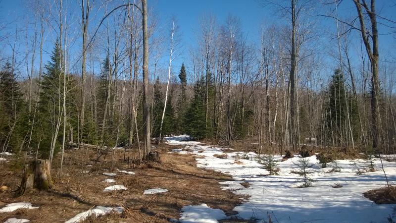
Bare sloppy woods and distant hills
The hike up Saux Head Hill didn't really give me a good view over the Lake Superior shoreline or Granot Loma's land. All that had been visible from the forested hill was an obstructed view of Saux Head Lake and Garlic Mountain. Now, I know that mountain does a good job at masking the cabin and island from most angles, and had little hope of seeing those, but a better view of the rugged terrain and the farm would be nice to see.
My route got a bit swampy. I was trying to avoid the little valley that Birch Creek had carved out, the valley where the falls were, avoiding both the unnecessary climb and possible snow cover hidden away there. Which meant I was stuck in a swampy section of the creek. I hopped and jumped from one dry-ish spot to another, eventually coming upon Birch Creek itself, and easily crossed the swollen waters.
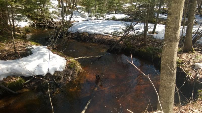
Deep birch creek
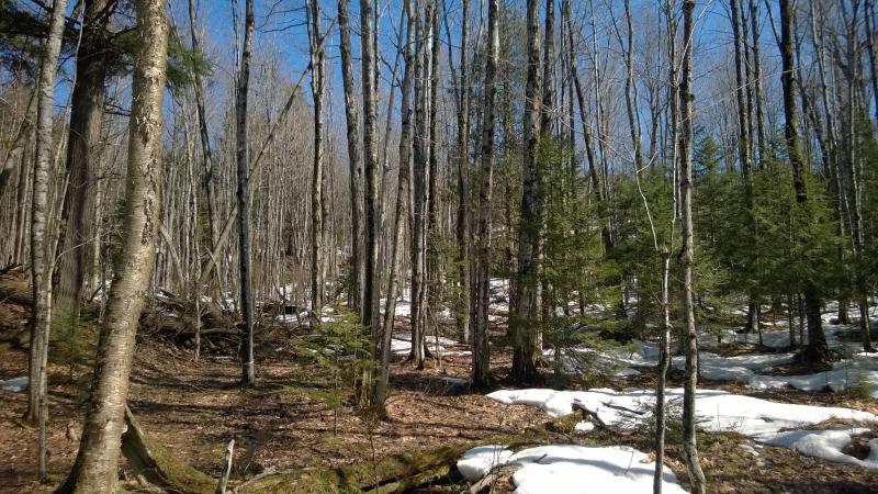
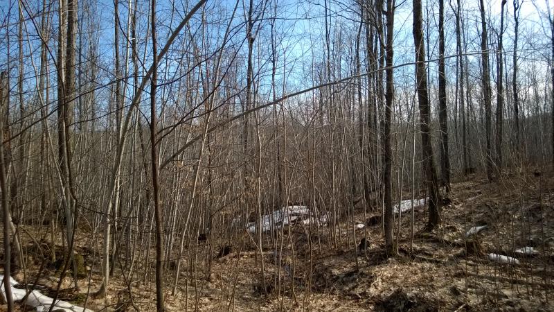
Mixed woods to poke through
After crossing the creek the woods began to slope up and the ground dry out. There were nasty little pines to deal with, clustered branches that blocked my path with long-dead talons, and I pushed and twisted through. It was so nice to walk without snowshoes, have that extra agility to move about without a slow plod. A few wooded slopes and rocky walls and I was looking out over a bald outcropping. It had taken no time at all to climb this first hill.
First views over the rocky outcropping
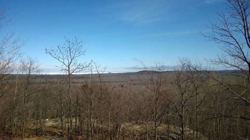
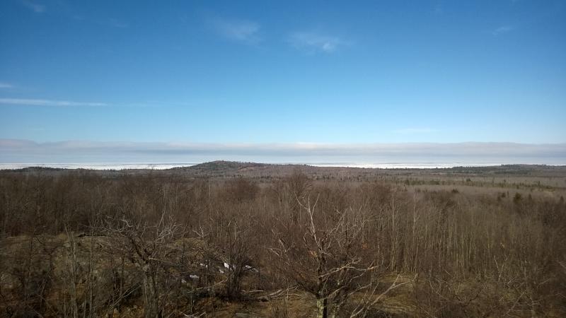
I slowly meandered along the bare rock, letting the sun soak into me and the warm ground heat me from below. This, this was nice. There was some low scrub on the bare top that was easy to skirt around to get unobstructed views. And the views started to open up, wide pans to the north and east, giving me the clear view of Granot Loma's land that Saux Head Hill had denied.
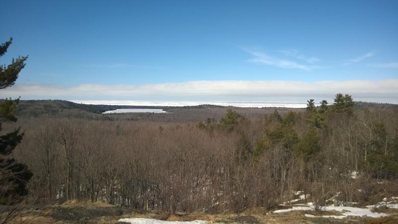
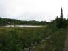
Clear view of Saux Head Lake
Both lakes to the east were white with ice, any open water hidden by the angle. Saux Head Hill lay low on the north bank of the Saux Head Lake, a mere bump in the landscape that barely resembled a hill. Garlic Mountain was barely visible at the moment (though I had little doubt that a better view would crop up soon). Surrounding the mountain was that private land, just dead woods for now. If I could swing further south to get a better angle I knew I would be able to see the farm.
Looking north over the spring forest
Far away car and road
Nothing to the north looked familiar, which seemed odd. I thought I knew this land better than that. There was that little bald peak near Sawmill Lake and then just trees. Couldn't tell if those rises were the mountains around Yellow Dog or not. For a minute I thought the clear cutting in the distance was on Alder but quickly corrected myself. That land was probably eight or more miles away, hidden by several changes in terrain.
Aiming for a better angle I meandered south on the bare hill, eyes scanning the horizon and feet slowly following. There was still a bit of snow tucked behind rocks up here. I unthinkingly stepped off a rock into a drift and instantly plummeted down, left leg sinking to my thigh and right knee crashing into the rock. Well shoot, that hurt. It took me close to five minutes to convince myself that I had no meaningful injury and continue on, knee throbbing slightly with each step.
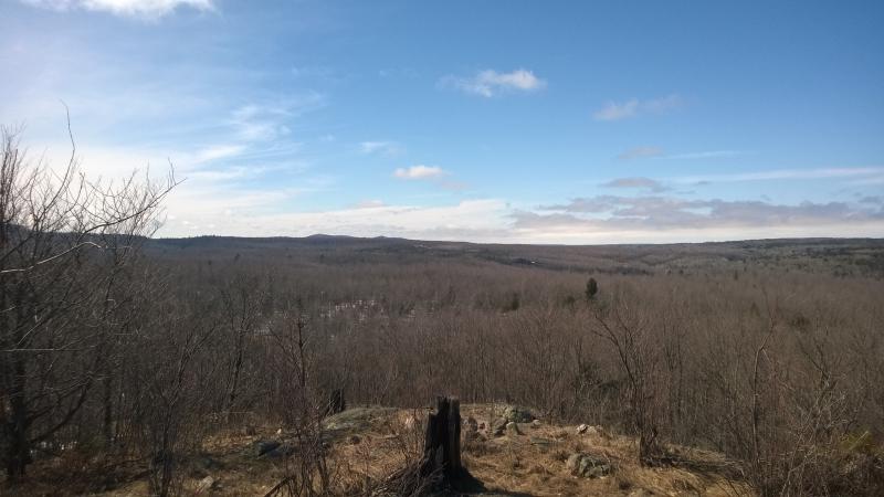
I gave up on the western view and cut across the nasty scrub on the peak of the hill, moving southwest. There was another outcropping on the opposite side I wanted to reach. The low, dry brush scratched and clawed at me, slowing my progress, but I fought back with vigor. It was so nice to be walking without snowshoes and be able to twist and duck with ease. When I popped up from the woods a relatively dull view opened up in front of me.
Even horizon to the west
Everything to the west was muted, any discernible peaks or ridges melded with distance. Hairpin Curve was somewhere out there, as well as the hills around Big Pup Creek, but I couldn't make them out. There were some radio towers, barely visible, that may be from the Wilson/Clark Creek area, and that was it. Just a bumpy line of brown-gray on the horizon.
Hints of Marquette features
The southern view was more interesting. I could make out pieces of Marquette along the shoreline, Little Presque Isle and Middle Island beyond. Some hills rose up to block the rest. I'd get a better view and understanding of those hills in a few hundred yards. Now it was time to descend.
More nasty woods to deal with
There was another hill to climb here to the south with more outcroppings and (hopefully) a better angle on Granot Loma. I tumbled down the woods, lumbering along the steep slope, swinging wide angles around the piles of snow in the shade. At one point I crossed under a giant birch barely propped up by its younger brethren. Yup, that looked like a trap. I quickly moved beyond its shadow.
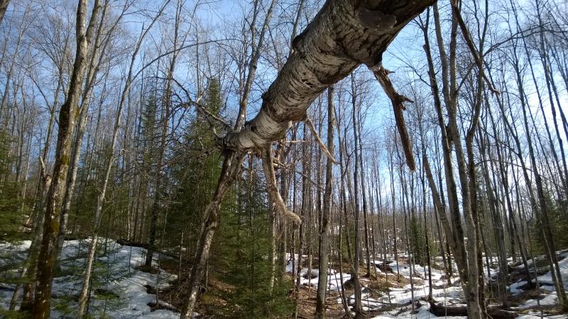
A falling tree trap
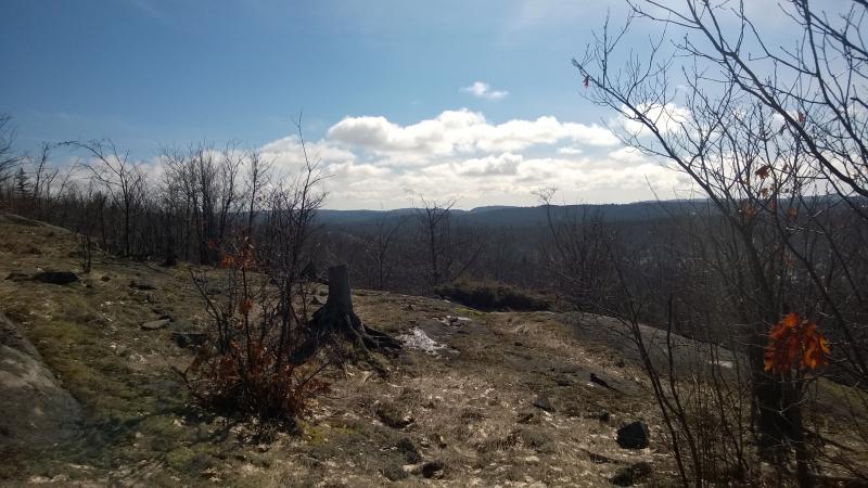
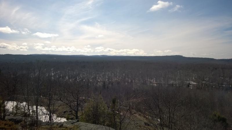
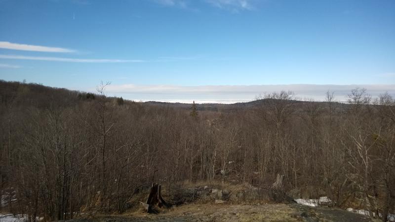
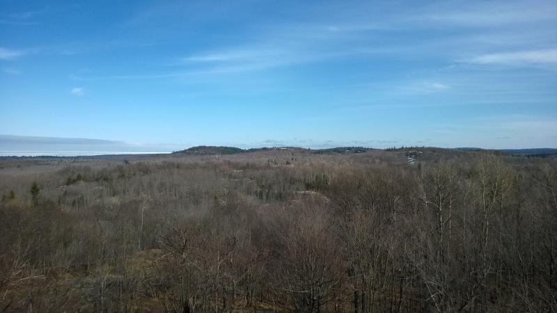
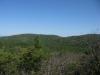
This hill was an easy climb, the saddle low and not as tall as the first one, though the views more impressive. After pushing through the last of the dry spring woods and one quick scamper over a deep snow bank I came out on a large piece of bare rock, north, east, and south all open to my wondering eyes. There was a lot to take in.
East to Lake Superior
Granot Loma land
Outcroppings around Big and Little Garlic River
To the northeast was a narrowed view of the southern Saux Head area. The first hill I climbed blocked the lake and hill, only leaving the ridge leading up to Garlic Mountain visible with icy Lake Superior beyond. Also to the east was the farm of Granot Loma, perched on the shoulder of Garlic Mountain, barely visible in the distance. The buildings had gables and bright siding that stood out from the dull woods.
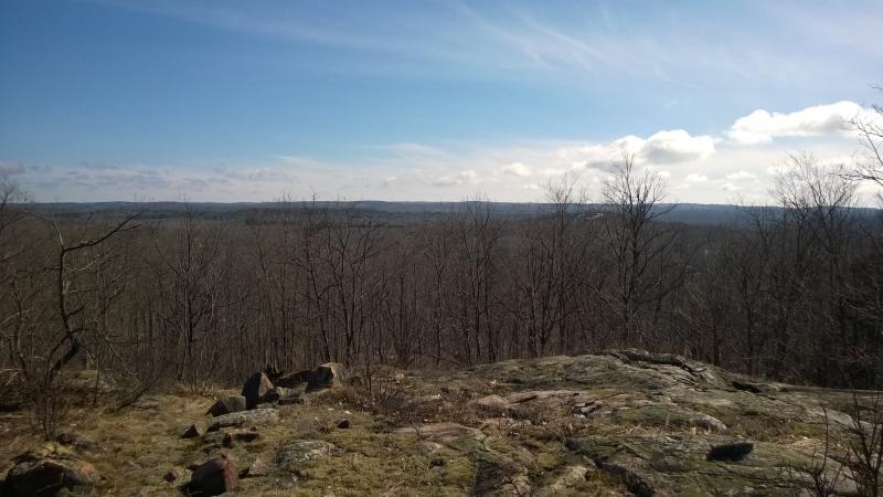
To the south was those hills, now fully blocking the Presque and Wetmore area beyond. The hills around the Garlic Rivers. I've been on some of them, near Little Garlic Falls and Blemhuber Lake, and was still surprised at how much bare rock they have. The tortured terrain reminded me of Echo Lake, which makes sense, as that area is only a mile or so south of the rivers. One could just wander around there and find view after view, though most of the rock doesn't reach too high.
It was time to retreat. I had gotten the view, well, much more than just a view, of the areas that the Saux Head trails had kept hidden. Wandering down the hill I briefly considered going through the woods to the east in circling around to Birch Creek Falls. Eh, I bet there was a lot of snow down there. I headed west instead. There was a logging road glimpsed down here, just above the seasonal creek… ah, yes, here it is.
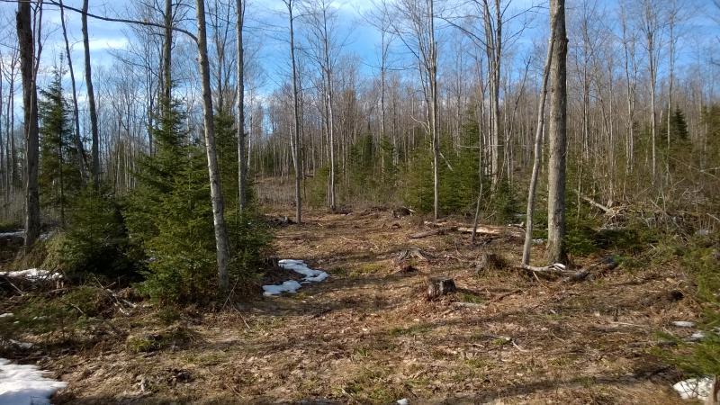
Young pines along the logging road
Trotting easily along the road I was only faced with the mild obstacle of staying dry, as the ruts collected wide pools in the sandy ground. The two mountains and this road formed a bit of a triangle, and with them sitting so close to Birch Creek as it is, I think it took me ten minutes to cross the creek and find my way back to Gold Mine Road. Where I found the private property signs.
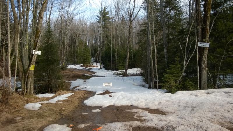
Signs for Granot Loma property
Oh, that was disappointing. Apparently I had been on Granot Loma land for a segment of this hike. That seemed weird, as they are pretty good at marking every inch of their property (well, on the east side of 550, at least). I wonder where I had crossed in at as well as when they let loggers in. Huh. Well, at the very least, next time I'll try that eastern loop to the falls to try to stay off their land.
-
mary smith
May 10, '14
Have you checked the area of the old town of Birch just across from where Gold Mine Road hits 550?This was quite a large settlement;not sure what remains.
-
Jacob Emerick
May 12, '14
Nancy - yes, it would be a lot of fun to visit it! Though kayak (or ice walk) is the only good way I can imagine getting a good look at the cabin. Or climbing Garlic Mountain. Bit worried about that now with the giant windmill and everything ;)Mary - oh, no, I haven't! I've snuck a few looks over while driving on Saux Head or 550 and never saw anything, curious about the map marking of Birch. Do you remember when the last of it was abandoned?
-
ms
May 13, '14
They started setting up camps and building houses around 1905;not sure how long people lived there,perhaps about 1920. This was a settlement with stores,school, post office;about 500 people at one time. Large saw mills of course. We walked around in maybe 1955;there were foundations left just off the road about 100 feet. Tracks were there at the time. Until I read Rydholm's book, I just did not know how large a town this had been.Good pictures. Did you get listing on Second and Third Bass Lakes?
-
ms
May 14, '14
I see that area where Birch was is owned by Loma Farms;they probably keep an eye on it now.
-
Jacob Emerick
May 14, '14
Oh wow, that's a much larger town than I had imagined! 500 people living in an area, all gone with little to no trace. That's too bad that Loma bought up the land, it would be a lot of fun to wander through and try to retrace the tracks between foundations.Ah, and yes, I got the listing. I'll get back to you soon! Thanks ms!
-
ms
May 15, '14
Louis Kaufman bought this piece supposedly because he wanted to establish a beaver pond in the existing pond, It was fenced but the beaver kept escaping;supposedly the locals trapped his escaped beaver and kept selling them back to him.
-
Jacob Emerick
May 18, '14
Ha, that's pretty funny! One can imagine just how much fun it would have been to re-trap that beaver and sell it back to Louis again and again, especially if it was a common project for local kids.
Add to this discussion