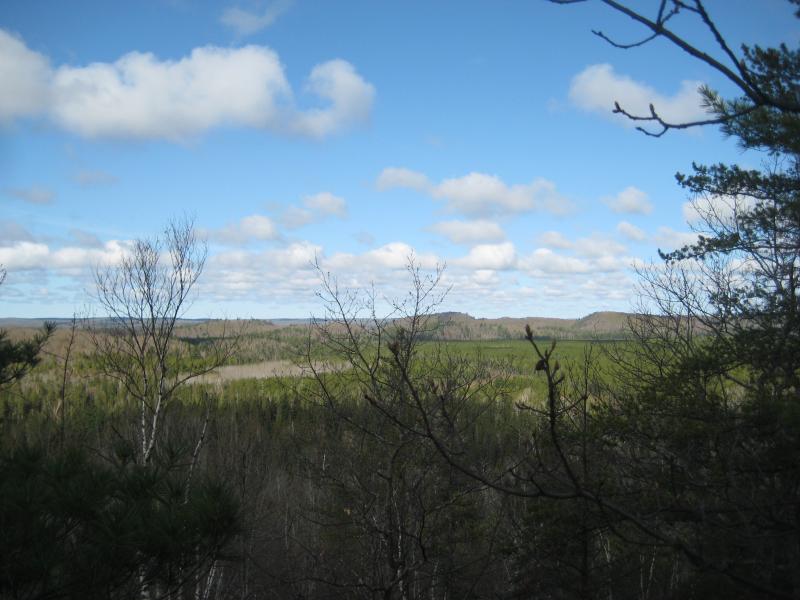
Eastern Cliff of Clark Creek Valley
Cliffs have quickly become one of my more recent hiking interests. Like mountains, they offer some excellent views of the area, and the sharp relief can make for some interesting routes and rock outcroppings. Good cliffs are hard to find in the Upper Peninsula, thanks to the millennia of erosion gnawing down on the terrain. An unexpected ally can help keep the steep rock face from getting buried by its own sedimentation - flowing water.
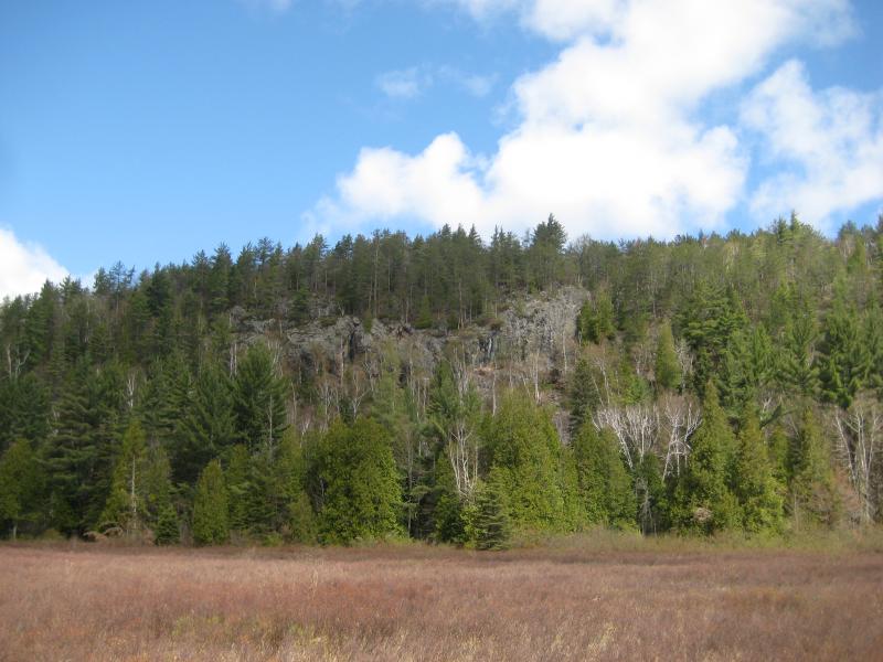
Cliffs of Eastern Clark Creek Valley
A river or a creek flowing at the base of a cliff can wash away any sort of debris that is eroded off of a cliff. I've already seen a number of examples: downstream of the McClure Basin (Dead River), southeastern edge of Mulligan Plains (Mulligan Creek), and the deep gorge near Cliff Lake (Cliff River). Mulligan Plains is the most interesting; with steep slopes stretching along the entire eastern wall, it is only the southern half, with Mulligan Creek flowing at the base, that the cliff's steep rock face is exposed. Today I was hoping to find another exposed cliff face on the southeastern tip of the Clark Creek Valley.
I parked off of County Road 510 a few miles north of the Dead River Basin. A logging road on the west side of the road offers a small parking area before it's gated off, so I parked here and headed up the two-track. The woods were clear with only hints of green poking up through the leaves and I enjoyed the easy path and pleasant views.
The road veered to the right away from my path towards a large radio tower. Curious, I followed it and was rewarded with some views to the east and north. The tower wasn't large but was surrounded by semi-recent clear cutting. The two-track continued north here, but I turned around and headed back south towards Clark Creek Valley.
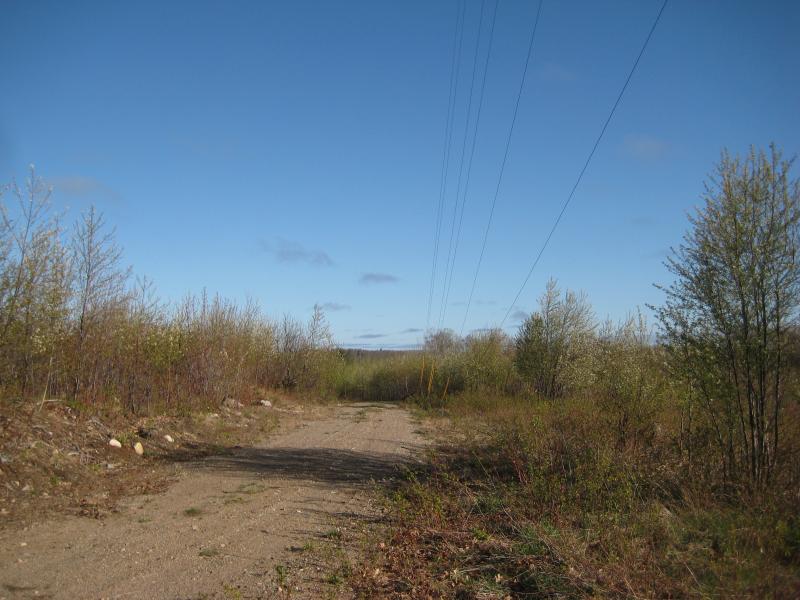
Dusty two-track and radio wires
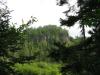
I followed several different overgrown two-tracks until I reached a creek near the eastern section of the cliff. The main cliff was to the right but I headed left first. The creek separates a taller outcropping from the main cliff, so I climbed it first. I managed to find a good view to the south but the tall trees below blocked views to the side. Taking the haphazard route straight down the cliff side back over the creek, I soon found myself on the main northern cliff over the swamp below.
First view of Eastern Clark Creek
Similar to other cliffs in the area, there was no 'sharp edge' to follow. Instead, the ground slowly gave way, getting steeper until it either reached a sharp rock face or merged with the bottom reaching up. Walking along the cliff means constantly climbing up and down a steep hillside, venturing to the edge when the view looks promising and heading back uphill to stay above the cliff. There was a single amazing view about half-way along the swamp below with 180 degree views atop a towering rock face that I spent a good amount of time checking out. The rock was surprisingly level here, making it easy to peer over the cliff edge.
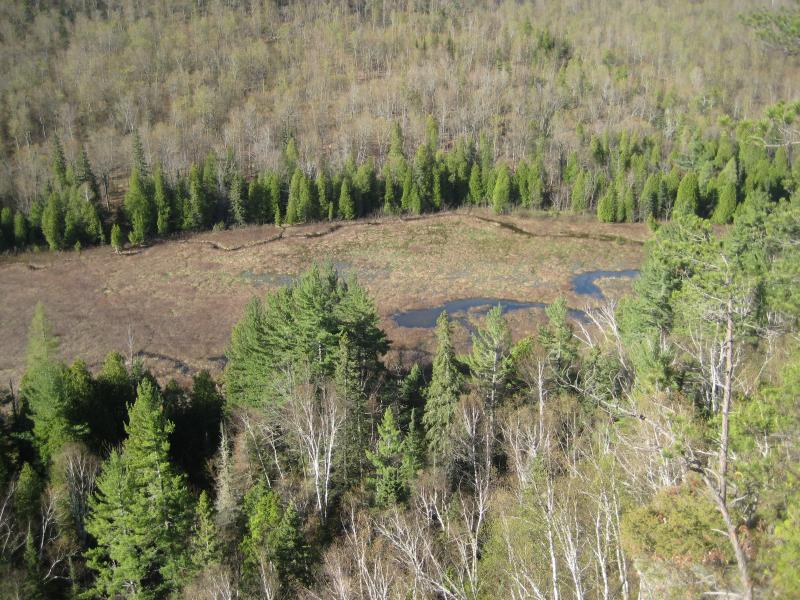
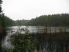
Looking down at the swamp
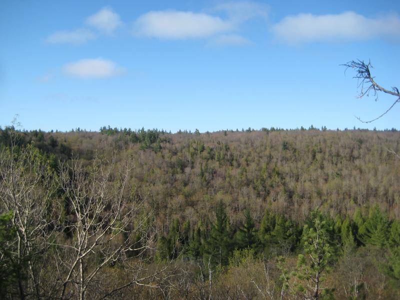
The plan was to follow the cliff edge to Deer Creek. After climbing out of three creek gorges across the cliff path I was ready to cut the path a little short. I had hoped to find a nice view north into the valley, perhaps even seeing as far as my earlier hike to Island Lake. While this angle was never reached, I did reach a good spot to view some of the western hills and a small glimpse of the Dead River Basin before heading down a small, falls-littered creek into the cedar swamp below.
Southwest Clark Creek Valley
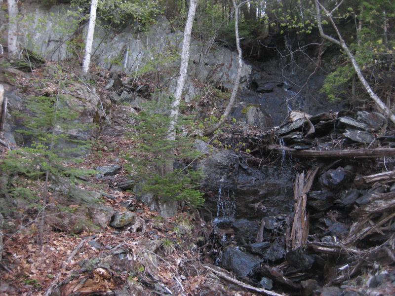
Water trickling down the cliff side
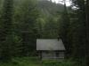
I was not looking forward to hacking my way through the swamp below. While I did enjoy the huge cedars and relatively small amount of brush, there was plenty of damp spots between the roots waiting to swallow my boots or twist an ankle. Luckily, after only a small amount of bushwhacking I managed to find a nice two-track that led to a cabin. A well-marked four-wheeler led from the cabin across the cedar swamp to the south side of the valley and a tiny sauna. Soon I found myself climbing up the south side of the valley towards the Dead River Basin.
Perched high above the Dead River Basin, a peppering of small lakes collectively known as the Silver Lead Mine Lakes had held my interest for quite some time. Just from the location and name I imagined some old mine shafts with sweeping views of the basin below. I did not expect the cabins, though. Each lake has at least one large cabin on it, with docks, wooden walkways, and trimmed lawns spoiling any sort of wild exploring I was hoping on. I made a single quick loop around the outside of the lakes, hoping to find something of interest or an unblocked view of the Dead River Basin, but soon started heading back to the car.
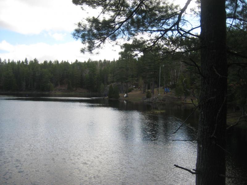
Cabin and dock on Silver Lead Mine Lakes
Unlike the cliffs I had followed in on the north side of the swamp, the south side was a gentle slope with plenty of logging tracks. After following the two-tracks for a bit I headed down the hill to the left towards the swamp, hitting the southwestern edge of it. This portion of the swamp did not have any trees and was only covered by knee-high woody brush, making it easy to walk along. Following it east took me to a strange wooden path north that crossed the deeper sections and took me to a cabin at the base of the northern cliff.
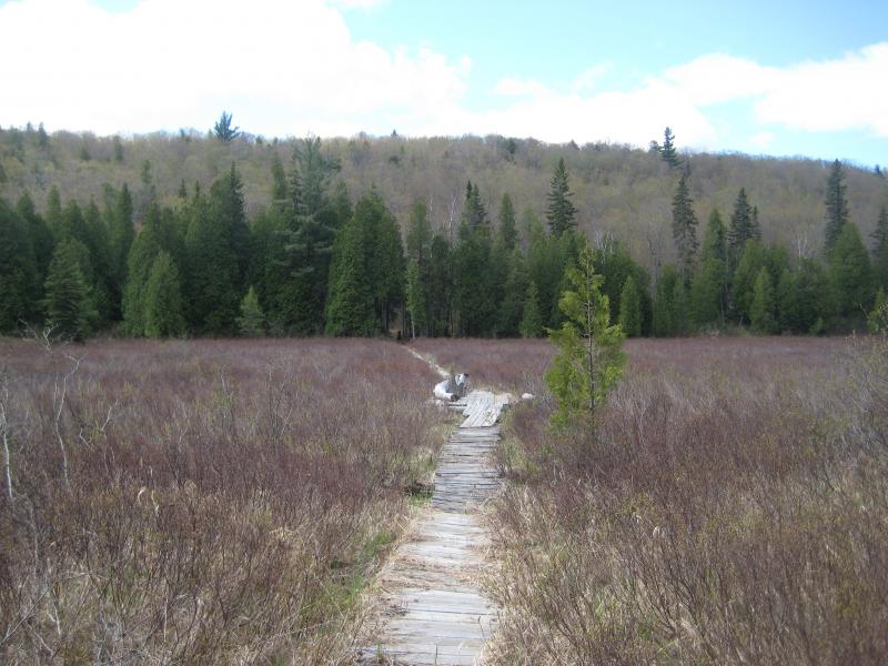
Easy path across the swamp
Instead of taking the creek that I had crossed near the beginning of my hike up to the two-tracks I stuck to the base of the cliffs, heading east until I was within earshot of County Road 510. The gorge I was in headed north here, so I took it parallel to the road back to my car. This added a solid chunk of distance to my hike, and I was exhausted by the time I reached the car. The route also took me past another large radio tower that had been visible from the swamp.
While these cliffs are not as impressive as some of the others in the area, the location and views were definitely worth the hike. The Silver Lead Mine Lakes were not as interesting as I had hoped, though, and I would recommend sticking to the northern side of this area to future hikers. Looking back I wish I had stuck to the cliffs to Deer Creek, which might have offered more western views and wilderness than my circular route by the lakes.

Comments (0)