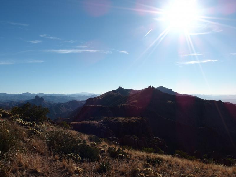
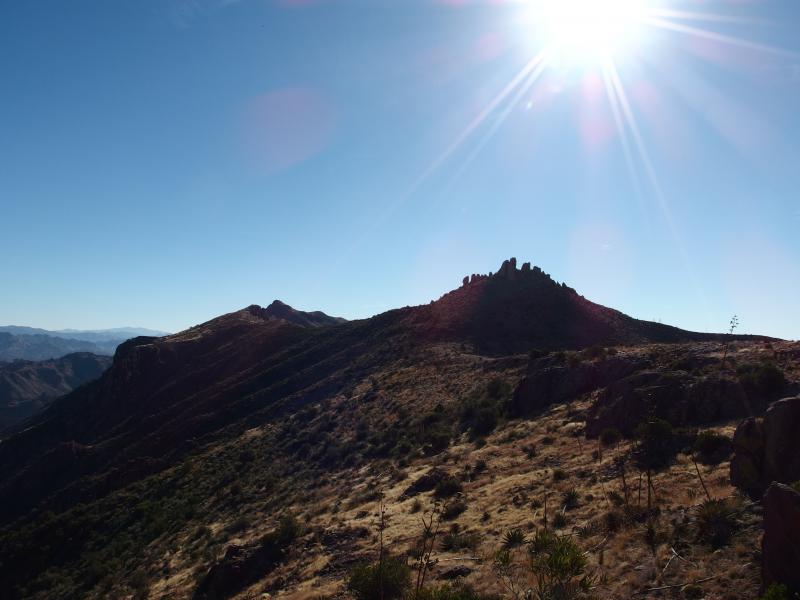
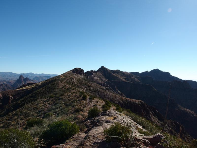
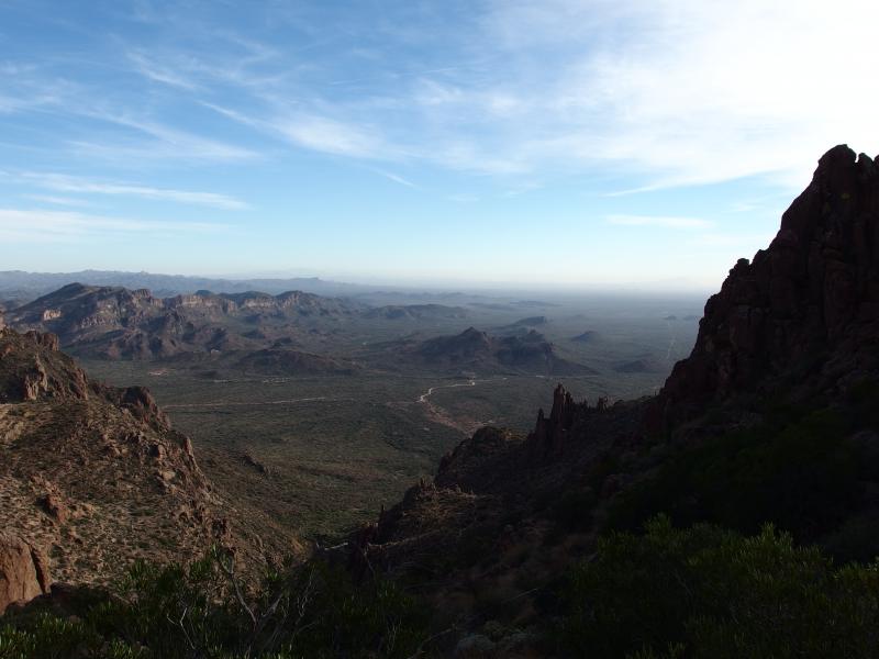
Along the Superstition Ridgeline
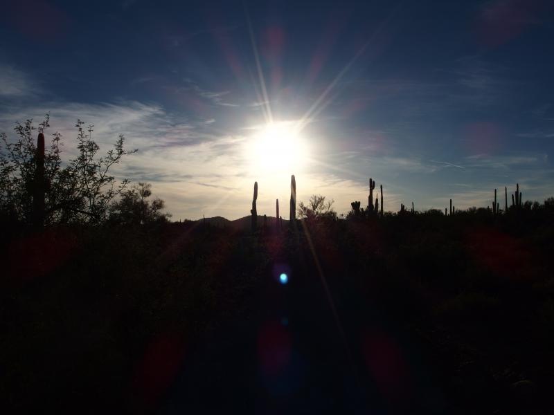
Bleary-eyed we stumbled along the rocky path to Siphon Draw. Chris and I had agreed to an early start for this hike thinking that we'd be familiar enough with the trail to Flatiron to tackle it in the dark. Knowing the general landscape of the trail does not stop you from tripping over railroad ties or boulders along the way. Nor does it stop you from accidentally wandering down side spurs and wasting time backtracking. It was a tough hike to Siphon Draw.
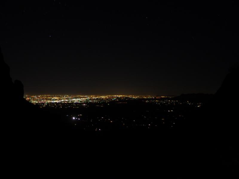
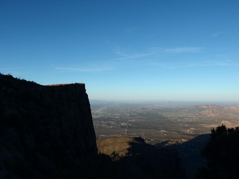
Night lights bright over Phoenix
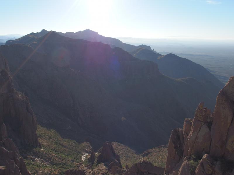
Once we reached the rocky waterfall things began to ease up. The trail is probably easier to follow on the way up to Flatiron, with some sections well defined and others just obvious. The way up from here is within a narrow canyon, so as long as don't wander up one wall or the other too far you're going the right way. As we climbed the sky started to lighten. We had started two hours before dawn, hoping to finish this leg shortly after the sunrise, and it looked like we were going to be right on schedule.
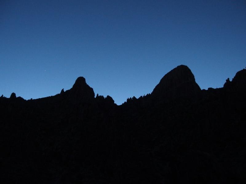
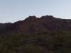
Dim outline of Flatiron in the predawn
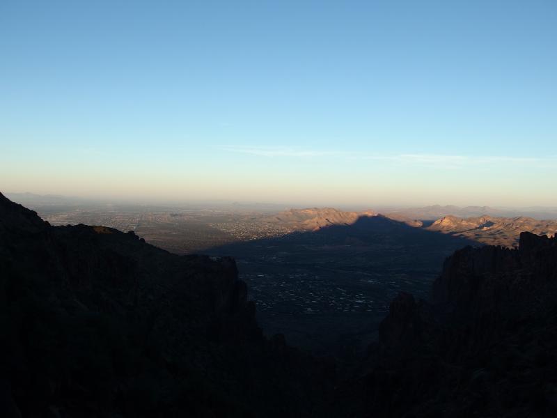
First shadows casting out west
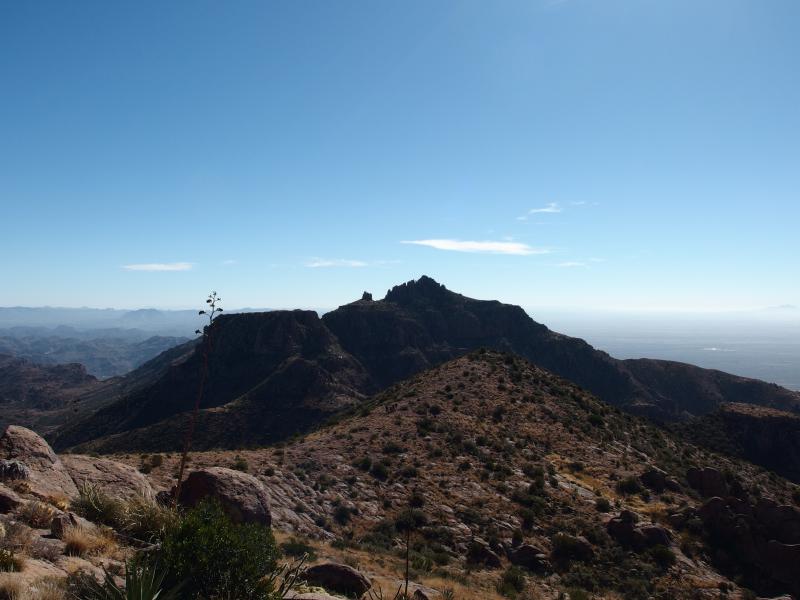
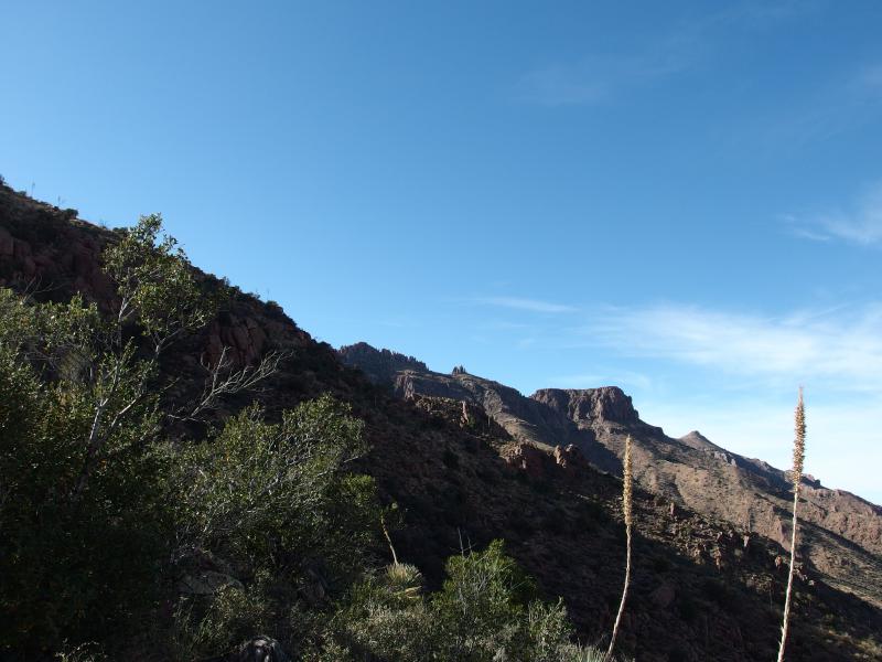
Ever since we started hiking and researching the area there were a few hikes that had stood out as major milestones for Phoenix locals. Obviously there was Camelback, a city hike that makes a great glamour hike or bragging point. Then there was Brown's Peak, the tallest mountain visible from the valley, that stands out to the east. And then there was the Superstition Ridgeline. Described as a grueling all-day venture with 5000'-plus elevation change along a twelve mile course, this hike seemed to be an ultimate adventure for the more crazy locals. So Chris and I had decided to attempt it.
Doing this hike during the winter months makes sense. There is little shade along the ridgeline and high exposure. Yet that runs into a different issue: daylight. Today we only had some ten hours of it, probably not enough, which forced us to do part of the hike in the pre-dawn dark. If we could get up Flatiron in the dark (which was perhaps the toughest leg) that would give us ten hours of daylight to follow the ridge. Neither one of us wanted to do the Carney Springs descent in the dark, the last part of the route, and an early start may avoid that.
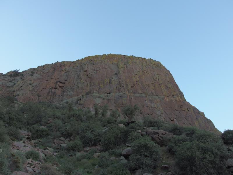
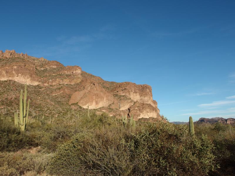
Daylight at the base of the rock formation
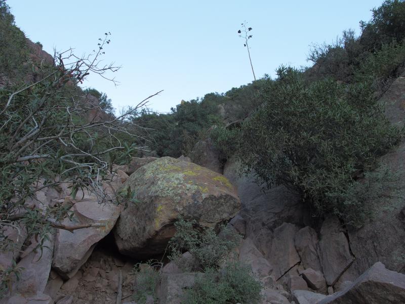
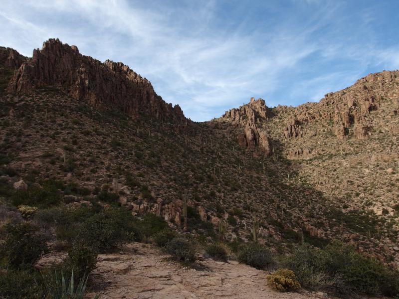
Steep boulders along the path
We reached the base of Flatiron just as the sun came up. It had taken us three hours to reach the top last week - if we could make it to the top in two and a half I'd still be happy. The canyon was bathed in an odd grey bath, light seeping in from the sky above like murky bathwater. We kept glancing behind us looking for other hikers. So far we had only seen a few far down in the distance, no challengers to the first ascent of the day yet, and I wanted to keep it that way.
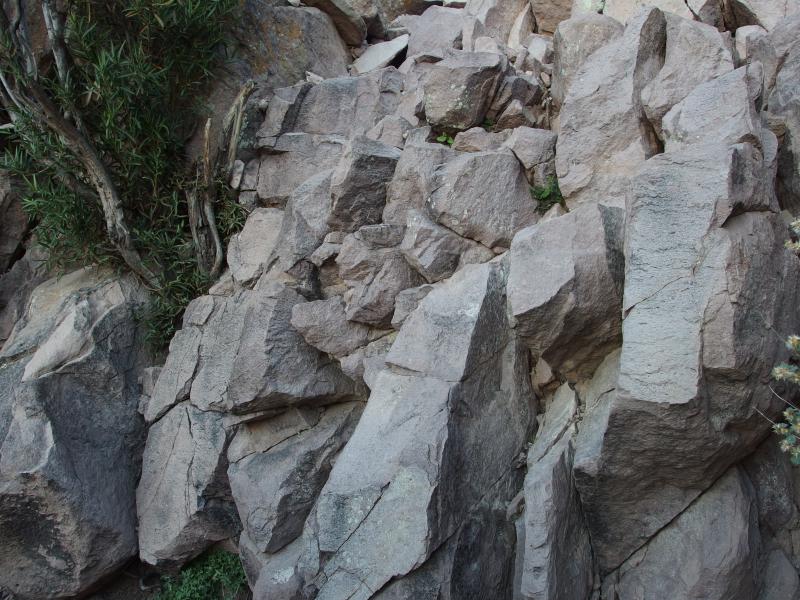
The rock wall
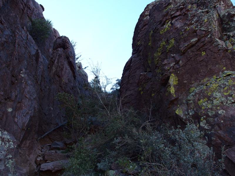
The technical wall showed up, grey and blocky, and we scrambled over it like old pros. This area seemed overly quiet after the last visit. It had been a sort of gathering place for others, a place to chat about approach and, for some, to turn back around and start on the descent. Now it was just us two and we didn't care to linger.
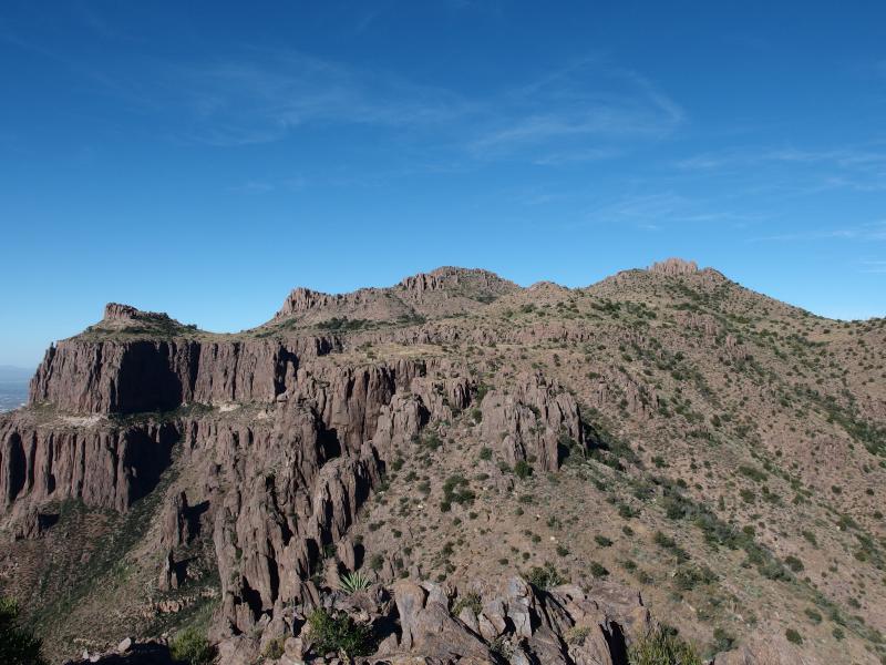
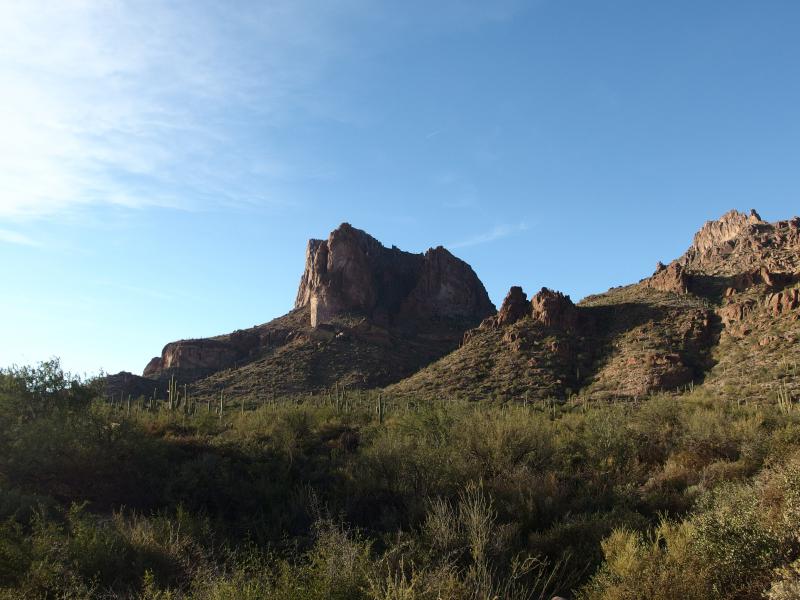
Quick glance over at Flatiron
Once we crested the top we paused briefly to look around. Flatiron lay to the right, North Peak to the left, and our path meandered up between the two. It would be nice to do some peak bagging today, climb up both North and (later) South Peak, but we were worried about time. Instead we skipped by and entered the rocky little saddle to the south… And promptly lost the trail.
Losing the trail used to mean so little to me up in Michigan. There were always animal paths or breaks in the trees to follow, and even if there wasn't bushwhacking slowed me little. Desert flora changes the game. We slowly stepped through the stuff, getting sliced and stabbed and scraped, wondering with horror if the entire hike would be like this. After the relatively quick ascent we were slowed to a painful crawl and it did not bode well for our schedule.
Going through the saddle
Small campsite beyond North Peak
We discovered the trail on the far side of the saddle, a most welcome sight, and we paused to recover near some shriveled pines. I had several dozen fine needles to pull from my rear and Chris had some gouges to bandage. I also decided to pull out my water at this point. Until now I had conserved it, planning on holding off on my first pull of my meager two liters until after we were done with Flatiron, and now I was a bit parched. Once we were ready we continued down the trail, hooking around some steep canyons under the rising sun.
Looking back at the saddle and North Peak
Long hike under the bright sun ahead
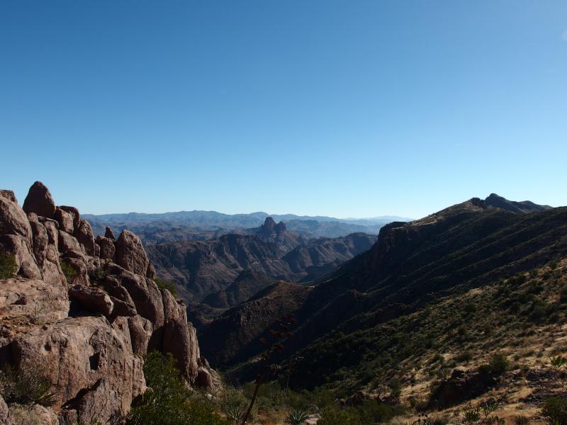
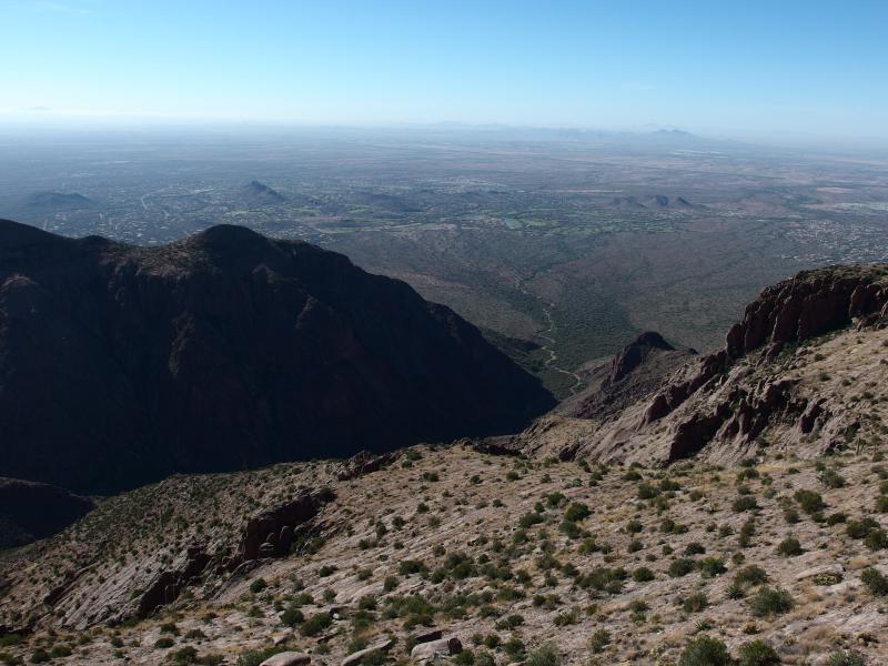
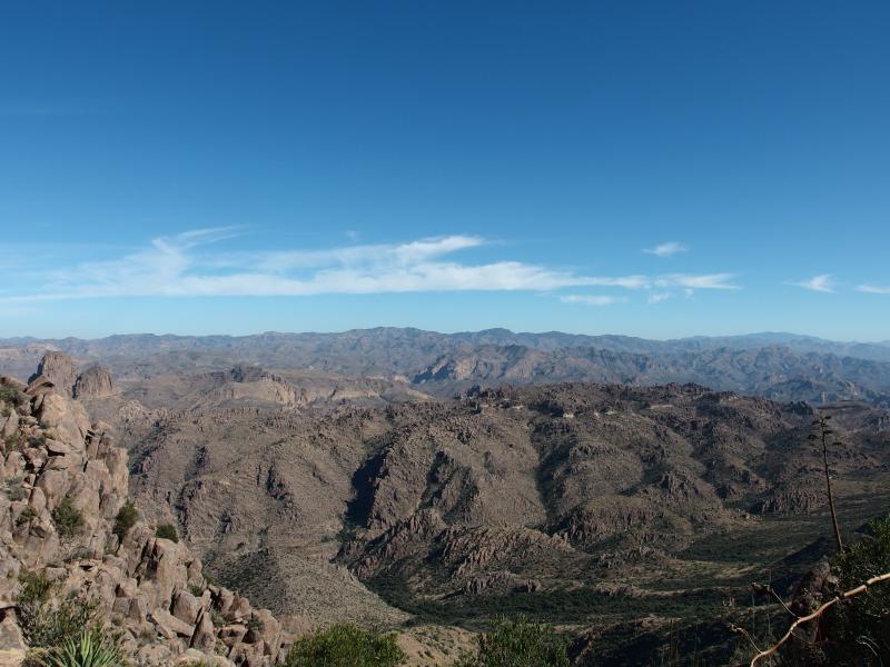
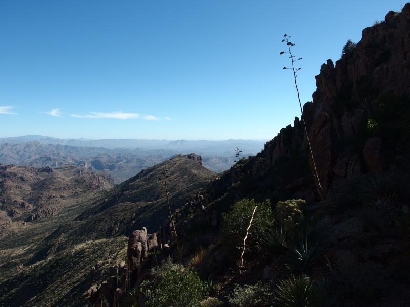
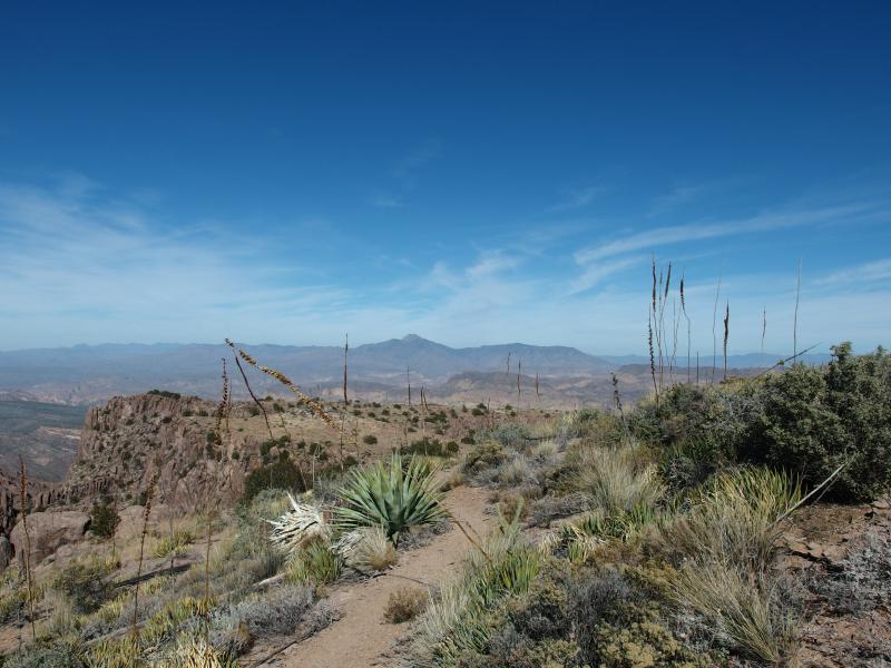
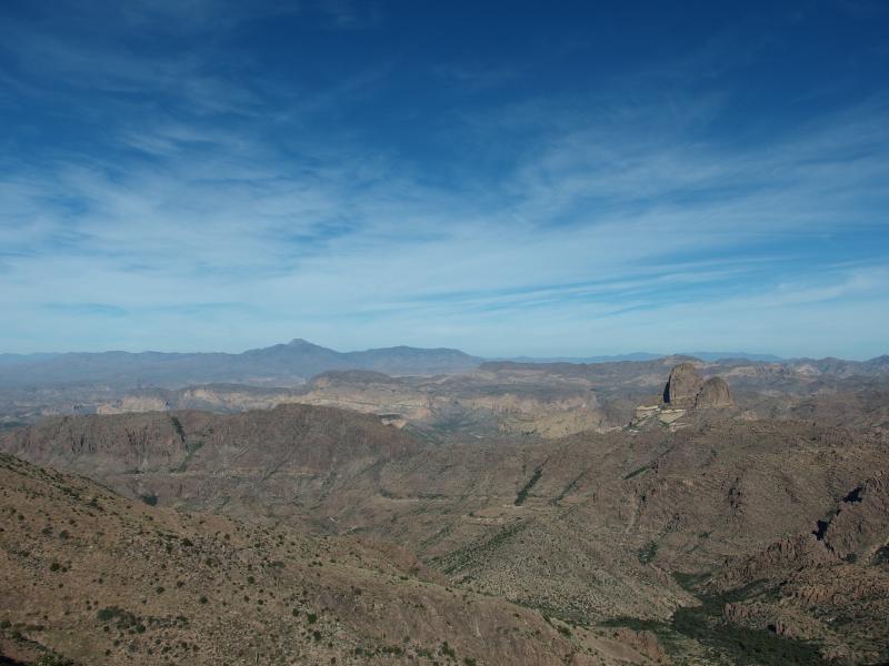
Our trail wound around North Peak for a while, avoiding a narrow little dip that shot out towards Phoenix (one of the upper branches of Monument Valley), and than made a wide swoop south. It wasn't too interesting at first, just an easy and mostly level walk along the flat top between scattered cacti. There were a few good views back towards Flatiron that were expected. After the swoop, though, things got more exciting. A soaring drop of cliffs lay mere yards from our narrow footpath, shooting down hundreds of feet over hard rock, shaped like a giant scoop out of the ridgeline. We had entered the start of Hog Canyon.
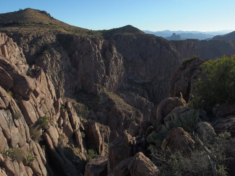
Steep cliffs around Hog Canyon
Hazy ridgeline ahead
The view was amazing, looking down and over the huge scoop. Spots of vegetation lay scattered far below, dotting a distant floor, yet there was no way I could see to reach them. Jagged rock cliffs extended all around the scoop. We couldn't help but toss a few rocks over the edge and count how long they took to fall, shivering slightly at the long delays.
We were forced to turn now with the scoop. At times we ventured close to the edge, though mostly we were dozens of yards aways. The vegetation sprung up too, a surprising collection of green trees and tall chollas clustered nearby, at times forcing us to duck and weave through branches. This ridgeline hike was turning out to be much more varied than I would have imagined up here.
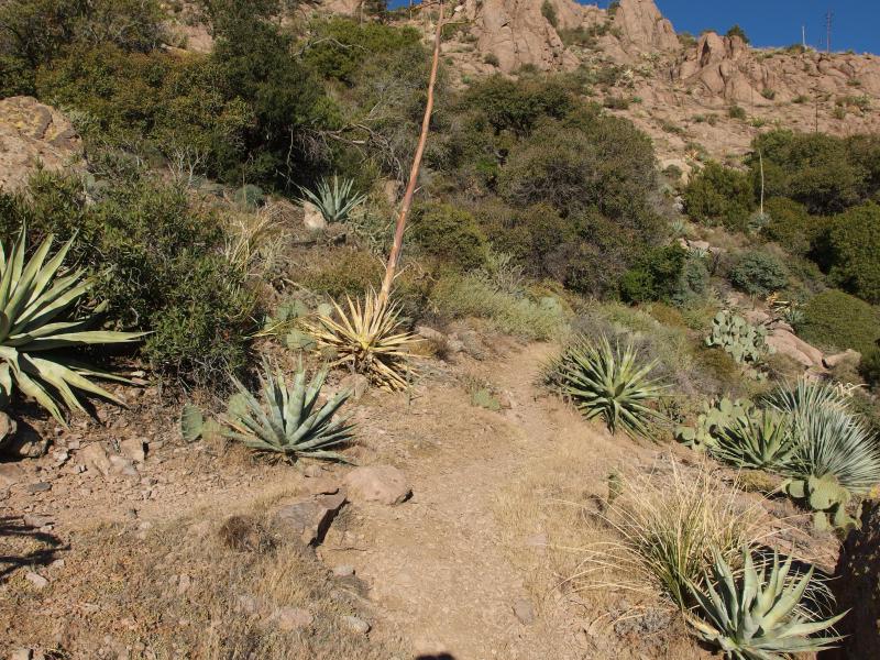
Desert flora clustered around the trail
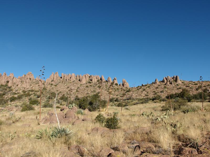
Distant hoodoos above
Looking back towards Flatiron
Even with the trail's wide loops we made quick time around the cliffs. Compared to the steep climb up to Flatiron this was mostly flat, letting us stretch our legs and really move. We didn't pause again for a break for a good hour, waiting until we had made our way around most of the scoop. We were rewarded with two great views at this break - one of Flatiron and North Peak behind us, and one of the sun-baked ridge ahead. Well, most of the ridge. There was a worrisome gap where it just disappeared.
Our zig-zag path on the ridge ahead
Now, we knew that the trail wouldn't be level the whole way. It is a ridgeline. Our trail would go up and down, climbing peaks and dropping saddles, with more than a few winding loops on the way. After the hard climb up Flatiron, though, I had hoped our big elevation changes were behind us. A 300' saddle was not something we were hoping to find.
Dropping was easy, switchbacks and sturdy rocks providing a painless descent. Going back up proved to be more difficult. We had to hunt for the path a bit and finally realized that it was nothing more than a narrow chute. Greenery clustered in it, providing thorny handholds with the craggy hallway, while loose boulders shifted underfoot. Once we got through this uncertain area it was time to plop down and pull out some food for a late morning snack.
Steep climb up the cut
Beyond the first dip
Some interesting formations were beginning to show up. Extending out like an extra arm from North Peak was a long ridge that dropped down to Boulder Canyon over some two miles, creating an interesting alternative approach to that mountain. Between that arm and the long ridgeline we were on was a lush green wash, through which we could easily make out Weaver's Needle. And further on our trail… A harsh desert scene, sand and dead grass spotted with small green shrubs.
Weavers Needle to the east
Along the steep edge
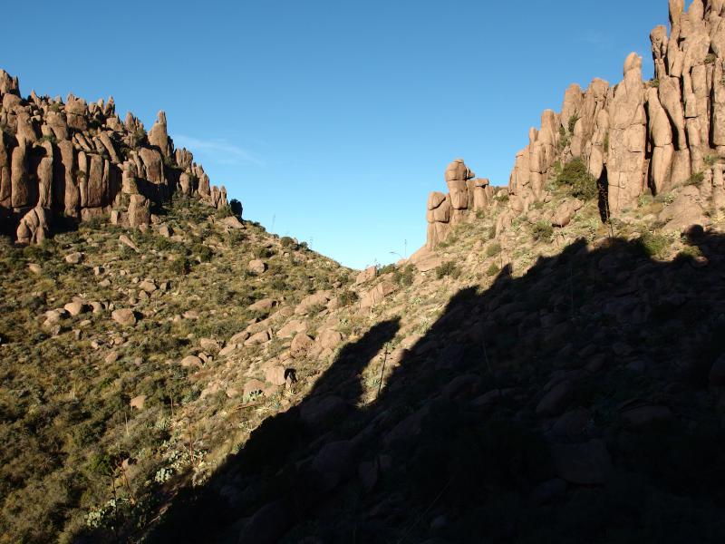
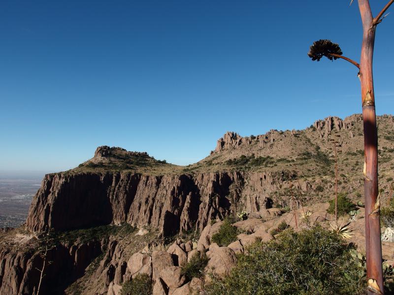
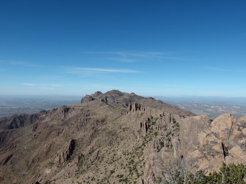
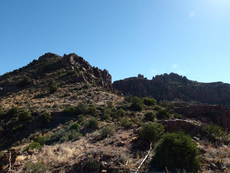
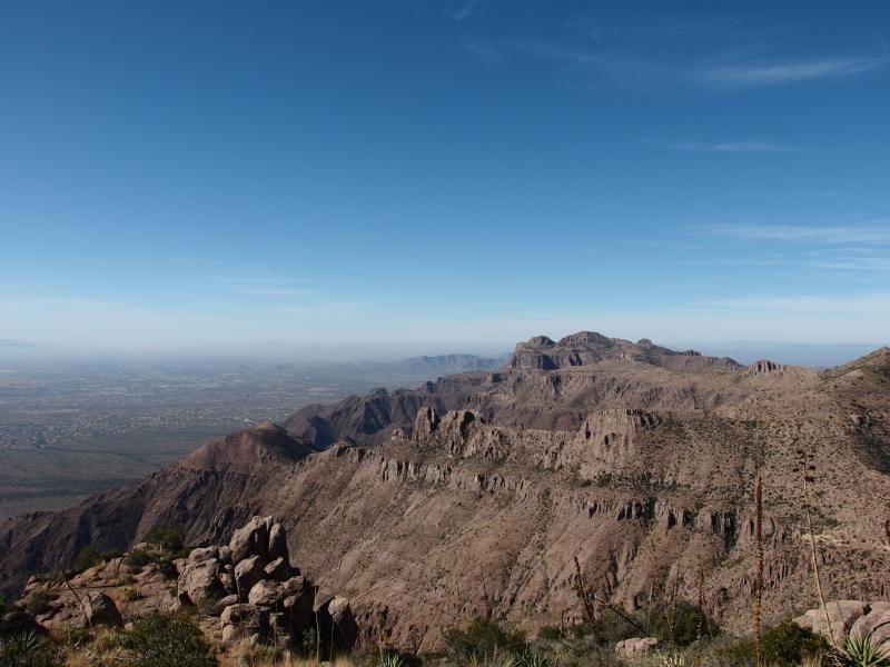
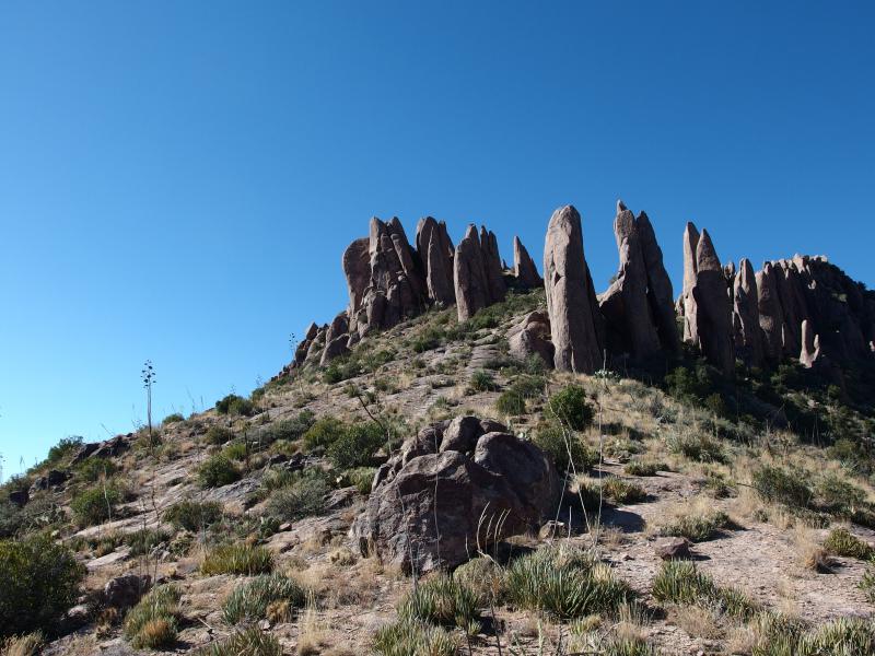
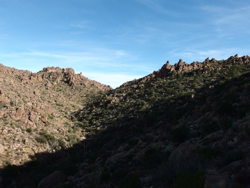
We were now on the center of the ridge, about three miles of gently bucking and weaving trail between North and South Peak. There are a few distinct peaks along this section, clusters of hoodoos that grew and merged to form small hills. The trail climbed some of these hills and looped around others. When they looped they did so to the west, something I was thankful for. We got less and less views of Phoenix as we continued and more and more of the Superstition Wilderness.
A narrow hillside path
A cloudless Four Peaks to the north
Looking down Hog Valley
Much more ridge left
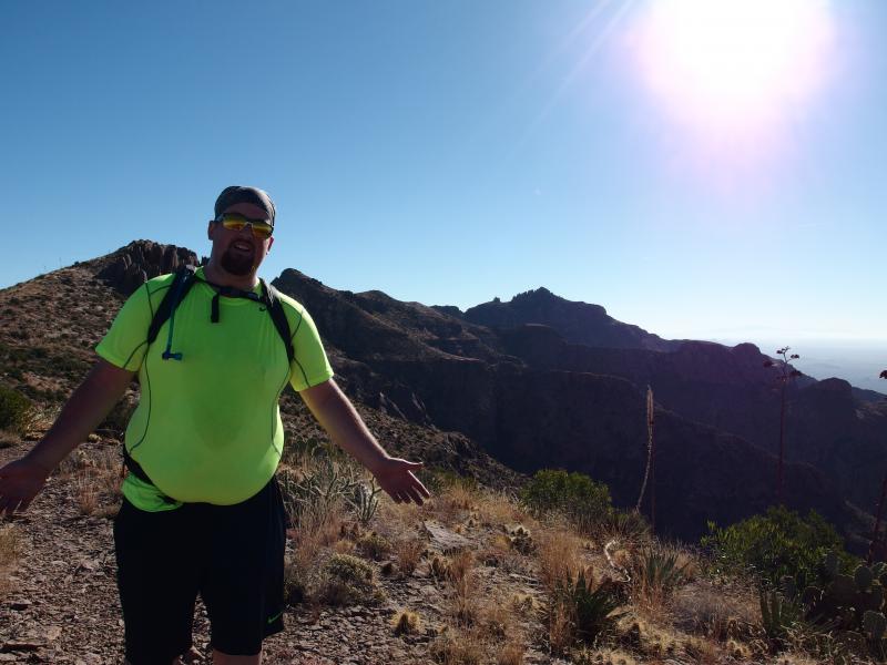
The sun beat down on us. The temps were not too much, maybe eighty in the afternoon, yet being on an exposed ridgeline with no shade sucks a lot of energy. We paused frequently, stopping for photos or to just drink water and snack on trail mix. In the distance behind us I made out a small group of hikers, maybe four or five, slowly gaining us. They may have started later in the morning than us but they were going to pass us. We pressed on only mildly faster. It was hot up here, our legs were sore, and we had some glamour poses to do.
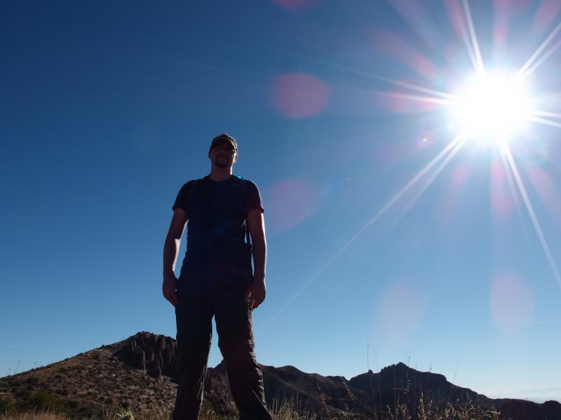
An optimistic Chris
Glamour shot of Jake over the ridge
Eventually the group passed us, six well-seasoned hikers who were old and wiry, after a few brief salutations. They were planning on going down the Perulta trailhead, not Carney Springs like us. This added a few miles to their route, though at their current pace they would probably beat us down anyways.
After that group went another one came from the other direction, heading towards Flatiron. This second group was only two, probably a husband and wife couple, and they packed little gear. A few water bottles and a long-sleeve shirt. Both seemed familiar with this hike and comfortable so we didn't offer any snacks or water. Besides, I was starting to worry about how much of my two liters was left at this point.
When we stopped next, near a highpoint on the end of the ridge, I pulled off my Camelbak and checked. It was empty. Over the course of three hours I had drained my water supply. The darn thing is way too easy to pull from, the hose always sitting in the corner of my eye. I'm usually good about conserving water, splitting up water bottles over the course of a hike, it's just harder to do when the water sits in an invisible bladder behind you. We still had some five miles or more to go over uncertain terrain and I was out of water. Great.
Long view back to the start
Getting closer to South Peak
The second couple we had bumped into warned about the upcoming saddle, the deeper one that marks the end of the central ridge and the uplift of South Peak. They had hinted that it was steeper and that the trail was hard to follow. We had brushed off this warning. However, as we approached the saddle we began to worry. The saddle was another 500' or so and did not climb straight out. We could make out pieces of the trail ahead, circling around through some boulder fields before climbing up near the summit of South Peak. This didn't look like fun.
At the base of the saddle is Hieroglyphic Canyon. This is where that trail, the one that passes by the old petroglyphs and follows Hieroglphyic Spring up, meets with the ridgeline trail. It was so tempting to turn here and head down. Chris's car was parked at the distant Carney Springs head, though, miles away from this trail, and it would probably be quicker just to keep on the ridgeline. With tired legs we set on the jumbled climb up the shoulder of South Peak.
Long saddle to climb out of
The climb started with a some hops and jumps around giant thrusts of rock, a fairly straightforward climb up the slope. Then it circled to the right, avoiding a small flat-topped butte. This was the section that group had warned about, a mix of slick sliding rock and boulder hopping without too many trail markers. After we had climbed up the boulders we were rewarded with a small saddle before the last climb up another narrow crack of rock. We rested here for a short time, trying to get our breath back while avoiding the wasps who guarded this saddle, before finishing the ascent.
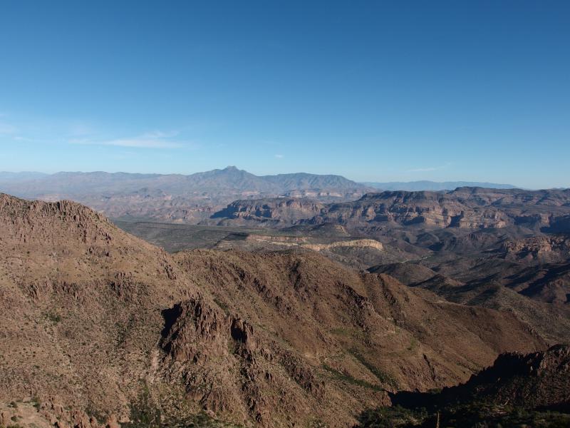
Rugged Superstition Wilderness to the east
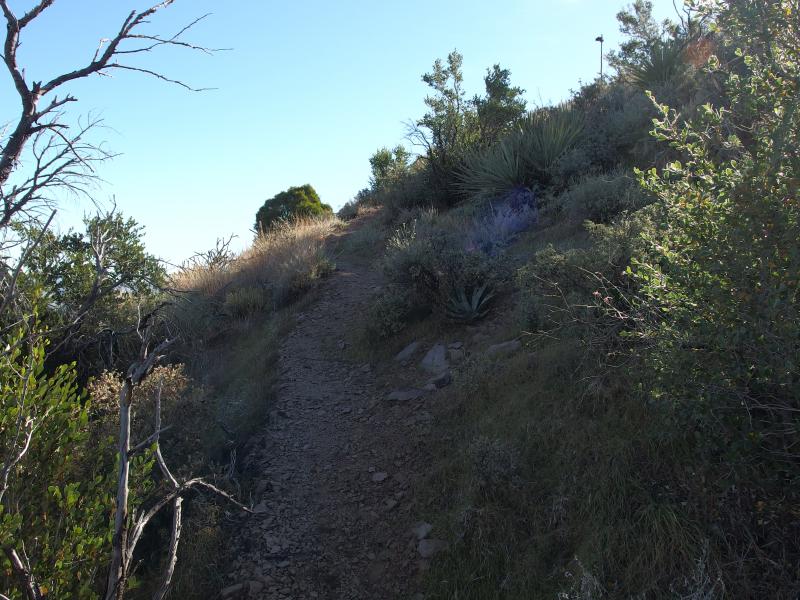
Speaking of trail markers… The ridgeline path is fairly well traveled. The footpath is fairly defined through the sandy desert stretches and through thick vegetation. However, there are questionable parts, parts where the path seems to meander or the hard rock hides sign of past hikers. This is where the cairns come in. There are little rock cairns every twenty or thirty feet, regular markers left by thoughtful explorers, to track the path. I've seen these little stacks of rocks on other hikes in Michigan, usually left at high points or on rock outcroppings, but have never seen them used in such a regular or helpful manner.
Once we were on the shoulder of South Peak we just had to descend. Neither one of us wanted to finish the several hundred foot climb to the peak itself, content to dutifully follow the path around the shoulder and down the east arm, especially with my dry throat and Chris's tired legs. I made the time-worn joke that it was "all downhill from here" (it wasn't) and we slowly made our way past the peak.
The ridge turns east
It was disheartening to see the ridge continue east, though. I knew there was still some ridge to go before Carney Springs, I had just tricked myself into thinking that we were almost done. The steep upthrust of Three Sisters in the east stopped that delusion. Our descent was far on the other side of that giant outcropping, another two valleys past it.
A forlorn, lonely path
Last look north along the ridgeline
Below the hoodoos of South Peak
Heading down off of South Peak was tough, slick rock on the numerous switchbacks. We took it slow. On the way we passed two more groups, one being an elderly solo hiker who warned us that the way down Carney would be painful, and then things were quiet once again. The path was tough, though nothing compared to the knee-killing descent off of Flatiron. We made good time with few pauses and things began to fade in the distance behind us.
On the south side of Weavers Needle
Quickly dropping down the hill
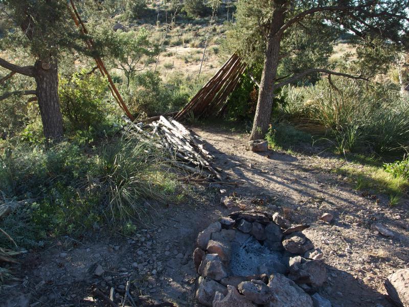
Almost two hours passed on the descent. We looped around the rear of Three Sisters, found a tiny damp creek that may hold puddles on cooler days, and eventually got lost in a rocky wash. Well, more of a boulder-y wash. There was a small campsite near the base with neat firepit that we sat and rested at. I wasn't completely sure where we were at, which trail or how far Carney Springs was, and Chris was probably suffering some version of heat exhaustion. I had been without water for close to four hours and was doing my best to ignore a dusty throat and mouth. We sat and looked at maps and wasted time at the campsite, pretending to get orientated yet really just resting.
I finally guessed that we were in an arm of West Boulder Canyon and that, while we could follow the wash to the south, we'd have a tough descent down the side of Three Sisters. A tough descent down a steeper and trail-less canyon when Carney Springs sat a few hundred yards to the east. We lumbered up and along the trail, finding a cute little trantula near a cairn, and finally spotted the saddle that marked our final descent.
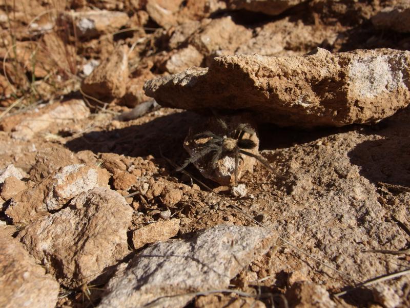
Cute, tiny spider along the path
Annoying rocky gorge
We found our way over to the saddle along the meandering path. At some point the Ridgeline Trail loosely merges with West Boulder Trail, though we weren't able to spot when exactly that happened. That latter trail heads all the way up to Black Mesa, a distant location in the Superstitions that we hadn't even thought of yet, but we were only interested in the descending section here. A small sign (one of the very few located anywhere in this wilderness) pointed us to the parked car some two miles away. We were almost there.
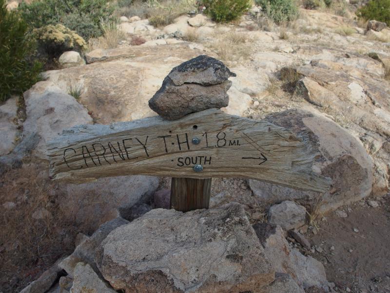
The trailside sign for Carney Springs
The steep drop down
Heading down Carney Springs was brutal. Chris and I have had some tough downhill sections that really killed our knees, Flatiron being one of the meaner ones. Carney Springs had a lot of ankle-rolling boulders scattered along hard rock and loose earth slopes. Walking downhill was a slow and overly careful experience.
When we got to the halfway point, with the steepest reach below us and the longest leg ahead, we were passed by a quick little hiker who had just been playing around in the canyon above. We had a brief chat, mostly about the tough descent, before he skipped past us. Chris and I watched him for a bit, envious of his relatively fresh legs, before slowly continuing down.
Looking back up Carney Springs
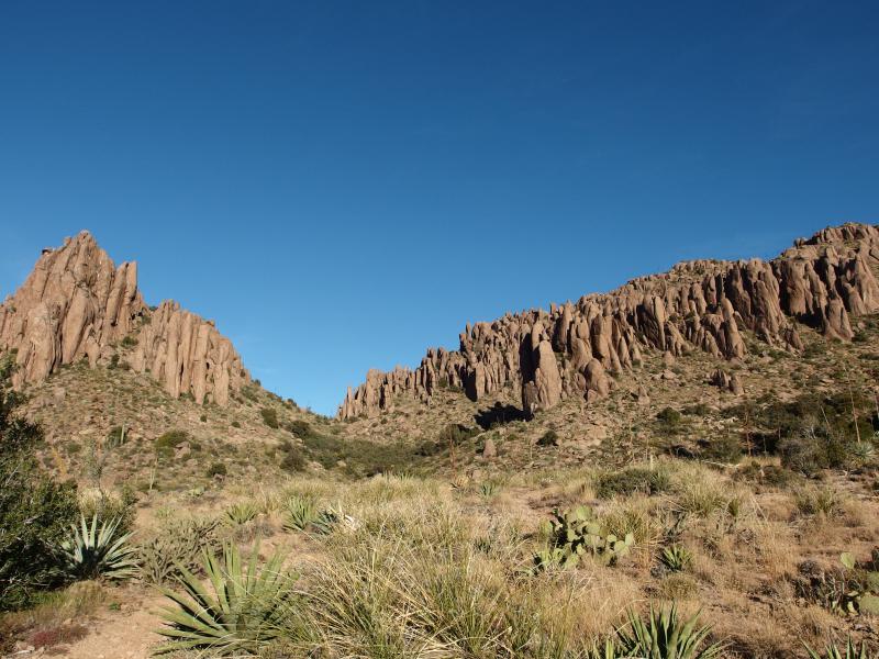
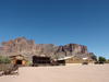
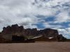
As we meandered down the steep path views began to open up to our sides. The first thing that began to show up to the east was the white/yellow Dalcite Cliffs, soaring up from the desert flow almost a thousand feet up. More impressive than that were the Three Sisters to the west. Close to 1500' in height the three huge rock formations stick out like ancient ship prows, the rocky bumps and shadows almost looking like proud women to our tired eyes.
Dalcite Cliffs
Three Sisters towering above
Our path flattened and we entered a thick forest of saguaro and palo verde. The sandy path was easy to follow here. The road once came up right to the edge of Carney Springs and a small campground before the legal restrictions of the 'wilderness' designation pushed back vehicular access. And the sandy path was basically the old road. We made quick time back to Chris's car, arriving almost eleven hours after our predawn start.
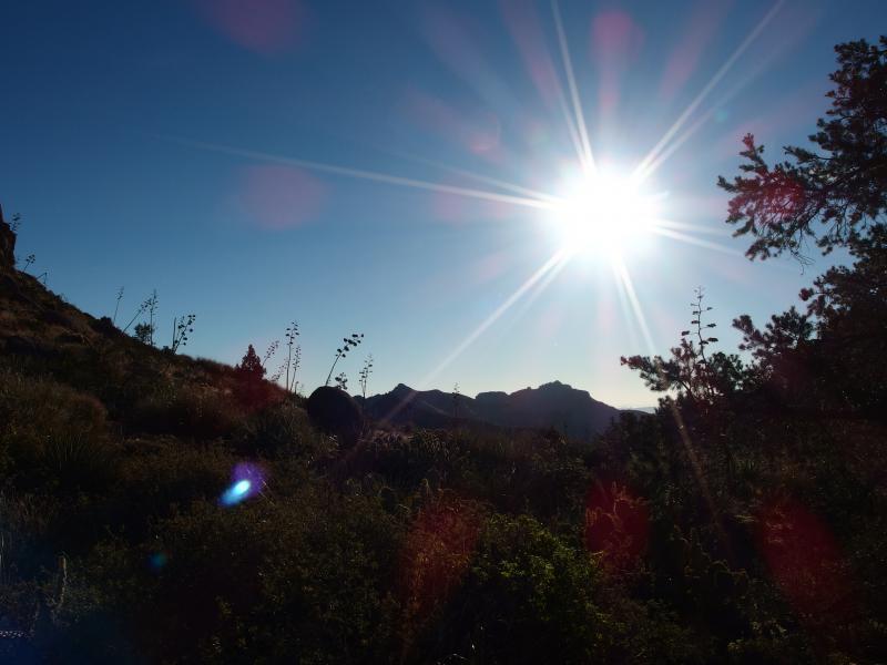
Bright sun over the cacti forest
It had taken all day to walk the twelve miles along the rugged ridgeline. By the time we picked up my vehicle left at Miner's Restuarant and returned to civilization the sun was beginning to drop down behind White Tank mountains. It had been an exhausting day. We had survived the Superstition Ridgeline, one of the most famed and testing hikes in the general Phoenix area. Now it was just a question of where we would push ourselves to next.
-
Jacob Emerick
Feb 13, '15
Ha, not too tiring? I left out the part of the story when I had to carry you down Carney Springs so you didn't feel bad.
Add to this discussion