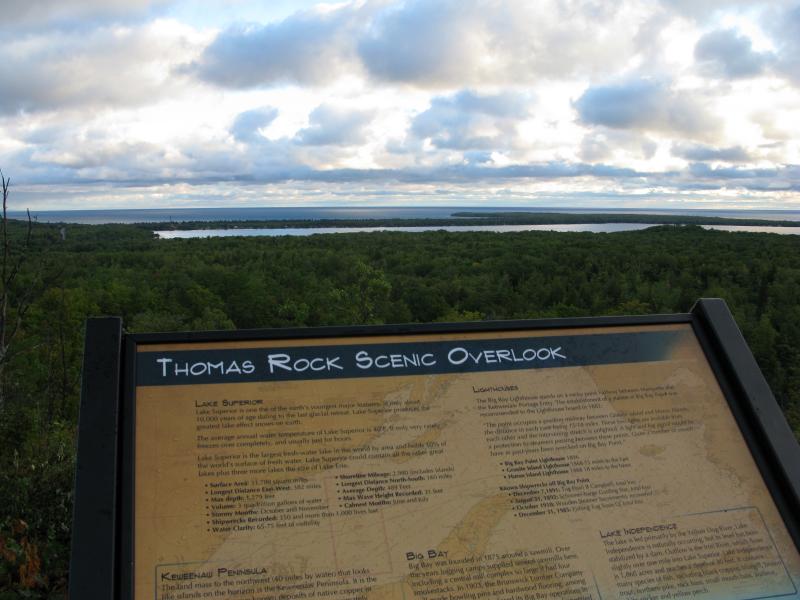
Thomas Rock of Big Bay
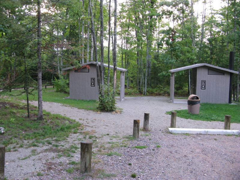
A few short miles south of Big Bay is an exposed overlook with a great view of Lake Independence and Superior beyond. Once an off-road destination for ATVs and people willing to walk in from County Road 510, Gobbler's Knob was purchased by the Thomas Family a few years ago and underwent a major facelift. A parking lot has been laid out, complete with restrooms, information stands, and trash cans. Wheelchair-accessible paths lead up to the overlook itself and wide decks provide easy access around and over the rock. Even the name has changed. What was once Gobbler's Knob is now Thomas Rock, named after the generous family who has spent so much on building out and maintaining the park.
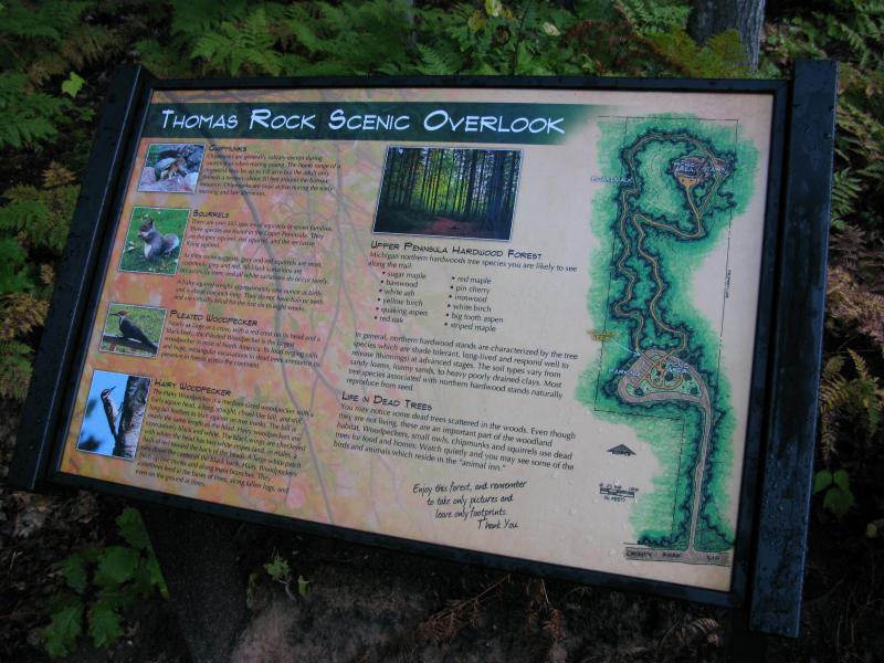
Friendly sign outlining the paths
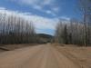
It was early in the morning when I pulled up to the park. I had tried to catch the sunrise from a different spot, north of Big Bay, but thick clouds and a brisk wind had drawn me inland shortly after the disappointing views. The park was still damp from an early morning rain, dripping green in the thick summer forest. I stepped out of my car, my boots crunching on the crushed rock, and the cool wet air surrounded me.
Parking area for Thomas Rock
One other vehicle was parked here, early risers who probably caught the rising sun, and I wondered if I would see the visitors. There are two paths up the rock, forming an easy loop, though there is not a designated path for 'up' or 'down'. I chose the steeper path up the rock, anxious for the overlook, and quickly left the parking area.
Obvious obstructions lay on either side of the easy, marked path. Logs, rocks, and even some freshly-planted pines tried to erase the routes that were once here, the four-wheeler tracks and footpaths of Gobbler's Knob. It was not easy tracing the old routes with today's well-made paths and boardwalks spanning wetlands and gaps. Yes, Thomas Rock even had a few sturdy boardwalks to make the walk even easier.
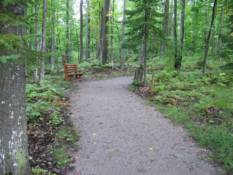
A wide and easy path
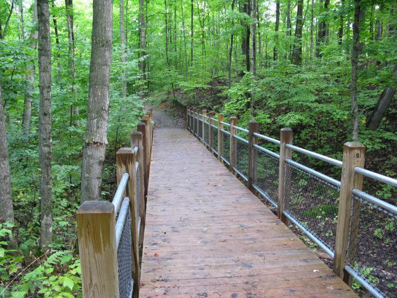
Steady boardwalk over a gap
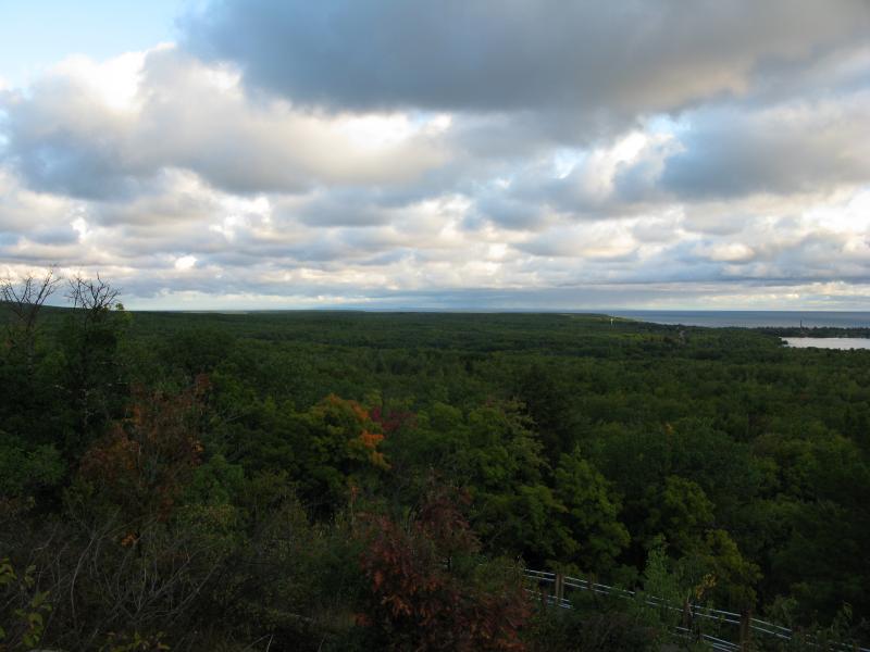
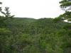
When the path and I emerged from the woods a wide view spread out before us. Salmon Trout Point, a large, flat expanse of green, extended out to the north with wisps of the Keweenaw Peninsula barely visible beyond. Big Bay and Lake Independence sprawled out below, the town barely poking through the thick trees. Not much was visible to the south outside of the bulk of the Western Alder Mountain, an ominous rise of green that soared five hundred feet above Thomas Rock.
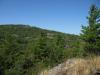
Lake Independence below bright clouds
North up Salmon Trout Poit
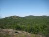
I meandered a bit on the bare rock, enjoying both the view and the silence. No loud trucks were roaring on the roads below and I never bumped into the other visitors out here (they must have taken the other path down). There is a high spot on the rock, almost a second tier above the main deck, and I hopped up on it. From here I could see the nearby radio tower, a stone's throw away, and the bright morning sun glaring from behind the clouds to the south.
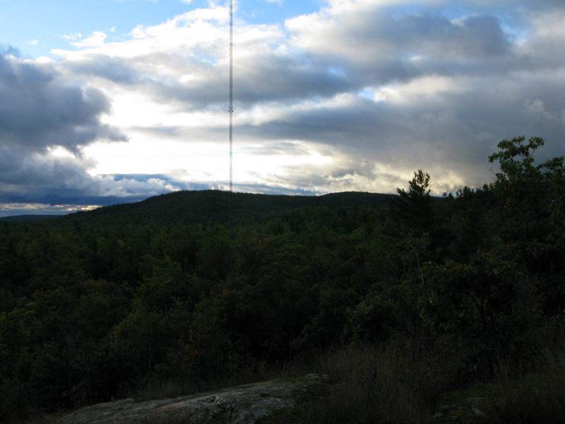
Radio Tower and Alder Hill
Heading down the path, the one that zig-zagged a bit more to decrease the slope, my mind went back to Gobbler's Knob. How were the routes to the rock back then? What type of people visited the spot? How many beer cans littered the now-cleaned forest floor? A man and his son passed me, the boy sprinting excitedly up the path, the man wishing me a good morning while keeping half-an-eye on his eager son. Even though I usally prefer the wild and untamed I couldn't help but wonder if this spot is better as Thomas Rock.
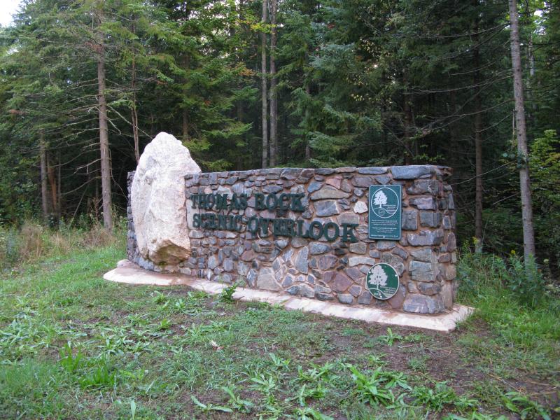
Large sign at the entrance
-
Jacob Emerick
Oct 12, '13
Gotcha. I've heard a few rumors of discontent about what's been done at Thomas Rock and just assumed that the 'Knob was a 'party' spot. From my explorations it seems like there are fewer of those left (Dodge City and Brain Hill are the only two that come to mind) with either access being cut off, things moving onto private property, or just the changing generation. It is kinda nice that Squaw Beach is being a bit more preserved these days, too. Thanks s!
-
LR Swadley
Nov 14, '13
Jacob,My construction company-Sunrise Builders Inc built this park and trail system a few years ago for Powell Township. One of the most unique projects we've done. Very challenging suspending trail across a cliff face etc!LR Swadley
-
Jacob Emerick
Nov 16, '13
Oh wow, I'm glad you bumped into this post! The trails looks fantastic, LR, and everything seems very stable for such a tricky location. Curious how long it took to build the park.
-
LR Swadley
Nov 19, '13
Seems like we built the whole project over about 90 days, first parking lot, access about thirty days late in the fall early winter, the our carpenter crew came in the following spring and built the trail system in about six weeks, and then finishing up picnic area, stone wall, sign etc. we were really proud to have been a part of the project. Trickiest part was the sixty ft section across the cliff face.
-
Jacob Emerick
Nov 19, '13
Wow, you guys weren't messing around! Again, everything looks very professional and solid. Looking forward to bringing my family up there in a few years and watching my (currently five months old) son climb up the Knob :P
Add to this discussion-
Jacob Emerick
Nov 11, '13
Big fancy signs usually scare me, but yeah, it's an interesting place to check out. Have you been any closer to the mill or just stick to the distant zooms?
-
nailhed
Nov 11, '13
we cruised up to it, but it looked like it was in someone's front yard, haha, so we left it alone. you would literally have to drive up their driveway since there is nowhere to park.
-
The Riiddler
Nov 14, '13
First just a "little" mine and now a park. So sad. Hey when is the gas station going up on AAA road? Don't get me wrong here, I would love for everyone to experience the great out doors, especially the disabled. To me it is truly sad that civilization is finally conquering on of the few pristine wild places left in Michigan. And I quote here from Ronnie VanZant of Lynyrd Skyryd here, come one everybody sing along now... "And Lord I can't make.. any changes All I can do is write 'em.. in a song I can see the concrete.. slowly creepin' Lord take me and mine before that comes" Yeah I know, I am just an old boy. Thanks Jacob for the post. Another great read.Matt
-
Jacob Emerick
Nov 16, '13
Hey Riiddler,Yeah, the steady progression is kinda sad to see, even just from my limited view over the last few years. Seeing the AAA being expanded and improved, construction work on 550, the bridge over Forestville, the park on Thomas Rock... Well it's nice to see improved access and more people enjoying the area it is sad to see the wilds pushed back. I guess there is still a few spots, deep in the Peshekee or deep in the Huron Mountains, that are still waiting for us more adventurous people. If those go, though, I'm heading to Canada ;)
-
The Riiddler
Nov 18, '13
"That's a fact Jack!"
Add to this discussion