Granite Point
The narrow road weaved and bucked between piles of snow under the thick pines. I began to wonder just how far I'd have to drive along this county road. I was east of 550, in the narrow chunk of land between it and Lake Superior, and was surprised at just how windy and out-of-the-way this destination was. When I finally saw the open waters began to filter in from the right my plowed route ended, leaving me with a small parking area to leave my car and another mile or so of snowshoeing to reach Granite Point.
A mile or two sounded great. When I was researching this hike I had no idea how far Granite Point Road (or KB) was plowed. I was a bit worried that I'd have to walk in from Saux Head Lake, some three miles to the south. Not only was there a parking turnoff here (more for the nearby cabins than hikers, I assume) but the track ahead had been beaten down by snowmobilers. The next leg of my hike would be an easy one.
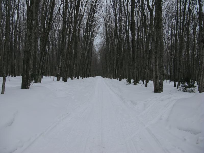
Deep ruts in the snowy road
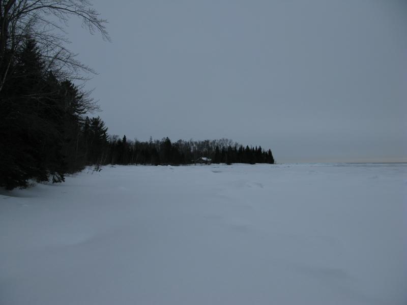
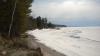
Once my snowshoes were strapped tight I started north, dutifully following the wide trail. Cabins popped up to the east along the shore, a few for sale. I gazed over at them as I tromped past, jealous of their location. Not only were they a good five mile drive away from the traffic of 550, these buildings were perched on a sandstone cliff some forty feet above Lake Superior. To the south lay Saux Head Point and Granot Loma, and north was Granite Point and then nothing until Big Bay. It was a peaceful and scenic spot to have a little camp.
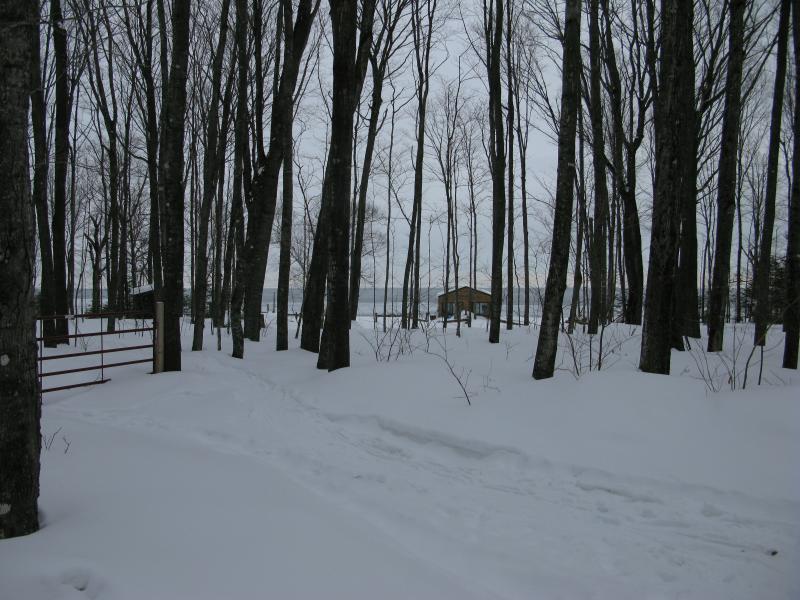
One of many small cabins along the shoreline
One little building stuck out to me, though. It was a tiny cabin, maybe the size of a large living room, with huge windows on all four walls. And a giant TV was perched in the southeast corner, blocking a good chunk of the view. I guess some people would rather watch TV than an early morning sunrise.
After a half mile or so along the track I was forced to cut off trail. The track curved west and my destination was east. I plunged into the deep snow, easily sinking two feet in the powdery stuff. Snowshoes or not, it was going to be a tough walk to the lake. Slowly I pushed downhill, tromping and puffing, trying to avoid walking too close to a cabin with a lighthouse tower (yes, its as cool as it sounds). I hadn't seen any 'no trespassing' signs yet figured that cutting through someone's front yard, even in winter, is a rude thing to do.
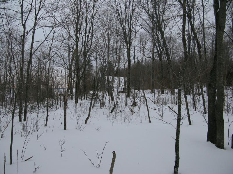
Distant cabin
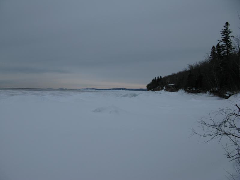
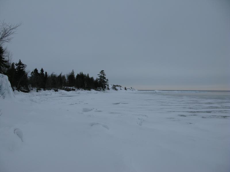
Finally on the icy shore
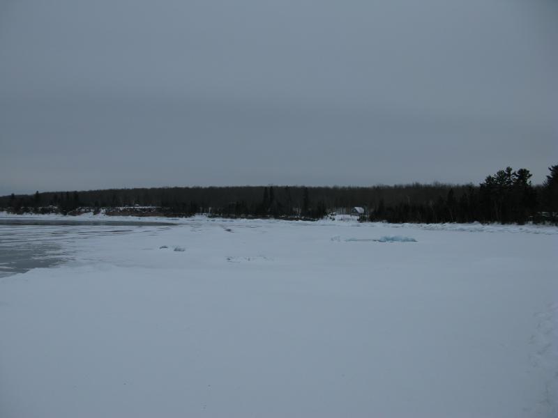
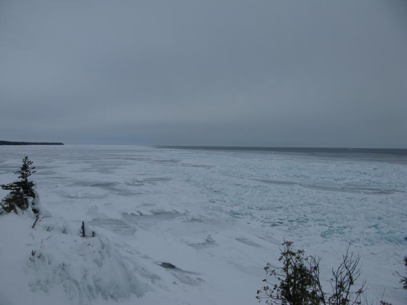
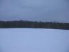
When I finally broke out of the woods onto the lake a stark vision greeted me. This narrow bay, one of two south of Granite Point, had a long swoop of snow-covered ice stretching into Lake Superior. It was sharp and desolate. Along the shore to the south were the cliffs that I had just missed. The lighthouse-cabin and my route were sitting on level with the great lake, saving me from an awkward jump or a tough walk along the cliff edge.
Turning north away from the cliffs I was met with the first point on the shore. There was a little cabin ahead. This was surprising; I did not think there was that many camps along this shoreline. Shrugging I trudged forward, veering slowly over the ice, cutting a few yards off the hike as I ventured away from the wintery forest and over the frozen waters.
Second leg of the hike
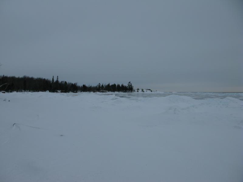
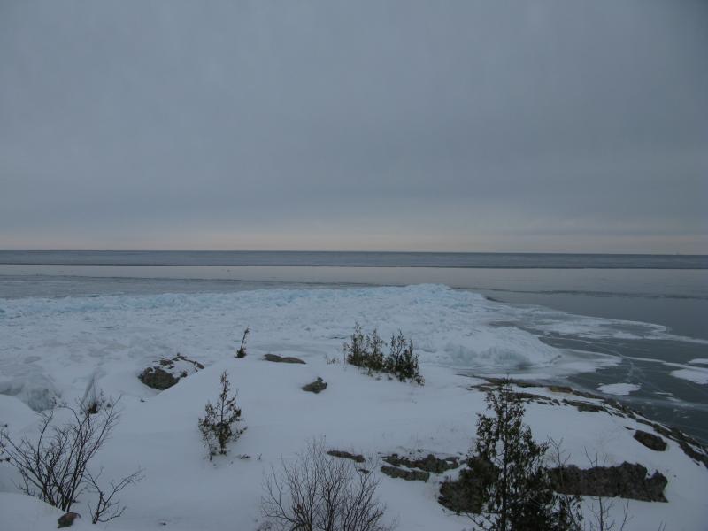
When I reached the point I paused to look around a bit. The view to the south had really opened up. I could still make out the lighthouse-cabin, with the tall cliffs stretching away to the south, and now I could better see the curve of the thicker snow-covered ice in the cove. Thinner ice extended out from it, shiny and new, ice that I wouldn't dare tread on. The northern view grabbed at me. I got my first view of Granite Point, an ugly protrusion of ice and rock sticking out into the cold lake.
Looking back at the cliffs and cove
Granite Point in sight
Layers of ice
Beyond the point there were no more cabins, just rocky shoreline and ice. My nemesis of this weekend, that ice. It creaked and groaned even here, in these small coves where it was piled high. I was easily walking several feet above the water level and still felt too vulnerable. I crunched forward, shoes making loud cracking noises over the snow, pretending that I was walking on solid ground.
As the land made the final swoop out to the rocky point the ice narrowed. Figures. Whether it was up by Big Bay or down by Freeman's Landing the shore ice had been out to get me. I stuck to it as long as possible, clinging onto the ledges of snowy ice that was shoved against the rock. And then there was no more. I could either try my luck on the clear thin stuff or head to the woods. I headed to the woods.
Ice swooping inland
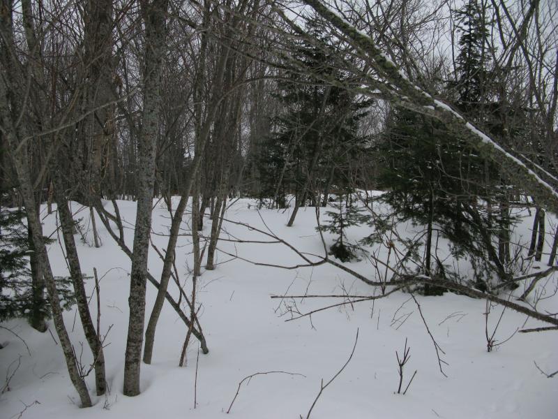
Deep virgin snow in the gnarly forest
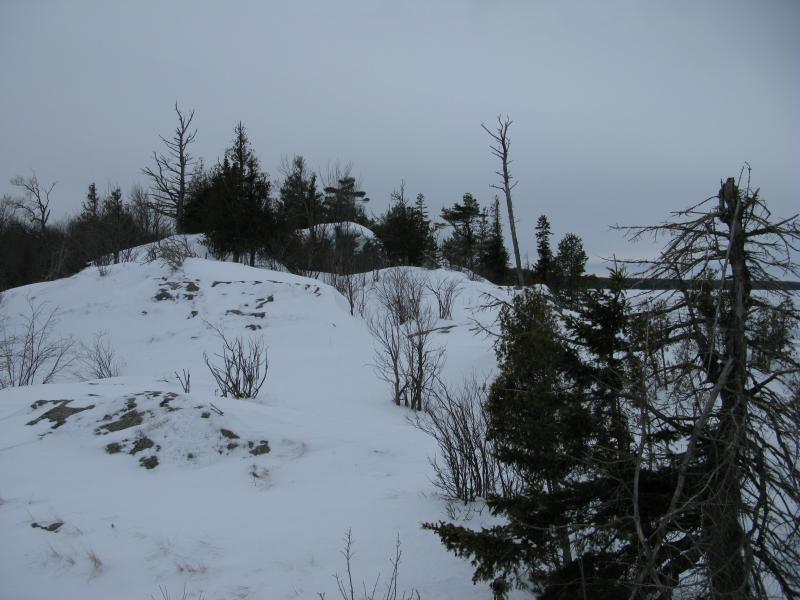
Between the scrubby immature forest and the four feet of snow I had a hell of a time in the woods. Crawling, grasping at trees, stumbling over hidden branches - I felt more like a drowning giraffe than a snowshoer. I was surprised at the nasty woods. There must have been a fire or clear cutting within the last ten years here. Most of the trunks were as wide as my arm, and the few larger trees were sticking out like forgotten sentinels.
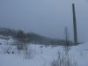
After the last few hundred yards through those woods I simply loved walking on Granite Point. The wind and exposure had packed down the snow to a crispy crust, letting me easily stroll over the rocks. There were a few icy patches to watch out for, nothing my crampons couldn't handle. And the views were awesome. I could see all the way to Presque Isle to the south, narrow smokestacks sticking out between dark hills, and even the awkward little windmill on top of Garlic Mountain.
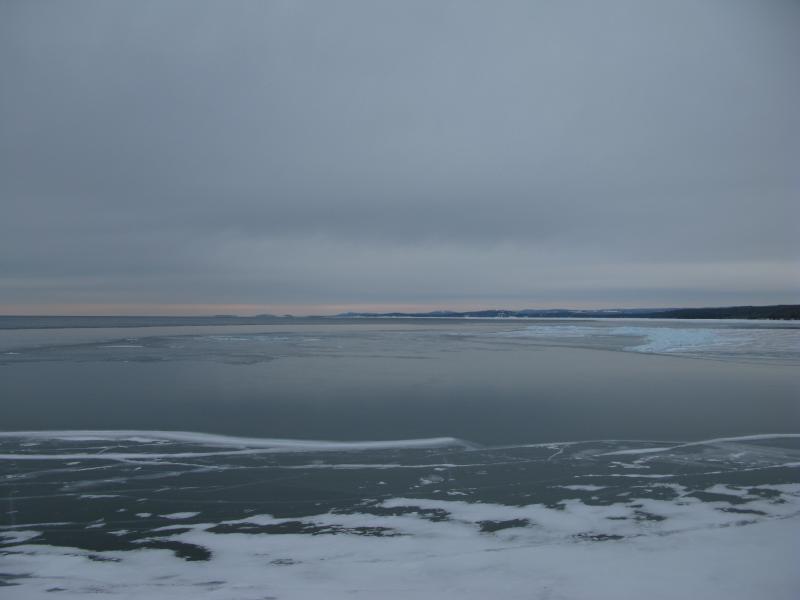
Looking south over the clear ice
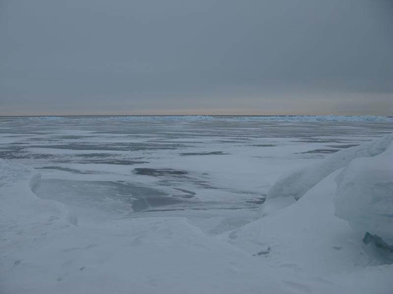
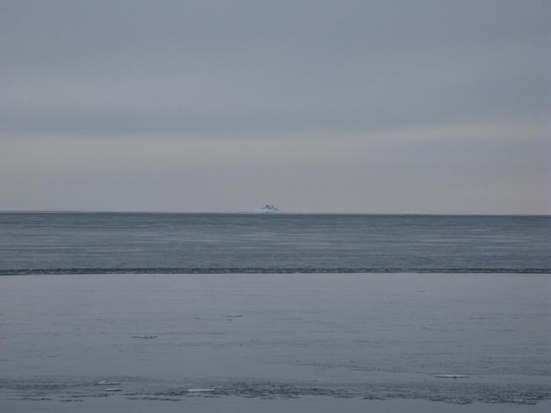
East and north held good sights as well. Beyond the point and piled ice and even the open water was a thin white line. Ice. Miles and miles out there was ice. It took a minute to click. Lake Superior had 80-90 percent covered right now. Here, though, the ice wasn't connected to the land. Several miles of open water, freed by winds or current, lay between the Marquette shoreline and all that ice. If there was a strong current here that would explain why so many of my hikes this weekend had been thwarted by unsteady ice.
Out over the lake
Even further out to the east was Granite Island and lighthouse, small specks that I had to zoom in on. If only the lake would freeze solid that would be an epic hike, a walk out to that far-away chunk of rock. And to the north - nothing. Just more ice. The shore stretched empty. Somewhere out there is Yellow Dog Point, an unexciting rounded shoreline between here and Big Bay, but I couldn't make it out.
Distant silhouette of Granite Island
Ice and water to the north
I turned and walked a short distance up the ridge. Similar to Freeman's Landing this point was part of a ridge that extended inland, a row of bumpy rocks rising up from the trees, though it bucks up and down enough to make following it a hassle. I made it to the third rise before surrendering back down to the nasty immature forest.
Up the ridge of Granite Point
The way back was uneventful, just a long plod back along my tracks. It was nice to see the lighthouse-cabin again, and the cliffs, and even nicer to retrace that snowmobile trail to the car. As annoying as the deep snow and questionable ice had been I'm not sure how easy it is to visit Granite Point any other way. Maybe if you followed the road another mile or so past all of the camps you could cut directly out to the lake, though that would take you through some nasty woods. The way I took, more over the lake than not, seemed like one of the more legitimate (and scenic) routes.
Following the tracks back
Comments (0)