Wetmore Hike Part B - Wetmore Beach
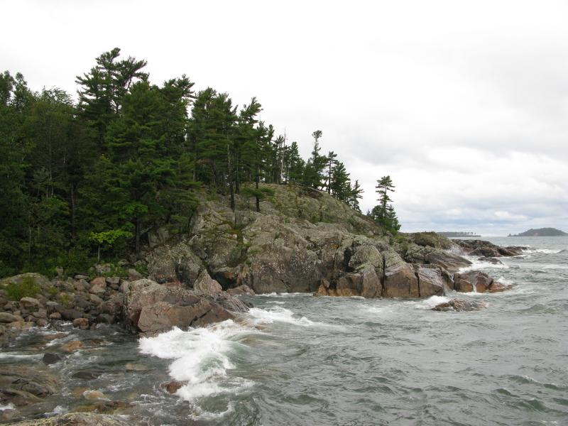
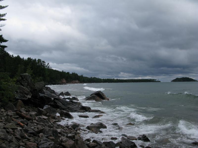
After climbing Sugarloaf Mountain, just a few miles north of Marquette, I headed down the eastern flank towards Lake Superior. With Wetmore Beach to the north and Partridge Bay to the south I stepped out of the cold, soaked woods and was greeted by an amazing view of waves pounding against huge, black rocks.
Waves crashing on the rocky shoreline
I carefully crept out on the slick boulders until I could feel the spray of the waves as they crashed onto the shore. My hike had been rushed to this point... I woke up early, quickly packed up my campsite, and scrambled up a mountain. This was a great time to catch my breath and really enjoy the scenery.
Cloudy skies loomed angrily over Lake Superior, with a few whitecamps visible far off to the east. I was on a bit of a point, and I could make out both Presque Isle and Little Presque Isle along the shoreline (in opposite directions). The black rocks I were sitting on were ancient, with lichen-covered crags and deep, worn grooves. Some of the waves barely curled over before hitting the shore, while others thundered and splashed me with foam and a refreshing mist.
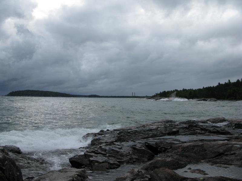
Presque Isle to the South
My route took me south from these rocks, away from Partridge Bay (which I think is private, anyways), and towards Wetmore Beach. For a while I climbed over the rocks, which led me to and from the powerful Lake Superior, but I soon tired of this tough route and headed into the forest along the shoreline. A path slowly started to form along the shoreline leading towards Wetmore Beach, especially after I found a small shelter that had a definite Crusoe-feel.
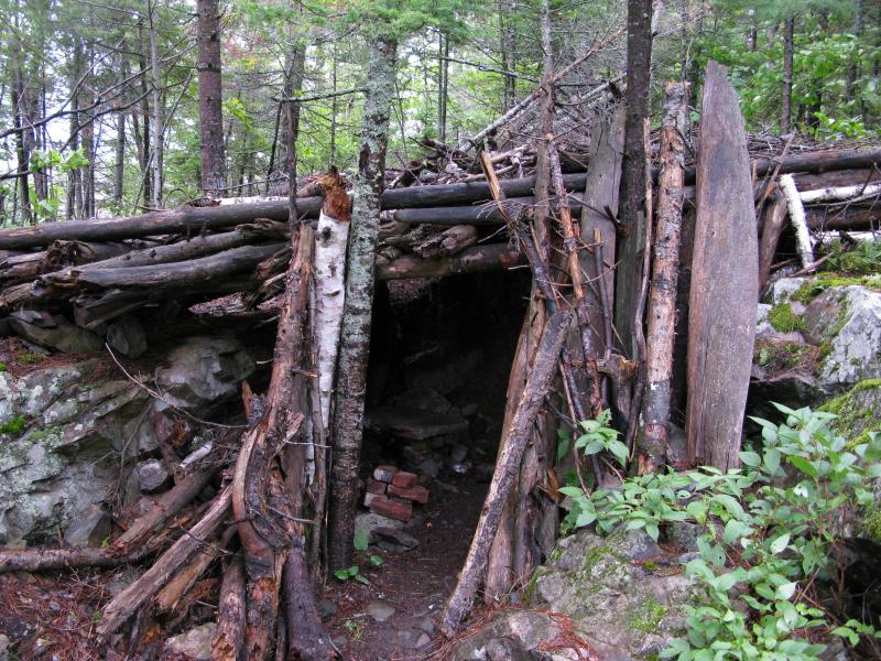
Shelter to the south of Wetmore Beach
After passing the small shelter the shoreline began to look more famaliar. I had visited a portion of Wetmore several years ago with Katie, when we wandered up and down the sandy beaches with Logan. There are a few outcroppings of old black rock with sandy stretches in between, making small, pleasant coves for summer swimming. Today's rough water gave the area a different look, though. Water reared up and crashed against the outcroppings, rushing up the sandy beaches until it touched the dangling roots from the forest above.
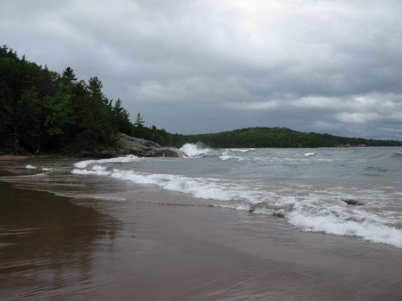
Sandy Cove on Wetmore Beach
Once I had passed this scenic but difficult stretch I continued on the 'true' Wetmore Beach, a long sandy beach with maintained trails in the forest. I could still hear the rumbling waves crashing onto the rocks behind me, but along the beach the water rolled gently in to touch the soles of my boots. I rounded the small, rocky point on the other edge of Wetmore to catch a quick view of the sandstone cliffs and Little Presque Isle that lay to the north before turning around.

Cloudy waves along Wetmore Beach
View north to Little Presque Isle
I had debated for a while where to head from here. Part of me wanted to continue north, to Little Presque Isle, before looping back. I decided against this, since it would add several miles to the hike and involve wading through Lake Superior on a cold morning. Also, this was my first hike of a multi-day camping trip and I decided to keep things easy for now. Instead, I turned back now towards the parking lot of Wetmore Beach, located near the apex of the water's curve. There was one more mountain to climb before heading back to the car - Hogsback Mountain.


-
Jacob Emerick
Mar 28, '13
Hi Cams, sure thing! Let me know when you do - I'd love to read the post and see what you're up to :P Thanks for the heads up.
-
Cams
Apr 1, '13
Thanks so much! I'll let you know when it's done :))
-
Cams
Apr 1, '13
Okay here it is: Surfing Gone Bad: Stuck in Lanuza.I just wanted to give the readers a picture of what I'm describing. Too bad I wasn't able to take photos due to our situation.. Hehe. Thanks a lot Jacob! :)
-
Jacob Emerick
Apr 2, '13
No problem! Glad I could help, in a very small way, to illustrate your story.
Add to this discussion