Deer Creek: Along the Mazatzal Divide
An open trail was a blessing and a curse. After miles of route-finding and bushwhacking it was nice to stretch out the legs and walk without watching each step. This section of Cornucopia Trail, and the Mazatzal Divide beyond, had a fine grade that was well-worn and maintained. However, there was that dreadful Arizona sun beating down on me. My morning within Deer Creek had spoiled me, much of the time spent in the shade, and I had forgotten about today's exposure. Suppose I better get used to it - there was nine miles of wide open trail to cover under the midday's sun.
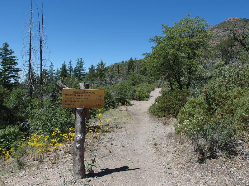
Wide trail leading towards Peeley
My next goal was Bear Spring, where I had just been a few weekends ago on a dayhike. That was where water and a decision waited for me. I could camp at Bear Spring and be in fine shape to finish this weekend's loop, or I could push onto an off-trail connector back to Gowan Camp. That off-trail connector frightened me. Getting it done today would be great, and could set me up for an easy Sunday, and it could also wreck havoc on my knees and gear. Oh well, that's for future Jacob to figure out. For now I enjoyed the views along this trail with an appreciative familiarity.

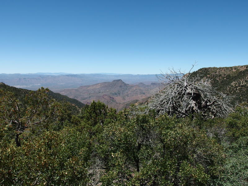
Southern view of Mt Ord, Four Peaks, and the Supes
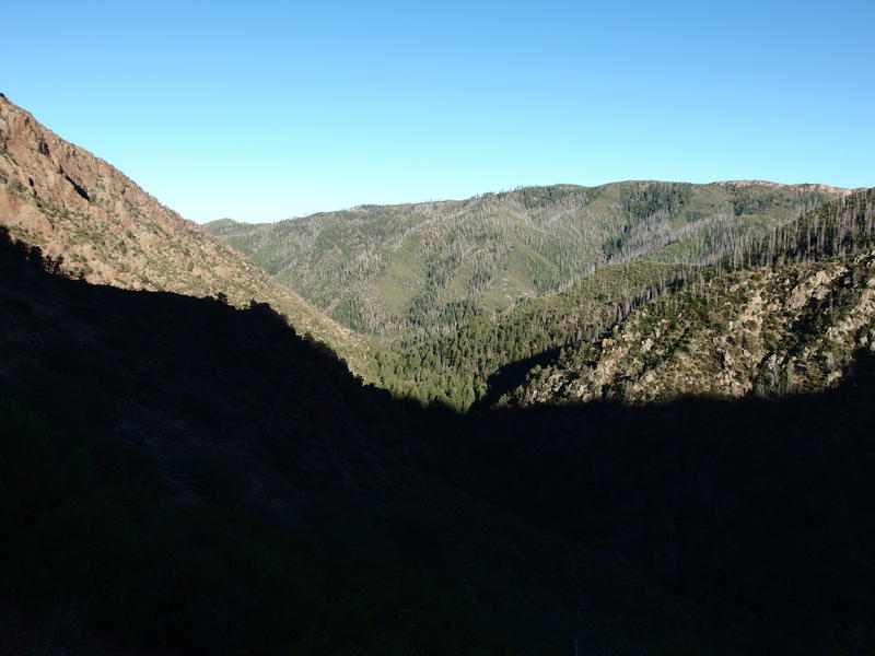
Looking back down Deer Creek

Looking up towards Bear Spring
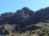
A year ago I had hiked this section of trail with Chris and my dad. We drove up to Mount Peeley Trailhead, followed this path for a few miles, and then cut off near the wilderness boundary to hit the summit of Mount Peeley. It was my third adventure into the Mazatzals and their first, a quick five miles and fifteen hundred feet. Compared to my current trips that feels like nothing now, but back then it had been a grand adventure to the top of a 7-ker. Plus a good hike with my dad is always something to treasure.
Today I didn't let myself stop on the climb, pushing up the switchbacks and skipping up the steep sections. Even with many miles behind me this morning I wasn't about to let past Jacob's performance beat me. When the wilderness sign showed up I paused and verified my time - 3 mph over 2 miles with a thousand foot climb - and virtually patted myself on the back. My legs felt like jelly. I decided to push on for one more mile before stopping for a needed break.
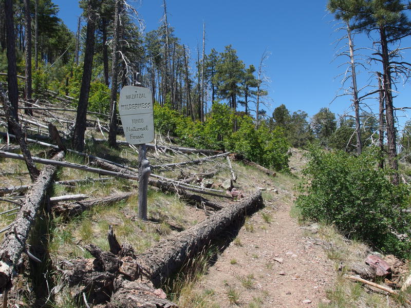
Back in the Mazatzal Wilderness
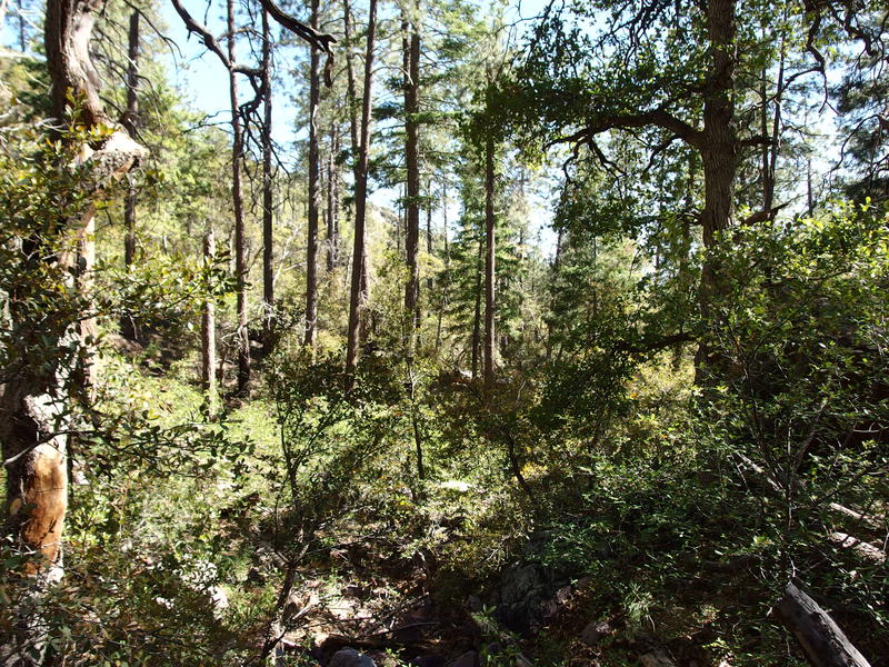
A half mile later and I found the most perfect forest that couldn't be passed up. Dropping my pack on the ground I eased onto a nearby trunk and pulled out some water and a snack. I only had two liters on me, with the plan to split this nine mile section into three via two water breaks, though I didn't like the idea of walking without water for that last chunk. Oh well, Bear Spring is dependable enough, as long as I don't break a leg or anything on the way. I washed down a dry snack and listened to the birds chirp above me.
This little forest was a rare sight in the Mazatzals. I know that the Willow Fire burned the side of Mount Peeley and started somewhere in the north, so the intensity of the burn must have been slacking at this point. I'm not sure how far Sunflower burned, if it touched on this mountain or not. There was some damage here, just not the high-intensity scorch that you find near Barnhardt or Knob Mountain. This was new trail for me, from the summit turn-off to Bear Springs, and I wondered if I would find more stands along the way.
Spared pine forest hiding behind Mount Peeley
Back on the trail I found the end of these pines when the trail began curving north away, though there was a lack of tall, dead trunks too. I wonder, not for the first time, how this all looked before the fires. It couldn't have all been towering ponderosa pine forests - there are plenty of burned remains of pinyon, juniper, and mature manzanitas. Does it look so different now then it did two decades ago? Sure, the ponderosa forests will take centuries to recover, but what about the rest? There's got to be grasslands in the west that burned during the Willow Fire that are fully recovered by now, mayhaps.
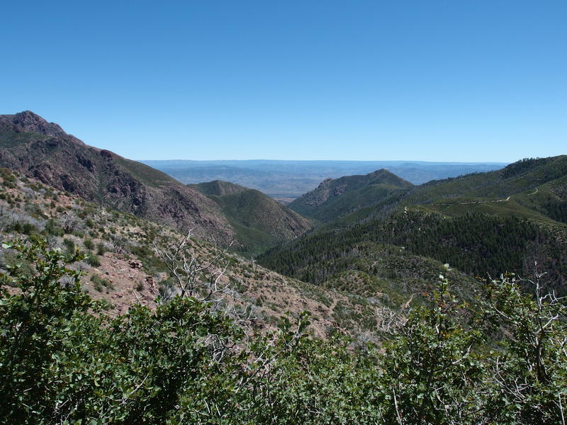
Western view of Table Mountain
Speaking of the western side, I was granted an amazing view down on a narrow ridge and admired it. I was a good thousand feet higher than I ever got on the Copper Camp loop, my last adventure over there, and everything was so much more visible. Well, at least within a narrow window around Table Mountain. I tried to pick out Davenport Wash Trail or the area around Sheep Creek Cabin and failed. Maybe I'll get some better angles later on.

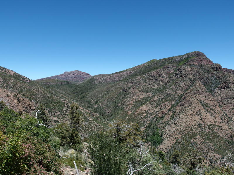
Ridge connecting Mount Peeley to Sheep Mountain
Mazatzal Peak poking up beyond Bear Spring
Another half hour and I got some great shots of the ridge between Peeley and Sheep Mountain. That's an important ridge - a few years ago a well-known hiker tried to climb Sheep and disappeared. No one's found any sign of him since. Since then the Sunflower Fire has caused serious damage, further complicating searches, and while the case is not officially closed it's been a long time since a team combed these lands. Few people hike in the Mazzies, so any casualty like that, especially for a well-known and experienced hiker, deeply resonates within the community.
As I thought about that loss, and gazed ahead at Mazatzal Peak poking above Bear Spring in the distant north, some voices drifted my way. People? People! Two dayhikers, from Peeley trailhead, were returning my way. We chatted briefly and they mentioned seeing some smoke from the Pinals far to the south, a range near Globe that had been burning much of the week. We separated ways, them heading back to their truck and probably a good dinner in an air-conditioned restaurant and me to more sweat and pain.
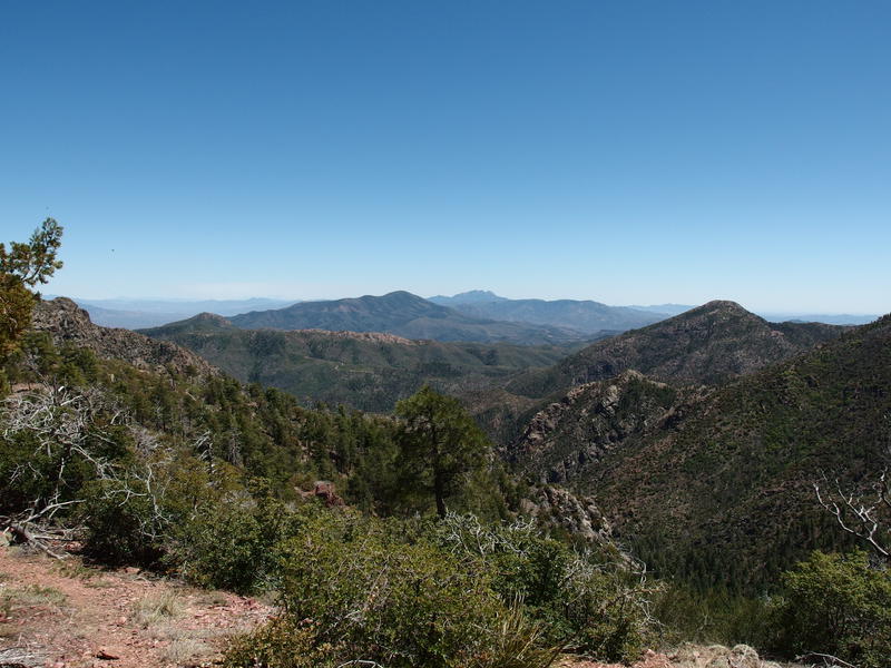
Looking north along the Mazatzal spine
Looking back towards Four Peaks
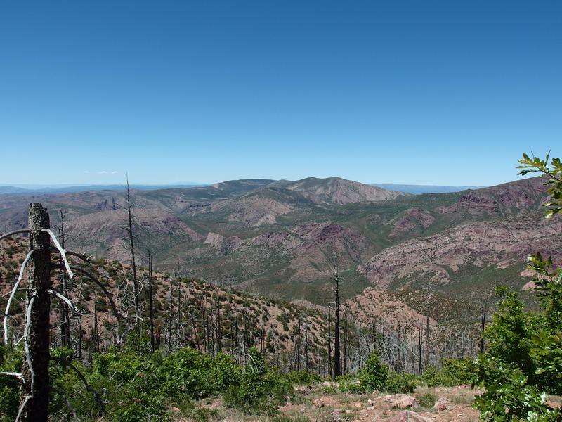
After the dayhikers and a short water break I finally ascended the highpoint of today's hike, and really the highpoint of any official trail in the Mazatzals, a narrow ridge at 7150'. The views were huge. To the north was an impressive range of rolling hills and rounded peaks, stretching all the way to North Peak and Red Hills, and to the south was Mount Ord and Four Peaks. I was much more interested in the north, in the closer lands around Fisher Trail and Chilson Camp and the further rugged cliffs around Deadman Creek, where I've been focusing my hikes and research on. I only have a few hikes left to do in the south, some wrap-up routes that will knock out multiple trails, and most of those are on or near the AZT.
Now it was downhill, with switchbacks and zig-zags and steeper rocky sections. My knee did not appreciate this, though my legs did. I had to be close to five thousand feet of accumulated gain by now. The fire damage was worse here, which gave me great views and left me fully exposed, and I began to long for the shade around Bear Springs. Less than a mile away and trail maintenance showed up. I had heard that there was a crew up here last week, this must be some of their work. With an extra skip in my step I cruised down the final leg, swung onto the spur trail, found the spring, and quickly set up shop. It was time to fill my light pack with some heavy water.
Slightly murky water at Bear Spring
Compared to the green, stagnant pool at Davey Gowan, the blue tint here looked positively amazing. And it tasted great, too. I drank three liters here and filtered another two for the next leg of my hike. Near the end of my break I heard some snapping twigs and looked up to see an overladen backpacker head my way. He was a section-hiker on the AZT and had started from Twin Buttes earlier in the week. We had some good chats, mostly about trail conditions, as he pumped at least a gallon of fresh water. Eventually I cut our conversation prematurely and wished him well. It was almost four in the afternoon, I had three hours of daylight, and with those three hours I wanted to make a go for Gowan Camp.
A drainage starts near Bear Spring, starting about a few hundred yards to the north, and flows south for two miles and east for one. This drainage is the start of Deer Creek and would take me right back to my morning's rest back at camp. I had a few options of how to tackle this: drop down from Bear Spring, follow the hillside contour south before dropping, or backtrack to the head. I backtracked. The forest looked terribly thick up here and not conducive to my weary state.
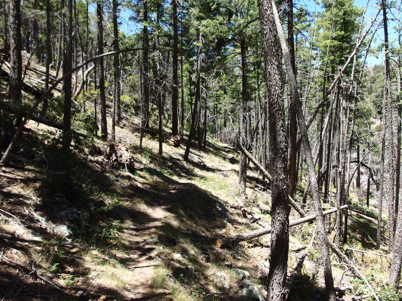
Relatively easy forest walking
This ended up working perfectly. While the drainage was dry and overgrown, it was still rocky enough to make for a reasonable path forward. I skipped along under tall trees, hauling over deadfall when needed, and made descent time. It was almost a mile before I bumped into the first real obstacle, some steep drops that forced me up along the bank and down sandy slopes, and even that was more of an annoyance then stopper.
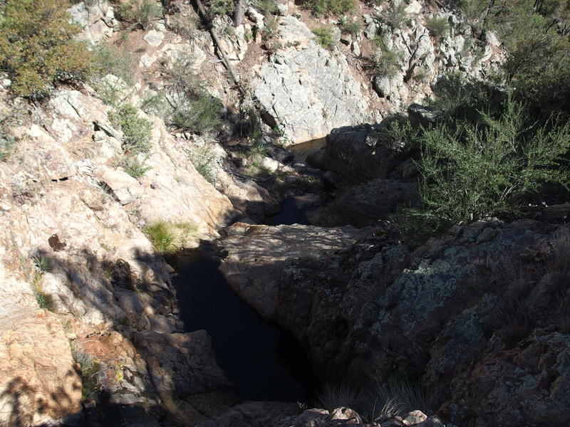
Sudden rocky drops to navigate

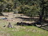
Rocky, forested canyon down
As I continued on there were three things that began to worry me. First was the obvious bear signs along the creek, from fresh scat to overturned rocks still damp. Every rustle or twig snap had me jumping. Second was the trails along the bank. They seemed very well defined, too much for game. There were no cairns, no evidence of man, yet I wondered what else could have hiked this length enough to leave a trail. And then the third thing - black plastic pipes running along the bed of the creek.
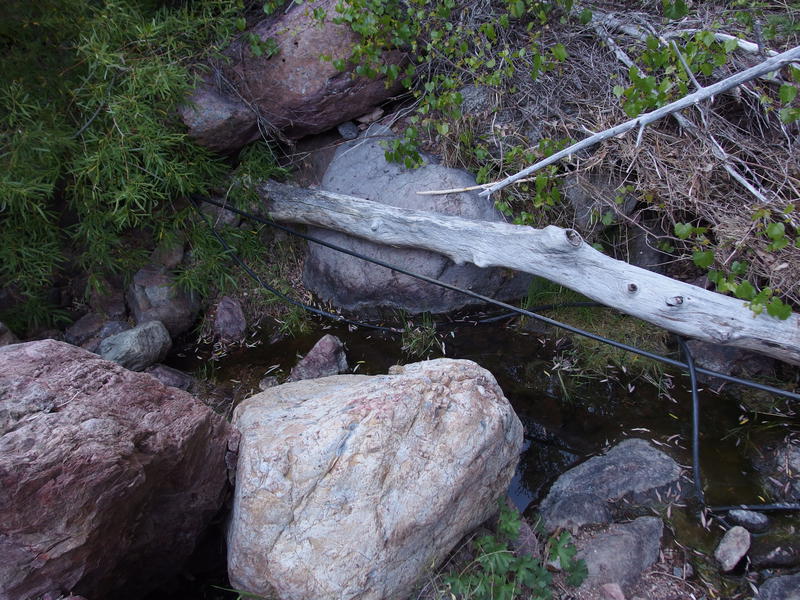
Mystery pipes along the creek
There were two versions of pipes, one looking beat up and partially pulled apart from wear and a second that looked to be completely functional. And they were pretty serious too, mostly buried under the creek until a rocky waterfall forced them above ground. Who would have had the manpower to haul this much tubing all the way up here, and for what? I didn't see an obvious start to them, no large pool that could be drained or anything, unless there was an underground reservoir they tapped into.
My first thought was illegal growers, a real problem back here, and that this tubing could be a way to draw water out of the drainage and into a more hidden grow area. It seemed too professional and exposed for that, though. If they wanted to be secretive they would have buried more of the pipe, right? Then there was Bear Spring up there - perhaps the AZT piped water up to make a year-round source. The amount of power needed to pipe water all the way up here ruled that out. Later I learned that the ranch below owns water rights to Deer Creek and could very well be using pipes to pull from up here. For now I leaned towards growers and was on high alert.
Longing view down to Gowan Camp
At one point the steep rock drops got to be too much and I climbed high up on a bank and, noticing that I could cut a corner, continued southeast to a saddle and a long view towards Gowan Camp. A little more than a mile away, with steep slopes over soft ground, thick stands of manzanita, and more creek navigation to go. I plopped down and drank some water, trying to wash some of the dust out of my throat, and planned a route down the steep slopes. Five hundred feet of hard descent is nothing to take lightly, not with twenty miles behind me.
Sliding on my butt more than hiking I made my way down, using catclaw and large rocks as brakes on the way. The large rocks were not trustworthy - they just made for short-lived surfboards that would cushion for a while before breaking free and rolling down. It was not a fun drop down. When I did finally get back in Deer Creek, covered in dirt and grime and coughing from the dust, I quickly drank some water before pushing on. Rock hopping felt almost easy after that badly chosen descent.
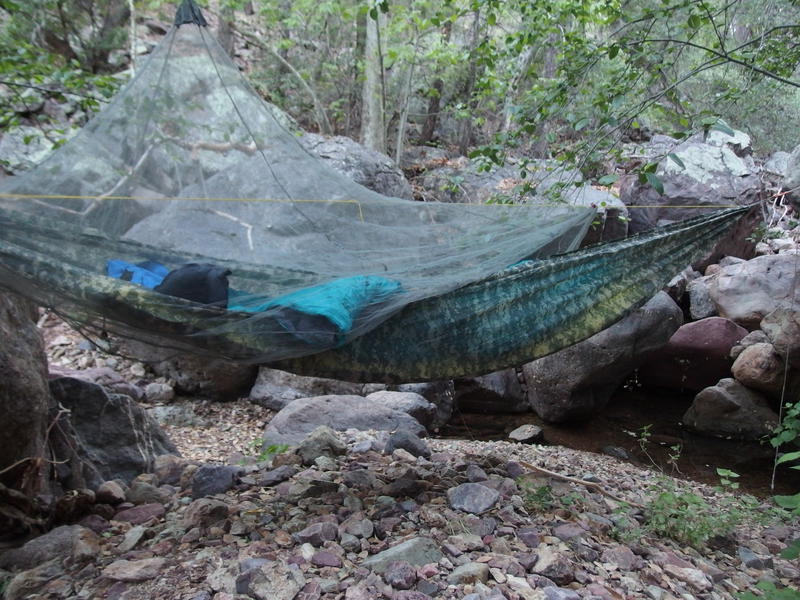
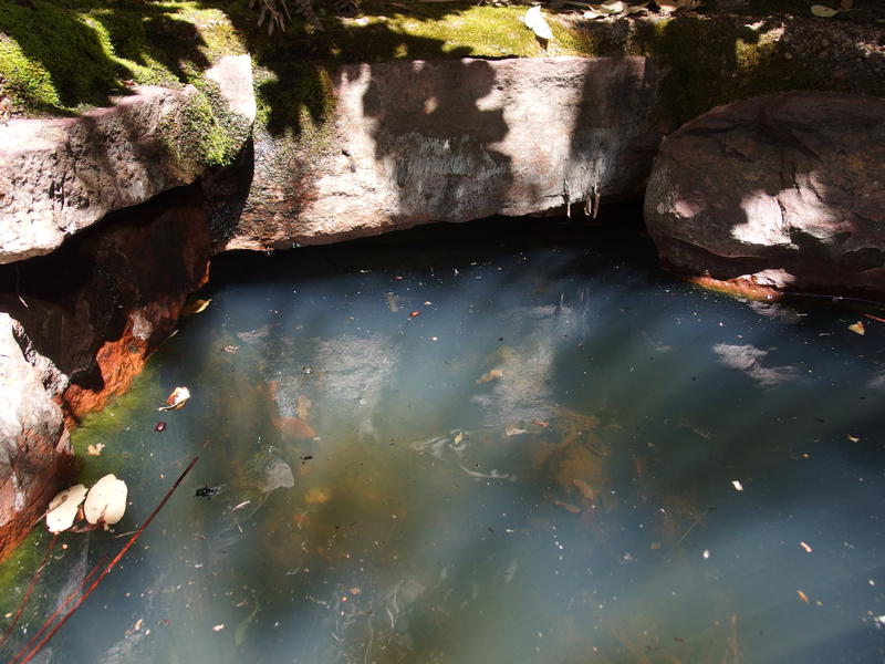
Hammock setup in the rocky wash
About thirty minutes later and I decided to call it. Gowan Camp was still a half mile to the east, yet I had found the most perfect campsite. Two small waterfall trickled into a scenic pool of water, framed by large trees and huge rocks that would make for great hammock stands and seats. Racing against the dying evening light I got my sleep system set up, using a sleeping pad for bottom insulation, and then began to bathe and filter water. It was close to eight thirty by the time I finally set Katie a final message and crawled into the hammock, making it less than three pages into a new book before falling into an exhausted sleep.
-
dcclark
Jun 13, '17
Roger, Roger.
-
Jacob P Emerick
Jun 14, '17
You're a quick one ;)
Add to this discussion