Deer Creek: Davey Gowan and Gold Ridge
Light trickled into Gowan Camp as I sat tiredly and rested, drinking water and chewing slowly on a granola bar. The half mile from where I spent last night to here was trivial, taking mere minutes to knock out, plus I had taken my time waking up and packing my gear. All in all it had been a lazy morning. There was some tough hiking ahead of me, including an overgrown Davey Gowan trail, nothing I couldn't finish before the afternoon. My legs would probably be a lot more eager if I had slept better.
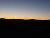
Morning light near Gowan Camp
Falling asleep in the hammock had been easy, and the first bit had been heavenly. The sleeping mat on bottom and a fifty degree bag on top was more than enough for the mild summer night lows. My first interruption was around ten thirty when snapping twigs alerted me to a bear less then twenty feet away. It wasn't a big one, a few years old at most, but it needed to be dealt with. I swung out of the hammock, switched on the headlamp, and made some noise to keep it away. Instead of meandering off it climbed a nearby tree, so without much else to do, I slipped into a fitful, watchful sleep over the next few hours.
Lying on a sleeping mat on a hammock introduced me to a new experience: the slip-n-slide sleep system. It makes sense, with two slick surfaces and the bottom one curvy, it just really sucked. I'd wake up every thirty minutes to find the pad either tucked to one side or completely on top of me. I even popped the deflate valve once while forcing it back beneath, so I had to re-inflate in the middle of the night. My butt kept warm at the cost of inconsistent sleep. I either need to switch to an underquilt or make the pad stickier for future ventures.
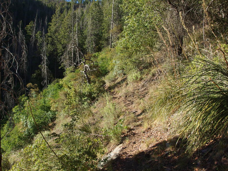
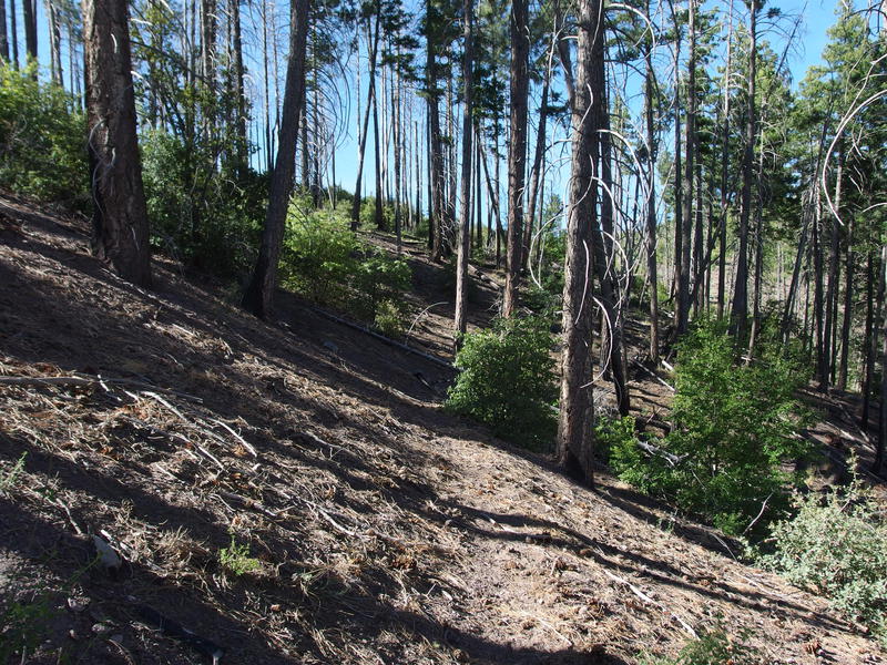
So yeah, I was a bit tired this morning. The ten miles left to hike today didn't care if I was tired. With an exaggerated sigh I stood up, packed my gear away, and started heading to the start of Davey Gowan. This is a short 2.5 mile alternate climb from this camp, swinging east and over towards, but not connecting to, South Fork Trail, and I had heard it was terribly damaged from wildfire. The start was easy enough to find thanks to some helpful blazes and the tread was obvious to pick up. This didn't seem so bad.
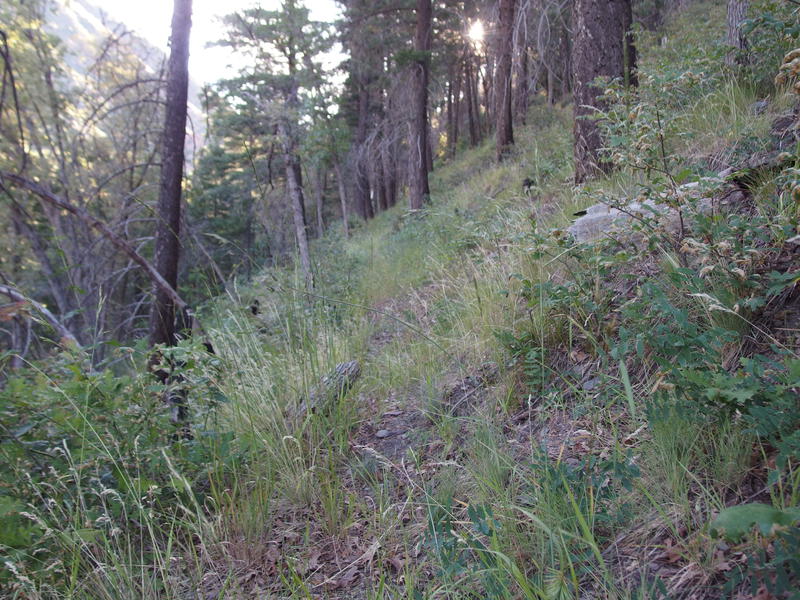
A faint tread on Davey Gowan
Easy tread to follow
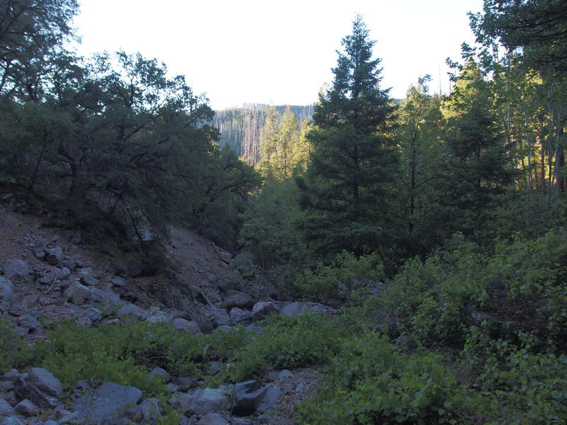
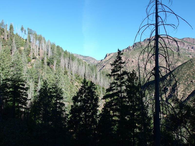
The open woods, clear trail, and slow uphill tread was delightful. I still had to watch my step, as the hill was steep enough that a misstep could be painful, plus there were a few roots and branches along the way, yet it seemed too easy compared to many of the Mazatzals routes. Almost whistling as I walked I zipped along and was soon greeted with a fantastic view down Deer Creek. Rough night or not, this was turning out to be a promising start of the day. Even if it got worse from here these sights were worth a bit of overgrowth.
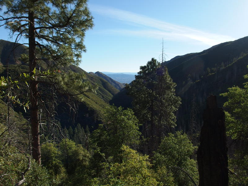
A great view down Deer Creek
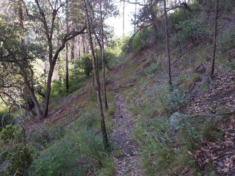
Easy walking along a steep hill
Sections of burn showed up past the half mile mark, with the exposed hillside promoting large bushes to grow up and conceal the trail. There was one short part that I crawled along, a slight annoyance, and then some game trails confused me near the big southern drainage. I ventured too low at first, finding a beautiful waterfall down there, before realizing the best crossing was a few dozen yards above me. The climb back up burned energy and gave me healthy scratches.
Looking back at the burn line
Once on the other side of the main drainage I tried to keep an upward trend, especially when multiple drainages showed up and gave the path definitive zigs and zags, it was just hard to do. Manzanita began to show up in larger quantities and it's not easy to just force a path through that stuff, especially when you're on a forty-five degree slope. I crawled multiple times and began using the brush to haul and pull myself up.
Washouts began to show up in greater quantities. This became painful when I finally found a good tread and felt confident on my route only to see it eroded by fire damage and/or covered with deadfall. A few of them were straight-up dangerous and I had to pick and choose a way forward that would minimize fall damage. Can't trust every rock you see out there to hold your weight, not when they're barely embedded in soft dirt. At least one was sort of fun, when a downed tree formed a perfect, if creaking, bridge straight to an easy trail.
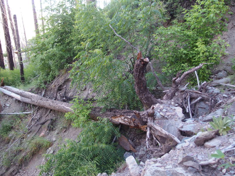
Dangerous washout section
When the trail began to climb in earnest the washouts stopped and the sweat began. So far I had gained a meager six hundred feet since Gowan Camp along a sloped hillside, now it was time to turn up that hill and haul five hundred feet over seven hundred yards. That degree of slope is a great way to burn out legs. This section started easy, well-defined switchbacks with only a few spots of confusion, though once the hill began to round more brush showed up to obscure my route. Near the top I gave in and just cut a beeline for the highest point. I was shocked when, after bushwhacking for a few minutes, I came across a well-defined section of path under tall pines.
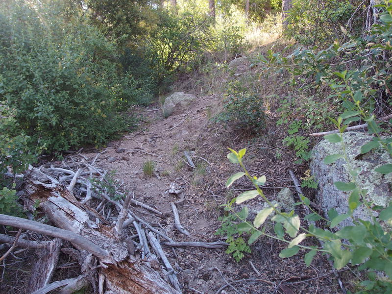
A steep uphill tread
A surprisingly good section of tread
The end was almost in sight. Three hundred feet gain over a half mile. When the nice path faded I again cut for the highest point, avoiding the catclaw patches when they showed up, and hauled over deadfall and through manzanita. It was sparse enough for easy going, nowhere as thick as Fisher Trail had been some weeks ago. Some cairns could do this trail good, and maybe a day or two of trimming. The deadfall and washouts would take longer to repair. This could be another short and easy trail that I could work on over a weekend to lure back some hikers.
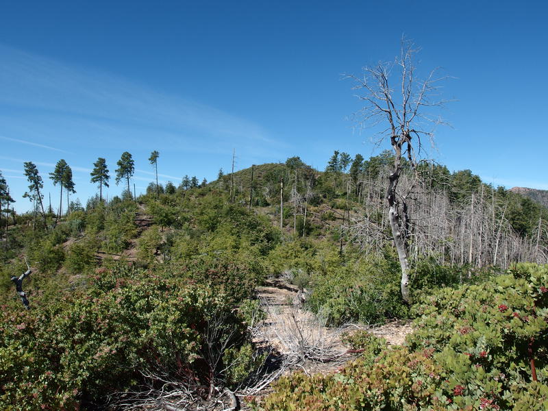
Badly scarred landscape on top of the climb
There wasn't much to see at the trailhead, no sign or cairn, only a humble fire ring and pull-out. The sight of Forest Road 201 was enough for me. I paused briefly here to sip some water and wash out the dust in my throat from bushwhacking before continuing on. A short distance to the east was South Fork and Gold Ridge and another decision to make.
My original plan was to hike up Deer Creek, play on the Mazatzal Divide Trail, and then go down South Fork Trail (which follows the South Fork of Deer Creek). One thing stuck in my mind, though - South Fork was rumored to be overgrown. Based on the few visitors to these trails, Deer Creek was in decent shape and South Fork was not. Well, Deer Creek had been no picnic yesterday and I had the cuts to prove it. There was a second option, Gold Ridge, and that was supposed to be in stellar shape. I decided to go down Gold Ridge. I'd have to come back on these trails anyways, so it only made sense to hike the easiest of these three routes twice. I may be a glutton for punishment but I'm not an idiot.
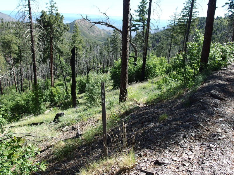
A humble start to South Fork Trail
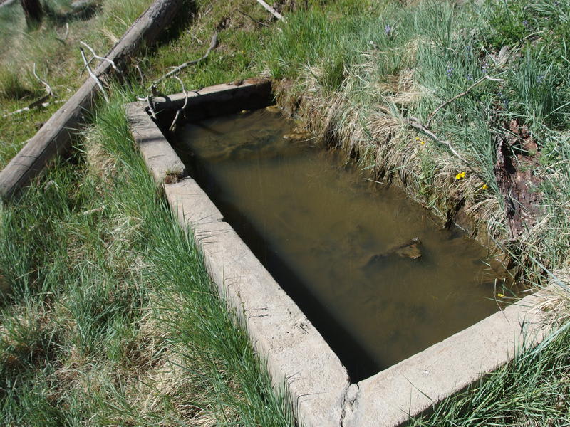
Murky waters at Pigeon Spring
There was something a short distance down South Fork that I was interested in: Pigeon Spring. This was the last water source before my descent. The last water I had pulled from was back at my campsite and I was down to one liter. Some extra water for the descent would be appreciated. What I found, though, was not pleasant. Pigeon Spring was a green, murky, and funky-smelling thing. Water is water, so I settled down, did a sock change, and filtered out a liter to go with a quick brunch.
With a liter of pea soup from the trough brewing in my belly I headed back up to the forest road and made quick work of the half mile to the turn off. I guess this is technically FR 3348, a short spur that runs along a rocky ridge and dead-ends near the start of Gold Ridge Trail. There was a friendly couple camping here that offered lunch and water, and I politely declined. Six miles of easy downhill waited for me and I couldn't wait to start.
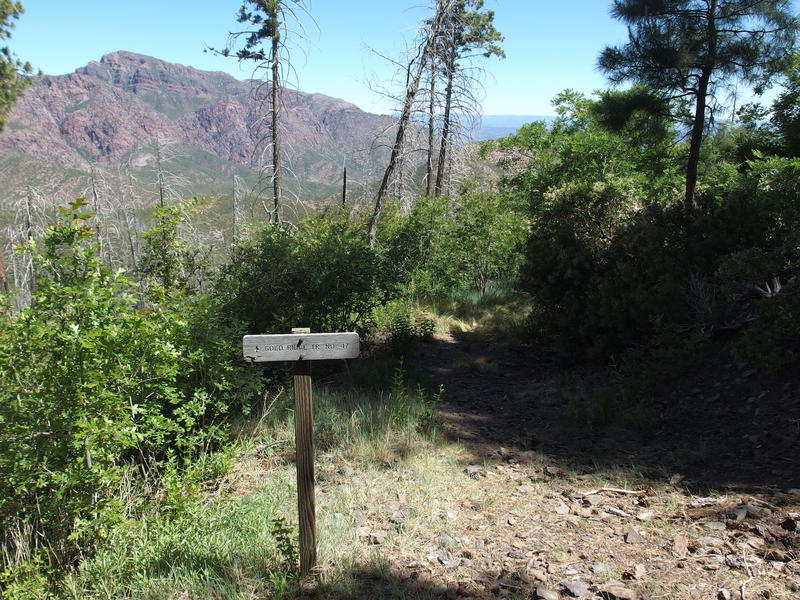
The start of Gold Ridge Trail
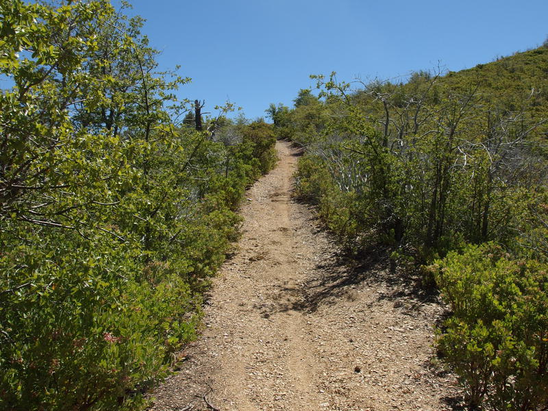
Luxuriously clear trail
Gold Ridge turned out to be easier then I could have wished for. Darn thing was as wide as an ATV trail and trimmed back a comfortable distance, and the slope gentle enough to keep my knees happy. I cruised along, enjoying the big eastern and southern views as they opened up, even getting a good view of smoke rising over the Pinals from beyond Roosevelt Reservoir.
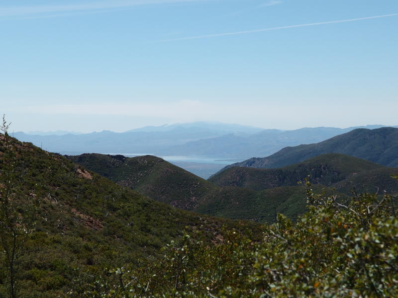
White smoke over the Pinals
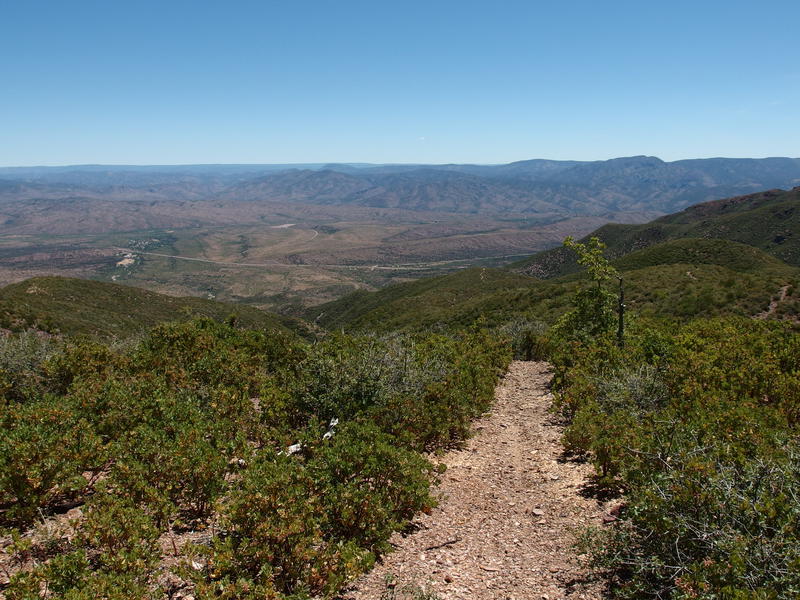
A long view down to the parking area
A slight breeze wafted in from the east, giving me a break from the hot, exposed trail. Going up this hill in the midday would be a real sweat bath. Down wasn't that bad, and the low shrubs gave me some wonderful views east towards Rye and Payson and beyond. This is one of those trails that I could only guess at its pre-fire condition. There were a few scarred and charred juniper trunks and that was about it. Unless the fire burned hot enough on these slopes to erase any sign of larger trees it probably looked much like it does now, low shrubs and very exposed.
Beyond a quick, sharp drop, I did take one break, just long enough to drink another liter of water and finish up some snacks. Then things got steep and I had to lean heavily on my trekking poles to avoid triggering my knees. It worked, and about two hours after starting on this trail I was passing through a gate and walking through a pasture. I didn't notice grazing cattle on the hike in, early yesterday morning. They were out today. The calves were skittish, bulls stared me down warily, and heifers lazy and dull. I couldn't care less, not after chasing off a bear last night.
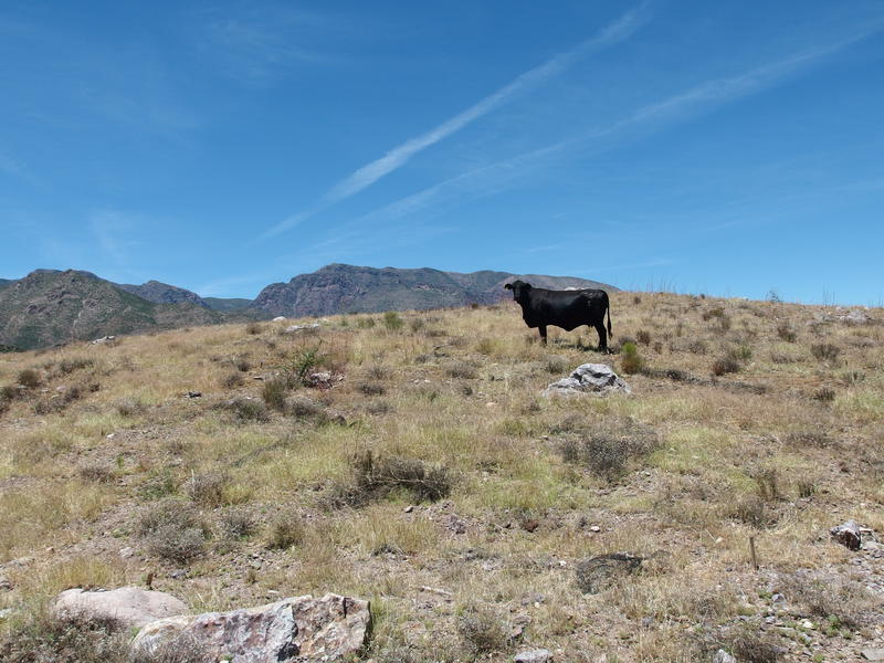
Queen of the Mazatzal Mountains
The parking lot was busy when I pulled out, four cars in the roundabout, though three of them had people near or at them. Not many hikers on the trails today. I pinged Katie and started on the drive home a mere thirty-two hours after starting. Thirty-one miles over thirty-two hours, a few more trails knocked off the list, and a night in a hammock to boot - not a bad way to spend a weekend.
Comments (0)