The Pup Creek Loop
Big Pup and Little Pup Creek are two fairly typical creeks in the Huron Mountains. Little Pup, the smaller of the two, starts right above the hairpin curve on County Road 510 and is only a few miles in length. Big Pup Creek is much more ambitious, almost twice as long and stretching far west towards Mulligan Plains. They join up before flowing into the Yellow Dog River below the main Yellow Dog Falls. There is a well-known, easily accessible waterfall on Big Pup Creek just downstream of County Road 510. Tipped off by a fellow hiker that there may be more falls downstream I planned a loop here, a stretched triangle that included both creeks and a few hills along the way, and waited impatiently for the spring melt to arrive in the Upper Peninsula.
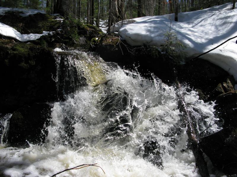
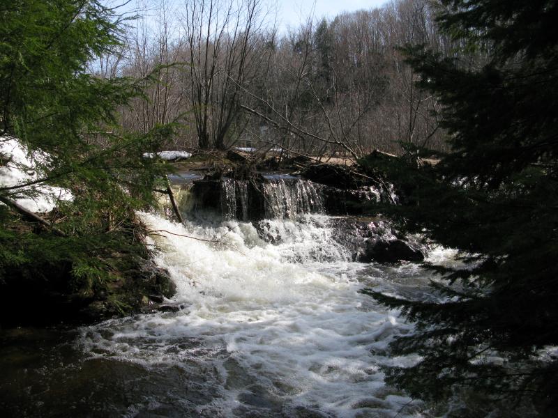
Splashing sideways cascade
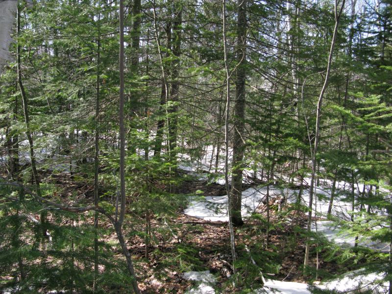
Warm temperatures turned 510 into a rutted, puddled mess of a road. By the time I made it to the Wilson Creek Trail both sides of my car and windshield were covered with splats of brown. There was just enough snow melted away at the start of the two-track to pull off and park - beyond this was a solid white cover. In fact the woods around me held more snow than not, a deeply disturbing view. I had expected a few drifts, not a slushy knee-deep blanket.
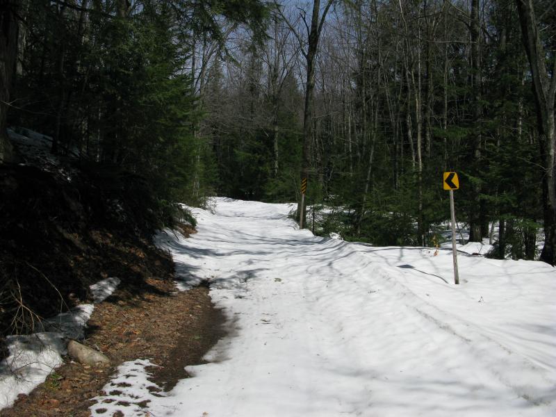
Snow covering Wilson Creek Trail
Throwing my gear over one shoulder I headed down the road, sloshing on the mixed ground. Sinking in every few steps, sometimes up to my ankle and muddy brown water below, I tried to make quick time to the first destination. Little Pup Creek has a substantial drop far up above the hairpin, one that was too far upstream to interest me much, so I aimed for a different elevation drop a few hundred yards into the woods.
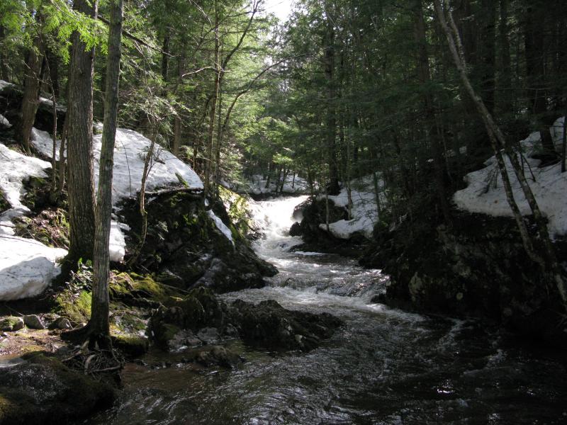
The creek passes Wilson Creek Trail a few times, simply flowing over the road around rocks and boulders. It was full enough with the spring water to completely fill the banks and be difficult to leap over. Enough noise was pouring out from overflowing cluttered rapids to drown out any potential waterfalls and I kept sneaking over and peering over the bank to make sure I wasn't missing any significant drops. It was a good twenty minutes before I bumped into the main drops, a rugged chute squeezed between huge rocks followed by a shorter tumble.
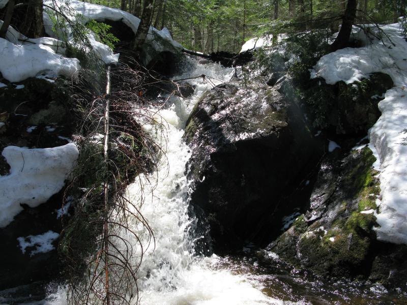
Rocky chute on Little Pup Creek
Choked up drop below the chute
This waterfall was pretty cool, much more than I expected from such a small creek. After taking a few photos and checking for more drops downstream I cut back to the road in hopes of avoiding the deeper slush that surrounded the water. Ahead of me, to the north, the woods began to open up with some logging activity. A huge swath had been clear-cut from the hill to the right, exposing the ground like a bare patch of raw skin. I don't understand clear-cutting: suppose that there are either economical and/or environmental reasons why it's a good idea, but it's always painful to stumble upon a section during a hike.
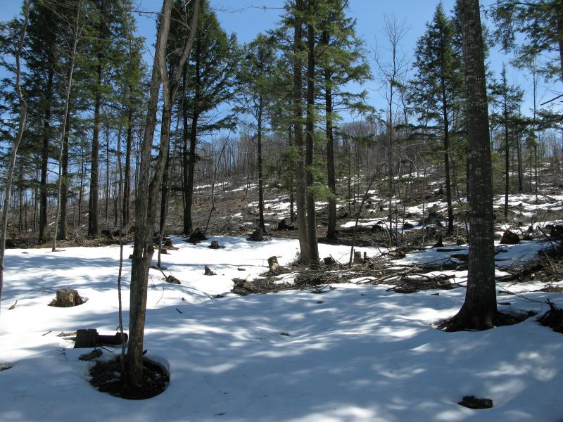
Clear cutting just east of Little Pup Creek
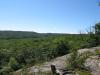
The thinned out trees around the logging road let more sun in and my trail browned up. I slowed down, thankful for the chance to stride normally through the soft mud, and looked around. Little Pup Creek had swung over to my left, where it would stay, as Wilson Creek Trail soon turns sharply to the east and leaves it for good. A few hills poked up ahead of me and I could barely make out a thin line of blue Lake Superior in the far distance. I've been thinking about climbing those peaks, the few south of Yellow Dog close to 550, although I think they are all privately owned. After one last look around I headed down into the snow, leaving the road for the creek.
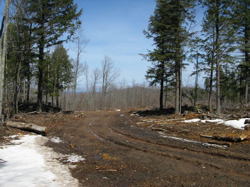
Distant peaks through the trees
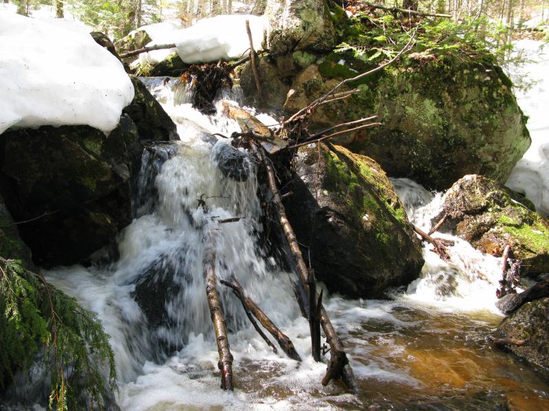
Logging peeps are usually fairly good at keeping their distance from creeks, not wanting to start an irreversible erosion problem or clog up the flow too much. There were a few trees and limbs hanging down over the water, probably indirectly related to the logging, but it wasn't bad. I found a few small drops here, nothing more than a foot high, that probably shrink down to nothing during the summer. Impatient to start the next leg of the hike I soon cut away from the creek, making my way north when the Little Pup veers northeast.
Some small drops along the creek
One last look up Little Pup Creek
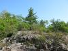
After a few trips down small seasonal cuts in the woods I made my way to the base of a steep slope. The slope was angled just right to get the full force of the southern afternoon sunshine. It was void of snow, brown leaves and grey rock underfoot. I've rarely been so excited to climb a hill.
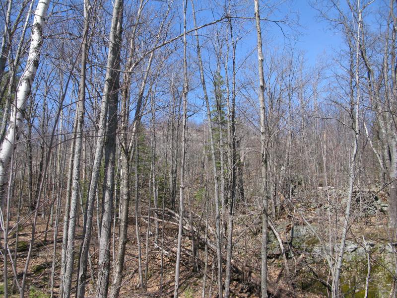
A welcoming bare, rocky slope
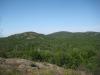
It didn't take long to climb the 200' slope and come out on a south-facing bluff. Glaring right in front of me was the clear-cut section I had passed by earlier on the hike, less than a mile away. I tried to ignore it and look around. To the right I could make out a few taller hills on the far side of 510, one of them probably the tall mound that the hairpin winds around, others reaching towards the Yellow Dog Plains. To the east I could make out hints of Lake Superior past some hills. I thought awhile of following this ridge west, getting some better views of the Yellow Dog and maybe Alder Hills to the north, and decided against it. The northeast face seems much more appealing.
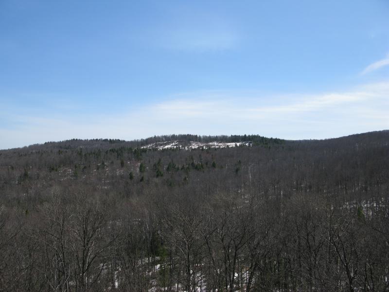
Looking across at the clear cut
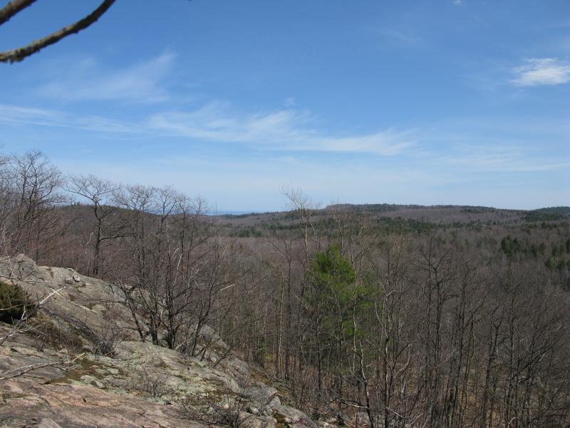
Southeast along the ridge
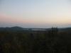
Turning away from the view I pushed through the scraggly brush that clung on top of the hill, a mix of stunted trees and undergrowth that pokes and bends around like stubby Velcro. It didn't take long to cross over to the north face and come out on wide bluff overlooking Lake Superior. The view was surprisingly open: everything from Alder Hills to the north to Saux Head Hill in the south was visible. I rested here, taking a few pictures and eating some sunflower seeds, and enjoyed the view.

Eastern peaks
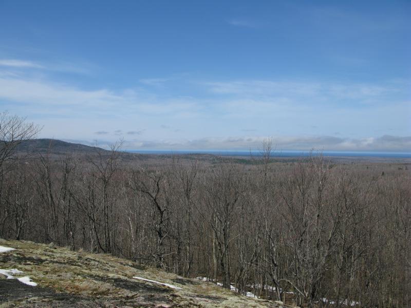
The southern Alder Hill and Lake Superior
A cool wind coasting off the lake eventually forced me to get up and continue on the hike. I wasn't looking forward to the next section, knowing that the protecting woods would shelter deep snow below. Skidding and sliding over the wet, deepening slush, I began to make my northwest to Big Pup Creek. The woods did not welcome me.
Snow and short, clingy trees
Snow covered large sections of ground, broken up in some places by sections of bare (and muddy) ground. I weaved back and forth, trying to stick to the bare ground, but often found myself sloshing through the snow up to my knees for dozens of yards at a time. I passed plenty of logging roads that ran perpendicular to my route, roads that had at least one bare shoulder, roads that would not lead me to Big Pup. It was frustratingly slow. When I first heard the rumbles of a creek below I wasted little time plunging down the slope in hopes of finding an easier route.
Big Pup Creek was swollen and much larger then I remembered from my summer visits. Usually a small creek, no bigger than Reany to the south and easy to step over, it now roared with all the force and flow of a river. Getting across would be about as easy as crossing the Yellow Dog River. I searched back and forth until I found a long-dead cedar bridging the banks, just rotten enough to sag uncomfortably as I quickly scampered over to the west bank.
Swollen Big Pup Creek
I wanted to be on the west bank for a few reasons. The hiker who had tipped me off about the falls on Big Pup Creek had mentioned a two-track along the river that I thought was on the west bank (in retrospect I think it follows the east bank). Also, there did appear to be less snow over there. The snow, which had been frustratingly deep since I left the hill, was thigh-deep near the water. Daring the risky crossing was well worth escaping from the wet slush.
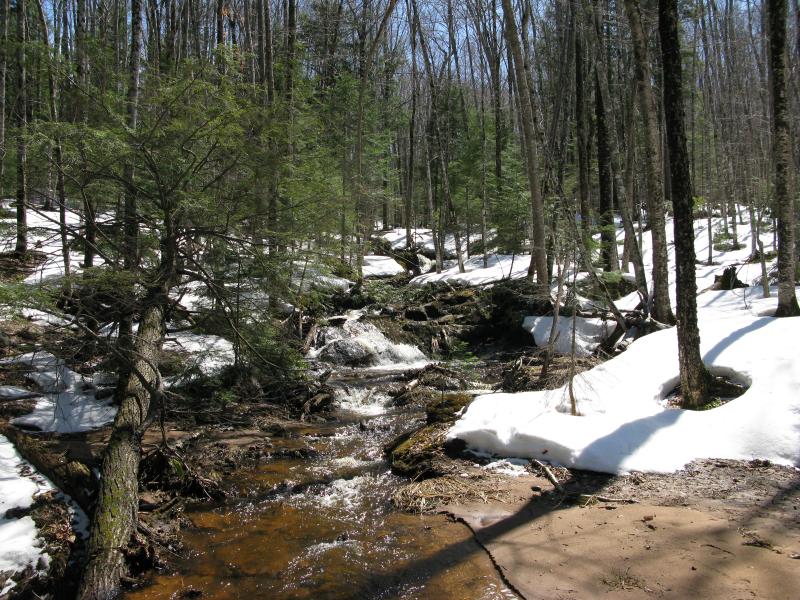
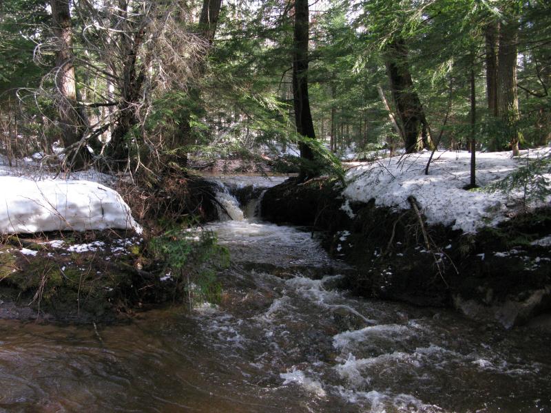
After determining that there were no drops of significance here I started heading upstream. The bank forced me up and down a steep slope, sometimes letting me stick right next to the river on muddy banks, other times pushing me forty feet up. In the summer it is probably possible to just stay in the creekbed - today the strong flow probably would have knocked me over. After about a half hour of this I came upon a calmer section, a swamp clogged with sand that promised easy going for a while.
Creek pouring out of the swamp over some brush
The swamp was a nice change, even if it was only a few hundred yards long. There was no snow here, no steep banks, just giving banks of recently-deposited sand surrounding a quick-moving stream of water. It felt good to stride again, if only until the woods regained the creek to protect mounds of snow underneath.
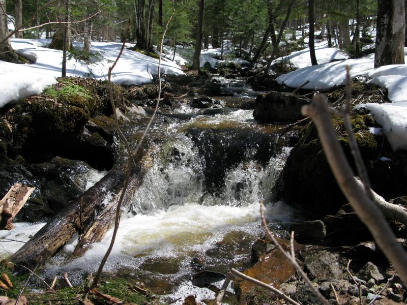
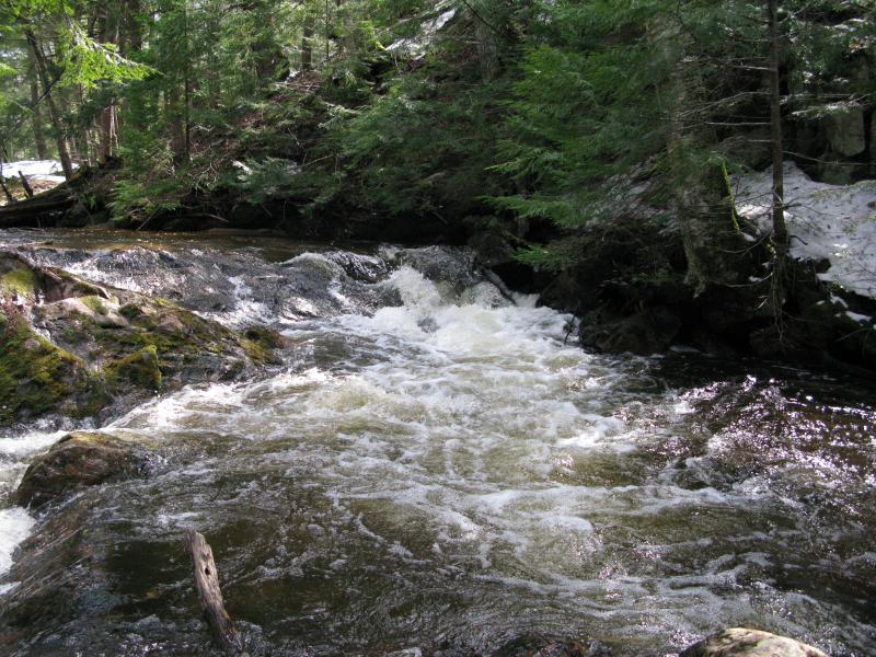
Upstream from the swamp Big Pup Creek began to roar a bit more, churning between rocks and steep banks. Ahead I could make out a waterfall, a narrowing chute that spit out angry noises and white mist. I couldn't reach it, though, with slick rock banks and deep waters below it. Taking a few pictures I moved on, slogging through the deep, wet snow, and found a taller waterfall above it. This one was even more impressive, a tall cascade that crashed and splashed over tough rocks. With a shorter bank and some convenient rocks I was able to creep up right below and feel the spray on my cheeks as I took some photos.
An inaccessible chute on Big Pup Creek
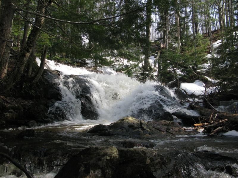
Impressive cascade crashing over the rocks
From here I had to choose between three paths. I could continue upstream to the well-known Big Pup Falls, a long fight through snow. If I could cross the creek I could make my way up to 510 and follow the road back. Otherwise, as I had seen about as much as Big Pup as I had planned, I could just cut a line back to my parking spot. Torn for a while I wandered upstream, just in case there was another impressive drop, and found nothing but a few small drops and chutes. Finally I turned left and headed back to the car.
Small, little chute upstream
The walk back was not easy, even as I attempted to cut from one logging track to another. Everything was sloped away from the sun, forcing me to both climb up an elevation and push through snow. When I was within a half mile of my car I cut out of the woods, straight up to County Road 510, and followed the muddy road back. While the creeks were full and waterfalls impressive I couldn't help but think that I should have waited another week before tackling this hike as my jeans and boots dripped cold water down.
-
Jacob Emerick
May 15, '13
Hi Joel - thanks! They do look different, eh? Spring melt sure exaggerated these falls, especially Little Pup. Thanks for the clarification about the two-track. That route didn't help much, as the track was covered in a solid foot or more of slushy snow, only partially packed down by snowmobilers, but I can imagine that it would make a nice summer destination. Really too bad about your spring trip... I've been waiting on the edge of my seat to get back up there, waiting for the snow to drop and the weather to warm up for camping. Were you able to check out anything cool in April?
-
Joel
May 27, '13
We really weren't able to make it out to hardly anywhere! Just about every road was a dead-end! Sometimes the road would be only a 100 ft. dead-end, and other times the road would be plowed for miles before the snowplow seemingly randomly decided to stop and turn around! 510 and 550 were plowed all the way through, and the Red Road/Deer Lake route was plowed all the way through. In Baraga County, Skanee Road was (surprisingly) plowed all the way through to the mouth of the Huron River (they logged just south of the beach and opened the view up a bit it seems...), Arvon Road was plowed end to end from Skanee Rd. to Dynamite Hill, and Indian Road was open end to end from Silver Rd. to Herman/Nestoria Rd. (which was plowed ALL THE WAY south to within a half mile of US 41 before dead-ending at a gate....?????) So, we were able to visit Quartzite and Black Slate Falls which were buried under snow and ice. We made it to the Mouth of the Big Huron which was a total ice field (and also the scene of a tragedy). We hiked along Gomanche Creek to it's confluence with the Silver River; (this was just stupid), the hike was aweful and I wanted to be along the Silver River-NOT Gomanche Creek.........how does one forget about a creek???Back up over by Big Bay, Sullivan Creek Rd. was surprisingly plowed to a small parking area for Black Rock Point- so we figured this would be a welcome easy hike out to the coast- boy were we wrong! This walk (I don't even classify it as a hike) has to be about the easiest in the UP 99% of the year. Unfortunately for us, this was the 1% of the year where the trail was basically impassable! We would take a step or two on top of the snow before crashing through 3-4 ft. of powder that came up to our hips. Fighting to get back on top of the crust, we would again take only a step or two before falling right back in. After about 2 miles of this we reached the Point- sweaty, irritated, and with fogged up glasses! After that, we pretty much wrote off any additional hikes and were content to drive back and forth on the few roads that were passable... I don't plan on making the mistake of heading up too early in the year ever again!
-
Jacob Emerick
May 28, '13
Holy cow! You really got around, even after so many obstacles!That's really surprising about the Mouth of Huron - never would have expected that to be plowed. What was going on out there? If they were logging south of the beach does that open up some of the swamp view or just weed out the 'camping area' for more spots? Hope they didn't take out too many, those pines are really cool. Also, did you wander around the beach at all? There's a few rocky hills just southeast of the mouth, was wondering how accessible they are (assuming one can get across the river easily, that is).Sure hope that Herman Nestoria doesn't have a gate on it! I know there is a turn-off by Kortio Lake that is gated, maybe a mile or two before crossing the Sturgeon River. Was this the gate that you bumped into? That road is a great 'short-cut' from the 41 corner and opens up a lot of land. Guess this is how peeps felt when Celotex was first gated off...Black Rock Point hike sounds all too familiar :( I've been on those before, cautious steps over brittle snow that suddenly breaks, plunging you feet down. It doesn't even matter who breaks trail, it just sucks. When you made it to the point did you climb down to the lake or just turn back in frustration?Hope you make it back up there soon - the ticks are just starting, not many black flies, and the temps are perfect!
-
Joel
Jun 2, '13
At the Mouth of the Big Huron, they took out a bunch of the smaller pines (Jack Pines, I think) that you drove through just before you reach the beach. I don't think they took out any of the big ones around the actual beach- It seemed like the lake will be more visible, a bit sooner as you drive out to it! Yeah, we walked out on the ice shelf to it's edge (not advisable, I know...) and checked out the extensive iceberg field that was between it and the Huron Islands. It was starting to drizzle as we were out there, so the visibility wasn't very good, and we didn't stick around very long. One of the mountains was visible over the tree line as we looked back to shore, so we were a little way out!Herman/Nestoria is still open (as far as I know...). It was plowed for miles south until the plow turned into a gated private area leaving the mile or so to US-41 unplowed and impassable- that was a LONG dead-end for us.At Black Rock Point, we went all the way down to the water's edge! On the north side of the point, there was a steady cool breeze. On the south side, though, it was calm and pleasant! I got some really nice pictures here of the Point, itself, completely covered in snow and ice with a band of small icebergs just off it's tip extending all the way to Big Bay. Unfortunately, after we were done, we had to do the return trip back through that terrible snow...About the Lower Big Pup Falls, I looked at my map and realized I got confused with my directions (again!)- The two-track and footpath to the side of the creek are on it's west side (NOT east...)! If you are driving south on 510, you would reach the two-track before you reach the bridge over Big Pup Creek. As we drove 510 in April, I kept checking the path out- but it didn't have one track going down it, and it was covered in feet of snow, so we passed on that hike.....I'm hoping to get up again for at least a long weekend in the summer and definitely again in the fall for more autumn color photos!I've seen that you've been busy with your hiking- I'm looking forward to reading the stories!
-
Jacob Emerick
Jun 4, '13
That adventure up at the Mouth of Huron sounds awesome - the thought of wandering that far out on the ice is just a little tempting ;) You'll have to let me know when you're planning on heading up later this year, it'd be great to bump into you up on the Longyear property or out on Curwood.
-
Joel
Jun 9, '13
I definitely will let you know! That sounds like a great time! Do a little hiking, maybe grill some dinner and have a few beers while sharing hiking stories....doesn't get any better than that!! Have you made it to any of the Mt. Curwood area waterfalls, yet? If not, I could show you the highlights (even in low water some of these creeks are beautiful) and maybe you could give me a tour of the Mulligan Area attractions.
-
Jacob Emerick
Jun 10, '13
Awesomes! I have not made it out to Curwood yet (which means I probably won't make it out there until late-summer/fall now). I was hoping to come in from the Peshekee Grade and hit up the peak, Dirkman Lakes, and loop around the falls, which may be a bit long of a hike. I was too worried about the condition of those roads in the spring to make it up there in May. It'd be a ball to check out those drops and revisit Mulligan... There is one section of cliffs on the Plains I've yet to check out (on the NE end) and an excuse to revisit the falls and Rocking Chair Lakes would be appreciated.
Add to this discussion