The Fortress of White Deer Lake
The straps cut deep into my shoulders. I was carrying a very heavy pack, filled with food, warm clothes, and extra supplies, much more than my usual haul. This was no simple in-and-out camping trip. My destination was White Deer Lake of the McCormick Tract and cold temperatures and rain were in the forecast.
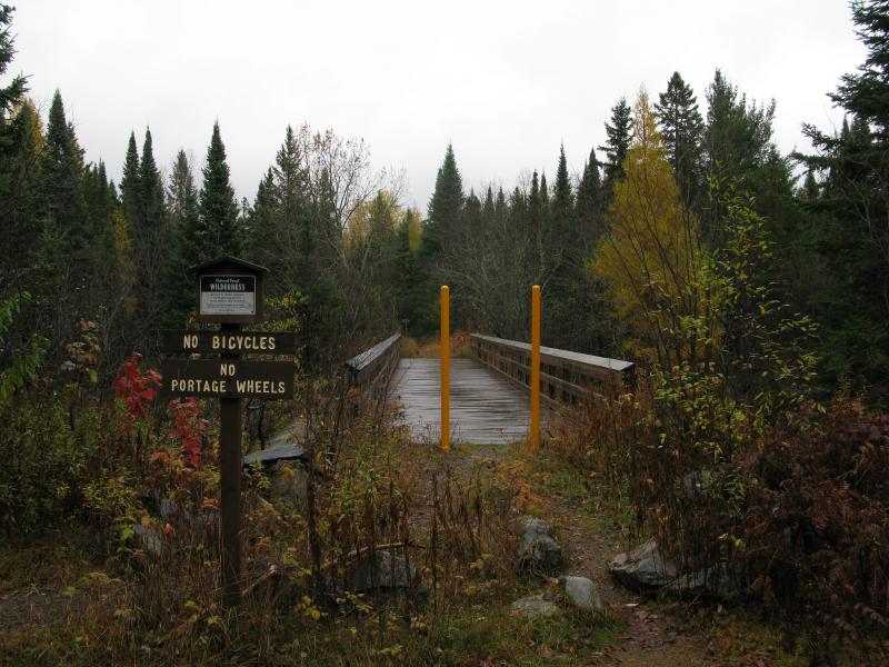
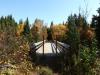
Bridge to the McCormick Tract
As I walked over the wet bridge I couldn't help but peer down at the Peshekee River underneath. It was swollen from a wet autumn, the dying vegetation changing color around the deep, dark waters. While the bridge is relatively new the footings are ancient, huge pillars of rock cemented together that once supported vehicles driving up to the now-gone cabins. I crossed the bridge humbly, thankful of the easy passing of the deep waters and thinking of past travelers.
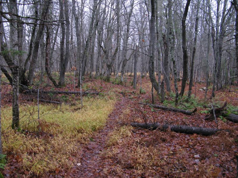
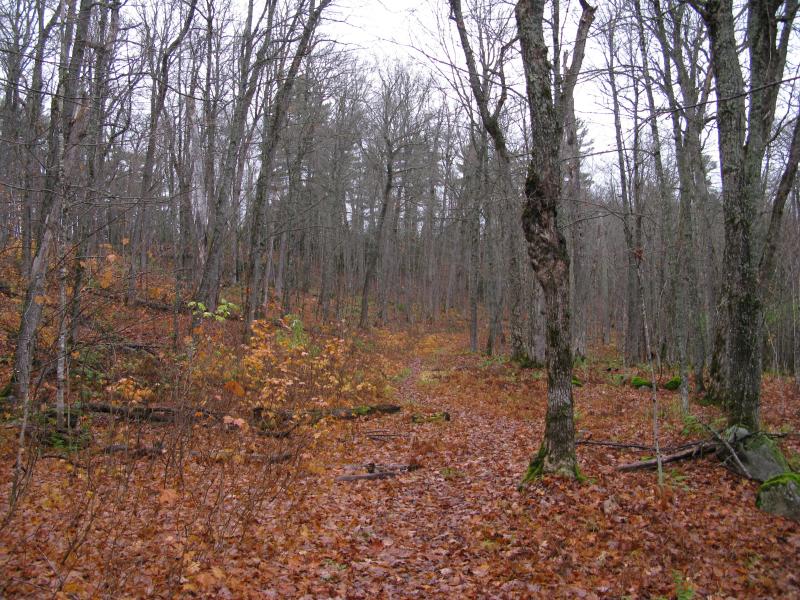
For the most part my trail would be an easy one. The old road up to White Deer Lake is now overgrown but a footpath remains, one that is easy to keep track of and follow. The first mile is wide and gravelly, with little to no impeding vegetation, and I quickly strode northwards. I had less than three hours of daylight to get to my camping site and, as usual, there were a few distractions along the way.
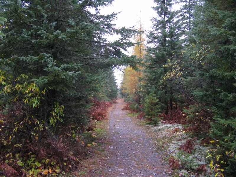
Wide, rain-wet trail
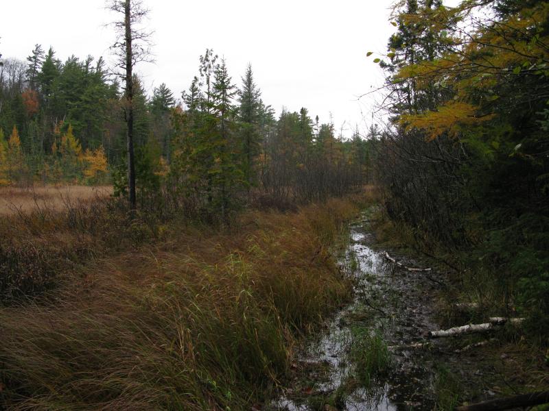
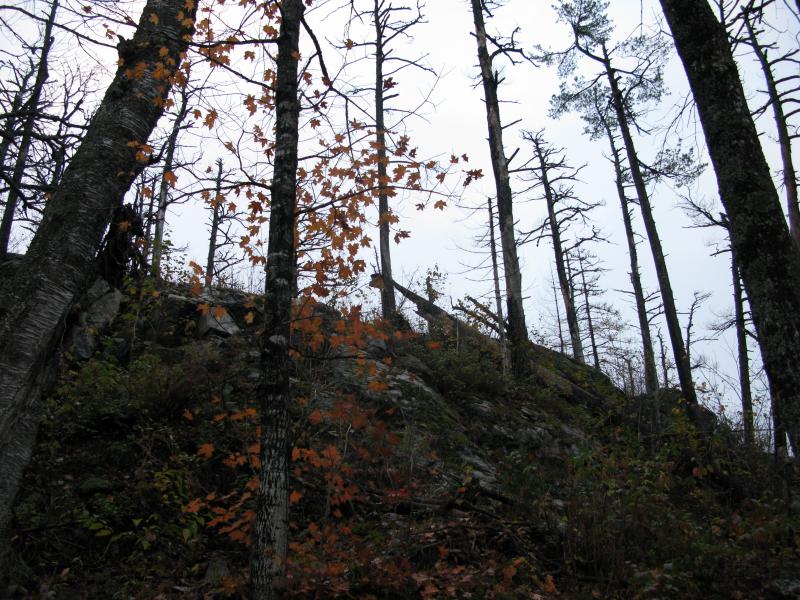
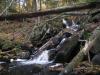
I tried to keep focus on the path and my pace, pushing forward under my heavy load. It wasn't easy with all the fantastical late-fall scenes around me. To the left was Baraga Creek, a wide, swampy stretch of water with dead grass and bright pines surrounding dark-brown water. Rising to the right were huge outcroppings, fifty, a hundred feet tall, pressing down on me with tons of exposed rock through the bare branches. When I finally bumped into Camp 11 Creek I began to breathe a bit easier. I wasn't making bad time so far and I was about a third of the way there. A few short minutes after a clumsy crossing of the creek and I dropped my pack to the ground, anxious to give my shoulders and back a break.
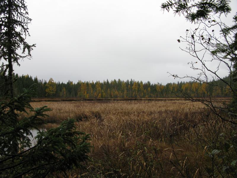
Wide swamp on Baraga Creek
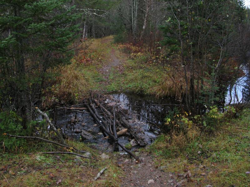
Trail crossing over Camp 11 Creek
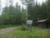
There are only three 'designated' trails on the McCormick, though none of them are marked or have any signs along their length. One leads from the Peshekee Grade to White Deer Lake, the one I had walked in on so far. A fork breaks off this path and connects over to Lower Baraga Lake, a short branch that I assume water folk are the most interested in. The last trail is way up near the Yellow Dog Plains and leads to the falls on the north side, a hike I had tackled some five years ago. Right now I stood on the fork to Lower Baraga Lake and, leaving my gear behind, trotted up the narrow footpath.
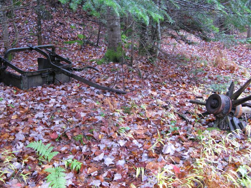
My plan was, unsurprisingly, ambitious. I hoped to follow the path to the lower lake, follow the lakeshore north, and then cut off to the upper lake a few hundred yards to the northeast. As I headed down the path I was surprised to see a large amount of trash along the trail, near the fork. It was all rusted and old, narrow tires and cast iron pieces, and I wondered if this was a dump for the long-gone landowners. That didn't fit with my knowledge of them, though. Shrugging off the mystery I continued trotting down the path.
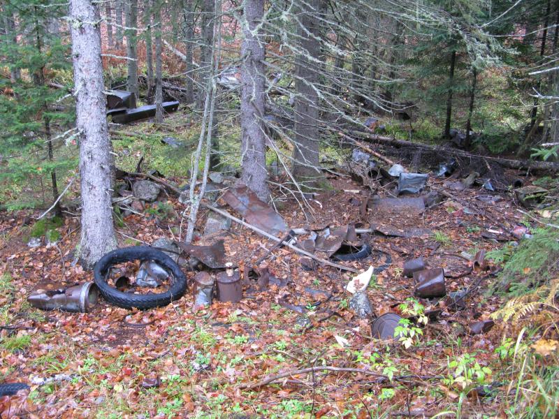
Trash along trail to Lower Baraga Lake
Drizzle picked up along the walk. From the beginning of my hike there had been a shifting precipitation, at times more fog than anything else, but now it began to pick up to an honest rain and quickly soaked through my outer layers. I tried not to notice. The woods were pretty and bare, the path narrow and unobtrusive through the dying undergrowth. Soft sounds of flowing water drifted in from my left, a more active Baraga Creek flowing nearby, no traffic or other noises around to drown away the delicate gurgles. Outside of the wet the hike was perfect.
Wet, bare woods
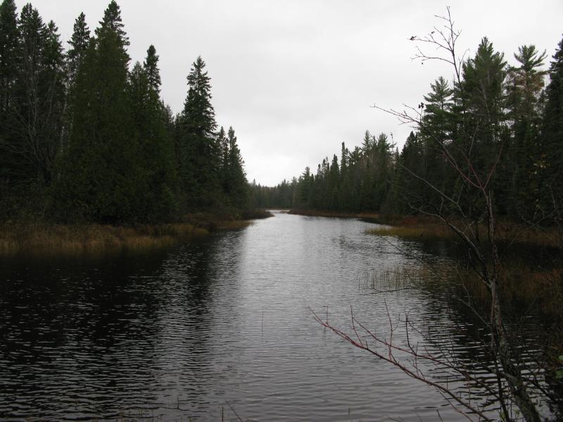
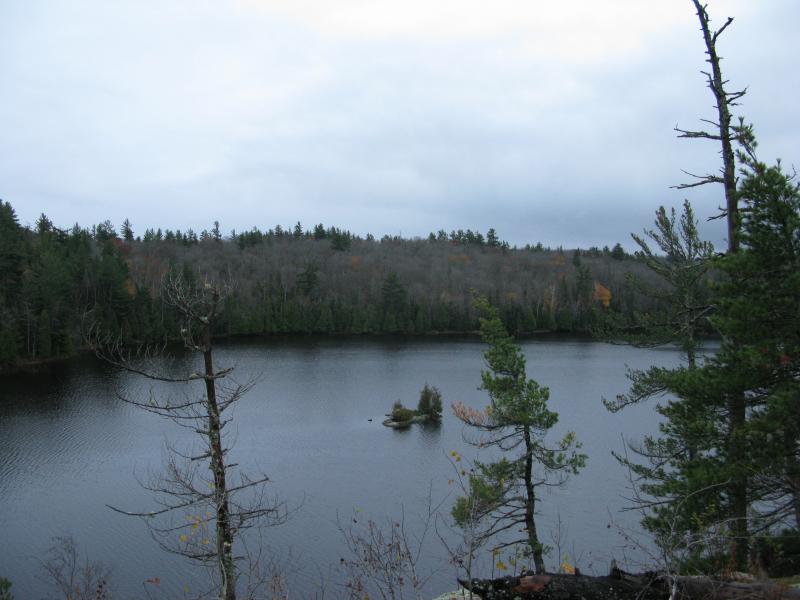
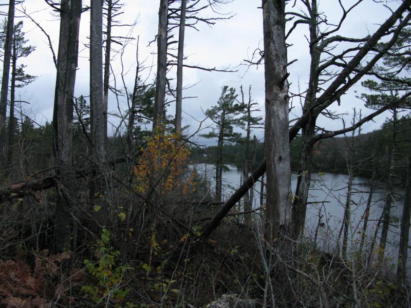
Eventually I came out onto the wide, swampy outlet of Lower Baraga Lake. A breeze was stirring up the waters under the cloudy sky, rippling the dark forest reflections. I pressed on, following the trail along the eastern shoreline, occasionally jumping over swampy sections and pushing through low brush. I knew the trail would go as far as the mid-point in the lake, though I suspected it would go further. When I got to a small campsite on a narrow spur I paused and looked around. There was a small fire ring and open views north up the lake. I checked my bearings and time. I was still hundreds of yards away from the mid-point, even farther from Upper Baraga Lake, and I was now running low on time. There wouldn't be time to go any farther.
Looking up the outlet of the lake
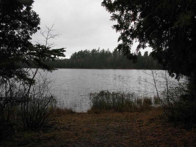
Lower Baraga Lake
With a sigh I turned and trotted back to my gear. I had briefly considered camping near here this evening, which would have given me plenty of time to explore the two Baraga Lakes today and continue to White Deer Lake in the morning, an idea that I now wished I would have followed through on. I made it back to my rain-soaked gear in short order and, re-shouldering the load, set back on the trail to White Deer Lake. I had less than two hours before nightfall.
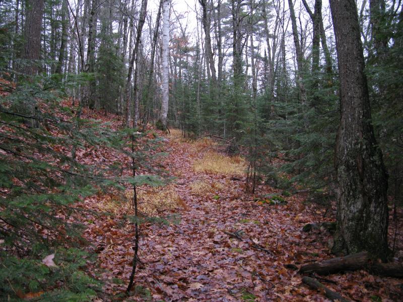
The trail changes quickly after the fork. Once level, gravelled, and wide, it degrades down to a narrow, winding footpath between tall hills. Thanks to the barren late-fall woods, though, I was still able to make out hints of the old road that once ran this length, wide enough for a single car and still, after all these years, level and unrutted. If it wasn't for the trees poking up through it one could still take a car along most of its length.
Uphill path
After the hills there were swamp, a long swamp, and the path was muddy next to it. I slipped and sloshed my way through this, trying unsuccessfully to keep my boots dry. The swamp was pretty, bright colors rising up to my left, though I was more concerned with the unsteady ground than the changing hues.
Sloppy trail along the swamp
As I walked I started thinking back, several years back, to my last visit here. Faith, AJ, and I had walked this same trail from the Peshekee Grade to White Deer Lake in the thick of summer. It was wet and rainy then too, bugs and humidity making the air a thick and chunky soup. Parts of that hike were coming back to me now, familiar sights and that-one-confusing-turn-next-to-the-swamp. Back then we had attempted to follow the western shoreline of White Deer towards The Fortress and Bulldog Lake and were turned back by impassable brush and marshy ground. That was today's plan, to attempt the lakeshore again, alone, burdened by a heavy back, and short on time. I tried to ignore the hubris in my plan and pushed forward past the swamp and woods.
A few hundred yards from White Deer Lake I found a fork in the path. I did not remember this fork. The path to the left was narrow, with a tree all but blocking it, yet it pulled at me. I checked my bearings. This could offer a route around the west side of the lake, high enough to avoid the worst of the marshy ground. Hopeful I began to pick my way down the path. A short distance off the trail and I found the wheel and scoop. I took the rotting scene as a good sign.
Old scoop and wheel
I continued down the narrow fork, picking out the path with some difficulty. It became apparent that this was actually a road at one time, a narrow and bucking one at best, yet still a road. Did the McCormicks and Bentleys have other roads back here besides the one to White Deer Lake? Or was this a more recent road, maybe fifty years old, that was used by the forest service to access the more remote areas of the park? Whatever the road once was a path followed it now, a path that led around the western shoreline, and I was grateful to avoid the marsh and brush that clogged the routes below.
Narrow little trail
The road led down through swampy areas, crossing over parallel cedar logs near the softer ground, and around taller hills. There were a few sharp turns that threw me off momentarily, forcing me to circle around and retrace my steps, but it wasn't until the tiny creek that I truly lost the path. I could trace it up to the creek and no further: the seasonal flow and darkening woods simply swallowed up the road and path together. A single hill lay between me and The Fortress, though, and I didn't mind a little bushwhacking. Leaning into the climb I scaled the hill, one last push before the end, and found myself in a thick and darkening forest on top.

Thick woods along White Deer Lake
Slightly worried I tentatively continued onwards. I wasn't sure what I was looking for now. The woods were too thick to camp in here and the day was gone. Aside from knowing the name and rough location of 'The Fortress' I didn't know if it was an outcropping, shelf, or just a simple rock, or if it would provide a sheltered camping location. White Deer Lake glinted lazily to my right, far below me, and I wandered through the nasty brush trying to ignore the clawing branches.
The woods began to open up a bit closer to the lake with a few potential spots large enough for my tent to fit. I slowed, trying to decide if I should just stop and set up camp and give up my search, and then something poked through the horizon ahead. A dark line, a huge bulge through the trees, blocked out the northern sky. It was The Fortress. I stumbled ahead in excitement, surprised by the size of the rocky mound.
Looking up at The Fortress
When I was close enough I dropped my gear, rubbing my sore shoulders and stretching my back, before tackling the climb. There was no easy way up the rock, no way I could just stroll up with a full pack, so I wanted to scout out the top before deciding whether or not to camp on top. A bit of scrambling up the damp rock and loose ground and I reached the flat peak. The top of The Fortress was disheartening.

Large firepit and scorched earth
There was a huge fire pit, probably left over from the old days, and around it was scorched earth and trees. It could have been a lightning strike that burned through the ground here, sure, but I would bet that it was a recent careless visitor instead. I circled around, trying to admire the view through the burned pines, trying to ignore the crunching ground underfoot and blackened logs.
Down on White Deer Lake
Up the neck towards Bulldog Lake
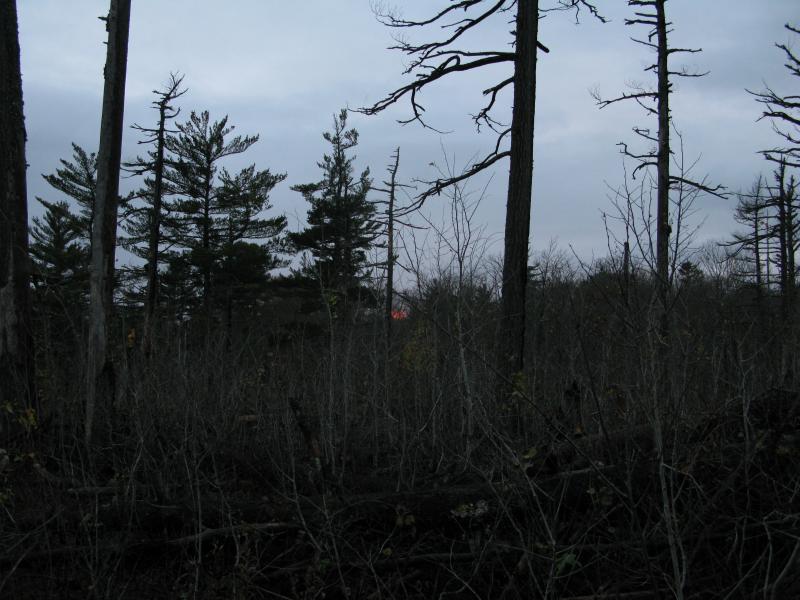
Distant fiery sunset
After a few minutes I headed back down to my gear. There was no way I was going to camp on top of that, not with the exposed ground and possible overnight rains. I picked some flat earth just south of the barren rock and pitched my tent. I had a long hike planned for tomorrow and, as I settled into my too-thin sleeping bag, I hoped to get a few decent hours of sleep through the cold night ahead.
-
Jacob Emerick
Oct 24, '13
Thanks! I found myself wondering that as well... It's becoming more apparent that there was logging back there way back when and that when they purchased the land only some of it would have been actual 'old growth' - the rest would have been either clear cut or, at the least, would have been ravaged by the older logging practices. Oh, and about the trail - a friend and I have been talking for some time about trying to retrace that route. That would be an adventure ;)
Add to this discussion-
Jacob Emerick
Oct 28, '13
Thanks Dana!I never would have guessed on the lightening strike... Figured with the tall pit (which is pretty large for being recently assembled) that would have been caused by humans. It's going to take a long time for that area to grow back to it's former glory.After the hike I think I saw those maps, with the old road leading back to the camp near the dam. I know it goes as far as the swamp-just-north-west of the Fortress, puzzled over it near the narrow section, but that's as far as I went. If I was smart (or had you with me) I could have saved some heartache by cutting from Island Lake -> Bulldog, then following the old road back to my camp. If the dam was pre-McCormick though... did they really shoot logs down Bulldog Falls during the spring?A boat sounds fantastic. Do you usually haul them all the way to White Deer or over to Lower Baraga and circle around?
-
Dana Sherry
Oct 29, '13
My memory might not be exact, but I recall the dam being constructed just before McCormicks began buying up parcels. As they purchased, I think the loggers still had the tree rights and were cutting as camp was being built. If McCormicks found a tree they were particularly fond of , they "bought" it from the loggers and asked them to spare it from the axe. The dam was built solely for the purpose of raising Bulldog lake to get logs driven out and down the yellowdog. You can see remains of a log boom at the dam. I have pictures that are pre-digital of various things, 2002-2004 I think. The Bulldog channel between the lakes was barely enough to drive a log in the high spring water, so McCormick actually paid the caretakers/trailbuilders to dredge it so a rowboat could be rowed through. All described in Superior Heartland i believe. A trip in by boat would be well worth your time. I've carried both to the Baraga Chain up to Island as well as into WHite Deer/Bulldog. Let me know when you want to go! Would be fun to combine knowledge and see new things.
Add to this discussion-
Jacob Emerick
Nov 9, '13
Now that you mention that, s, that does sound familiar, that Bentley was the one who was more interested in the Club and pushed for the long trail. Though in the latter years, after the first generation, wasn't it McCormick's son who put a lot of effort into widening/maintaining the trails and putting in the benches? Not sure if he was improving the Huron Mountain trail or just the ones on their land...
-
s
Nov 11, '13
It seems that Bennett was more in love with the UP than McCormick really. The two had a major falling out. The whole trail was lost until Rydholm made a major effort to find it. Of course they had to go across JML land. There were Bennetts at Conway lake later and Bennetts still own parcels up near the Salmon Trout. I cannot remember if there is a map of the whole trail in Rydholm's books.The whole story of White Deer Lake is a long section in the books.I think the ladies were more comfortable at the club.
-
Jacob Emerick
Nov 19, '13
Well, if you say that Rydholm retraced the trail, now I'll need to make an attempt! From what I've heard the books do not have a map, but I don't think it would be impossible. From West Branch Yellow Dog Falls to Mountain Lake is about nine miles, and I think one can assume that Bentley Lakes were on the trail. The tricky parts would be the roads, as I bet that the trail has been run over by either truck or ATVs many times in the last few decades, and the property ownership. At the very least it would give me an excuse to explore the rutted valley between the Northwestern Road and the Yellow Dog Plains, an area that I've wanted to explore for a while now but haven't found good access/reason to.That's too bad about the ladies being more comfortable at the club - that probably attributed to part of the McCormick Tract's downfall. The social aspect makes sense. I do feel like White Deer Lake would have been almost fancier, though, more dignified than the Club to the north.
-
dick bentley
Aug 10, '20
I went to Bentley Lake a few years ago. It's right on the Bentley TrailDick Bentley
Add to this discussion-
Jacob Emerick
Mar 26, '14
Hi Nancy!Just found your group on Facebook - beautiful pictures. Kinda curious how you got on the island. I've been tempted to swim across but never had a protective bag for the camera (or the guts to do it). Of course one could bring a canoe or kayak... just a long portage from the grade...Yeah, I did mean Bentley. Corrected. Thanks! And no, I don't mind sharing at all. You're absolutely right - it is a lot of fun to tell these stories and connect with people about some of these lands, whether or not they have the interest/ability to visit themselves. Hope you two keep exploring too! All the best.
-
Tom Groenevelt
Aug 17, '20
I hiked up to the lake about 8 years ago roughly 2012-13. I actually found a canoe underneath camouflage netting up the hill SE of what would have been the boathouse. My wife wouldn’t let me use it as she was afraid the owner might arrive?????I also have the book by Kay she was the child of the last caretaker of WDL it’s an interesting book in limited print. She was in her 70’s roughly 15 years ago when I contacted her, living in Colorado. Interesting story she had.Tom
Add to this discussion