Around Bulldog Lake
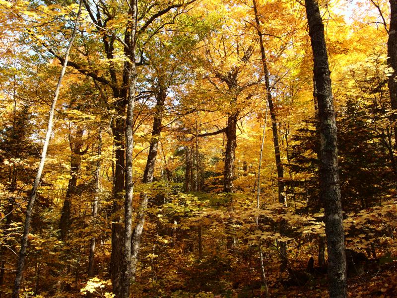
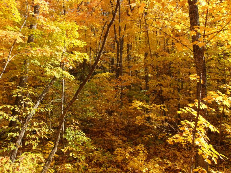
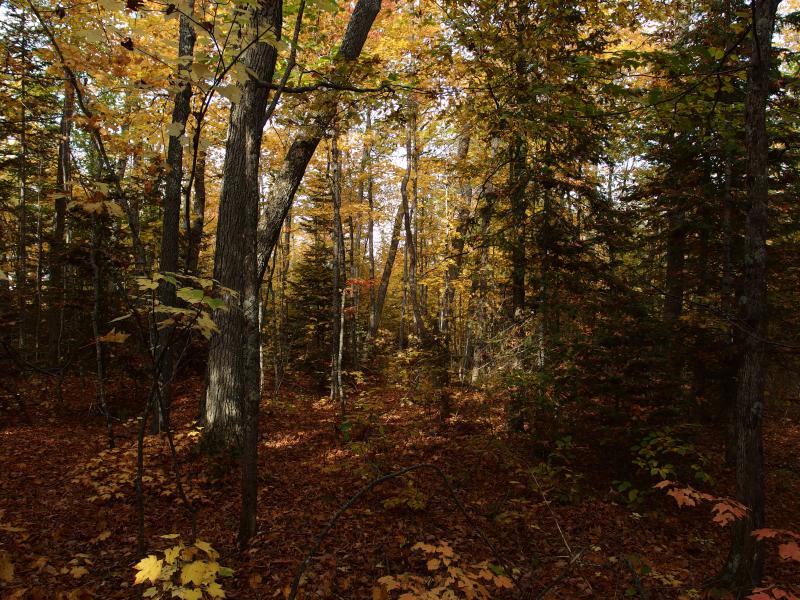
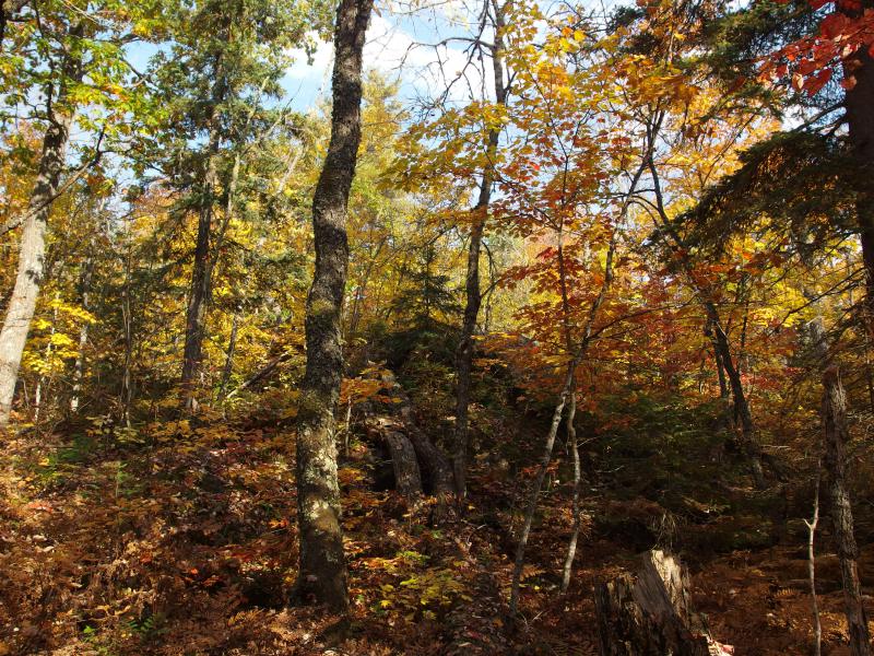
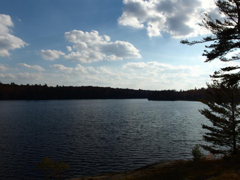
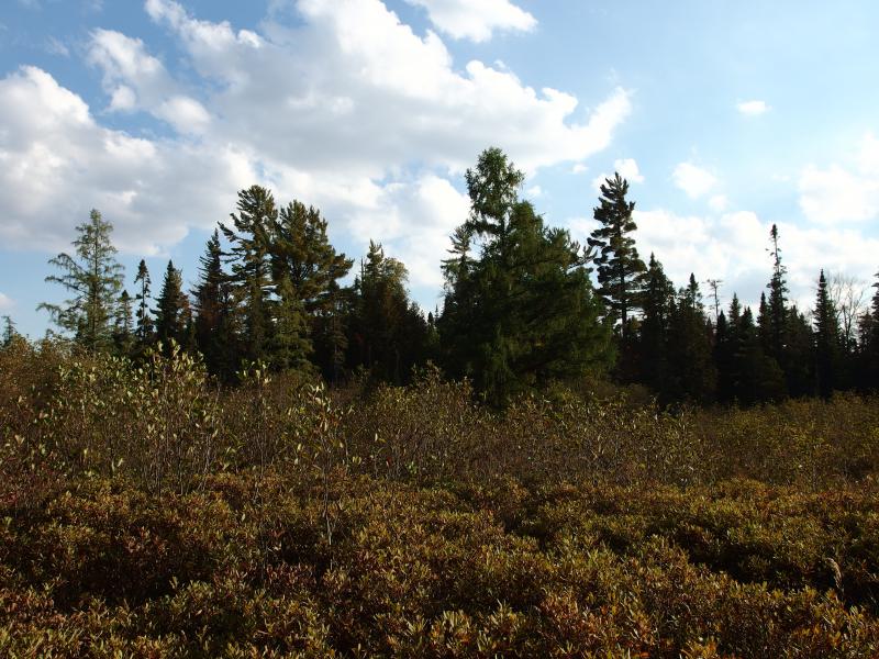
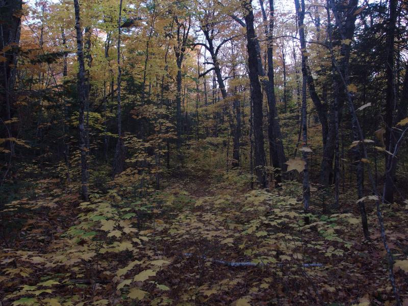
Crisp fall colors and scents poured out over the Peshekee and rushed around me as I stepped out of the car. Ah, yes. Everything was perfect today. The temperature was warm, edging close to eighty degrees. The sun shone down through a cloudless sky. And it was autumn over the McCormick Tract, the forest blazing with brilliant colors. Everything was perfect for a good, long hike today.
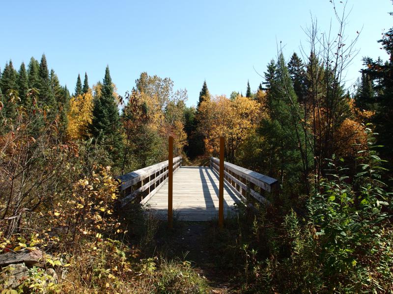
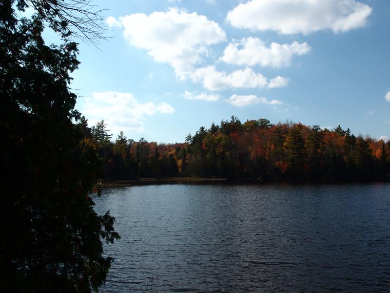
Fall colors around the bridge to the McCormick
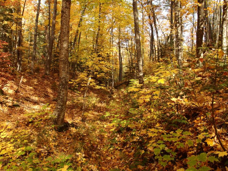
I had learned a lot about this land since my last visit, from friends and Rydholm's stories alike. One thing didn't change, though. A hike around White Deer and Bulldog Lake still called to me. This hike was something that I had played around with since first entering the Tract and the idea had only grown on me over time.
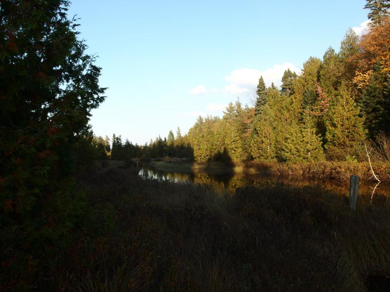
Hiking around the lakes is an appealing adventure from both a geographic and historical sense. The path in from the parking area, the three-plus mile walk on the old drive, is the main trail and one of the few recognized paths in the entire wilderness area. It takes you to the edge of White Deer Lake, at the heart of the tract… and no where else. Most people simply turn around at this point and just walk out, unsure or unprepared to go further. A circumnavigation of the two joined lakes is a natural extension of this route through the center of the wilderness.
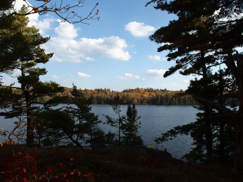
This shoreline holds many historical artifacts as well. On the far side of Bulldog Lake is a cement dam used to raise the lake, a clearing from the Sawyer-Goodman logging camp, and the pilings from a once-stately causeway. The Bentley Trail took turns on both the north and south side of the lake, meaning that one may find old paths by both Birch Point and the Fortress. This was the center of their Grand Camp, where huge cabins once stood and visitors from the Huron Mountain Club would be entertained, and the two lakes swam with memories.
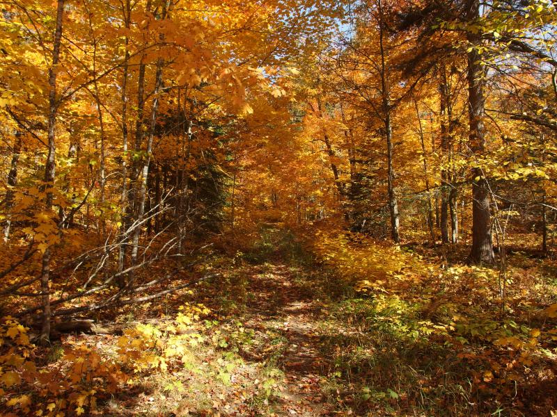
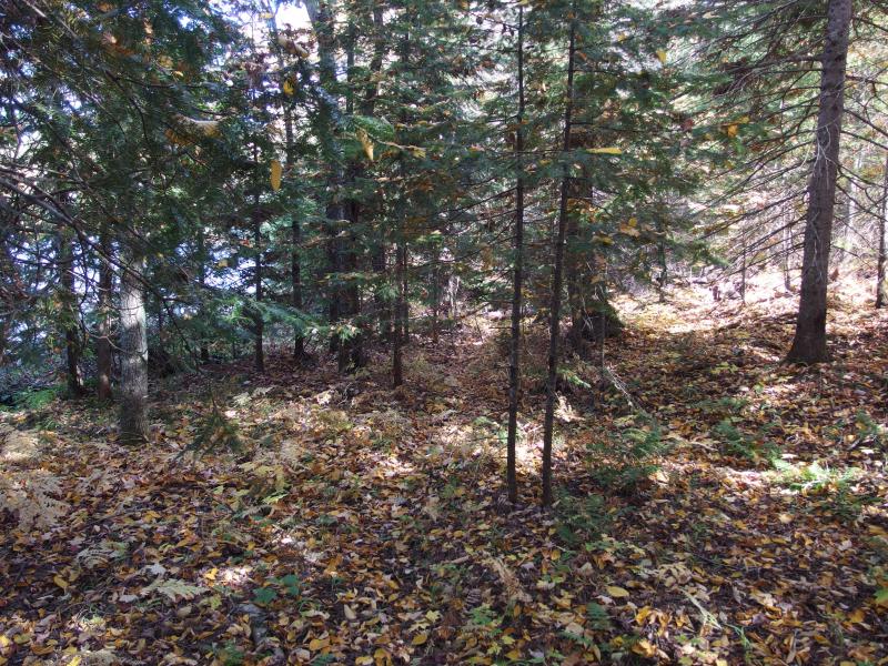
Bright hues along the trail
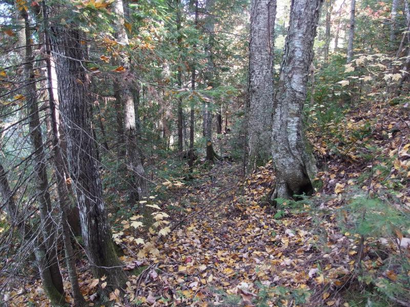
Hiking to the edge of the lake was a long trek, hauling my camping gear on the wide path through swamps and over hills. The trail was in excellent condition today - only a single downed tree to duck under and a helpful group of step-stones to cross Section 11 Creek. Even the swampy sections seemed relatively dry. When I finally reached the old foundations of the mainland cabins I was surprised to see a friendly man camping just off-trail. We talked briefly: I was excited for my upcoming hike and he was here for solitude and fishing. Soon I had dropped my gear on the shoreline (next to the old boathouse), grabbed some necessities for the next leg, and started around the lake.

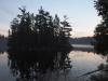
Tall trees on the island of White Deer Lake
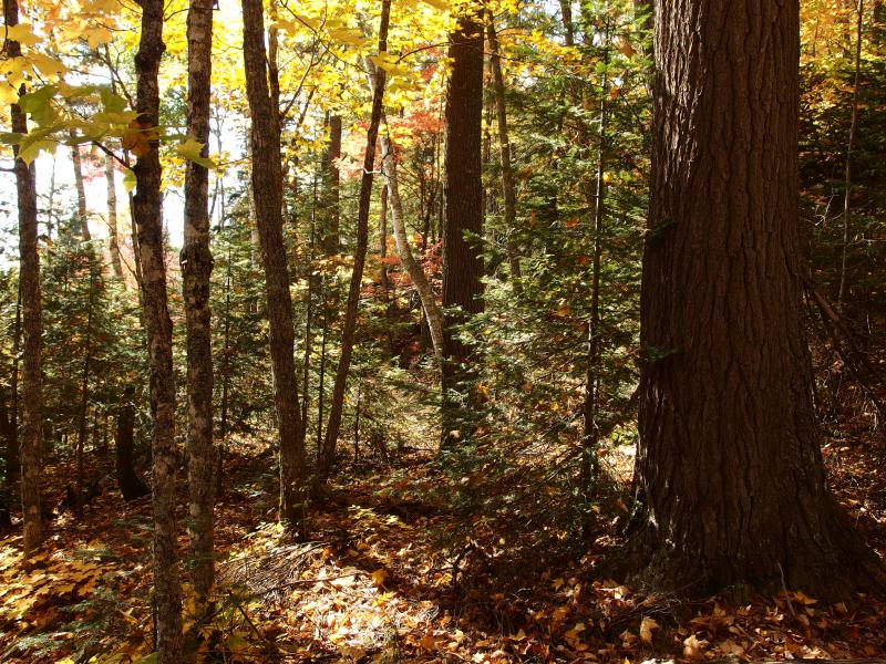
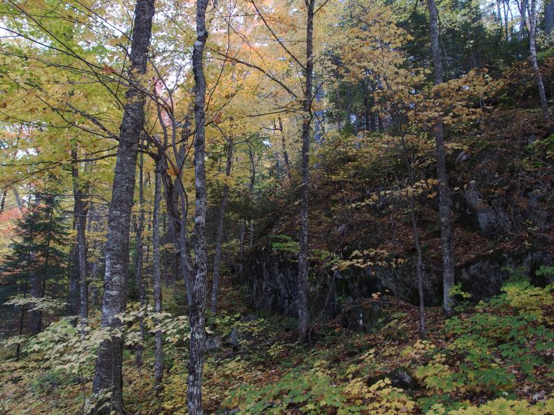
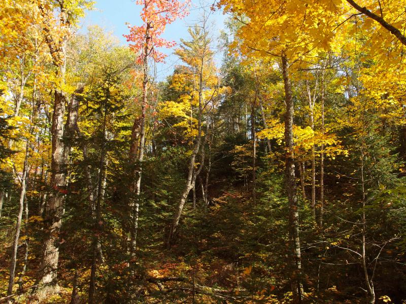
Mixed forest along the shoreline
There are a few trails that sputter eastward from the mainland camp. I followed one, than cut uphill when it died out, found another one, and then ended up on a small ridge. There was a pumphouse around here, and maybe an artesian well, though I had little idea where. All I had found on these short paths were old pipes, none leading in any direction. I had hoped that one of these trails would take me to them. Instead the trails stranded me some eighty feet above a cluttered little swamp. Maybe the little buildings were down there.
Steep rise across from the first swampy channel
I headed down the ridge, slipping and sliding over the leaves, and then fought my way through the tag alders at the bottom. A challenging start to the hike. There was a brief thought of following the swampy creek upstream in hopes of finding the pumphouse and well but I brushed it aside. I could always come back for that another day. Instead I concentrated on the thick foliage and pushed through to the other side.
When I broke through the confusing tangle of trunks I quickly found a little path, much closer to the lakeshore. It led north, where I wanted to go, so I followed. The little path was not maintained, with branches and young growth blocking sections, yet it seemed well thought-out. It was narrow, smooth, and even, winding around slopes and providing several good views back over the lake. Something felt very odd about this.
Looking over at the east side of the island
Hint of a path through the dappled forest floor
The forest service does not officially maintain any paths in the wilderness area. Well, maybe the trails to White Deer and Baraga Lakes, but that's it. Even those are not marked, with only the well-trod ground to guide hikers on their destination. So where did this path come from? It had to be one of Cyrus Bentley's old paths, almost a hundred years old. Remarkable.
There were once plenty of trails here, a spiderweb network connecting almost every lake and major feature on this land. Of course the Bentley Trail, both old and new, was the main gem, stretching across the Yellow Dog Swamp and Plains up to the Huron Mountains, yet there were plenty of other trails. Guests could use a knowledgeable guide and head out on an easy walk to the Acropolis, or Lake Dorothy (known as Dortay today), or Lake Raymond without ever having to barrel through thick brush. It made sense that there'd be an old path along the south shore of White Deer Lake, it was just surprising that I could still make it out today.
Looking back at the southern shore
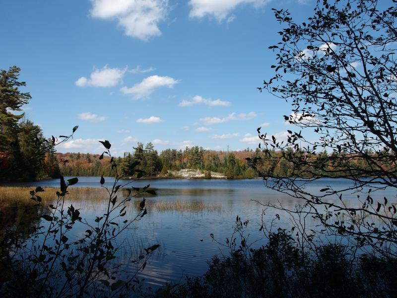
Far distant fortress and channel
After a fairly expansive view around the lake I checked on my progress. I was maybe halfway to Birch Point, the first major landmark on my route. My hike was divided into five sections - if I could complete each section in an hour I'd make it back to my campsite by nightfall. Barely. And I was already running low on time. I pushed onwards with increased speed.
Following a faint path onwards
On the way to Birch Point I bumped into a small campsite. The campsite featured bricks, old planks, and a metal grating. This was weird. As far as I knew there were no buildings on this shoreline. Maybe an ambitious group brought over some rubble from the island via a canoe to set up a little site here. That could be fun, staying in the McCormick for several days and building up a little home to return to at the end of each day. It was simple, just a nice fireplace and some benches, yet it was much nicer than most of the spots I've camped at.
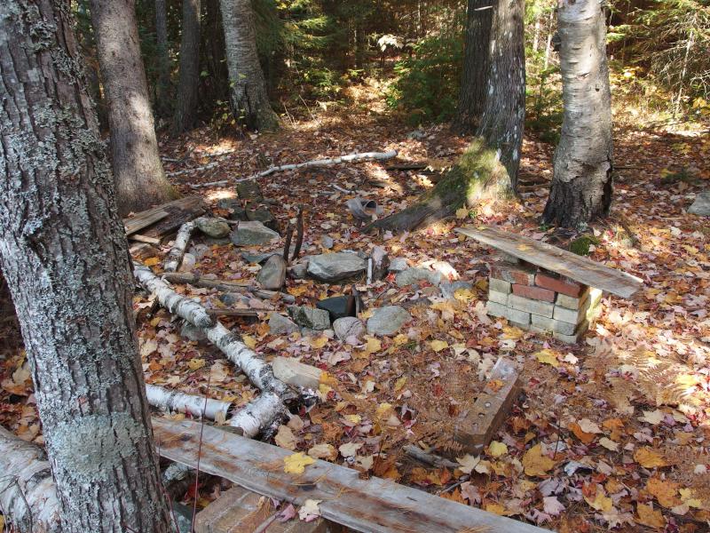
Campsite made of brick and driftwood
My first destination just sort of showed up. One minute I was pushing through the woods, the next minute I came out on a view over to The Fortress. The stark outcropping covered in dead trees rose sharply from the water's edge. Birch Point should be located right across from it, on my side of the shoreline… Oh, and the trail ended with a steep, mossy bluff. Guess I was at Birch Point.
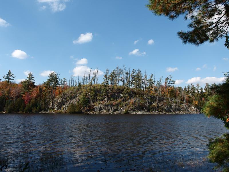
Bare trees on the Fortress
Solid wall of rock on Birch Point
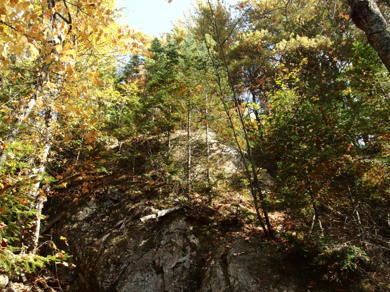
Without a path or any way forward I was stuck. With a deep sign I leaned in and tackled the climb. I didn't really want to climb up and down outcroppings all day, not with many miles to walk around the lakes.
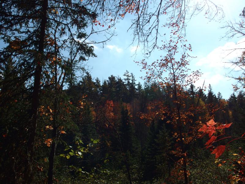
Yellow light filtering down
Colors above a mossy outcropping of rock
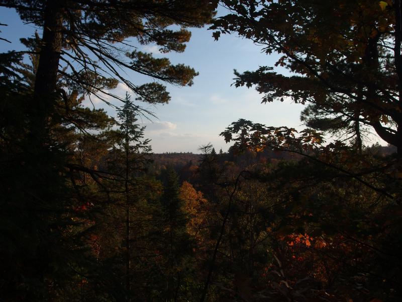
There wasn't much to see from the top of the point, though the bright yellow leaves and giant birch trees made for a peaceful spot. Some of the trees up here, with scarred and rugged bark, had to be around during the turn of the century. The name fits. After reaching the peak of the hill I turned and meandered north a bit before heading back down to the lake. Maybe, after this one detour, the shoreline would let me continue along it.

Looking further up the channel connecting the lakes
Back at the Fortress
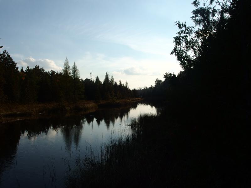
The view across the water was very different now. I was in the narrow end of White Deer Lake, close to the channel, and the distant shoreline was rugged. The Fortress was beginning to fade out behind me and new hills topped with living white pine giants grew up. I had forgotten about this northeastern extension, this stretch towards the channel. If one was on a canoe, heading in this direction, you would first pass by the twin outcroppings of Birch Point and the Fortress, like the Gates of Argonath from Tolkien's books, before entering the narrow swampy way to Bulldog Lake. Cool.
The shoreline was too rugged to continue on, though. If there was a footpath here it didn't last long. With another sign I turned and headed inland again. I was done playing this game. My next destination, Lake Margaret, was about a half-mile to the northeast, and there was a valley to follow. On the left side of the valley was a handful of rocky hills next to the channel, and on the right was a long hill. If I stayed in the middle I could have a level walk for some time.
First encounter with a cluster of red pines
Within minutes of leaving the shoreline a red pine forest reared up in front of me. I wasn't wearing my usual light jacket, opting for a short-sleeve shirt in the warm bug-free temperatures, and the branches quickly scored my arms. I ducked, weaved, and leaned into the trees to no avail. Soon my bare skin was criss-crossed with red scratches.
Red pines eventually gave way as I gained more elevation, the tough branches opening up into another pleasant yellow-tinted forest. This little valley was alive in color. I wandered through, gaping at the huge trees and bright light. Part of me felt bad for cutting away from the lakeside (I was missing the channel section) yet it was so darn pretty out here.
Blinding fall colors
Tall, tall walls around the valley
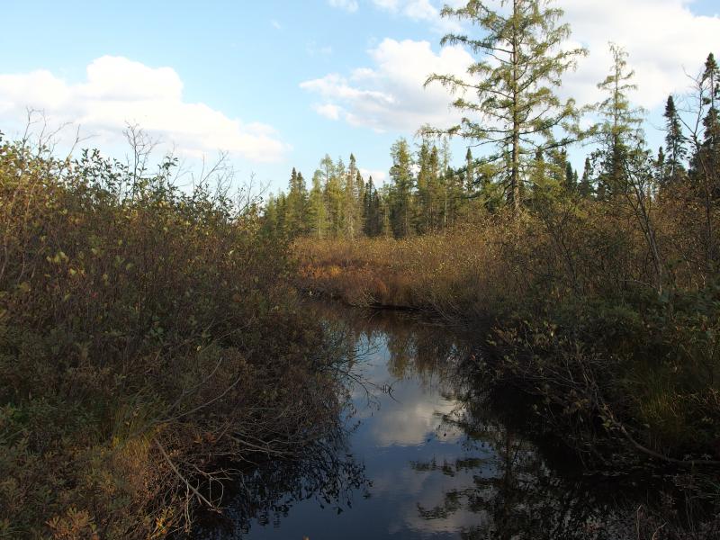
The walls began to rear higher around me as I neared the outlet of Lake Margaret. I had to judge this carefully. Lake Margaret extends far to the west as a swamp, reaching across my path, before it tumbles down into Bulldog Lake. I didn't want to try to cross that swamp. There's a bridge up there, an old relic from the early days, though I don't think it's in crossing condition. I wanted to hit the outlet right at the end of the swamp for an easy crossing.
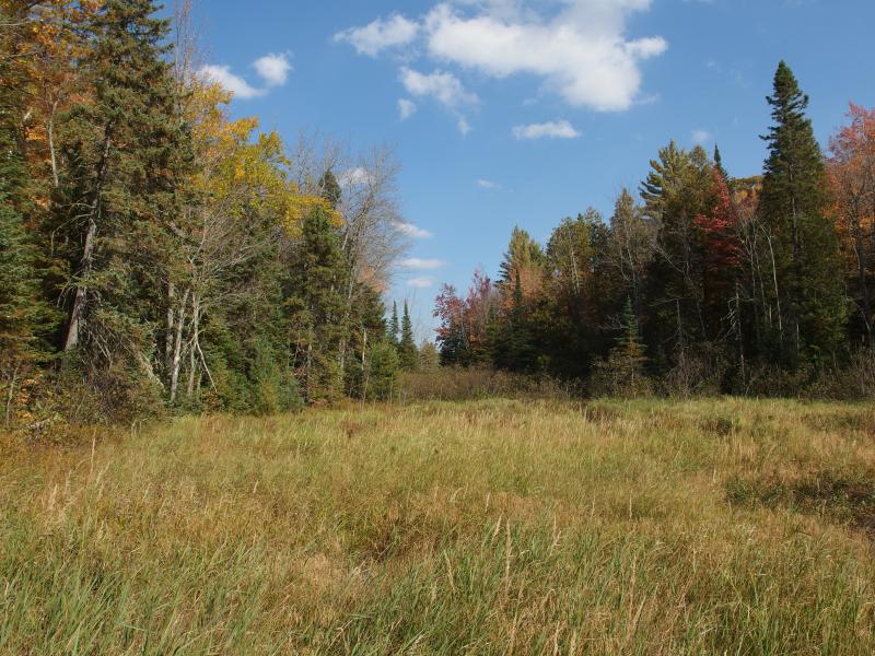
Open grassy along Lake Margaret outflow
Up the swampy outlet
Luck was on my side. I came out of the forest on the edge of a wide, grassy flat on the west side of the swamp. I couldn't tell if there were any beaver dams for crossing upstream. No matter, though. A small cluster of rocks and debris allowed me to skip across the creek with ease.
Once I was on the north side of the outlet I paused and looked at the time. There was a point about a thousand yards to the east into the lake, a point that would command an awesome view. I was running low on time, though. Plus the way was covered in red pines. With a sad spirit I turned and headed up the hill, aiming further north instead. Hiking along Lake Margaret would have to wait for another day.
Fall shadows over clear ground
A ridge climbed up and I followed, with hints of open blue twinkling through the trees to my left. The channel connecting White Deer and Bulldog Lake was opening up. I ignored the tempting blue and pushed onwards. On the way I passed by a small, barely visible trail used for portaging between Margaret and Bulldog. With the thick leaf cover I almost missed it.
Hidden trail on the portage to Lake Margaret
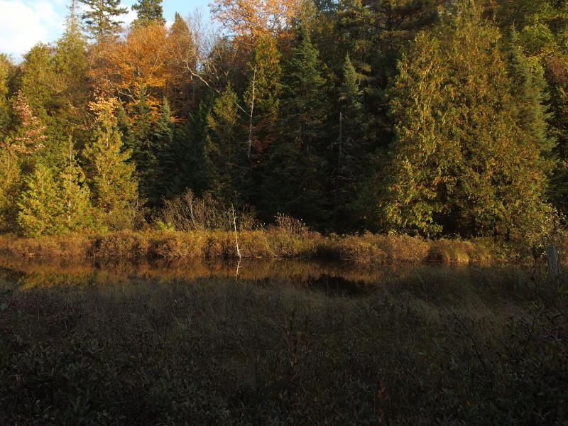
Between the portage and the dam ahead, my half-way point, was a right-angled cove. The lake makes a jag to the east before coming back to a narrow point. The point was another possible destination. There was an old logging dam there that predates today's cement one, a dam put there to hold back the waters and shoot down a rush of white and logs in the spring, as opposed to the cement structure's recreational purpose. For now I focused on the cove.
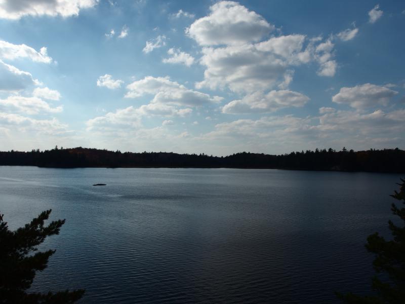
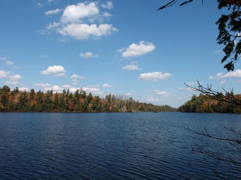
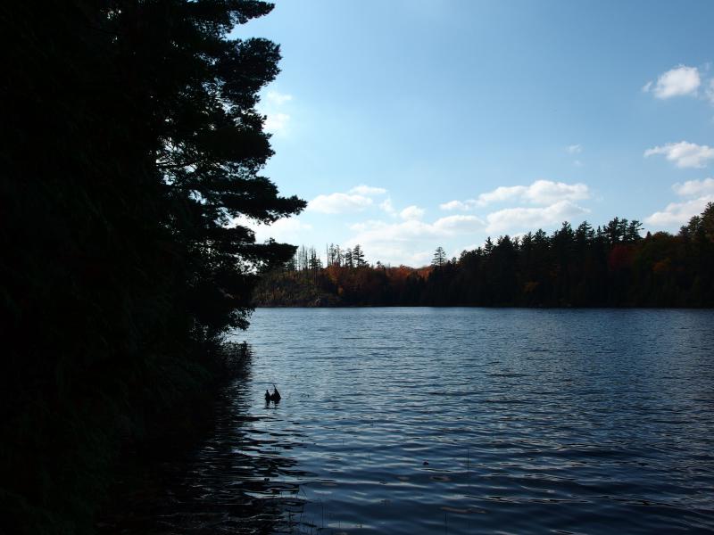
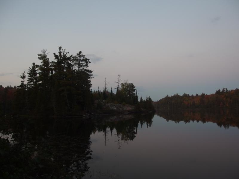
Bright skies over Bulldog Lake
Campsite on the point
The blue waters and blue skies glared at me, a sharp change from the bright colors in the autumn forest. A good breeze was rippling across the lake, creating little waves and streams that stretched toward me. I stood and let the wind flow around me. It was a welcome change from the warm and close woods.
Far below was a little point and a campsite. There was a deep, narrow break in the way, though. I stood out on an outcropping, some fifty feet above the water, and getting down to the campsite looked pretty difficult. Then I saw the trail. That little footpath from Birch Point was still here, though I'm not sure how it traversed the distance. It twisted in a seam in the rock and headed down the break, then up the other side into the woods. After bushwhacking for the last mile it felt good to be on a path again.
I skipped visiting the campsite and the site of the old logging road and stuck to the path. It was leading right where I wanted to go - the cement dam on Bulldog. Like an arrow it shot through the woods, weaving only slightly around a few rises, and popped out next to the structure. Finally, I was halfway through my hike.
Steep hills on the way to the dam
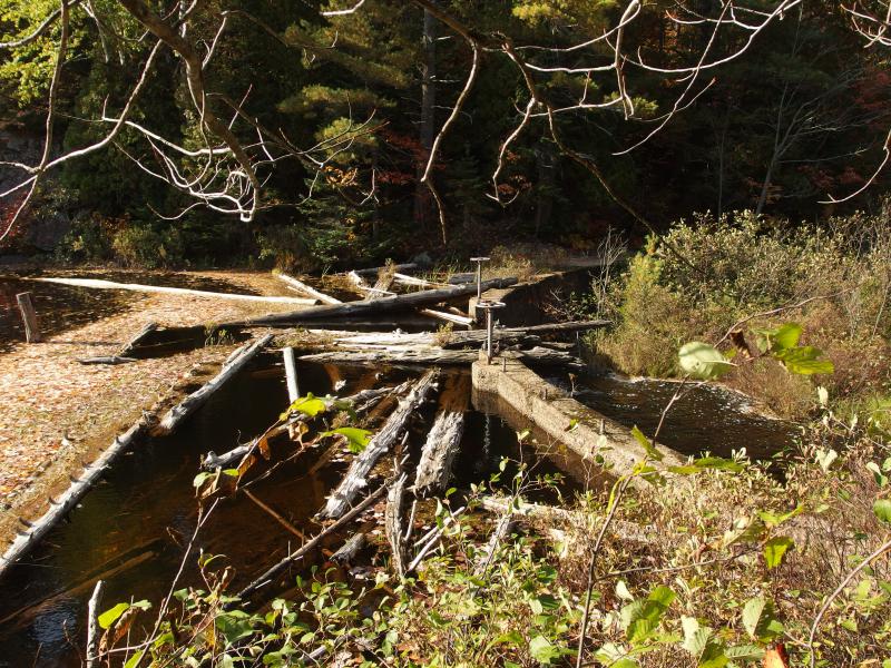
Cluttered logs on the Bulldog Lake Dam
A few steps on the dam and I plopped down, letting my legs dangle off the side. It was time for a rest. I was out of water and starving. While I munched on some snacks I pulled out a water filter and got to work. I drank, filled up, and rested. It felt good just to stop and listen. Beside me the water cascaded down into the swamp and the breeze sighed quietly. Everything else was silent. No cars, planes, music, nothing.
After a half hour or so I had to convince myself to stand up and get moving. My legs were starting to get tired after the morning's hikes and this long bushwhack. I only had three hours of daylight, though. It took me three hours to get out here, hopefully it would take me three to get back.
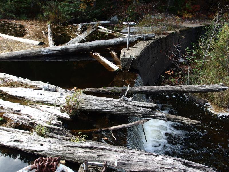
A tricky crossing
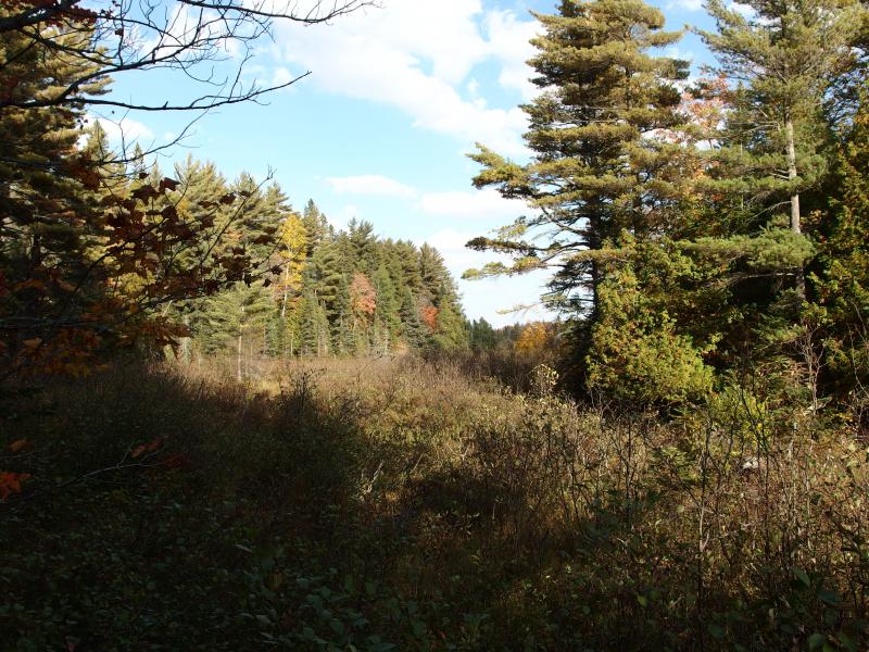
Thick brush heading north to Yellow Dog Plains
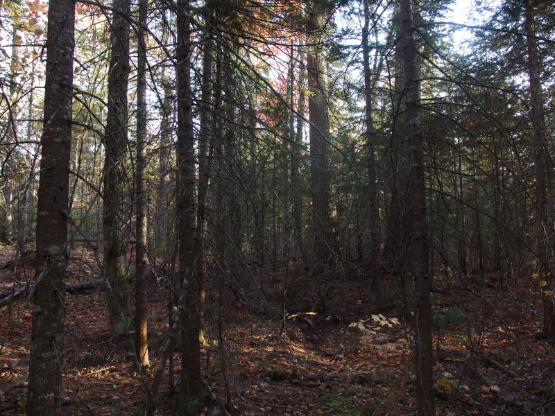
Crossing the dam was tricky, with rotten logs providing rough step-stones across, and soon I was heading west. If there was a trail over here I didn't find it. Instead I fought with red pines, climbed up and down sudden rises, and wrestled thick undergrowth. This shoreline was mean. As I pushed my way along I completely forgot about stopping by the logging dam. When my battle westward suddenly eased, when I bumped into a wide clearing of ferns, I had to stop and regain my bearings. I had stumbled right out on the old logging camp by accident.

Small campsite at the old logging camp
This clearing had a decent amount of significance. The Sawyer-Goodman logging camp was once here, on the north shore of Bulldog Lake, the last lumber camp on the McCormick Tract. They handled the nearby dam and plucked white pine from the area to send down Yellow Dog all the way to Big Bay. After they left Bentley chose this spot for the start of his trail to the north, either hiking the shoreline or boating to the camp before continuing north.
Oddly enough, the patch of land here is still clear. There is a a few pines growing in the center and the rest is just ferns and grass. I'm not sure of the camp was established in a naturally bare spot or if they salted the ground, but the forest has not reclaimed the camp yet. I wandered around a bit through the dead ferns looking for old foundations or ruins and found nothing. The view over the lake was nice, though, the bare rock giving an unblocked view over the blue waters.
Bulldog Lake from the logging camp bluff
The next point in my hike was a significant obstacle. Island Lake, a mile or two to the west, flows into Bulldog Lake through a wide and sluggish swamp. This camp had a logging road that had to circle far to the west to avoid the worst of this wetland, and even Bentley's trail had to first follow the road west and later go over an impressive causeway over the water to avoid this inlet. I plotted a course west as well. The causeway is long since rotted away.
My feet kept leading me south, though. The woods weren't too bad, an even mix of hardwood and scratching red pine, yet the want to cut sharper to the south to save distance and follow the shoreline overrode my planned course. Beautiful views, first of the lake and then of the old pilings from Bentley's walk, awarded my straying path.
Mix of pines and color across the lake
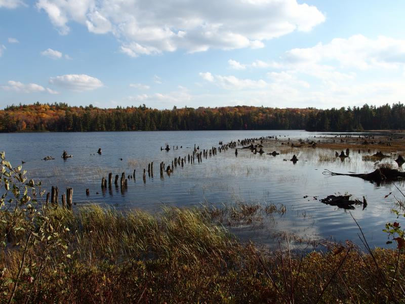
Old pilings from the Bulldog boardwalk
Old pilings were a pleasant surprise. I didn't expect to find anything left on the lake, thought the causeway would have completely succumbed to the elements. If they were in a bit better shape and continued all the way across the gap I could attempt to hop-skip my way across the open water. Instead I continued west, along the edge of the swamp, through a steadily thickening forest.
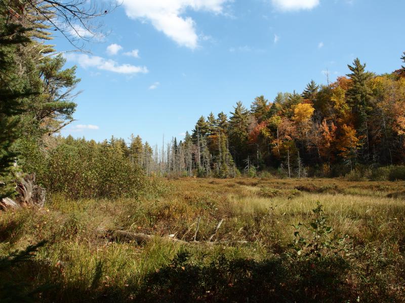
Wide swamp on the Island Lake inlet to Bulldog
Attempting a swamp crossing
Stuck between red pines and tag alders is not a fun place to be. I pushed west, keeping a steady eye at the swamp for potential crossing spots. There had to be beaver dams over there that could provide passage. Thirty minutes of tough hacking and I had enough. With ginger footsteps I headed out towards a lone pine tree, hoping that it owed it's existence to earth captured by an old dam. My hope was correct. I crossed the dam, using alders as hand-holds, passing by water and muck too deep for my eyes to measure without getting damp.
Calm, deep waters to cross
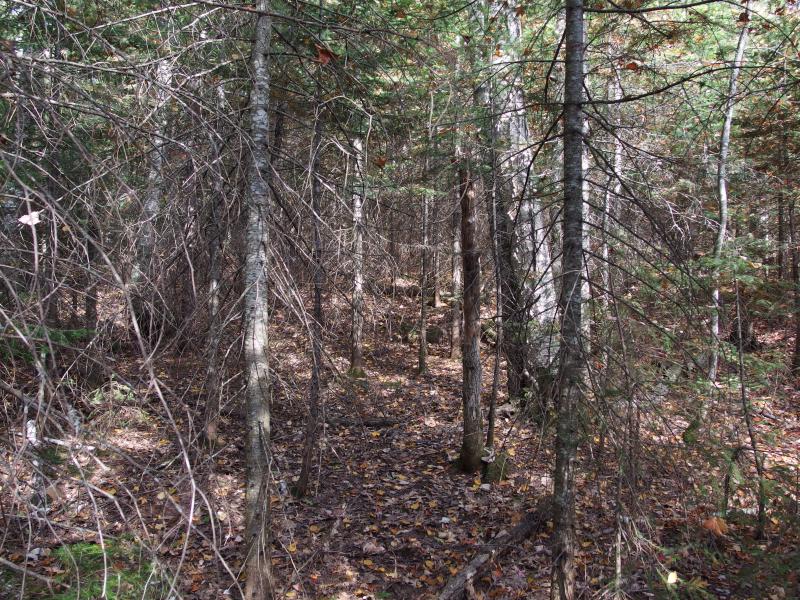
Another forest of red pine
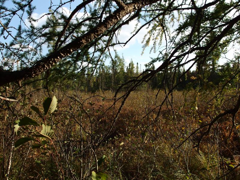
The other side of the inlet greeted me with more red pine thick and another swamp on the far side. I didn't remember a second swamp. I dug for my map and came up empty. Uh oh.
Now, I do carry a GPS with me. Ever since that one-time-on-Nestoria-swamp my wife and family have pressured me to keep it on me for my longer hikes. It's a dandy tool for tracking routes and waypoints for later retrieval, anyways. But I still heavily rely on printed maps. There's something about being able to have something with a lot of detail, that you can add little marks and notes, and that is scannable without scrolling that is much more useful than the tiny digital screen with pixelated lines. And my precious map of the McCormick was gone. It must have slipped out in the swamp or back by the logging camp.
I sat down and reviewed what I remembered. I didn't remember the second swamp. That's okay, it looked passable. To which side, though? Shoot. If I headed too far to the south I'd end in the lake, and too far to the west I'd by climbing up and down the highlands that I got stuck on during my last adventure here, last year. Ending up in the lake sounded like an easier thing to deal with. I decided to follow the swamp downstream.
Late sun over the open channel
Old poles along the edge of the channel
The sun was low when I came out onto the channel connecting White Deer and Bulldog Lakes. I had maybe an hour of daylight left by now, much of my time having been squandered at the Island Lake inlet detour. There were some old poles in the channel - odd, I didn't remember hearing anything about that. I'm not sure what they would have been used for. I looked to the south and felt a little thrill of hope. It was distant, and I knew there were outcroppings and hills in the way, but the Fortress was visible.
Far distant fortress
There is an old track that connected the logging camp to the main trail, though it is very overgrown. I had found it last year and tracked it almost all the way to the Fortress. If I could reach that outcropping before it got too dark I knew I could find my way back to camp by flashlight. My legs had started to cramp by now, angry at today's pace and lack of water (I hadn't stopped to filter more water since the dam) and the thought of spending the night out here with limited supplies was an unwelcome one.
With a fresh burst of energy I cut west from the channel, hoping to save some time by heading up and over the nearby hill instead of fighting the random shoreline outcroppings. I topped the ridge and tumbled back down, entering a swamp below. It was nastier than I thought it would be, scummy water sitting on the surface. I stumbled upon the edge, along the top of an old beaver dam, and began to sweep the area for any hints of the old road.
Partial view south over more hills
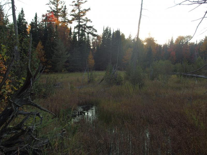
Another swamp
A few hundred yards from the swamp I found something that looked promising, a wide, long clearing, and stuck to it. For a while it was wet and spongy, and then it began to climb, and then I knew for sure. I had found the old track. Thanks to its width and age there was plenty of growth on it, young saplings and brush springing up where horses and men once tread (and maybe vehicles, though I think it predates them). I meandered on it, trying my best to trace it through woods, losing and re-finding it as I went.
On the old logging track
It felt like cheating, yet there was no way I was going to wander off the track to climb the Fortress. The sun was gone from the sky, leaving the forest cool and dark, and I was ready for a hot meal and bed. Plus I still had a long way to walk. Even after finding the track I had several miles to go. I made it to my camp well after sunset.
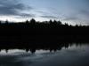
Dull evening light over White Deer Lake
Silence greeted me at my campsite as I set up the tent and cooked dinner. Complete silence, a huge change after my continuous crashing through the fall leaves had filled my ears all day. After my fire was out a few owls came out to sing their songs and unseen things scurried around the tent. I watched the stars come out, more stars then seemed possible, and slowly drifted to sleep on the shores of White Deer Lake.

-
Jacob Emerick
Oct 6, '14
It was very exciting! Honestly, though, seeing those old pilings were probably more exciting. Fully expected those to be completely rotted away by now. You can't make them out until you're on that side of the lake. If you look from the eastern side, by Lake Margaret (which is fairly easy to reach) all you see is the stumps from the drowned inlet. You can't make out the pilings.
Add to this discussion-
Jacob Emerick
Oct 6, '14
Thanks Sharon! It was a very magical place, especially after Rydholm's books. I kept feeling like I was treading in Bentley's or Anderson's footsteps on those old foot trails, and that I'd bump into an old man who'd introduce himself as a Mr. McCormick, relative of the late Cyrus or Gordon...
Add to this discussion-
Jacob Emerick
Nov 13, '14
Hi RB, great to hear from you! Yeah, it did feel good to get this down before the move, especially on the last trip up there. Plus it was deep enough in the wilderness to give me a taste of how much is left up there for me to miss...
Add to this discussion-
Jacob P Emerick
Nov 26, '19
Thanks John! Yes, that swamp/stream connecting Bull Dog and Island is a pain to cross. If it helps, you don't need to cross the dam on the northern end. Below the dam there is plenty of ways to cross the river, you just need to wander downstream a bit. Happy hiking!
Add to this discussion