The Acropolis of the Peshekee
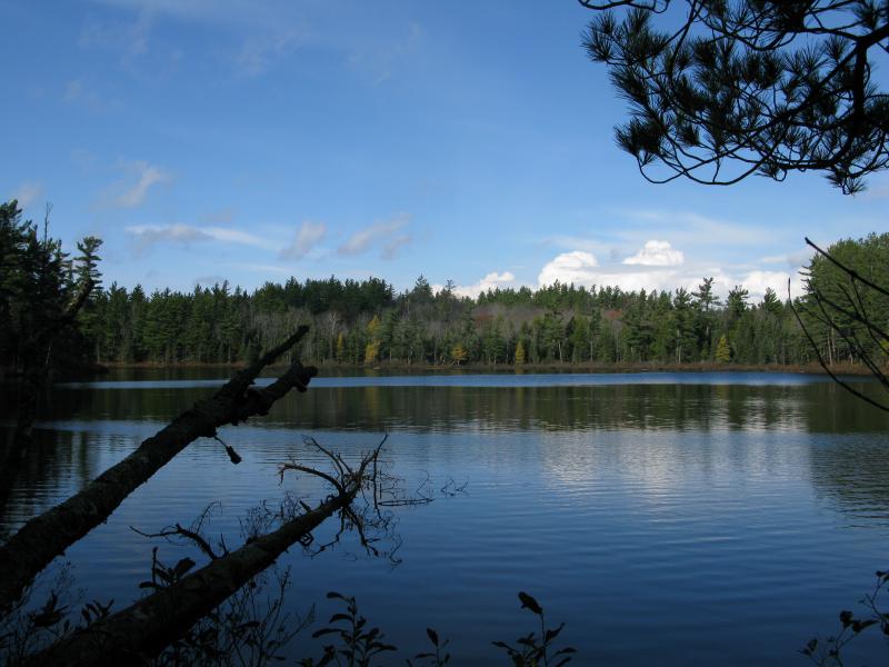
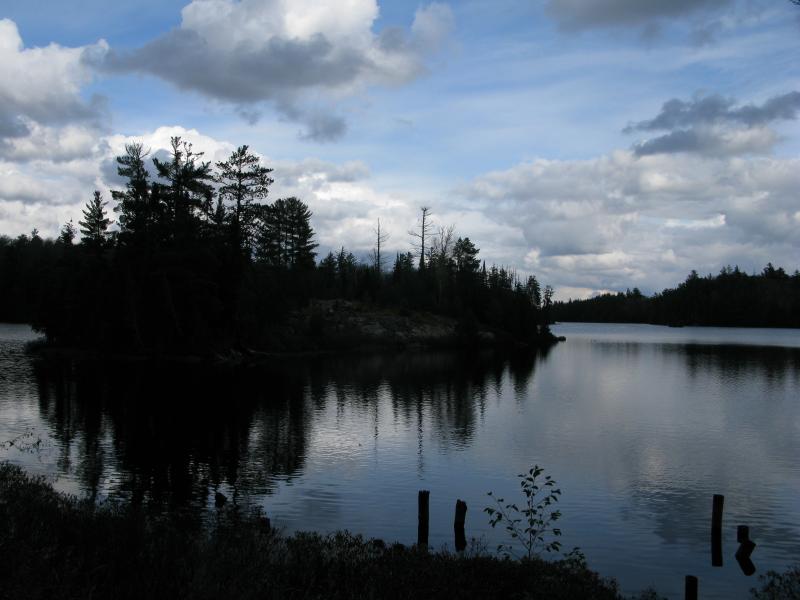
My legs were sprawled out on a flat rock, a timid autumn sun slowly seeping into and drying off the wet patches the thick woods had left behind. There was no way to get completely dry - my boots were far too soaked through for that - but I held some hope that the damp clinging to my calves would lessen a bit. I was sitting on the north shore of Lake Dortay, deep within the McCormick Tract of the Ottawa National Forest, and I was enjoying my first break of the day. The peace and quiet of these deep woods could keep me content for a very long time.
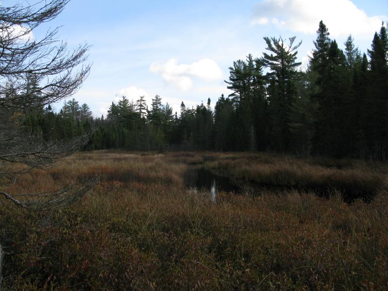
There were new places to visit, though, and I was running low on both energy and time. In the back of my head I was already rerouting my afternoon, trying to figure out what I could do with my limited time and resources. With a certain level of regret I lurched to my feet, gingerly testing out the injury in my left foot. Earlier in the morning I had bruised it hard on a rock near Clear Lake, an injury that could have been much worse (an inch or two was the difference between a bruise and broken ankle). A few warning signs shot up my leg, nothing too severe, and I headed out. It took maybe five minutes to leave the clean peace of the mirror-smooth lake and break out upon an expansive swamp, one with open waters and deceptive flat grass, a nasty obstacle that I would have to work my way around.
Grass and swamp along the outflow of Dortay
Wary of the thick grass and the swampy waters that they hide I eased slowly to the left, keeping to the outskirts of the swamp. Lake Dortay is a small lake with only a few small, unmarked inlets, yet this swamp on its outflow was significant. The ground began to squish under my boots, water pooling under each step, and then I saw some open water in front of me. I couldn't make out what was on the other side a few feet away, not with the thick grass. Feeling cold water starting to pour into my boots I took a deep breath and jumped, hoping for solid ground. I got lucky. A few more quick and awkward steps and I was on the dry shore of the swamp, on the north side. Now there was just a minor pinnacle to climb.
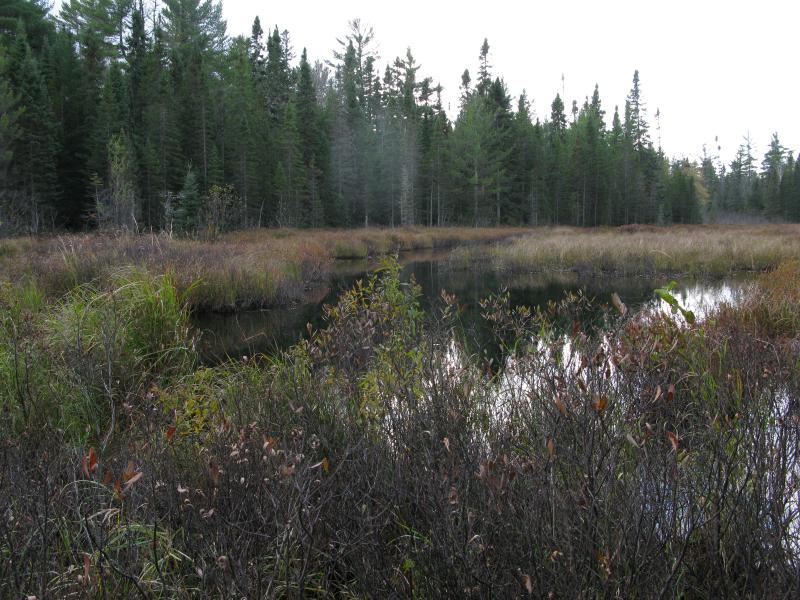
Climbing the steep spur of rock I couldn't help but glance down at the dark water below. The bottom was lost in the brown water, sharply contrasting with the bright yellow grass spurting up from the southern side. I pushed forward, hoping that this little watercourse would get easier, and passed up and over the spur. And found more swamp.
Cursing I checked my map. I didn't feel like tempting any more marshy ground, not with wet boots and cold feet. I had hoped to follow the outflow from Lake Dortay to the northern shore of Island Lake before cutting north to the Acropolis. Apparently the outflow was more a chain of swamps than a creek. I charted a new course, straight for the distant rise of rocks, noting with a sad eye just how rugged this path would be.
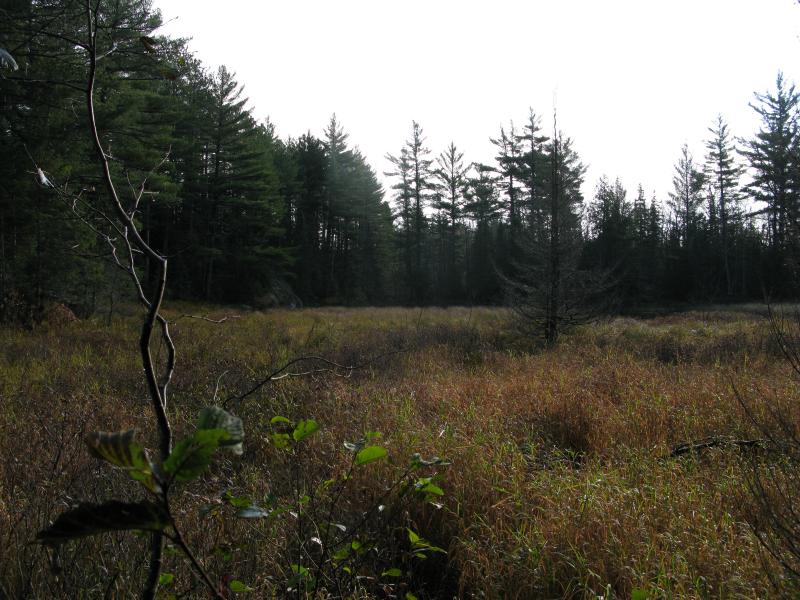
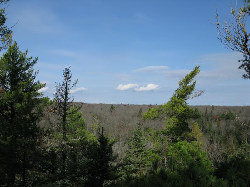
Turning up a nearby rise I climbed, than trotted down a slope, than tackled the steep side of another hill. The dead leaves were now dry, swishing loudly below me, no longer slick with the night's wetness, just hiding rocks and branches underneath a crackling layer of scales. The undergrowth was minimal here, which did make the way a little easier, and I was able to focus on my pace. When I finally topped the last rise, breathing hard and fogging up my glasses, I looked out onto a different sight: an open vista to the north.
Partial views northwards
I glanced up and down the ridge, admiring the sharp rocky cliffs and sizeable drop below. I was near the 'Northern View', an old destination from the days of the previous inhabitants, but this was not my destination. I looked, with apprehension, at the steep canyon between the Acropolis and I. This was my punishment for not sticking to Dortay's outflow.
Carefully I slid down the steep rock over concealing leaves, testing each hold before putting my full weight on it. This canyon was a sudden one, a sharp cut that starts from nowhere, yet it marks the beginning of West Branch Yellow Dog River. A creek starts up at the bottom, possibly leaching out from the water table or draining (underground) some of the waters from Lake Dortay and Island Lake. When I reached the base I noticed how soft and spongy the ground was. There was no visible water - I was still too high upstream for that. Still, I was standing on the very headwaters of the Yellow Dog itself, the mighty river that flows through rock and plains and mountains and forms dozens of waterfalls downstream.
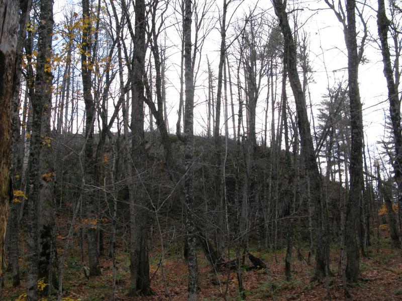
Imposing side of the Acropolis
Looking up at the side of the Acropolis was equally humbling. The top was peaked with pine, hints of a rocky and rugged top, and the sides of this outcropping was no picnic. Sharp walls stuck out towards me, green moss and leaves mixing to form a dripping treacherous climb. I set forward, determined to ascend the guarded fortress, knowing somehow that the danger would be worth it.
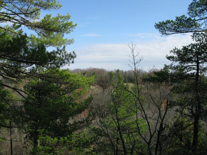
Bare outcroppings on Castle Rock
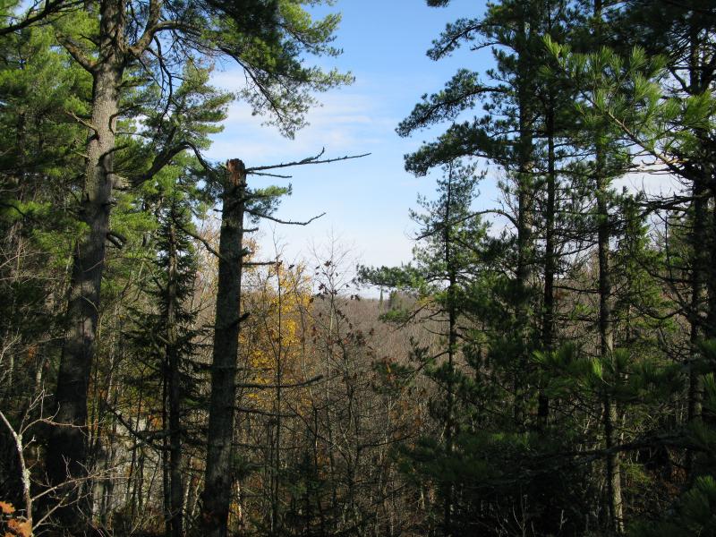
Blue sky to the north
It was. The view from the Acropolis was impressive - open vistas far to the north and (some) to the west. An exposed ridgeline from Castle Rock showed up to the northwest, one that I wasn't too interested in. The view there would just look back to the Acropolis, not high enough to look back south to Island Lake or anything. With a bit of imagination I could pretend I could see all the way down the East Branch Huron River from here, all the way to Lake Superior itself and over to the Keweenaw. It was too hazy and cloudy in that direction for that, though. Grey branches, interspersed with tall pines, rose up from the other side of the canyon, and beyond that just blue and white.
After looking around I plopped down on a convenient rock. Rumor has it that a pavilion once sat up here, a lavish addition to the already beautiful outcropping. There was no hint of it today. The top of the Acropolis was rugged, with a few stunted trees here and there, and seemed untouched for decades. No trail, footprint, or trash marred the wild nature. I sat and munched on some granola, being sure not to drop any grains, not wanting to spoil the land.

Rugged top of the Acropolis
Eventually I stood up, stretching my tired legs, and turned south with the sun. I had one more destination to reach before returning to my camp. Walking south was easy to do without checking my GPS - all I had to do was follow the shadows towards their source. The occasionally old pine would soar up above the bare branches, looking like a king among lesser trees. These pines made me wonder what the future of this land would be.
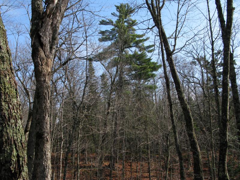
Towering pine
Sure, there was some old growth here. When McCormick and Bentley purchased the land, though, there was plenty of active logging going on. Some of their trails would go through logging camps, both active and deserted. How much of this land had been clear cut? What kind of trees grow naturally in the Peshekee Highlands? How long would it take for the land to recover from the logging that occurred over a hundred years ago? I've seen 'old growth' up on/near the Huron Mountain Club but a lot of that has been nurtured, tall pines allowed to grow while surrounding trees were cut back. Was the entire Upper Peninsula once covered in giant pines that towered to the heaves, leaving open, needle-covered ground below, or is that just a dream that today's conservationist are trying to propagate? I love the old pines, the giant trunks too large for three men to circle with their arms, I just question if one day (hundreds and hundreds of years from now) if the entire McCormick Tract will be covered by them or some other, mixed, type of forest.
As my thoughts spun between the ancient forests and future unmanaged ones I found myself in a thick swamp. There were no towering trees or open forest here. I didn't expect to find difficult terrain here. Pushing through the tangled growth and treading lightly on the giving ground I forced my way through, trying to beeline to the shoreline of Island Lake. This large lake was reasonably close to Bulldog Lake and I hoped to find well-trod trails along the shoreline, easy going for the next leg. The land north of the lake definitely was not easy.
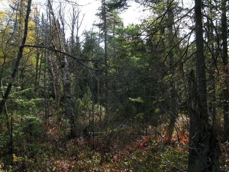
Thick swamp near Island Lake
Slight ripples on Island Lake
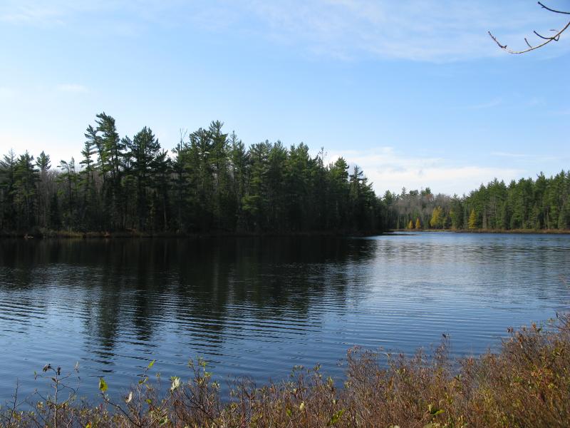
When I broke through the thick growth I discovered a large, blue lake with many ripples on its surface. A slight afternoon breeze had kicked up, sighing through the trees and disturbing the waters, breaking up the reflections into dozens of distorted pieces. Island Lake was pretty, with bright colors dotting the shoreline and a mixture of wet grass and rocks forming the shoreline. There was no trail, though.
I headed east along the edge of the lake, using the grassy shore when I could, cutting up to the thick woods when I had to. This wasn't as easy as I had hoped. My initial thought was to follow the lake all the way to the southern end, to the half that held the lake's island namesake, but this was tough going. By the time I reached the eastern point I was done with the lake, tired of ducking over and under all the downed trees and pushing through the small trees that clustered near the water's edge. With one last look over the water I cut off the lake, making a line back to The Fortress on White Deer Lake.
Last look over the blue waters
The woods were easy for a time, flat dry land with only a few scattered obstacles. I kept a straight line by aiming at one tall pine after another, denying the urge to check my GPS. This late in the afternoon I was getting dreadfully tired, much more tired than I thought I'd be. The constant bushwhacking and unpredictable topography of this land was wearing on me, pushing my Midwestern legs beyond their limit. When I bumped into the swamp it felt like a hard slap, an insurmountable wall that someone had plopped down as a cruel joke. The waters connecting Island Lake and Bulldog Lake, running east-to-west, made a wide and deep passage directly in my way.
An impassable swamp
My options were few. I could circle all the way around Island Lake, adding miles of tough backtracking to my route. I could circle around Bulldog and White Deer Lake, a route that would leave me pushing through the woods well after dark. I could just jump into the water and swim the couple of yards across and be left shivering and mucky for the remaining mile of my walk. Or I could hope that someone, either a colony of beavers or a previous explorer, had left a way across. This meant that I would have to hack sideways along the swamp, an unpleasant option, yet the most reasonable one. I set off downstream, staying just within sight of the open swamp while avoiding the water that crept into the woods with cold, narrow tendrils.
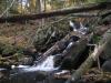
After what felt like hours of plowing through the thick undergrowth (that was only about a half hour) I stopped dead in my tracks. There was an impossible sound bouncing off the trees and undergrowth: trickling water. Water does not trickle through a swamp. I pushed back to the open grassy land, stepping heavily over some wet sections in the woods, until I found the dam. Water poured over the narrow structure at multiple points and I could tell that the far side was, well, nonexistent. I didn't care. It was a way across.
Along the beaver dam
The crossing was rushed and dirty. The deeper waters were easily passed over the dam, though the wood-and-mud creation could barely handle my weight. There was a lot of water that bypassed the beaver dam on the far side, though, flowing unnaturally high through the grassy swamplands in multiple channels. I did get fairly wet here, boots dunked into the deep water a few times too many, and I emerged on the south bank with ever-more chilled feet. At least it beat swimming across.
From here it was a bit less than a mile back to the Fortress. This last leg was little more than a determined push, my legs moving more from force of will than remaining strength. I stuck to channels for the most part, avoiding any steep climbs, only cutting away from the lowlands when they got too swampy. The snow started during this time, spurts of flakes wafting down through sunny skies and melting as soon as they hit the ground. I got scared. The last time I had seen snow on the Peshekee Highlands was a few years ago. There was nothing in the forecast, just some scattered showers in the month of May, and inches of accumulation overnight. I was not prepared for that situation.
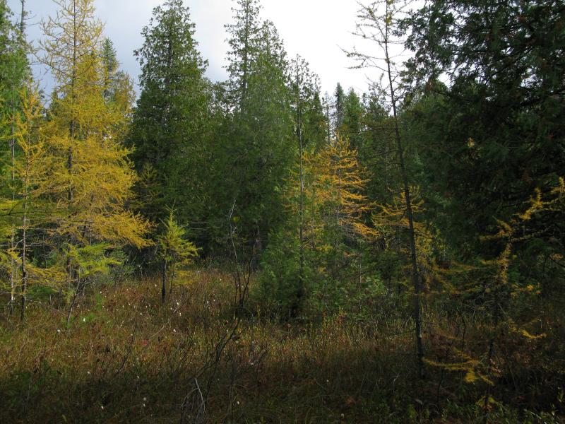
Sun and snow and bright colors
By the time I reached my campsite on White Deer Lake my rushed hike had turned into half-stumbles. Clouds were racing across the sky, clouds with deep grey bottoms that carried short flurries of snow. When I reached the campsite I knew what I had to do. I gave myself ten minutes to rest, to drink and to eat, before packing up my gear. There was no way I was risking staying in the highlands if snow was coming, not alone and with soaked boots.
The backside of The Fortress
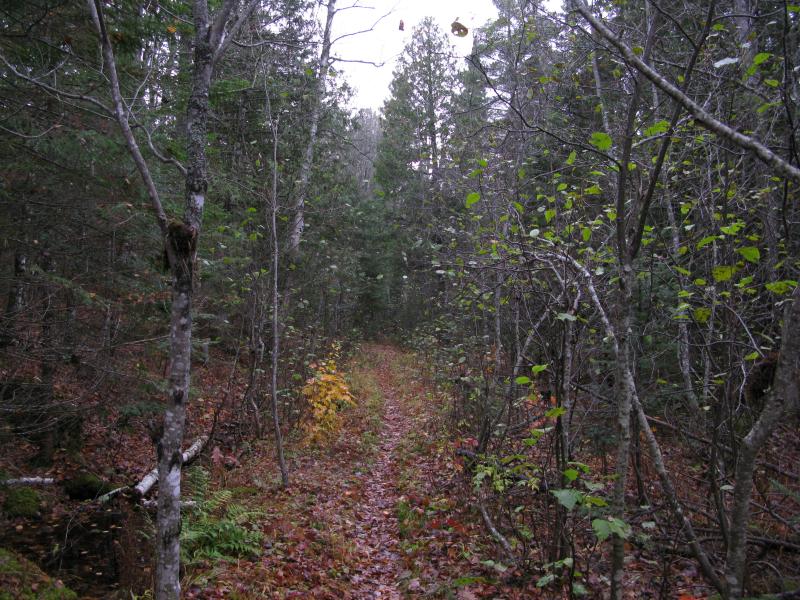
It did not take long to find the path in, the ghost of a road that leads around the southwestern end of White Deer Lake, and make it back to the main trail. During this mile or so six different spouts of flurries showed up, most lasting less than a minute. When I finally reached the main trail, the route that connects White Deer Lake with the Peshekee Grade I started to breathe easier. I had my gear, a good trail back, and I was less than four miles from my car. One last detour wouldn't hurt.
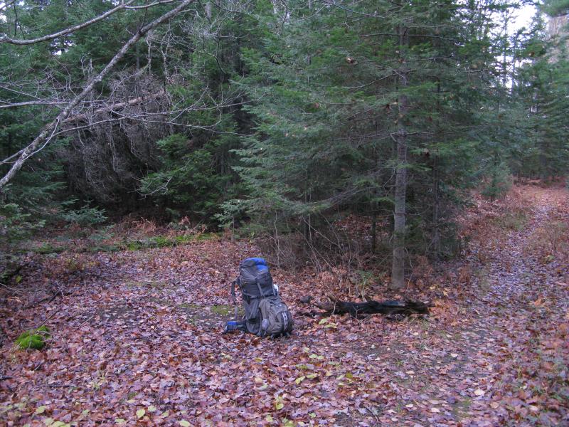
The fork to the western shoreline
Leaving my gear at the fork I set down the main trail, trotting down the slight slope to the lake's edge. On the way I passed some familiar sites - a large campsite, old cement foundations - and a few things that I did not remember from my visit years ago. Numerous trails spouted off the main route, similar to the path to the Fortress, trails that had once been wide enough to be a road and were now just a footpath. Did some of these lead to more interesting points, like Birch Point on the eastern shoreline or the pumphouse to the south? I didn't have the energy to check them out today but stuffed them in the back of my mind for possible future visits.
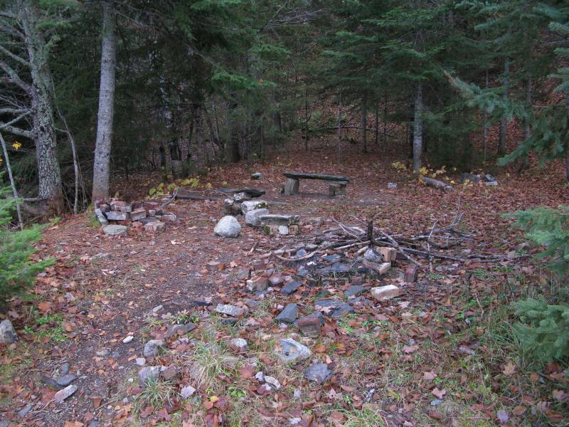
Well-used campsite near the lake
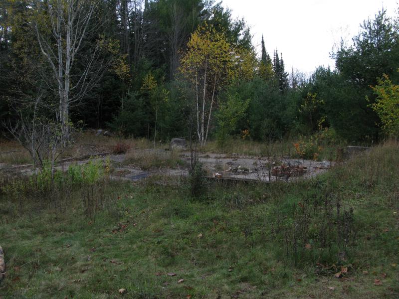
Familiar cement foundation
The island stood as it has for well over a decade. A few green pines sit on it, small compared to some of the old trees I had seen in the surrounding woods, and huge scars in the rock were still exposed from the old cabins. After the cabins were removed I think the forest service burnt down the remains, any structures left behind, so I was surprised to see any growing trees on the island at all. I wished, not for the first time, that the ferry was still here to access the island, that the mighty cabins remained perched on the rocks like huge beasts, that the majesty of yesteryears could be seen firsthand by intrepid explorers. It was all gone today, though, the only hints left in healing scars and grainy photographs.
The island on White Deer Lake
I headed back to my gear, scooping the load onto my back, and headed back to my car. During the return trip the snow started to come in force, almost blizzard-like at times, though the infrequency and spotty sunshine kept it from accumulating. I watched for the main waypoints, the one tree that you have to crawl under, the long swamp where the trail gets muddy, as uncertain markers for how far I was from my car. When I finally reached the trailhead, with the Peshekee River running high and brown below, and saw the advancing dark grey clouds in the west I breathed a huge sigh of relief. I had missed the coming storm by an hour at most, what very well may have been the first snowstorm of the year, and had survived the McCormick.
Big flakes flying over the trail
Sun and snow
-
Jacob Emerick
Oct 28, '13
Ah, that's good to know. So the rocky areas up by the Club, up on Benison where they are promoting the old pines... that was once all white pine. I'd guess that the Yellow Dog and Baraga Plains were also pine, though I'm not sure how tall they'd grow in that sand before the winds would knock them over. That would leave the Peshekee a 50/50 mix, depending on how rocky the section was. Are those old survey maps online somewhere or are you referencing some secret mining resources that you've collected over the years, Dave? ;)
-
dcclark
Oct 28, '13
Knock yourself out:http://www.dnr.state.mi.us/spatialdatalibrary/pdf_maps/glo_plats/GLO_Index.htmI find the writing hard to read, but often you can find comments written across a broad area: "Sugar Maple", "Undulating hills", etc. In southern Baraga County, I see a lot of "Birch, Fir, Maple, Elm, Tamarack".I also have these in kmz format, but they're rather large...
-
Jacob Emerick
Nov 9, '13
Well, this is pretty awesome. Thanks Dave! I have a feeling that this will keep me researching for a good long time.PS One of my icebox-ed projects is to build a custom overlay of the Google Maps, one that is half-funny/half-representative of the current UP area. Like, rough boundaries of the HMC, some of the more gnarly swamps, historical areas, all in a Tolkien-ish scrawl. If I ever get around to that again I think that parsing these maps and serving them up in a GM interface would be, well, simply awesome.
Add to this discussion-
Jacob Emerick
Nov 11, '13
Ha, thanks Andy! I've heard that the bugs were wretched this year - so you picked a good year to miss. The spring melt and waterfalls will be ready for you in a few months :P
Add to this discussion-
Jacob Emerick
Nov 29, '13
Both are names given by the former inhabitants (McCormick/Bentley). I've heard that the Acropolis had a nice gazebo of sorts on the top, crowing the peak like its namesake, and that the Fortress had a firepit (not an actually Fortress). Today they are just both just outcroppings on the McCormick Tract.
-
nailhed
Nov 29, '13
i see. now i wonder why McCormick--who was an HMC member--would have owned his land separate from the HMC? you would think this would be part of HMC too? or did he have land in both places?
-
Jacob Emerick
Dec 3, '13
Well, I'm sure that 's' may have more to add, and I really need to read a book about this, but here's a short version from what I've pieced together.McCormick/Bentley started their own chunk of land after an epic hike up the Peshekee River. They fell in love with that area (and were a disheartened to see the clear cutting of that era) and started buying up land to protect around the White Deer Lake area. They built camps and cabins, trails and roads, portages and waterways, gradually exploring more and more of the highlands. In their heyday they probably had over a dozen buildings up there, some of the cabins being two stories tall, and a footpath leading all the way up to the Huron Mountain Club (more discussion on this comment thread). They ventured up to the club at times, having cabins and friends up there too, and sometimes other members would venture down to them. It was as if there were two huge resorts up there - one on the lake and one in the highlands - though getting between the two was best handled on foot.So yes, McCormick (and Bentley) were members of the Club, but they invested a lot of time and money into their own 'Rough Camp'. Eventually they passed and the family started to lose interest in maintaining the land so they gave it to the government. By then it was some 17,000 acres in size.All in all, a great place to visit ;) Hope that answers your questions!
-
nailhed
Dec 3, '13
thanks, yes
Add to this discussion