Weekend on Mulligan Part C - Northern Cliffs
After a full day of hiking yesterday at Deer Lake and Silver Lake Basin I slept in past the sunrise. When I finally woke up and made some breakfast I made the difficult decision to head home early. The original plan was to stay at Mulligan Plains for another full day, going on multiple hikes around the area, but I was running low on water (and energy) and was ready to be done with the high temperatures and bug swarms.
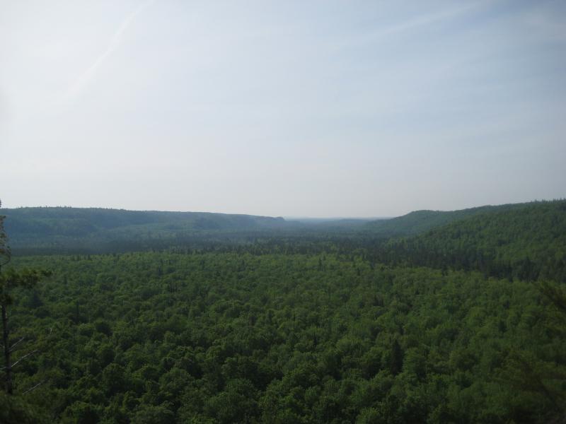
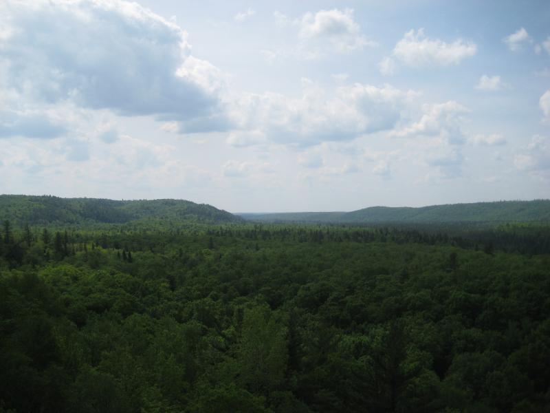
Foggy morning view of Mulligan Plains
However, I did have enough water left for one more hike. I smothered my campfire and headed north along the cliff edge. My campsite was just off of the trail to Bob Lake on the tall cliffs north of Mulligan Falls, so I was just turned north and headed towards Stager Lake. This route offered some excellent views southwards of the plains and a glimpse or two back towards my campsite and the gorge of Mulligan Falls. Once I reached a prominent outcropping on the route I decided to cut west into the woods towards Stager Lake.
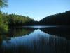
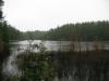
Making my way around a few swampy sections on the way to the lake took me through some really awesome old growth cedar and pine forests. These are by far my favorite type of woods - little undergrowth, spongy ground, and huge trees. Stager Lake was surrounded by these woods and I took my time wandering around the shoreline. The lake itself is tiny and pretty insignificant - I'd be surprised if there was anything larger than a minnow in it.
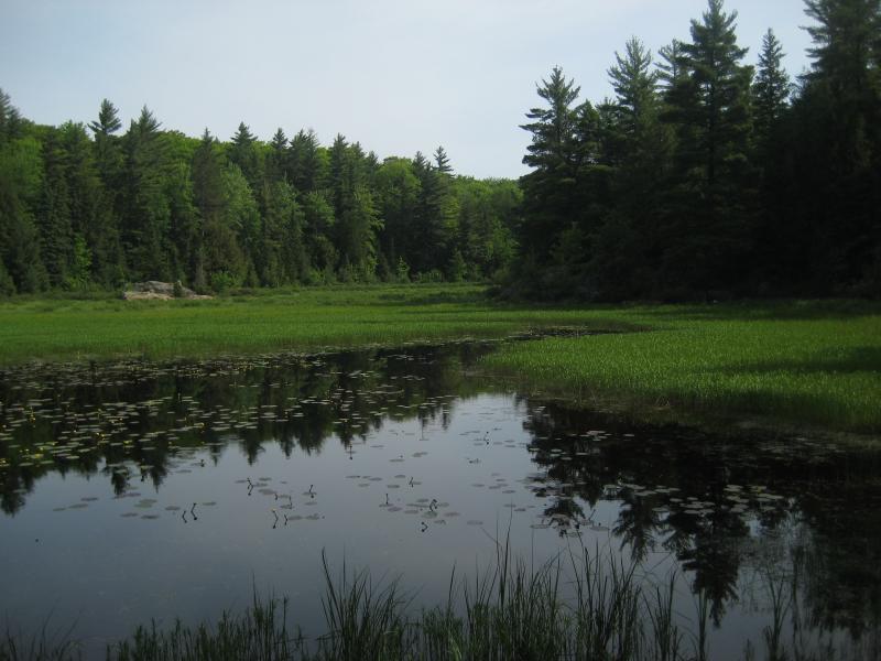
Grassy Stager Lake
A small outflow creek is located on the northeast side of the lake. I've heard that there's a waterfall here so I tracked it down and followed it back to the cliff edge. While the water does travel over a fairly steep rock on the way down to Mulligan Plains, the drop was tiny and the creek was barely a trickle. Disappointed, I continued with the water to a pretty neat site.
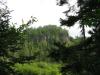
A huge beaver swamp surrounded by tall trees and cliffs lay ahead. Climbing up a rocky outcropping on the southern shore offered some great views of the beaver swamp as well as the cliffs I had been climbing earlier. This was a really beautiful spot, and I took a bit of a break here to enjoy the view before heading east.
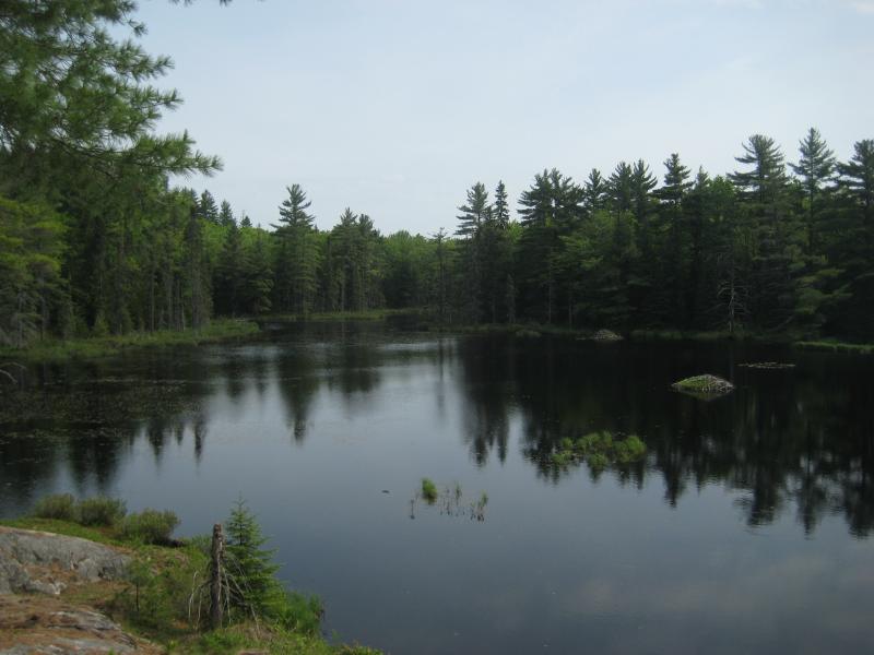
Large beaver pond below Stager Lake
The four-wheeler path that leads over Mulligan Creek has a fork a short distance after it turns away from the creek. If you take the left fork you'll climb up the cliffs I was camping on your way to Bob Lake. I suspected the right fork would continue north, up the plains, and would be located near the beaver pond I had just left. Sure enough, I found the path after a small amount of bushwhacking. Taking it north was a welcome change from pushing through the thick forests of the area. There's a cabin along the route, but it was off a small (and the only other) fork and I didn't even see it.
I was starting to get a little worried about where the path was taking me when I heard a familiar roar to my right. A small footpath led down the steep hill to my right straight to one of my favorite waterfalls - Pinnacle Falls on the Yellow Dog! The four-wheeler path turns left here and I can only assume it continues on and makes a full loop with Bob Lake near the ford on the Yellow Dog River.
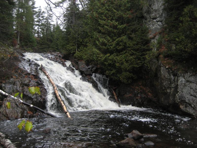
Pinnacle Falls
Sticking to the west side of the Yellow Dog River while heading back south took me to Outlet Creek, my next big destination. This tiny creek descends out of Mulligan Plains from a series of swamps north of Mulligan Creek in a series of tiny rapids in a deep, cluttered gorge. Not fond of the tiny, swampy, and log-filled creek, I quickly crossed and headed up the steep eastern bank. This slope continues southeast, getting steeper and rockier, until you reach some amazing rock cliffs facing west. The views from here are amazing, with both the Yellow Dog Plains and Mulligan Plains visible from the same cliff. On a clear day you can even make out some of the Western Huron Mountains.
Looking south from the northern end of Mulligan
After resting and enjoying the view atop the cliffs I headed south into Mulligan Plains. The trip down to the plains was surprisingly easy and I made a beeline southwest back to the four-wheeler path. This side of the Mulligan Creek is a bit wild... No roads cross over here and there's no cabins in the northeast corner. The woods felt just as old as any on the plains, but the undergrowth was thicker and everything was quieter.
I had one last difficult piece of the hike before making it back to the easy four-wheeler path and my campsite. Outlet Creek swells out to a large swamp this far north and was directly in my way. Luckily, I hit the water right at an old beaver dam and was able to cross over without even getting wet.
After this hike I headed back home. It was disappointing to turn around early without visiting Lake 8, Rocking Chair Lakes, the Southeastern Cliffs, or Bob Lake, but I was ready for home. As usual, the visit merely whetted my appetite for future hikes here, and I was determined to visit the Silver Lead Mine Lakes on my next trip up north.
Comments (0)