Weekend on Mulligan Part B - Silver Lake Basin
The air felt uncomfortably hot as I walked down the trail, away from my campsite, in the early afternoon. My first Mulligan Plains hike seemed pretty easy, a simple trek around the Silver Lake Basin. There would be little bushwhacking with the lake levels still below normal from the burst of 2003. I carried a single water bottle with me, thinking that the hike would be easy and I'd be back at camp well before dark.
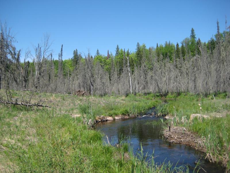
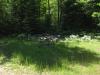
Uninviting upper Dead River landscape
After crossing Mulligan Creek I continued south until I hit some recent logging activity. I headed right, westwards up the hill, wandering around the piles of brush and avoiding the ankle-twisting traps left by the loggers. They only made it a short distance up the hill but I was surprised to see even more logged-out areas at the top. A recently widened two-track from the south gave them access to the entire area at the top. Disappointed by the lack of untouched woods, I headed down the sandy road.
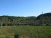
The hill I was on is one of the tallest points on the west side of the plains. Rising up to 1800 feet, it is quite prominant from both Rocking Chair Lakes and inside Silver Lake Basin. As I walked down hill I was surprised to see a small four wheeler path leading to the west with an opening in the woods beyond. This opening was on top of a large rock outcropping that offered some amazing views westwards into the basin. I was quite surprised - there's no hint of this outcropping from satellite photos or the basin below.
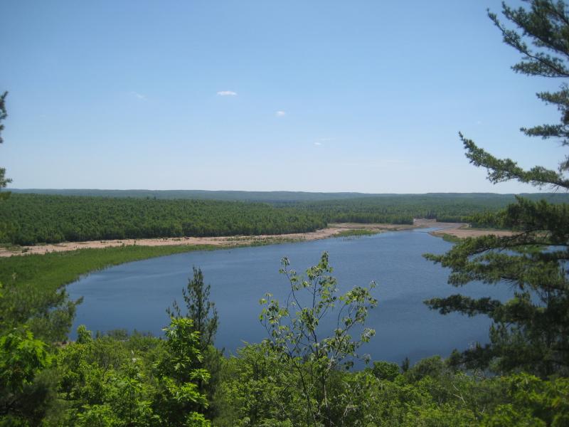
Eastern overlook of Silver Lake Basin
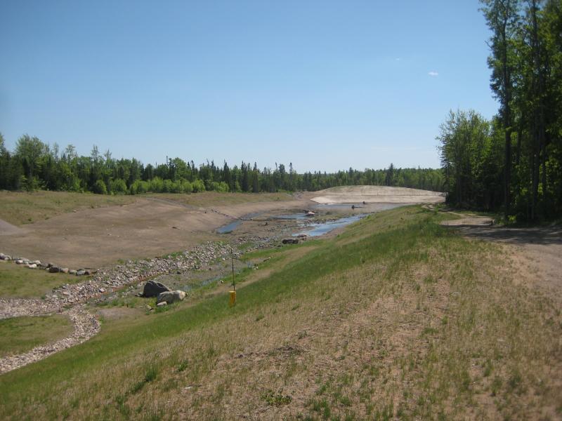
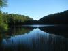
The rest of the way to the basin was an easy trek down the road. I first stepped out of the woods on the eastern shore and turned southwards. Not looking forward to the next section of the hike, I set a good pace along the southern shoreline following four wheeler tracks. Compared to the northern side, there's not a whole lot to see on the south side of Silver Lake.
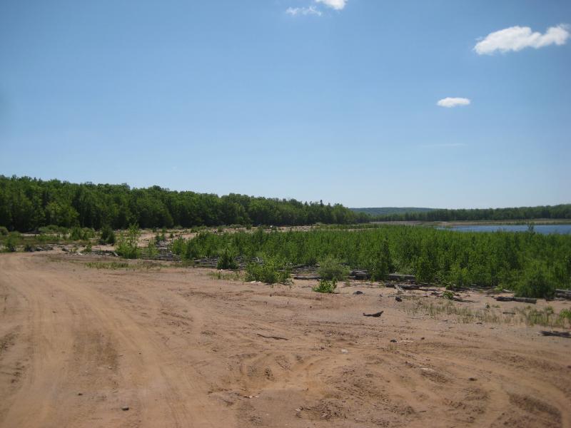
Southeastern shoreline of the Silver Lake Basin
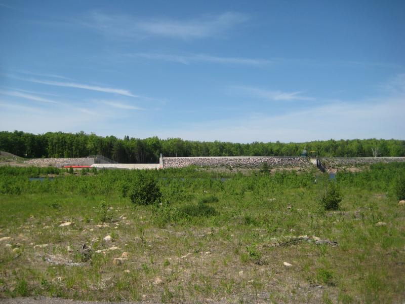
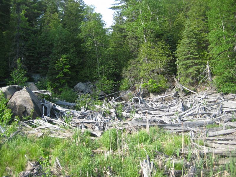
I first bumped into the site where the earthern dike burst in 2003. This entire area is strongly reinforced now with a thick earth-and-rock wall. Damage is still clearly visible from the burst if you look out of the basin; A deep, wide channel is cut out of the forest. The channel quickly joins up with the Dead River which is also scoured and widened from the flood of water. Instead of following the basin's shore here I headed down the channel and back upstream the Dead River to the Silver Lake Basin Dam.
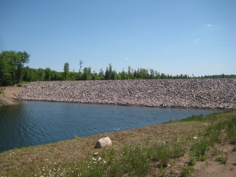
New rock barrier at the failed plug
Scoured channel downstream of the failed plug
Surrounded by large, dead trees, the river was ominious. The swampy land and thick underbrush made it very difficult to bushwhack here, but I made it through and came upon the small dam. This dam is the smallest one on the Dead River, probably only 10 feet high and having a large pipe as a drain at the bottom. Asides from some recent overflow improvements, the concrete and steel dam looked very old, especially the catch on top to control water flow.
Silver Lake Basin dam (from inside the basin)
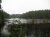
Back in the basin after the dam, I was able to start making some short cuts across the dry lakebed. While they have been slowly raising the lake level this year there is a substantial portion of the western basin that is still bone dry. Some of the creeks that flow in from the south were a little difficult to cross, since their normal flow is lower than the lake level and the water was creeping back up the channels in wide, deep reaches. Asides from a few neat rock outcroppings and some small falls on Voelker's Creek (that would be covered when the lake is full), this walk was uneventful (and quite hot).
Dry, grassy lake bed on Silver Lake Basin
I had been roughly following a four-wheeler path around the lake. The lake isn't difficult to follow but had plenty of obstacles - brush that towered over my head, large logs, swampy sections - and the path made an easy trek. After Voelker's Creek, though, the path died out. Also, the basin jutted northwards in a large rectangular chunk. Hoping to cut some time out, I headed inland along some old logging roads in a beeline to the point where the Dead River enters the basin. These roads were quite overgrown and the route only saved me distance - not time.
After passing a neat cabin title the 'Wildcat Hilton' I walked down a nice dirt road to the Dead River. The river is pretty small here, easy to cross as it enters the basin. My original plan was to head up Wildcat Canyon Creek and Cole's Creek to the west, but I was far too tired at this point and just cut northeast. Dead River had other plans, though - it cuts an angle and widens out to uncrossable portions in my route. I had to backtrack around and meet up with the northern shoreline between Wildcat and Cole's Creeks.
Western end of Silver Lake Basin
This entire area is very remote... Unlike the other Dead River basins, there are no cabins lining the edge of the Silver Lake Basin. The southern edge had only a few scattered houses in the woods and some logging areas. Compared to the northern side, though, the south side is tame. With no road access and a single cabin (that I know of) near the Silver Lead Mine Lakes, the north side is straight up wild. I felt a little odd walking along the shoreline here, almost as if a cougar was about to stroll out a few feet ahead of me. The trees loomed overhead, and on a few occasions, I could make out rocky cliffs rearing up behind them.
The creeks flowing in from the north were difficult to walk around, with large amounts of bleached logs crowding around their mouths. I could make out a small waterfall from the Silver Lead Mine Lakes outflow but didn't wander close enough to confirm. With little water on this hot day I was starting to drag a bit, taking regular breaks on the rock outcroppings and even a short nap. The four-wheeler path that used to run on the side of the lake was now covered by the rising waters and I had to push through the tall brush and clamber over the frequent outcroppings.
Clutter near the Silver Lead Mine Lakes outflow
When I reached the northeast point of the Silver Lake Basin I had to make a difficult choice - head back up the tall hill overlooking Mulligan Plains I had climbed on the way in or circle around (adding miles to my hike) and keep a mostly level route. I choose the former and tackled the hill with a sudden burst of energy. The hill was steep, but with the clear forest floor and old growth moss, I made it back to the logging road very easy.
The logging road was very rough this far north. It veered west after a while, but I can't imagine it continuing on for much farther. I headed north here, along the ridgeline and away from the road, until I reached the rocky hill just to the south side of Mulligan Creek. It looked like there might be a few outlooks here to the north. Far too tired to check it out, I tumbled down the hill back to my car which had a half gallon of warm water waiting for me.
This hike was the longest trek I had ever attempted. Although I used a number of easy routes (logging roads, paths, etc) over half of it was bushwhacking, and with a final tally of 17 miles over the course of 5 hours, I was pretty happy with the hike. If you're in good condition (and have enough water for it) I'd recommend this circum-route to other hikers. With the length and a shortage of time I did have to skip a number of cool destinations (Silver Lead Mine Lakes, Wildcat Canyon, etc), though. I plan on returning and focusing only on these destinations without the full route in the near future.
Comments (0)