Taliesin Overlook of the McDowells
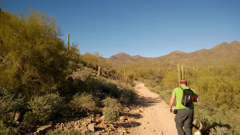
The drive up to Lost Dog Wash Trailhead is around an hour from my house - a bit on the long side when you have two impatient sons squirming in the back of the van. We survived the drive with minimal issues, though, and pulled into the parking lot just before Chris. Preparation took some time, as it does when you need to make sure you have snacks, water, diapers, wipes, etc for two extra people, and eventually we headed over to the trail and started the short hike north.
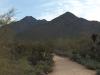
Chris and Mya leading on the trail
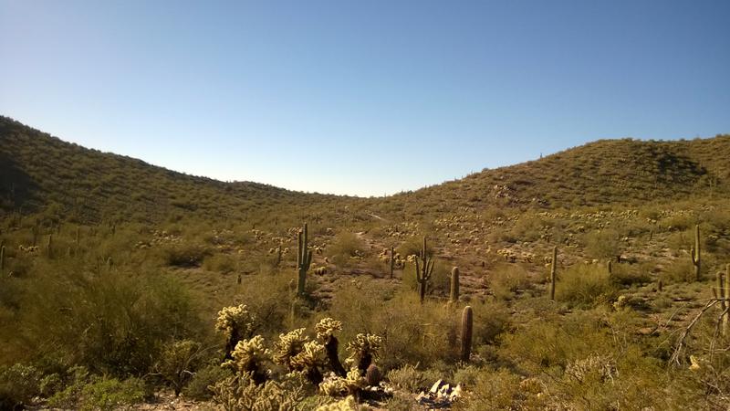
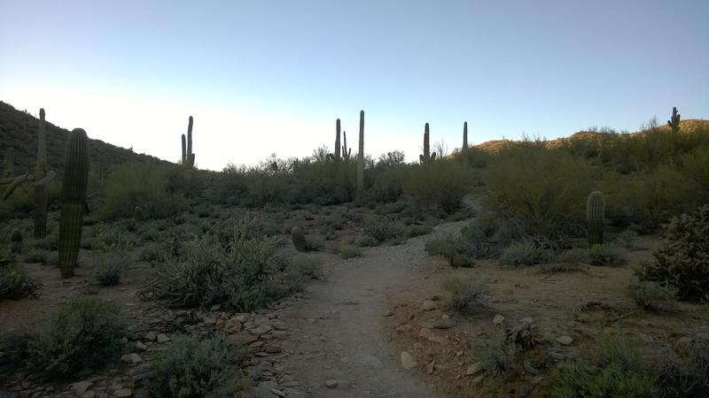
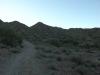
Lost Dog Wash runs through a small valley on the south side of the McDowells. The hills around it do a great job at blocking out much of the noise of Scottsdale, though a bit of Fountain Hills does leak up from the southeast end of the valley. There are a handful of trails in the small valley, none more than a few miles long, and I had my heart set on a little loop that runs around the inside perimeter and would be around five miles in all.
While both Noah and Thomas can walk on desert trails alone now they have vastly different capabilities. Noah can handle a few miles with only a bit of assistance over tougher sections and some encouragement. Thomas is good for a few hundred yards, tops, and needs constant help. Which makes sense - Thomas is barely over a year old. Unfortunately, time was of the essence today, and we didn't have enough time to teeter along the trail that much. I had Thomas in a back carrier and Noah I just carried with one arm, hauling their combined sixty-plus pounds along the rocky path.
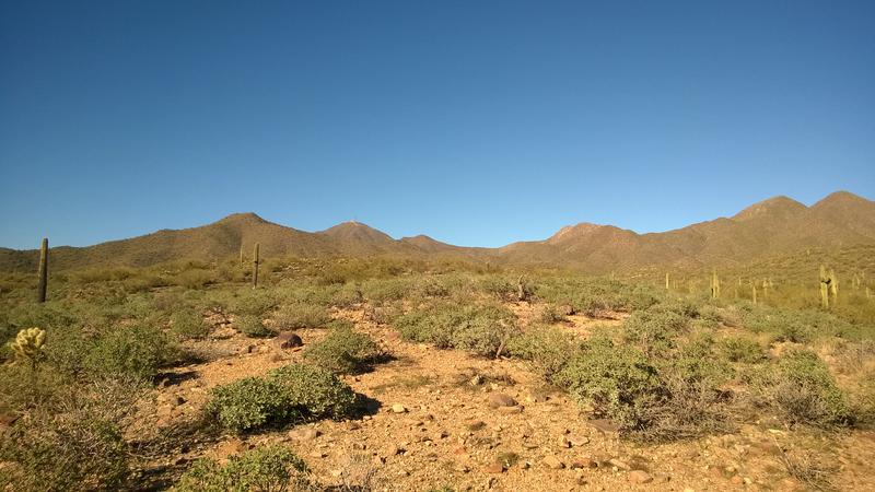
Hot, dry desert landscape
Chris had brought Mya along on this hike and the little dog pranced and trotted along. They weren't going to be the slow factor today - I was. Those two zipped up the trail without much concern, keeping an eye out for joggers and other dogs, while I sweated and stumbled behind. At least I was going to get a workout on this hike. Carrying two kids up two miles on a slight uphill grade kept my hands (figuratively and literally) full and I didn't take many pictures. Until I saw the saddle ahead, of course. The halfway point of our hike deserved a photo.
Slowly approaching the saddle
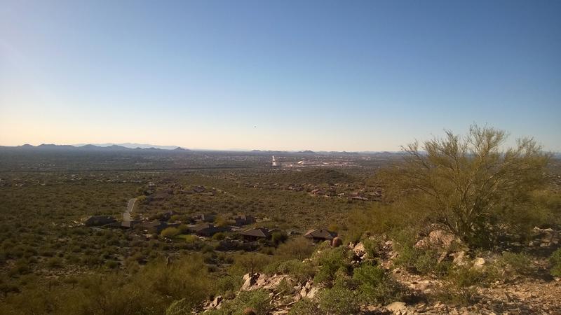
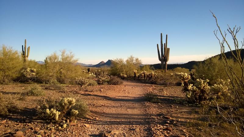
We huffed up the last bit and set up for a small break. Chris filled up a water bowl for Mya while I let both boys down and got them each their water cups. Once everyone was attended to I turned around to see just what this saddle gave us. This was the Taliesin Overlook, the upper crest of the Lost Dog Wash area and the bridge to Quartz/Paradise/Bell Pass trails, and even at a mild 2100' it had a decent view of Northern Scottsdale.
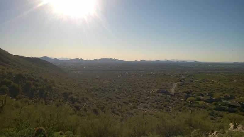
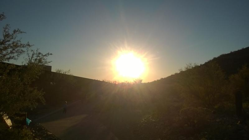
Bright sun over northern Scottsdale
Direct shot down some of the Arizona Canal
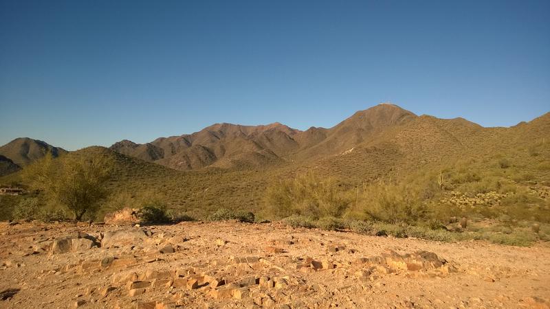
Thompson Peak (radio towers) and McDowell beyond
The views over Northern Scottsdale were okay - city, streets, canals - but the one up along the McDowell Ridge was more interesting. From here I could get both Thompson Peak (the one with radio towers on it) and McDowell/Drinkwater in the same shot. East End, the fourth of the main peaks, was hiding behind McDowell. I'd need to be a mile or more to the west to get a view of all four.
Compared to the other ranges around here the McDowells still feel a bit dull. They are all relatively short, barely breaking 4000', and are more rock-covered hills than craggy mountains. And there are a ton of well-maintained trails covered with joggers and bikers and city hikers coupled with a strict no off-trail policy. The proximity to the city is nice for Scottsdale residents, I guess, and makes for a short drive (or walk) to get on a trail. And there is always the lure of sneaking around off-trail and tackling that ridgeline - three of the four peaks have no path to their top.
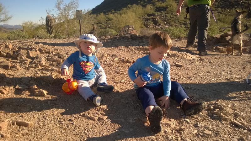
Noah and Thomas relaxing at the saddle
Noah and Thomas enjoyed their break, sitting on the rocks and drinking water. Soon they were getting antsy and began to wander around the small saddle. The ground was too rough for Thomas and too craggy for me to feel comfortable with him falling so I kept within a arm's reach as he stumbled around. Then Noah decided to venture a bit too close to a scree slope down and I had to chase after him. It took me a whole three minutes before deciding it was time to get Thomas back in the carrier, where I knew he would be safe, and start on the way down.
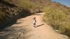
The hope was to let Noah walk the entire distance back. It was all downhill with a few up/down through washes and we had well over an hour of daylight left. Chris wasn't terribly patient so he quickly started down the trail with Mya ahead of us. Noah, on the other hand, made it ten yards down the trail before he decided it was break time. This was going to be a long walk.
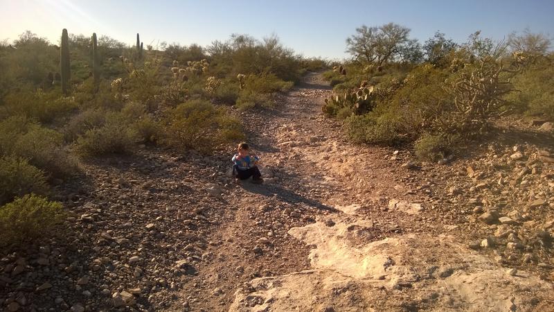
Noah deciding it's time for a break
Eh, we had time. I coaxed him along a few times but for the most part let him choose his own pace. The last thing I want to do is turn our hikes into unpleasant rushes, especially for his curious and impressionable mind. We slowly dropped back into the valley of Lost Dog Wash, leaving Taliesin Overlook behind, and sometimes Chris would wait up at a bend for us and sometimes he wouldn't. The only concern I had was the coming coolness of night, something that I felt in the shaded portions of trail, though that could have been my still-cooling sweat from the tough hike up.
Shade falling on the trail
More and more people began to pass us, runners out to enjoy the cooling temperatures and hikers on longer loops heading on their way back. My rule with Noah is to hold my hand when someone else comes close by, mostly to make sure he's out of the way, something that is all the more important when a bike zips around the corner and he doesn't know which way to go. Them mountain bikes, I love them, but they could bowl over Noah much quicker than I could snatch him out of the way.
Long shadows on the way back down

A tired, dirty Noah heading down the trail
Shadows continued to stretch over the trail and Noah began to slow down. He didn't have a ton of energy to start with - it had been a long day that started with an early trip to the zoo, some errands, and now a desert hike that was dangerously close to dinner time. I kept half of my attention on him (and Thomas) and also looked at the view south. Everything to the north, east, and west was blocked by the wash's valley, tall hills and saddles, but to the south was Shea and beyond the Salt River. Not much was visible from our meager elevation, but it was a view.
I also paid more attention to the vegetation. It was mostly cholla trees and tall saguaros, all protected by the valley walls. There was also a good mix of palo verde trees in there, possibly due to the slight increase of water that is available around a wash area. Everything was well-maintained and pushed back from the trail itself, something that I was thankful for as Noah isn't always as careful as he should be around the prickly stuff.
Blinding sun over the trail exit
Eventually we reached the exit, around twenty minutes before the sunset. Chris and Mya were waiting there and we headed back to the parking lot together. He had a ten minute drive home and I had over an hour. While I was glad to have visited a new area and finally got to Lost Dog Wash with the boys I'm not sure it was worth the drive. Oh, and it was nice to hike a new part of the McDowells with Chris, too.
-
Jacob Emerick
Mar 18, '16
We do SPF 50 sunscreen, hats, and (usually) long sleeve shirts, regardless of the heat. I'd rather have them sweaty than sunburned. Unfortunately, Noah dropped his hat on the first half of this trip, so the pictures don't really show it (and it's now lost). I'll be picking up a new one for him soon.
-
s
Mar 22, '16
Great job Mom and Dad. Also glad to hear of your first aid courses.
-
Jacob Emerick
Mar 24, '16
Thanks s :)
Add to this discussion