Return to Amethyst Peak
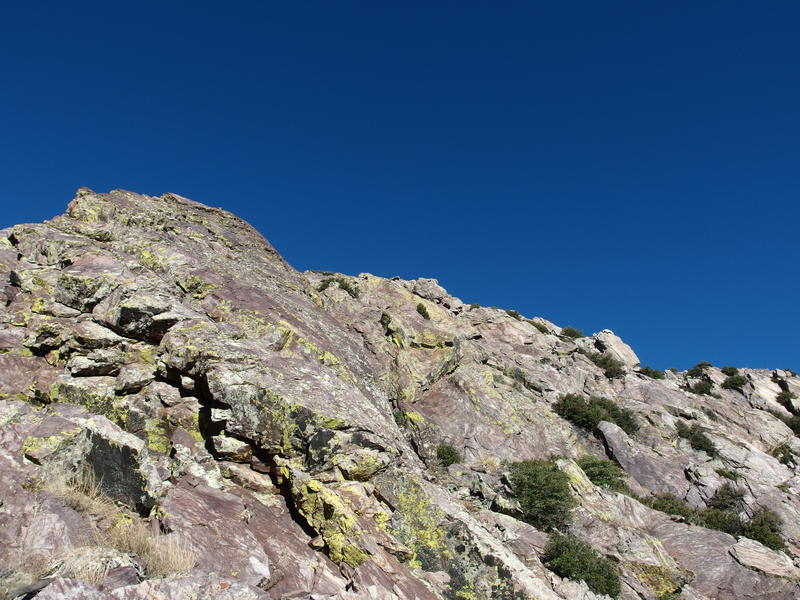
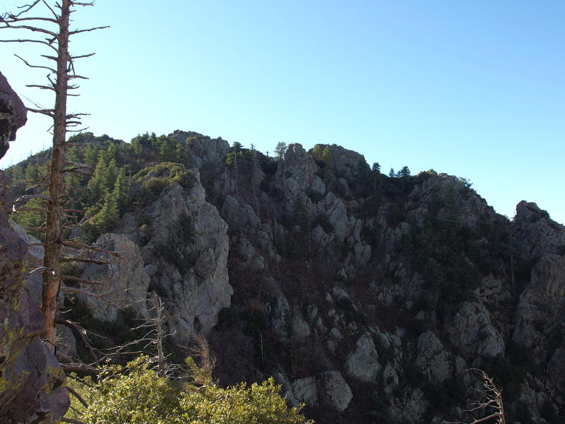
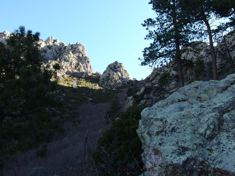
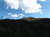
A cool breeze flowed around me as I stood on the summit of Amethyst Peak. The sun had been up for an hour, barely enough time to warm the earth, and last night's low temperatures still lurked around. Chilled, I pulled out a sweater from my pack and put it on, and then continued to eye up the three peaks to the north. They looked rugged and terrifying from here. Could I find a safe path over them?
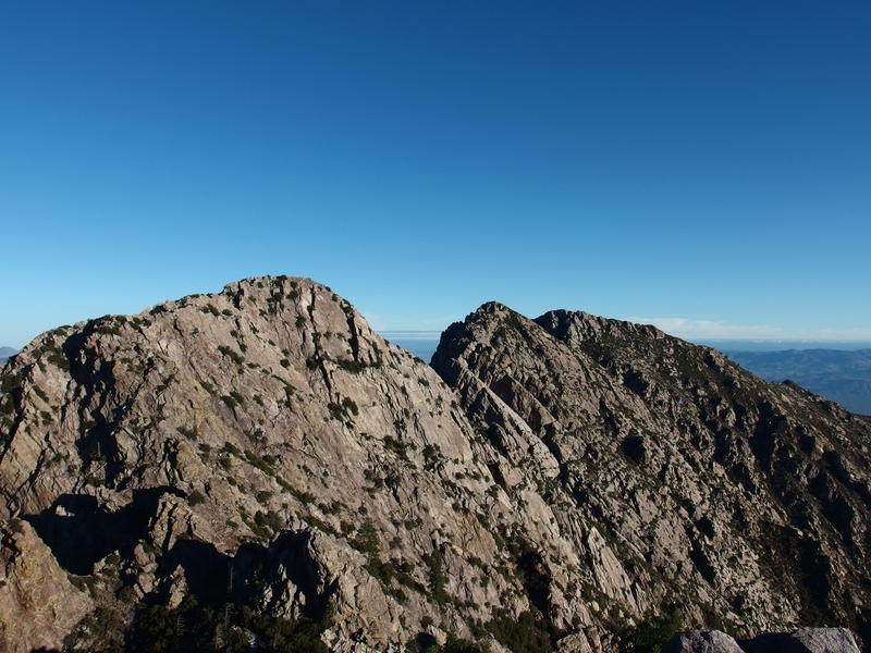
The three rugged peaks to the north
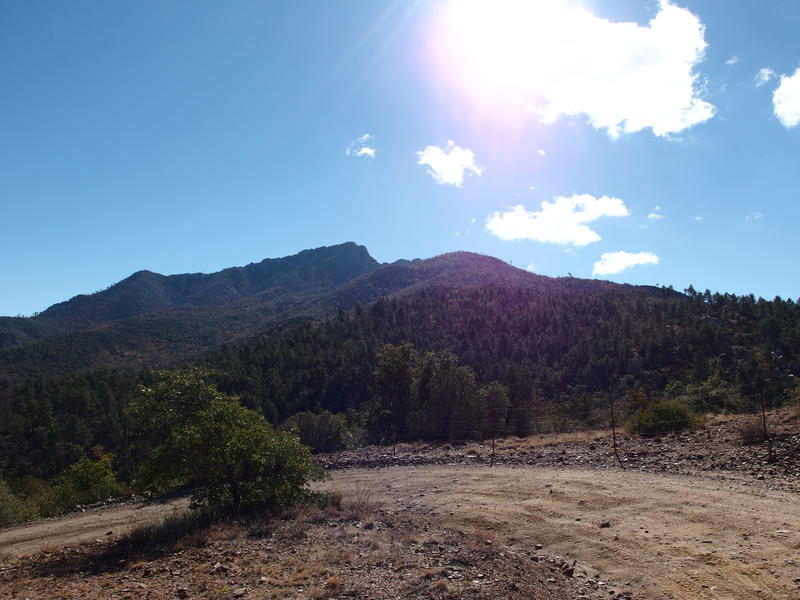
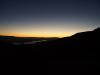
Let's back up a bit. I had spent last night in the overflow parking lot at Brown's Peak, reaching it just in time to make a quick dinner while watching the sun set over northern Phoenix. Even then it had been chilly, especially in the exposed overflow lot, and it wasn't long before I was huddled under my sleeping bag and reading a book. After a good night's sleep and a chattering morning routine I hit the trail at five under the starlight.
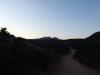
Hiking up to the saddle had been a rushed affair. I paused a few times to wipe the mist collecting on my glasses and to adjust my water-heavy pack. It's been a long time since I hiked in a climate cool and humid enough for misty glasses - I don't miss that part of Michigan at all. A long-sleeve shirt and sweatshirt may have been overkill for the hike, too. By the time I reached the saddle I was pretty damp with sweat. Under a still dark sky I ripped off the sweatshirt, tied it to my pack, guzzled a few mouthfuls of water, and pushed on down the little trail to Amethyst.
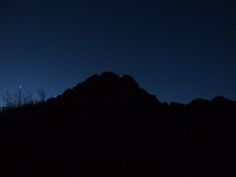
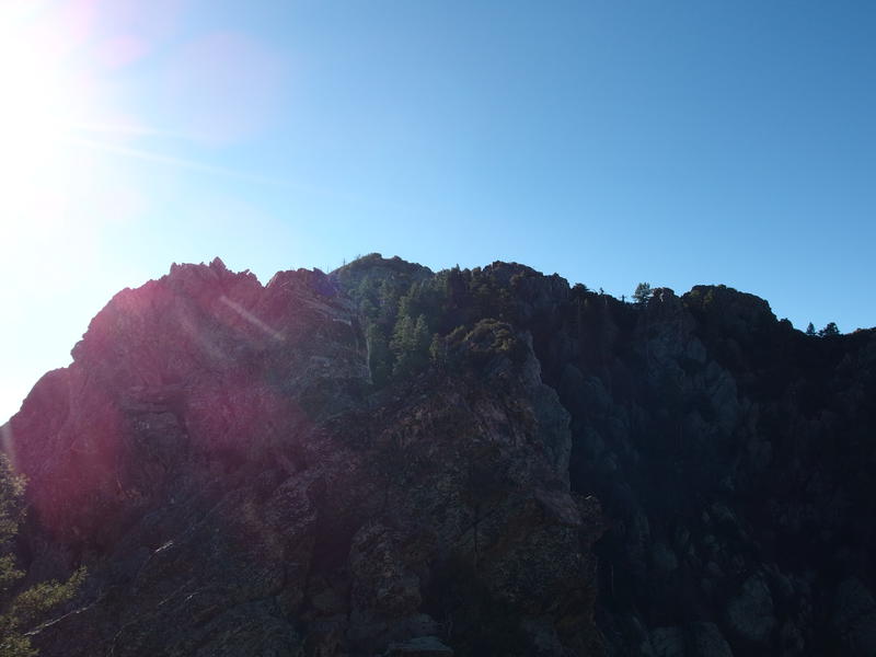
Dark skies over Brown's Peak
When Chris and I had first been to Amethyst, many moons ago, it had taken us seventy minutes to reach the saddle and a total of four hours to bag the peak itself. Some of that time had been wasted finding the little trail that swings along the western slope of the ridgeline. Today I had no trouble finding it. Just keep on the route to Brown's Peak until it hits the lowest part of the saddle, near a cluster of saplings and a small campsite, and then take the right fork over.
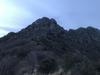
My pie-in-the-sky hope was to bag the distant peak in two hours flat. That was definitely optimistic. While I didn't have to spend time looking for the path, it still took me fifty minutes to reach the saddle and at least a half hour to reach the mine. And then there was that damn chute. It's 500 yards long and climbs 700', all loose rock and choked up with brush, and it chopped down my optimistic pace. Plus I made a bad decision halfway up and had to clamber over a dividing ridge between two routes like an insane monkey. By the time I made it up the chute and the leaf-covered slope of Amethyst Peak itself I was thoroughly soaked in sweat, shivering from the light breeze, and disappointed by the three hours it took to reach this point.
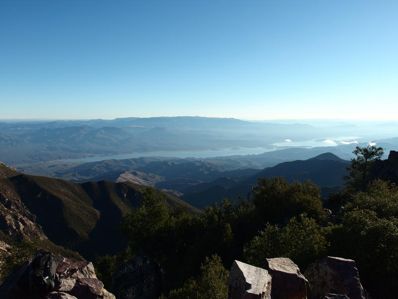
Morning light shining on the reservoir below
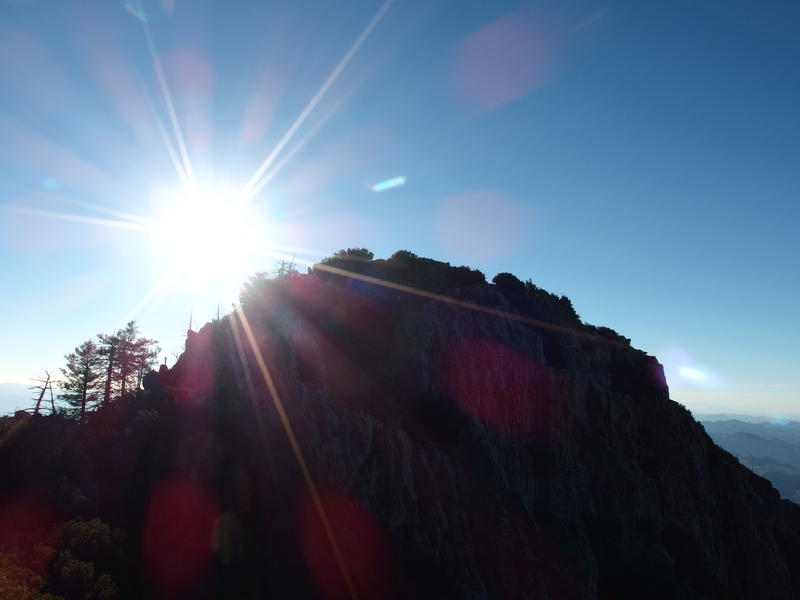
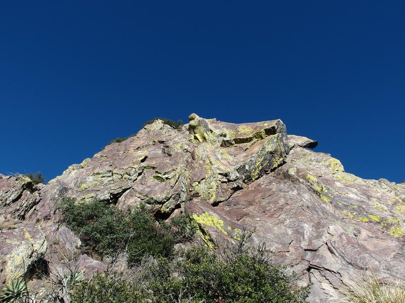
Bright sun on Amethyst Peak
At least the views were still amazing. To the east is Theodore Roosevelt Reservoir, the uppermost basin on the Salt River, with a few clouds drifting over it lazily. Beyond the reservoir was the tempting rise of Sierra Ancha Wilderness. To the west, a few of the lower basins on Salt River was visible, and then the expected Superstition Wilderness and smoggy Phoenix beyond. I found a comfortable rock and sat heavily, changing into a pair of dry socks while munching on second-breakfast, and reviewed my options.
See, my pie-in-the-sky hope was actually pretty important. My plan for today was to do a Mother Lode attempt - y'know, a dance with death along the treacherous Four Peaks ridgeline. I had the gear, basic knowledge, and a few good routes loaded up on my GPS. The one thing I didn't have was time. Katie wanted me back in Phoenix no later than five. Even with my early start this morning this only gave me nine hours to do this hike. Getting on top of Amethyst in two hours would have put me in a good spot to make the deadline - reaching it in three hours ate up some needed leeway.
Feeling a bit rushed I cut my break short, a break that my legs (which had already climbs 2400' over 4 miles) were begging me for, and re-packed my gear. It was time to push on. Sure, I was behind an hour, but maybe I could make it up somewhere. Checking the loaded GPS route I dropped down the northern face of Amethyst, deviating quite a bit from my path up, and tackled the divots.
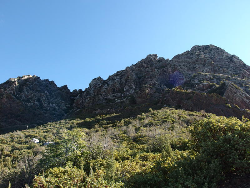
See, there are three mini peaks in the saddle between Amethyst and Sister's Peak. The first one is easiest to circle around to the east, the next two to the west. That's important, because you don't want to waste energy climbing up things you don't need to, and everything is so darn overgrown up here that the wrong route could mean a lot of painful bushwhacking. It was easy enough to bypass the first two divots along well-worn paths. The third one was a bit tricky until I realized that I had to climb up into a crack near the top and then drop ten feet down on the other side. While I was in that crack I got my first close view of the next leg of the hike on Sister's Peak.
The climb up Sister's Peak
Yeah, one steep climb. There's a way up there, though I couldn't picture it from this angle. It all looked steep and painful from here. I dallied here and tried to guess at which way to go - maybe that crack, or those bushes, or the little ledge over there - and soon gave up. My GPS is good to ~10' or so, especially in an exposed area like this, so I'll just let that guide me.
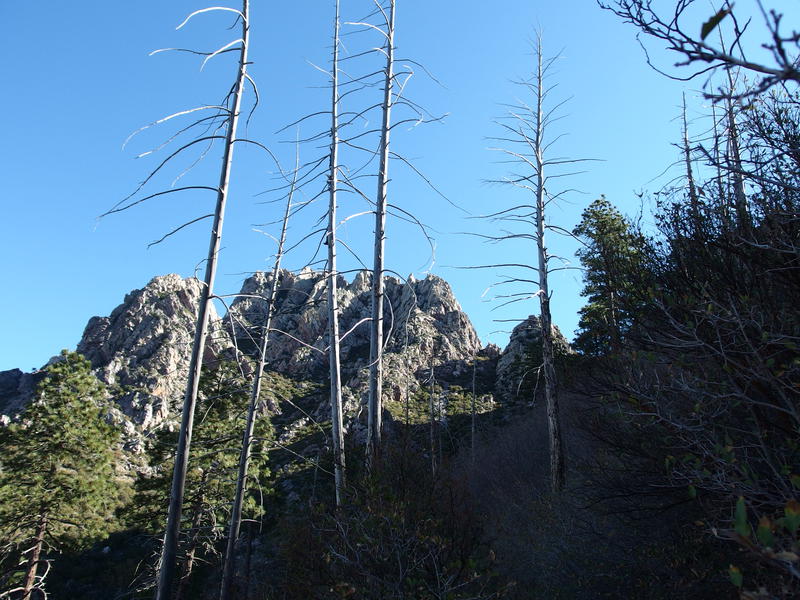
Looking back along the divots to Amethyst
Dropping down off the third divot, I zipped over to the base of the climb, leaped over to a ledge on the right, and then pulled my way up a diagonal crack. It was actually pretty easy going, barring that first leap. A few bushes made for good handholds (scratching me up in earnest along the way) and the way wasn't stupidly steep here. I gained a good thirty feet, inched my way back to the right, and then gained another thirty or forty. Shoot, this might be easier to climb than the leafy Amethyst Peak. Leaning against a sun-warmed rock I pulled out my GPS for the next direction. The GPS was dead.
I had been questioning the push for Mother Lode since I started. It's dangerous to go it alone and the time crunch made for a stupid accelerate. And now, an hour behind schedule and with no route to guide me, it was time to bail. I had already learned on Brother's Peak what happens when I try to do this hike without a guide. It had taken me over an hour to cover twenty minutes worth of hike. With the schedule constraint I didn't have any time for that. I leaned against the sun-warmed rock and let the defeat sink in.
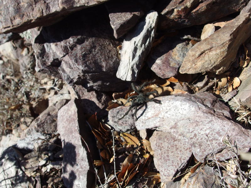
A little friendly tarantula along the way
Over half-way up Sister's Peak and I turned around, stepping around a lively tarantula on my descent. It was easy going this time, now that I had a feel for things. When I reached the divot with the crack I eyed up the drop from here, realizing that this chute probably meets up with the same chute that goes down to the mine below, and it looked terribly overgrown with manzanitas. Instead I skipped up over the crack again and slowly made my way over to the southernmost divot, right next to Amethyst.
More fun climb to go
Looking back at the ridiculous climb up Amethyst Peak
An easy path down showed up out of nowhere, leading me past the thicker stuff and right down to the mine in record time. A pleasant, and unexpected, surprise. I began to play with the idea of returning back to the parking lot by noon. That would give me more than enough time to unpack, do an afternoon workout, and be ready for a double date with Katie after five. Not sure if I needed a workout after this hike… Anyways, once I got past the mine I found a shaded spot to sit in, changed my socks for the last time, and ate a third-breakfast while contemplating this route.
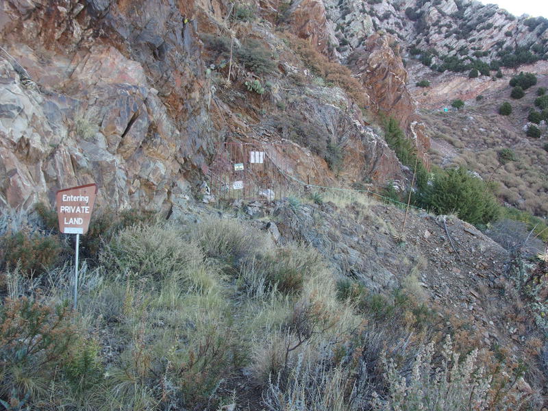
Private land and gate at the mine
Doing Amethyst first (4321) does have a few benefits. It's easier to walk these trails in the dark. Indeed, I probably could have started earlier this morning and still had enough predawn light to climb the chute. Also, once you descend off of Brown's at the end it's all downhill to the parking lot. The biggest con is the chute. The chute up Amethyst sucks. Doing 1234 would kick off the Mother Lode sooner and have the relatively easier descent down the chute. I'm not sure which one I prefer in the end.
Sun beginning to light up the peaks above
With two full liters drank (of the five I brought) and a fraction of my snacks eaten I set down the trail to the saddle. Well, up would be a better description. It climbs over 600' in a mile, with a few flat areas and a few direct climbs. On most days this would be nothing, a non-stop cruise that might not even kick off a sweat on a cool day, but today my legs were pretty tired. I stopped for a few photos/breathers and, when I finally made it back to the saddle, stopped for a healthy break in the shade.
Sharp jags high up on Brother's Peak
Looking up at the valley between the peaks
Brown's Peak was hopping today. I saw a few groups while resting, including one running low on water that I donated two liters to, and at least a dozen more on the trail down. There were couples, families, even a scout troop herded by a single weary leader. I wondered if they were part of the campers at the trailhead that I had been so annoyed by. The trailhead was full of bikers and vehicles and ATVs that I barely glanced at before zipping up to my car in the upper trailhead.
One last look at Brown's Peak
Seven hours in all. Seven hours to hike ten miles, climb 3300', face the Amethyst chute twice, and play with a tarantula. Well, that seven includes a few healthy breaks, I guess. I quickly changed out of my clothes into something more comfortable and started the long drive home. Now that I had the time I decided to change up my return by taking the Globe route home, a much more scenic option than AZ-87, and snacked my way through the detours and curves. Above all, I finally felt confident about Mother Lode. On my last attempt with Chris and Kirsty I had left feeling defeated and worn out, yet today I felt like it was possible. I'll be back here, sooner rather than later, and this time I'll bring extra batteries.
Comments (0)