Pine Creek Loop and a Bail
Cars, trucks, and semis roared out over the desert mere yards away from Ballantine Trailhead. I guess this is the alternative to long, rocky roads that usually prelude my desert hikes; parking next to a busy highway and doing my best to ignore the traffic. Wincing as my shoulders took on the heavy weight of my pack I locked the van and made my way over to the start of the trail.
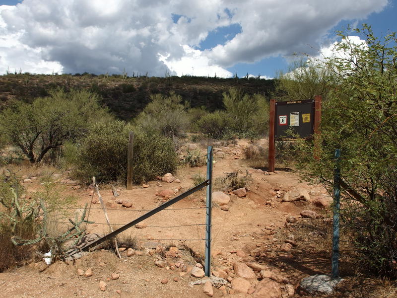
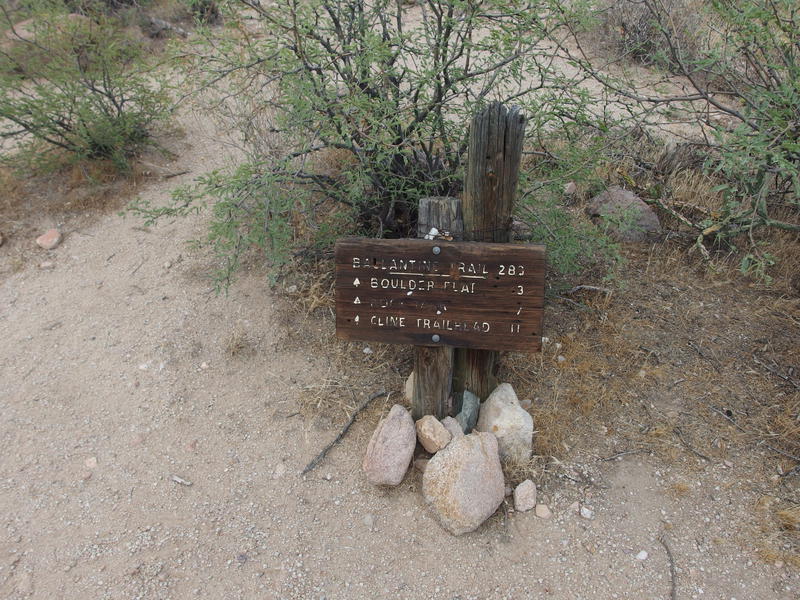
A plain-looking Ballantine Trailhead
Over twenty pounds of gear was stuffed into a simple backpack that felt like it wasn't meant to carry more than twelve. I didn't have anyone to blame for that weight but myself. The packing started innocent enough, making sure that I had enough water to cover eight miles of hiking in triple digits, and then it ballooned out to a plethora of 'just in case' items. Ten pounds of water, a pound of food, and at least nine pounds of the kitchen sink. One night in Four Peaks area didn't require this much weight.
That was the plan, anyways. I was going to hike out on half of the Pine Creek loop, connect with Ballantine Trail, then take that east towards Boulder Mountain and set up camp at Rock Tanks. Today's hike was eight miles over exposed ground with 2300' elevation gain, and my afternoon start meant that it was an uncomfortable hundred-degrees-plus. Well, maybe the overhead clouds would cool things down as the day progressed.
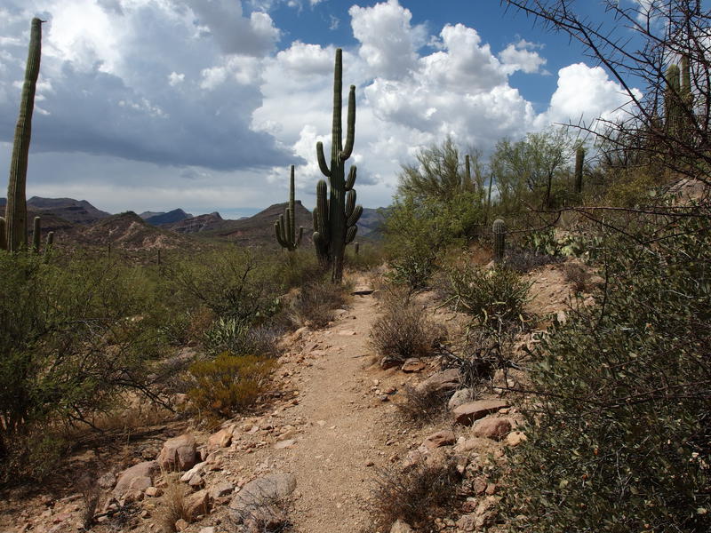
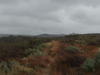
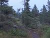
Easy desert trail along the hillside
I took the clockwise option for Pine Creek, which meant walking along the highway for a few hundred yards and saving most of the climb until the end. The trail was fantastic. Cactus and thorny branches were cut back from the path, which wound in and out of the hillside carefully. This wasn't even in Four Peaks Wilderness proper, which made me wonder who took care of it. Sure, the traffic on AZ-87 was annoying, but at least the trail was smooth sailing.
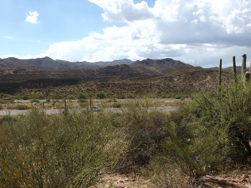
AZ-87 far too close to the trail
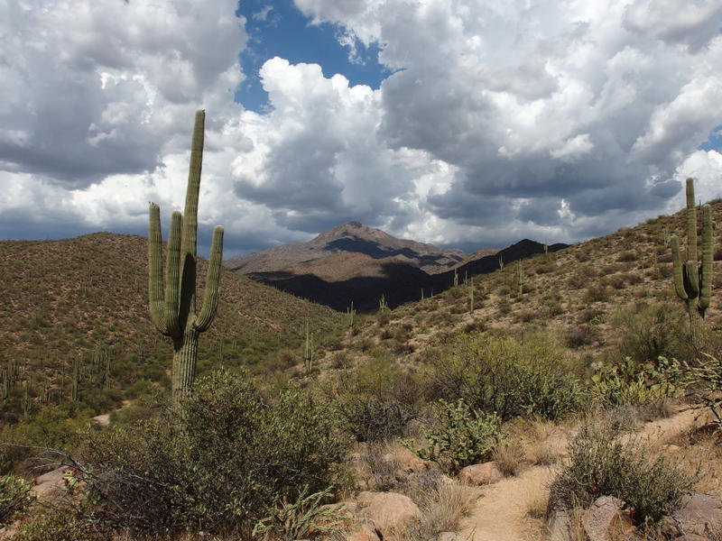
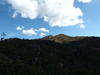
First view of Boulder Mountain in the east
My northward journey began to turn east as the hill descended down into Pine Creek. The trail didn't drop at all - instead, it turned and made a course parallel to the creek high up on the bank. I got my first view of Boulder Mountain out there, huge white fluffy clouds overhead. That, that didn't look promising. The forecast had promised a 10% chance of rain in this area but the clouds told a different story.
The trail climbed, the roar of the highway fell away, and the clouds thickened overhead. I ignored the clouds and kept my mind busy with today's route. 1.4 miles to the Ballantine Junction, 2 miles to the cabin turn-off, 1.4 miles to the corral, and 3 miles to Rock Tank. 8 miles to go and 4 hours before the sunset. Trail climbed and only the loudest trucks on the highway penetrated the quiet desert. I idly wondered if I'd hear the highway from my campsite. It's a long distance, though the valley and canyon ahead would create a funnel to carry the noise to me. Then the trail curved and steepened, I sweated and huffed my way to the saddle, and I was at the trail junction.

Trail junction with Ballantine
The next leg of the hike
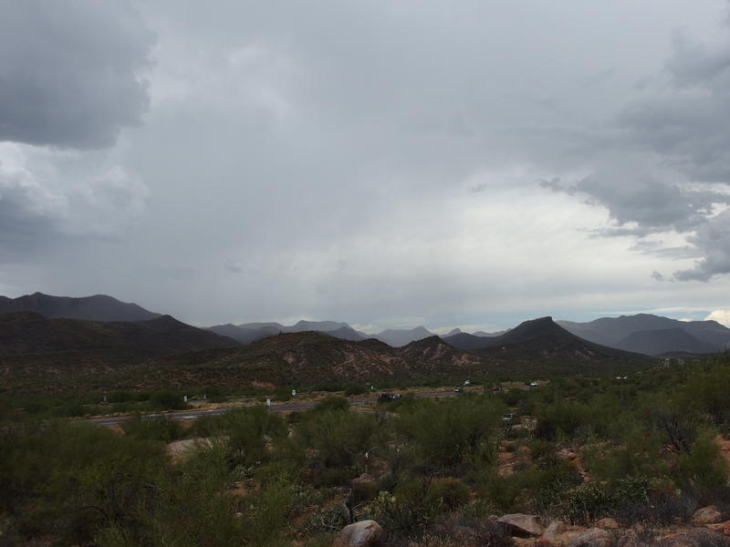
Clouds had given me intermittent shade for the last ten minutes and there was that darkening to my left that I was ignoring. I looked now, gazing to the north, and saw a downpour not five miles away. A downpour that was heading my way. The east didn't look good either, though I hoped those clouds would drift to the other side of Four Peaks. So this is what 10% chance of rain turns out to be, eh? A monsoon thunderstorm? There was rumbling in those clouds, though I didn't see any lightening snaking through the dark gray.
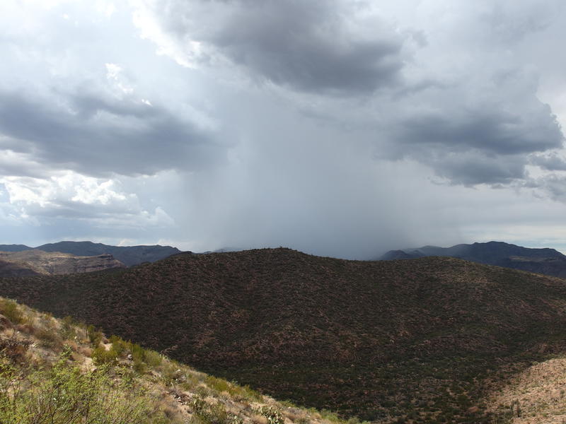
A growing downpour slowly approaches
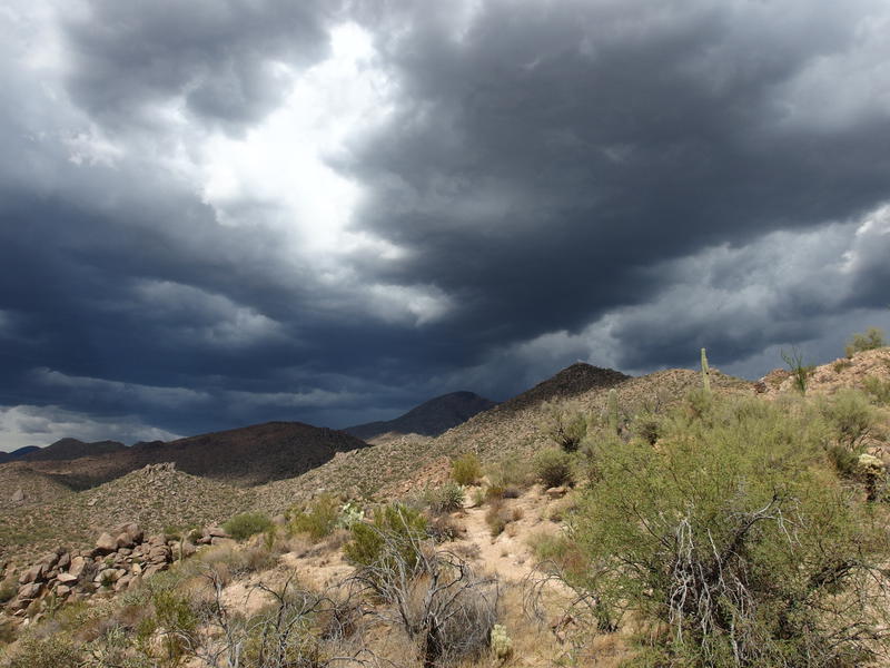
Darker clouds rising over Boulder Mountain
As I stood and weighed my options I heard my phone make a little jingle. My phone? I never bring my phone out on hikes. Lowering my pack I saw that not only had I accidentally slipped it into my bulging pack, Katie had been sending me screenshots of the radar and was trying to call me. A massive blob of yellow and orange was heading my way. I called her, since apparently the nearby Mt Ord gave me enough reception out here, and we talked about it. Turning around is never an easy choice to make, especially with the cabin a mere two miles away as a potential spot to hunker down, yet I convinced myself that a warm dinner and bed was better than huddling in a tin can of a cabin without a nearby source of water. Them terrible dark clouds over Boulder Mountain helped with the decision.
Instead of backtracking, I decided to take the southern part of Pine Creek Loop back, especially because it goes up and over this little hill, which further increased my exposure to stray lightening bolts. There wasn't much of a climb left, maybe a hundred feet over two humps, and then it was all downhill. The views were nice enough up here. To the east was a shrouded Boulder Mountain, complete with a massive downpour beyond it, and to the south was AZ-87 snaking towards Phoenix.
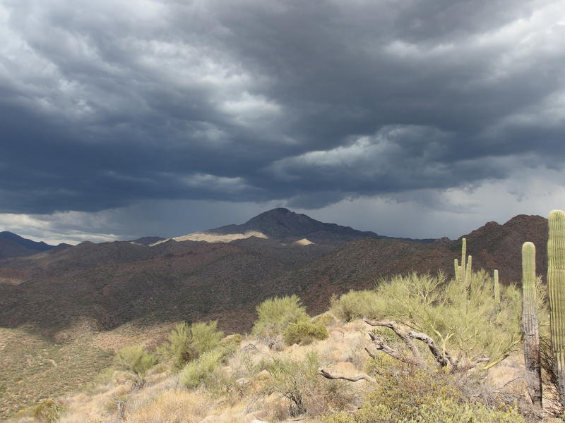
A last, dismal view of Boulder Mountain
Heading down from the crest was an annoying process. The trail was washed out a few times and was hard to follow through all the prickly pear. Climbing up this would probably be easier. Plus, I kept glancing to the northwest to track the progression of the storm. Would it beat me back to trailhead? The storm wasn't moving fast, though it was hard to tell exactly where the misty gray of raindrops started. More and more of the southbound traffic had their lights on, which is never a good sign.
The storms continue to approach
I made it back to the van, threw my gear in, took my first deep swig of water for the day, and was taking my knee brace off when the first drops hit. Perfect timing. In fact, I was able to start driving south, away from the storm, in just enough time to avoid using my windshield wipers. Behind me the storm crossed over the highway and began coming down on the land around Pine Creek Loop.
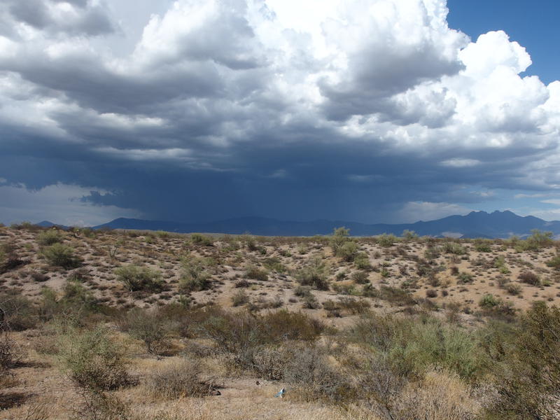
The entire eastern side of Four Peaks shrouded in dark storms
Bailing turned out to be a great idea. Not only was there thunderstorms and confirmed strikes around the Boulder Mountain area, the National Weather Service issued a warning for washouts and monsoon damage to the area specifically around Ballantine Trailhead. Best case I would have been stuck in the cabin for much of the evening, collecting water to drink with my poncho or from mud puddles, and would have a muddy trail to deal with. Worst case I would have been stuck out in the storm away from shelter, huckered under a boulder and tarp, and washouts would pose a serious risk to both me and the van. If my phone wouldn't have found it's way into my already heavy pack, with reception, and Katie hadn't been checking the weather, this could have been a pretty dreadful outing.
-
Jacob P Emerick
Sep 9, '16
Now that sounds like a serious rain coat. Have you had a chance to use it yet (perchance on Isle Royale :wink:)?
-
dcclark
Sep 9, '16
I did run outside during a cloudburst to move some potted plants around. It worked! Our experiences on Isle Royale inspired the purchase. Nothing terrible, but we could have been really stuck if our schedule were different.
Add to this discussion