Northern Boise Creek Valley Explorations
Boise Creek Valley is an awkward, sand-filled depression just north of the Dead River Basin. There are four main creeks that flow through the valley: Clark Creek flows in from the highlands to the west, Wilson Creek seeps along the towering eastern cliffs, Deer Creek drains a large swamp to the northeast, and the namesake Boise Creek flows through the center of the valley picking up all of these tributaries before emptying into the Dead River. Boise Creek isn't contained within a single valley, though. There is a narrow, twisting channel to the north, one that only has this creek flowing through it, and one without easy access or many visitors. Naturally I had to hike there.
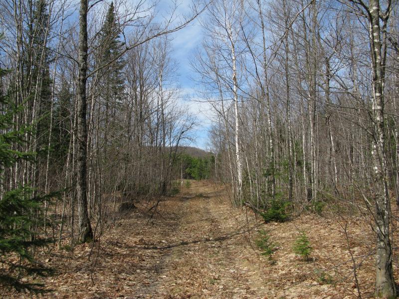
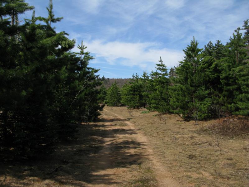
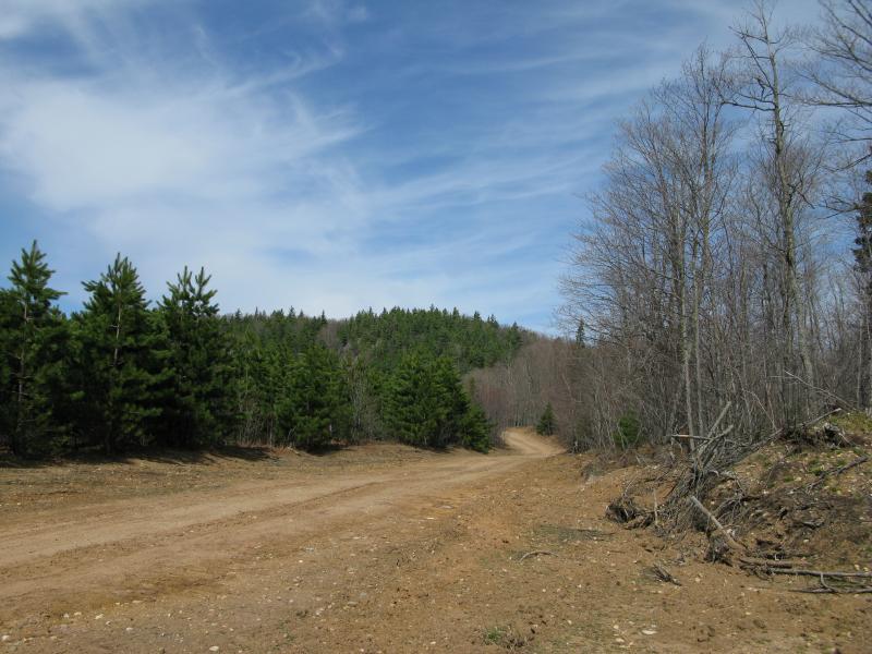
Bare trees and lonely tracks in Boise Creek Valley
There is a gated road that connects this valley to County Road 510. To spice up the approach I decided to take a snowmobile trail instead of this road near a spot that geocachers call 'Ho Chi Minh'. Parking my car early in the spring morning at the trail I got my first big surprise of the day - loggers are using the trail to haul wood. The trail had been widened and improved for their large, heavy trucks and was gated with several 'large truck' signs. Stepping past the gate I trotted up the path, slowly gaining elevation on the muddy, rutted tracks while passing huge pieces of equipment and stacks of logs.
I wasn't opposed to following roads on this hike. After all, I was pretty sure it would be a long trek and I was more interested in exploring the general area than bushwhacking to a specific outcropping. Only after the logging road started curving north did I cut off in favor of the woods, heading west to a large swampy creek that flows south into Boise Creek. The woods were thick, even for the early spring, and I spent most of the time weaving or ducking around the thick undergrowth. When I broke through into the swamp I was relieved to see wide, open swaths of grass and knee-high brush, although the large moose droppings and tracks in the area kept me on edge.
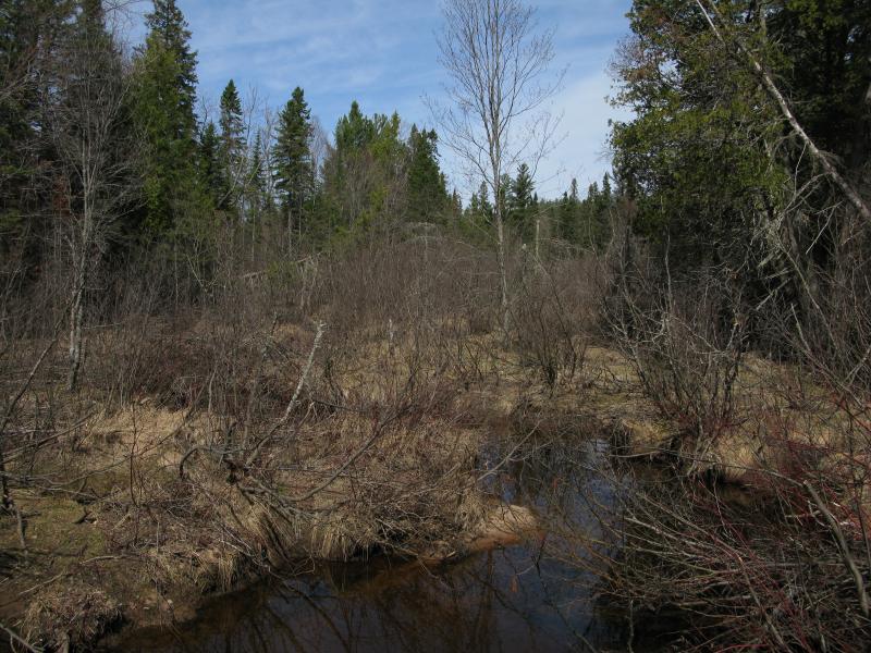
Grassy swamp high above Boise Creek Valley
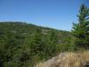
Winter's melt still had these swamps swollen, although it was obvious that there had been much more snow and water here a few weeks before. Large pools forced me to the edges of each beaver dam-defined section, especially where the water deepened near the dams. While I was enjoying the openness of this route I was more interested in the valley to the west than these highland swamps and I eventually left the creek and headed over to the ridge overlooking Boise Creek. Similar to Mulligan Plains in the west, the ridge is not a continuous line but has many dips and rises, so I aimed for a highpoint and saw… nothing. Trees obstructed any hope of a view.
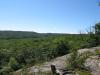
Obstructed views were definitely a possibility in this valley. After all, the height difference was only a bit over a hundred feet for most of the valley and there was no strong river (like Mulligan Creek) to scour away at the base of the ridge. I still had a few hopes, though, so now I turned south again and paralleled the valley. There were a few big dips to climb out of it, including one carved by the swampy creek flowing down into Boise Creek (which had a number of tiny but cute drops on it). By the time I reached the top of the narrow exposed ridge I was starting to get tired, but the views were worth the extra effort.
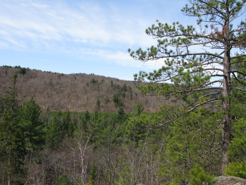
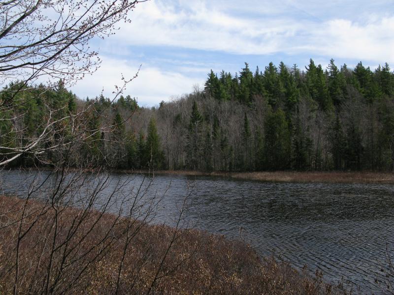
Looking across the valley to the western ridge
There wasn't much to see - the outcropping only offered a view straight across the valley. I had been hoping for a good look either up or down, with the creek sparkling below, but I was happy just to see something. The floor was covered by a managed pine forest (I'm assuming Mead) and the sides of the valley slowly rose up with hardwoods dotted by pines. The western side was only a thousand feet away, although the lower elevation I stood at made it seem further away. It was time for the next stage of the hike and I turned back toward the small creek - it was time to get to the floor of the valley and find Boise Creek.
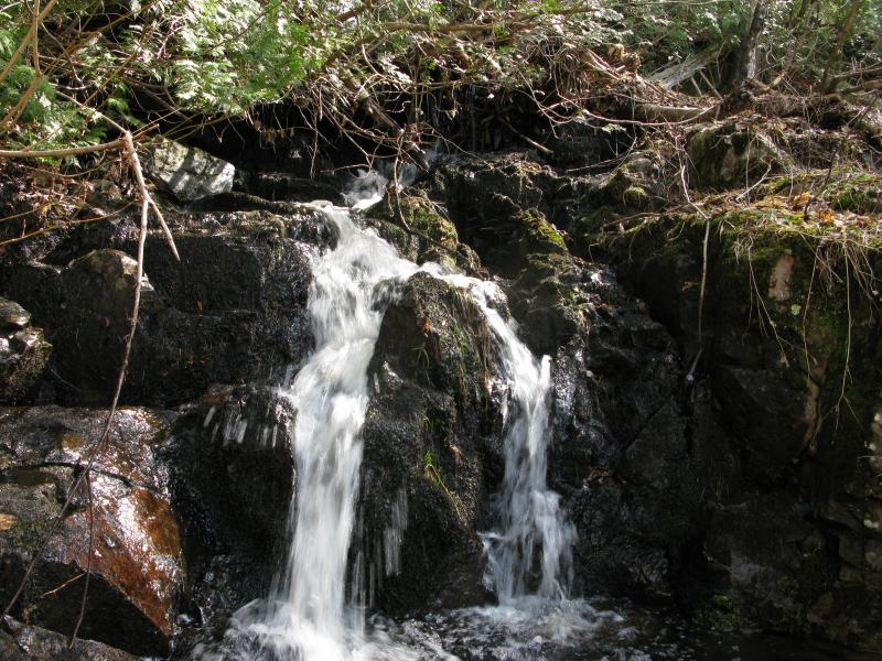
Tiny drop on the drainage creek
Thanks to some careful research beforehand I knew that this creek flows near a two-track, so I followed it down until I bumped into the culvert-ed crossing. Turning north I took it past a cabin and through the first of many stretches of managed pines, catching occasional glimpses of the valley's sides rising up behind them. With little leaf cover it was difficult to tell if there are additional outcroppings along the sides, but nothing really stuck out of the dull grey early-spring colors. After about a mile along the flat sandy road I cut west to my first view of Boise Creek, an unimpressive, sandy creek surrounded by brush.
Narrow two-track in the young managed forest
A brushy sandy Boise Creek
The two-track crosses Boise Creek two more times before the creek veers to the west up into the highlands, an area I'd like to explore on another day (Penny Lakes, the source of Clark Creek, is also up in those highlands). One of these crossings had an interesting beaver-versus-man situation, with the bridge almost completely blocked by a large dam and a section of the road washed out. Some repairs had been done here, but it looks like the war is far from over. Near the top of the valley, before the sandy plains and road turn back eastwards toward County Road 510, there was several interesting sights: an unnamed pond, several stacks of logs, and a promising outcropping.
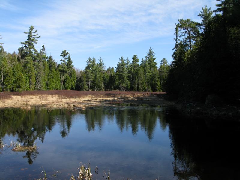
Small northern pond on Boise Creek Valley
While Boise Creek heads west two small ponds stretch further north. They are located a few dozen yards off the two track and are surrounded by short undergrowth and tall trees. Far too small for any sizable fish but still a bit large to be created naturally in a sandy basin with several spots for draining, my guess is that they were either created relatively recently by beavers (sometime in the last few hundred years) or artificially to help water the managed forest.
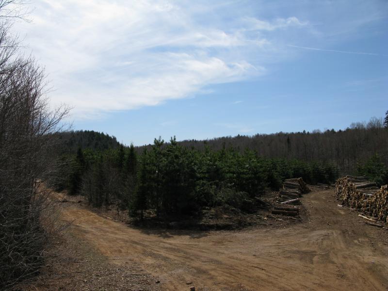
Logging activity up the western fork
There were several stacks of logs piled high near the northern terminus of the valley, with suspect tire ruts leading up to the west and north. Logging this deep in the highlands brings an obvious challenge - how to get the lumber out - and it looks like the road into Boise Creek Valley is the answer. I can't imagine the landowners of the cabins are too thrilled about this situations, especially with the damage their road is taken, but UP logging companies usually do a good job of cleanup once they're done. The views from the top of the piles were nice and gave me the first glimpse of a solid outcropping to the north.
Northern rise with some rocky outcroppings
Mostly obscured by towering pines, an imposing northeast-facing ridge showed a few streaks of exposed rock that promised views of the unnamed ponds below and the winding valley to the south. This was the perfect view that I had been looking for, but I was far too tired to climb it today. Also, the bright sun would have washed out any south-facing photos. I took a few shots up at the outcroppings and continued on, planning on revisiting this area during a darker time of day to get some good views of the valley below.
Now all I had left was the return trip along the sandy, climbing logging road. There were a few hills along the road that really tired me out and I stopped several times to rest. A deep trench pointing north offered limited views of Lake Superior, obscured by the thick leafless trees, and several ponds gave me a quiet, peaceful breaks. I wasn't paying much attention, just trudging along the road and enjoying the silent woods when I started noticing familiar trees... somehow I had ventured back on the re-purposed snowmobile trail! The normal road into this valley completely skipped my notice, with all of the logging traffic cutting south and exiting onto County Road 510 right where I had parked.
There is plenty of reasons to return to the northern Boise Creek Valley. That northern outcropping, Penny Lakes to the west, the headwaters of Big Pup Creek just a mile to the north... Even the southern half holds some interest as it opens up to the larger sandy plains to the south amid multiple large outcroppings. I'm not sure how soon I'll return, but this exploration was successful in both learning more of the terrain in the area and in piquing my interest for future hikes.
Comments (0)