Mount Peeley Summit
Forest Road 201 was a long and winding ordeal, stretching north from AZ-87 and circling around numerous ridges and peaks on a slow climb up into the Mazatzals. All three of us were impatient to get on the trail. My dad and I had woken up at four this morning in order to meet Chris at six in Fountain Hills, and now it was getting close to seven and the sun was already hot and bright. At least the drive into the pine-covered mountains was pretty. When we finally reached the trail, with ponderosas towering above the parking area, all three of us jumped out, gaped at our surroundings, and quickly got our gear squared away for the climb up Mount Peeley.
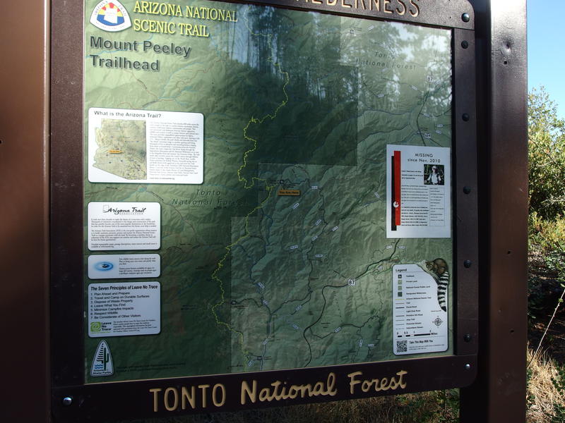
Beautiful sign at the Mt Peeley Trailhead
Today we were heading to one of the southernmost peaks in the Mazatzal range. The long forest road had done much of our climbing already - the trailhead is at 5560', far higher than the hot Phoenix valley below. And the difference in temperature was most welcome. A slight breeze sighed through the broken pines and I suppressed a shiver. It had to around fifty or sixty and it felt wonderful. The three of us started along the trail and slowly approached the rocky peak, some 1500' above us.
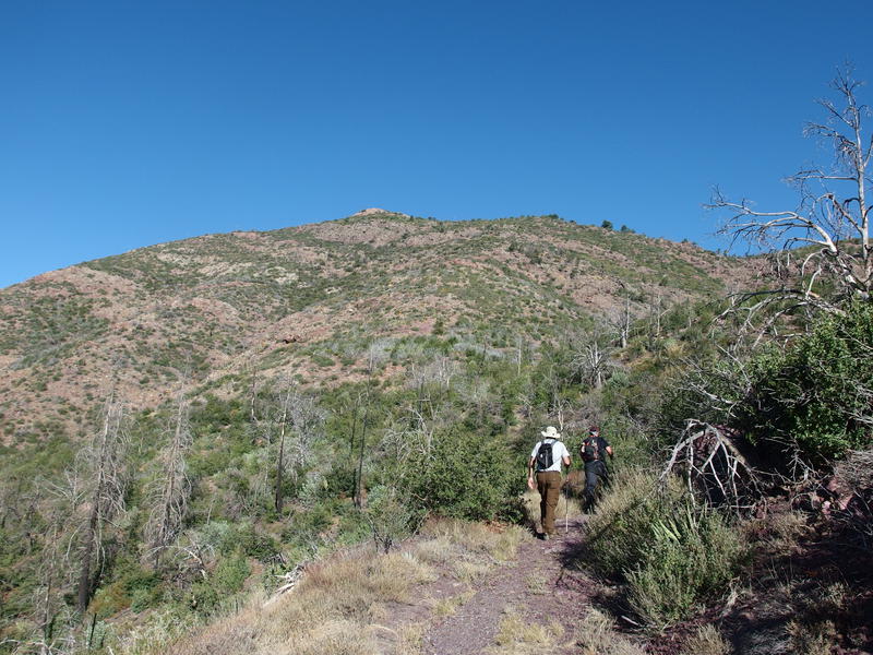
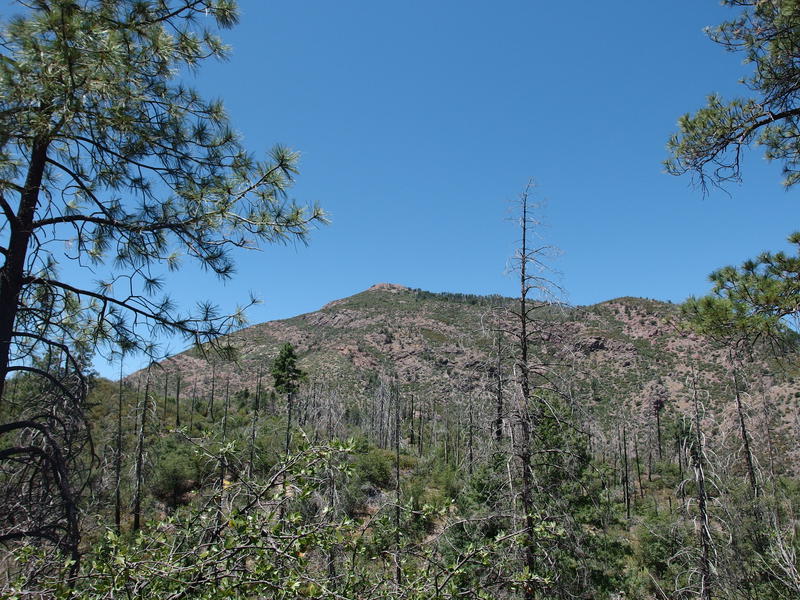
Rocky top of Mt Peeley poking up in the distance
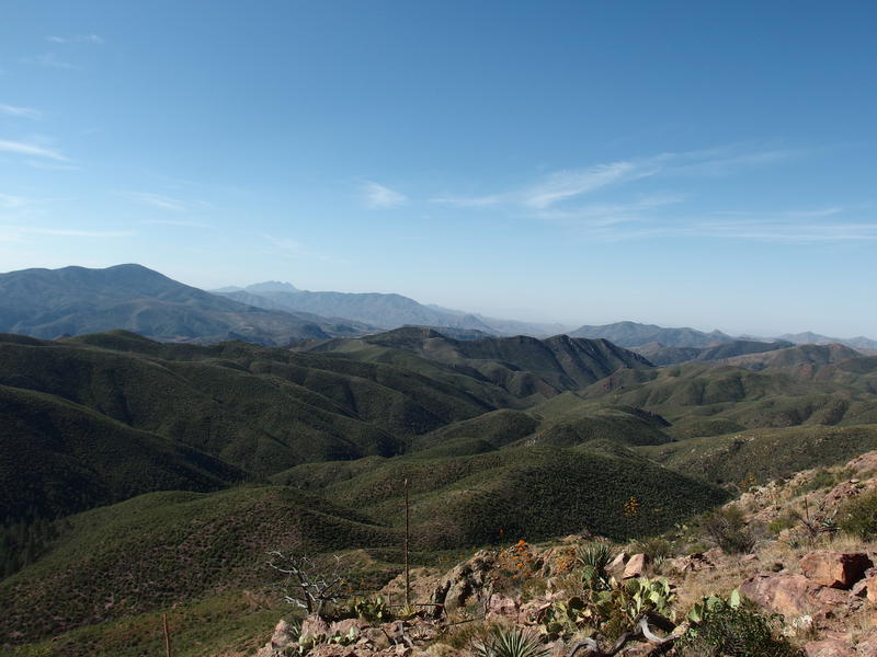
As soon as we left the trailhead the trees began to fade away in charred remnants. This whole area was hit by two devastating wildfires, the first in 2004 and second in 2012. Peeley was left bare and exposed after these fires, which I guess would give us good views from the peak. Plenty was visible from our trail along the narrow ridge. Four Peaks poked up, far and away to the south, and a gnarly mountain rose high to the north. I wondered if Mazatzal Peak would show up today or if it'd be blocked by the random hills along the divide.
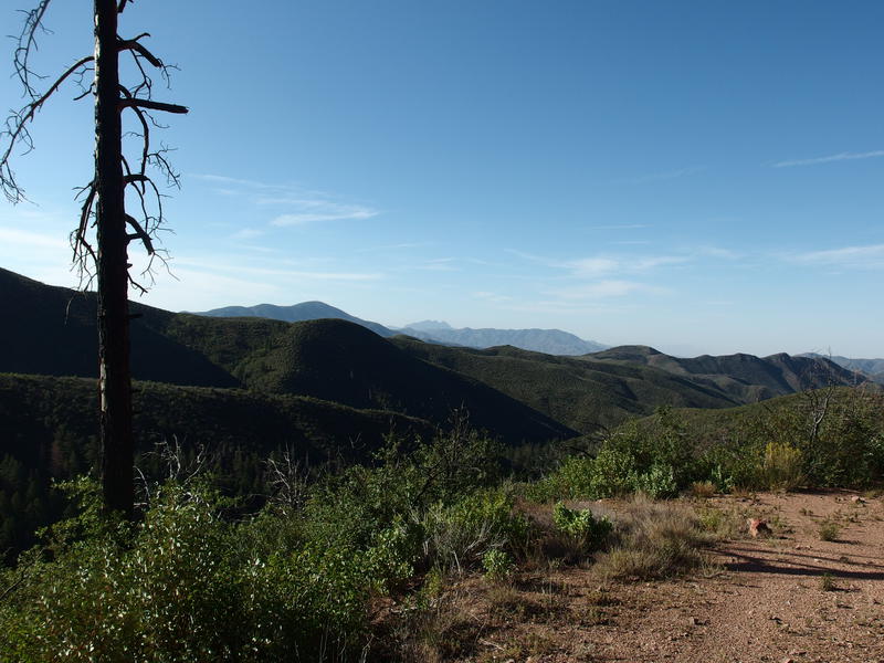
A hazy Four Peaks poking up far to the south
Unnamed rocky peak sitting to the north
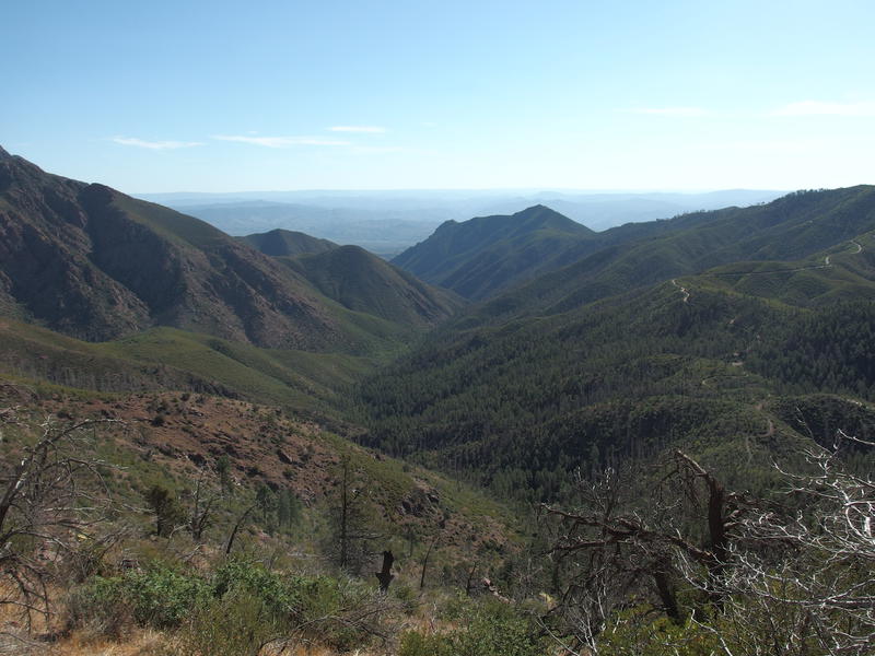
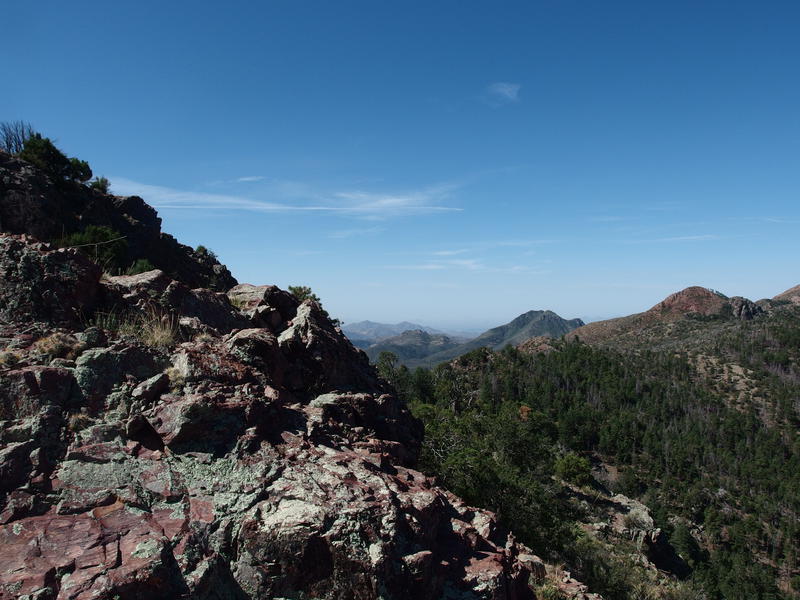
We took our first quick break at the corner of a sharp switchback where someone had put up a hitching rail that doubled as a long seat. I was surprised to see just how green things were. It wasn't just the high ground, either - the valleys themselves were verdant and thick, especially after a fire only a few years ago. That must be the East Fork Sycamore way down at the bottom of this one, which flows through Sunflower and snakes along AZ-87 before fading in and out of the dry desert towards the old Fort McDowell. Whether or not any water was at the bottom of it today was hard to tell from this distance.
Green hills around the West Fork Sycamore
Water was sipped, some snacks were munched on, and then we continued on. My dad was tickled about the terrain. So far I had only taken him on dry desert hikes in the Superstitions and San Tans, which is composed of much more cactus and rock than green trees. Bringing my mom out here on her next visit was something that was discussed more than once. Chris was also pretty happy, though we've done similar hikes in the Four Peaks and Mogollon Rim area. This was his first time in the Mazatzals. I hoped he enjoyed them - would definitely like us to start hiking up here more often.
The trail began climbing the eastern slope with more intent now, switchbacks hacked into the hillside with wide, rocky sweeps and an ever-climbing slope. The morning sun beat down on us and cool temperatures soon faded from memory. Maybe leaving an hour earlier would have been a good idea. We slowly made our way up and around the curve of the hill, moving towards the northern saddle like tiny ants.

Low, ugly brush along the side of Peeley
Some tall pines hiding along the banks of Deer Creek
Looking down to the east opened up two interesting topics. The first one was the obvious "look how high up we are now". Sunlight glinted off of Chris's car far below at the trailhead and we could trace the road winding back through the hills beyond. We even saw a new vehicle, a red truck, driving up the road and we guessed that we might be having some company on the trail today. The other topic was Deer Creek. That's the creek in the valley down there, in the valley that looked so full of pines that it must have been skipped over somehow from the wildfires.
See, the Mazatzal Wilderness only has a handful of trailheads that a normal vehicle can reach. Most of them are only accessible by something more durable than, say, my lowly minivan. There are three trails along Deer Creek that start right next to AZ-87 and stretch all the way to the trailhead we just parked at. Eight miles, with a lot of climb, along a dependable creek sounded like a great way to start a long backpacking weekend. And if even half of it has tall pines overhead than it sounded like something I needed to check out soon.
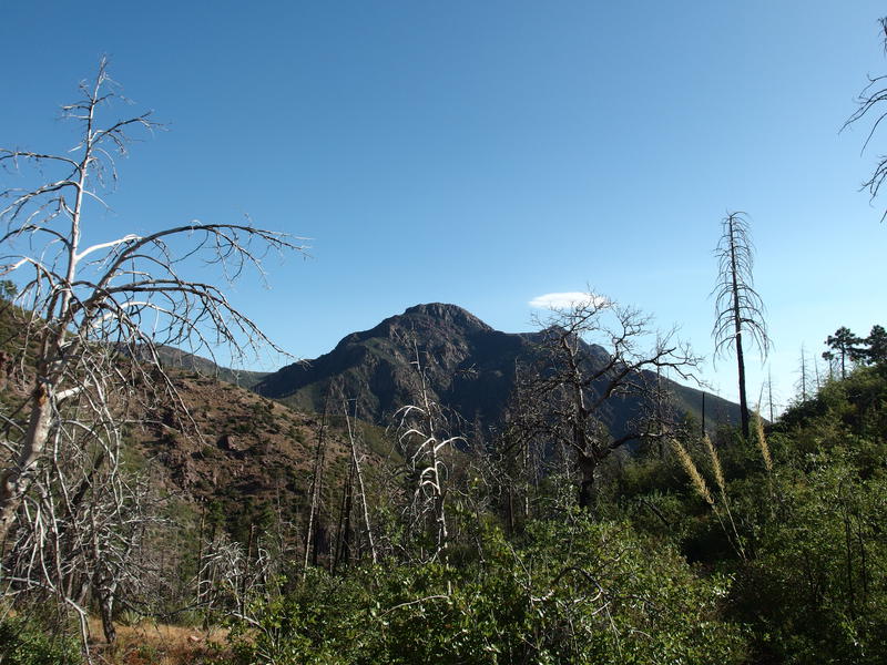
We finished the swoop around the eastern face and soon entered a pine forest interspersed with charred deadfall. The trail was still clear, though. This is all part of the AZT, which stretches from Mexico to Utah, and the maintainers do a great job at keeping things clean for thru-hikers. We kept looking at the forest to the left of the trail, looking to see where we could cut off-trail to the summit, and the deadfall and charred trunks didn't look appealing at all. Eventually we passed by a wilderness sign and saw a huge cairn at a fork. It was time to leave the established trail and climb the final five hundred feet to the peak.
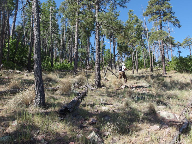
My dad zipping up the off-trail climb to the summit
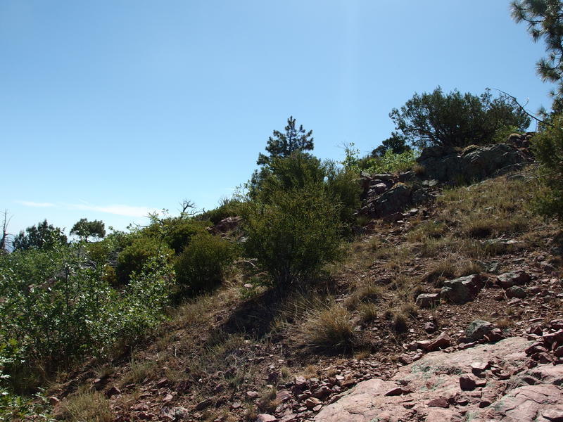
My dad took off with rockets, leading the way from cairn to cairn as Chris and I followed. He must have had a stronger cup of coffee than I did or something. When we made it to the first big clearing we stopped briefly to check out the views of the final climb ahead, all covered in tall pines with the rocky ruggedness hiding behind. Chris needed to stop and change his socks so I hung back with him as my dad pushed on. There was only one way to go - up - so we weren't worried about losing anyone. As long as he didn't go to far and fall down the other side.
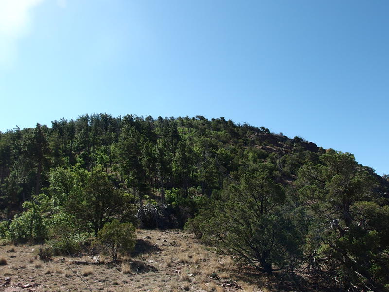
Taking a quick break before the last climb
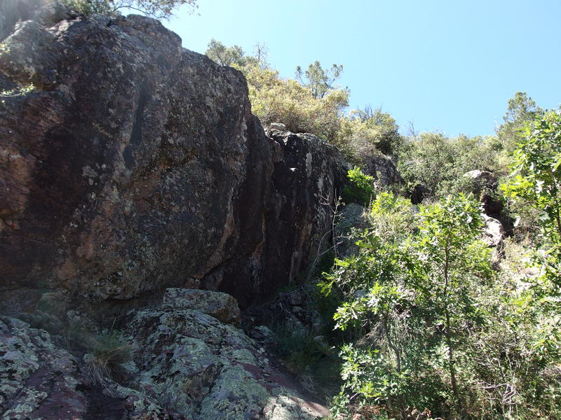
Once Chris had fresh socks and tied boots we started up the hill, guessing which way my dad went as we climbed. The cairns took us along the edge of the forest and through some nasty manzanitas, and we didn't see any footprints in the softer sections. He must have cut straight up through pines and over any downed trees or branches in the way. Our way did give us some good views and rugged climbs, though. There was one outcropping close to fifteen feet in height that I went over the hard way, clinging onto small cracks and knobs in a pitiful rock-climbing attempt.
Patches of pines among craggy peaks to the south
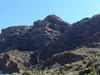
Craggy slope with plenty of loose rocks
Beyond that outcropping was just steep, loose rocks between low pinyon pines and over scattered grass. We found my dad waiting for us under one of the pines, relaxing and watching hummingbirds flit around in quick dances. Together again, the three of us trudged the rest of the way up the hill and soon found the peak, conveniently marked by a lonely stick propped up with rocks. There was no summit log or benchmark in sight, just views reaching away in all directions.
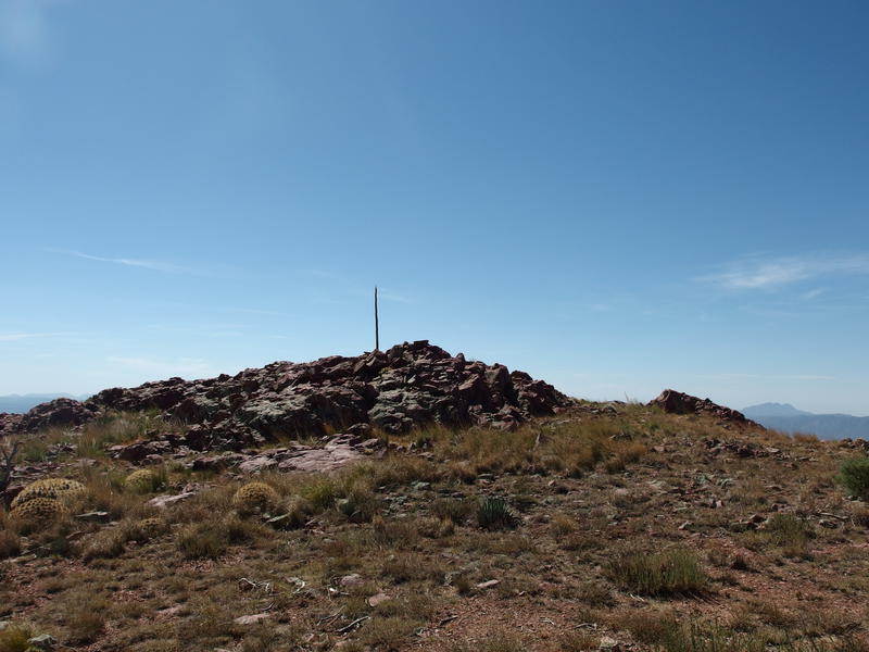
Lonely stick marking the summit
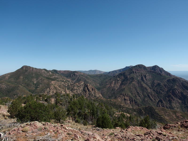
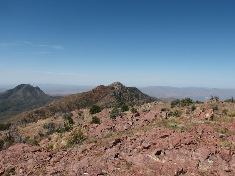
Northern view along the ridge
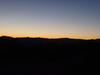
Smoggy haze hiding the Phoenix Valley and Superstitions
Mazatzal Peak may have been visible to the north behind that one craggy peak - I couldn't tell. Peeley isn't that tall compared to the other mountains here. The unnamed peak in the way is around 7500', and Mazatzal Peak is over 7900', while Peeley just over 7000'. A green saddle swooping down behind the craggy peak might have been near Y-Bar, but I couldn't tell.
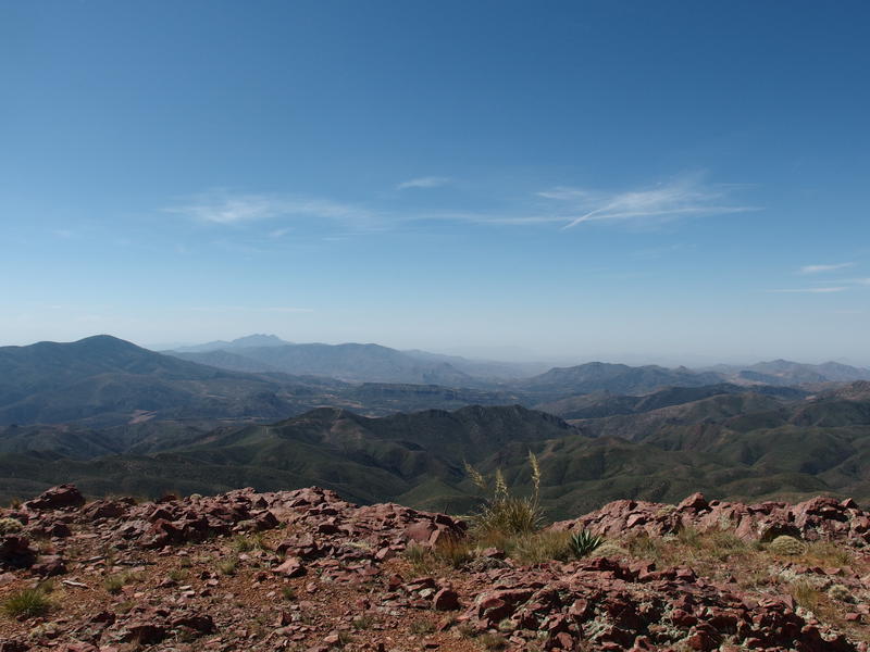
The view to the south was disappointing. Four Peaks was still there, with only three visible peaks, and we could just barely make out the Superstition Ridgeline, but everything else was hazy. It might have been dust or smog from the metro area that blocked our view. On a clear day you should be able to see the city down here, and maybe even make out the McDowells and Camelback and Weaver's Needle, but not today. Today was dim outlines and white-brown haze.
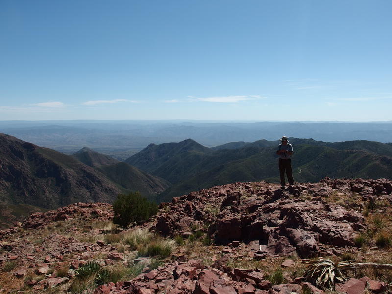
Dad looking east, back down on the trailhead
Sheep Mountain to the west, close enough to touch
My dad poked around the summit, checking out the steep cliffs and drinking up the views. This was a very different part of Arizona than he was used to. I'm looking forward to taking him on more trips like this, either up to the Mogollon or further into the Mazatzals. Mom would probably be up for these outings too, and with the boys increasing their range we could have some good group hikes in the years to come. On the other side, looking down to the west, was Sheep Mountain and Horseshoe Basin. I tried to pick out where Club Cabin was down there for a while before giving up. Maybe a few more backpacks out here and I'll be able to recognize one brown hill from the next.
A break was in order. We had all brought plenty of snacks and water today, more than this relatively short hike called for, so might as well eat up. There was plenty of rocky seats on the summit, as well as a small fire ring. Camping up here would be fantastic, except for maybe the wind. I could easily imagine setting up a hammock in the trees a few hundred yards away and eating/watching the stars from the peak, though.
Eventually it was time to head down. The driver of the red truck bumped into us immediately below the peak - apparently our frequent breaks had given him more than enough time to catch up. A brief chat and we continued down, each one of us picking our own way back to the trail. I don't think any of us stuck to the cairns. My path was the most direct (and also hit the most deadfall) so I found the trail back first.
Some cooler rocks along the trail back down
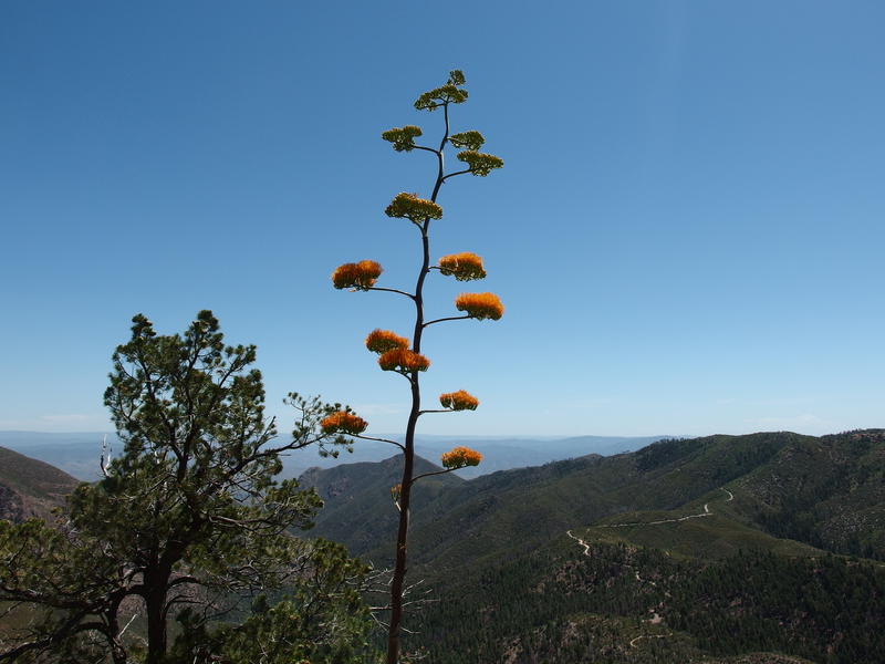
Brightly colored agave on the trail
Our hike back was on the hot side. The sun had been baking the eastern side of the mountain for a few hours now and both the air and earth were toasty. Going downhill is always easy, though, so we only stopped once at the hitching rail to drink up before tackling the rest of the switchbacks. I decided to be difficult on some of the winds and cut straight down through the manzanitas, both to surpass Chris for the lead position and to shake up the boredom of retracing a route. In-and-outs are boring.
One last look back at the peak
It's always fun to be able to take a look back at a peak after you've climbed, to see the tall mound of rock and trees in a slightly different light. The three of us talked about this as we stood at the trailhead, done with today's hike. My dad admired the green pine forest stretching up the northern face, Chris and I discussed backpacking up, and I looked at the eastern face and thought about a direct ascent. That would only make sense in the afternoon sun, I guess. Once the musing was done we piled back in the car and started the long drive back down 201, back to the hotter Phoenix area and the desert and the brown.
Comments (0)