Mount Ord
Looming over AZ-87 like a great green giant, Mount Ord climbs to over 7100' and is the most accessible peak of the Mazatzal Range. The Beeline Highway (AZ-87) crests at 4000' in a narrow saddle next to the mountain, and FR 626 branches off from that saddle and winds its way up to the summit. Another forest road, FR 27, splits off of the highway at a lower elevation and provides a more remote access route. It was to this second road that I drove on a chilly Sunday morning.
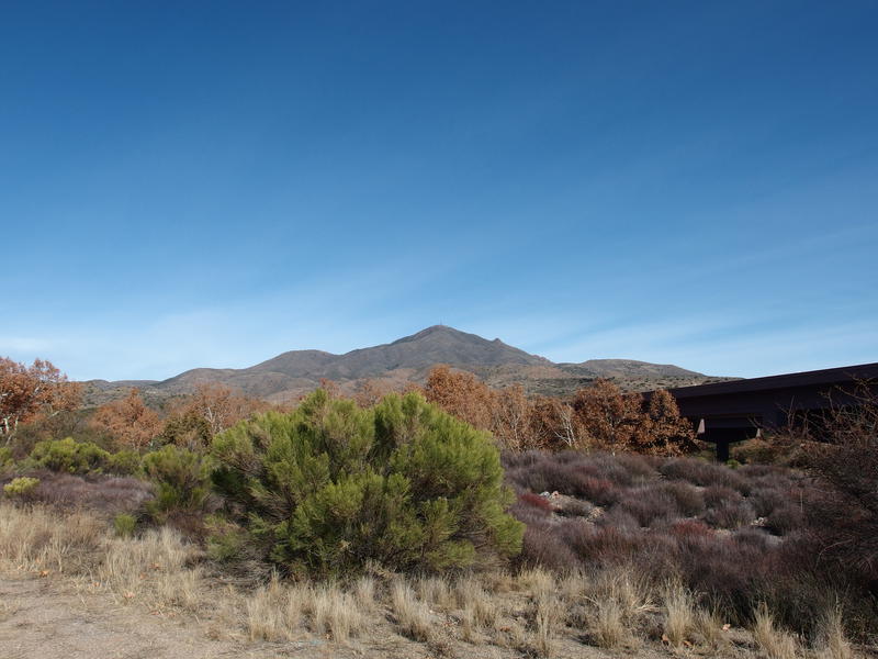
Mount Ord in the distance
Chilly is a subjective term, I guess. It is December and most normal lands have several layers of snow and ice. Here in central Arizona it was in the mid 40s, with not a flake of snow to be found in the valley of the sun. When I stepped out of the van I had to pull a sweatshirt over my wool base layer to keep the shivers at bay. Golly, has two years been enough to thin my blood that much?
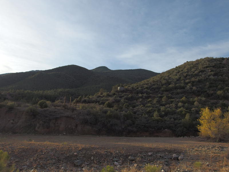
Soft morning light falling over the green green hills
Only one other car was at the Slate Creek Trailhead. The owner was pulling rocks out of the creekbed and carrying them to his trunk. He looked at me suspiciously before locking up his car doors. Not sure if it was my height or unshaven chin that painted me as the unsavory character. I returned the favor, securing my van before pulling my water-heavy pack on and strolling over to the start of FR 27.
There is a wire gate strung across the beginning of the road. Could be for either wildlife or just to discourage drivers from attempting the road. I stepped past it, crossed the creek, then slowly started climbing up the rocky road on the far side. It was pleasant enough to walk on at first: soft purple slate underfoot, cement mining ruins, overreaching green branches on either side. This was all a nice distraction from the steady uphill grade.

An odd cement foundation along the purple road
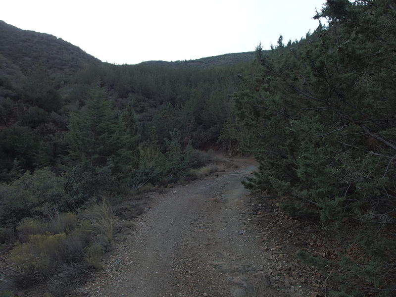
Green trees reaching onto the trail
It's about time to talk about the uphill. This trailhead starts at 3200', which gives it a total climb of just under 4000' over 7.5 miles, or 10% grade. A steady and unrelenting 10% grade at that. This is one of the easiest spots for Phoenix hikers to gain that much elevation without doing laps, which is useful if you're training for something like a Grand Canyon hike (yes, a return to the Grand Canyon has been weighing on my mind). Anyways, my goal for this hike was to average at least 3 mph overall and to stop for as few breaks as possible. And enjoy what scenery I could with the busy highway roaring below.
There were a few good washouts along the road that would stop most vehicles. The grade itself probably rules out something like my van making it up, and the overreaching branches would make some pretty pinstripes. Other than that it wasn't bad. No huge boulders stuck out of the ground, or loose sand, or even unsteady gravel. When I passed a low, long retaining wall it was obvious that this road was made to last. Not sure when the more used FR 626 was built, but there was a lot of care put into this one.
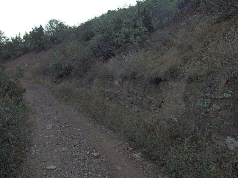
A long retaining wall on the old road
I wound back and forth through a few ravines and then circled around to the west, eventually looking almost directly down onto the Beeline. The traffic's roar was drowned out by my loud breathing. I was not going to give myself a break, not yet. From here my route began swooping to the south, starting to make a more direct route to Mount Ord, and the ground went from purple slate to rust-red dirt. Some of this dirt was soft and muddy from recent rains and I did my best to avoid the slick sections.
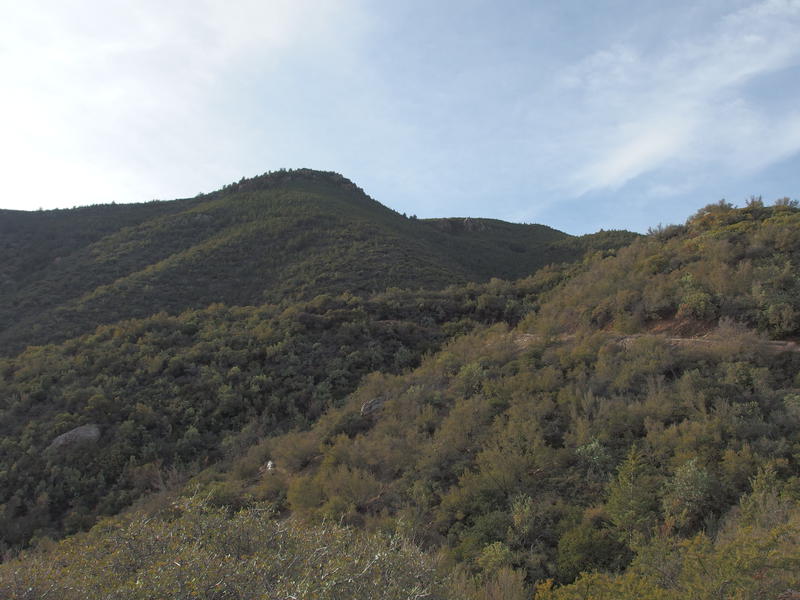
Still plenty of climb to go
When I did stop for my first break, less than an hour in, I had more than 2.6 miles and 1300' behind me. Not too bad. I plopped down on a pile of dirt and drank deeply from one of my platys. In a rare abundance of caution I had a gallon of water in my pack and more than enough calories to sustain me for an entire day of hiking, and I wanted to use up as much as I could. My van was a lonely dot in the distance - that other guy must have gotten what rocks he wanted and left. Once my breathing was back to normal and I had a few snacks in me I leaned up, threw my sweater in the bag, and got back to walking.
The road got rougher here. Solid rock with loose gravel shifting over it began to show up, though there still weren't a lot of boulders that would require high clearance. Good tires and a steady hand could navigate this road just fine. A few tracks could be made out in the rain-smooth ground from previous drivers. I began to wonder if I would see anyone, driving or hiking, out here today. If there was no one at the parking lot by now then I had a solid chance for a quiet hike, which was just fine by me.
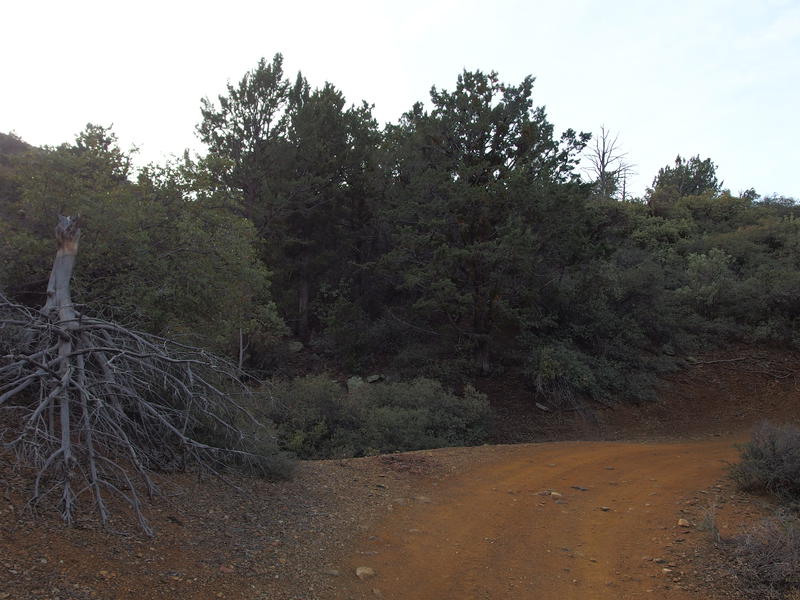
Changing colors along the road
As I huffed and puffed up and enjoyed the solitude two heads poked around a corner above me. Hunters, carrying rifles, dressed in orange and camo heading down the road. Hunting in Arizona? Guess it makes sense, as there are mule deer and some whitetail here, but it never entered my mind that there was actually a season. It's not like the Midwest, when the first day of hunting season is a recognized work (and school) holiday. We had a few hushed words about the cool temps (of course we had to whisper, because we didn't to scare all three deer in the surrounding hundred thousand acres) and then separated. So yeah, there were hunters out here, and I didn't have a stitch of orange on me. Excellent.
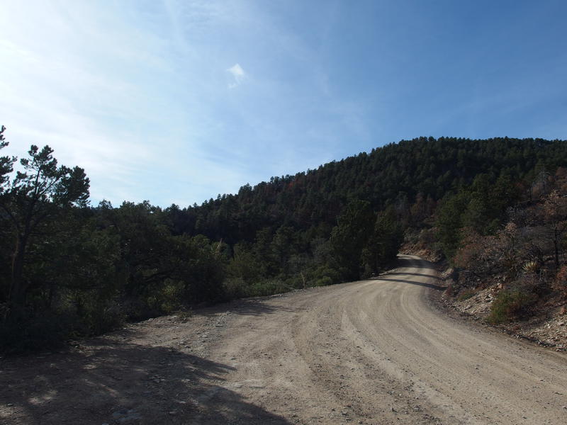
A more popular way up the mountain
Shortly after separating from the hunters I reached my second milestone, the forest road junction. I bumbled across, found a rock to sit on, and tumbled on it. 5 miles and 2700' down, a short hop and skip left to go. I finished off a liter of water, forced down a Clif bar, and let the sweat dry from my shirt. A cool breeze whispered through the pine trees, which had began replacing the smaller trees and bushes around the road, and when I eventually pulled my pack on it was delightfully cold.
FR 626 would take me the rest of the way to the top. It was even easier than the last road, which had been a breeze to walk on. Now the dirt road was graded, the curves were smoother, and the incline was smoother. It still climbed, though. As I started on this last leg I pushed hard on my trekking poles, launching myself forward, getting my arms involved in this little adventure.
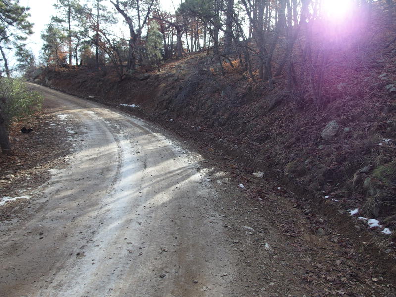
Some hints of snow along the road
Mere minutes later, when the road swung into a protected fold of the mountain, some ice and snow showed up. Huzzah! There was winter here, even though it took me thousands of feet of climb to find. Slick half-melted ice forced me to shuffle forward here and I was reminded of all the times in the Upper Peninsula I had to do this, whether it was on the way to class or playing broomball or hiking on Lake Superior. This ice only lasted twenty feet before giving way to mud.
A few more icy slicks and small clusters of snow showed up in shaded areas as I continued to climb. Also, I began to pass more and more parked vehicles. They were all oversized trucks with proud slogans blasted on the windows, so I think it's safe to say that there were a fair amount of hunters that had driven up here this morning and hoofed a short distance from their parked vehicle to sit for a few hours. Only a single vehicle drove past me, coming down from Ord slowly, and he didn't even return my wave.
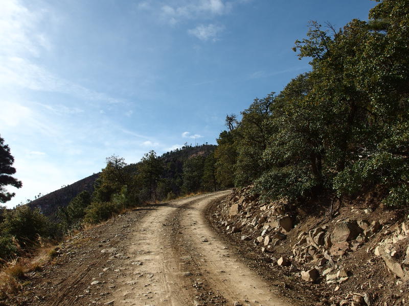
First view of the communication towers on Ord
On one of the more open twists of the road I finally saw the cluster of radio towers on the peak. Mount Ord has been used for communication since the territory days, when the military had a system of signals stretching along the length of the Mazatzals to pass news between outposts. Nowadays there are radar dishes and antennas and big towers on top. Maybe that's why this road was so well constructed, for the military aspect back in the day, and then they just kept it in good condition for workers and rangers.
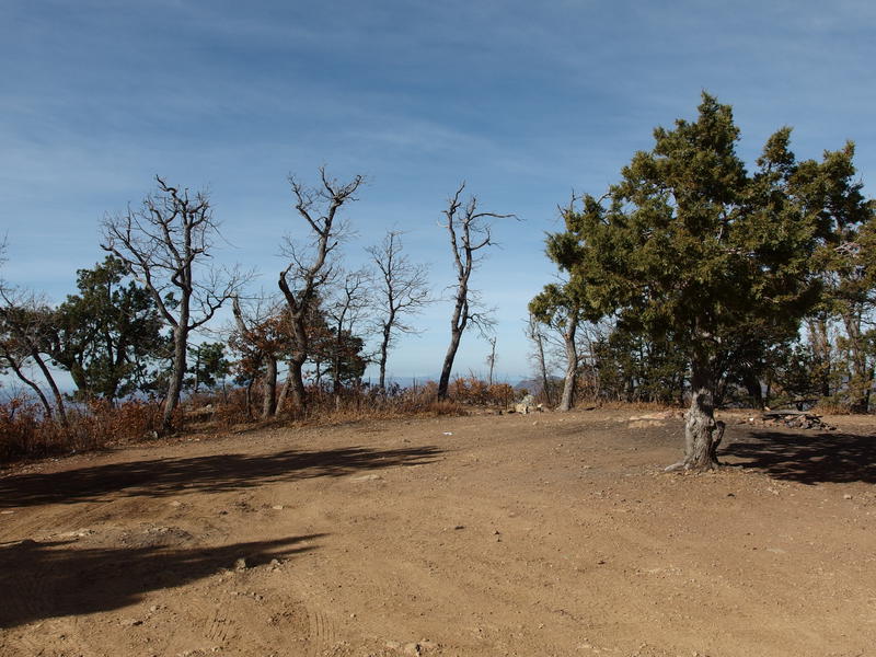
Turnaround and campsite near the gate
Some more climb and twists later and I reached a turnaround spot before a locked gate. There were a few signs warning against unauthorized vehicles and nothing about foot traffic so I just kept moving, squeezing between the gate post and fence. Plenty of boot prints showed that I wasn't the first one to do this. The road got a whole lot muddier and wet here, thanks to the high elevation, increased tree shade, and the decreased drivers. I kept on, ignoring the little cramps that were clawing at the edges of my muscles, determined to reach the top before taking my third break.
Five hundred yards after the gate and the road split. The left fork seemed to go straight to the peak, but a sign pointed to the right for electronic station and observation point. I was so close I figured that it couldn't matter too much which path I chose, so I went right (there was less slushy snow on it). A few minutes later and I was rewarded with a treeless vista to the south and west, the first solid view I had gotten in a while, and it was spectacular.
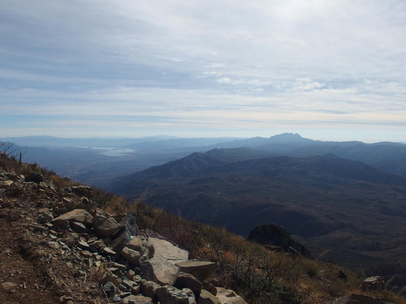
Four Peaks and Roosevelt Reservoir in the south
The southern view was dominated by Four Peaks, fuzzy in the distance, with Theodore Roosevelt reservoir snaking to the left. There were no significant mountains between us. Sure, there are a few named hills along this section of the Mazatzals, just nothing that approaches the lofty 7000' elevation that Ord is at. I tried to make out Boulder and Pine Mountain and failed. Still need to get better at learning these lands.
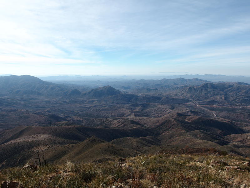
Beeline highway reaching towards the Phoenix haze
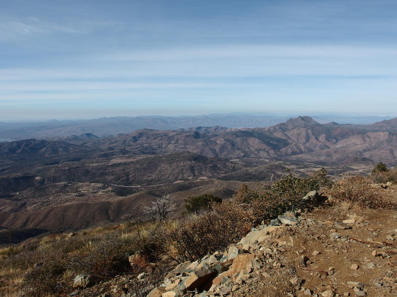
Saddle Mountain and other western hills
To the southwest was the smoggy valley of Phoenix, the Goldfields and McDowells barely poking above the dirty shroud that sits over it. Superstition Ridgeline was hiding behind a tall shoulder of Four Peaks and was barely visible. Snaking from my point towards Phoenix, Beeline Highway traveled between brown hills and over green valleys like a long snake. The western view was a bit more difficult to parse out, though I was pretty sure that Saddle Mountain was the most prominent formation over there. The rest of the northern Mazatzals were blocked by the trees. Hopefully I could get a view of them from the highpoint above me.

The whining, humming cluster of electronics at the peak
Speaking of, the highpoint was just a turn and skip above me. I could tell from the overpowering whine that was emanating from the cluster of electronics up there. Doing my best to ignore the unnatural and headache-inducing sound I started circling around the buildings, curious of what all was going on here. All of the metal sheds were locked up tight, signs warned against climbing up the tower ladders, and trees on the north and east sides blocked any further views. I did get a chance to look down on Eagle Peak, a small spur that sits below Mount Ord to the north, and decided to hold off on bagging it for another day. Growing weary of the machine whine I made one last pass of an old ranger cabin and headed towards that other fork in the road, the snowy one, to began the descent down.

An old service cabin boarded up
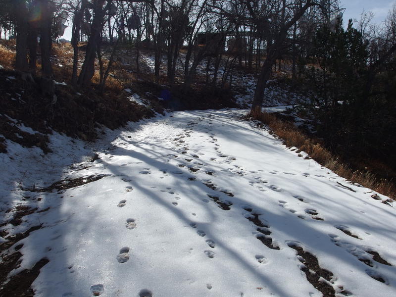
Fresh snow prints on the road
Fresh snow prints. It's been a while since I left those behind me. I briefly admired my large boot shape (I've never made snow prints with my current Solomons) before trotting down the slope. There were some decent views of the northern Mazatzals here and I could pick out both Peeley and Mazatzal Peak, and maybe Sheep, along the rocky and distant ridge. As I gazed out that way and let my legs stretch out in the delightful downhill slope, the first downhill they've tasted for hours, a surprise showed up below. Two runners, dressed in bright red shirts, were gasping for air on the road below.
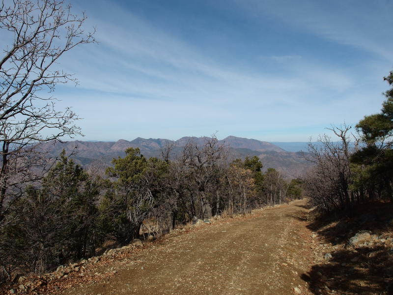
Mazatzal Ridgeline in the north
They stopped when they saw me, waiting for me to come down, and then asked if I had seen anyone out here. Apparently there was a third runner ahead of them, and they were wondering which fork they had taken. I had not, so we all must be taking the right fork first. I had a lot more questions for them. Apparently they had started at the same trailhead I did and were part of a rather cool veteran's awareness group Team Red, White & Blue. Today there was a run/hike up this mountain and there was over a dozen people participating. Guess my lonely hike, which had already been interrupted by hunters, was going to be a bit more crowded.
By now they had their breath back and looked anxious to keep on so I wished them well. Shoot, if they were running and were less than a half mile from the peak we'd be seeing each other on the trail soon enough. I continued downhill and made it to the gate and turnaround point before finally taking my break. The peak had been far too noisy for me to rest there and cramps were catching up with me. The third runner caught me with my legs stretched out, three liters of water sitting nearby, and a bag full of snacks on my lap. She was cooking and barely had time to wave before passing me. Here I thought my 3 mph goal for today was aggressive. These runners were making me feel downright slovenly.
Eventually I lumbered up, pack lighter and stomach heavier, and tested my legs. The cramps had retreated for now. A few snacks were stowed in one of my pockets. It was all downhill from now - no need to stop for any more breaks. After a few slow steps I began the walk down in earnest, pushing forward with my poles for a small boost. It was noon and I had seven miles to go. Maybe I could make it to the bottom in an hour and a half.
The other participants in the run/hike were lumped into two groups, both walking. Both were engaged in loud conversations and only gave me quick waves as we passed. I did give one guy a knowing nod, as he was in a group with three very loud women and looked both exhausted and exasperated. There were more vehicles driving around now too, probably hunters done with their morning coffee and more interested in sitting behind a wheel than sitting on a stump. I was quite happy when I reached the road junction. I was done with wheeled traffic (and probably other hiker groups too) and had the trail to myself.
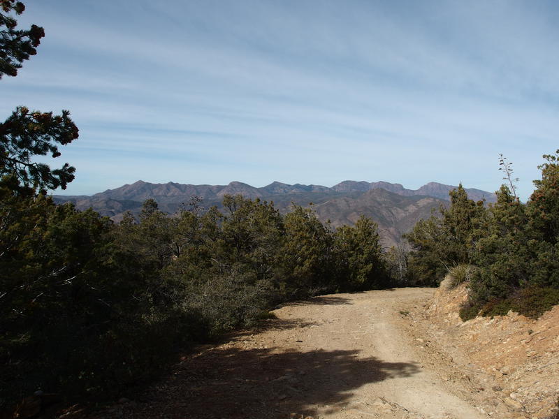
Mazatzal Ridgeline in the distance

A long descent left to go
Views were excellent for the next mile, something I had missed on the way up. I was too busy sweating during the climb to turn around and drink in the views. Most of the Mazatzal peaks were still visible. Granted, the sections I'd be more familiar with in the center aren't prominent enough to see from here, but I could still point out Peeley and Mazatzal Peak easily enough. I could also see some things in the northeast, which consisted of the hills around Payson and the Mogollon Rim beyond.
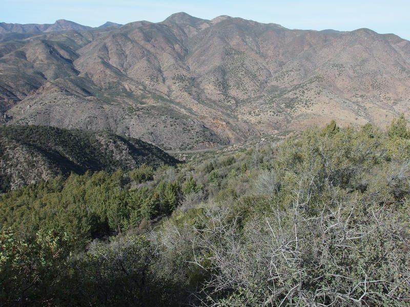
The tiny highway, thousand feet down or so
I pushed on quickly, trotting over the steeper sections and hopping lightly around the loose gravel. Part of me flirted with the idea of beating those runners down. Chances weren't great, as they would be running downhill and were carrying way less gear than I had on me. Perhaps tennis shoes would have served me better than my heavy boots. I was on a dirt road, after all, and the few sections of snow had been shallow and short-lived. When I paused to take an interesting photo of a broad swath cut around the straight power lines heading towards Payson I heard them behind me, chatting breathily, and knew it wouldn't take long for them to pass me.
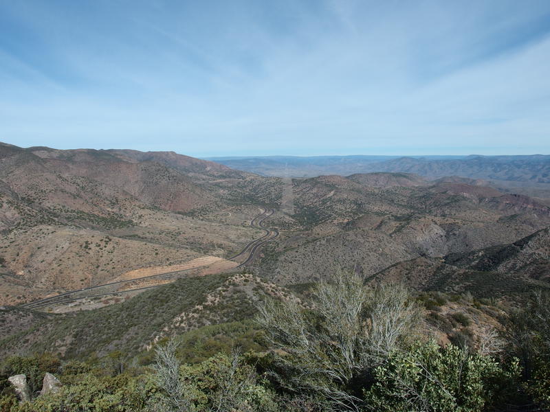
A cleared straight shot for powerlines
They caught up just as we started on the curly, twisty path around the old Ord mines. We exchanged a few jokes and then they skipped past with tired legs, stopping to walk a few dozen yards ahead of me. We entered in an awkward game of hopscotch now, as my long gait quickly caught up with their tired half-resting shuffle, and then they'd start jogging again and pass me. When we reached the main cement ruins of the mine right above the parking lot I decided to ease the awkwardness and hang back to explore a bit.
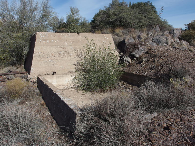
Cement foundations from mining days
I'm not terribly skilled at understanding these old cement foundations, which is a shame for someone who claims to have experience hiking the Keweenaw, yet I did my best. The larger foundation could probably be lined up with a shaft, and a depression covered in a mixture of rocks might fit that. There was a large cement basin above the possible shaft that didn't quite fit, though. Perhaps a water tank, or some part of the mill? I wandered around a bit more, half-heartedly looking for more sign that could hint at the layout or scale of this thing, and didn't find much. They only mined mercury here for a few decades and probably didn't have an extensive operation.
Those runners were probably at the bottom now so I returned to the trail and booked down the last bit, reaching the creek an hour and forty after leaving the peak. Not bad at all. The three runners, now reunited, were sipping water and leaning back against larger rocks. I was curious about their group and their start time, as I had a view of the parking lot for a part of my ascent and never saw their vehicles, yet they seemed occupied with their recovery. Instead I returned to my van, content with my 3+ mph average, and started on the busy drive back to Gilbert.


Comments (0)