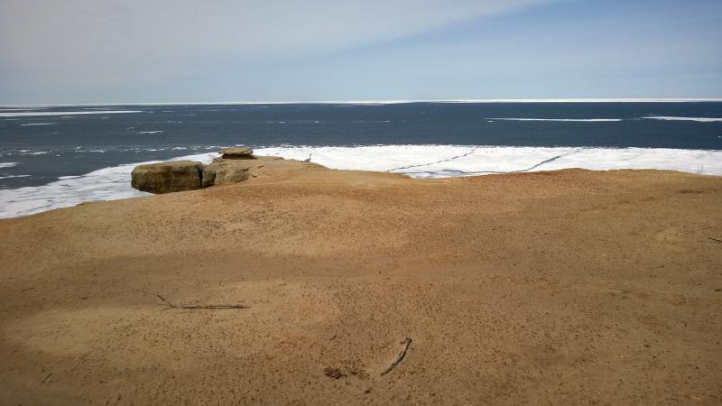
Grand Portal Point
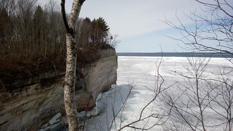
Returning to Chapel Rock was a tedious venture. The sun had continued to rise, warming the woods and melting the snow, and the trail of mud, slush, and water made for a tiresome slog. I tried to remember the longer sections of snow from the walk out to strap on snowshoes for, just so I could walk a few hundred yards before pulling them back off. The lake and tall cliffs distracted me from the labors, though, as well as re-visiting key sights from a different angle. When I made it back to Chapel Rock from Spray Falls I was in decent spirts, gaping up at the scrappy pine above me.
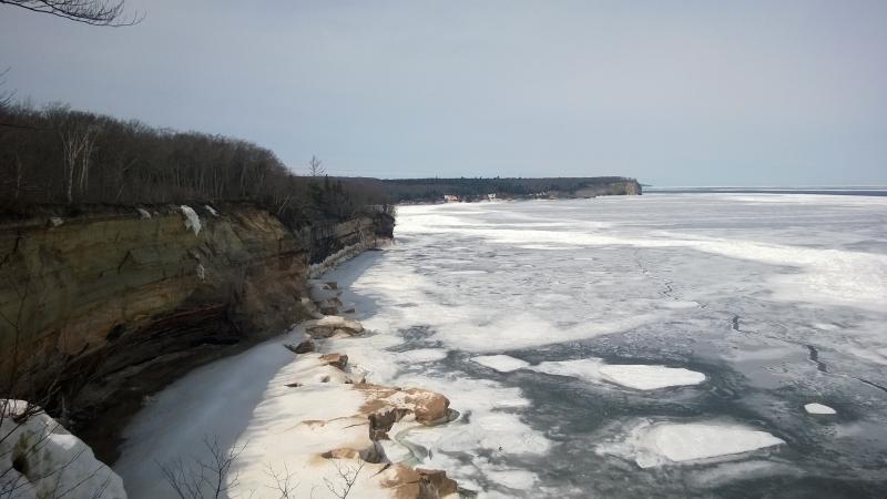
Tall cliffs on the return to Chapel Rock
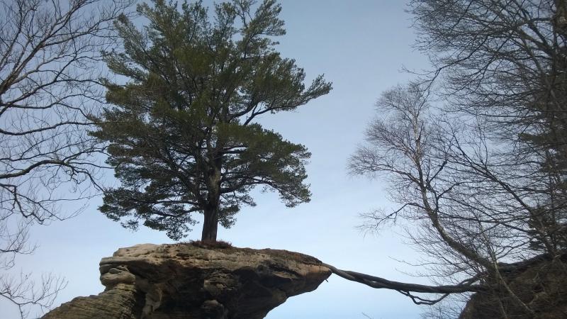
Looking up on the tree of Chapel Rock
In the back of my head I tried to run the numbers. It was dangerously close to noon by now, almost halfway through the day. And I was a third of the way through the hike. Those numbers didn't sound good so I tried a different calculation. Chapel Loop was nine miles long. Add some for the extra miles I walked on the dirt road to the trailhead, three miles for the side trek to Spray Falls, and some more for another side trek planned near Mosquito and I had an estimated fifteen mile route. I checked my GPS: eight miles so far. Cool, I was halfway. Sort of.
I was running the numbers because I had a choice. I wanted to continue on to Grand Portal Point and Mosquito Beach, along the planned routes, but this hike was tougher than I planned. The slush and water on the trails were slowing me down to less than two miles/hr, much slower than my normal pace on footpaths. There was one path here back to Chapel Falls and my car beyond, another that followed the western shore of Chapel Lake in case I didn't feel like backtracking, and the long trail ahead. Heck, I had a whole granola bar and two bottles of water left. I was going to aim for the whole loop.
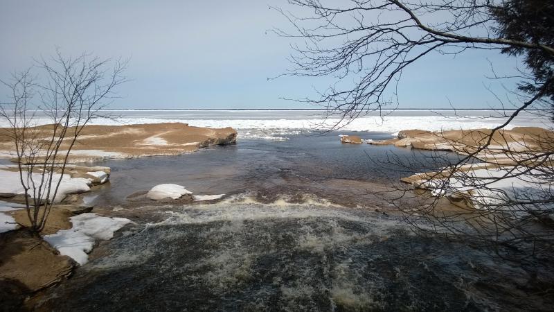
The trickling waters running down the trail earlier today had turned into wide, flowing streams. I skipped over large pools, trying with little luck to remain dry on my way down to Chapel Creek. Well, if it was worth calling it a creek. It was large and roaring on its way down to Lake Superior, swollen from the melt and crashing over layers of sandstone. I was surprised to find that it didn't have a name, sitting along the trail and having such a scenic setting. 'Chapel Beach Falls' would suit it well.
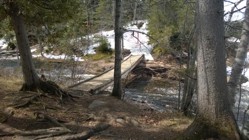
Sagging bridge
Down along the outflow of Chapel Lake
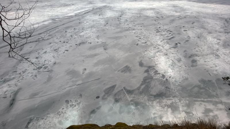
I slowly crossed the bridge, gazing out over the tall piles of snow just off the sandy beach. It was nice to be close to the snowy piles after looking down on them for so long up on the cliffs. They were huge and dirty, sitting between ten and thirty feet off the shoreline, open water separating them from the sand.
After crossing the bridge the trail heading into the snowy woods. I didn't want to have anything to do with that, not with the beach beckoning me. I cut to the right, following the creek ten feet before coming out on Chapel Beach. The short waterfall was a solid span of froth, gushing out over flat rocks before sliding into the lake. It made a spectacle of itself with Chapel Rock sitting silently in the background, now towering high above the surrounding snow.

Gushing spring waters
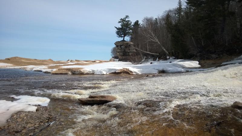
Chapel Rock above the dirty sow
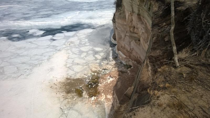
There was a bit of snow surrounding the creek, perhaps chilled from the cool waters, and soon the beach opened up in front of me. It was a weird juxtaposition against the icy Lake Superior and snowy woods, this summertime scene, making me feel terribly out of place in my hiking boots with snowshoes hooked to my back. Closer to the lake I could see that it wasn't open water separating the snowy 'bergs from the sand - there was a thin sheet of ice. The lake was cold. Even today, with the woods melting and me standing in a simple long-sleeve shirt the water was cold enough to keep ice. There would be no swimming here today, not from me.
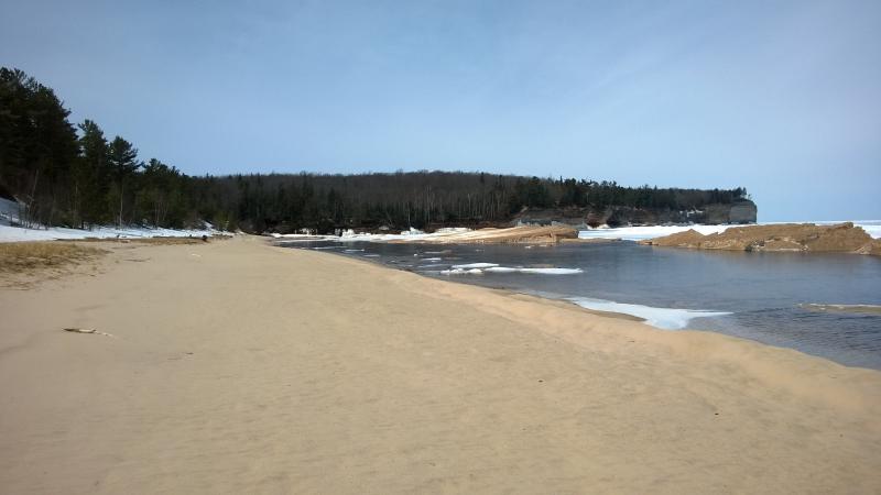
Long sandy beach
Walking on the beach is always an odd trade-off. There are no branches to duck under, no trunks to weave around, and you get a great view as you walk. But the sand. I trudged forward, wondering if my snowshoes would make things any easier, and deciding it wasn't worth the experiment. When I reached the far side of the beach a nice pathway took me up away from the warm, giving ground, taking me up to the woods and snow.
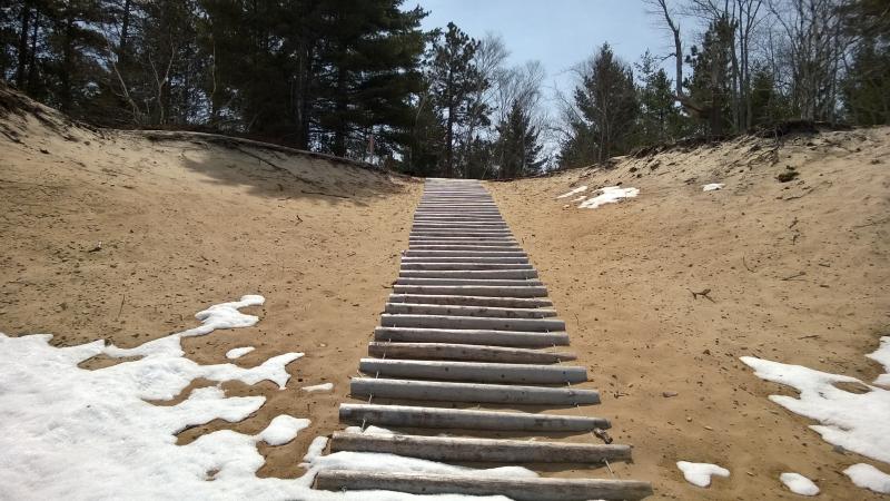
Boardwalk
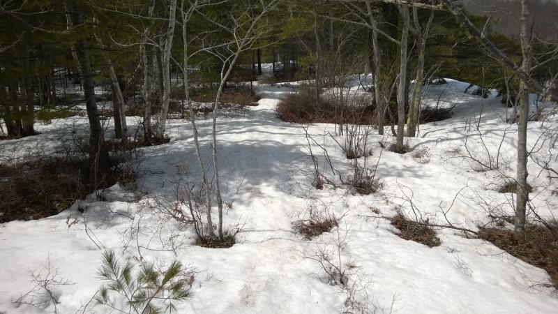
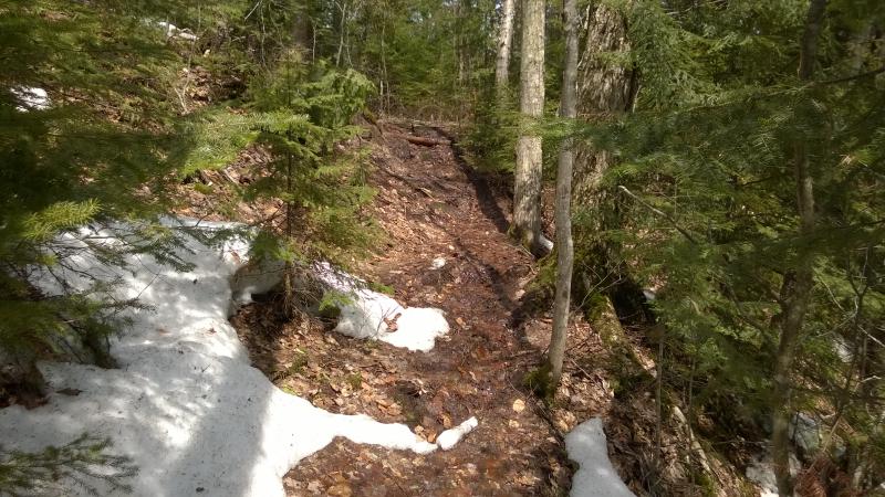
Slushy path
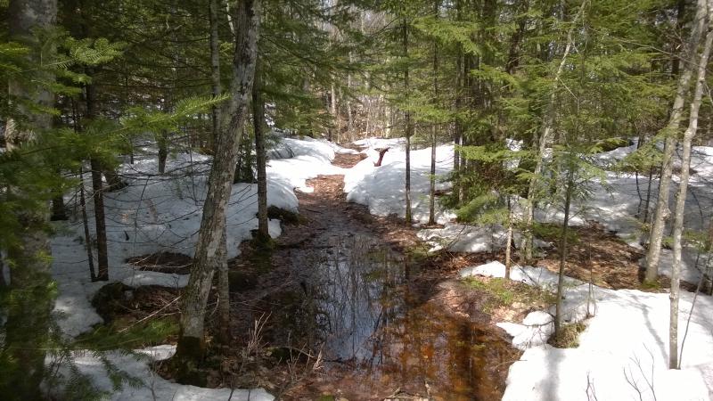
Two steps into the warm slush and I paused to strap on my snowshoes. This stuff was soaking wet, more liquid than solid, and boots weren't going to cut it. The path was thinner, too, leaving me less options to roam around when things got hairy. It was slow going, soft walking through tight woods and careful steps on the bridge over Little Chapel Lake's outflow, until I finally got away from the beach area and my route got a bit more variety.
A slog of a path up
Mixed water and snow on the trail
It wasn't worth taking off the snowshoes, not with a new batch of snow every couple dozen yards, even if it meant slopping through puddles with skeletal Mickey Mouse feet. This trail was so much worse than the morning's walk. The cliffs were facing east, towards the morning light, and was sheltered from the afternoon light, leaving it with deep, soggy drifts now. Head down I pushed forward, slowly climbing in elevation, completely missing a scenic detour to the tiny, narrow cove west of Chapel Beach. The view on this side was limited at best.
Looking down the narrow cove
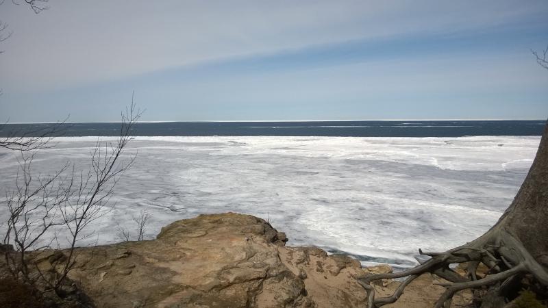
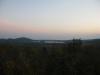
As I continued northwest I imagined that the trail would get easier once I reached the point, where the shore bends back down. Maybe it would, maybe it wouldn't. At least I only sank to my knees once every ten steps, when the slush refused to support the wide print. The views were nice. All morning I had been glancing westward towards the tall cliffs of Grand Portal Point, and now I was looking back, back at the icy bay and the cliffs that marched straight to Au Sable Light many miles away.
East back towards Spray Falls
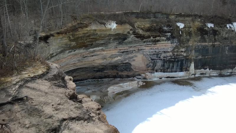
Sea caves started to appear below me, gaping holes far down at water level. The waves must curve around the point to eat here, gnawing at the soft rock and pushing the grit eastwards. The tops of the cliffs were also eroding away in a scary way. Gravity and wind pulled at the soft sand, bringing trees and brush with it, creating unstable coves that were draped with snow and ice. The trail got uncomfortably close to the sandy edge a few times.

Precarious sea caves below

Snow and ice draped over the cliff edge
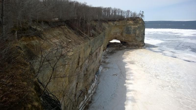
When I reached the far side of the sandy coves I finally saw the point. It was tall, sharp, with a lone pine on the tip that I had seen most of the morning. It felt like a big milestone after the last hour's snowshoe. The woods were opening up too, less snow on the trails and more open ground, and I slipped off the shoes to make the final leg quickly. I was almost there, almost to Grand Portal Point.
Getting close to the point
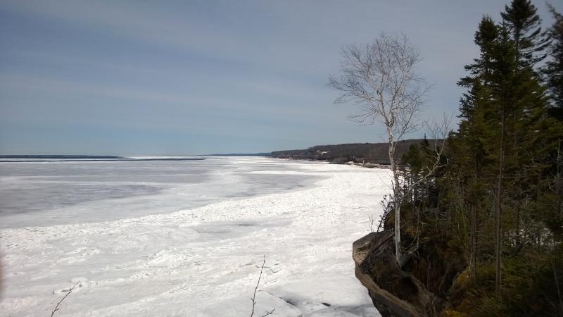
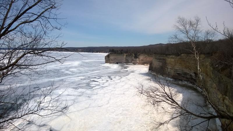
As I neared the tip everything seemed to get more awesome. I was ridiculously high above the ice of Lake Superior, huge cracks looking like a half-broken eggshell in the distance. The views began to open up, showing me more and more of the eastern shoreline. When I reached the very tip the blue-blue waters of Lake Superior were so close, a mere mile or so offshore. And then I looked west and saw the real Grand Portal Point. Oh, this was just an unnamed point.
Hard ice far below
Icy lake out over the point
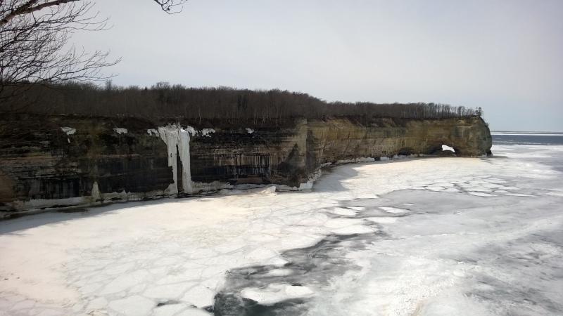
Awesomely tall cliffs ahead
I did not mind at all. These cliffs were massive, stained, and wonderful to look at, making all of the morning feel like child's play. This, this was going to be a fun leg.
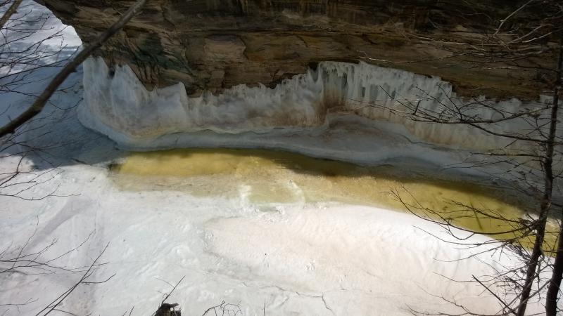
The woods were still clear and I sped along the path, passing over a huge arch of pinkish rock and straight dark walls. There were a few spots of recent activity in the arch, a huge boulder that had fallen down, dusting the ice with fresh powder. That had to have happened today. There were loud cracks throughout the day which I had assumed was the lake's ice. I evaluated the strength of the cliffs and my trail with a new eye.
Big scary inwards bite
Evidence of recent erosion below the cliffs
Without snow or snowshoes to slow me down it felt like mere minutes to catch up to the real Grand Portal Point. On the way I passed over a tall trickling waterfall, the ice formation many times the size of the actual flow, a seasonal thing that probably had no name or spot on a map. There had to be dozens of these drops. If Lake Superior wasn't so frozen spring tours would probably get quite the waterfall tour.
Getting close to the point
When I finally stood on the real Grand Portal I was surprised at how much elevation I had gained. The earlier points seemed a hundred feet lower. I could see so far east, cliffs and hills reaching up. That looked to be the Beaver Basin Lookout, and, with a little imagination, I could make out the Grand Sable Dunes (I probably couldn't make out the dunes). This was my last view back, back towards Chapel Beach and Spray Falls. Now there was the long hike west to Mosquito Beach.
Long way back to the first point
Flat sand on the point
Comments (0)