Upper Mazzie Loop: Wet Bottom Paradise
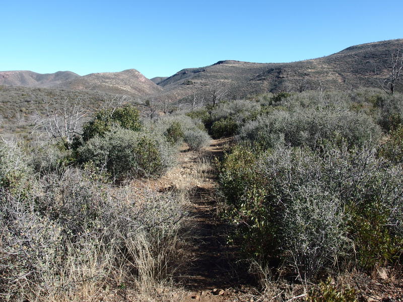
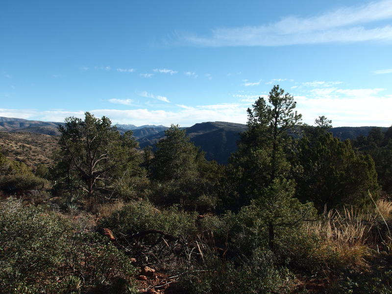
Bull Spring Trail passes through three drainage basins after it leaves the AZT. With each basin it swings north to avoid losing too much elevation, though there is always some drop, and then it crosses a rocky bed before climbing up the other side. The first one is Red Metal Canyon and it looked barren and devastated from the Willow Fire of fifteen years ago. At least the tread was easy to follow, a narrow single track that crawled along the side of the hill and offered good views of the humble vegetation below.
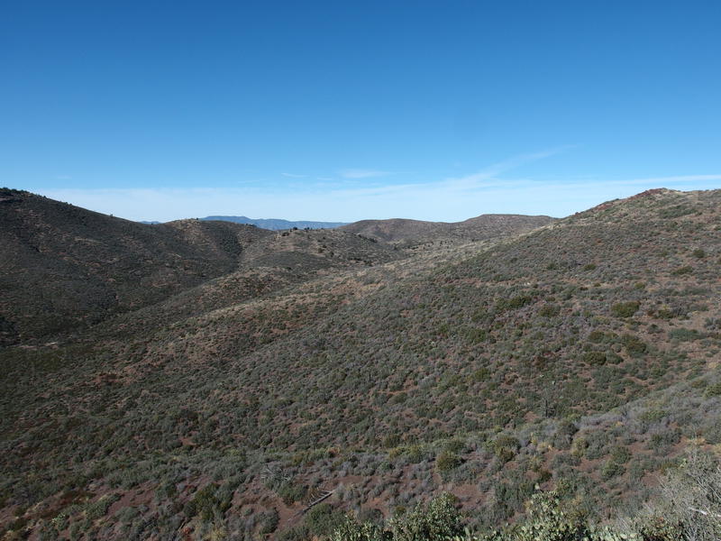
A barren, damaged basin beyond the saddle
Red Metal Canyon did hold a few things of interest. There is an old mining prospect about halfway through, one that had a meager collection of pilings and appeared to have been filled by natural slumping. Then there is a tank next to the trail, which was dry, even with the relatively wet weather we've been having as of late, so I'm guessing that it's fairly unreliable. Even with these distractions I was happy to crawl up the other side and mark a few more miles done. My lunch break was waiting for the final basin ahead.
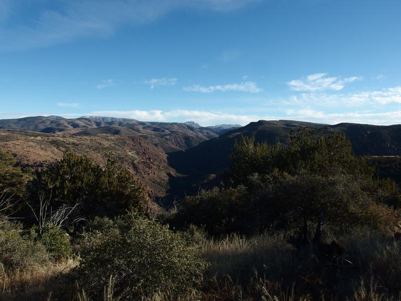
The second, unnamed basin, was of little note. The drainage actually flows into Bull Spring Canyon, which forms the final basin, and the only reason the trail climbs out of it instead of following is likely to take advantage of some easier terrain. While I trotted across I began to catch the whiff of something large and decaying, and of course my mind went to a lion kill. A mountain lion is one of the few creatures I haven't seen in the wild, and while it'd be nice to check it off the list, I also don't feel like getting eaten by one. My awareness went up a few notches as I began to imagine a lion kill sitting next to the trail or one of the springs below, with a jealous predator watching from above, waiting for a dumb hiker to wander by and make a sweet desert.
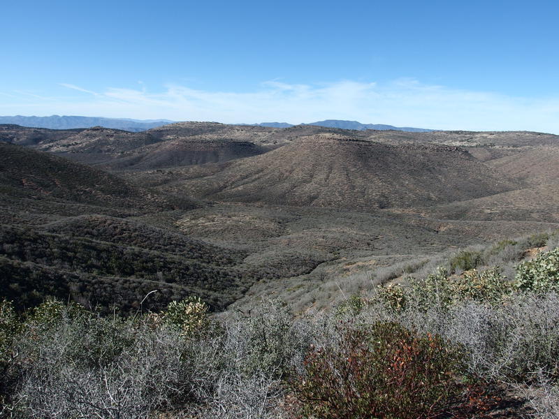
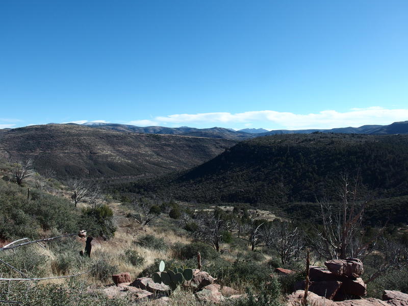
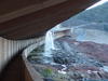
Looking down into Bull Spring Canyon
Bull Spring Canyon showed up a quarter after noon, by far the largest basin to walk through. My route swung down and followed the canyon downstream to LF Cabin, where I hoped to bump into Wet Bottom Trail, which would take me up the other side and, eventually, all the way down to Verde River itself. The smell of decay was strongest here. I moved quickly down the fading tread, looking forward to getting some lunch over with so I could get out of this valley of stench.
There are two springs down there. Bull Spring shows up first, located along the trail, and then Bull Trap Spring is down by LF Cabin. I didn't know which one was more dependable, though I had assumed Bull Trap was preferred, given that someone once made the decision to build a cabin there. The tread followed a shallow ridgeline down to the canyon, then crossed it, and then faded in and out of definition on the far bank. Sun beat down and I began to struggle a bit, even with the cool temperatures. When Bull Spring showed up, complete with two troughs of clear water, I decided it was a good time to take an early lunch.
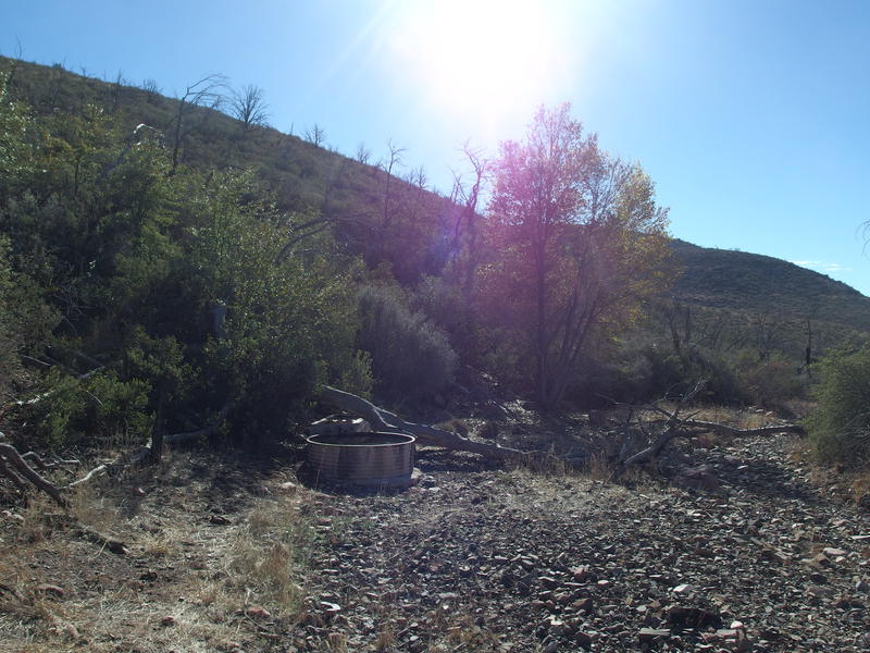
Two troughs at Bull Spring
This could be my last water of the day. Sure, Bull Trap was there, less than a mile away, so it barely counted. Knowing that I drank several liters and filled up to full capacity, over a gallon, and groaned thinking about the weight. I had packed light this trip and my overnight gear was around seven pounds, so a gallon doubled my pack weight. Honestly, the only reason my gear was over five (an established goal for us silly ultralight hikers) was some extra cold weather gear I was bringing, including a cotton sweater (I know, I know, cotton) that carries sentimental value.
I ate some jerky and bars and tuna before packing up and heading out. It took some effort to rediscover the tread after the long break, and I wandered in circles until I picked up a line in the brush that continued for more than a few yards. This trail really seems to avoid using cairns. I'm not sure if that's because of recent re-routes or the original builders assumed that the tread was good enough, but the current overgrown state of things would sure make cairns useful. Once I found the tread I pushed downstream quickly, hopping over the creek when it crossed, and found a dilapidated cabin at the end, complete with ancient camping gear stowed away and some broken walls, and a few humble puddles of water nearby.
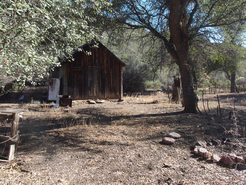
Quaint spot for LF Cabin
Great tread along Wet Bottom Trail
Picking up the tread for Wet Bottom on the far side of cabin was easy, mostly because this trail actually had cairns along it. Before starting it I double-checked my progress. It was two in the afternoon and I had twenty miles behind me - right on schedule, actually. If my math was right I had seven or eight miles to travel, which seemed achievable before it got too dark, with today's sunset at 5:15pm. My hope was to be on the bottom of the trail by six, which would give me an easy start on Highwater in the morning, and would set me up for a relatively easy second day overall.
Last view back over Bull Spring Canyon
From the cabin the trail climbed up the other side of the basin, a short 300' to the top of the basin that was over what seemed to be an old road with helpful cairns spaced along it. The road was curious - then again, there are a few old roads up here, and I shouldn't be surprised if the western half Bull Spring Trail was a newer creation that blazed its own faint way through the basins. After one quick look back I headed down to a small drainage, one that flowed past Meteor Tank into Wet Bottom Creek in the south, and, after finding a curious spur trail, discovered some rock tanks that held clear water.
Even though I had just stopped for water, the thought of the hot afternoon and a dry camp tonight weighed heavy on me, so I paused here, drank a full bladder, and topped off. I was up to seven liters consumed for the day, which was higher than I planned for, with the cooler December temps and all. I've downed up to twelve during warmer months, which, when combined with regular doses of electrolytes, seems to be just right for my system. With my stomach freshly gurgling I backtracked to the trail, hauled up the 200' to the other side, and mentally prepared myself for a change in scenery.
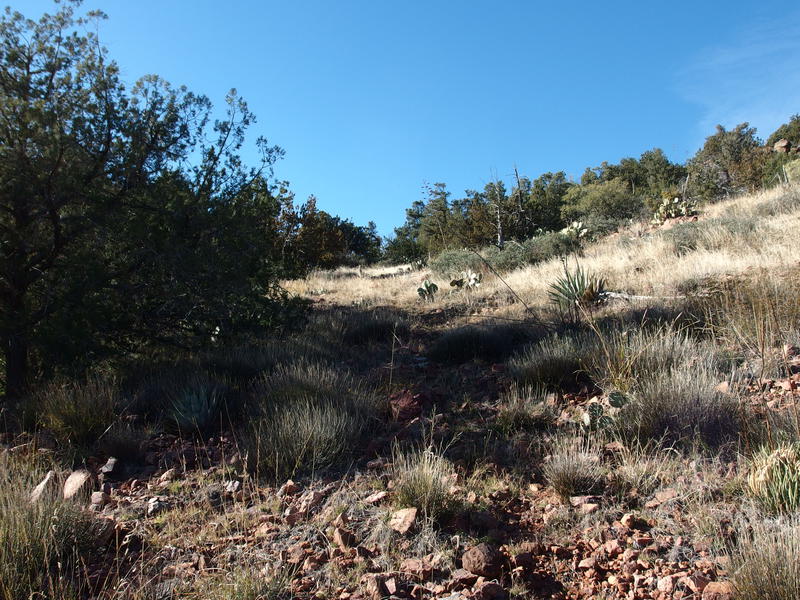
Climbing up out of the last basin
I had already noticed some differences over the last few miles. After the desolation of Bull Spring Canyon there were now trees, slowly becoming more prevalent, as I approached the edge of Willow Fire's reach. Down by those tanks there were tall pines - not ponderosas, I don't think, yet tall and pine-y. Now on the other side I entered a whole new type of forest that reminded me of the distant Mogollon Rim. The trail was covered with needles, tall trees provided ample shade, and some surrounding brush grew large and sporadic. This was not the short, thick, annoying vegetation that plagues so much of the higher elevations of the wilderness, with frequent thorns and tangling branches. This was mature highland forest and it was magnificent.
Near the spur of Childer's Seep I started a small herd of cattle. I was surprised to see them out here, thinking that the wilderness didn't allow open grazing. Maybe they were loose or something. Not trusting the seep and unwilling to waste an hour finding it I skipped on, continuing on Wet Bottom Trail, continuously amazed by the pleasant going. This must have been what the Mazatzals were like before the fire, and it was delightful and depressing all at once. Then the views showed up and gave me a whole new reason to drool.
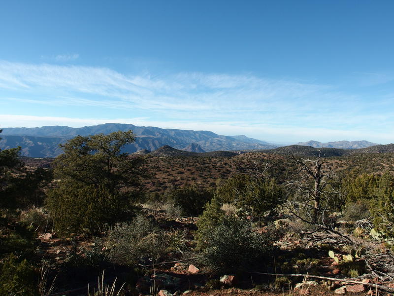
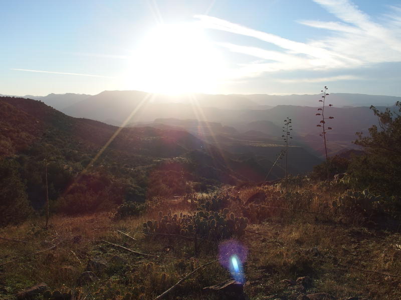
Big views west from the highpoint
Trees, mountains, and big views
Dang, everything was visible from this ridge. To the west I could make out Squaw Butte, and the Verde Rim, and Pine Mountain. To the south, thanks to the epic chasm of Wet Bottom Creek, the one I recently was chased out of by a monsoon, I could see a snow-covered Mazatzal Peak and Peeley - Sheep ridgeline. While the trail was starting to get difficult to follow, with tall grass and infrequent cairns, I couldn't care less. These views made me want to wander around up here all afternoon.
Hard time tracking the trail through the vegetation
Time was ticking, though, and if I spent the night this high it'd be a cold one. My bag is only good to thirty degrees, and it'd be colder than that up here. I pushed on, tracking the trail back and forth, sometimes giving up and just walking in the right general direction. Right before the big drop off the ridge I paused for one last look south, an open vantage of Wet Bottom Creek, and marveled at how big this wilderness is. One could, as I have, spend years exploring this place and still find hidden wonders.
Direct view down the cut of Wet Bottom Creek
From the high ridge the trail drops down the north side, following a drainage down, and then swings along the side until it levels out on the actual Wet Bottom Mesa, far down near the junction of Highwater, which I had just visited a few weeks ago. I was a bit worried about the miles of hillside travel. A remote trail, with little traffic, along a north-facing (thus shaded and heavily vegetated) slope would mean plenty of washouts, overgrowth, and game trail confusion.

Hot afternoon sun on the mesa below
Before any of that hillside stuff started I was served with an early dose of head-scratching. The trail followed the drainage down with tiny cairns and faint tread, plus a few switchbacks, and then a series of huge cairns showed up and led due north, perpendicular to the route. I followed it dumbly and was abandoned on an open meadow. I circled around slowly, trying to find a path further north or west, trying to guess what this re-route was supposed to do. After twenty minutes I gave up and started to go back south when I saw that this was just a giant switchback that took me right back to the original drainage and the same path and the same small cairns. A recent re-route to turn a few hundred yards into a much longer switchback, I guess?
That, plus the dropping sun, began to deflate my high spirits. Or maybe I was just getting tired of being on my feet. The tread faded in and out and the game trails started to compete for attention. Cairns helped, even if they were small, there just wasn't enough of them to provide a consistent route forward. There were a few times I had to crawl through the hillside drainages, using branches to keep from sliding downhill, and other times I had to tip-toe around large prickly pears. I spooked an elk, which was cool to see, otherwise this was turning into a typical slog.
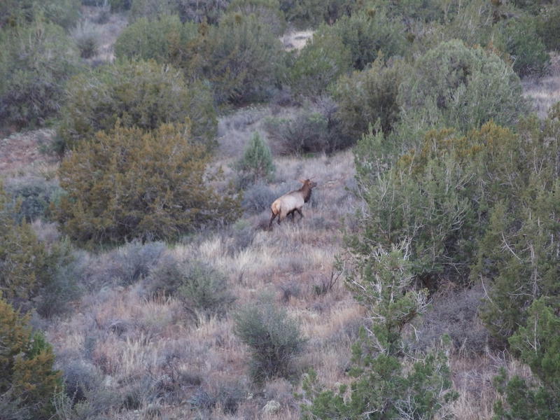
Startled elk ahead
Planned campsite below, seeming impossibly distant
I rounded a hill, caught a glimpse of the still-distant mesa below, and adjusted my plans. I had thirty minutes of daylight, maybe an hour of usable light left, and five miles left to my planned campsite. My pace had recently slowed to less than two miles an hour, and I had no reason to think that would change over those five miles, and there was no way I could safely traverse this hill by headlamp. My planned campsite wasn't going to work. One more mile from here and I would drop 600' and be located at a saddle that could give me a flat spot to camp. That would work.
The next mile was painful and I was thankful of my changed plans. There was no way I could do this type of terrain in the dark, and the thought of stopping soon and eating some warm food gave me extra motivation. After more hacking and shoving and fighting the vegetation I reached the saddle, with minutes before the sunset, and wasted no time finding a small flat pad next to a protective pinyon pine and setting up a basic camp, with plastic groundsheet, luxurious sleeping pad, and a down quilt, all covered by my tiny tarp poncho. No need to bother with a tent or bug net in these cool temperatures.
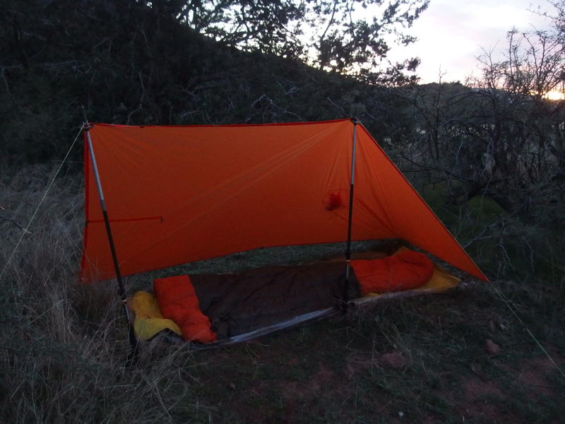
Camp setup for the night
Next hour passed by with the enjoyable mundane of camp chores. I took my time, sipping water throughout, trying to avoid any leg cramps from the day's exertions. Dinner was rice and tuna, with a few snacks and deserts on the side, and I warmed up some tea to finish it off. The temps dropped with the light and I pulled out a puffy jacket while cleaning up from dinner to keep the shivers at bay.
The night ended up being one of the deepest and most relaxing sleeps I have had while camping, likely due to the long day and big miles. Read a few chapters before drifting off, only waking up three or four times to roll over. Each roll meant carefully adjusting the quilt, which, while it was strapped to the pad, still shifted around with me and let cold air seep in new cracks. During one of my rolls I noticed some cloud cover building up to block the stars, which I had expected with the forecast, meaning that overnight lows would temper and that rain was a possibility for the next day. There was some concern about that, about my missed campsite and the many miles left to get back to my car and how rain would affect the day, yet I was still riding the high of that great stretch of trail and the fact that I had just traveled over 27 miles over rough terrain.
Comments (0)