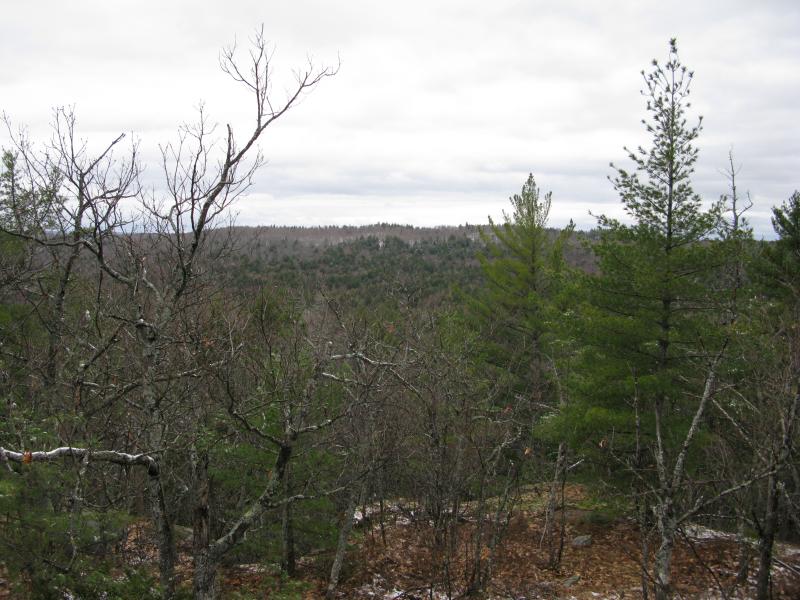
Tokiahok Head on Mount Ida
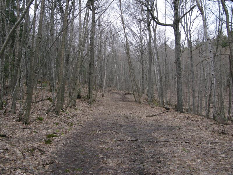
A two-track led east and I followed. There was a much more ambitious route to my right that climbed rocky hills and pushed through thick woods, one that promised sweeping views of Cliff Lake and the eastern swamp, but I stuck to the track. Snow had been falling for the last few hours, soaking the forest and hiding anything more than a half-mile away. I had a long hike to Tokiahok Head on Mount Ida and I did not want to burn up energy on a difficult side trek.
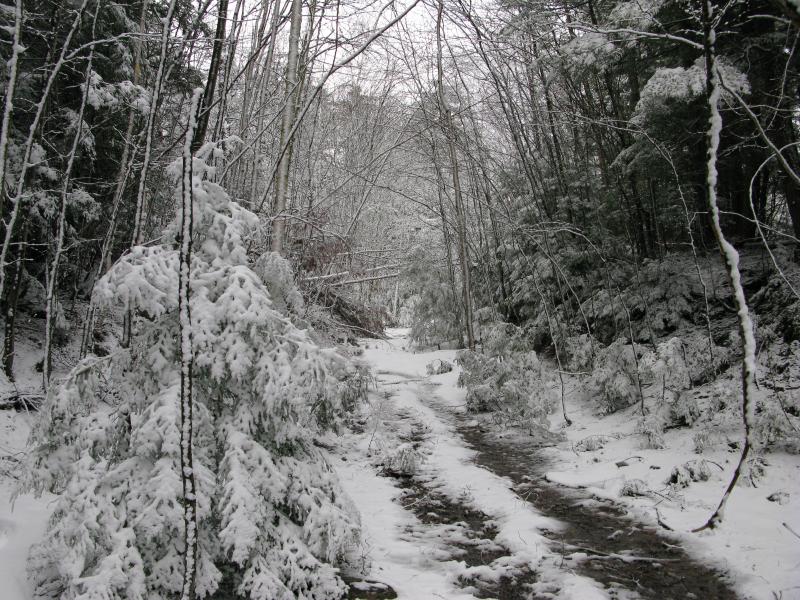
The track passed recent logging and slid under huge puddles that would swallow most vehicles. Eventually it began to climb the southeast shoulder of Mount Benison, snuggled within a narrow pass, and the logging activity fell away below. I was getting close to the Anne and Cameron Waterman Preserve, a place that the loggers don't touch. The track lost the muddy ruts and started to narrow, trees began to press in from both sides, and the snow clung easier to branches. Drifts grew out of the shady areas, remnants from the long winter, forcing me to either take long loops around or plow right through. By the time I reached the top of the pass I felt like I had wandered into an entirely different world.
Early morning snow on Mount Benison
My pace slowed and I took stock of my situation. I didn't have a firm plan for the day (outside of climbing Tokiahok Head, that is). This track stretched far to the east. There was plenty of other spots to visit along the way to Mount Ida: some potential ridges to my left up a shoulder of Mount Benison, some bare outcroppings above Turner Point, and Mink Run far below. I decided to make for Tokiahok first, following the track for a bit longer before cutting north. The snow was still falling and would probably continue to block views for another hour or more anyways.
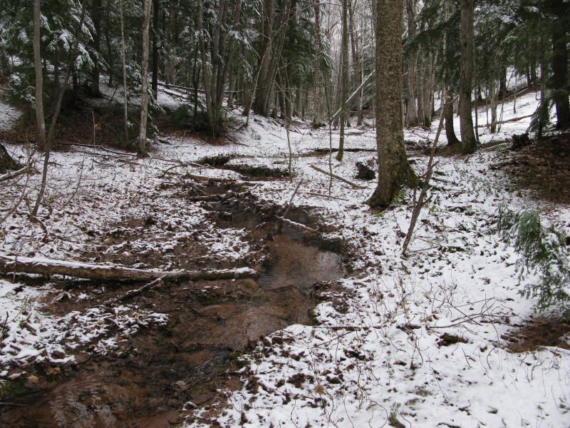
The track slowly drifted downhill and to the right, following the curve of the unknown forested ridge just north of Cliff Lake. I could hear a seasonal stream splash and jump below me, following the slope down, and decided to veer off early and check it out. Trotting down the steep snowy bank I found the creek snaking through the sandy earth about as large as a seasonal stream could hope to get.
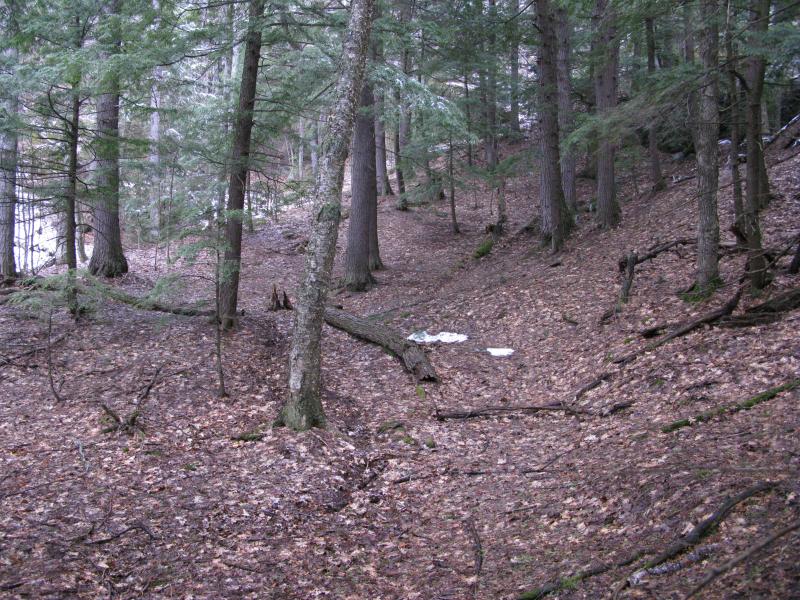
Dusting of snow over a muddy seasonal creek
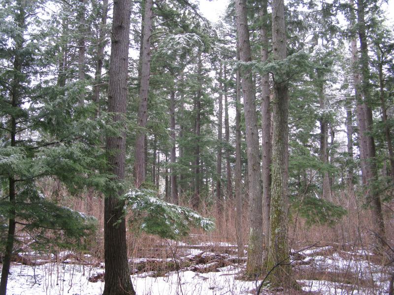
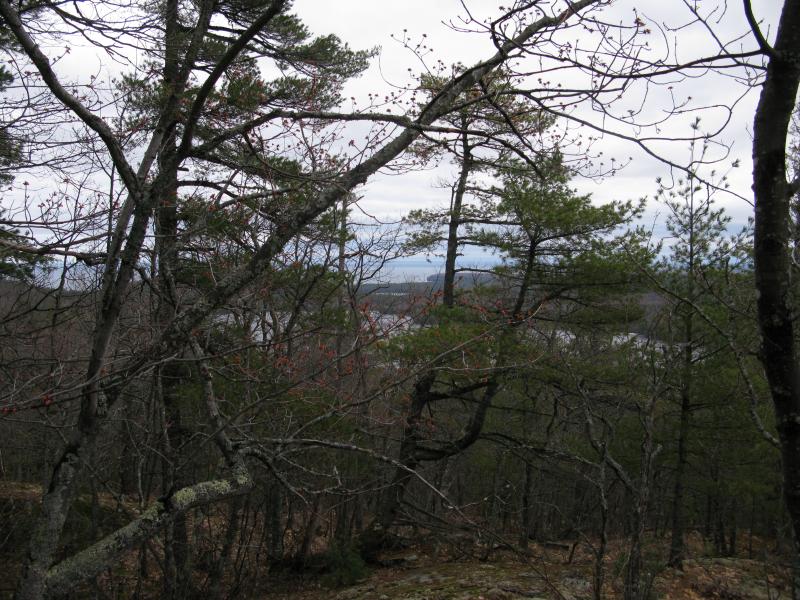
Now off the track I headed northeast, following the creek for a few hundred yards, then simply walking through the woods. I tried not to lose too much elevation - the pass I had come over was roughly the same height of my end destination - and curved a bit with the eastern face of Benison. The pines were tall, much taller than I had seen on my first visit to this mountain a year ago, but they weren't the only type of tree here. Groups of smaller trees sprung up, clustered tight and sheltering banks of snow underneath, and in other places clusters of saplings stretched tall and caused me to weave between their slender trunks. While the path I walked was remote and the trees thick there was something that constantly broke the illusion of wilderness.
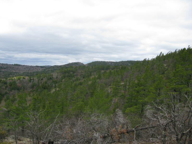
These woods were managed. Huge trees had been felled, sometimes within yards of each other, in order to let others grow without competition. Some of the downed trees were birch but most were pine, huge monsters that left behind trunks large enough for a small dining room table. It made sense even if it was disruptive: the managers of the preserve were trying to help the trees grow larger and older.
Managed pine forest
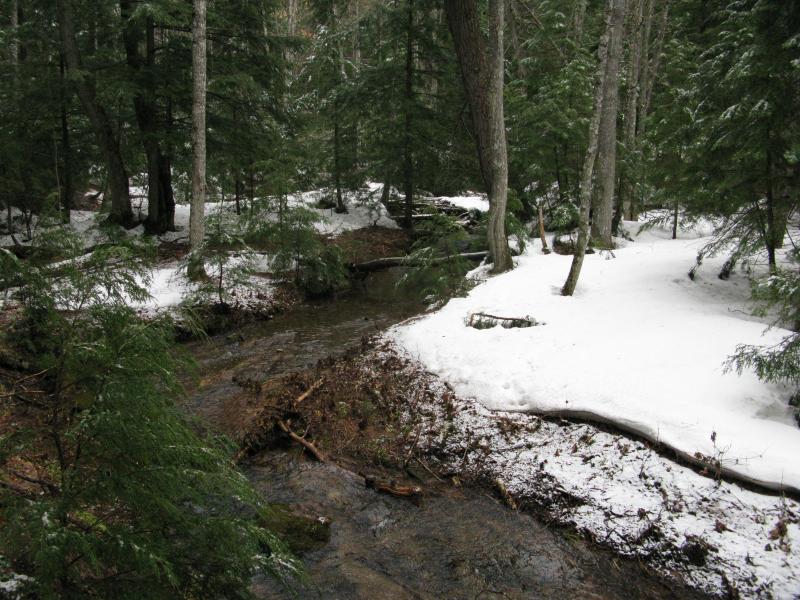
When the next splashing sounds began to float through the air I felt my step quicken. It had to be Mink Run, a wild creek that flowed off Mount Benison and Ida into Mountain Lake. The creek cut a deep sandy channel and was surrounded by banks of snow. I tumbled down the bank and leaped over a narrow section. I was getting close to my destination.
Snow banks on Mink Run
Mount Ida itself is a long ridge of a mountain, cleaved off from Mount Benison's east face by Mink Run. Tokiahok Head is located on the far eastern end of Ida, a shoulder that reaches out to the middle of Mountain Lake across from Mount Homer. There are a few outcroppings that overlook the lake and should offer views north, east, and south. All I had to do now was climb a few of the southern rises in the way.
The first one was an easy climb. While the sun had not yet showed up the heat had been slowly warming the south-facing slopes. In fact, it had been 'raining' within the forest for the last hour, the snow trapped high up on the branches melting and falling down on me with cold plops. One long push over soggy and snow-free ground and I was standing on a partial view over the Mink Run valley. There wasn't much to see.
Partial views south over Mink Run
Directly across from me rose the hill I had come over on, the hill the track crossed over. There were no north-facing bluffs that I could make out from here, just trees and snow. To the right I could see a glimpse of Benison. No bluff east towards Mountain Lake opened up. I turned and continued north into a little canyon and a dashed line that marked another track. I never found the road, though.
Wet slopes up the mountain
Nestled deep in a narrow canyon was the barest hint of a trail. The canyon and trail followed the slope of Mount Ida southeast towards Lumberman Bay, possibly connecting with a whole trail network around Mountain Lake. This trail was unmarked and hard to make out, and the only ways I noticed it was by studying my topo map (the dashed line) and seeing an unsteady line of overturned leaves. Someone had recently climbed Mount Ida and used at least one, if not two, walking sticks.
I followed the trail for awhile, looking out for markers or the remains of an old road. There was nothing that I could see, no sign that a road had ever crossed over Mount Ida. After a bit longer I cut off to the right and up a steep rock wall. I was much higher than the first rise, and when I came out on a clearing the difference was striking.
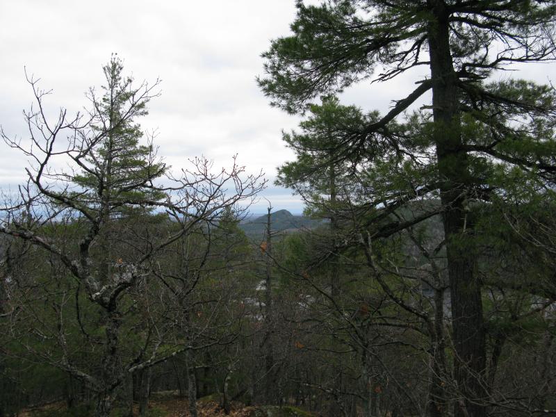
Distant ridge of Mount Arvon in the south
Looking back to the south, where first I could only see a ridge of pines and snow, the long ridge of Mount Arvon poked up beyond. An odd clear cut, one that I had noticed on other hikes, was also visible to the east of Michigan's highest point. It was far too large to be the small view cut for Arvon, probably some logging around the headwaters of West Branch Huron River. I scanned around more, standing near the peak of Mount Ida around 1400', and caught my first view of Mountain Lake.
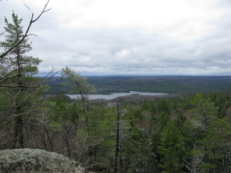
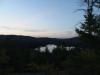
First view of Mountain Lake
The lake looked cold, ice clinging onto the shoreline within the rocky harbors. The wind had picked up by now, rushing through the trees and stirring small waves, but I could still make out reflections of the trees around the pristine waters from this distance. Compared to the view from last summer - when the deep water radiatiated summer-sky blue - it looked sharp and unfriendly, a wild thing that did not welcome visitors. I shivered and continued on, searching for more outcroppings.
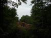
As I walked I curved a bit to the left. I was hoping to catch a northern view with Huron Mountain and Lake Superior, although I know my chance was slim at best. Mount Ida, like many of the peaks of the Upper Peninsula, has a gentle north slope and a steep south face. Some of this can probably be blamed on glaciers pushing their way down from Canada, though I've started to wonder if the actual rock layers are angled this way. Regardless, it is hard to find a north view, and when I did come out on a partially obstructed view I did not mind the trees standing in the way.
Scraggly trees blocking the northern view
Steep face of Mount Ives in the distance
Checking my bearings I noticed that my northward curve had taken me out onto the uppermost of three fingers that stretch east. The southern fingers promised much better views. If I cut a straight path over and I've to go down a very steep rock wall and then climb back up. Instead I backtracked, back along the flatter top of Ida and skipped the shorter, tougher route.
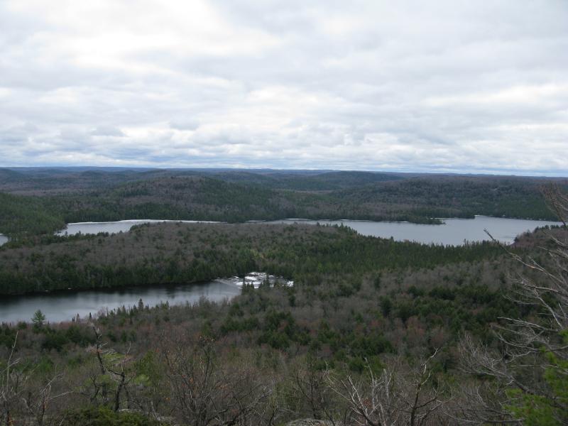
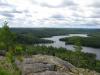
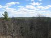
There hadn't been any real knockout views over yet. Sure, I had glimpsed the southern end of Mountain Lake, and the last obstructed outcropping had even shown me Mount Ives beyond Trout Mountain, but compared to my climbs last year these were mild at best. As I stepped out onto the next ridge one presented itself, a sweeping vista of the middle of Mountain Lake and Homer Mountain.
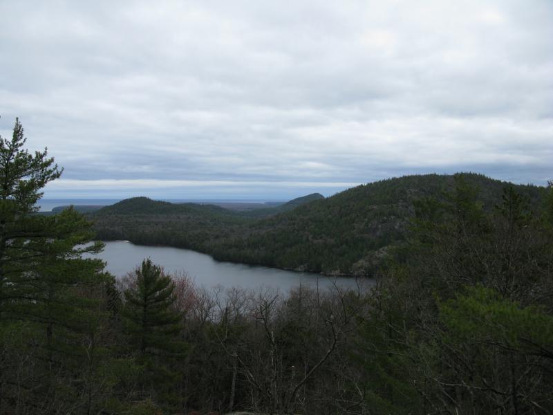
Homer Mountain and Mountain Lake
This is exactly what I had been hoping to find. I rested here, drinking in the view. More waves showed up below on the lake, pushing from one end to the other in a lazy sweep, and the pines shushed loudly in the gathering gusts. Salmon Trout Point pushed out past Ives, a small hook in the distance, and I imagined that there must be much more wave action over on Lake Superior. Mummy Mountain, a curiously shaped hill on the far side of Trout, was little more than a lump compared to enormity of Homer in main stage. It wasn't until I started to shiver, exposed and wet from the morning's hike, that I reluctantly got up and moved on.
It was tempting to head back now, after this last view. I knew I was running low on time already. If I wanted to make it back to my campsite on the far side of Cliff Lake, especially via the swampy eastern shore, I would need to start heading south soon. When I climbed down, though, another rock wall greeted me. I didn't expect one here. There was a small blip on the topo map, a tiny circle, but I had assumed it was just a fluke. The wall tugged at me so I climbed, all grasping hands and sprawled feet, and pushed myself onto an honest-to-goodness bald peak. Tokiahok Head wasn't supposed to have a bald peak, not when it was starting the final dive into the lake.
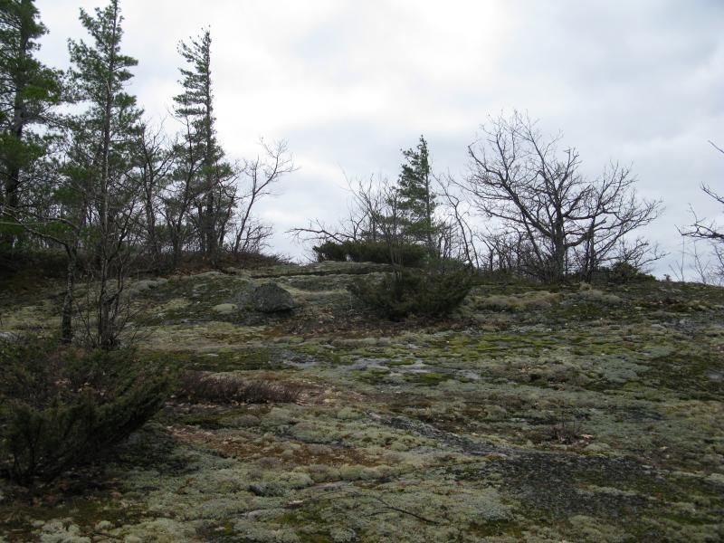
A mossy, rocky peak ahead
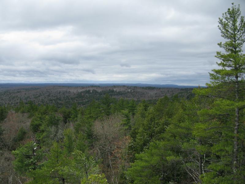
Acres and acres of pines on Mount Benison
Ice on Lumberman Bay, Mountain Lake
Floating ice on the eastern shore
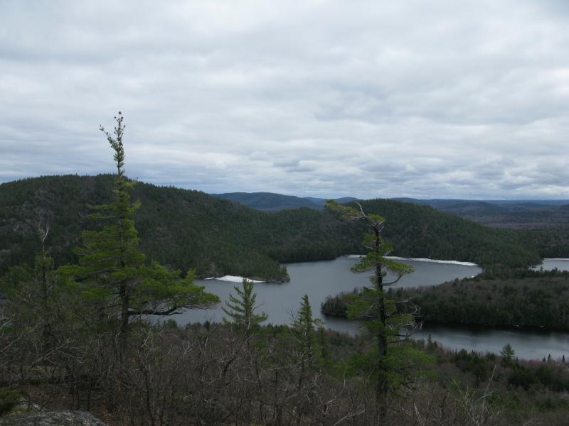
The views were crazy, almost a full panorama around me. To the west was Benison, with an odd ridge cut clean off the main bulk and hinting at possible outcroppings. Ahead lay Lumberjack Bay Lumberman Bay and large floating pieces of ice tucked up against the tall cedar sides. Burnt Mountain, a relatively humble mound on the south side of the lake, was barely discernable in the thick forest around it. Dudley Point was also choked up with ice. I believe that there is a small boat dock there which had probably not seen use since last fall. Even a north view opened up, the shoulder of Huron Mountain blocking some of Lake Superior, and Pine River Point beyond.

Looking north up Mountain Lake to Lake Superior be
Wind was whipping around me, threatening to blow off my hat. I stood for a time, enjoying the view and the roar and the quiet, and then moved on. I had a long walk back.
The way back down was tougher than my route up. I had lost a lot of elevation and the slopes had steepened this far east. The unmarked trail was even harder to pick out as it weaved around a few boulders. Once I found it I followed it for a short time, if only to look for anything interesting along a different length, before cutting a line back to Mink Run and the road beyond.
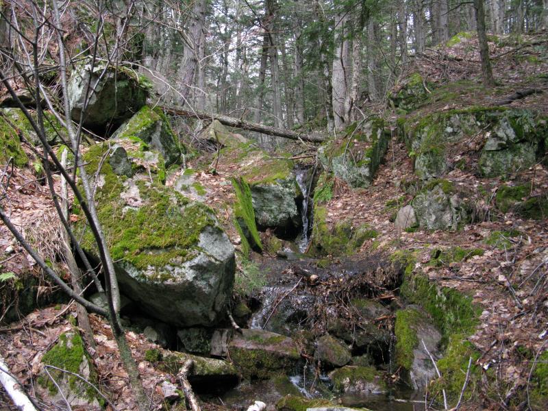
Mossy rocks and falling water
The woods were quieter as I got lower. I could hear the wind whoosh far above, among the peaks, and Benison's bulk and the thick forest protected me. Eventually I came across my original path in and found a small bit of fun trying to pick out my prints. The morning's snow was gone now, leaving only a few deep drifts from the winter. When I walked out over the two-track in the pass my boots squished softly in the mud. The woods and mountains prepared for the coming storm, the growing winds and the next bout of snow, and did notice my passage.
No more snow on the track
-
Jacob Emerick
Jun 14, '13
You are completely correct, sir! Thank you for the correction. I blame it on Lumberjack Tavern in Big Bay... Might have been a bit hungry on this hike... ;)
-
Douglas Feltman
Jun 14, '13
Hey, you're not the only one who has done it. Heck I misspelled Keweenaw on a couple of my videos.......... :)
-
LR Swadley
Nov 14, '13
Jacob ,I found your site and read with much interest of you hikes into our beloved Huron Mountains. I haven't hiked in there in quite awhile, but you might find it interesting that every year for about twenty years another guy and I hiked in there for four day backpacking trips. We explored much of the range year after year. We have many stories of our adventures and discoveries of this mystical, remote and mostly unknown wilderness. We've climbed most of the peaks, spent many a night on top of Huron Mountain itself, and others. Mink Run... One of my favorite forgotten canyons. Glad someone else is out there these days "discovering" this incredible area. Was a lot of fun bush-whacking and trespassing... We used to say to really see the heart of the Hurons you had to earn it! And few have.LR
Add to this discussion-
Jacob Emerick
Jun 14, '13
Now that you mention that about the Keweenaw Ridge area that makes a lot of sense. Everything from Brockway/Baldy to Bare Bluff follows that pattern. I'm not sure if the Hurons has the same thing going on, though there are defined ridges. Tokiahok Head/Homer Mountain feel like they are part of the same layer (with a lake sitting in between) and Huron Mountain/Mount Ives are also very similar. It'd be interesting to learn if anyone has done detailed samples of the rock near/on the HMC, especially the grade... And for picking locations - that's a whole process! I study both topo maps and satellite photos (like, Bing, Google Maps), play w/ Google Earth a bit, dig up old hand drawn maps, read a lot of books, and of course pick up tips from other hikers like you. The really nice thing about the Huron Mountains is that they are all so close together. You climb one and you can see another half-dozen exposed bluffs around you. A fun (if tiring) afternoon can be had out by Little Huron River - just climb from one 'peak' to another for hours on end. Hope this answers your questions!
Add to this discussion-
Jacob Emerick
Jul 16, '13
Ha ha, good to hear, sir. It was a heck of a hike, especially combined with the trip around Cliff Lake. It was tough dragging myself up Ida but so worth the views!
-
brightmoor
May 19, '15
Like
Add to this discussion