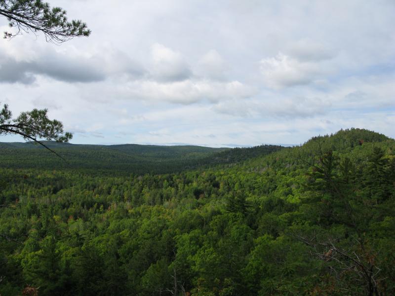
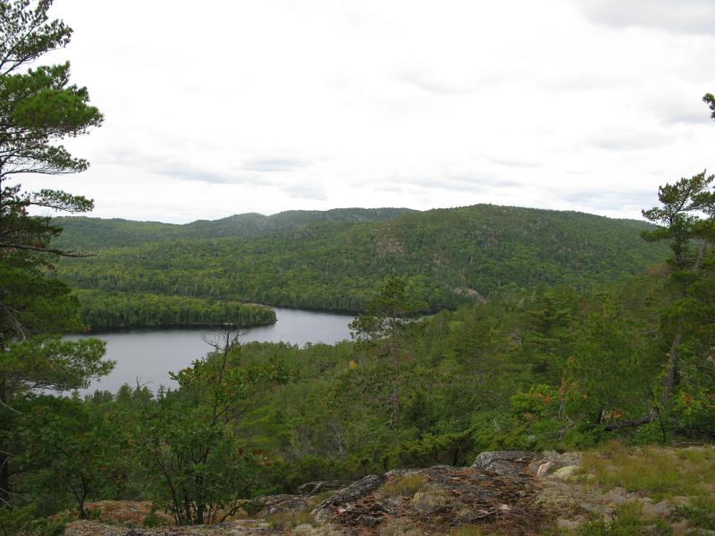
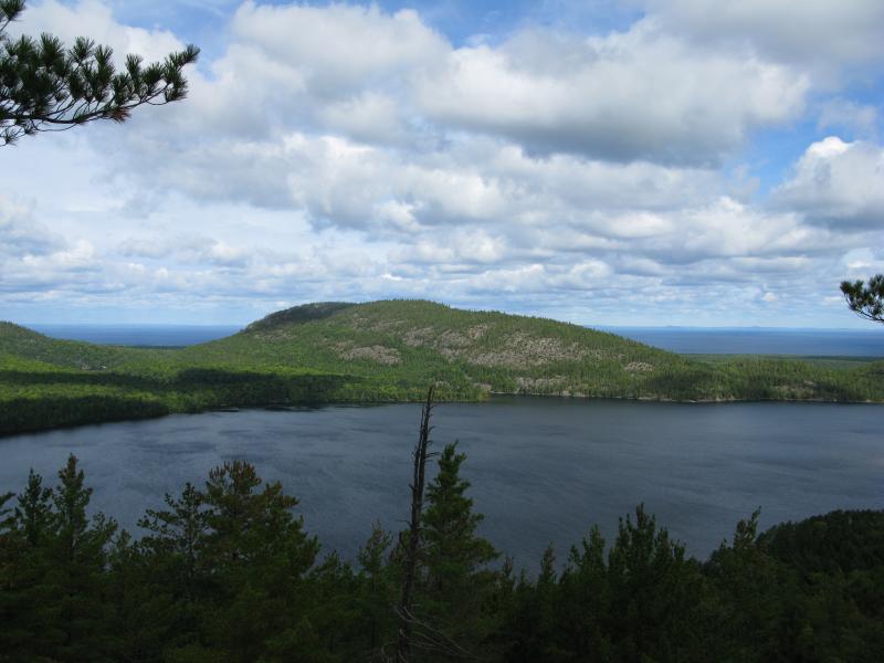
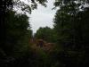
Mount Homer and Mountain Lake
Forbidden land stretched out in front of me. I was within a mile of the Huron Mountain Club property, standing on an unnamed outcropping southeast of Burnt Mountain, looking north along the eastern guardians of Mountain Lake. For years I had been trying to see this huge lake within the Club's borders but had only glimpsed distance slivers. Mountain Lake is surrounded by hills and mountains on all sides, all within HMC land. Today I looked north, listing the visible and hidden peaks in my head… Burnt Mountain, Mount Homer, Trout Mountain, Mummy Mountain, and Huron Mountain.
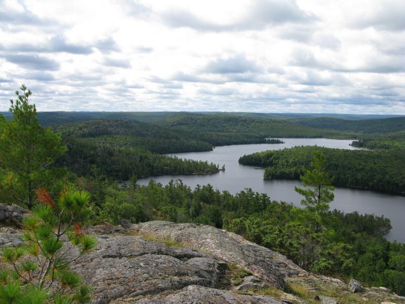
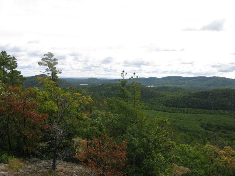
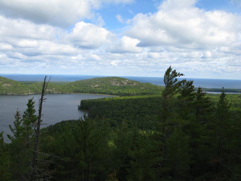
South along Mountain Lake
Letting out a deep sigh I headed down the cluttered, bumpy slope. It had rained last night, leaving damp undergrowth and dripping leaves for my hike today. The logging road showed up, predictably, perpendicular to my route and I turned and followed it. I had a long walk today, normal for the Longyear property north of the Northwestern Road.
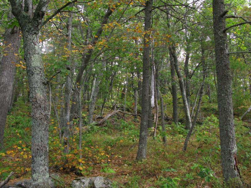
The first obstacle in my northward path was Elm Creek. Draining most of the flat land between Ives and Mountain Lake with multiple branches reaching south towards the Salmon Trout River valley, this small creek is one of the main inlets for Ives Lake. While not large it does cut a decent bed in the sandy ground. After walking along Elm Creek for a short bit I crossed the dark, rocky creek before climbing up to the end of a logging road. Luckily this sandy, vine-crossed road continued north to one of the main thruways in the area, one that would lead me right to Mount Homer.
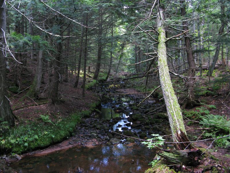
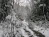
Wooded tributary of Elm Creek
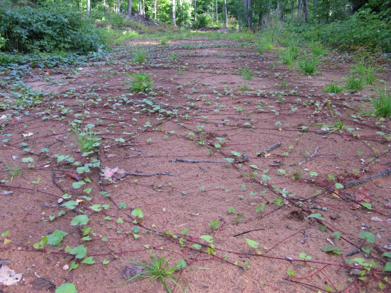
Vines criss-crossing the sandy logging road
Working off of a tip from Joel, another hiker of the Huron Mountains, I was aiming for the eastern shoulder of the mountain. Based off of a variety of sources it appears that the Huron Mountain Club does not own this section of Mount Homer, which I hoped would give me a decent view of Mountain Lake. Cutting off the main two-track onto an overgrown logging road I approached the mountain from the south, getting occasional glances of the towering outcroppings ahead of me. The road led through a wide sandy clearing before disappearing into a recently logged area and forcing me to push my way through young trees and over piles of rotting brush.
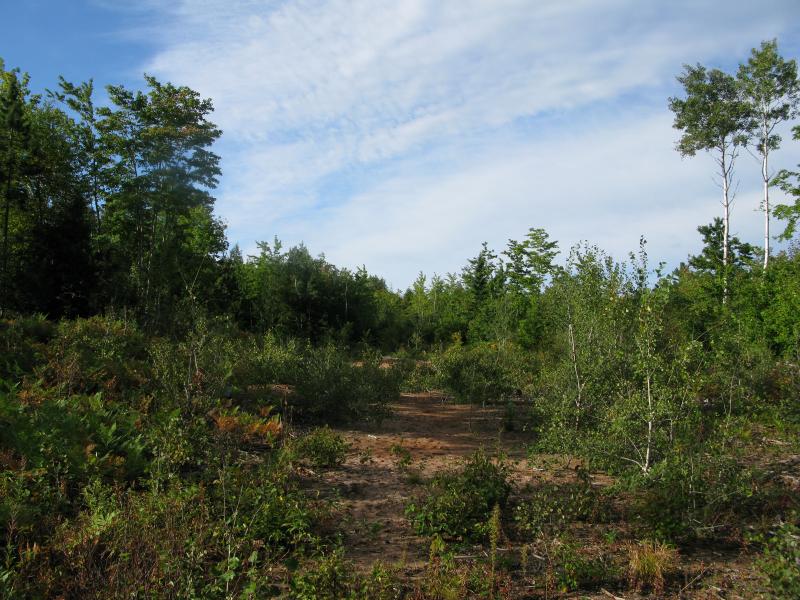
Sandy end to the logging road
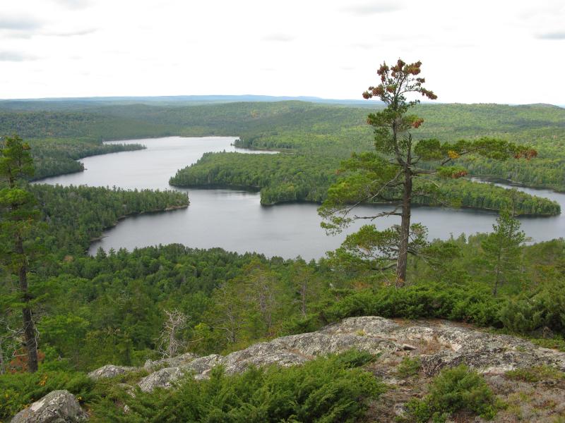
Young trees gave way suddenly to old growth near the slopes of Mount Homer. After the long walk over flat ground the gradient was a welcomed change, at least for the first couple hundred feet. I climbed over the pine needles and around boulders, eventually crawling on the final outcroppings, before coming out to a view that took my breath away.
Looking south along the ridgeline

East twoards Mount Ives (on the left)
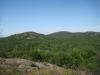
While I couldn't see Ives or Mountain Lake, the plains and all the outcroppings stretched out in front of me in amazing green splendor. Mount Ives, Florence Pond, and the hills lining the eastern shoreline of Mountain Lake. Hungry for more I turned west and climbed the shoulder, watching for any sign of the property lines. Every new outcropping gave me a bit more height and better views to the east, eventually giving me views of Lake Superior, Conway Lake, and a glimpse of Ives Lake. And then I went too far.
Slivers of Superior and Ives in the distance
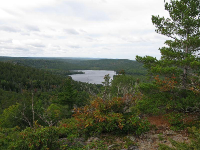
First view of Mountain Lake
Mountain Lake lay before me to the west. At some point during the climb I may have crossed the property line. I know that not all of Club's property is marked well. Areas with a lot of traffic usually have large signs tacked on trees, some spots even have webcams, but I've always at least seen blue splashes and wire fence (although the fence is usually partially run down). There was nothing along my climb.
Unsure who's property I was on now but too far invested to turn away I checked out my position. I was on a narrow southern ridge with excellent views spanning from the southern area of Mountain Lake to Ives Hill in the east. The peak of Mount Homer lay a short distance to the north with a possible north-facing ridge beyond. I decided to continue on until I knew who owned this land. I wandered along the south ridge for a short time longer, getting amazing views of Dudley Point and Lumberjack Bay below, excited and humble for the chance to be so close to an area I had been stretching towards for years.
Closeup of tables and tents on Dudley Point
First view of Mount Ida and Benison
Once I reached the west end of the ridge I turned towards the peak of the mountain and started uphill again. The trees thinned and changed with the rocky, wind-swept peak. There was no defined peak, which is pretty typical for the Huron Mountains, but there was some surprisingly clear outcroppings along the western side of Mount Homer's summit.
On the peak of Mount Homer
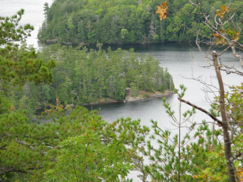
Dudley Point and Lumberjack Bay
Looking south towards Yellow Dog Plains
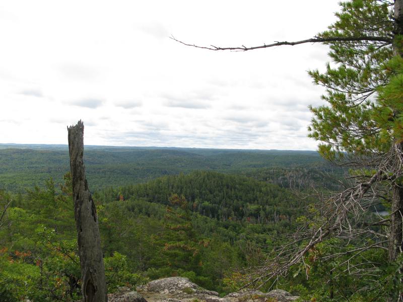
Continuing north over the mountain in hopes of finding a north-facing slope my path started to become more difficult. The rocky layers are aligned east-to-west and are very well defined, so traveling perpendicular, up and over each layer, meant crossing over sharp elevation changes. When I made it to the clearings I had spotted from satellite photos I was starting to tire a bit. Still, being able to see Lake Superior, some northern mountains, and even Third Pine Lake made the extra distance completely worth it.
Huron Mountain, Lake Superior in background
Northern end of Mountain Lake
I now had to decide how to make it back. I was sitting on the far side of the mountain from my exit, so I could either retrace my route or circle around the side of Mount Homer. I decided to follow the western face to get some more views of Mountain Lake (and avoid Trout Lake, which I think is a well-visited Club location). The difficulty I had traveling over the rock layers before was multiplied on the western face, with sudden blocks of rock sticking far out towards the lake below and plunging down quickly. My hike was split between creeping sideways along cracks in the hard rock and crossing narrow wooded valleys in between the rocky layers. Along the way I was greeted with several good views of Tokiahok Head off of Mount Ida, just across Mountain Lake, as well as the green eastern face of Mount Benison.
Tokiahok Head on Mount Ida
Last look at Mountain Lake
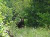
After several perilous drops and rock climbs I rounded the bottom of the southern ridge and took a saddle back to the recent logging that I had taken into Mount Homer. A long return trip lay ahead of me during which I bumped into a bull moose. Overall I was incredibly pleased with the hike. I may have crossed into the Huron Mountain Club property along the way, but I didn't find any signs or disturb anyone (Club member or not). Personally I am more concerned with just staying out of people's way whether they are logging, landowners, or hunters than whether or not I'm on state/commercial or private land, but that's a different discussion. Today I had climbed a mountain that I never imagined I'd climbed and saw a lake I never dreamed of seeing so close, all while enjoying some of the most remote land that the Upper Peninsula can offer.
-
Jacob Emerick
Dec 22, '12
Ha, I'm definitely do not have the mad photography skills that y'all have. A hiking friend tackled this same hike later in the year and got some amazing fall color shots, may have to reattempt in the future.
-
nailhed
Dec 22, '12
oh i just meant that that type of sunlight is always tough to take good pics with...the sky always looks all blown out & white
-
Jacob Emerick
Dec 22, '12
Ah, gotcha! Yeah, that is true. There wasn't much direct sunlight that day, just enough to ruin the clouds overhead. I was much more interested in getting good shots of the lake itself to pay much attention to the sky, though.
Add to this discussion-
Jacob Emerick
Dec 31, '12
Thanks Joel! Yeah, I have no idea what those vines were, but I sure was thankful to bump into the road. Didn't really feel like bushwhacking along Elm Creek, not with a tough climb ahead. I have friend who climbed up Huron Mountain (not sure if I told you that before or not) on legit business who wasn't too thrilled about the view, but between some postcards from 'The Fortress' looking north and that photo of the south face, I can't imagine it being anything but epic.
-
Joel
Jan 1, '13
Your friend was not happy with the view from Huron Mountain?? How can that be? I agree with you that it looks like it should be spectacular- maybe it was hazy or overcast when your friend climbed it??
-
Jacob Emerick
Jan 3, '13
She claimed that Mount Ives was much better and that Huron was just 'meh'. We might enjoy it a lot more, as we're much more interested in the area. I remember the first time I climbed Burnt Mountain with a few friends. I could catch a few glimpses of Mountain Lake through the trees and was amazed, where neither one of them seemed to excited until we left that area and went over on Superior Mountain. Between the Fortress, Dolmen, and Mountain Lake, though, it's hard to imagine anyone wouldn't enjoy Huron Mountain.
Add to this discussion-
Jacob Emerick
Jan 24, '13
Thanks Aaron! I really hope so as well - it would be great to see this land become an accessible yet protected part of the Upper Peninsula.
-
Dave
Aug 1, '13
Hi Aaron,Do you have GPS way points of this area, especially you starting point/trailheads? Are you willing to share them?Thanks,Dave
-
Jacob Emerick
Aug 5, '13
Hi Dave,If you're asking me for the GPS points I can definitely share - just shoot me an email via my contact form (in case you want me to reach out to you on a different email address) and I'll get them to you. Thanks!
Add to this discussion