Superior Mountain Hike
Superior Mountain is a lumpy set of peaks located west of the Mouth of Huron river. Rising from the edge of Lake Superior and sandwiched between Little Huron River and Mount Benison, the mountain has many rocky outcroppings with excellent views of the surrounding area, some over 1400 feet of elevation. This rugged peak offers some of the best climbing and hiking options of the western Huron Mountain range outside of Huron Mountain Club boundaries.
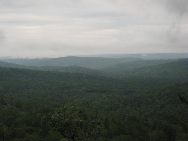
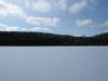
Foggy view from Superior Mountain
Starting on the western end of Little Huron River, a number of rocky outcroppings rise before the large, forested Mount Benison. These peaks do not have official names, but the majority of them are grouped together as Superior Mountain (or Clause Mountain) with the two southern ones as Tick Mountain. While I had visited two tough rocky mounds of Superior Mountain during my Tick Mountain climb, I never attempted climbing the bulk of the peaks. The sheer, south-facing cliffs blocked my usual route from Little Huron Road, and I thought I would have to devote a good portion of a day to climb Superior Mountain.
I headed east along Erick's Road past the two-tracks for Bald Mountain and an unnamed peak, eventually turning north on a wide road that wasn't on my maps. I usually continued east past it, but this led to two fenced off roads and a small group of cabins clustered around the Little Huron River. By heading north, I easily circumvented the cabins and found myself on a road parallel to Little Huron River's last run to Lake Superior. I stopped briefly at the site of something truly surprising, a wooden bridge over the river (I had assumed that there were no bridges over the small stream), then crossed it and started heading further east, uphill, to the base of Superior Mountain.

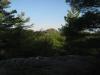
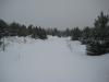
Grassy slope near the first peak
These roads were wide and easy driving, as the entire western side of the mountain had been recently logged. I parked a short distance along it and followed the cluttered paths uphill, eventually reaching the first of many rocky outcroppings. Similar to other nearby outcroppings, the rocky was partially covered by scruffy grass, stunted trees, and bushes, yet offered a decent view of the trees below. This mountain did have particularly steep bluffs surrounding the outcroppings, though, and I had to choose my path carefully. After climbing reaching the first one, I continued to head north and east towards the higher peaks.
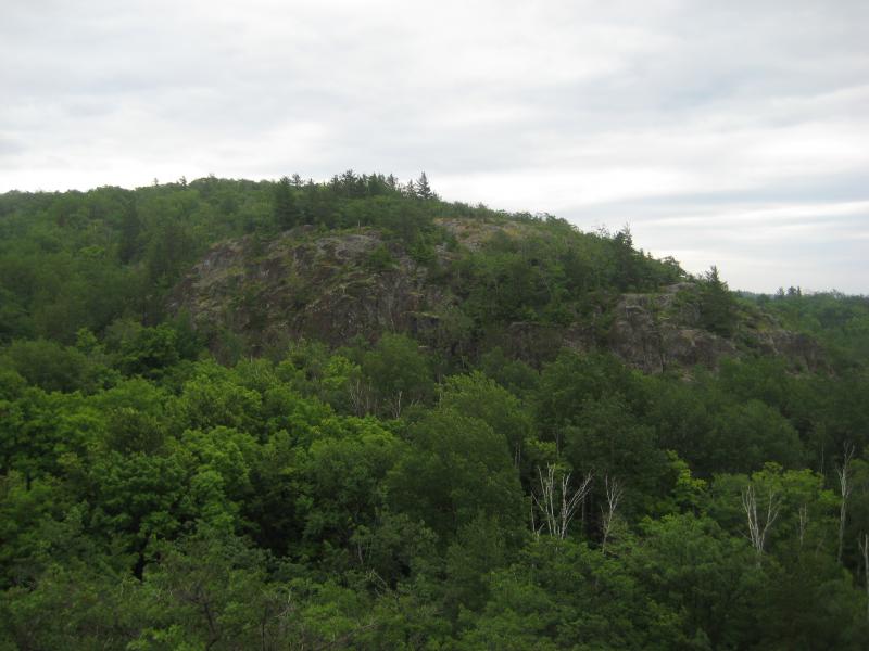
Ominous cliff along the route
Each peak was separated by a gorge - sometimes only fifteen feet high (a fun, if rough, slide down) and other times reaching over a hundred. Climbing up these usually meant looking for a large crack that the earth above had slid down into so we could scramble up, though there were a few gorges we followed out of our route to approach the peak from the north, where the slopes were milder. After a mile of this, we finally reached the eastern peaks and sweeping views of Mount Benison and Huron Mountains, as well as the tiny Cliff Lake to the south. The Little Huron River formed a deep valley between us and Mount Benison, though we had no interest of visiting that mountain anytime soon - it's a private conservancy with few, if any, rocky outcroppings.

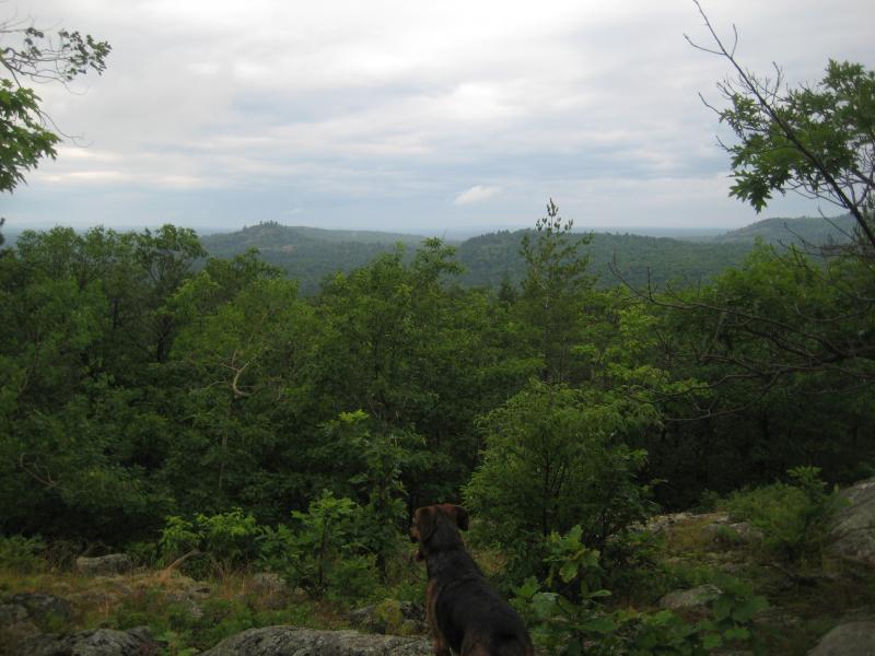
Cliff Lake and Little Huron River valley
There was still two peaks to visit before heading downhill - the 'true' summit of this mountain and Raven's Nest. A USGS benchmark, called 'Super' on topographic maps, was located on a peak a short distance from the eastern peak. About a mile to the northwest was a surprising cliff to the north, one of few in this area, which promised unparalleled views of the Huron Islands and the Keweenaw Peninsula. However, as we were heading to the next point, the sky decided to open up with large, stinging drops and lightning. Logan and I ran into the gorge, thankful now for the limited protection they provided, and ran, slipping, back to the car. Finding our road again was a surprise, as had I stuffed my GPS with the rest of the sensitive gear into my small pack, and we were over a half mile from our original route up. Even though we were both soaked to the skin, Logan and I managed to survive another thunderstorm without injury, and we were happily jumped back in the car to wait it out.
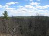
View westwards from the mountain
This was the last of the four major rocky mountains of the Western Huron Mountains to visit, as the others outside of Huron Mountain Club property offer height but no good views. I do plan to visit Mount Benison one day, but as it would involve either climbing over Superior Mountain or hiking around Cliff Lake (both requiring two miles of bushwhacking), I would have to do some serious planning prior to that adventure. Of the four major outcroppings, this one was the most varied and intense, and I highly recommend it to any adventurers in the area.
-
Jacob Emerick
Dec 13, '09
Ha, Logan was having a great time on this hike. He loves heights. The ominous cliff is actually part of Superior Mountain - you can see the location on my hiking map. I know what you're talking about though, with Cliff Mountain... That big ol' cliff was quite scary the first time I saw it. The biggest thing that surprised me when I got to the top was the northern cliffs. I thought that it would be a smooth gradient down to the north, similar to other peaks in the area. Had to make a heck of a detour to continue on to Superior Mountain. What's your usual approach route to these mountains? Those cabins on the south of Little Huron River have the nice access road all blocked up, so I end up parking across from the western most knobs of Tick Mountain.
-
Joel Schuett
Dec 14, '09
I see what you're saying about "Cliff" actually being part of "Superior", I guess I only was considering the knob with the benchmarks as being Superior Mountain! "Cliff Mountain" is a bit more descriptive for that particular knob, though!! As for accessing the area, we crossed the wooden bridge over the Little Huron, and parked on the "main road" where an old, extremely overgrown logging road intersects it. We followed this "trail" up the slope all the way to the base of the rock knob that is the summit of Tick Mountain. Climbing up the knob along the N/NW side, we took in the sights from all directions, then headed down the knob along the NE side, finding a small "slide" in the rock face to use going down (and eventually back up). Once at the bottom, in the short "valley" between the Cliff and Tick knobs, we headed E/SE, and reached the base of Cliff Mountain where the cliff face finally peters out. Climbing up to the top here, we followed the top of the cliff along the north face, curving to the western side of the mountain (where you can get some great panoramic photos looking down onto the summit of Tick Mountain, with Bald Mtn., Pt. Abbaye, Lake Superior, and the Huron Islands in the background), then curving to the long southern side of the mountain, rising higher in elevation as we traveled east along the cliff. We made it about half way along the southern side (heading east) before a nasty storm blew in with 30-40 mph winds, and we got out of there fast- re-tracing our path back to Tick and then back down to the vehicle! I can't wait to get back there for some further exploring! I want to get to the summit of the really bare knob just to the south of Cliff Mtn., I bet the southern face of Cliff Mountain is spectacular when viewed from this vantage point!!
-
Jacob Emerick
Dec 14, '09
The southern face is impressive from the knob! The second time I climbed Tick Mountain (third attempt) I took -almost- the same route, bushwacking a bit more to get to the western rock knobs and climbing up the 'spine' to the east. When I went down the northern side I climbed up two of the southern knobs (though I think there's at least three distinct bumps). They were a bit much for my dog and I, as he started to slide backwards about halfway there and I had to haul him by the scruff of his neck to the next crack. After that experience and seeing the towering cliff in front of us we decided to turn around, taking the small managed pines out. Several months later I returned and climbed Superior Mountain. After hearing your views by the benchmarks, though, I definitely need to return again to check them out. The most surprising thing for me with that area are the sharp cliffs. I assumed that erosion would have made that area nice and rounded, but there are some sharp cliffs and deep canyons there!
Add to this discussion-
Jacob Emerick
Apr 13, '14
Howdy! So that gated road - I'm guessing that was up by Raven's Nest, within a mile of the mouth of Little Huron. I've seen some logging on the north side of Mount Benison (which is weird, thought the whole mountain was on a preserve) that could account for those giant logs. You were a good ways up past Superior if you saw those! If I had to guess I'd say we were in the same area here: https://blog.jacobemerick.com/hiking/huron-mountain-view/.
Add to this discussion