Summiting Mount Lemmon
Faint morning light outlined the bulk of Mount Lemmon ahead, a majestic scene as I eased into Catalina State Park. I paid the fee and parked at Romero Canyon Trailhead on the east end. There were a dozen vehicles scattered around the lot, a surprising amount so early in the morning, and I wondered if hikers in Tucson were early birds or if there were that many overnight campers on the trails. Shrugging on my day pack I headed over to the trail and prepared for the long day.
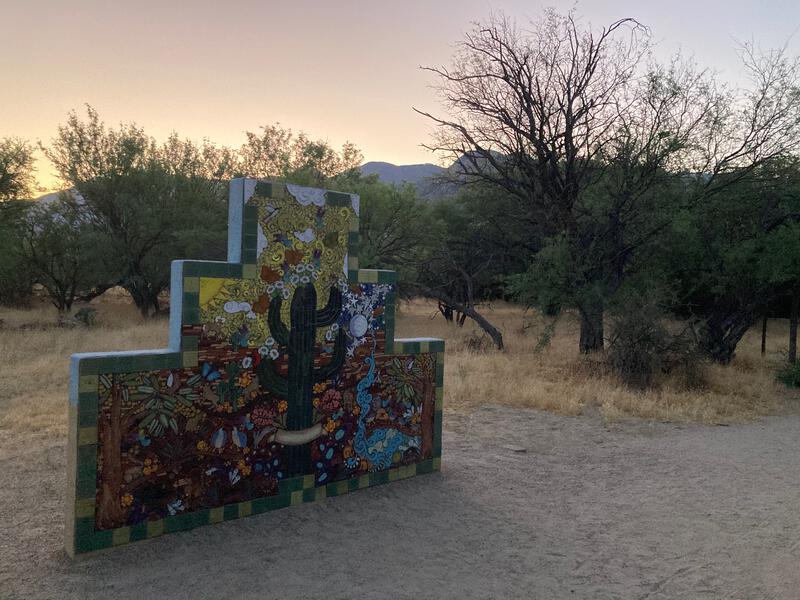
Cool mural at the trailhead
Summiting Mount Lemmon is no small feat. Its a 6500' elevation gain from the park, a true saguaro-to-ponderosa adventure. My route would have me take Romero Canyon up past the pools, through the Wilderness of Rocks, past Marshall Gulch, to the summit, and then down Sutherland, for a total of thirty miles. At least there were several water sources along the loop to keep my pack weight low.
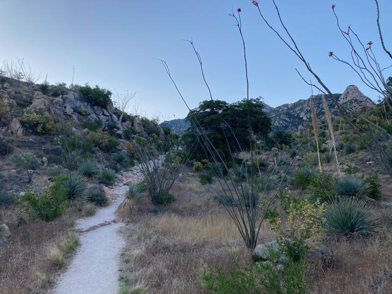
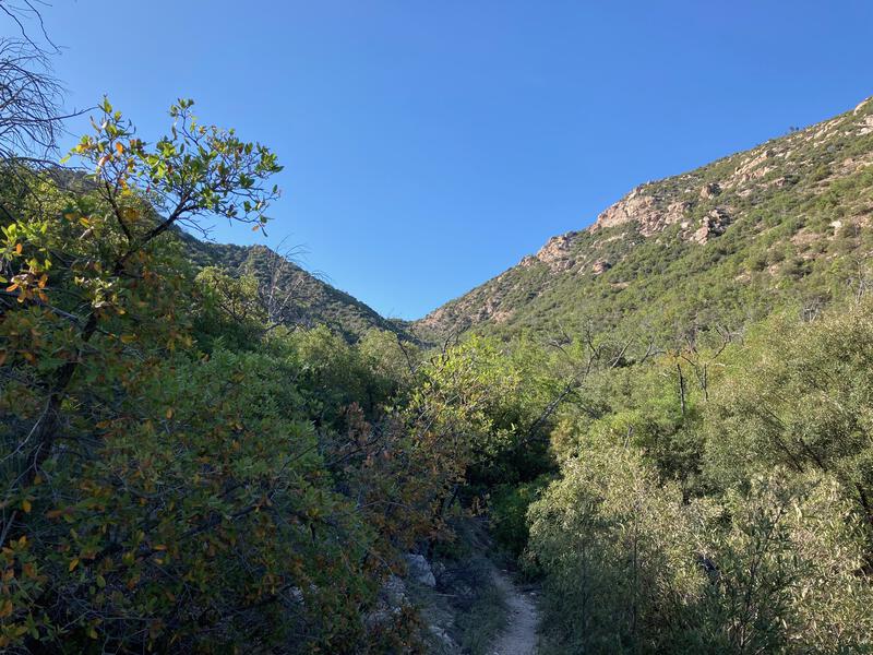
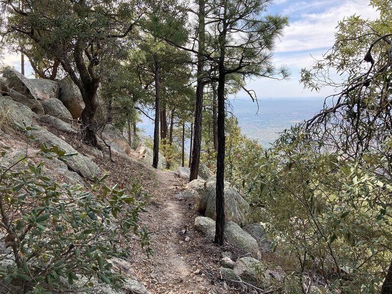
Walking through Catalina was a pleasant stroll, a wide path that was mostly flat for the first mile. Once I reached the park boundary things got steep, hauling up the rocky ridges along the side of Montrose Canyon, and I soon passed a few groups of slower hikers. As much as my legs complained about the relentless uphill climb I enjoyed this section of trail, the solitude and the shade, the mixture of highland desert with sporadic pines, and I was thankful that my early start gave me a chance to enjoy it in peace.

Wide, easy path approaching Romero Canyon
Dreamy path with a mix of vegetation
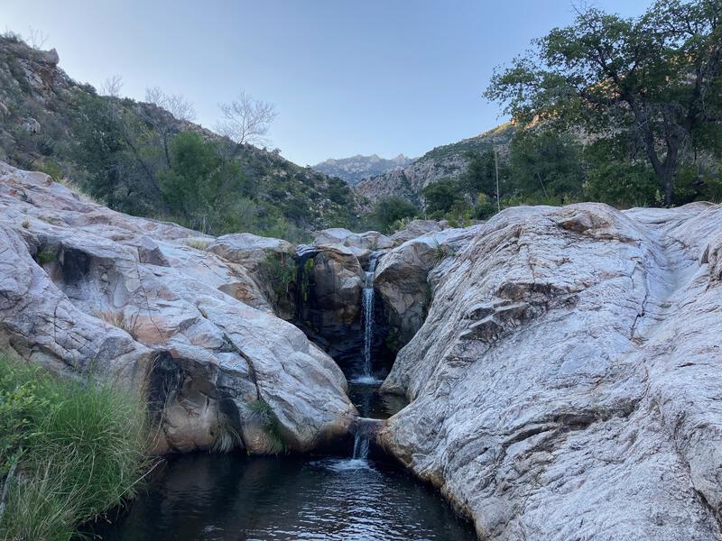
Tiny drops between the pools
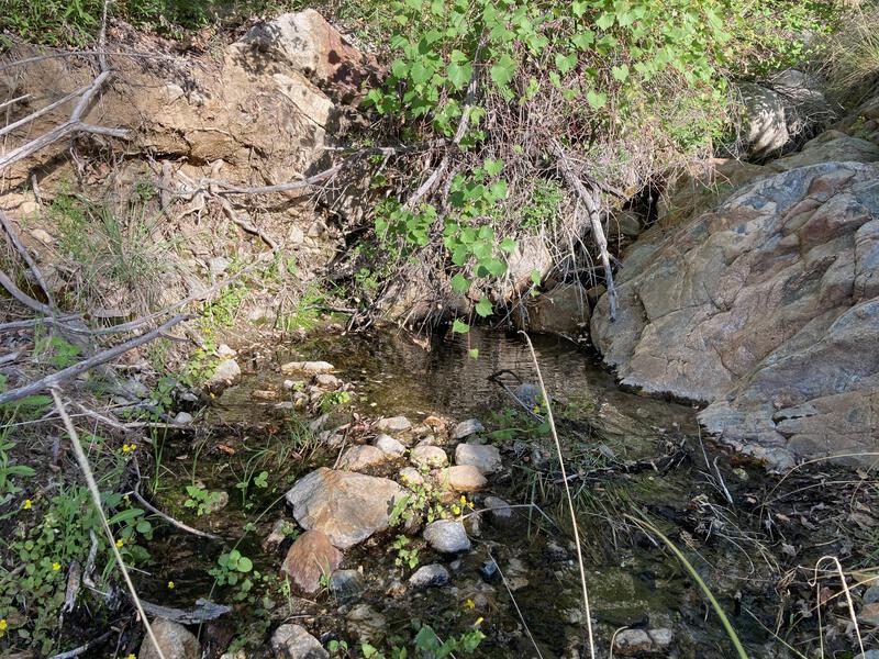
Soon I crested the side of Montrose Canyon and dropped into Romero Canyon, and reached one, then a second, water crossing. I'm not entirely sure where Romero Pools, the popular destination for this trail, is located. Both crossings had pools and both had waterfalls, and there are several more crossings further up canyon. I paused at the second crossing to refill my water and rest for a minute.
Beyond this set of pools was a steep climb, a scenic haul that I pushed hard on, only to be treated to my first blast of sun at the top. Two backpackers were here, packing up for their second day, and I learned that their wives were planning to pick them up from the summit. I left them with some envy. Skipping the whole downhill thing seemed like an ingenious way to avoid serious knee pain. Maybe I could bribe Katie into driving down here and giving me a free ride back down to the park.
First light on rugged rock
Finally, the saddle is in sight
The next few miles dragged. The trail was pretty, defined yet overgrown enough to make me work for it, with plenty of shade and a healthy mix of vegetation. I was just ready to be done with the uphill grind. Every once in a while the saddle would slip into view, although it never seemed to grow any closer. There were a few more creek crossings and nice campsites along the way. Then, after a sandy scramble on all fours, I suddenly gained the last few yards and was done with Romero Canyon Trail.
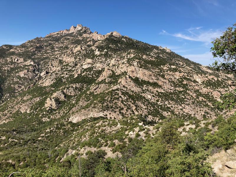
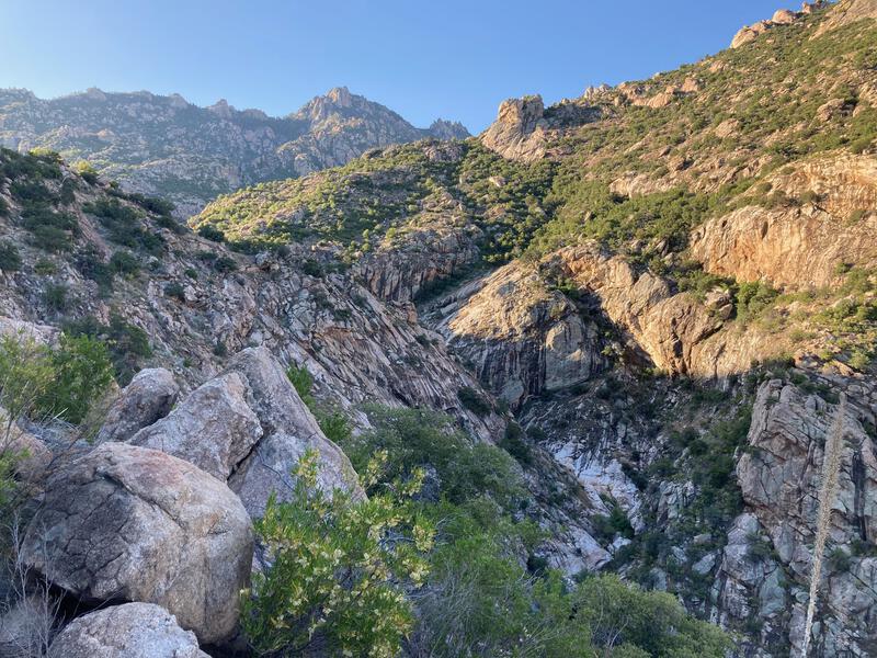
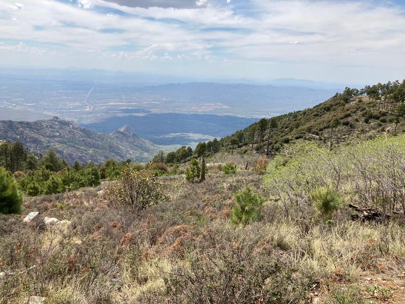
Pusch Wilderness looks wicked
Seven miles done, plenty more to go. I turned north on Mount Lemmon Trail, part of the AZT, and was quickly taught how good I had it this morning. This trail was steeper, rockier, and fully exposed to the morning sun, endless little switchbacks up a punishing slope. I began to pick a spot twenty yards above me, push to it, rest and catch my breath, and then repeat. Motivation was sinking fast right before a most epic view showed up between pines.
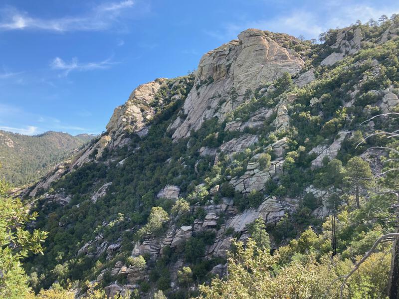
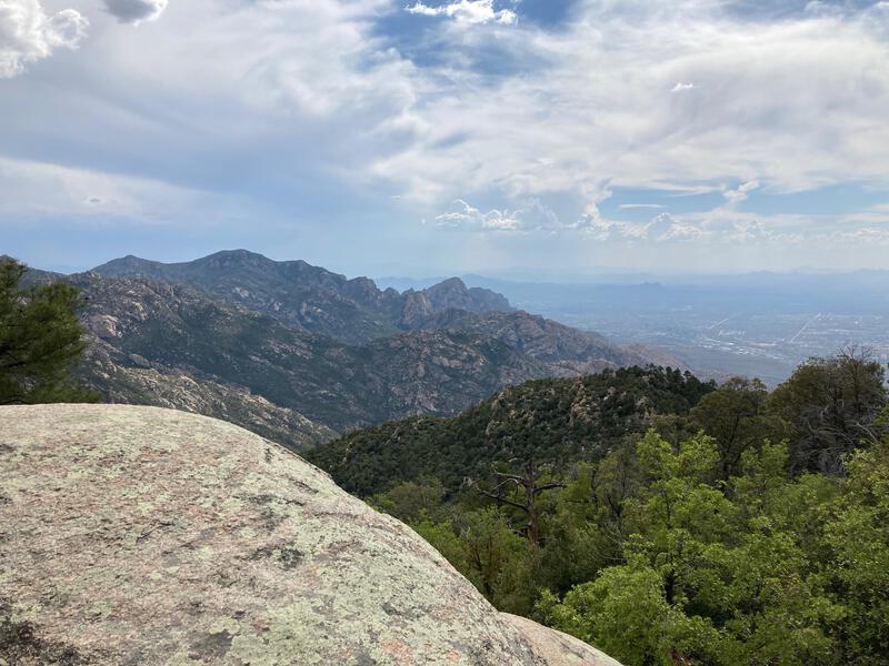
Some awesome bluffs along Mount Lemmon Trail
Unexpected views like that make it all worth it. From this point I found a renewed source of energy and continued on, entering a wonderful ponderosa forest and some nice flat sections, and then a pleasant view of Mount Lemmon itself, right above the turn-off for Wilderness of Rocks. No good hike is easy. I entered the little valley underneath the peak with tired legs and a fresher outlook.
Top of Mount Lemmon in view
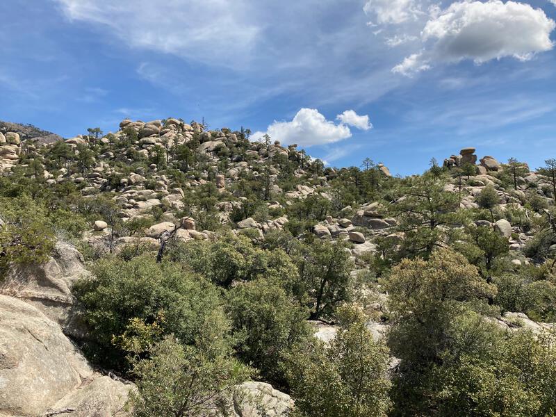
Stacks of rocks in the wilderness
My water bottles were feeling light after the last few hours of hot climbs, so I hunted down a nearby tank and filtered and drank. It was still too early for a full lunch break so I continued on, trotting up and down the little hills through the valley. People began to show up, other day hikers on shorter loops, a few campers in the trees, even some groups of 10 to 12 people. I kept my distance, with the covids and all, yet I felt safe enough outside to keep my buff (a makeshift mask at best) in my pack.
I found a lovely flowing creek with convenient logs for lunch and enjoyed a luxurious mix of meat and cheese. I sat and enjoyed the trickling flow and soft whisper of the wind, glancing every once in a while at the gathering clouds ahead. The shade was nice, the chance of rain not so much. A few minutes after my lunch break and the sprinkles began to show up, a few drops at a time, with only one serious downpour that had me leaning into an overhang to avoid getting completely soaked.
Fourteen miles into the hike and I was out of Wilderness of the Rocks, on Marshall Saddle, and it was about time to finish the uphill climb. Aspen Grove Trail makes a switchbacked climb through a devastated section of forest, a sad reminder of how many times this mountain has burned in the last few decades. (I did this hike in May, about a month before the Bighorn Fire, which has since completely devastated the entire area).
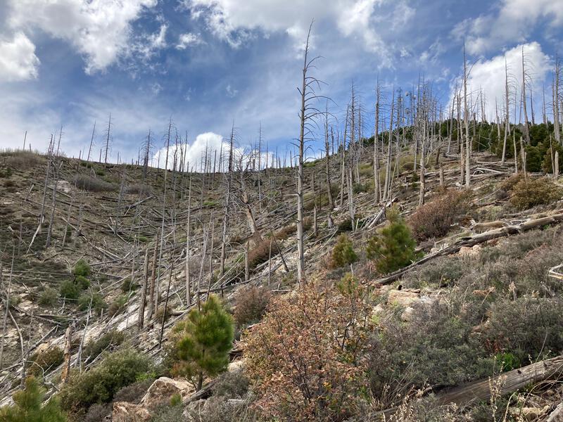
Sad remnants of recent fires
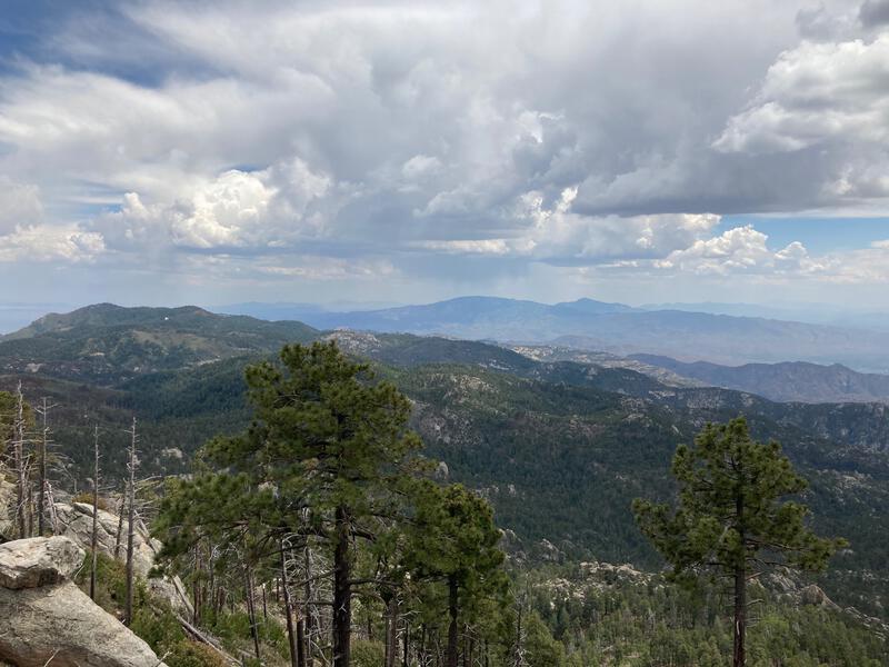
Dark skies raining on the nearby peaks
By the time I reached the top of Aspen Grove Trail I was a sweaty, huffing mess. I blamed it on the elevation and stumbled onto a dirt road, past the communication towers and utility buildings, through a trailhead and onto a paved road, falling uphill towards the summit. A large fence blocked the way. There were families milling around, other people hoping to gain the true summit, and I didn't want to hop a fence with so many impressionable witnesses, so I decided to follow the posted signs and not make the true summit. Somehow I had missed the fact that the highpoint was not publicly accessible in my research.
Feeling bummed and more than a little tired, and quite annoyed by how many people had simply driven up the road to the summit and were crowding the area, I circled around and found a quiet overlook for second-lunch. Sure, it was nice that the Tucson residents were getting outside and enjoying the cool temps on top of the mountain, seeing so many people wearing crocs and sandals and jeans merely cheapened my tough climb. So I sat and watched the distant storms and ignored the din.
Once my water was gone and my food stash severely depleted I got up and headed to Quartzite Spring, a dependable source below the peak. Cool water gushed from an old pipe, a few feet below the trail, making it easy to collect and filter several liters quickly. Curious muggles stopped and asked about the water, asking where it came from and if it was safe to drink and why I didn't just bring more water on my hike, and I rushed my process. Back to full capacity I jumped back on the trail and began the descent. Twelve miles and 6000' sat between me and the Jeep and most of it would be on remote, quiet, and pleasant trail.
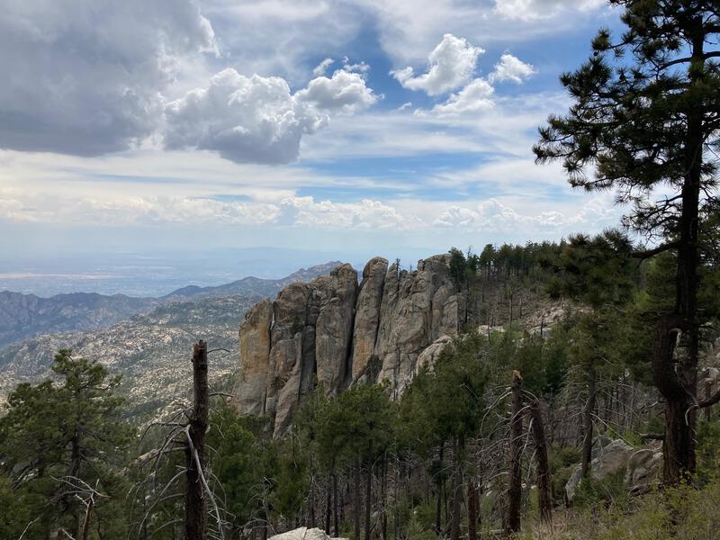
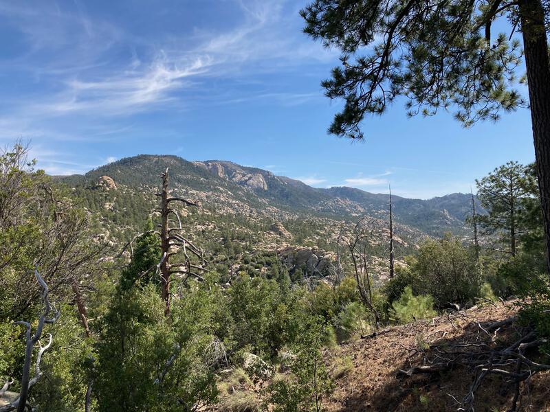
Unique finger rocks along the ridge
Looking down at the long descent ahead
First mile was on an old two-track and was a gentle slope through towering pines, with good views on either side. Second mile dropped steeply through an old burn section with short saplings taking root. Then a sign showed up for Sutherland Trail marking it as 'not-maintained'. I was not expecting to deal with an unmaintained trail today, especially not after hiking all day, and grumpily followed the narrow track through tall grass. The other fork, Canada del Oro, heads north, and does not link back to Catalina State Park, so I was stuck with Sutherland.

A mixture of old and new burns recovering
Longing look over to Romero Canyon
A rare pleasant section of Sutherland
Sutherland Trail was a real challenge. The first few miles were okay, some overgrowth to deal with, the barely-defined tread forcing me to consult with a GPS frequently, and epic views along the way to distract. It dropped fast, sometimes over boulders, which gave me knees quite a workout. Wish I would have gone up this trail and down Romero Canyon. There was only one short section that was completely hopeless, overgrown with manzanita and steep enough to worry me. Overall, though, it wasn't quite as bad as I feared, and before I knew it I was at the bottom of the ridge with a few hours of daylight to spare.
Temperatures had risen during the downhill hike, and most of it was west-facing, so I was feeling a bit parched by the time I reached the base. Cargodera Spring is located off-trail down here and I planned on hunting that down. Before I neared that, though, the path crossed two small creeks, the first of which had a pool of water just big enough to filter water. It was a appreciated find that gave me a little lift after the challenging afternoon.
Unexpected, and appreciated, spring at the base of Sutherland
Soon I exited the wilderness boundary and an old two-track showed up, a rocky affair that rolled and twisted underfoot, threatening injuries with my tired legs. I trotted along as quick as possible, bypassing trees buzzing with bees and fields of yellow foxtails. Then it swung around the side of Sutherland Ridge, entering the State Park, and switching back to friendly singletrack.
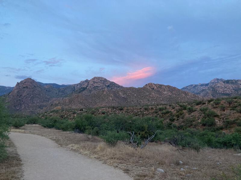
Evening light over Mount Lemmon
Final few miles were a blur. The sun was setting, giving me a welcome respite from the heat. Catalina State Park was busy and I passed at least a dozen groups out hiking, enjoying the hints of desert nightlife. I merely nodded and kept marching along right up until the Jeep was in view. It was a long day, and a long drive back home, but I was thankful to have visited this treasure of the southern Arizona before the Bighorn Fire struck in June.
Comments (0)