Picacho Peak Loop
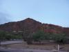
Picacho Peak is a sudden mound of rock located halfway between Phoenix and Tucson. It isn't that tall, topping off at 3,370', nor is it large, especially compared to the nearby Newman Peak. However, it does have a very distinct profile. The sharp spur soars above the desert and provided early travelers a useful navigational aid. Today it is the centerpiece of a state park and the location of a few hiking trails that I wanted to check out.
Okay, this isn't exactly the Mazatzals. On this particular Saturday afternoon I was more interested in a quick challenge than knocking out some more wilderness miles. Plus it was over a hundred degrees out and I only had a few hours to spare. Picacho Peak was new ground, more interesting than Camelback or Squaw, and I figured that there would be few people on the trail. That last part was definitely true - I pulled next to a single vehicle in the Barrett Loop parking lot.
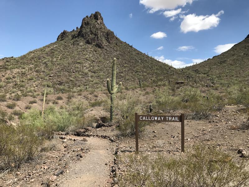
Start of the Calloway Trail
To the trails. There were two that started from here: Hunter and Calloway. Hunter Trail hauled up the north side of Picacho Peak, met up with Sunset Vista, and then swung to the summit proper. Calloway stuck to the north and climbs up a much lower saddle for a eastern view. I decided to do Calloway Trail first as a warm up, a fun little 250' climb over a half mile.
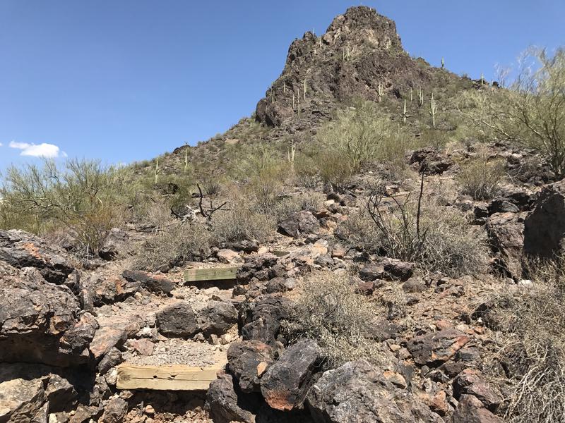
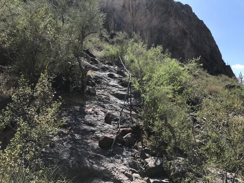
Rough, rocky stairs
This warm up was a bit more intense than I planned for. There were stairs to climb, loose rocks that rolled underfoot, and even some washed-out sections to navigate. Rougher than I expected for a state park. Between the heat and monsoon humidity the sweat started early, dripping into my glasses and collecting in my beard. I pushed on quickly, not giving my legs a break on this first trail of the day, and crested the saddle with a breath of relief.
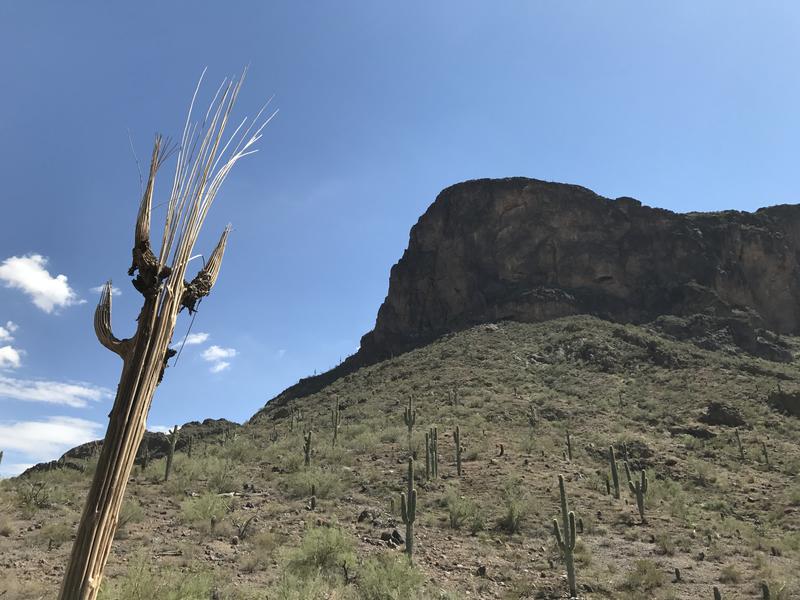
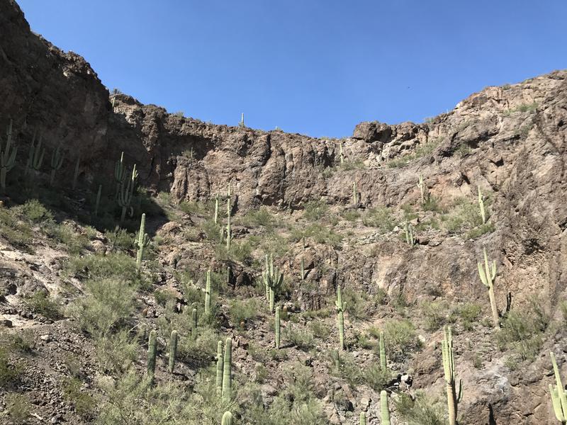
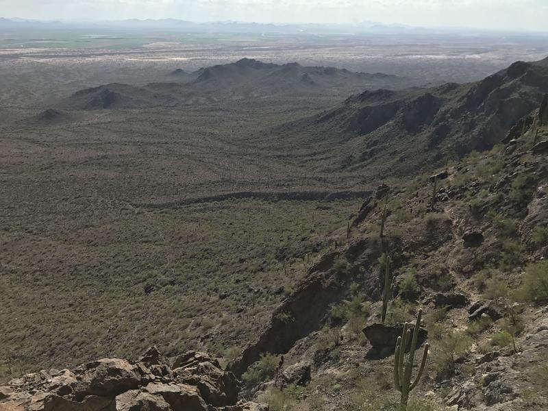
Gazing up at the cliffs on Picacho Peak

Mild vista at the end of Calloway
A view of an RV park and I-10 was all that Calloway gave me in the end, so I took a few photos and turned back without testing the wooden bench. Heading down was easy even as I babied my right knee over the unsteady sections of trail. By the time I reached the trailhead most of the sweat had dried and I was feeling optimistic about the next trail. After all, I had close to a mile behind me - how hard could the 1.5 mile Hunter be?
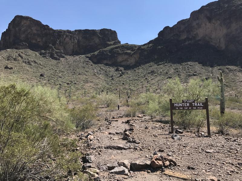
Hunter Trail, to the top
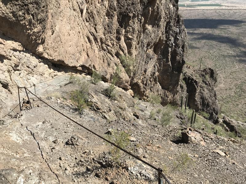
First set of cables, barely needed
For starters, the grade was much steeper. Steep to the point that the rangers had decided to string up some cable assists on the rock portions. They probably didn't have to, as I was able to handle most of these portions upright without any hand assists, and the rocks had grooves and cracks to grab into if needed. The gravel was probably worse, with a few washouts to scramble up.
The amount of desert growth along the trail was surprising. There were washes on both sides cutting deep grooves in the slope, complete with thick, tangled vegetation, and even the ridge the trail followed had a decent amount of trees and brushes. Some areas were thick enough that, when combined with taller boulders, there were spots of shade to rest in. I tried to ignore the tempting shade and pushed on, glancing down on the thin line of Calloway below, not letting myself stop until I reached the cliff base.
Looking down on Calloway Trail
Brief break of shade along the cliffs
I sipped some water and eyed up the mostly-shaded path along the cliffs. Today I had brought along 3.5 liters of water and two Gatorades, which should be plenty for a quick afternoon outing. At least I hoped it would be plenty. After the brief rest I leaned into the rest of the climb and quickly made it to the saddle. The first half of Hunter Trail was done.
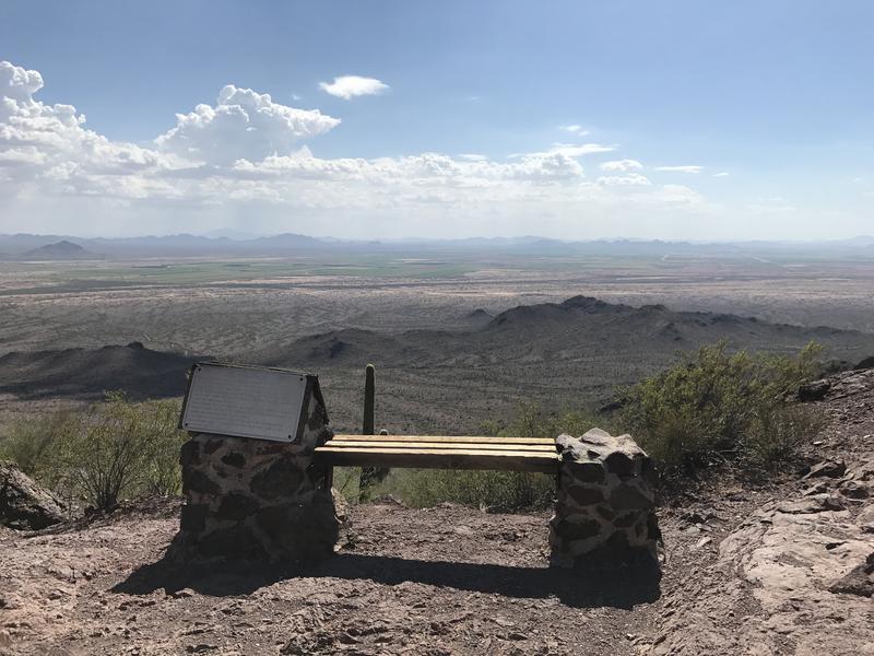
Bench and plaque at the saddle
A plaque and a solid bench adorned the saddle, and there is the first good view south. Which was mostly desert broken by weirdly green fields. There were also some lofty clouds and distant mountains. I know little about the mountains around Tucson, though I've heard that they are tall enough to support mini-alpine ecosystems. Not sure if these peaks in view were that tall, or if those 'sky islands' lived further to the east.
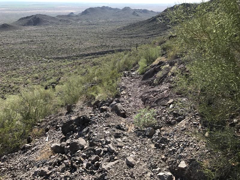
The other thing in view was the trail, which tumbles down the other side of the saddle via a very quick, 250' drop. I pulled on my gloves and started down, using the cables liberally, grudgingly giving up the elevation that I had just earned with so much sweat. Some parts were over solid rock, others over crumbling gravel, and all of it was steep.
Harsh drop on the other side
As I made my way down from the saddle I kept an eye out on the southern flank of the mountain. My next trail, Sunset Vista, was supposed to dance along this side and loop over to the west. I couldn't make it out, though. There were a few paths visible that led south, use trails or abandoned alternate climbs, just nothing that led west. Well, if I couldn't find the trail, I could always just double back. As I was weighing how much fun it would be climb back up to the saddle from this side the junction showed up, alleviating my concern.
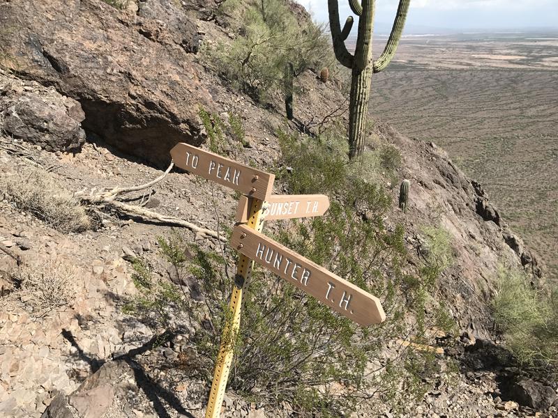
Trail junction with Sunset Vista
Beyond the saddle things got fun. The trail picked back up, climbing quickly up the rocky face, with enough exposure to the south to give my stomach a funny feeling. The cable sections went from being helpful handholds to a necessary climbing tool, and there were even a few catwalks that rattled as I passed over them. This was nothing like Camelback or Squaw Peak - Picacho Peak was definitely in a different league.
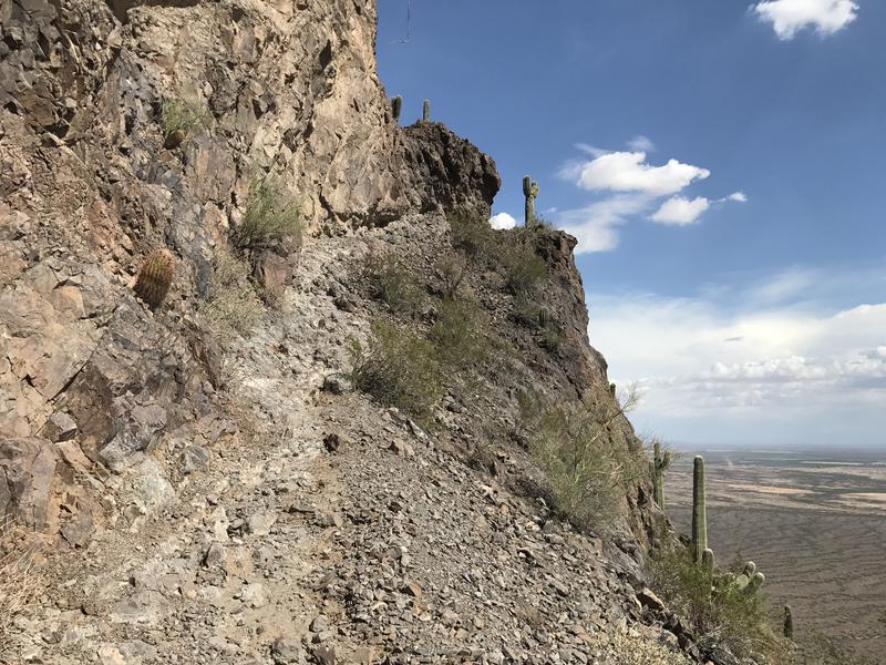
Climbing and more climbing
Some fun climbing along the way
A deep bowl to traverse
On the other side of a sharp point there was a large bowl that showed up, looking as if a giant spoon had scooped out a break from the cliffs. It was here that I finally saw another hiker, a distant blue shirt climbing up the other side. My competitive nature loves a challenge. Instead of pausing to catch my breath I pushed on harder, taking advantage of the lower grade that followed the curve of the bowl, hoping to catch up with blue shirt before they reached the summit.
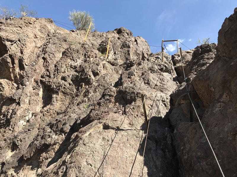
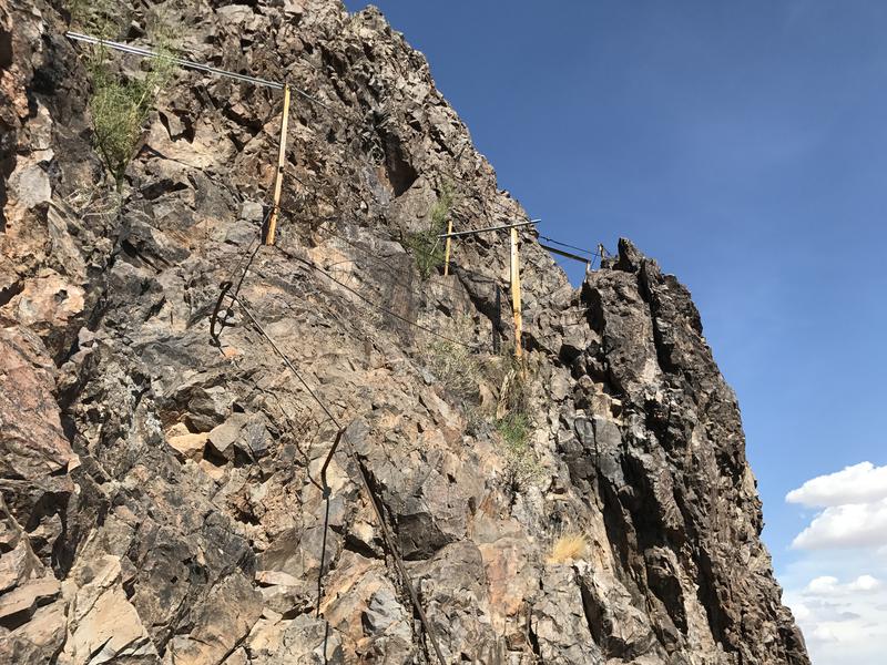
Even more cables to help with the steep parts
Another series of steep cables and catwalks helped me out of the far side of the bowl, and then a couple of ramps led up to the main saddle below the peak. The other hiker was here, resting and watching me haul up with some amusement. We chatted and climbed together, weaving back and forth on the switchbacks. He was a climber from Tucson who was doing some light training before a multi-day trip and had some great stories to share. Not knowing much about climbing or pitches or lines I mostly just nodded and smiled.
The conversation was a nice distraction from the crumbling trail and before I knew it we had reached the summit. I quickly took a few photos of the south and east, the flat desert reaching out towards Tucson and the larger Newman Peak across the highway. Tall clouds to the east were starting to worry me, specifically the dull gray color at their base. I pushed that worry to the side and cracked open one of my Gatorades, sitting on a jagged rock and relaxing for a few minutes.
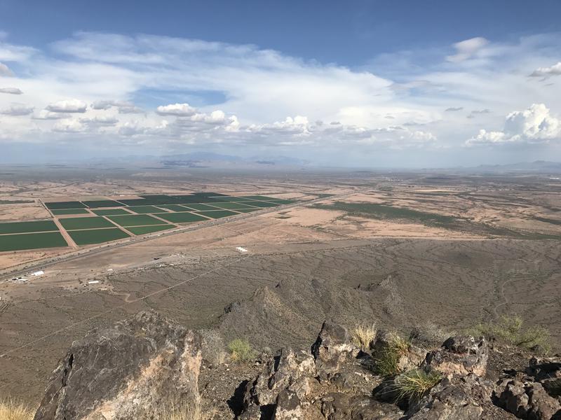
View of Tucson from the peak
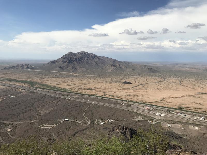
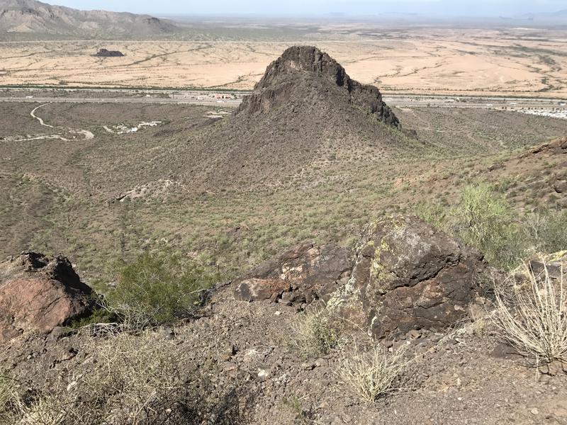
Nearby Newman Peak
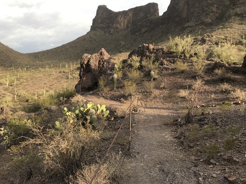
When the climber from Tucson and I decided to start heading down he made it clear that he was interested in checking out a side peak along the way, which sounded great to me. We were moving at two very different speeds and I had many miles to cover before those clouds got any closer. At the base of the peak we parted ways, him heading south towards what appeared to be a helicopter pad for rescues and me continuing down the trail, making a quick go at the steep downhill. I got a little shaky on one of the cable sections, one of those spots where you just have to put your foot down and feel around blind, but made it through the bowl and back to the junction with Sunset Vista Trail.
This trail wasted no time in dropping elevation. Within a few yards of the junction it plunged straight down a rock crack with two cables on either side for the necessary assist. From there it swung back and forth along steep, washed-out switchbacks, often so damaged that I had to hunt around for the proper trail. Things cleared up at the base and I realized that the rest of this route would be along fairly mundane desert, complete with cholla trees and saguaro hanging out along a beaten footpath.
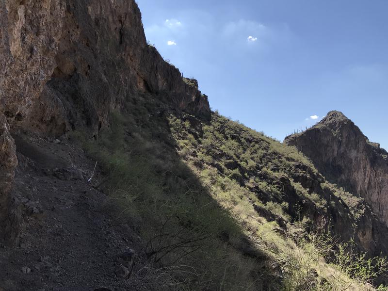
The valley to the south
Crumbling trail down the slopes
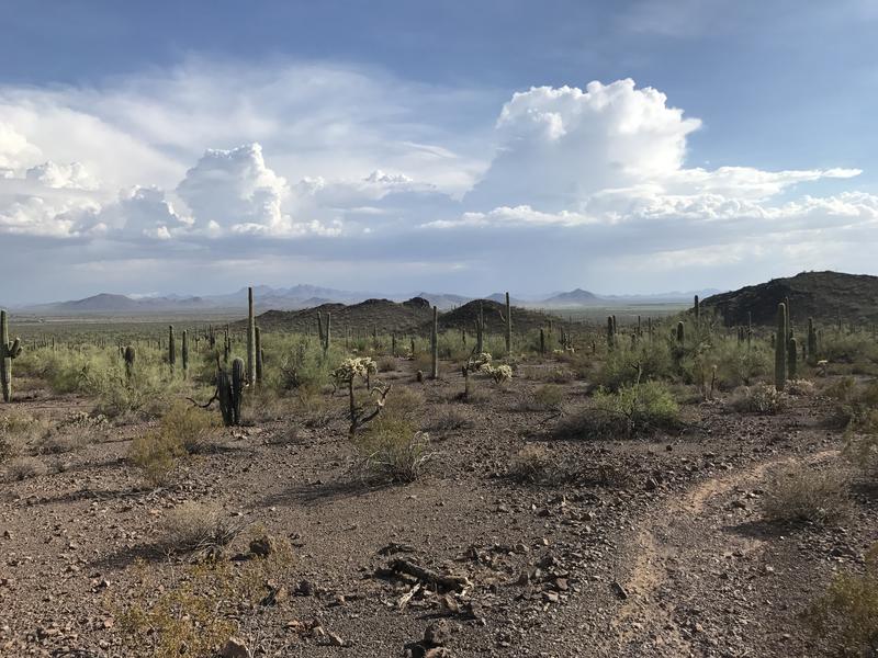
Some big clouds to the south
Two hot miles led me south and west of the bulk of Picacho Peak, two miles of crossing shallow washes and climbing short ridges. It reminded me a lot of Barkley Basin from the Superstitions. A flat trail, stuck beneath tall cliffs and ridges, fully exposed and baked by the sun to the south. If anything this trail felt more barren - Barkley has enough water to support a large plethora of bushes and trees. Here it was just sand and gravel and cacti (and a few small bushes).
One last ridge and I reached the trailhead in the far west of the park. There was no real sign to mark the beginning of Sunset Vista Trail, just a parking loop and path. And a picnic bench. I plopped down and hauled out some water, drinking liberally from my pack. Over halfway done, all of the nasty elevation done, and all I had to do was make my way back to the van.
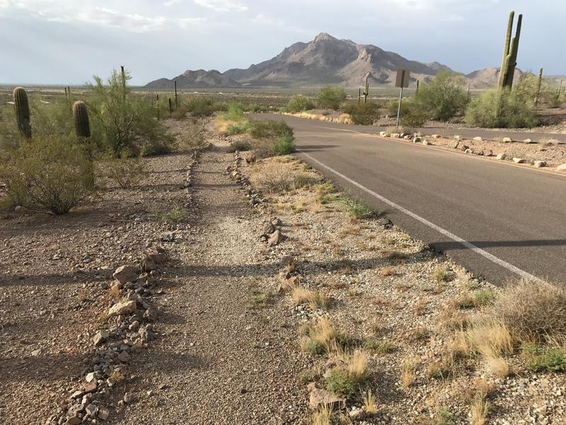
An easy roadside trail
An easy roadside path waited for me, which was a pleasant surprise. I had expected to be forced to walk on asphalt for a few miles. Pushing off with my trekking poles I made quick work of the flat path, watching the different camp areas pass by and the mountain change shape to the south. They seem to split the park into different sections, for group camping and individual sites and special events, each one with a different desert-inspired name. Some paths branched off the roadside one I walked and meandered through these sections, forming a giant inter-connected maze of walking options.
When I returned to the start of Barrett Loop I decided to go on with my planned route and headed towards Children's Cave. There were two reasons for this. First, I did want to check it out, as I plan on bringing my kids down here in the near future. Second, there are only five named trails in this park. I just completed three of the hardest ones - might as well polish all of them in one giant loop.
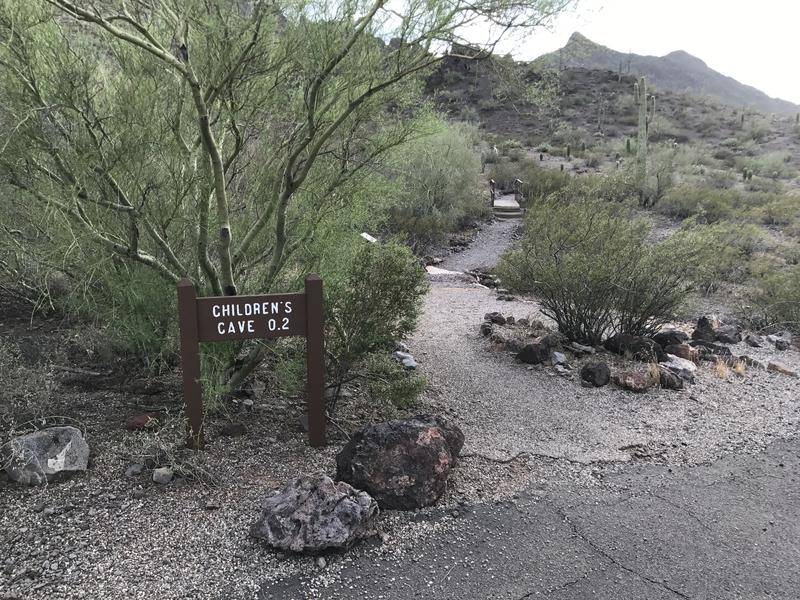
A very short trail to Children's Cave
The end of Children's Cave trail
Children's Cave Trail was shockingly short. It crosses a wash, climbs a hill, and ends. Definitely not worth driving my boys down for. The cave at the end was kinda neat, as was the views of Picacho Peak, but it was just too short for the hour-long drive. Maybe if I paired it with Calloway or something else it'd be worth a family outing.
After that short spur I headed in a general eastern direction, making my way to where I hoped Nature Trail would be. This was the last one trail to check off. There were a few unnamed connectors that wound around here, connecting parking lots to pavilions and making it easy to get confused on what was and was not a named path. By now those gray clouds were right across the highway, and the winds kicked up by the storm were throwing sand and dust in the air. My eyes stung and my mouth felt gritty when I saw my first sign for Nature Trail.
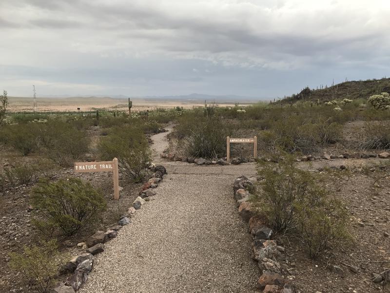
A well-groomed nature loop
There weren't a lot of obvious directions out here. There were a few pointers yet no distinction between one trail and the next. I wandered around, guessing at a few junctions, feeling a cramp creep into my hamstrings. When I bypassed the visitor center I checked out. There was no way that the Nature Trail ventured this far east. (it did) Isn't this outside the boundary of the actual state park? (it wasn't) When I saw a sign for Calloway Trail I turned and booked it south, back to the van and the liter of cold water waiting for me.
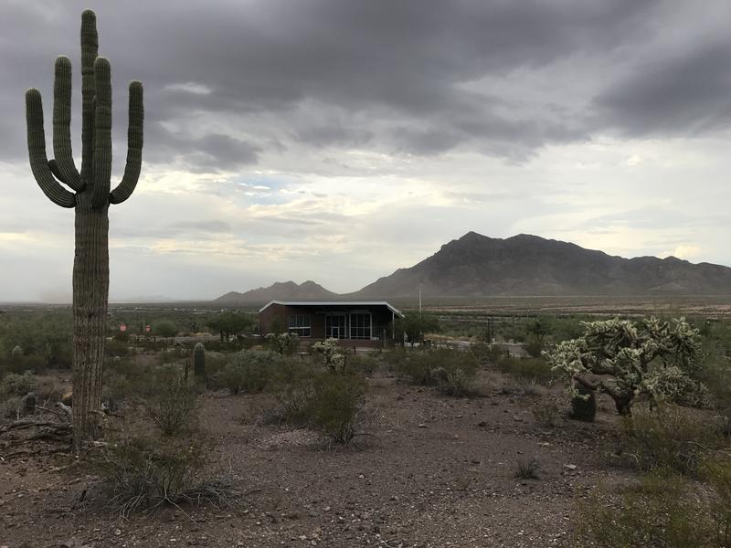
Walking past the park's visitor center
Four of the five trails done in a single, eight mile loop. The temperatures were a slightly more reasonable 90 when I drove over to a nearby Dairy Queen that featured cherry-dipped cones. Oh, I should totally have an ice cream after every hike. As I relaxed in the restaurant I watched the storms roll in over the peak, missing me by a mere thirty minutes. All in all this wasn't a bad little outing for a quick summer afternoon.
Comments (0)