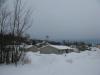
Lakes of Tilden Mine
Tilden Mine, for all its positive contributions to the Upper Peninsula's economy and history, looks like an oozing orange-and-grey wound gouged deep in the green hills of Ishpeming and Negaunee. Summit Mountain, Tilden Lake, and Palmer Lake are remembered only on old topographic maps, completely gutted and subsequently buried under heaps of tailings. The surrounding waterways stink of processing and heavy minerals. Sounds of large machinery echo off the nearby remaining hills. I normally avoid the mine, preferring the quiet of the deep wilderness further to the north and west. Today, though, was the day that I would explore six lakes north of the mine and see what lived under the mine's shadow.
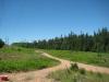
Suicide Bowl Road is a tough, winding track that leads south from Ishpeming/Negaunee. I drove it slowly, avoiding the jutting cracking though the thin, aged pavement and deep potholes. To my left towered three ski jumps up above a small valley, the namesake for this road, and mine tailings rose beyond. It was tempting to park here and explore the jumps but the entire area was surrounded by a tall gate. I shifted down and continued the lurching drive towards the lakes.
The road worsened and I began to watch for a parking spot on either side. The road was too narrow for me to park on the shoulder. When a dirt track led off to the right I turned and parked along it leaving enough room on one side for other motorists. Checking my bearings I noticed that I was a short swamp away from Lake Minnie, my first stop. I was exactly where I wanted to be. I shouldered my gear and continued on foot down the track, slowly circling around to the lakeshore.
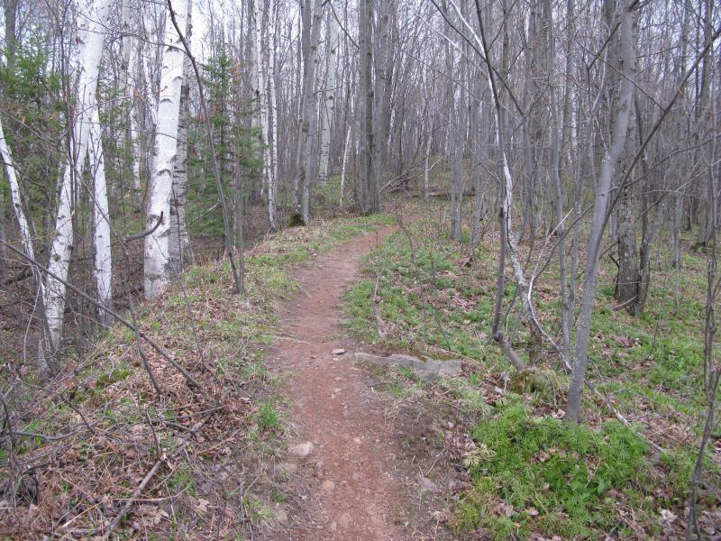
Biking trail through the woods
I would later learn that this area was a popular recreational spot for locals. There are countless bike trails that zig-zag around the lakes, climbing up and down the many ridges here, and plenty of ATV trails too. I had a map with a few of these trails marked, though there were a few legs that I would be wandering blind through. For now there was an easy route, a track that led straight to Lake Minnie, and within five minutes I was standing on a well-visited beach on the north shore.

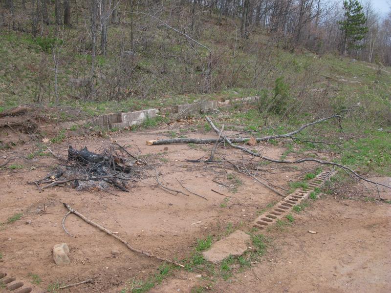
Bonfire-strewn beach on Lake Minnie
The beach was a bit more frequented than I'm used to finding, with several large dark circles from old bonfires and countless tracks criss-crossing the dirty sand. Some rock poked up from beneath the sand, solid bedrock that hinted of a natural shoreline only a few feet under. The wind blew cold across the water, stirring up a few small waves and cutting through my layers, and I left the beach. On the way I passed an old foundation, making me wonder if this was once a city park or something more industrial.
Old foundation on the shore of Lake Minnie
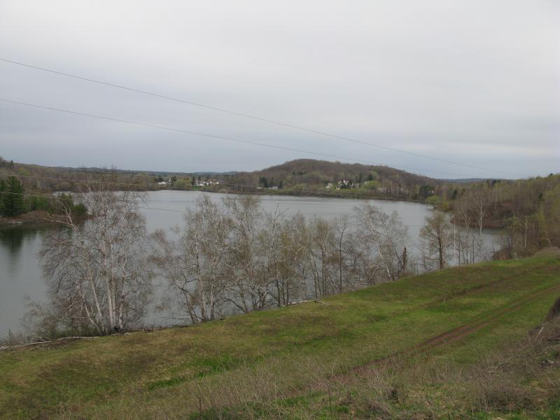
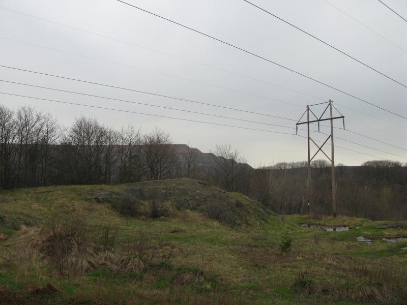
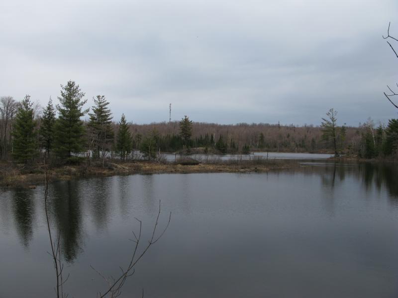
A track led up the north side away from the lake. I climbed the hill, taking in the crisp morning air with sharp breaths, and eventually found a large clearing sloping north. I could not make out specific landmarks ahead of me, not recognizing the two hills or the distant railroad tracks in between. The power lines were a different story. They led west, over to Lake Angeline and Salisbury, and were my easy route to the second lake of my adventure.
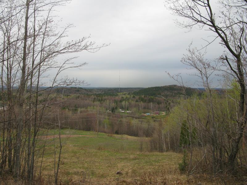
Partial views north towards Negaunee/Ishpeming
There are actually two lines here that slowly spread out in a small angle. The upper ones led to Lake Angeline before bending west to civilization and were the ones I wanted to follow. As I crossed the lower power line I looked down the long straight cut in the woods. Below me was the western shore of Lake Minnie, surprisingly far down already, and there was something in the distance. Way far to the southwest, past several rises and at what appeared to be the tallest point in the area, were two huge squares like billboards. One was dark, the other light. Curious I checked my maps. There was nothing marked there, though I suspected I would pass by them along my route. I would find out what they were in a few hours.

Powerlines stretching over the point on the lake
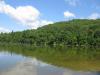
The upper lines led over grassy swells between tall banks of trees. A few rock outcroppings were spread out, sudden steepenings in different spots. Weaving tracks provided easier walking for the most part, sometimes just two ruts in the ground, other times a wide gravel path even enough to handle my small car. It was easy walking on either the trails or the grass (though the grass hid plenty of ankle-rolling rocks) despite the climbs. I should have expected the climbs. This area is fairly rugged, swinging between 1600' and 1400' regularly, and the frequent changes soon tired out my legs. By the time I reached Lake Angeline I decided the shoreline view, a drop of about a hundred feet from the power lines, wasn't worth it. I stayed up on an outcropping to take my pictures of the grey waters and distant houses of Salisbury.
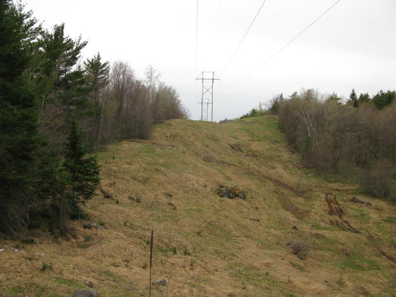
Grassy rolling land under the powerlines
Lake Angeline and Salisbury beyond
It was time to start heading south. I backtracked a distance, unwilling to lose any elevation along the eastern shore of the lake, and found a convenient trail heading into the woods. The trail was definitely multi-use. ATV tracks, bike treads, footprints, and horse hooves all marked recent passage in the soft mud. There were a few huge puddles that I had to inch around to stay dry (they looked well over a foot deep and spanned the entire trail). Before long I was on a new power line, the lower one that had only spread south a few hundred yards since I last saw it, and was faced with a deep gorge. I couldn't even see the mysterious squares beyond the sharp wall of rock on the other side.
Steep rock face with no easy way up
My original plan was a frontal assault. There was no easy way down or back up. If only I could reach up to the power lines and zip over the wires. I shrugged and turned around. Maybe the trail that led me to this gorge would give me a way around.
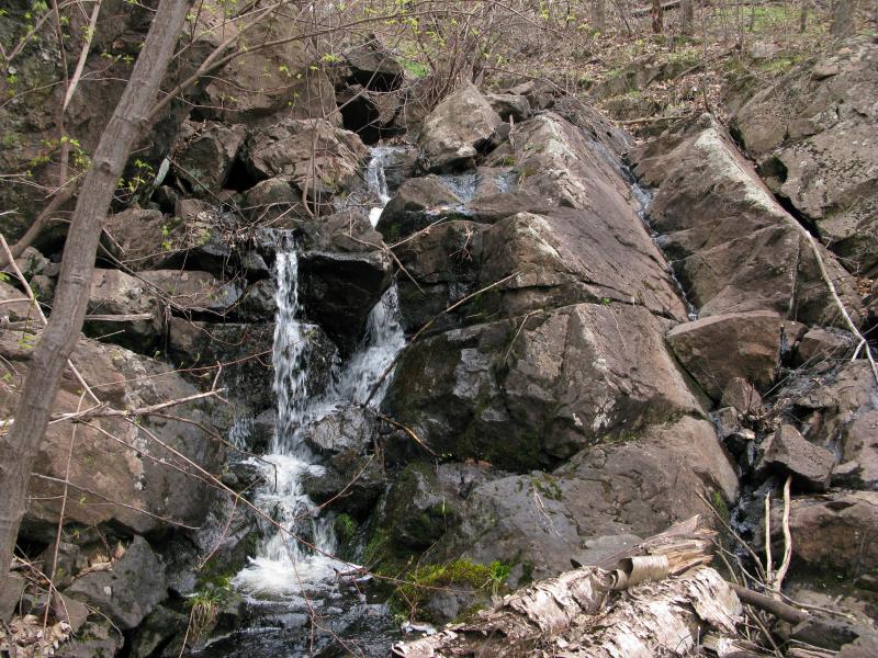
The trail worked out, sort of. I still had to drop and regain a hundred feet to continue along the power lines. At least I had a dirt route to follow instead of clinging dead brush and unsteady rock. When I reached the bottom I heard the faint sound of falling water off to my left and veered over to check it out. A small unmarked inlet to Lake Angeline, the tiny creek that was at the very bottom of the huge gorge, was overflowing an ancient rock dam. The tiny little waterfall made for a cool hidden spot, barely within sight of the trail, an ideal break spot for a weary visitor.
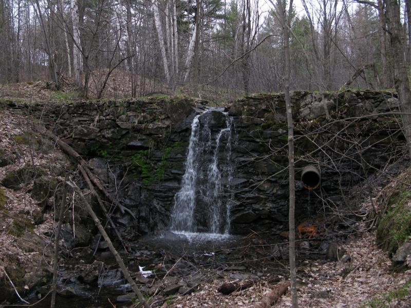
Tiny little dam and seasonal waterfall
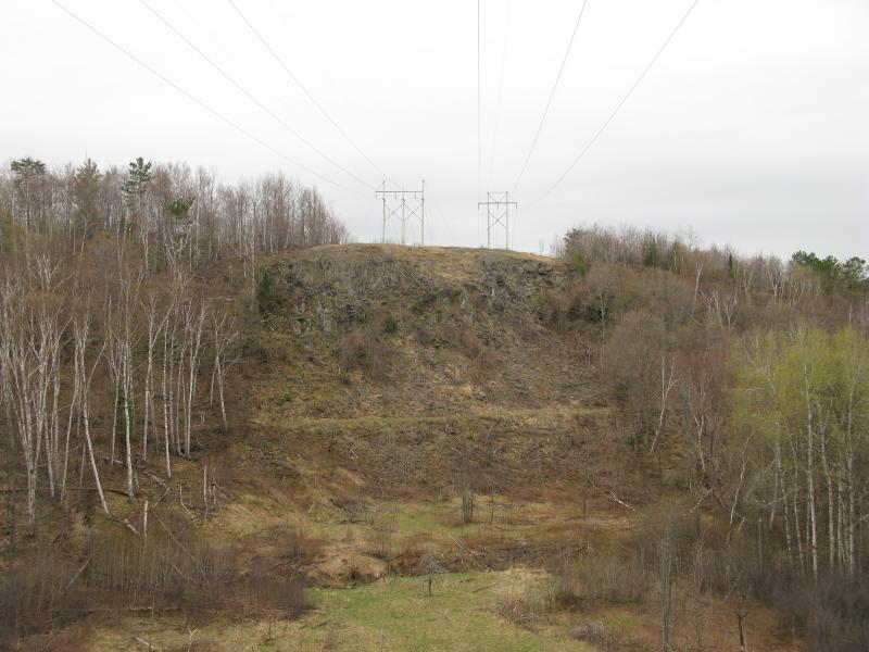
I headed up the trail, staying on the left side of the power lines. I still wanted to reach the highpoint, which was beyond the top of the gorge, and I also wanted to eventually get to Lake Sally, further south than the highpoint and the strange squares. The main route turned at the base of the rock face and I stayed straight, quickly gaining elevation as I made my way around seasonal flows that eroded away the trail under my feet. It was a quick climb followed by a wandering path followed by another sharp climb. When I finally broke out from the woods again I was worried that I had passed by the highpoint along the punishing track. I had not. I stood upon the highest point of the hike, almost 1700' above sea level, at the very base of the huge square reflector plates.
Looking down from the highpoint

Giant radio reflectors on the highpoint
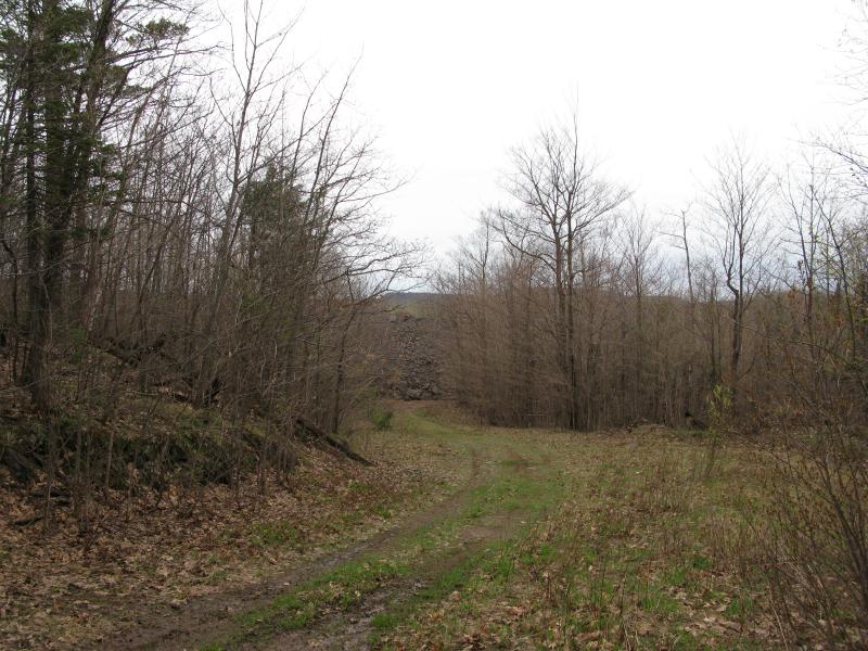
Waste rock tiers of Tilden Mine
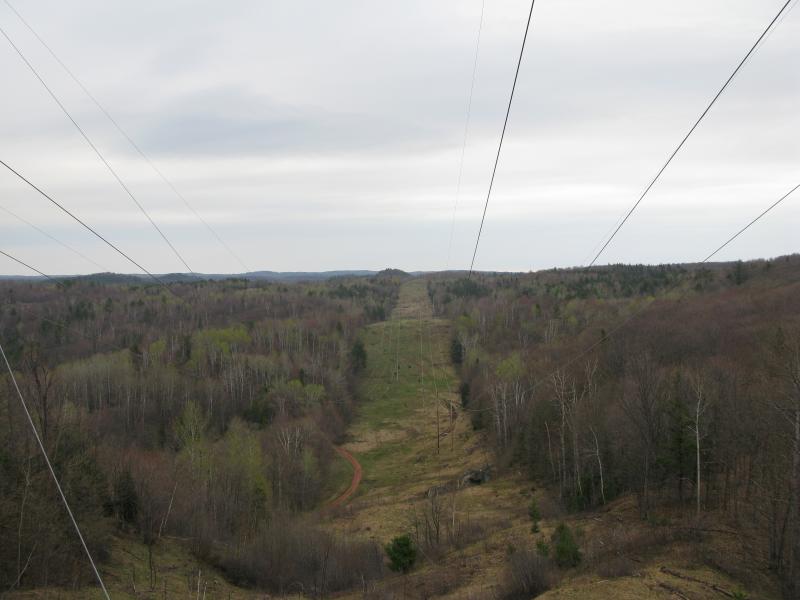
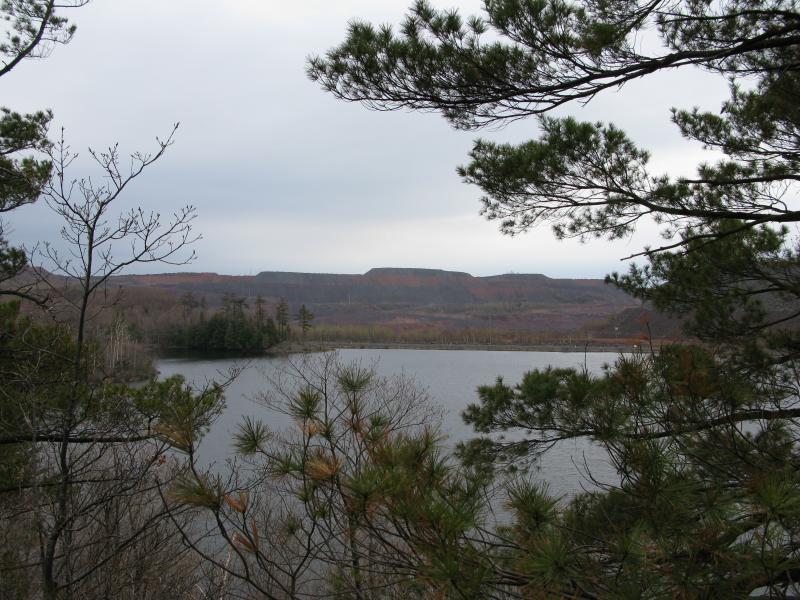
Plenty of cool views opened up in front of me. Back along the power lines, to the northeast, were several sudden dips and swoops that were almost dizzying to look down on. I couldn't make out the exact gorge that I had turned from, hidden behind the first rise, but it was a fantastic view down and over the woods. The huge squares I had puzzled about earlier were just a pair of reflecting microwave plates for some unknown distant purpose. To the south rose several layers of Tilden Mine tailings beyond the trees, the first view of the piles since I drove past Suicide Bowl. They looked more like pyramid tiers now than waste rock, like a half-finished monument to some deceased figurehead of government.
It was time to head south to points three and four, Lake Sally and Grass Lake. The plan was to simply bushwhack the short distance down, but that was before I started finding trails to everywhere. A short backtrack into the woods brought me to a side track that looked promising. Within ten minutes I was strolling through a large camping spot right on the shore line of Lake Sally, complete with a rope swing and several campfire rings.
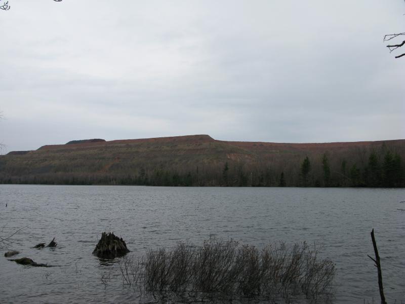
A slight misty rain had started while I was up on the highpoint. By the time I reached Lake Sally the sky had decided to actually rain and I tried to stay underneath the thicker stands of trees. There were no leaves to truly provide cover, only bare branches and thick trunks, so I moved quickly in hopes that the rain didn't last long. Instead of dawdling at the campsite I booked over to a small outcropping overlooking Grass Lake, crouching underneath some dead brush to watch the lake get pelted. A nasty odor rose from here, leaching from the mine and awakened by the fresh rain, and I realized that these were the headwaters of Ely Creek. That explains the foul scent of that waterfall by National Mine.

Grass Lake and the mine beyond

First view of Lake Sally
The rain soon died after I returned to the shore of Lake Sally. I had an ambitious plan now. I made my way over the dam on Lake Sally, the small cement structure that lets the water pour down the far side, and started along the south shore of Lake Sally. I was hoping on following the south shore along the footings of the tailings piles all the way pass Ogden to the east.
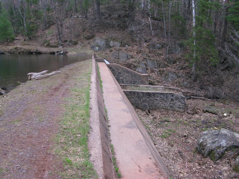
Overflow dam between Sally and Grass Lake
A half-trail led along the shoreline, a forgotten road or overgrown railroad grade. Bugs seemed thick on the south shore, possibly stirred up by the fresh rain fall, and I pushed quickly over the flat ground. This route would be a bit risky, passing up on the lower tiers of waste rock at several points, and I was excited to see the stuff up close. A sign showed up rudely, thrusting out of the overgrown forest towards me. Cliffs had marked their property well here. I turned around, not interested in trespassing, especially on potential blasting ground.

Angry sign near the mine pilings
Once I recrossed the dam I decided to try sticking to the north shoreline. It was easy for a while, mostly flat with a few good views over the lake to the pilings. Then I bumped into the swampy section. I bet that this is normally dry for a good part of the year, or at worst a few narrow trickles of water through tall grass. Today it was sodden. Tall rock outcroppings rose up on the other side, further discouraging me, and I turned back to the trails. It was hard to persuade myself to bushwhack through the thick forest when so many convenient paths were nearby.
Long ridges of the mine across Lake Sally
The next stop, Lake Ogden, is an interesting one. It is connected to Lake Sally via a small channel, almost one large lake if it wasn't for the thirty-yard narrows. Back on the trail I headed east, hoping to stay close to the lakes. The trail did. It winded around a lot but stayed on an eastern course, keeping to the lowlands, forcing me to inch around more bottomless puddles.
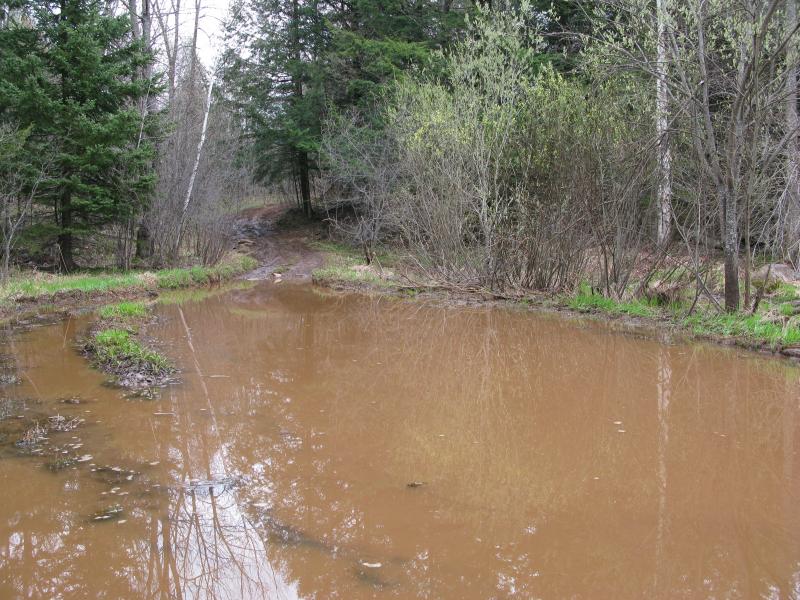
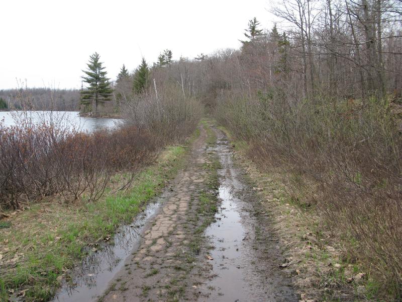
Large mud puddle along the trail
More from intuition than anything else I eventually cut on a side track and found myself back on a shoreline near a campsite. I was directly on the narrows between the two lakes. There is a two-track on the opposite bank, directly across the way, making me wonder if a ferry or bridge once spanned the shallow water. I poked around, not finding anything obvious to hint one way or another, catching a good view east into Lake Ogden. I had now visited five of the lakes and the final one, Lake Miller, was only a short hop above me.

Very close shoreline between Lake Sally and Ogden

Looking up into Lake Ogden
I headed east, along the shoreline, and drifted through some recent logging. It was the first obvious sign of cutting during my entire hike. I wondered how they hauled out the wood. There were plenty of two-tracks and various states of repair, but it was still several miles out to Suicide Bowl Road. There could be a side route over to Salisbury that I missed, or maybe one that led east past Lake Miller. As I wondered I came upon another camping site complete with a rough bench on a outcropping overlooking Lake Ogden to the south. It was surprisingly pleasant, even with the harsh industrial sounds clanging over the water.
Rusty tailings across Lake Ogden
Little campsite on the rocks
Swampy south end of Lake Miller
Cutting down the hill I found the outlet of Lake Miller, a series of waterfalls leading down a narrow ravine. With the lake being their only real source of water I doubt that the drops flow during the summer months. On the opposite bank I was forced to push and hack my way through thick brush, thicker than I had encountered so far. I was close to the road I had came in on, Suicide Bowl Road (that turned into Cliffs Drive beyond my parking spot, I think). When I finally broke through the nasty dead web I just about stumbled out on the road, right behind a large yellow gate. To my right was the base of tailings, and to the left was the gate. I was on Cliff property.
Small waterfall emptying Lake Miller into Ogden
Bottom of the tailing pile spilling onto the old r
The gate was open and there were recent tracks leading past them. I hurridly crossed to the legal side, assuming that there were some mining workers out and about in the area, and then paused to examine the road. It had been paved at one point. Years of neglect and seasons had turned the flat asphalt into narrow treads, covered in water and growth in sections, yet still a proper road. This may have been one of the mine's main entrances long ago.
Ancient cracked pavement below
The road curved and snaked along the eastern shore of Lake Miller. I followed it, skipping past the spots where water flowed either into or out of the lake, and enjoyed the occasional view over the lake. This one is one of the more interesting ones, a large island in the middle with pines and swamps around the fringes, and seemingly removed from most visitors. This was the sixth lake for today, the last Tilden lake to visit, and I enjoyed the easy scenic route along the shore.
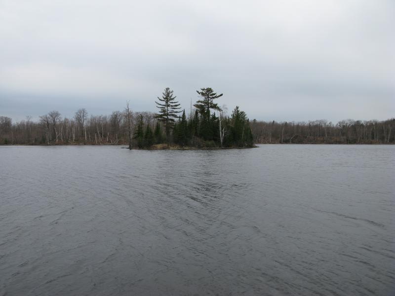
Lonely island on Lake Miller
After leaving the wetlands near the lake the road seemed more solid and defined. Paint markings were still visible on the surface and water ran underneath through culverts. I did notice a few interesting signs of how rushed the road was laid. There was no grade put down first, just pavement poured over the ground, and large rocks (and even old stumps) poked through areas where the road had settled. This furthered my belief that the road was an old mine entrance, a short-term route that was outgrown and forgotten as the mine continued beyond it's expected lifespan.
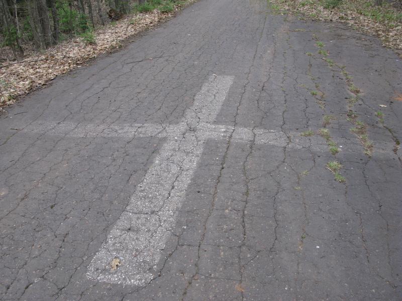
Fading paint on a cracked road
Finally I got close to my starting point, Lake Minnie. The water winked through the trees ahead, marking an end to the hike, and then the gate showed up. The Cliffs boundary was this far north, not the first gate by Miller. Confused and frustrated I stepped over the gate, wishing that the land by Ogden and Miller had been better marked.

Another gate, this one by Lake Minnie

Slightly different view over Lake Minnie
Even if the last few miles had been on private property the hike was still a good one. I had visited the six lakes north of Tilden Mine and gotten plenty of good views up the rock piles. Even if the water had stunk and the mine's noises permeated the woods it was obvious that plenty of people enjoy this land for various recreational purposes (even though I did not bump into a single person this morning). I left the mine glad to have visited… and swiftly headed north to quieter lands in the north.

-
Jacob Emerick
May 5, '14
Ah, thanks Jane! Yes, I definitely don't know the area that well. But the ashes and tracks near Cedar Lake really showed off how much activity goes on there. Must be a lot of fun to hang out there with a group of friends, even more so back when there was a changing house there.
Add to this discussion