Keweenaw Hike - High Rock Adventures
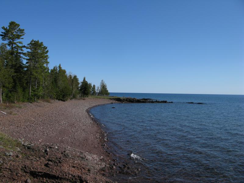
Cool air issued out of the hole of the woods like the gentle yawn of a waiting giant. It was surprisingly tough to leave the open air of the shoreline, with Lake Superior's vastness sitting always to one side, and enter the closeness of the forest. I stepped away from the Keweenaw Rocket Range and followed the access road on my way to Schlatter Lake.
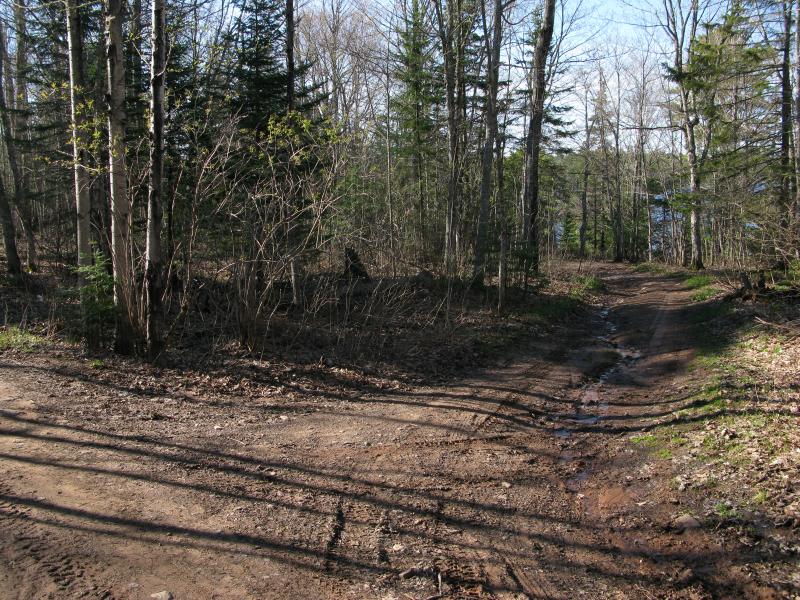
The dirt access road was not built to last. It bucked and weaved around rocky areas and wetlands with the occasional dip of one side or the other into mud, a twisted little drive that would slow down motorists and bog down most cars. As I followed it west I munched on an apple. For once I was well stocked with food and supplies. I usually try to tough it out, carrying a granola bar or sunflower seeds for a hike if anything, but today's adventure was different. I had already travelled six miles and had another fifteen to go and I didn't want to sputter out. In a backpack I carried fruit, half a dozen bottles of water, beef jerky, trail mix, and more, and I was eager to take advantage of this small fortune in goods with an early morning breakfast.
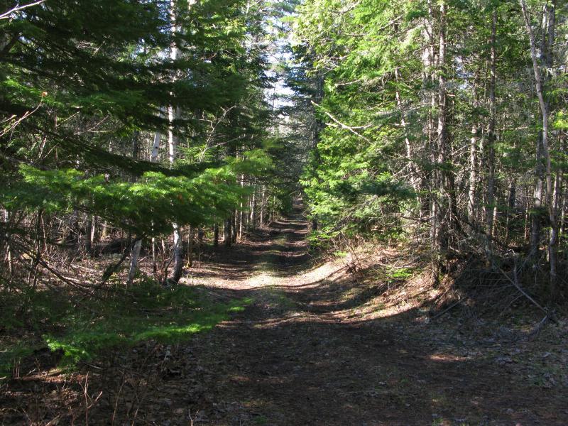
My route was easy and I soon bumped into the High Rock Road which led right past Schlatter Lake. This road was much wider and could possibly support a small car (though not this early in the year). Along my walk I passed a pair of bikers, all decked out on their little sport bikes, a reminder that the day was passing and people were already up and stirring. I increased my pace, ever worried that I would run out of daylight on this hike.
Narrow track leading down to the lake
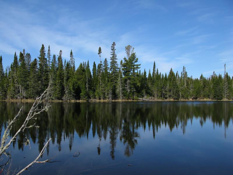
The lake began to show up on my left through the trees. I wasn't entirely sure when to cut down, doubting that there would be an access point, yet hoping to get a good angle of the island near the middle of the lake. A deeply rutted path showed up soon enough and I cut down, passing some camping spots, and then plunged down to the lakeshore. There was an access point, complete with ATV access, and I stood upon the open shore of Schlatter Lake.

Forested island on Schlatter Lake
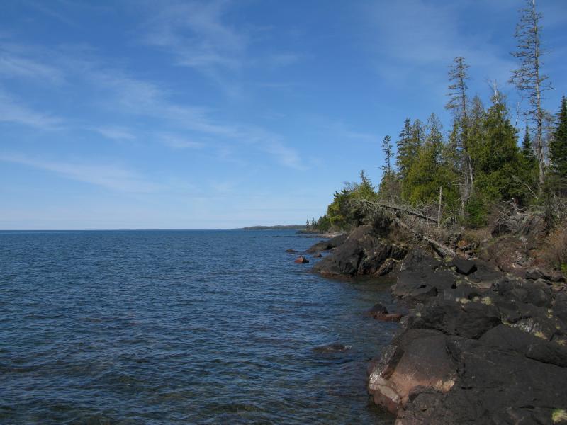
Foreboding swampy eastern shoreline
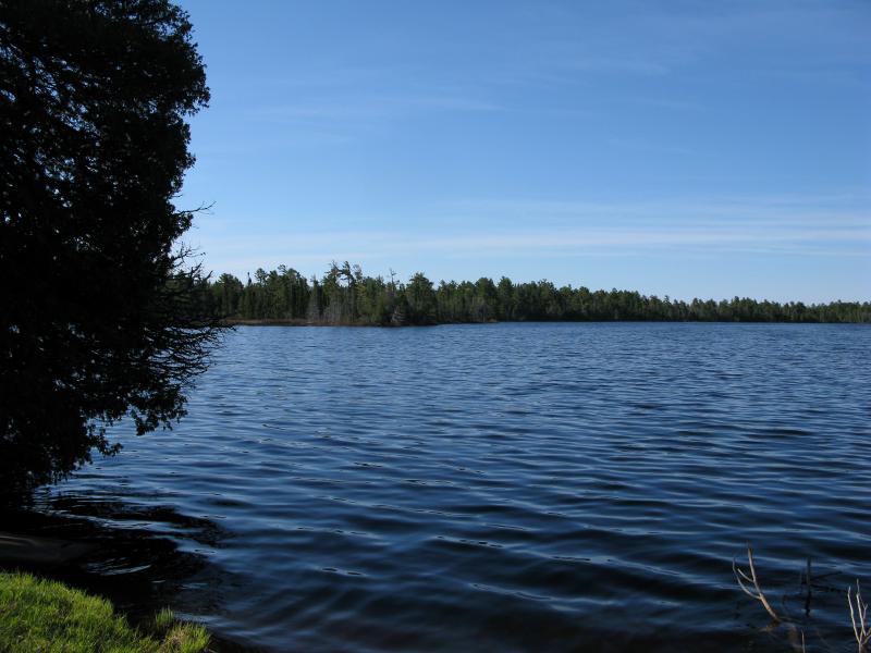
This destination was not really along the shoreline and had taken me close to a mile away from Lake Superior. Still, the detour was worth it. Schlatter Lake is not quite the easternmost lake before the Keweenaw ridge sinks below the great lake (Gill Lake by High Rock takes that, or Perch Lake on Manitou Island if you count that), but it is still a big body of water with a cool island in the middle. I've heard that there is a cabin in the area, either on the island or on a distant shore, and a canoe waited here to take visitors to and fro. I didn't have time to try a paddle and turned away, heading back to Superior, wondering if I could bribe someone more familiar with the area to take me there someday.

Waiting canoe for future visitors
This time I stayed on High Rock Road, passing the access road to the Rocket Range, though not before noticing a thin track leading south past the east shore of Schlatter Lake. There may just be some roads here in the far southeast of the point. My assumption was that I would be losing all easy routes as I continued around the Keweenaw, that I would be stuck on the shoreline for the next bunch of hours. Maybe I would get lucky and find another shoreline road, like the one up on the north shore. (Spoiler: I did not.)
Narrow track to High Rock Point
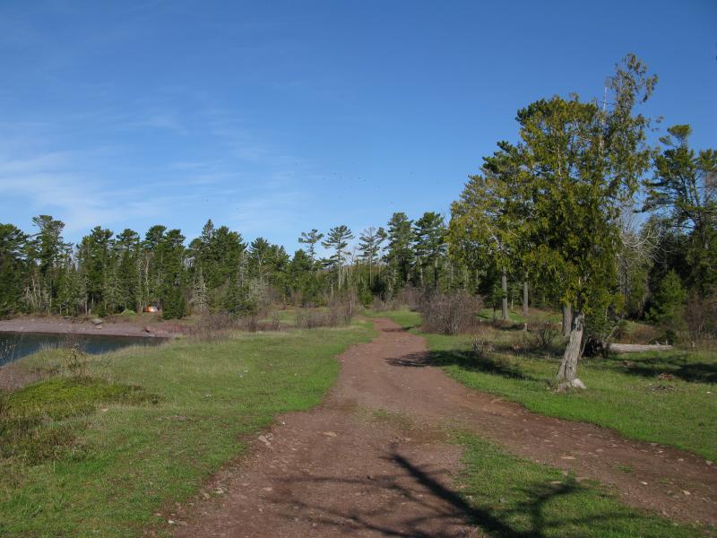
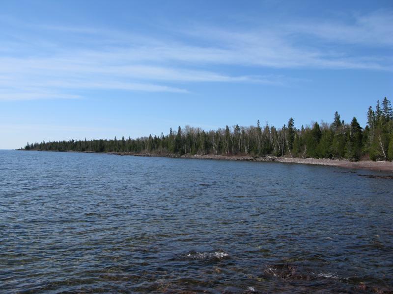
High Rock Road narrowed then straightened and I could make out the cool blues of open sky and cold water ahead. Before long I exited the woods and stepped onto the open sunlight again, blinking while I looked around at the open space about me. Wide meadows sat to my left, offering plenty of camping spaces, while High Rock Bay yawned to my right. It felt good to be back near the lake.
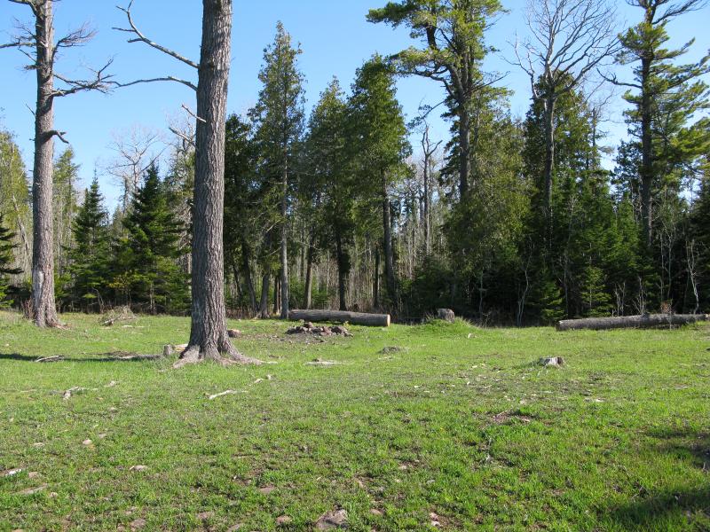
Wide clearing for camping spots
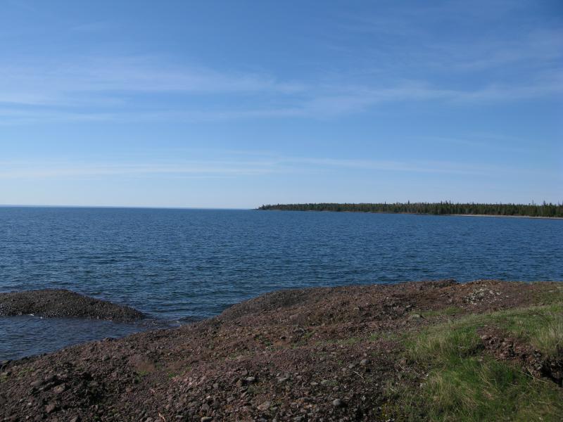
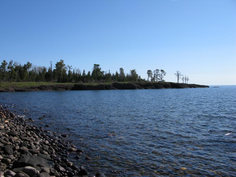
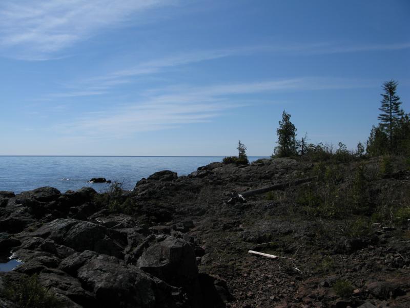
There really is not a true point here. Instead the Keweenaw almost appears to have an overbite - as the shore marches southwards it suddenly cuts back west with a sharp corner before curving back south in a long, wide bay. The rock is not terribly tough, just your run-of-the-mill conglomerate, though the bite does sit a healthy dozen feet or so above the water. As I stood on the end, sun flooding down on me and the waves crashing below me, I felt wonderfully relaxed. For many years I doubted I would make it to High Rock Point, with the difficult access roads and unpredictable Mandan Loop, yet here I stood, even if it took me a good chunk of the morning to walk here in a rather roundabout way.
Looking north from the point
Distant point south, beyond High Rock Bay
Manitou Island beyond glinting waters
Looking back from the point into the woods
With one last glance out into the lake I turned back west, back to land. I had noticed that Gull Rock Lighthouse, which was once on the right side of the island, had moved now in front in a meager attempt to eclipse it. My little tracker had ticked forward, just like a steady clock, and I was making progress on the eastern shore.
There were several campers here - a pair of tents by the end of the bay, a truck parked near the point, the smell of campfire in the air - and I was in a bit of a rush to leave them. I should have expected people out here to enjoy their weekend next to Superior but still found it a bit unsettling. After walking for so long I've grown to expect traffic to fall away behind me (Huron Mountain thinking). With a few quick steps I fell off the point and started the long walk south with High Rock Bay.
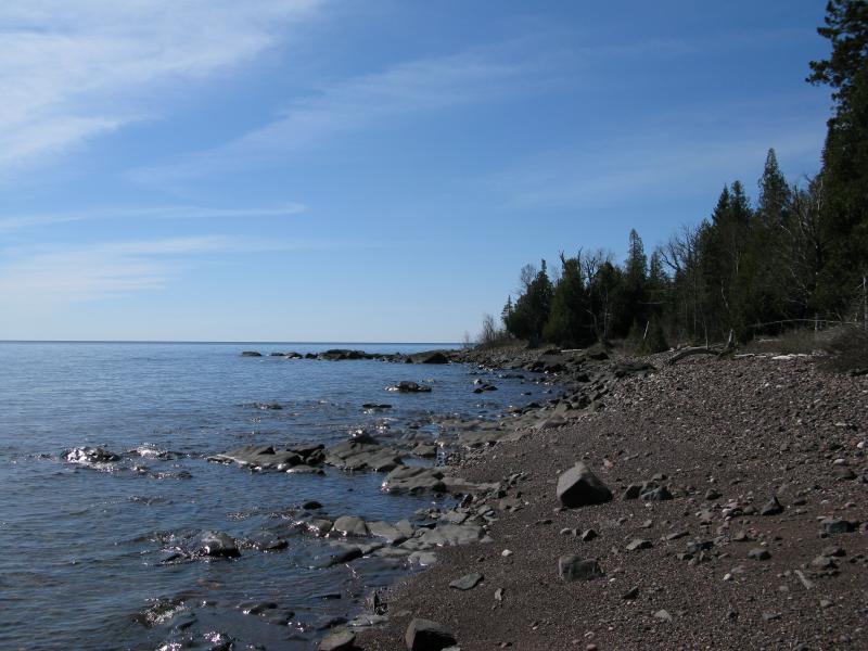
I was surprised to see how much the shoreline changed this far south. Up until now everything had been solid outcroppings and cobbly beaches, grains around the size of broken marbles at their largest that ground shrilly against one another underfoot. South of the point were larger rocks, most around six inches in diameter, with a wide variety of colors and origins. They rolled underfoot, threatening to twist an ankle or spill me from one side to another, and I was forced to keep my eyes downcast and watch my step. This was not incredibly fun.
Shallow and calm Gill Lake
Sudden conglomerate bluff of High Rock Point
After passing by Gill Lake, a small pond that sits right on the shoreline as if artificially made, I took one last glance back at the point. From the south it looks like an honest spur, a sharp point out into the lake, with curving conglomerate bluffs and tall pines overhead. It must be a lot of fun to kayak along the length with the sighs and gurgles of the many little caves and depressions underneath. I checked my topographic map and noticed with some surprise that High Rock Point is not the easternmost spur; that title falls to an unnamed point to the south. I'd be passing that way soon. I turned and pushed south, picking my way across the small boulders with care.
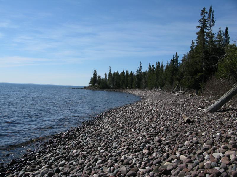
A rather rocky beach
Along the bay I passed a fairly odd couple. They were pushing around the rocks, shoving them around in knee-high waders, searching for agates. After a few pleasantries I continued on. They seemed more interested in their quest for the elusive rock than a conversation.
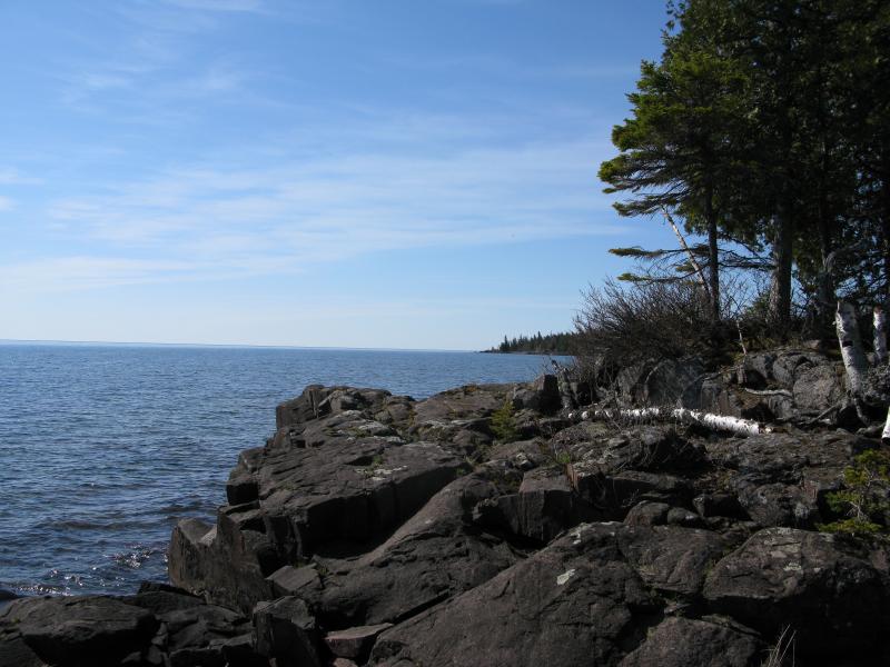
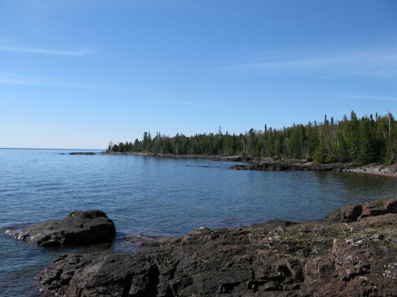
While High Rock Bay is mostly, well, a bay, there are a few basalt points that stick out to chunk out little coves. These points were a welcome break from the nasty shoreline, flat solid ground that my ankles and knees welcomed. The other thing I noticed about these points is the trails. The woodland path, so nice and helpful along the north shore, had almost completely disappeared now on the east shore. Small footpaths showed up on these points, cutting through the woods to short out the sharp basalt outcroppings, though I preferred the hard open rock over the short, cluttered paths. Rounding out one of the more prominent points I was greeted with a long view south over the last stretch of the bay.
Stubborn basalt chunks against the water
Long rocky beach ahead
Gradually my route began to ease. Basalt started to show up more often and the nasty rocks less so, replaced either by solid bedrock or decent cobble beaches. I did peak up into the woods a few times, hopeful to find a path or road or something, but they did not welcome me. The woods were a mess that I dared not attempt.
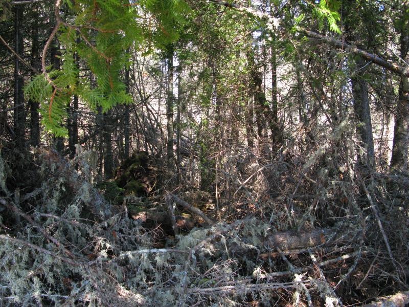
Nasty thick woods inland
When I reached the far south end of High Rock Bay I stopped and looked around. I was hesitant to continue south. High Rock Point was the point of no return. There were roads there, roads that would easily connect me back to my camping spot and people if I needed help. There was no help to the south. If I sprained an ankle or ran into an aggressive bear I would have no options. I'd be stuck to the lakeshore without help or an easy way out. I could still turn back, double back to the roads, and leave this hike behind.

Looking north back at High Rock Point
Barren basalt outcroppings along the shore
The decision was tough to make. This hike was different than most, exposed to the elements and over uncertain ground, far from my usual Marquette and Baraga haunts. My legs were already tired from the sloped ground and long distance, weary from balancing on rocks and trotting over rough spots. I shrugged and pushed forward, continuing onward with a cautious eagerness.
Beyond the south end of High Rock Bay a tougher shoreline arose. Basalt started to take over, stained black near the water and speckled with moss closer to the forest. Driftwood showed up in larger amounts, trapped in the small coves and between hefty boulders. Between the changing shoreline and thick, unkempt woods I felt more remote now than I had all morning.
Another unnamed cove
There was still signs that others had come this way. A faint footpath cutting a shortcut past one of the basalt points, upright sticks jammed deep in a crack, even a fake nest full of rock eggs showed up along the shoreline. Others may have been this way once but today it was just me, the swooping shoreline, and small waves bubbling ashore on the Keweenaw shoreline.
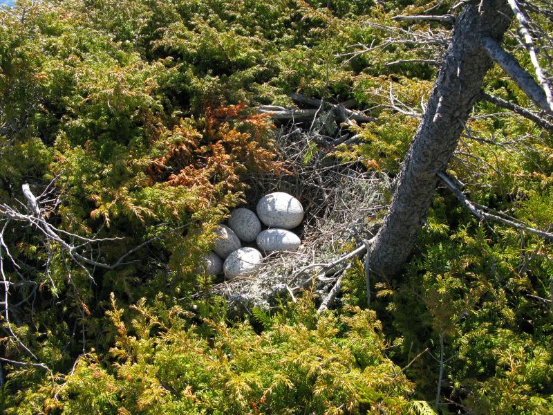
Old nest, complete with rocky eggs
Volcanic beach
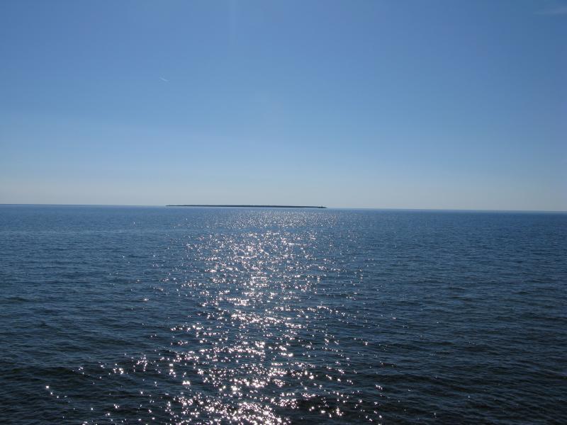
As I walked I glanced back east at times, looking to my ticking distance tracker. Gull Rock Lighthouse slowly made its way across Manitou Island, showing steady progress south, though it was hard to get anything close to exact. I estimated a few fractions - half done vs two-thirds done - and when the lighthouse finally poked out to the left of the island I felt a sense of accomplishment. I wasn't sure how far I had left to go or how close Keweenaw Point was, but the lighthouse had cleared the island, and I was that much further along.
Gull Lighthouse ticking past Manitou Island
Just when things seemed the most quiet a visitor showed up. The friendly kayaker poked out in the distance, several dozen yards from shore, and made a beeline towards me after a wave. We chatted for a good fifteen minutes. He was shocked to see me walking the shore, even more so when I told him how far I had come already today. The kayaker was on his way to Manitou Island after spending the night at Montreal Falls. I tried to glean some information from him about the shore of Big Bay, beyond Keystone, as I was not sure if I wanted to go that far today. He didn't really get what I was asking about. Eventually we parted ways, each of us enjoying the area in our own way and path. I was glad to bump into someone who wasn't scraping through rocks for agates or roaring through the forest on bikes.
Keweenaw Point was the next big milestone, being the far southeast tip of the peninsula. It's not a point or even a sharp corner, just a bend in the shoreline. I wasn't sure when I would hit it exactly (if there is a single point that could be considered the point), though I could tell when the shore began to curve. A buoy showed up in the distance and I sped up slightly, hoping to hit the unofficial halfway point for today's hike.
Stubborn tree on Keweenaw Point

On the far side of Keweenaw Point
The view showed up without much fanfare, a sudden vista far ahead. Way off to the west rose great hills above white sand. I had passed the point and was now on the south shore. Everything felt different now. Now I would be circling back to my car, every step taking me closer, and I was also nestled in the very tip of Keweenaw Bay. Lake Superior, still very open to my left, was contained now. I could even make out the Huron Mountains in the far south. I plopped down on the rocks, breaking open my pack, and had a small feast. The sun was high and I drank some extra water, probably more than I should at this stage, but I was celebrating. One last shore remained, possibly a short one, and I thought that the worst was behind me. It wasn't.
Sharp basalt chunks taking over the shoreline
-
Jacob Emerick
Aug 7, '13
Yeah, I can imagine that. The swoops and such seemed severe but everything was dry (mostly), even that early in the year. I think High Rock Road was kinda bad a few years back, close to Schlatter, though I didn't venture that area this time.You'll have to let me know about those explorations over there... I'm really quite curious what lies along the south shore aside from Smiths Fisheries.
Add to this discussion-
Jacob Emerick
Aug 7, '13
Hi Sue - Glad you enjoyed the story! I can totally understand about dirt bike being faster... Really need to slow down and take it easy with the lil' Saturn Ion. How tough is the road out to Fish Cove? For a long time I assumed that Smiths Fisheries was the only real way to Montreal Falls, sounds like there may be a more scenic route.
-
Sue Ackland
Aug 7, '13
There IS a closer hike to the falls from Fish Cove. If I remember, it's the next road along Mandan Rd. past Keystone Bay Rd. It's a fairly smooth sandy two track that a car could easily do. It can take you to Hoar Lake but there is a left fork that goes over a really bad two track bridge over a creek. I will send you a couple pics of the bridge. A bike or atv can go over it but I would NOT take anything larger. Once I got to Fish Cove, there is a bear path thru the woods near the shore. It's another shoreline with a small cliff along it like the one you were on the north shoreline. It's about a 1/4 mi. hike to another gravel cove and that's as far as I got. I think the river is only one or two more coves beyond that - not more than a mile total from Fish Cove.
-
Sue Ackland
Aug 7, '13
Ok, can't figure out how to send you a pic. If you want it, email me and email address and I'll send it on.
-
Jacob Emerick
Aug 8, '13
Hi Sue,Yeah, sorry, the site doesn't have image uploads. Too much risk involved with something like that :P I'll email you directly for the picture. Thank you for the info!
Add to this discussion-
Jacob Emerick
Sep 29, '14
Hi Kristen,Glad to hear you're enjoying the Keweenaw posts! Sadly, I don't think I'm related to any Emericks in the UP. I've been bugging my grandparents about for years, they don't know anyone from up there. My great-grandfather moved to the 'thumb' area in Michigan and his whole family either stayed there or drifted south. It would be awesome, though...
Add to this discussion