Ice Cliffs of Freda
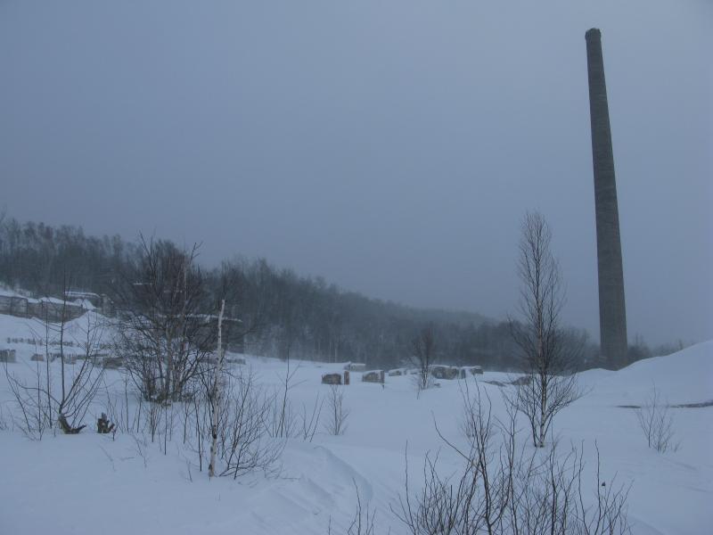
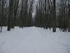
Trying to hide my nervousness I glanced around at the snowy trees and hills around us. Emily and I were driving up M-26 towards Atlantic Mine, one of the most notorious stretches of winter roads this side of the Mackinaw. Sputtering snow and strong winds cut down our visibility and kept our conversations short and simple. Once we reached Atlantic Mine we still had to head west, along Obenhoff and Covered Drive, to reach the small town of Freda.
By the time we made it to our destination we were both worn and anxious about the approaching sunset. Neither one of us were excited for the drive back in the dark or the howling winds whipping off of Lake Superior. Hesitantly we left the warm interior of her truck, donning extra layers against the frigid air, and crept over to the edge of the cliff. It was a scene from the Arctic. The sun, hazed by clouds far above, gave us no warmth. Distant landmarks were lost quickly by the snowy air. Drifts of white piled up high and obscured everything in swooping curves. Getting to the cliffs would be tough.
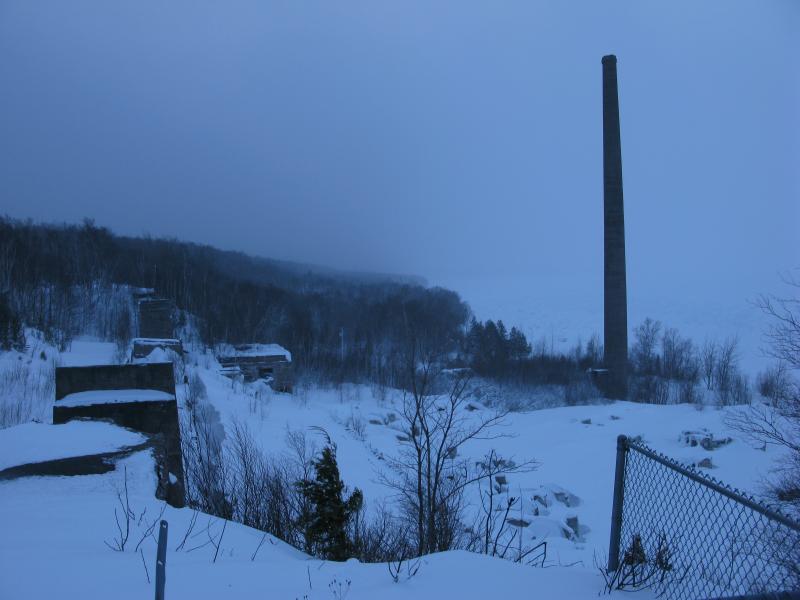
Frigid view of Champion Mill outside of Freda
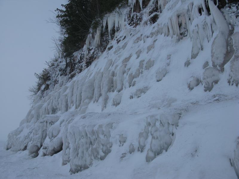
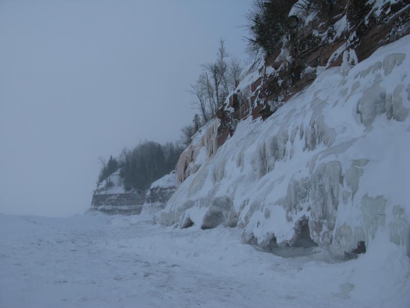
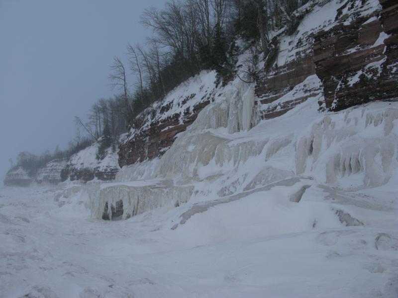
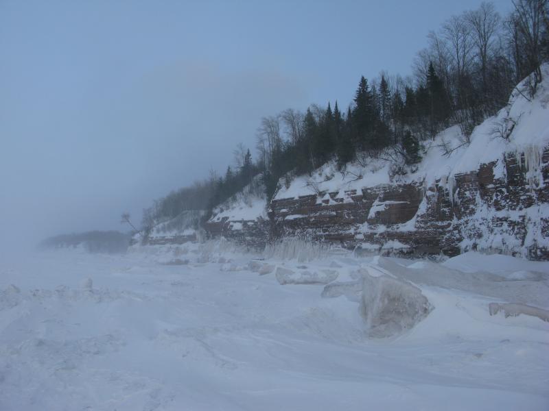
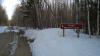
These ice cliffs are fairly well-known. Between Redridge and Freda along a mile or so of shoreline are tall, crumbling cliffs of sandstone that drop down suddenly into the lake. There are a few interesting features here - five stamp mills lay in ruins with their sands strewn below, several creeks cut deep ruts in the highlands - but it is the the ice formations that form in the winter from seeping ground water that most people know about. A small part of me was hoping to walk the full length between the towns today, taking full advantage of the thick shore ice, though the sharp winds and coming dark conspired against that plan.
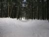
Getting down to the base was no small feat. There is a path, a very steep path made of hard-packed dirt, which had turned into a verifiable bobsled slide over the snow. We slid and swung down, reaching the old mill with sore butts. Another eight-foot drop waited for us below, a steep plunge down to water level, and then we were nestled behind tall drifts. After being up in the wind it was eerily still trapped between walls of snow and ice.
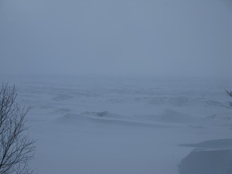
A barren Lake Superior
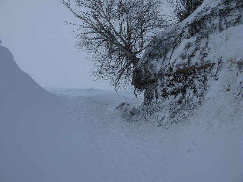
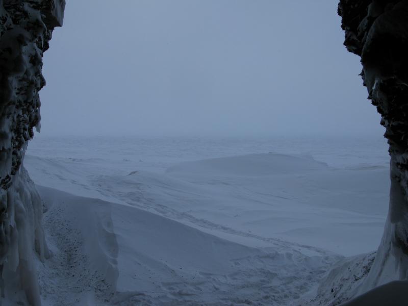
Narrow path between rock and snow
The cliffs lay to the east. A wide trail was stomped into the ice and snow in that direction though today's winds had blurred out most sections. It didn't take long to reach the cliffs. Five minutes of tromping on the intermittent trail the sandstone reared up, ice clinging to the face. The height was shocking.
First icy cove
As we meandered east the shore came in and out, forming small points and coves. The first point was covered in ice. It flowed down like a waterfall frozen, piling up in a slow-motion crash down. At some points the water came out stained, coloring entire sheets, though most of the formations were milky white. The scene was beautiful, the globs and icicles morphing together to create a fake front over the sandstone cliffs.
Looking up at the piles of ice
Distant bumps ahead
Tumbling ice waterfall
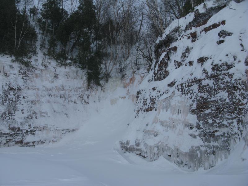
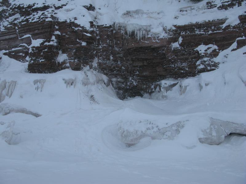
Not all of the sandstone was covered, though. Plenty remained exposed, especially the points. It was interesting to see just how much erosion was taking place at the exposed walls. Small chunks of rock littered the ground here, roughing up the otherwise slippery walk.
As Emily and I walked on and on we passed by sandstone caves that were coated in ice and around tall ice volcanoes. Eventually we bumped into another group out on the ice, all geared up with snowshoes and ski goggles (we had skipped out on our snowshoes for this hike) who recommended checking out one of the caves some three or four coves ahead. It had a hole in it. Interested we continued on, looking forward to the hole-through-the-ice, and found it in short order. The hole was at an angle making it impossible to tell if there was water at the bottom or not. Still, the cave was big and deep, making it a cool spot to stray into.
Sandstone cave fringed with ice
Looking out from inside the cave
After the cave I convinced Emily to continue on a short while longer. I had accepted that walking to Redridge was too far for today but was still considering cutting off the shore by Beacon Hill. There is a small creek here, one that would give us egress from the icy lake and winds, though it would mean pushing through a few hundred yards of deep snow and along a semi-active road. We reached a point and peered forward. The creek was still out of sight. Emily put her foot down and I had little room to protest. We headed back.
Shallow, windy cove
Our walk back was rushed. Sure, for some sections of our hike drifts had protected us from the western winds. Now, as the sun was setting in the hazy distance, we faced the wind head-on and froze. When we finally reached the mill and had to climb up the snow-slide our faces were numb and limbs a bit sluggish. I stubbornly headed up the same path, jumping from one small hold to the next. Emily took a long, roundabout path and had to wait for several minutes as I lumbered up.
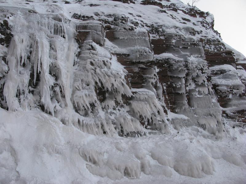
Close view of the ice formations
Last view down at the mill
We drove in the growing dark and made it back to Houghton just as the street lights were flipping on. I was a bit bummed for not planning for the long drive here or the side trek at Courtney Lake appropriately, both factors that squeezed our visit to Freda short. Still, with the frigid temperatures and winds I'm not sure how enjoyable the whole distance would have been. At least we got to see a good chunk of the cliffs and made it out of there before nightfall. Now it was time for a warm meal before the long drive back down M-26.
-
Jacob Emerick
Mar 14, '14
You've never been there in winter? I figured that would be your kind of hike! Though, to be fair, the snow seemed to be doing an admirable job at hiding a good chunk of Champion and was probably doing even better at the other mills.I was working off of this this post on CCE for the mills. According to Mike there is the 'Adventure' out there too, between Trimountain and Baltic.I have to ask, if you've been out there in the summer - how did you get around? Like, did you keep to the cliff tops and mills, only diving down to the shore at the beaches? I'd love to revisit during less-snow to check out the mines, not sure how difficult or accessible things are.
-
dcclark
Mar 14, '14
Ah, duh -- Adventure, which I think is at Edgemere. I think there are a few ruins visible in someone's yard (on satellite photos, at least) but I've never seen it.The different mills require different approaches. You can get to Baltic from the beach most easily (avoiding private property). Trimountain was just a bushwhack -- the cliffs are higher there and it's hard to get to the beach. Trimountain is a real hidden jewel. The easiest way to find it is to look carefully on the beach side of the Freda road until you see an old bridge approach near a stream. Just on the west side of that stream, you can bushwhack down towards the cliffs (cheating to the west) and get to the ruins.
-
Jacob Emerick
Mar 20, '14
Good to know. I had hoped to be able to walk the shore in the summer time, hitting up each of these mills along the way, but the cliffs are probably a bit too cliff-y for that. CCE's write up of the Trimountain mill is pretty awesome. I've seen hints of those trestle supports in the woods near that stream. Massive.
Add to this discussion-
Jacob Emerick
Mar 20, '14
Yeah, Eben is pretty slick. Was up there a few weeks ago (bit behind on my posts). I was surprised at how treacherous the trail was. Sure, it makes sense that the ice caves would be slippery (something to do with the ice part of the caves, I dunno), but the path was so trod that it felt like a bobsled trail! Anyways, you'll have to let me know if you ended up making it out there last weekend!
-
nailhed
Mar 21, '14
nah, we didnt do much after that...it got super friggin cold out, and she was awful beat up, plus we had to start heading home.but i agree, Eben seems to have turned into a super-ultra-mega destination now, based on the millions of footprints there.
-
Jacob Emerick
Mar 23, '14
Ah, that's too bad. Saw an article the other day that Grand Island is starting to crack up. Won't be long before Lake Superior is moving again and all these areas (Freda, Jacobsville, Pictured Rocks) and their icy cliffs will have to wait for next year.
-
nailhed
Mar 23, '14
yeah, i was bummed we didn't go out to Grand Island, as that was one of the places we were thinking about going on this trip.
Add to this discussion