Cliffs of Freeman's Landing
Eyeing up the sign in front of me I continued forward to Wetmore Beach, snowshoes in hand. Apparently the state owns this land and visitors are required to have a recreational pass. I didn't have one. I also wasn't in my car where one would slap this sticker on. The road to Wetmore was buried in a foot of packed snow, dozens of footprints pressing a solid path in from County Road 550, giving me an easy route in. I guiltily passed the sign and was soon surrounded by tall trees.
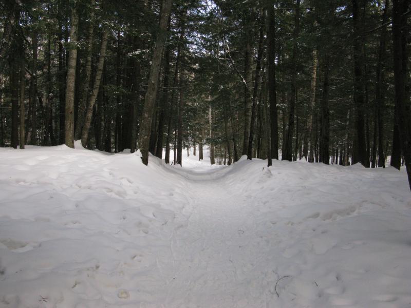
Well-trod path to Wetmore Beach
This beach was no strange land to me. I had been here several times before: leisure trips with the wife, thru-hikes from Sugarloaf, and a few easy stops with friends. Today I was using the beach as an easy entry point for a daring ice walk on Lake Superior beneath some sandstone cliffs. A sign about recreational passes did not, unfortunately, hold much sway over me.
Snow and ice stretched far into the bay and completely masked the shoreline. One would have to lean on memory to retrace where the sand ended and the water began. I ventured out from the woods, following the diminishing path, walking farther and farther over the lake ice. Eventually I reached an ridge and stopped, the ice beyond looking questionably thin, and strapped on my snowshoes. Between the drifting snow and ice I figured that the surface area couldn't hurt.
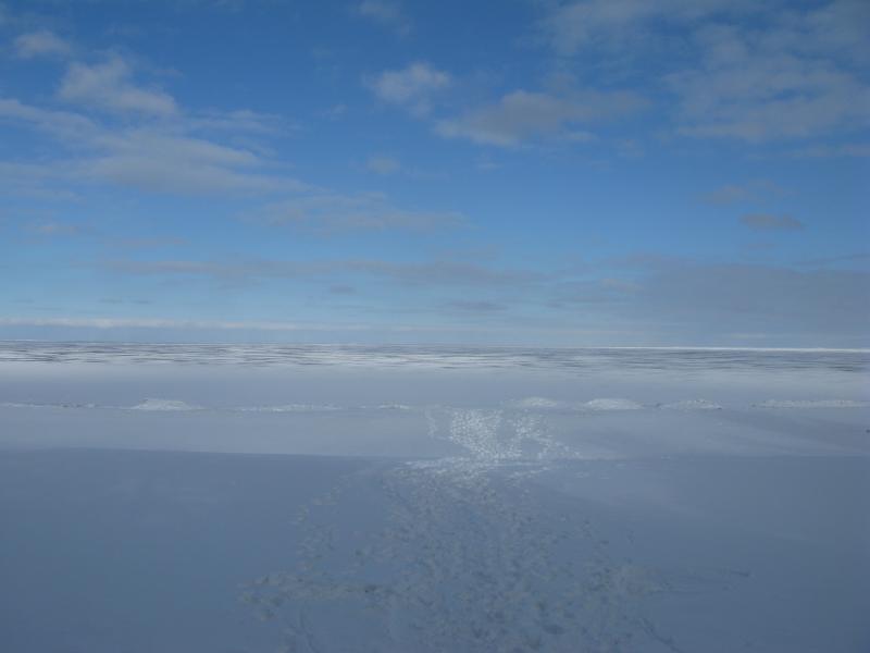
Path over the ice
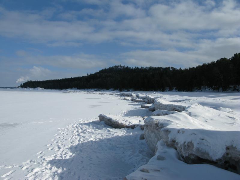
The dirty, icy ridgeline
My destination was to the north. Between Freeman's Landing on the north side of Wetmore Beach and Little Presque Isle is a line of tall sandstone cliffs common to the Marquette shoreline. Several of these cliffs were rumored to house tiny beaches known only to locals. My (optmistic) plan was to head north along the ice, beneath the cliffs, and then come back on the North Country Trail, above the cliffs. I turned left and crunched along the ice.
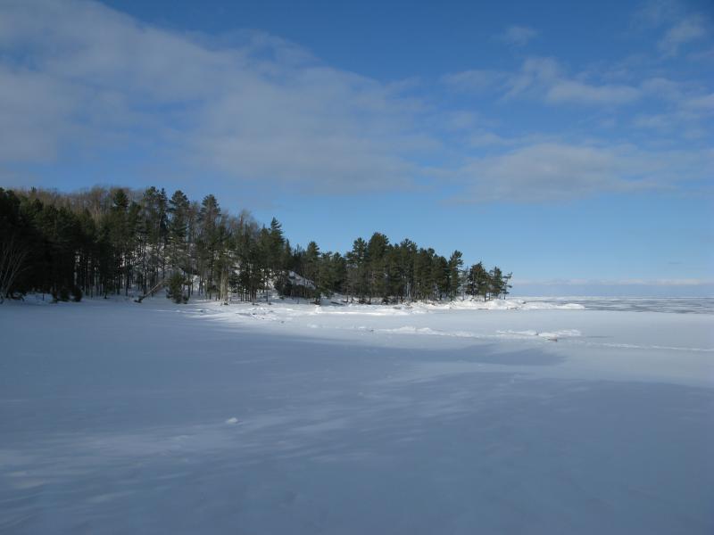
Freemans Landing, cloaked in snow
There were a few footprints out on the thinner ice, ice that was probably only a few days old at most. I took one opportunity to wander down and check it out. A thick layer of snow lay on top, though some cracks in the ice were wide enough to show through the snow. I stuck to the top of the ridge.
Freeman's Landing is an annoyingly messy protusion of rock to get around. Rumor has it that there was once a dock here. I can't imagine that constructing a dock, let alone getting supplies to and from the ships, would have been easy with the outcroppings jutting up from the forest floor. And now, with winter grasping and piling up on the point, trying to imagine a usable dock being here was a stretch.
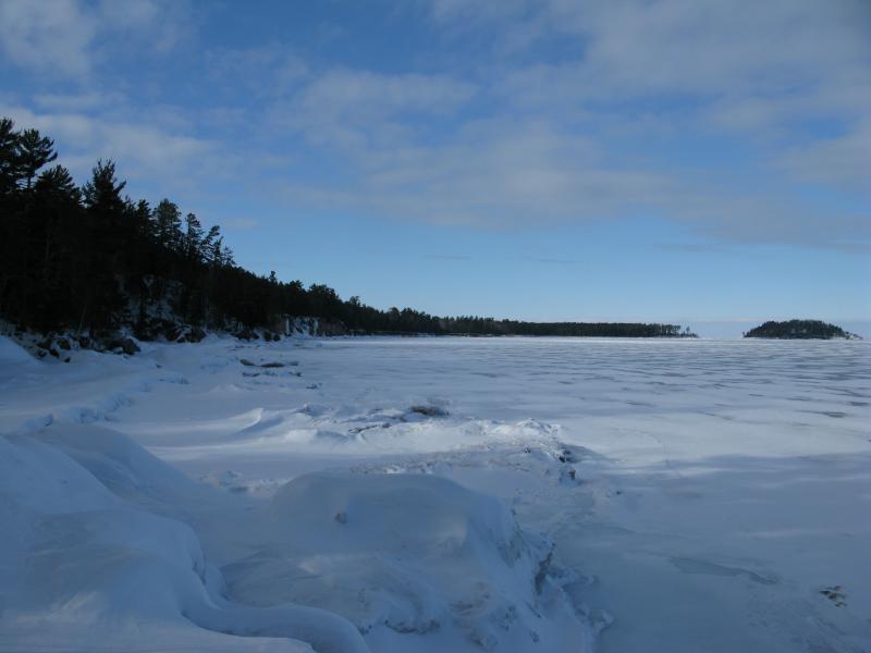
Looking north beyond the landing
Once I got past the landing I could make out the long sweep of cliffs stretching north. The icy ridgline was piled high here, pushed up twenty feet or more above the water, forcing me to climb up and down several times before slowly to smoothing down. The shoreline here was made up of steep forests, deadfall leaning down over the banks. I couldn't tell if there was enough beach for a summertime traveler to follow without wading or not. When I finally started to get close to the cliffs I noticed something a bit disconcerting.
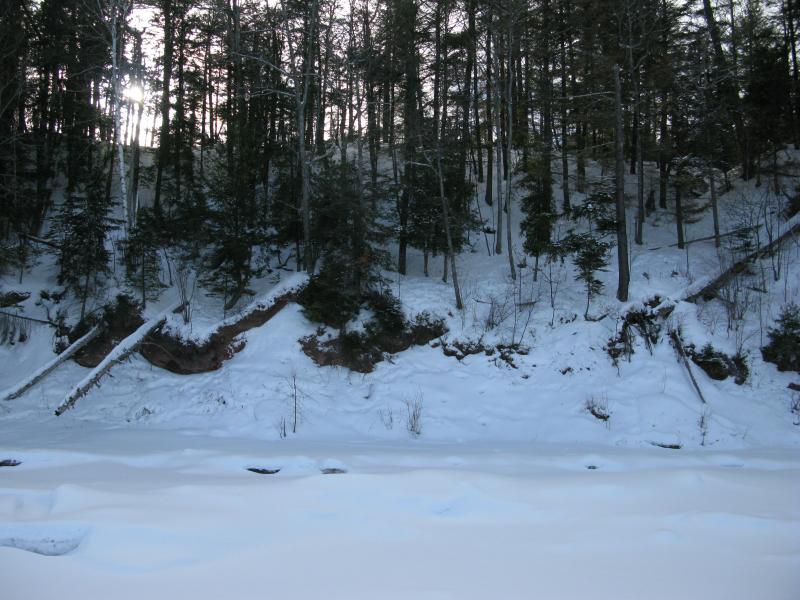
Steep forested shoreline
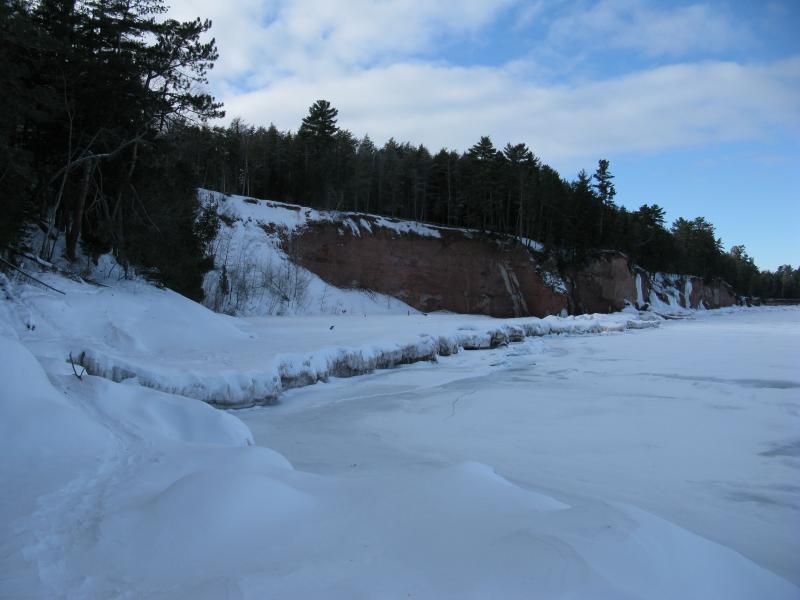
First of the cliffs
Up until now the ridges of ice were layered, leaving me several tiers to walk on, before they ended above the questionable thin stuff. Oh, and they reached a good fifty feet or more from the shoreline. When I reached the cliffs, though, the ice swung inland, giving me a single tier and spots that were barely wider than a few feet. Walking the entire length to the island was starting to seem daunting.
The first big cove was impressive. I'm pretty sure that this is 'the' hidden beach, the one that's difficult to reach, as there was no obvious path up the hill. The rock cliffs towered above the northern end like a guardian wall while the southern side was made up of crazily steep woods. If you wanted to swim here you'd probably have to walk (or wade) in from Wetmore.
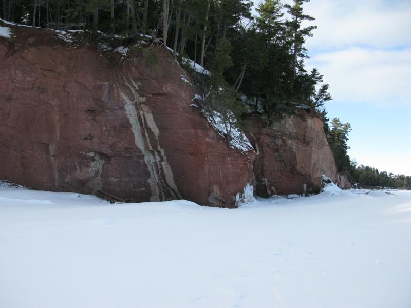
Huge rock walls
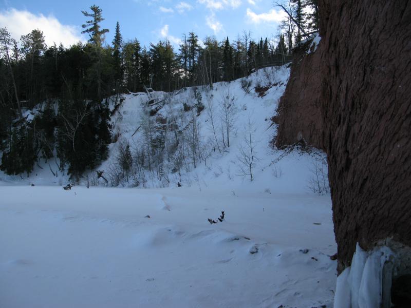
Looking back into the hidden cove
North of this cove was a towering cave with a crumbling ceiling and more cliffs. My path continued to narrow, weaving around ice volcanoes and huge slabs of fallen rock. Some ice started to show up on the cliffs, huge frozen waterfalls formed from seeping groundwater, although the majority were just composed of bare rock. I kept a constant eye to the horizons, comparing how much closer Little Presque was to the north and how much more distant Marquette was to the south.
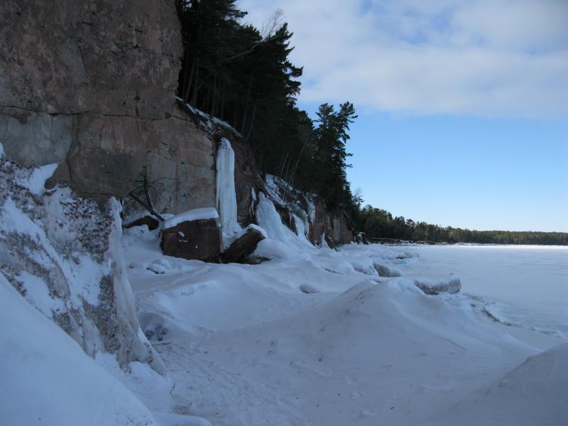
A jumbled path forward
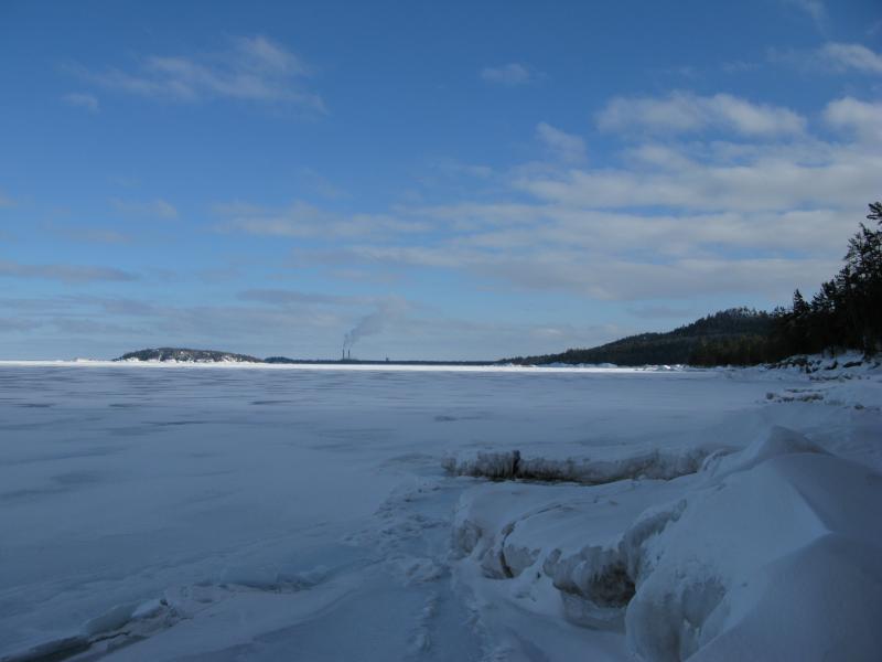
South to Marquette
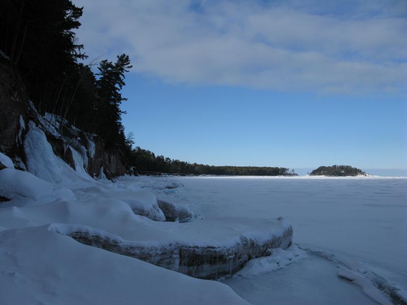
Little Presque Isle, looking closer
As I continued north the ice formations grew and the cliffs dipped down. Some spots were now maybe only ten or so feet up in some spots. I held onto a small chance that I could clambor up there if the ice gave out. There was no way I could climb the slick ice walls, that is, but maybe if I could grab on some roots and pull up (in snowshoes) and then crawl up the steep forest above (through virgin snow) without hitting any more cliffs above… It was an option. If I could find a spot.
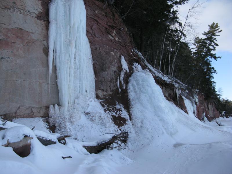
Icy waterfalls
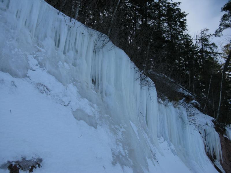
Long, wide cascades of ice
By now the huge, wide path at Wetmore had dwindled down to a single old snowshoe track. At least one other person had come out this far. I tried to ignore the fact that the tracks doubled back on themselves.
Finally, it happened. The ice ridge stopped at a point. To continue on I'd have to either make a four-foot vertical jump and grab onto roots or try my luck on the thin ice. I stopped and listened. Up until now I was consumed with the cliffs and my route, hearing yet not listening to the sounds of the lake ice. Now I heard it. It groaned and creaked, letting out sharp pops and deep booms mere yards away from where I stood.
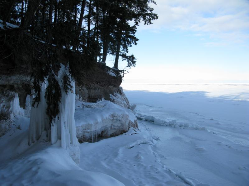
The end of the route
That's what ice is supposed to sound like, right? At least I think so. With bated breath I leaned over the ridge and prodded at the ice. I poked through a small hole and saw water. So I moved over a few feet and leaned tenatively. It held. With slow, even steps I ventured out onto the ice, away from the horrible-looking overlap that paralleled the ridge, and made my way around the point.
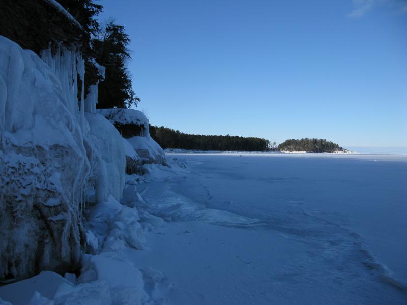
Looking beyond the point
My ridge was gone. I had hoped that this point was it, that it would pick right back up a few dozen feet away, but it didn't. As far as I could see was the cliffs and the thin ice. As I stood unsteadily I noticed some movement out of the corner of my eye. The ice was bubbling up, giving way from the pressue to the east, stubbornly folding up and cracking sharply at the edges. I was done. Done done done.
I scurried back to the shoreline and retreated back along the ridge, the sounds of the ice making mocking sounds to my back. There was no way I could climb up the shoreline so I was stuck following my tracks the whole way back. At least I got to enjoy a different angle of the cliffs and ice formations.
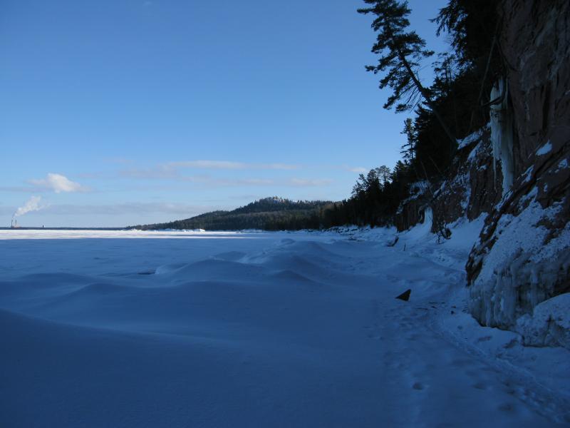
The long road back to Wetmore
These cliffs between Freeman's Landing make for an interesting visit. They are fairly close to Marquette and have Wetmore Beach on one side and Little Presque Isle on the other. However, they are still cliffs on the edge of a lake. Kayaking may be the best way to visit them. Today was about as good as the ice gets along the Marquette shoreline thanks to the western winds and nearby currents. As I passed by the sign for recreational passes on my way out I considered bringing Katie and Noah here for a visit to that hidden beach. With a pass, of course.


-
Jacob Emerick
Apr 23, '14
I felt like such a wimp backing out, too! I had been talking to another guy about making an attempt on the Huron Islands this winter, with how much of the lake was frozen over. From Mouth of Huron it's not too long of a trek to them. After these experiences, mere yards from the shore, it's going to take a lot of gumption to try something like that.
-
nailhed
Apr 24, '14
wow, the Huron Islands would be a pretty intense trip!
Add to this discussion