Driving through the Huron Mountains
The roads in the Huron Mountains are the result of years of logging, recreation, and lack of maintenance. As the only maps of this area show all possible routes as random, haphazard wiggles, it takes time to understand which roads are drivable and which are barely fit for walking. Once you understand the main routes, though, much of the area becomes accessible by normal cars.
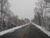
County Roads 510 and 550 connect Marquette to Big Bay. Big Bay Road, or Country Road 550, is the eastern one and is paved, more direct, and takes you past Sugarloaf, Hogback, Presque Isle, and other popular destinations. If you're looking for a more scenic route, 510 meanders further west but is gravel and require a respectable low speed. It does pass the Yellow Dog Falls and meets up with Blind 35 and the Triple A, although it doesn't actually go to Big Bay - you need to reconnect with 550 to do that. County Road 510 does have a bit of interesting history, as it was part of the planned route for M-35, the highway that Ford stopped. You can read about this on Michigan Highways.
County Road 510 and 550
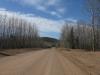
Only half of the Triple A Road is suitable for road vehicles. Starting at County Road 510, this road leads west and is the main route for much of the traffic to the Yellow Dog Plains. At the western edge of the plains, though, the road swiftly deteriorates to a conditional barely suitable for ATVs, with massive puddles, large rocks, and steep inclines. I took an old Ford Taurus down this road once by accident and could feel the value of the car dropping with each mile. While the Triple A road is a great way to get on the Yellow Dog Plains from 510, the Ford Road makes for a much better eastern route.
Triple A Road
The Northwestern Road is an alternative route from Ford Road to County Road 510 that completely bypasses the Yellow Dog Plains. This old logging road also follows the southern edge of the Huron Mountain Club property, offering plenty of possible routes for trespassing. However, the middle of the route is pretty treacherous, with washouts, rocks, and steep grades. I don't recommend this route for most vehicles as it is a classic example of a non-maintained Upper Peninsula logging road. If you drive in from the western end, you can get to Cedar Creek without trouble, and the eastern end leads to Dodge City and Hogback Falls, but trying to drive through will probably disable your car.
Northwestern Road
One of my most traveled routes is Skanee Road to Ford Road. This combination of roads leads to a number of my hiking areas, including the Yellow Dog Plains, Slate River, Western Huron Mountains, Cliff Hunting Club, and Huron River. The first part of the route, Skanee Road out of L'Anse, is paved to McComb's Corner. It then turns into gravel along Erick's Road and passes over Big Erick's Bridge on the Huron River. This road splits a few times (even though it maintains its name on each of the splits) before merging with a bit of the Northwestern Road. The route then heads south along Ford Road, which slowly winds and climbs its way up onto the Yellow Dog and the Triple A Road. Most of the route is marked with spray paint and is smooth enough for any vehicle.
Skanee to Ford Road
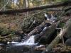
Reaching north along an old railroad grade, the Huron Bay-Peshekee Road starts near Lake Michigamme and ends near Mt Arvon. It does a good job of following the swampy Peshekee River for most of the route, offering excellent views of wetlands and surrounding tree-covered hills. Even after the pavement ends, there are long, flat stretches of road excellent for driving. Passing by the southern entrance of the McCormick Tract and connecting with the Arvon and Silver Roads, this is an excellent road to reach the western edge of the Peshekee Highlands.
Peshekee Grade
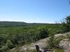
The important thing to realize about most of these routes are that they are not marked. There are no official road signs along, and you might see a few spray-painted symbols only if you're lucky. I highly recommend bringing a map and watching your odometer closely, as it is easy to turn on the wrong road and find yourself in three feet of mud. However, with a good sense of direction and a bit of luck, you can easily traverse some of the most rustic land in the Upper Peninsula, gaining access to some awesome hikes with a simple car or truck.
-
Jacob Emerick
Jun 15, '11
Hi Rob, just saw this! Did you get a chance to explore the mountains that weekend? I've noticed some of these roads are quickly degrading (like Ford rd) and some are getting better from logging (like the Northwestern).
Add to this discussion-
Andrew
Dec 18, '17
If you love taking trips to the U.P., try coming in on Skanee Road to Ford Road. Camp at Big Erick's Bridge State Forest campground on the Huron River, and explore from there. if you're into backcountry camping, check out Craig Lake State Park. The rough road in was being upgraded last Fall, and the remoteness and beauty there is fantastic!
-
Jacob P Emerick
Dec 22, '17
Thanks for the update on the road to Craig, Andrew! I never did make it out there, was always too worried about the road conditions.
Add to this discussion