Bad Times on Lake Mine Hills
Mining ruins are not my normal hiking destinations. It's not that I don't find the old sites interesting or that I'm not drawn to the Copper Country's rich mining history, it's just that I find the natural beauty of the Upper Peninsula more appealing. Well, that and ruins are more difficult to explore. Barely anything remains from the vast industrial network that once covered the Keweenaw area, only crumbling rock foundations and the occasional depression marking a covered shaft. To find the remains, or even just the shafts, takes hours of careful research.
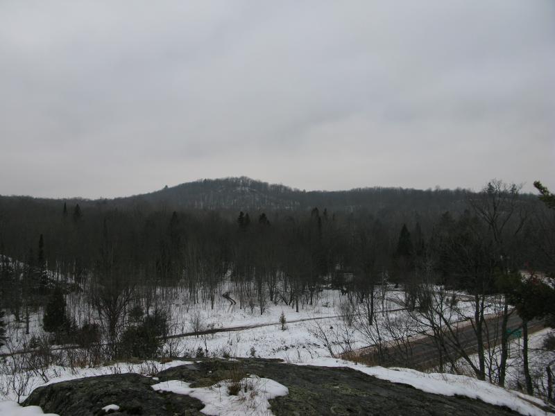
On this snowy day I was drawn to an old mine by a bit of curiosity but also a sense of completionist responsibility. There are a few rugged hills near the junction of M-38 and M-26 that I've passed by dozens of times on my way between Houghton and Ontonagon. Their bald outcroppings mark an end to the otherwise rolling, forested hills of Trimountain and South Range. Every time I drove past them I thought about stopping and going for a quick climb, if only to see the views the outcroppings would offer, and every time I continued past. After learning that there was an old mine in the area I decided to finally stop and explore the Lake Mine Hills.
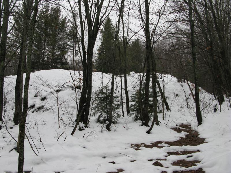
A steep, snow-covered climb
A large parking spot was available right at the intersection and I left my car there, heading northeast to the first hill. There are three main hills here, two north of M-38 and one south, and the middle one would be my first climb of the day. The climb was steep and sudden over snow-slick crumbling rocks. I climbed carefully, testing each step, eventually making my way to the first slippery outcropping.
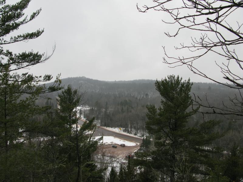
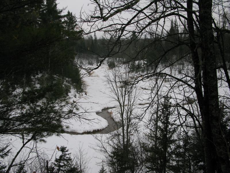
Looking down at the parking area
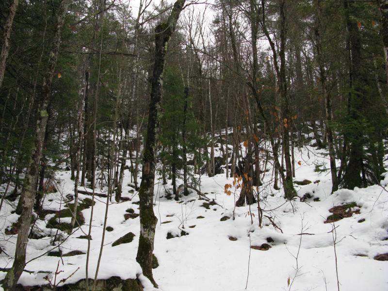
The view was modest but unobstructed. I spent little time here, annoyed by the cars and semis roaring past below, and continued uphill. I had been hoping to eventual gain enough elevation to see over the rises to the west, maybe even a glimpse of Lake Superior. Eventually the slope leveled and I made it over a saddle, surrounded by odd boulders.

Large, mossy boulder at the peak
The moss and ferns were still bright green, even under inches of snow. I found myself half wondering if there was an old shaft up here, supplying cool, damp air throughout the year to give the plants this lushness, but a hole on top of a hill would have been wasteful. Passing the rocks I headed east to the other side of the hill.
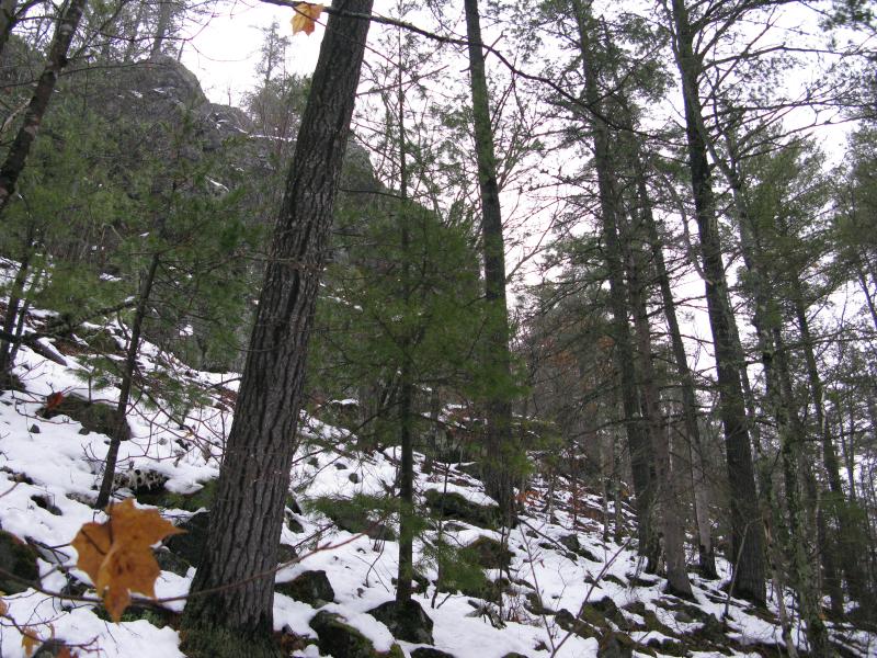
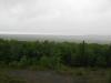
M-38 was not nearly as busy as M-26 had been, which gave me a brief break from the traffic noise. Walking along the eastern cliff, which was very pronounced but not tall enough to peer over the trees below, I looked south and east over the hills and trees. There wasn't much to see. While the middle hill of Lake Mine was relatively tall the land in the distance rose higher, hiding most features after a mile or two.
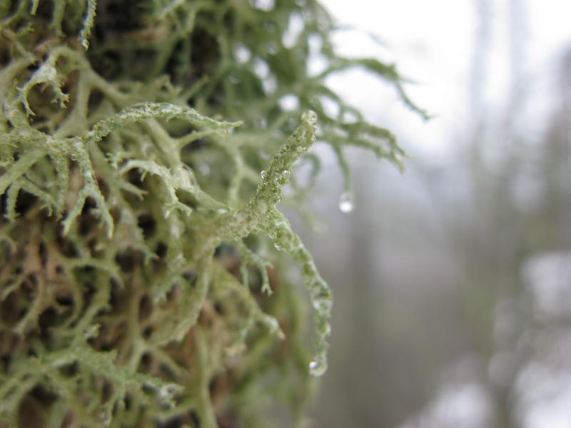
Closeup of the dripping tree moss

Looking south towards Mass City
My current route would soon take me up a steep rise and I chose to head downhill instead. The traffic from M-26 floatd occasionally through the background, disrupting me from my usual peaceful wandering, and the views were nowhere close to what I had hoped for. I crept and slid down a narrow rock chute to the base of the cliff and turned north. I wanted to stay close to the sharp rock in hopes of finding an open shaft in the rock, even if it meant walking along the crumbling loose rock at the base.
Imposing rock cliffs on the eastern face
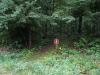
This dangerous route didn't last long. After several hard tumbles on the slick, unsteady slope I gave up and headed down to level ground. If the hill would not cooperate with this adventure than maybe the mining ruins would. The forest started to close around me, transitioning from the open, older trees of the hill to a scraggly pine forest. Ducking and weaving I tried to stick to a straight path when I bumped into a straight, even path perpendicular to my path, what could only be a railroad grade.
Thankful for the break I turned and followed the old grade. The main tracks would have been further to the east, what is now the Bill Nichols snowmobile trail, so this must have been a short spur that led to the mine. Sure enough, after a short distance my path bumped into the wider, graded snowmobile trail.
By now I had given up on the Lake Mine Hills and decided to search for the remains on level ground. The first item to check out would be the trestle to the north, retrofitted with a wide wooden bridge for ATVs and snowmobiles. According to some photos I found online the trestle should only be short distance north along the trail, so I followed the easy path towards an unnamed creek. I found the creek but not the trestle.
Tiny unnamed creek below the trail
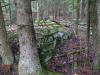
Instead of a towering trestle crossing the creek the trail used poor rock and a few culverts to level the path. Disappointed I turned around. The trestle must be farther down the trail but I wasn't willing to hike the distance. My knee, aggravated from the climb's slips and tumbles, was starting to send little warnings up my leg. I backtracked to my spur and made my way back into the woods through the small pines towards the second item, one that was on my way back to the car. Marked on a topo map and now lying before me was the tailings pile of Lake Mine.
Small tailing piles
Expecting more from the tailings of Lake Mine I stopped and just looked. The piles were maybe a dozen feet high and not that large across, covered in brush and snow. There may be other piles in the woods, towering above the trees, but these weren't worth the hike. Again disappointed I passed by, now making steady progress to my car.
The third item I wanted to check out was a shaft that I had seen in a photograph. The shaft was large but did not indicate where exactly it was taken. I had checked out the eastern face and the tailings, two suspected locations, and had written off finding it when I started circling around the southern end of the hill. Opening up in front of me was a large clearing, obviously once containing a massive amount of poor rock, with suspicious gaps near the top. This very well may be the shafts that I had given up on.
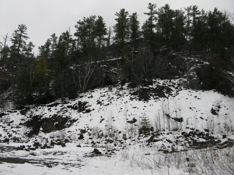
Poor rock piles and clearing
It took a few seconds to decide whether or not I wanted to climb the snowy piles of loose rock. I tackled the left side, scrambling up the rocky dirt, and reached the first opening with little problem. While it looked more like a shaft up close it was efficiently filled in by the poor rock. I'm guessing that someone had just pushed the rocks up to and back down the holes it had originally came down.
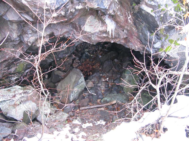
Shallow mine shaft of Lake Mine

South from the mine shafts
To get back to the parking lot I still had to make my way around the last spur of the hill. I could either circle it to the south, which would take me onto M-38, or go over. Since I was already on the poor rock pile I decided to maintain my elevation and climb the spur. The bare top offered a few more views southwest but nothing new, and I quickly headed down to my car.
Spur above M-38
And then it was over. I was back at my car after a short hike covering several miles, a hike that had been pretty full of disappointment and poor planning. At least I had finally visited a spot that had been on the back of my mind of years, but it wasn't worth the drive or hike or my reawakened knee injury.

-
Jacob Emerick
Jan 29, '13
Yup. I've heard awesome things about this area but I'm not even sure I'll return to try and find the ruins. This hike was quite a bummer.
-
dcclark
Jan 31, '13
Ohhhh boy is there a lot more over there! You were on the "Belt Mine" hill. It's practically hollow with mines -- the shaft you found is one of a long line of collapsing stopes (areas of extracted copper) which collapsed on the surface. There are also tons of stubby adits, exploratory shafts, and other scary things.The next hill north has better views from its top, but only one small water-filled mine shaft. The last one north after that is smaller, has some decent views, and also has some bigger mining ruins at its base (the North Lake mine). Its poor rock piles flow right down into the Firesteel River valley and make an amazing sight.To get to the Firesteel Trestles that you were looking for, you'd need to follow the snowmobile trail (parallels the road you took, just about 30 feet east!) for a mile or two. They are impressive and worth it!To the south, there's a lot more to be found. The bluff in the southeast corner of the M-26/M-38 intersection is large and contains the "South Lake Mine", with a giant gaping hole in it. Not many ruins, but a lot of scary swiss-cheese. Further east along M-38, there's a short dirt road which takes you to the Lake Mine itself. This is the one with enormous cement ruins. No views, but some really spectacular ruins.Whew... anyhow, I really do recommend it. That's one of my favorite areas for exploring, and there's a lot more to see there! Let me know if you're interested in some map-based details.
-
Jacob Emerick
Feb 2, '13
I was wondering if you would jump in on this one, Dave! Was checking out some of your content and photos before this trip, just wasn't studious enough when planning out my route. One of those 'maybe if I just wander around the ruins will find me' hikes that did not work out.So, Belt Hill, eh? The collapsed stopes were rather cool but mostly covered up. Other than that I couldn't find much else there, but there was a lot of snow and I didn't know the area well (can't imagine that being a bad combination at all). By your explanation another trip sounds totally worth it, one focused on the north hills and going over that trestle. Are the shafts easy to find or covered in growth?South Lake Mine is one of the spots I was hoping to find, didn't realize it was on that other hill. Your photo of it looks amazing! Scary too, but still fairly amazing.Have you ever tried tackling all of the spots in one trip? That was my original plan, didn't really work out in this weather, but I'm wondering if it would be smarter to split it up over a full weekend (and throw some of the south bluffs by Rockland, waterfalls up by Twin Lakes too). Thanks sir!
-
dcclark
Feb 2, '13
Glad to help! :) That area is a real favorite of mine. I'd spend half of a day on the Belt hill. The North Lake and the other hill, plus the trestles, are probably another half day (at most). South Lake is at most half of a day... maybe an easy morning. The Lake itself could be a full day if you really want to spend a lot of time, otherwise half of a day. So I'd say: make a weekend of it! The Rockland area is AWESOME, and I highly recommend the Minesota/Michigan/Rockland mine bluffs for their amazing views. Also, the Adventure mine has a lot going for it, including views and an amazing tour.If you're curious, drop me an email and I can send you much more specific locations.
-
Kerry
Mar 31, '18
I have always wondered who owns the old Minnesota Michigan mine I know some people in financial investments and speculations that are looking for an old abandoned mine that had a very good record of production they wish to purchase one and rehabilitate it and reopen with modern technology and Mining techniques anyone have any ideal who owns the old Minnesota Michigan at Rockland?
Add to this discussion-
Jacob Emerick
Feb 14, '13
Ha, I was thinking of crawling down as well but I was a bit worried about the unsteady rocks. Might be worth a revisit, though, after some research. Did you just go for one visit or did you end up returning later?
Add to this discussion