Dakota Farm
Soft, cold rain drizzled down around me. I was attempting to cross Lower Silver River Falls, a waterfall near Skanee, MI that I've visited at least a dozen times (and even proposed to Katie at). The river was higher than normal and the rocks were wet-slick, making a crossing tricky and dangerous. Three slow, careful steps on the rounded, slippery rocks and I was on the eastern bank. A long hike was ahead of me, so I checked my gear and lowered my shoulders into the dripping underbrush.
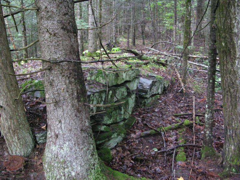
Old foundation from the abandoned bridg
Just east of Silver River and south of Point Abbaye a number of rocky outcroppings poke up from the surrounding deep northwoods. These peaks, scattered randomly about, are roughly located at the site of the old Dakota Farm. Back in the mining days this was one of the farms that provided the Keweenaw fresh foods although there is no buildings or fields remaining today. Rumor has it that the men working at the farm would watch for ships sailing down Huron Bay from some of these outcroppings to know when to haul crops down and supplies up. My hike today was to check out these outcroppings with the goal of getting a nice view of Huron Bay and Point Abbaye to the north.
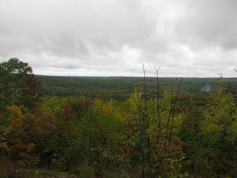
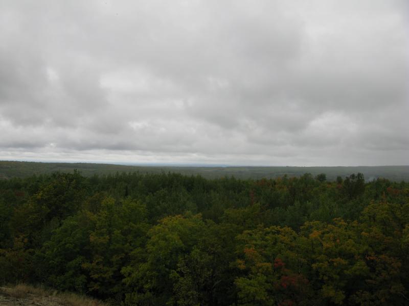
The climb started quickly. One of the high spots was nestled right close to Silver River so I tackled it right away. Sopping leaves and branches rained heavy drops down on me, soaking my hat and jacket as I climbed the steep hill. The woods were thick and young, forcing me to squeeze sideways multiple times to get through. By the time I reached the open mossy rock I was wet through to my shirt and my jeans were dripping. The view was pleasant but not great. Most of my climb was spent just getting out of the Silver River's gorge and not gaining prominance.
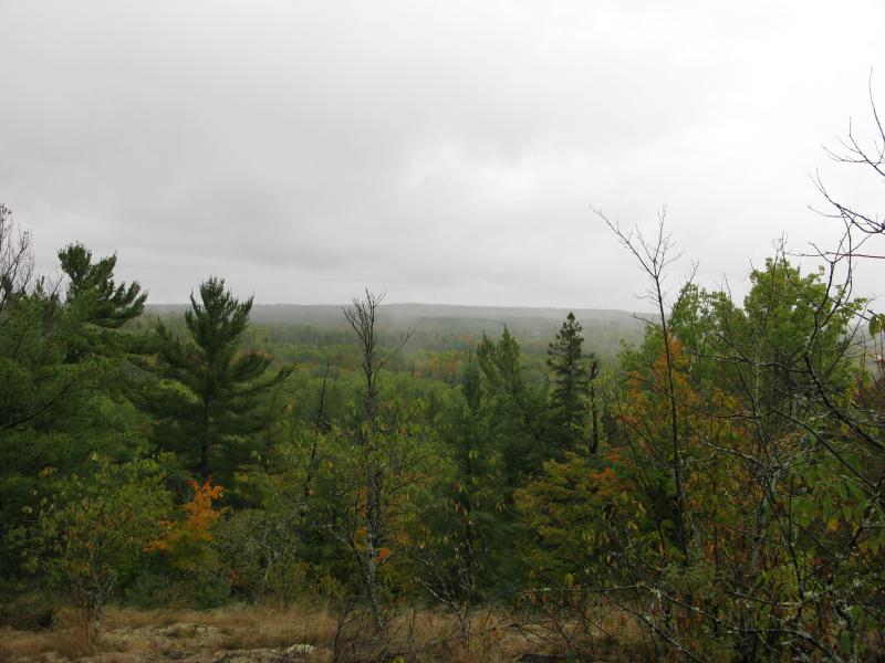
Looking west from the Silver River Lookout
Turning away from the view I headed due east. A slight downhill took me throw an older, pleasant forest with some undergrowth. I enjoy walking through this type of woods, even though there are plenty of branches underfoot to snap and give away your location. Everything was shiny clean with the rain, which had stopped while I was climbing down off the rocks. Clean and quiet, with only the sounds of my footsteps blundering through the undergrowth.
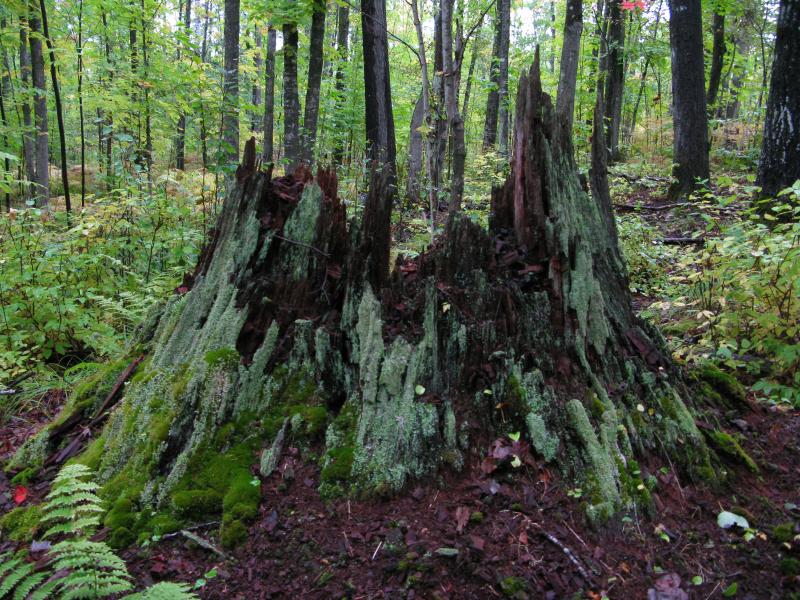
Mossy stump in the damp woods
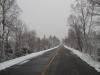
A dark gravel two-track cut through the peaceful woods like a foreign intrusion. Dakota Farm Road, which is gated on both ends, runs along Silver River from Skanee Road to Arvon Road. It was surrounded by dripping trees but still felt like an unwelcome alien here. I still took the opportunity for a few hundred yards of easy walking and heading northwest along it, making good time on the well-traveled and smooth road.
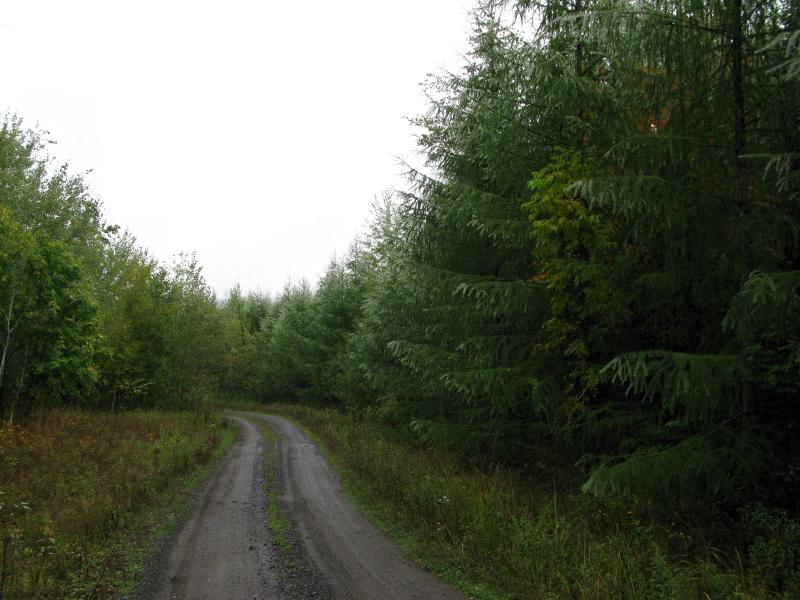
Well-maintained road surrounded by misty trees
When the thick pines on the right of the road opened up for an overgrown logging road I cut off the road, heading up a gentle slope. The sky was still cloudy, and thanks to the elevation gain and low hanging wisps, I'm pretty sure that some of the mists I walked through were low clouds. This surreal hike didn't last long enough. Soon the next outcropping made it's presence known, with the dark grey rock rising up from the forest floor and beckoning me up. This climb was tougher than the Silver River outcropping, forcing me to crawl and zig-zag along crevices to reach the top.
Farms and woods on Point Abbaye
Looking straight up Huron Bay
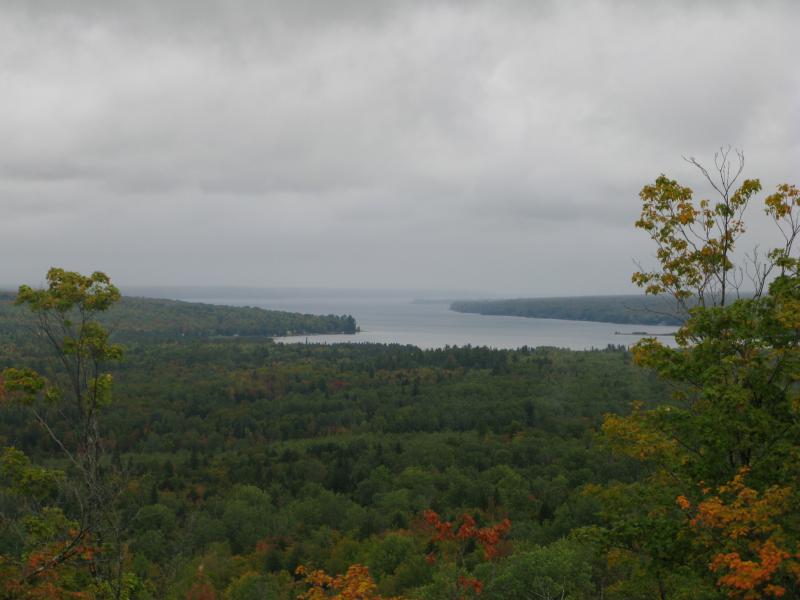
Zoomed-in view of Huron Bay
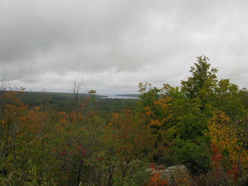
This outcropping was more reminiscent of the peaks of the Huron Mountains to the east than the Silver River outcropping. Bumpy, misshaped grey rock rose suddenly out of the forest floor, giving excellent views to the west and north. This had to be the lookout for Dakota Farm… even with the mist and fog I had a great view of Huron Bay and could easily tell if a boat was approaching the mouth of Silver River. I rested here awhile, drinking in the scene and planning the rest of my hike.
There was still a few high spots I wanted to check out so I turned to head south. The south slope was much more gentle and had a four-wheeler path, so I headed down that for a bit before cutting through the woods. These woods were a bit younger than before, twisting my route and raining down water when I brushed against a tree, but it was relatively easy to each of the other outcroppings. While they were bare on top, neither were tall enough to grant me a view over the surrounding trees, and I continued south without too much delay.
Low basalt rise nestled in the trees
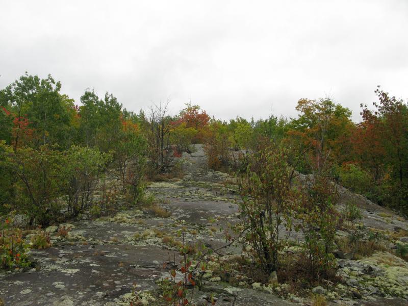
Most of my attention had been spent looking north towards Point Abbaye. There was one spot that I hoped to get a south view, up the Silver River valley. A short distance from the two low outcroppings was a ridge facing south, so I ventured over to it. A surprisingly long, east-west rise of rock offered a slim view south to the greenery upriver as well as easy walking. I trotted downhill along the rise to the west, careful of the wet rock below but enjoying the break from the soaked woods.
South up the Silver River valley
I dropped back down to the forest floor inside of a low, flat valley. Done with outcroppings, I now wanted to head south towards Dakota Creek to check for waterfalls. There was a suspicious elevation change that I wanted to check out but first I had to push my way through a young forest left over from recent logging. The trees were less than twenty feet tall and packed close together, perfect for collecting the rain and mist to shower down on me while I walked past. Eventually I gave up trying to avoid it and just pushed my way as quick as possible, getting further drenched in the process. Finding an overgrown path, following it to wider road, and finally finding the main logging road along Dakota Creek was a blur of cold and wet that I was glad to be done with.
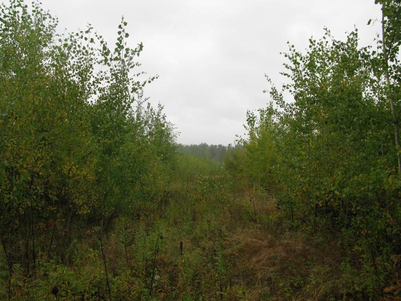
Thick brush and overgrown trails left from logging
Guessing that the falls were to the west I turned right, following the logging road downhill. I passed Dakota Farm Road where it crosses the creek and soon heard a familiar noise to my left. Cutting off the road down towards the creek over a surprising amount of old boards, wires, and trash I found a small and narrow creek running over dark rocks. It was only a short distance upstream that I found Dakota Creek Falls, a stepping set of drops cutting small slides into the solid rock.
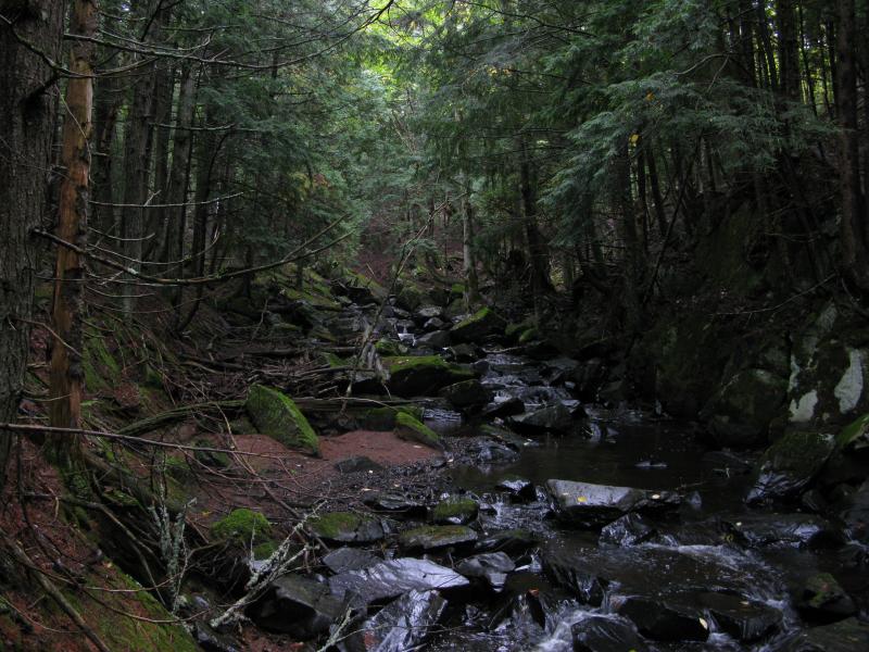
Damp, shaded Dakota Creek
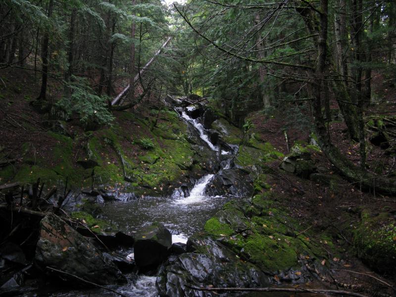
Sliding waterfall between slick wet rocks
The feeling you get after finding an unmarked waterfall is always pretty cool. There are many named drops in the Upper Peninsula, but to find one that is so relatively close to a well-known spot (Lower Silver Falls) that is not visited often or named is definitely exciting. After slipping and sliding up the waterfall, taking pictures of the individual drops, I headed back up to the road and continued on, elated. I had found both the lookout I was looking for and a new waterfall, and I was less than a mile from my car.
My return trip was soon complicated once I walked into a small meadow. My nice road ended with only a small spur leading north. I took it in hopes that it would take me to Silver River, but it petered out after a few hundred yards. In hopes to find the river easier to follow I veered westwards and found a cluttered, steep riverbank that slowed my progress to a crawl. Fighting for every yard through some of the thickest undergrowth in the area I cursed my path, knowing full well that I could have backtracked onto Dakota Farm Road and my original route up the first outcropping. It took awhile, but I finally made it back to the falls and my car.


-
Jacob Emerick
Sep 4, '12
Hey Dave! Good to hear from you, sir. I was kinda hoping to find some remnants of the Farm up near the lookouts, but I wasn't sure where or what to look for. The waterfall was a nice surprise.
Add to this discussion-
Jacob Emerick
Oct 22, '12
Hi Henry! Yes, it is usually gated. I've never seen the north end unlocked, but the south entrance off of Arvon Road has been open a few times. It leads through a gravel pit right close to some of the Middle Silver Falls. Hope you're able to get to those area, and glad that you enjoy the blog!
Add to this discussion-
Jacob Emerick
Oct 28, '12
That's right, I remember you telling me about the concussion! I might have a picture of the plaque, I'll have to dig through my archives to check. The first time Katie and I visited the falls back in the summer of '06 we wandered around taking pictures of the river and I know we saw it. There was also a huge spider that I had to save Katie from, pretty sure it was a Fishing Spider. Also speaking of strange events, have you been to the upper falls on this stretch, a couple hundred yards upstream just under the remains of a railroad bridge? I had a tough going there once with a puppy, thought I was going to get swept downstream in a freak thunderstorm that swelled the river like nothing I've seen before.
Add to this discussion-
Jacob Emerick
Aug 22, '14
It was hard to make out, if I remember correctly, but it was a memorial I think. Want to say that a young girl (or boy) drowned in that area, maybe in 90s. It was hard to make out all the words.
-
Sarah
Sep 22, '18
I follow Nancy’s Haun’s Facebook page. I was intrigued by one of her posts regarding the Dakota Farm. I of course had to do a google search, which led me to this thread. After reading the comments I was plotting a trip to the falls with a hike in mind. Well, spontaneously today my hubby and parents and I stopped at the falls. I told my husband about the plaque so we attempted to find it. It is a memorial, but not for a young girl. She was around 74 or so. I’m thinking maybe this was a favorite spot of hers. I only hope to be loved by someone enough to be memorialized with a plaque like this. IMG_1089.jpeg I’m hopping the pic posts too!
-
Jacob P Emerick
Oct 1, '18
Hi Sarah, and great to see a fellow follower of Nancy's adventures! Thanks for providing more information about the plaque. We were so distracted by the fisher spider that I completely forget the details, lol.
Add to this discussion