Across the Mazatzals: Crossing Deadman Creek
Waking up was hard, and getting all my stuff packed up and ready to go was even harder. Not only was I sore from yesterday's beating on the trail, two nights of broken sleep was beginning to wear on me. That elk towering above me at ten last night didn't help things. I managed to get some hot coffee in me and left Mountain Spring just before sunrise, making quick work of the short walk over to Deadman Trail. This is where the fun begins.
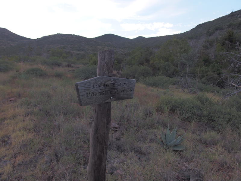
The start of Deadman Trail
Today's plan was simple, mostly. I was on the north side of Deadman Creek, that tiny drainage that started way up along Willow Spring Trail, and needed to get to the south side. Deadman Trail crossed the creek by dropping 1800' and then climbing 1200'. Which didn't sound like a fun time. This trail meets up with Davenport Trail and then, ideally, I would cut over to Sheep Creek Trail to knock out the three mile section between Davenport and the old cabin on Sheep Creek before spending the night at Club Cabin. Maybe fourteen miles in all.
The biggest challenges were elevation, heat, and the unknown condition of Deadman Trail. I knew nothing about it. The first bit was promising, a well-marked path leading down to Horse Creek (the same thing that Mountain Spring flows into), although as soon as it met the trickling water the cairns disappeared. I paced back and forth a few times, hoping to find some trace of the path, before hacking my own way up the thick bank. Up top all I could find were game trails, no clue on how to get past an unexpected rusted, barbed fence, and was forced to shimmy under in a most undignified manner.
That well-marked trail was completely gone. I paced back and forth a few times, hoping to find something, and could not find a single cairn or anything that looked to be more than a game path. Without something to follow I blazed my own way up the next hill, a modest 300' climb through cactus and catclaw that knocked the wind out of me. On top I found another barbed fence without a break and was again forced to slide underneath. This was going to be a long day.
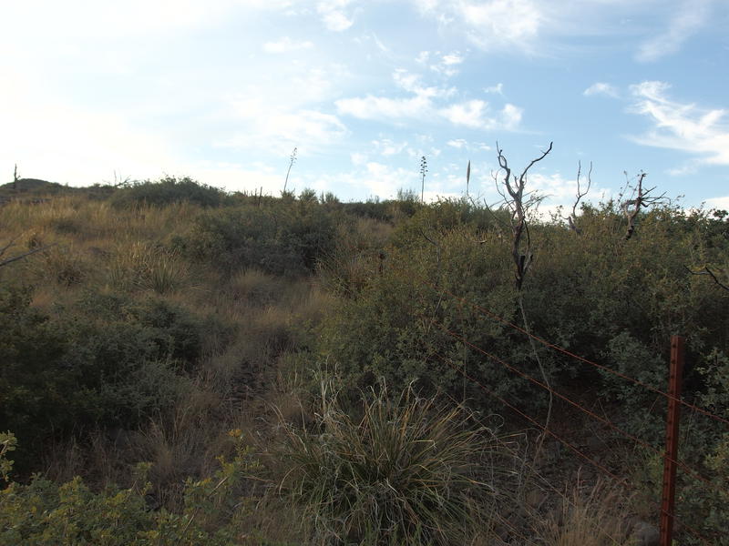
Old, annoying fences to deal with along the trail
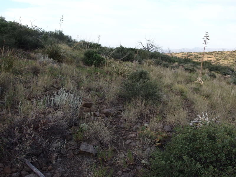
Barely visible trail among the grasslands
Ten minutes later a small cairn showed up, and then another one, and then I was on trail. The next thirty minutes was a dream. The trail weaved in and out of a number of drainages, staying relatively level as it bypassed small hills and valleys, and was effortless to follow. Shoot, I never could have expected anything this nice in a remote corner of the Mazatzals. I must have really messed up while crossing Horse Creek to miss this. Soon I was overlooking the ridiculous drop down to Deadman Creek with a full silhouette of the Mazatzal Divide on the horizon.
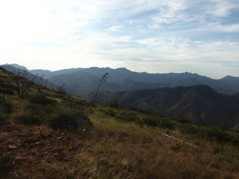
Looking along the Mazatzal Divide
It's nice to be able to recognize the peaks of that ridgeline now. Last year I would have waved in that general direction and muttered something about Peeley; now I can pick out Saddle Mountain, the Peeley to Sheep ridge, those unnamed peaks near Bear Spring, and Mazatzal Peak individually. Suppose if on spends enough time hiking the same wilderness week after week they start picking up on the landmarks.
So, I was overlooking Deadman Creek. Before the real descent the trail veers west and parallels the creek, dropping off a tall hill and aiming for a little saddle. Most of this had easy trail to follow. I did lose it a few times, as paths tend to switchback on steep climbs and those can be hard to follow through tall grass, and when I made it to the saddle I was pretty confused. There was another fence to cross and the path didn't seem to handle this gracefully. I always assumed that fences would give to a trail, that there would be a gate or latch or something, and these fences seemed to not care one bit. In fact, the trail got more faint nearby as hikers and animals were forced to find their own way across.
After a half-mile of bushwhacking and sliding down the steep, loose hill I was able to pick a trail back up, and again it was annoyingly easy to follow. Cairns and good tread cut a route into the hill that descended easily and regularly. Someone cared a lot about this trail at one point, even if sections had faded with time. Reminds me in some ways of Copper Camp Trail ten miles to the south, which has excellent construction marred only by a few overgrown bushes and wash-outs.
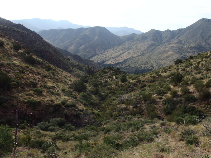
Long ways down to Deadman Creek
I trundled down the hillside, impatiently watching the green growth at the base getting steadily closer. This creek seemed to make a wider cut than anything else, as the descent didn't seem that steep, especially compared to the distance. I might be singing a different song on the way back up. My trail followed the hillside until it headed out on a low ridge, than dropped quickly into a wash, then faded as it entered the creek proper. I couldn't care less at this point - there was an excellent source of water to enjoy.
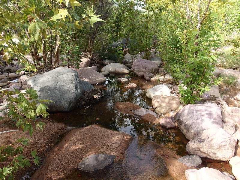
A most pleasant section of Deadman Creek
Time for second breakfast, a sock change, and all the water I could filter. This creek was clearer and cooler than anything I had dealt with this weekend and I wasn't about to pass by thirsty. My filter performed slowly at best, taking well over a half hour for gravity to push through 1.5 liters, and I wondered (not for the first time) if I should try a Sawyer Squeeze. For now I dealt with it, pulling up to full capacity, before continuing on.
Directly on the other bank was a corral, tangled and overgrown with thorny mesquite trees, and no cairns. Curious I followed the creek upstream and eventually found a single cairn without much of a path. The bank didn't look promising, though I assumed it doesn't take much time for things to get overgrown this close to water, so I pushed up through some terribly thick stuff and broke through to a grassy slope above. There was no trail or cairn to find so I started a zig-zag climb in hopes to find it.
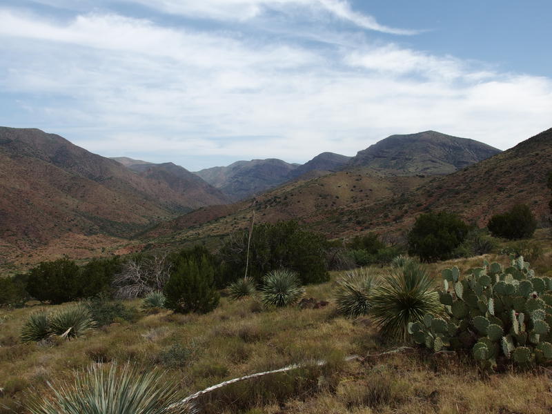
Hot, exposed climb
So began the wretched climb. Eventually I'd find some cairns, further east than I expected, though tracing a route in between the piles of rock was difficult at best. Instead of wasting too much time on that I kept climbing and only took advantage of the faint trail when it was convenient. Things were never that steep, with an average grade of 15%, just enough to push my already-tired legs beyond their comfort. Plus the temps were climbing under the hot morning sun. When I finally reached the top I was drenched with sweat and in rough shape, swaying a bit as I looked back over Deadman Creek, trying to gauge my ability to do that Sheep Creek Trail segment. This is when the wasp got me.
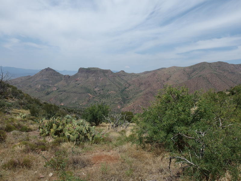
Looking back over Deadman Creek
I got four stings in my right arm before I realized what was happening and smashed him. Darn thing had gotten caught inside my sleeve and couldn't fly out. I took off my shirt, made sure he was alone and checking on the stings, and then did a quick self-check to see how I felt. My dad is allergic to bees and wasps and I'm a little hyper-sensitive to that. Nothing seemed off, so I pulled my gear back on and started downhill. Going down was easy enough, a gentle trot over a mostly-defined path, though things started to get a bit confusing at the end. Not really on the trail front - I started to feel confused.
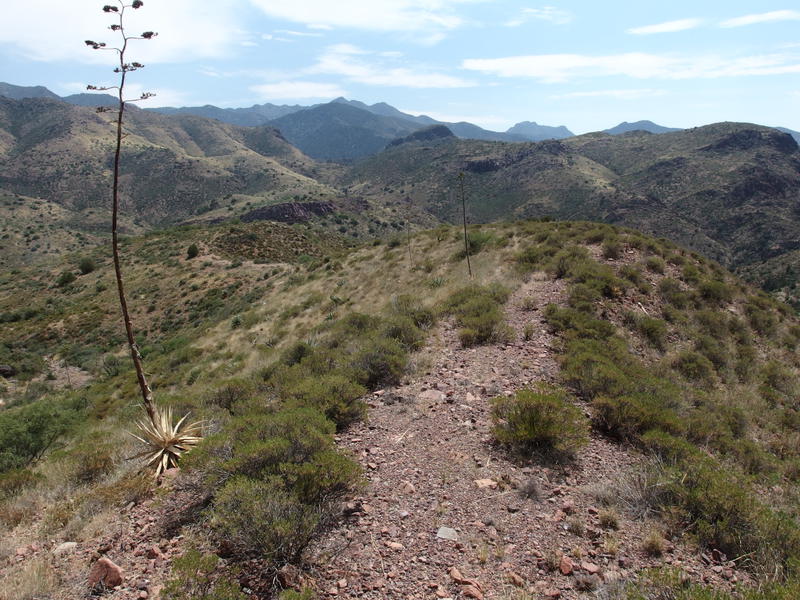
Dancing along the narrow ridge path
Beginning to get worried about either heat or the stings were getting to me I decided to ping Katie on the DeLorme about the wasp, and then, instead of focusing on Sheep Creek Trail, I headed over to my planned campsite for the evening. I could relax, water up, and then make a rational decision on what to do next. It was shortly after noon and the hike to Club Cabin was only a 400' climb over a half mile. That short hike took forever. I couldn't track the trail, I was short of breath the entire time, and my heart rate was zipping up and down. Something was off.
Things didn't get better when I reached the old cabin site. My first thought was to get water, so I followed the use path up to the spring to pull water. However, I couldn't find any place to hang my hammock, so I left my trekking poles at the water and headed back down to the corral to hang my hammock. Nothing looked good there, so I left my water bags there and returned to get my trekking poles. I was back at the water, where I would eventually be filtering from, so I left my water filter there and returned to the corral. It was here that I realized that I was being stupid. Instead of making more useless loops I stopped, laid down in the shade, and tried to make sense of an increasingly senseless situation.
Something had me unbalanced and I could feel panic setting in as my heart and breathing refused to settle down. I took a benedryl, informed Katie of my worsening state, and finished another liter of water. When I started to feel a bit better I set off, carrying only a water bucket to minimize stupid mistakes, and pulled ten liters for later filtering back at the corral. I drink the water about as fast as it made it through my filter and let the day slip away, napping and drinking and moving as little as possible. At some point Katie and I decided that the best option was for me to follow Davenport Trail down, the shortest and easiest way out of the wilderness, though there was no way I could handle those miles today.

Messy camp at Club Cabin
Part of me was appalled that I had let an entire afternoon waste without covering any more ground. Sheep Creek Trail was so close, and I only had three miles left to finish the entire thing, and it was such a pain to finish. Plus there was the seven miles of Davenport between here and Chilson. However, something broke in me today, and knowing that I was in an irrational state was terrifying. I suppose that I should be grateful that Katie was there for me, that she had come up with an early exit plan, and that I was able to get to a spring and not need air rescue. Those stupid trails can wait until later.
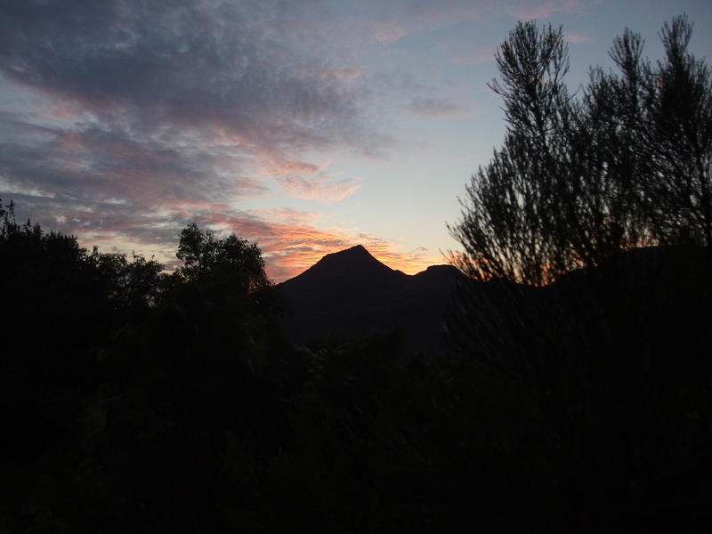
Sunset over Table Mountain
As the sun died I finished a hot dinner and settled down for the night, fully hydrated and with a solid plan for tomorrow. Chris and Katie had driven up that afternoon and were parked at Horseshoe Dam, and were even camped at Sears Trailhead, a mere twelve miles downhill from me. Tomorrow I would head down towards them, and maybe they would head up to me, and together we would get the heck out of here.


Comments (0)