The Mulligan Area
There are several important pieces to the 'Mulligan Area' of Marquette County. Mulligan Plains is a long, narrow valley pointing from the western end of the Dead River north to Pinnacle Falls on the Yellow Dog Plains. Emptying the large and wild Mulligan Swamp into the Dead River is Mulligan Creek. Along the creek is a series of relatively unheard of waterfalls collectively called Mulligan Falls. All of these are wrapped around Silver Lake Basin, the uppermost dammed basin along the Dead River, located on the edge of the Peshekee Highlands.
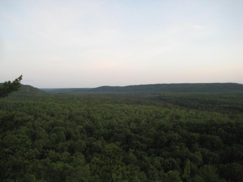
The Peshekee Highlands are a large, expansive, and rugged plateau just south of the Yellow Dog Plains. The elevation here is surprisingly high, usually around 1600 feet above sea level. Much of the plateau is swampy and sprinkled with lakes; the hard rocky outcroppings make it difficult for the water to drain out regularly. This area also has mineral wealth, with numerous abandoned gold and silver mines throughout the plateau. Almost two-thirds of the highlands are located within the McCormick Tract and Craig Lake state parks, and the remaining portion is too rugged for regular traffic, making it the whole area exceedingly difficult to visit.
Northern Mulligan Plains
On the eastern boundary of the Peshekee Highlands is Mulligan Plains, a wooded valley with several cabins interspersed along the two county roads that wind up its length. Most of the plains is composed by tall pines and sandy ground, except for the swampy area north of and around Mulligan Creek. On the eastern side of the valley are several lakes perched hundreds of feet above, including the Rocking Chair Lakes, a DNR designated camping and fishing area. The Silver Lake Basin is located on the western side of the valley, also perched above the valley. Thanks to the narrowness of Mulligan Plains, you can see both sides rise up suddenly from the county road, which heads north before terminating at Mulligan Creek about two-thirds into the valley.
Eastern side of Mulligan Plains
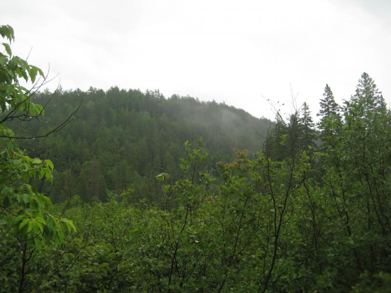
While Mulligan Creek drains a massive swamp of the Peshekee Highlands, it is normally a small river easily crossed by Beaver Dams or fallen logs. Thanks to its swampy headwaters, the river is heavily colored, even appearing to be a deep red in the larger pools. There are only two bridges over the creek: one easily driven over at the entrance of Mulligan Plains along Silver Lake Road and a second one at the end of the county road that can barely support a four wheeler. Due to this, the only way to easily visit Rocking Chair Lakes involves crossing the creek on a beaver dam near the end of the easternmost county road. While Mulligan Creek is calm, swampy, and deep within Mulligan Plains, it has a large and tumultuous drop before that result in a number of waterfalls and rapids along the creek.
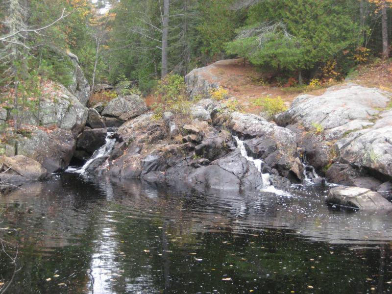
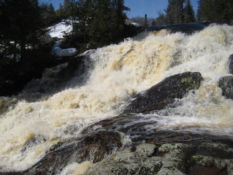
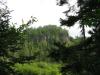
Mulligan Falls
It is hard to say how many waterfalls are along Mulligan Creek simply because there is no easy way to travel along the creek. You can only drive to within a mile of any sizable drop, and there are no trails or tracks that run along the creek, so any adventure involves heavy bushwhacking through old cedars, thick swamps, and rugged terrain. From the swampy headwaters, the creek drops around two hundred and fifty feet within six miles before calming down. The formations in this area force the creek to drop several dozen feet at a time, either over pillows of basalt or through narrow gorges carved in the rock, with large pools and swamps between each drop. The last several drops are located in a very old, deep canyon, with moss-covered cedars and towering rock cliffs reaching up to the sky above. While this area is beautiful, finding and exploring it is beyond the difficulty level of most hikers.
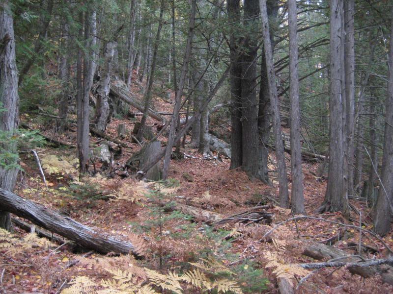
Woods near Mulligan Creek
Mulligan Swamp is easier to access by avoiding the plains and swamp all together. North of Champion and Humboldt is a maze of roads and popular fishing lakes that head west of Silver Lake Basin towards the swamp. There are a number of cabins and recreational areas in this area thanks to the accessibility, though few people actually head into the swamp. This area is the true meat of the Peshekee Highlands with thick woods, marshy lakes, and rocky hills.
Upper Mulligan Falls
To explore Mulligan Plains and Creek, head north on Deer Lake Road out of Ishpeming until you cross the Dead River. Turn left at the first fork, cross over Mulligan Creek, and turn right on the second two-track. This road will take you within a mile of the lowermost falls on the creek and deep within the valley. The road system north of US-41 is poorly marked and difficult to navigate, so bring a map and/or GPS unit to assist. The Rocking Chair Lakes are on the first right after Mulligan Creek, though this road is in very poor condition. Mulligan Swamp can be reached by taking Wolf Lake Road out of Humboldt, staying on Wildcat Canyon Road, turning right after Voelker's Creek, then winding northwards up onto the plateau.
-
Jacob Emerick
Dec 10, '09
I have been on a piece of Outlet Creek that didn't look promising for waterfalls, but it was near Pinnacle Falls. There's probably a few drops further upstream where the small swamps drop from the highlands. Stag Creek - followed it upstream from Mulligan Creek to a steep, rocky jumble that was bone dry. There might be more drops further upstream (not entirely sure where that jumble was, no GPS), but all we found was a bunch of rocks. Mulligan Falls is pretty amazing, though the upper falls is a heck of a hike. If you're feeling up to it, keep heading up the creek, as it looks like there's more drops another mile or so west. Though you might end up doing a whole circle around Silver Lake Basin if you decide to take two-tracks back.
Add to this discussion-
Jacob Emerick
Apr 5, '10
Anytime is good for Mulligan Plains! Although it will be quite buggy. I've been lucky with winter/late fall/during thunderstorm visits so far, but the swamps in that area promise some wicked swarms of black flies :PAs to getting to it, there is two main options.A) Take the first road on the right side after crossing Mulligan Creek. May be driveable, though it is crazy overgrown. Follow road up to the cabins (road goes through their yard) where it bends along their driveway for a bit before continuing north on a 4 wheeler path.B) Take the much improved second road on the right until you see a driveway ~1.5 miles on your right. Park, follow driveway until you see the cabins. The 4 wheeler path is on the left just within site of the cabins... No need to even walk close to them, though this does involve using their driveway (not sure if this is fully legal).After you get to the 4 wheeler path, follow it and cross Mulligan Creek on the beaver dam. 99% sure you'll be walking this whole time (unless Option A is actually driveable), but there's no way you can drive across Mulligan Creek (sanely). As soon as you cross the creek head rightwards up any path you can find. The lakes are on top of the steep hills/cliffs, so as long as you're climbing up, you'll find them. Alternatively, follow the small creek that flows into Mulligan downstream of the beaver dam to find the outlet of the lakes and a small waterfall, though this route up is pretty difficult.If you're feeling lucky after reaching the lakes, there's always Island Lake about 1/2 mile to the northeast. Bit more elevation and a heck of a hike (Peshekee Highlands can be pretty cruel to bushwhack through), but it's a neat little lake.Good luck, and thanks for the comment!
Add to this discussion-
Jacob Emerick
Aug 7, '12
Hi Leonard! Great to see you on here... I think we might have crossed paths last year and chatted a bit. It's sad to hear that people are leaving trash and/or creating large fires out there. That camping site is one of my favorite places to spend the night in the UP. I hope that those issues are short-lived and everyone can enjoy this removed and pristine area. Thanks for the comment!
Add to this discussion-
Jacob Emerick
Apr 18, '13
Hi Tom - I'll throw in what I know (even though it's been far too long since I was in the area). On my last visit to Rocking Chair Lakes I caught a glimpse of Silver Lake across the plains. It looked fuller than it did on my circum-route (when it was de-watered to pre-dam levels). That glimpse was over a year ago so I'm assuming it should be full now, haven't seen any news stories come across one way or another.
Add to this discussion-
Jacob Emerick
May 16, '15
Hi Travis, thanks for stopping by. Feel free to drop questions if you have any, you picked a great place to live and explore :)
Add to this discussion-
Jacob Emerick
Sep 14, '15
Oh wow, congrats Ben! I don't think that's a bad idea... At least, marking the trail up to the Mulligan Creek crossing. Keep lost people from wandering too close to your cabins.Anyways, I hope you enjoy the land and lakes. That's beautiful country up there.
-
Tom H
Oct 23, '15
Does anyone know if Island Lake, north-east of RockingChair lakes is accessible by car/truck ?
-
Jacob Emerick
Oct 26, '15
Hi Tom - it is not. There is an old track up there from the east, coming up from Clark Creek area, but it is gated off a few miles from the lake and makes for a long (but easy) walk up.
-
Ryan K
May 5, '16
I tried to follow your directions to the lower mulligan falls and ended up turning back I'm pretty sure I stopped just short of where I was supposed to go the GPS said I had arrived. Sucks I had to turn around cause my buddy was getting upset about a half mile of getting scratched up lol. Seeing how much trash was out in the woods by the creek would make you think that there was some signs of humans walking through. Also I'm surprised you don't have any entries for Craig Lake State Park there is a small waterfall http://imgur.com/tRwKVOB at the north end of the lake.
-
Jacob Emerick
May 9, '16
Hey Ryan,The waterfall definitely sneaks up on you. On my first visit I was constantly convincing my hiking partner to push on for just a few more yards, just a few more yards of bushwhacking and we'll turn around. We heard plenty of trickling water that sounded like falls that just ended up being beaver dams. When I finally broke through onto the large pool below the waterfall it was one of those weird, semi-mystical moments that felt totally unreal. So yeah, possible that you were right on top of it without noticing.As for the trash... that's really too bad to hear. I know a lot of fishermen visit the area and venture up from the bridge, though I don't want to blame any particular group. Shoot, it could even be stuff washed out of the swamps above from loggers or landowners. I hope that it didn't take you out of the adventure.Ah, Nelligan Falls. Yes, those are some that I never got to, kept pushing them off. One day I'll return and check them from the list. Did you find any other drops in Craig? I've heard rumors of more waterfalls hiding in the Peshekee, would love to know if they are anymore little ones in the park.
-
Ryan K
May 9, '16
Its hard finding anyone as willing as me to get messed up finding somewhere cool the same buddy made fun of me for trying to wade to the island on white deer lake, that failed attempt made me realize how boggy stuff can get, also after having a leg fall through at wetmore pond ive been super wary of shorelines although I think its irrational. That isn't Nelligan falls but I believe it is *mostly* seasonal. It's right at the portage between Craig and Clair lake so I am sure quite a few others have found it. There is a couple potential ones I can see using the google earths historical images but I think the american whitewater website already has most of them described :/. How do you avoid getting yelled at for trespassing? I tried to get to haypress dam falls and turned myself around because of the signs I thought about wading but I chicken out alot. I was told to buy a plat book to avoid stumbling across peoples stuff but the marquette county one seems to be in progress perpetually. Ive really enjoyed your blog I wish there were more like it I stumbled across it originally looking for information about bushell lake in Harvey cause I lived close now that I live in west ish I'm trying to find more stuff close to town that my girl will actually enjoy going to with me.
-
Jacob Emerick
May 14, '16
Wading in White Deer Lake, eh? I managed to do that on my last visit to McCormick (and the Upper Peninsula) before moving to Arizona. Never got more than chest deep on the way over. The island was a bit rocky to traverse with bare feet (or water shoes, as I think I had), but otherwise was totally worth it. They jammed a lot of cabins on the tiny thing. Would have loved to see it back in the day.It is hard to find willing partners for these kind of hikes. When hunting down waterfalls I always took the approach of finding the falls first, then backtracking the trail on the way out, which was never popular with my friends. But yeah, there can be some thick stuff out there that must people will balk at.Private property is tricky. Very tricky. I've always taken the route that asking for forgiveness is easier than for permission, which has had mixed results. If I see a property sign I'll turn around, but if I'm not sure I just try to respect the land and be polite. Dee Lundeen is very well marked. I've thought about approaching it from the east, to try bushwhacking in from the Peshekee Grade, never got around to it. Haypress Dam (14 miles up the Peshekee Grade) was always public... Did someone put up some signs?
Add to this discussion