Superstition Peak via Hieroglyphics
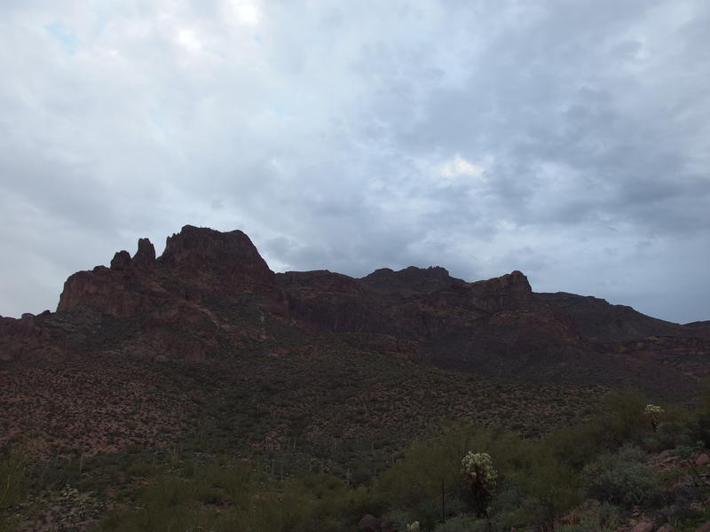
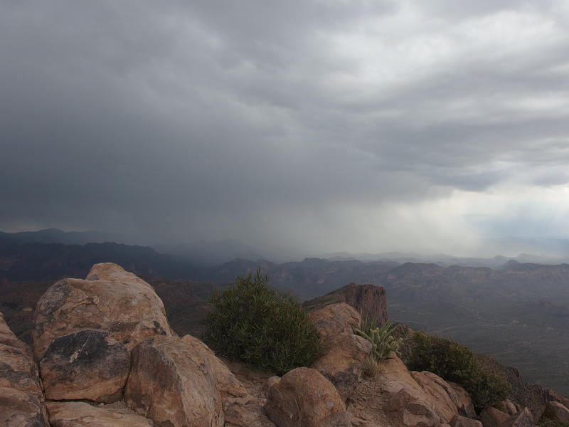
The gray clouds hung oppressively low overhead, muting the sunrise colors and darkening the usually-bright rock formations of Superstition Peak. I ignored the clouds and continued marching forward along Lost Goldmine Trail. Behind me, in my pack, my new phone chirped and an app I've been trying out, Route Scout, informed me that I was walking too slow and had a long ways to go (more or less). Grimacing I pushed faster against my trekking poles and ignored my leg muscles complaining about the six miles I'd already covered this morning. There was plenty more distance to go before the cloudy sky blossomed into afternoon thunderstorms.
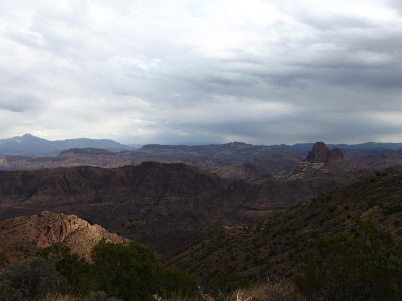
Making my way around Peak 5057
Two mountain bikers were the first sighting of the day. I was disappointed - had hoped to avoid seeing anyone until the trail junction ahead. The bikers passed me, heading east, exchanging polite nods when I stepped off the path for them. After them was a wash, a quick climb, and then the Hieroglyphics Trail junction. This was a busy spot. The parking lot below was filling up quickly, six cars pulling in as I paused at the junction, and there were several dozen hikers visible. The sun had been up for a good thirty minutes now, more than long enough to get people out and active.
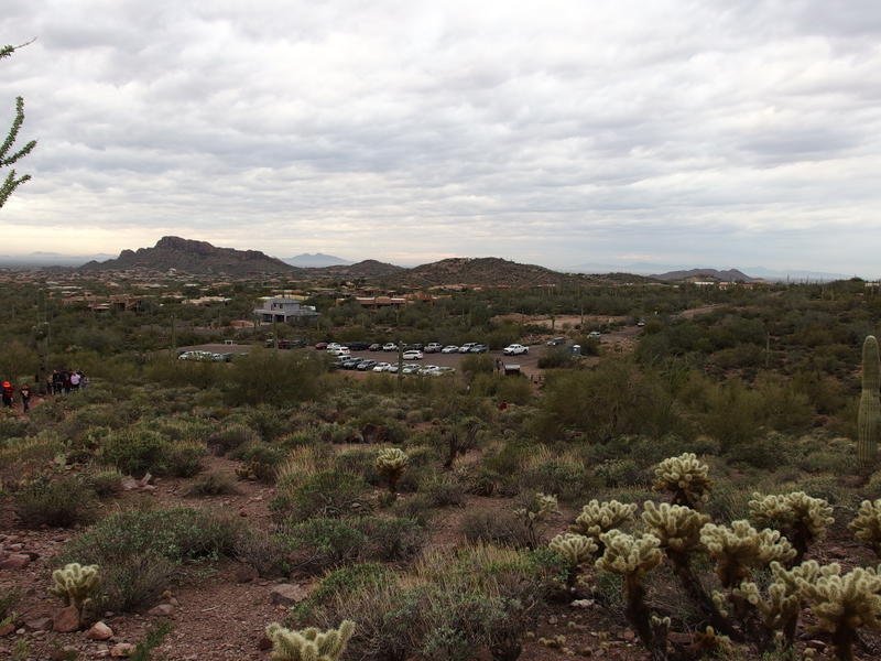
Full parking lot for Hieroglyphics
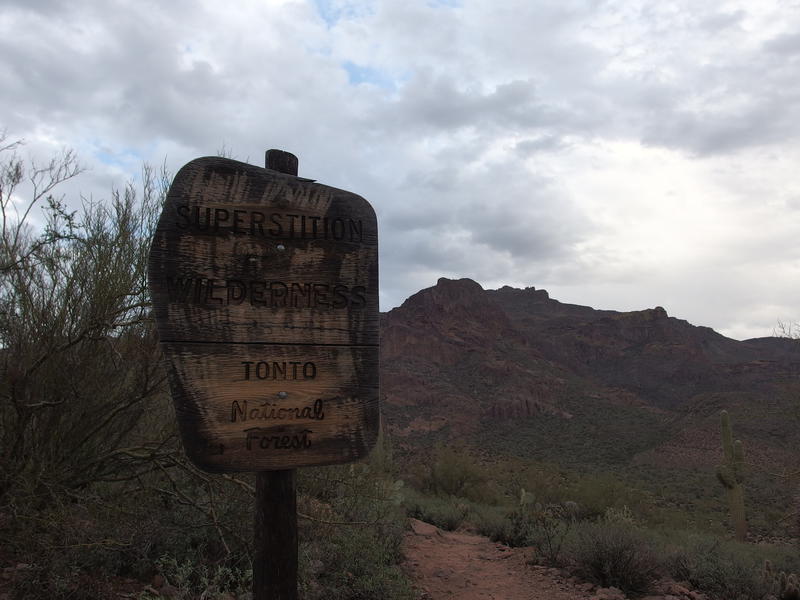
Glamor shot of the wet wilderness sign
I had expected that this section would be crowded. With a few photos I turned and headed up the trail with an even quicker step. 1.5 miles and 500' lay between me and the pools ahead, where all these hikers would stop and congregate before turning back, and then it would be solitude for a long time. I passed several groups in my headlong rush, including another solo hiker taking a break on a convenient rock shelf, and reached the pools in twenty minutes flat. There were people climbing around the petroglyphs, splashing in the water, and chattering loudly. I shouldered through with an antisocial aura and rounded a few bends to rediscover blessed silence.
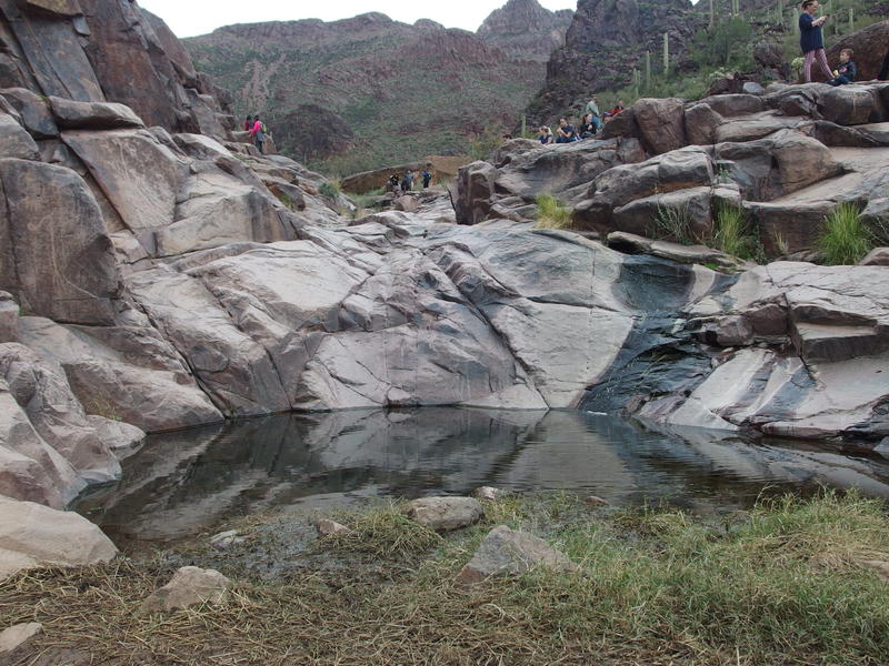
Crowds at the springs
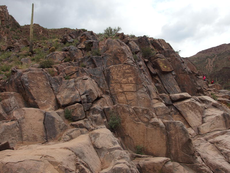
Small chunk of the rock drawings
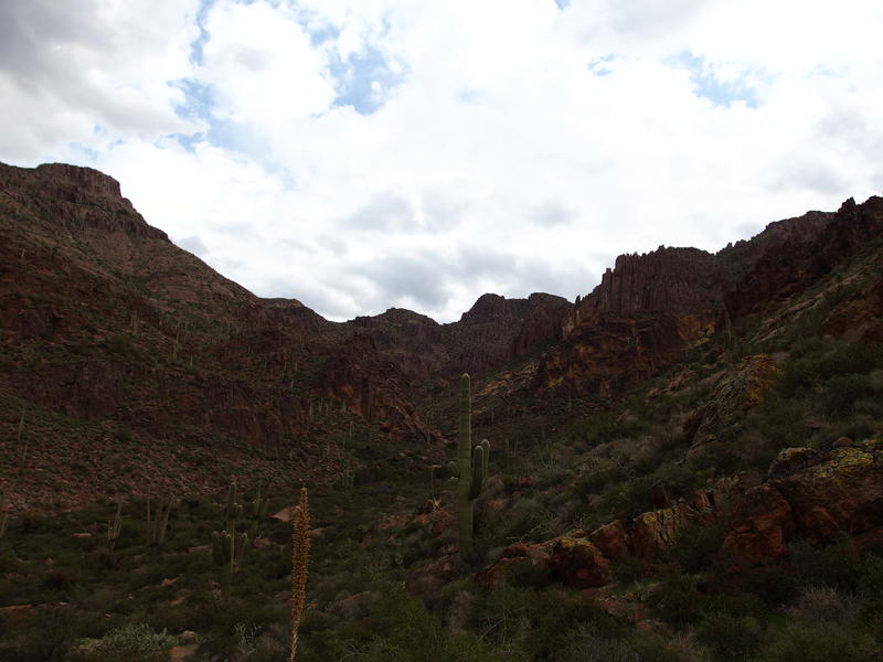
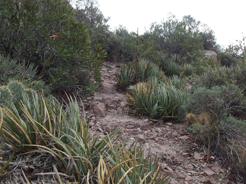
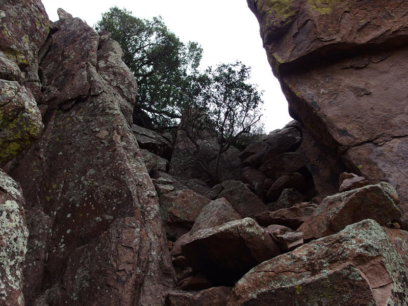
Pausing for a sip of water I ran through the next leg of the hike in my head. Two miles up Hieroglyphics Canyon along an unofficial trail, climbing 1700' over boulders and gravel and sheer rock faces. Not the worst thing in the Superstitions, though plenty difficult enough to be wary. I had hiked down it during my previous ascent of Peak 5057 and remembered it as being overgrown on the west end and steep on the east.
So far things seemed overgrown, as expected. The few bends above the petroglyphs climbed up the banks of the canyon, staying above most of the boulders, forcing me through prickly brush and steep gravel slopes. I didn't remember it being so steep last time. Granted, I had been exhausted and heading downhill after a long morning, but there was a lot of big steps out here to deal with. I eyed up the canyon around me, trying to pick out familiar formations, when a dark cloud blew in overhead and sprinkled me with motivation.
A wet, steep climb up the canyon
The route climbed up the banks of the wash, dropped into little side drainages, and then climbed up again. A few weird switchbacks and misleading cairns kept me on my toes. The trail was actually pretty well maintained, with some recent pruning of the encroaching brush. Any mistakes I made could be chalked up to sweat in my eyes or general exhaustion. As I lumbered upwards I kept an ear out for running water. Today I had only brought two liters, with the hope of filtering if needed.
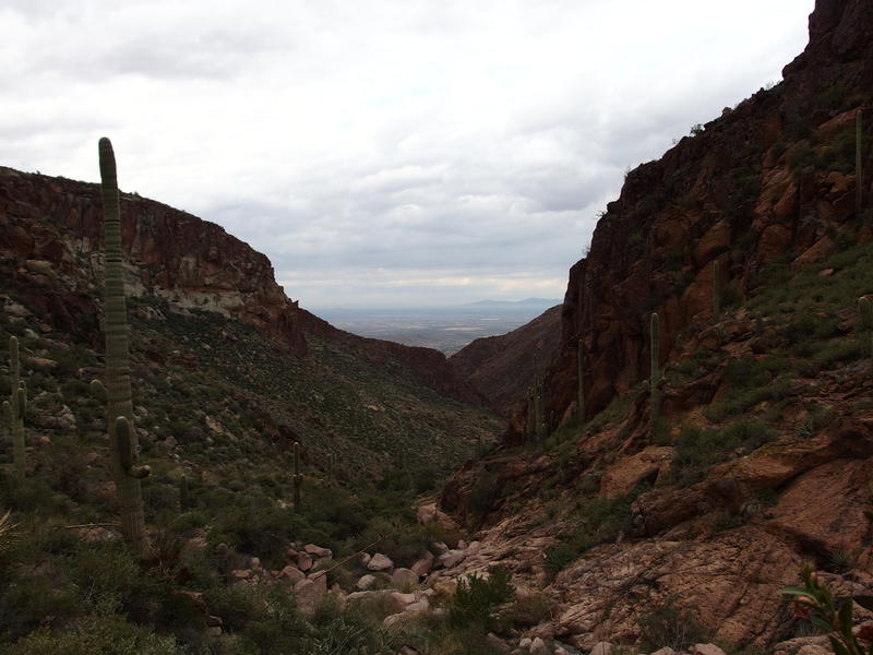
The wash below forked a few times, and each time I had to check carefully to make sure I took the correct one. High above me was a huge rocky peak that really looked like it was part of the ridgeline, which this trail eventually met with, so I kept thinking I had to start climbing towards it. That peak wasn't part of the ridgeline. Had to check the map twice to convince myself. Within the canyon my sense of direction began to go loopy. Not that it mattered much - I had a trail to follow and a GPS track to guide me forward.
Gaining elevation along the canyon

Pooling water near the final climb
Some pools of water at the last wash crossing showed up just as my legs were starting to cramp. I decided to give myself a luxurious ten minute break here. Drinking a full liter, filtering some water, and even enjoying a small snack, I tried to ignore the ticking clock and the coming storms. Suppose I could turn around, though at this point there would more miles involved in backtracking. Plus there's no fun in backtracking. When I tried to stand up my hamstrings seized up, forcing me to stall and stretch, and when I finally started moving again a literal wall of rock faced me. It was time to climb up that steep eastern end of the trail.
A sudden change in hiking difficulty
Breaking over the ridge
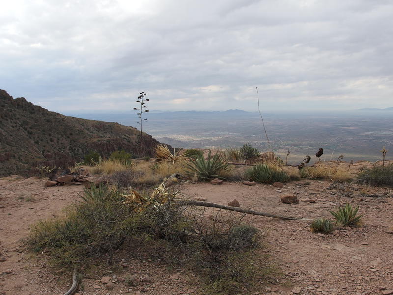
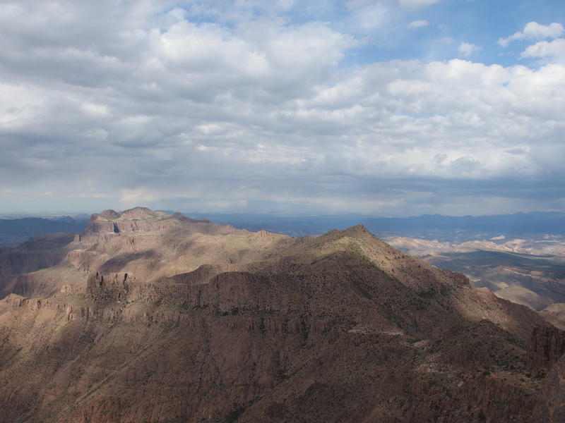
Once I broke the top of the ridge I paced slowly back and forth in the saddle, knowing that if I collapsed on the ground my legs would knot right up. Cooling down and continuing to move I drank in the views to the east. The west wasn't that exciting, just the canyon and Phoenix beyond, but the east had Weaver's Needle and Four Peaks and Tortilla Peak and lots and lots of dark clouds. That rain was a-coming.
There was still more distance to travel. I turned right at the ridge and followed the informal ridgeline trail. The first thing it treated me to was clusters of shin-stabbers. I'm not sure what these things are called, I just know that they did a great job gouging out hunks of flesh back on Malapais last year. Not my favorite desert plant. Beyond the shin-stabbers was an epic campsite (there was a smaller one back at saddle) and then the trail died. Great - five minutes in and I had already lost the path.
Terrible little plants along the trail
An epic camping spot near the saddle
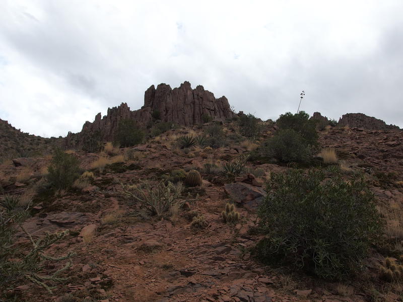
Unwilling to trace back to the saddle I checked my position and saw that I had strayed a few hundred feet to the right of the trail. A few hundred feet to the side and a few hundred feet below, that is. I cut a diagonal route to tackle the difference slowly and cursed the prickly brush and loose boulders along the way. Soon I rejoined the trail, which cut a fairly level path across a huge boulder field that tumbled down from the butte that sits north of Superstition Peak. I was getting close to the top.
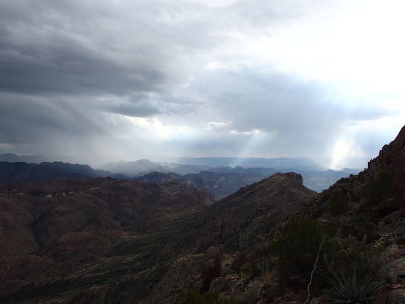
Sheets of rain fighting sun rays
On the far side of the butte was a small saddle and a tough climb through a little chimney. I remembered this spot. When Chris and I had hiked the Superstition Ridgeline two years ago (I've been in Phoenix for two years? Geesh.) this was a rest spot for me while I wanted for Chris to catch up. I was out of water and exhausted and there were wasps buzzing around. There was no Chris or wasps today, though I was again exhausted and cramping. I lugged myself up chimney, creeping along the cracks and lifting over rocks, and reached the top with a dramatic huff.
Fun little rocky chute
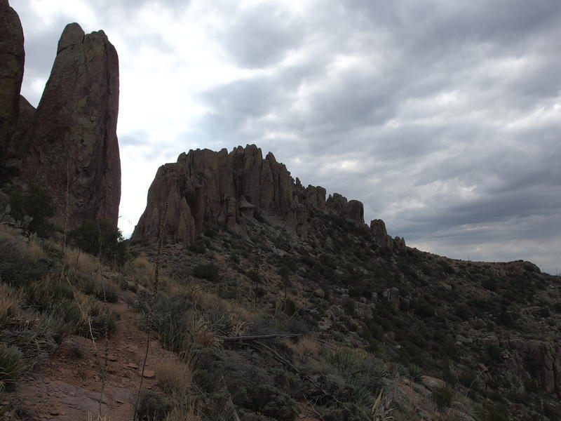
Nearing the hoodoos around 5057
Hoodoos surrounding the peak were so close, no more than two hundred feet up. My legs let me know that I was going to pay dearly for those two hundred feet. I circled around, getting one last good look down at the saddle above Hieroglyphics Canyon and the ridgeline beyond, and saw two hikers coming from the direction of Flatiron. I gave them a holler and didn't hear a response - either they couldn't hear me or they were more civilized. They seemed unsure about continuing on in my direction or turning down the canyon, likely being cautious with those dark skies in the southeast. I didn't wait to see their decision and pushed on.
From here things were simple enough. The path swayed between tufts of vegetation and climbed slightly, swinging close to, yet not climbing, the highest point. Too many hoodoos surrounded the highpoint for the trail to do that. Once I was past the peak I saw the fork heading back west and took it, hating the sharp change of incline that showed up. A few cairns led over the rocks and to a break in the hoodoos, and to a rock wall with a small crack barely wide enough for my toes to edge along. And then I was at the top of Superstition Peak. I took a few quick photos before giving in and dropping for a seat near the peak log.
Shifting light over the ridgeline
Dark clouds hiding most of the western Supes
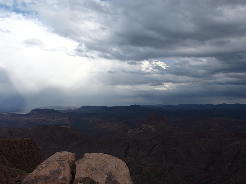
2800' higher than my starting point this morning, though with all the ups and downs (like Turk's Head) I had climbed well over 4000' so far. I drank deeply from my clean water and filtered out a dirty liter that I had hauled from that last pool in the canyon. My legs ached and I needed at least an hour to relax the cramps and to enjoy the large lunch I had brought. Those storms weren't waiting for me to work out the cramps. After the water was filtered and I had wolfed down a granola bar I stood up painfully, eyed up the storms roaring through the Supes not more than five miles to the east, and began the long descent.
Solid storms over Coffee Flat
While I had been briefly resting on the peak Katie and I sent a few texts back and forth, and she had updated me on the weather situation. I was mildly safe, most of the storms starting near Superior and drifting northwards into the Supes in between Reavis and La Barge. All that was miles to the east. Some things were starting to form up in the southwest and could drift over this position within a few hours. As we texted I had watched the storms, seeing the physical manifestation of her radar screenshots flash with huge bursts of lightening, and didn't feel like getting caught in that while so exposed. Which meant that I had a few hours at most to get back to my car, thousands of feet below, and maybe check out something cool along the way.

Comments (0)