South Bluff of Rockland
Sitting south of the town of Rockland and the famous Minesota Mine is a long buff overlooking the Military Hills. The bluff is not especially tall, staying below 1400'. Other outcroppings along the Trap Hills and Gogebic Ridge easily close in on 1600'. In fact, if it wasn't for Irish Hollow Cemetery I might have never even noticed South Bluff of Rockland. A few years ago I visited the cemetery and, curious about the nearby ridge, climbed the trail and was blocked by dense wall of fog. Today I hoped for more luck.
Last night had been full of storms and rain, driving me from my tent and leaving me with little sleep. As I tiredly stepped from my car, shielding my eyes from the morning sun, bugs zeroed in on me to fill my ears with their whines. Around me the foliage steamed and dripped from the last night's soaking. This, this was going to be a fun morning.
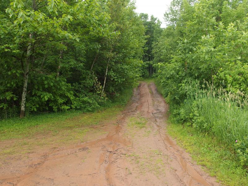
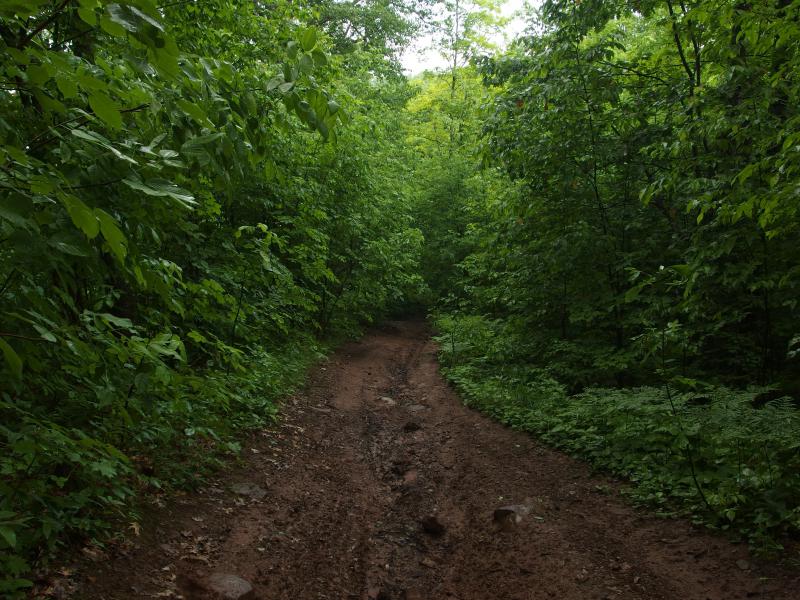
Rutted muddy road past Irish Hollow Cemetery
Grabbing an apple for breakfast I headed up the slimy mud track past the cemetery. I was only interested in the bluff today. The muddy open way quickly turned into a narrow, overgrown ATV trail, more suitable for hikers than wheeled vehicles. I couldn't help but gape at the green surrounding me on all sides. For as wet and buggy this UP summer was turning out to be it sure was pretty. As I looked around me I felt a deer fly bite into the knuckle of my ring finger. I miss the winter.
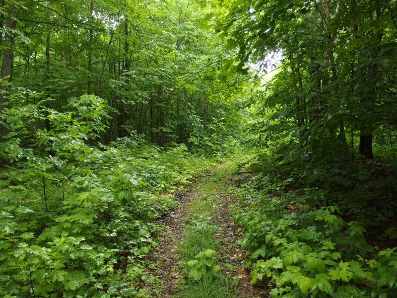
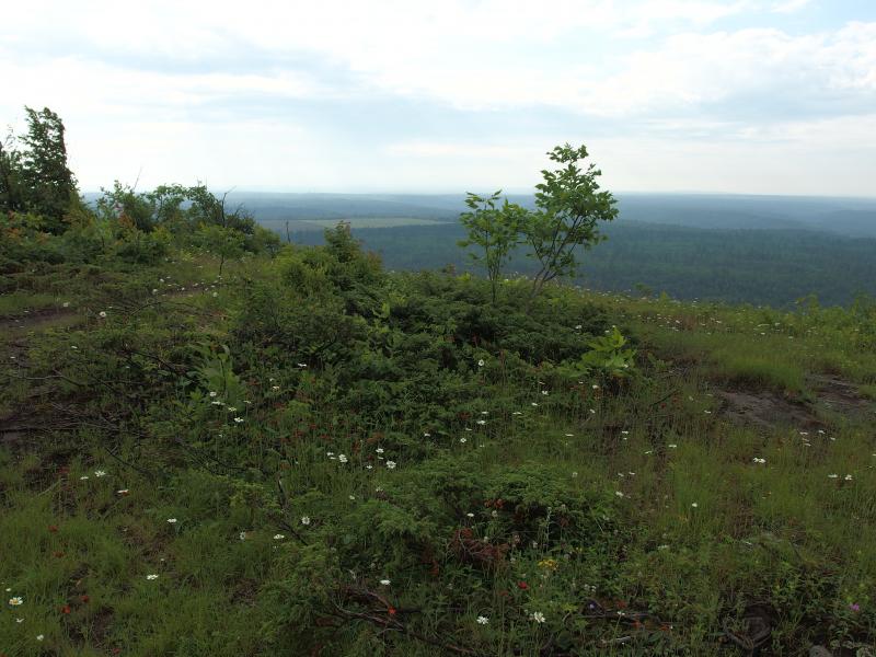
Overgrown ATV track up South Bluff
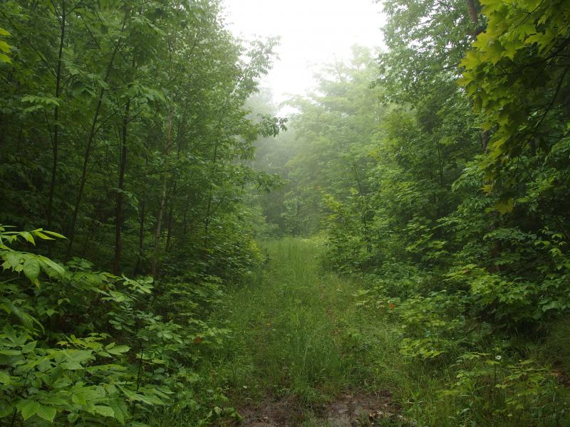
Dreamy, misty haze near the top of the trail
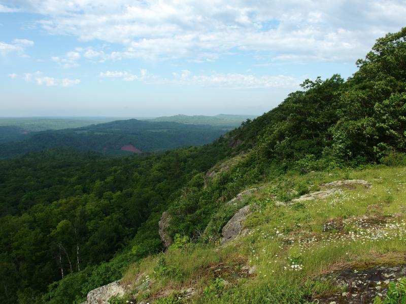
Before long I was near the top of the bluff, the trail leveling out and turning west. Ahead I saw a cluster of low mist, looking like a low-hanging cloud dragging gently through the woods. Boy, I hope that it wasn't going to be blocking my view today. I turned southeast anxiously, cutting through the wet woods towards the ridgeline, letting the wet green slap and drip on my clothes. Freshly dampened I burst out onto the ridge and was greeted by the wide-open view I had been hoping for.
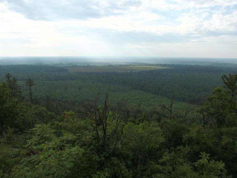
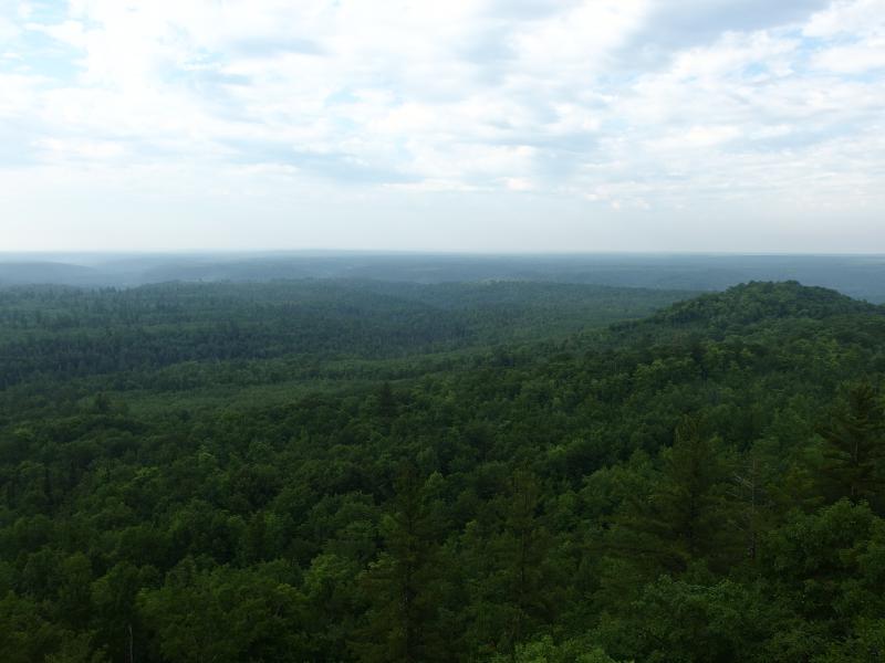
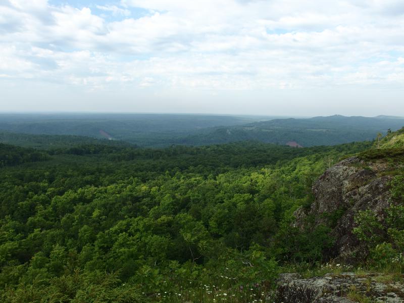
First view down from the bluff
I couldn't make out much, with limited knowledge of this land combined with the hazy humidity. There were a few fields, farmland that sits along US-45 maybe a mile away, and everything else was forest. Some of it was logged recently, light-green brush next to the deep green of established growth. With a bit of imagination I could make out some of the dip near the Ontonagon River. This I wanted to see. I was close to the junction of West Branch, East Branch, and Middle Branch, three mighty arms of the river joining between North and South Military Hill, and I would love to see them meet.
South over the different Ontonagon River branches
Looking west to the Victoria hills
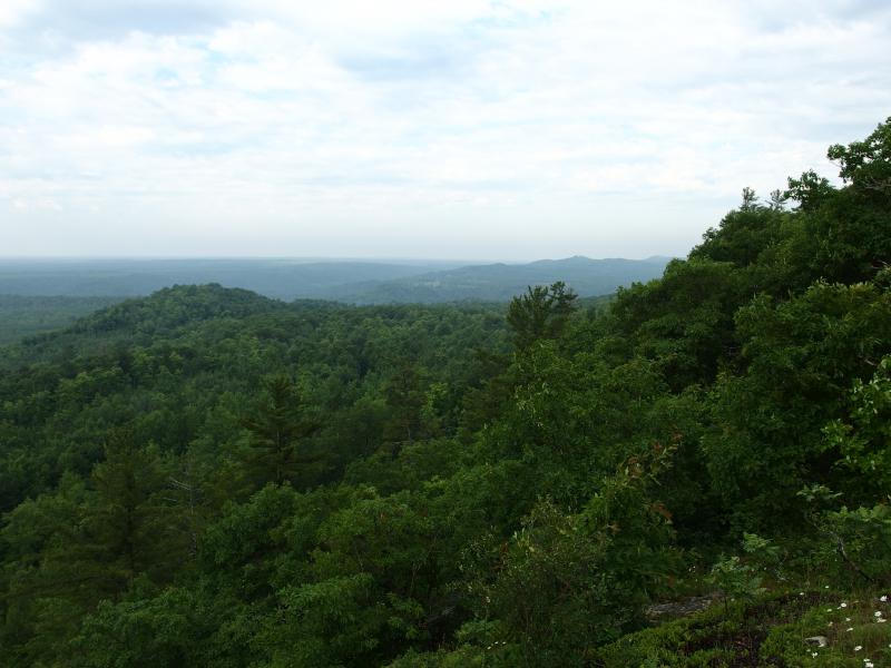
Turning west I followed the ridgeline. There are some outcroppings the other way, rocky views to the east, though they wouldn't give me a good angle onto the river below. As I followed the open rock some hills started to show up beneath the clouds, tall mounds of forest near Victoria. They're bumpier than I would have expected.
As I walked along the sodden dirt and slick rock I kept gazing down to the south. It was nice up here, a stiff wind keeping the bugs at bay, and I was in no rush to re-enter the woods. The apple and a bottle of water was making a fine meal, too.
Somewhere below me were the headwaters of Rockland Creek. There's probably a waterfall on it, right where it flows into the Ontonagon, though I've never checked. The easiest way to reach it would involve climbing along one of the steep muddy banks of the river that just looked dirty. On a day like this I'd probably end up whooshing down right into the swollen water like a big muddy slug.

Dreamy haze over fields near US-45
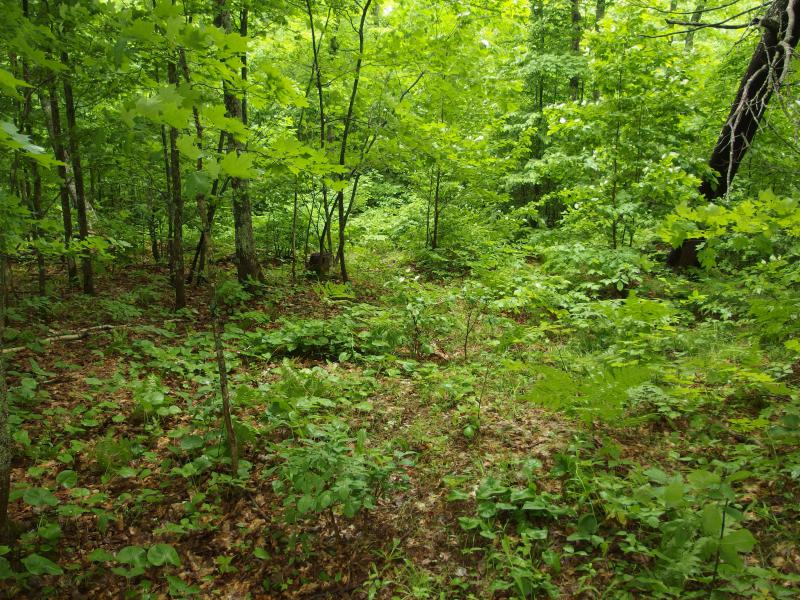
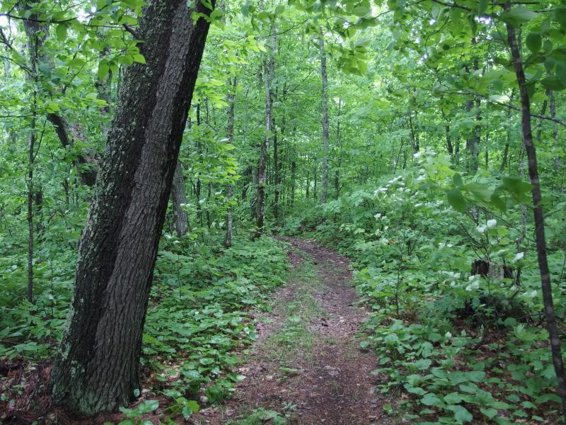
Eventually the bluffs cut back and I was forced into the woods. I picked up a small footpath with little difficulty and continued west. There's no main trail up here, no branch of the North Country Trail, but this bluff probably gets enough traffic for natural paths to show up. Obscuring ferns were the only difficult part of this trail, the rest easy to make out and easy to stride on.
Loose trail around the spring growth
Another ATV trail
The path grew to an ATV trail, this one much more used than the one coming up from the cemetery. It ran over even gravel and ran straight. It could have been an old road at one point. There were mines to the north and east - maybe there were some explorations done up here too. As I meandered down the route looking out for signs of old mines, lazily sweeping away the bugs that landed on my neck and hands, I was led back out onto the bluff. This time the river was visible, if barely.
Open view over the bluff
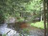
Steep banks around Ontonagon River
Two muddy sloughs shone through the green woods, one from the full Ontonagon and one from West Branch before it joined with it. A glint of water was at the bottom of one, though that glint was all I could see of the wide river. It was a start. Perhaps if I continued west I would see more.
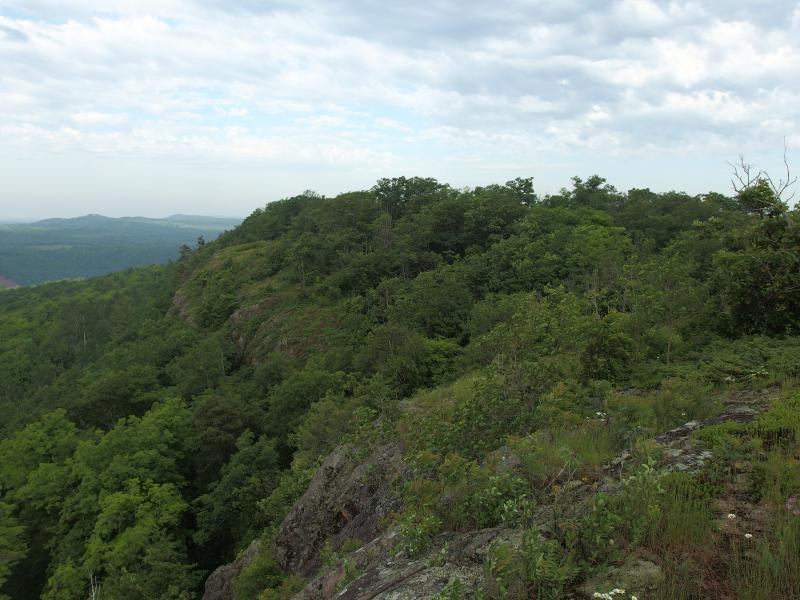
Long line of bluffs marching west
The view and a sight of circling eagles ahead boosted my mood, which was appreciated. To continue west I would have a decent dip in the ridge. I had been undecided about going this far, knowing in the back of my mind that I had plenty of other hikes planned for today. Going too far west meant dealing with a swamp on the return trip as well as a questionable route along overgrown power lines.
I found the ATV trail again and trotted quickly, heading down over muddy tracks that threatened to slip under my clumsy footfalls. Away from the open air the bugs quickly zoomed in on me. They weren't too bad if I kept moving, mosquitoes too slow to land and deer flies too neurotic. I don't mind deer flies that much. They circle around, zipping around in narrowing circles, yet somehow finding a way to silently land on exposed skin. If they bite its a quick shock of pain followed by a dull ache that usually goes away in a few minutes. Usually.
The path began to climb again, forcing me to zig-zag across its slick surface to keep from sliding. The dip wasn't too bad to deal with after all. I had noticed that the ridgeline to my left had gotten pretty hairy, overgrown nastiness over loose rock, and was glad that the trail offered an easier route. Nearing the top a side track led to the open bluff where the eagles wheeled overhead.
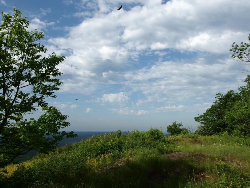
Surprising the eagles
Maybe a dozen of them drifted overhead, some less than thirty feet above me. A few of them swooped close, close enough for me to make out the individual downy feathers underneath their wings, though I wasn't fast enough with my camera to catch them. For a fleeting second I worried that they were going to come down on me. Instead they swung back east, floating above the rocky outcropping I had come from, leaving me alone on the warm open grass.

More rolling hills of green below
Gently bowing hills covered in moss and grass
Not much had changed to the south. I could make out more than a glint of river now, a lazy bow of a river showing up under the muddy bank, and a bit more of the upper banks on the Ontonagon River. That was it. There is a small plain between South Bluff and the river, flat land that was heavily forested that blocked my views, and I just wasn't high enough to gaze over. If I headed west any farther I'd be losing even more elevation. With one last look over the bluffs I turned back to the woods and bugs.
Instead of following the ATV trail back to the cemetery I followed it northwest. The track was wide and well-used, much more so than the one I first followed up, so there had to be another way up this ridge. It plunged down the hill suddenly, a rutted thing over rock and mud, and led me towards the swamps I had been so hesitant on nearing.
Muddy slide down to the north
The trail met up with another, I turned right, and then it went right through the swamps along a straight, dry grade. This was easier than I expected. Around me the wet croaks and splashes of a deep swamp leaked onto the trail. I'm not sure if this area is natural or not, being so close to the mine. It could be a small creek that was dammed up for water or even a pit of its own. On the northern shore of the swamp there were mine tailings spilling down into the water to create a sparsely-covered flatland, making the ponds feel even more artificial.
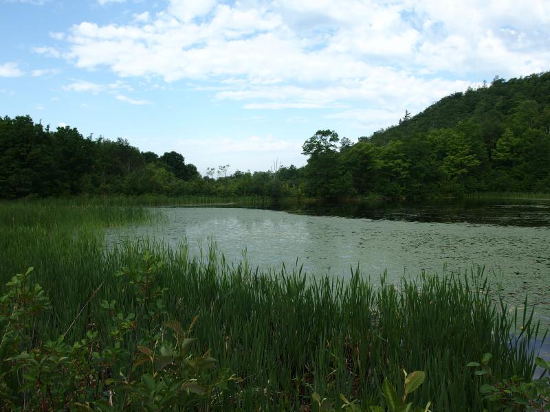
Large swamp sitting north of the bluff
While the main ATV trail turned here and headed towards Rockland, a mere quarter mile away, a side track twisted away to the east. I twisted with it. Crossing an empty US-45 I was brought to an interesting road burrowing down in between mine tailings. This, this looked more interesting than following the shoulder back to my car. I dived down with the narrow track.
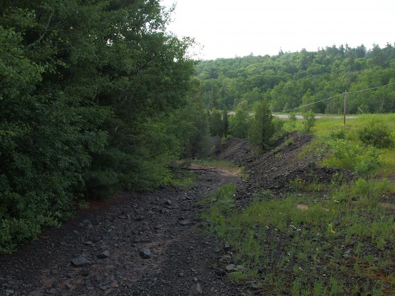
Chute of a trail made of poor rock
There was loose rock all around me: on the track, on the shoulders, and pushing up the sides of the hills around me. It was unkempt, shoved around, and I couldn't make out any pattern to the stuff. Was I walking through waste rock? Or did they dig shafts and let the rock tumble out of the ground? There were a few suspicious low spots, where water engulfed the dark rock, that could have been buried shafts. Maybe this was an easy way to erase the pits and holes from the mining, just shove the removed earth on top.
My trail wound through the green woods and slowly climbed up, up to the flat ponds of Minesota Mine. After a brief exchange with some visitors equipped with metal detectors I continued east along the shore of the pond. I was still a fair distance from my car and the tracks continued through the rock and woods. If I didn't have to walk the shoulder of a highway than I didn't want to. Plus, it'd be neat to see some mining ruins along the way.
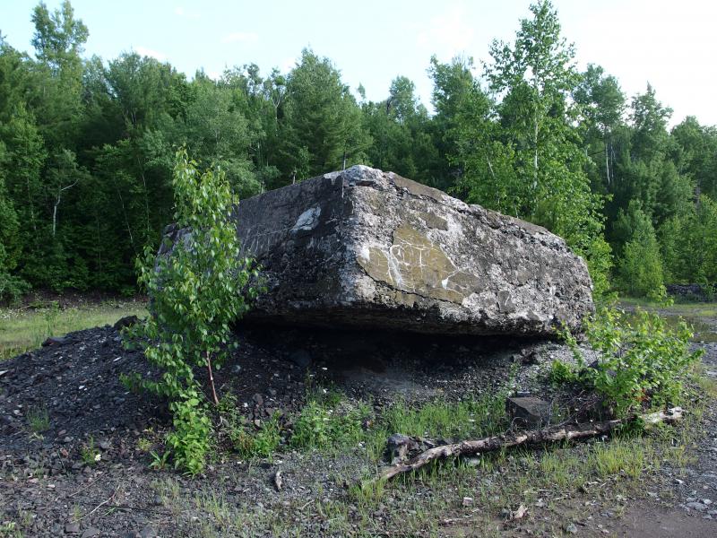
Huge cement foundation sitting on loose rock

Mirror pond remain of Minesota Mine
No good ruins showed up. They were either hidden in the woods or erased by time. After more winding track and a few gigantic mud puddles to maneuver around I came out right at the cemetery, my green car baking in the sun. That turned out to be a nice loop, from the bluff through the old mine. I got into my hot-hot car, sweat and wet from the hike clinging to me as I quickly rolled down the windows and got the vehicle moving. There had been views this time, not enough haze to block the ridge, and I had seen eagles. It was well worth the bug bites. Maybe.
-
Jacob Emerick
Jul 7, '14
Beaton's Cave! Augh, I knew I was forgetting something. I should really hang out on CCF more often, that was a spot I was planning on getting to. Thanks for the reminder, Dave. I'm pretty bad at giving these old mining spots the proper exploration. You (and others) have many more years of experience in these areas.
Add to this discussion