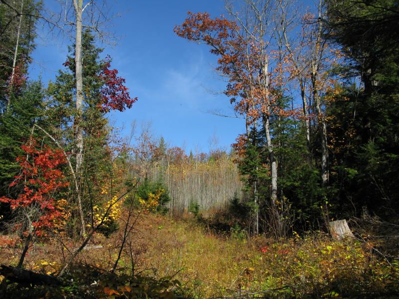
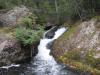
Snake Creek Hills
Several years had gone by since I last drove through Dodge City on the Northwestern Road up past the Yellow Dog Plains. Back then I had been hunting for Hogsback Falls, the only named drop on the Salmon Trout River that is not on Huron Mountain Club property. There is a logging road that extends north from Dodge City towards the waterfall which I planned to drive up on in Katie's SUV. This road proved to be too rutted and degraded for anything larger than a four-wheeler and the quick stop turned into an eight mile trek through swamps and young forest surrounded by tall hills. We still enjoyed ourselves and the unique, remote waterfall was well worth the hike. Today I returned to the area for something we had glimpsed through the shedding trees on that hike… Rocky outcroppings on the hills east of Salmon Trout River.
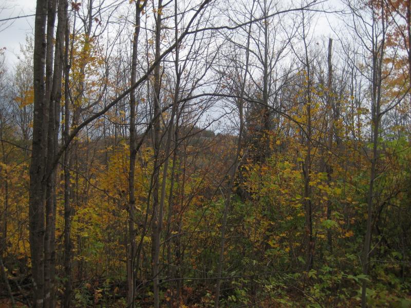
Hiding outcroppings in the fall colors
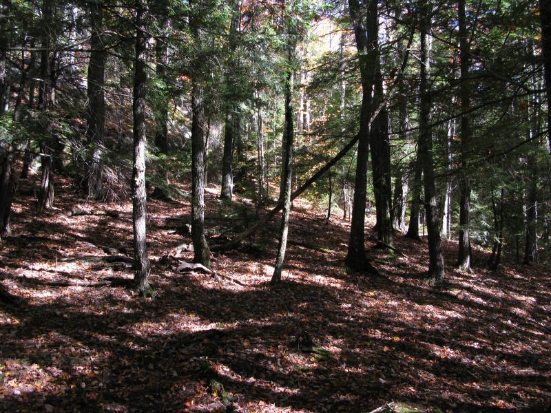
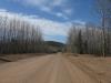
Today the state of the forest was very similar to my last visit. Less than a third of the leaves were still clinging on to trees, and those that were had bright hues that contrasted sharply with the dry, brown underbrush. I was hit by several instances of déjà vu as I walked along the dusty road. My car was parked near Dodge City… If Katie's SUV couldn't make this drive than there was no way that my little sedan could. It was good that I had left it, because less than a mile a large piece of logging equipment was purposely blocking the road.
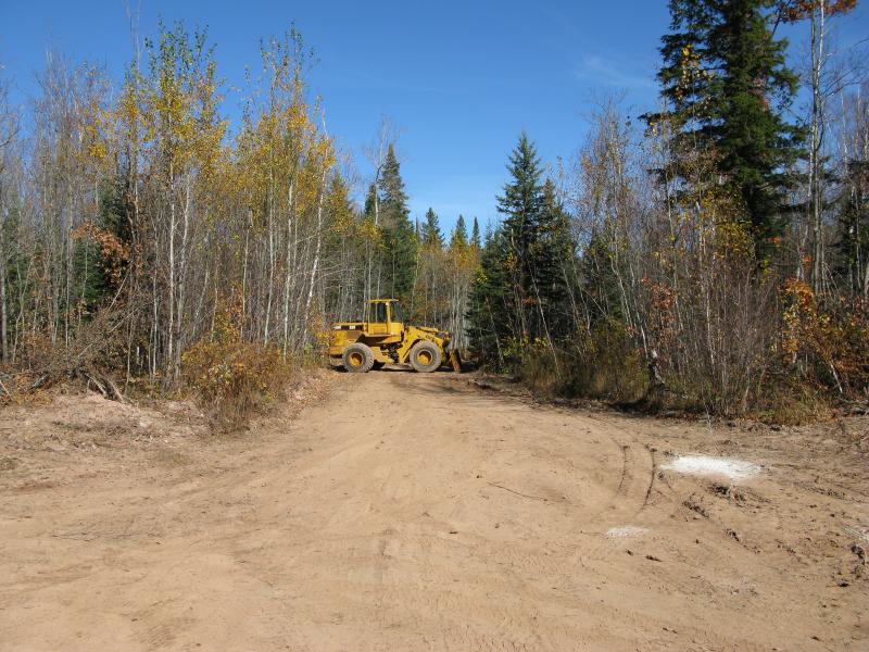
Logging equipment blocking off the road ahead
Most of the forest for the first few miles along the road is too small for logging. The last mile or so, closer to Hogsback Falls, had plenty of large trees. Hopefully the loggers plan on improving the road all the way north, meaning easier access for me (and any other hikers) planning on accessing some of the falls and outcroppings up this way. For now I made my way through their stationary equipment and around a blasted outcropping (probably being used for some wet chunks of the road) and started heading east on a side path.
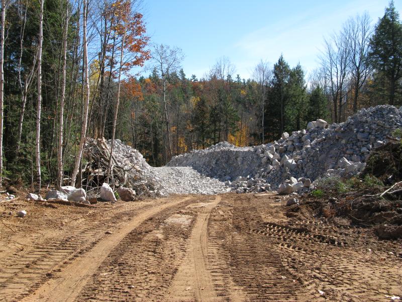
Logging road construction
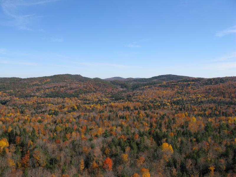
There are three main hills located between Snake Creek and East Branch Salmon Trout River that I hoped to visit today. The southern one is mostly covered in trees and probably isn't worth a climb. There is a bumpy ridge connecting it with the middle peak that promised some good views. The middle peak has a prominent south-facing bluff which really sticks out when viewing the hills. A few hundred yards to the north is the last hill, the largest by far, with numerous outcroppings on it's southern and western faces. I decided to aim for the middle hill first, using a bit of the ridge if necessary, but first I had to get on the other side of the Salmon Trout.
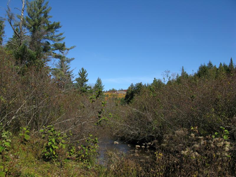
First clear view of the impressive bluff
My side path ran into the river at a convenient spot with a great view of the prominent bluff on the middle peak. Up until now I wasn't sure if I wanted to embark on this hike (a few of the morning hikes took a lot of adventure out of me), but seeing the bluff made up my mind. I crossed the river easily and followed an overgrown logging road north, along the base of the smaller outcroppings to the east. The road degraded to a stand of young trees growing so close together I was forced to weave my way sideways through them, which eventually gave way to old growth pines sloping up to middle hill.
Young grove in the saddle
Sloped pine forest
Pine needles and loose rocks underfoot, I slowly gained altitude until I reached the bluff. Not feeling like wandering too much I tackled it head on, making my way up a crevasse that was cluttered with large boulders. The climb was tough but short and I soon found myself on the southwest face of the mountain looking down at my route.
Back west over the Salmon Trout River
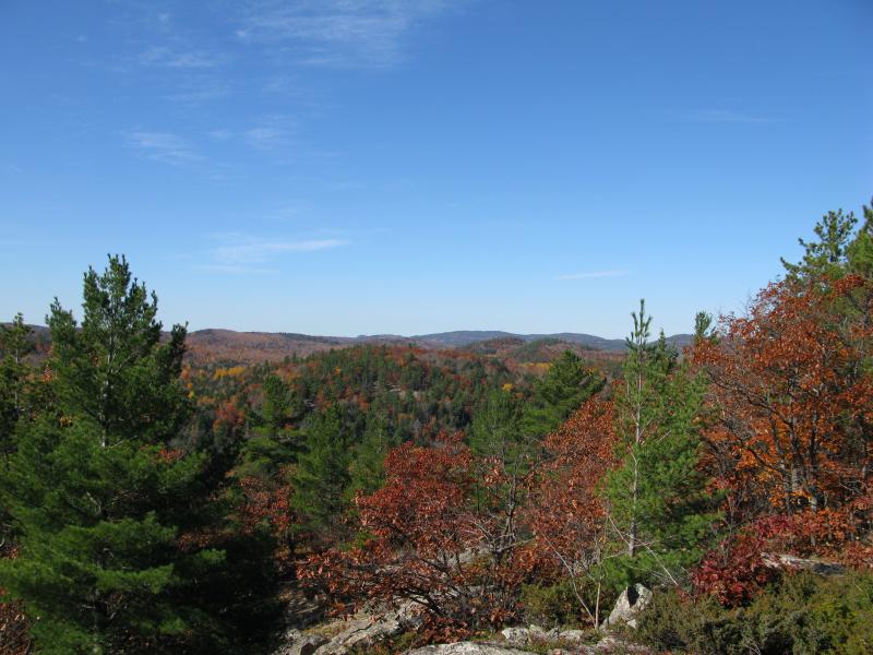
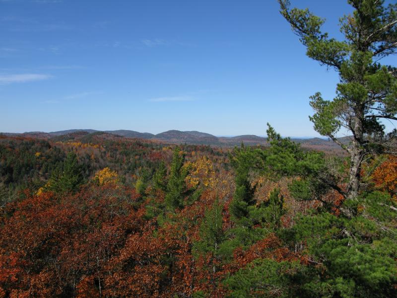
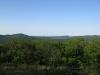
Relatively flat view to the south
There was a surprising amount of exposed rock westwards, back across the river I had crossed. I had assumed that the chunk of land between East and West Branch Salmon Trout River lacked any good outcroppings. The view south was a bit disappointing, though. I've been hoping to find a good spot to view the Yellow Dog Plains from the north, but this hill (and most of the Huron Mountains) was not tall enough to get such a vantage. Heading east first, I started on a circle around the top to see what other views I could get.
East towards Alder Hills
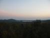
Salmon Trout Bay to the north
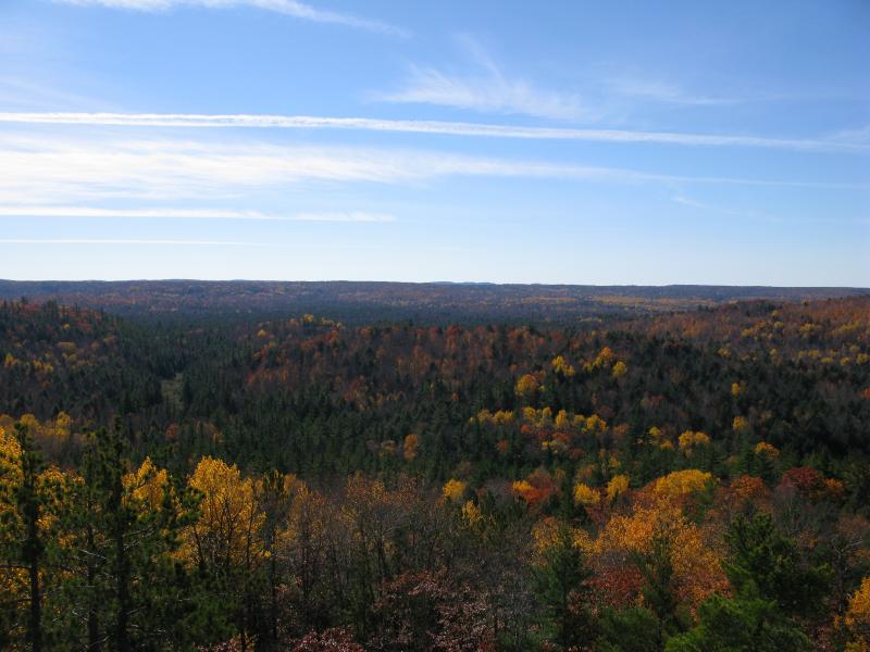
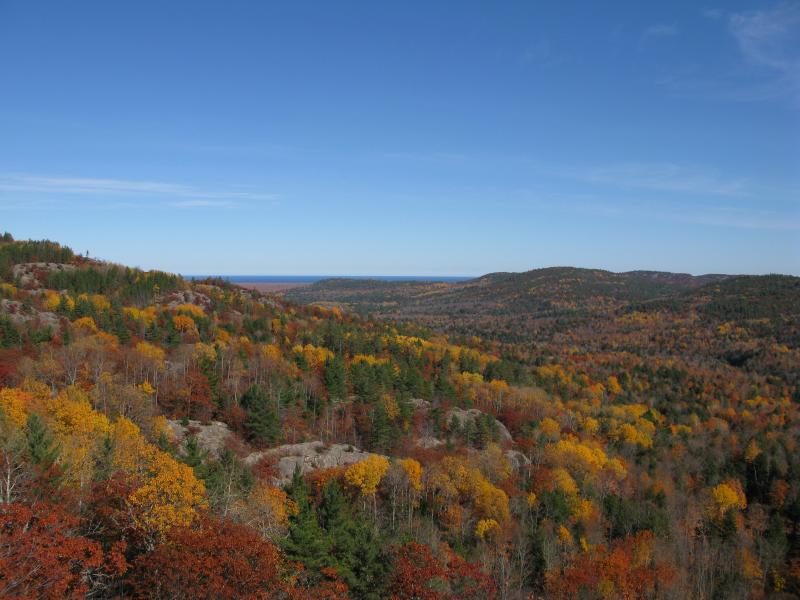
While the ridge to the south had looked promising from the satellite photos I couldn't make out any rock faces through the trees. They may have a few good spots facing off to the south, but I doubt they would be worth the climb compared to where I stood now far above them. The hills to the east showed off a few interesting features. There appears to be a number of rocky outcroppings on the hills south of Blind 35 and some sharp elevation differences. To the north was the best views, though, with Lake Superior in the distance, the northernmost hill showing multiple exposed bluffs, and numerous Huron Mountains (including some very impressive bluffs on Ives Hill) rising majestically from the colored lowlands.
Northwest to Burnt Mountain and beyond
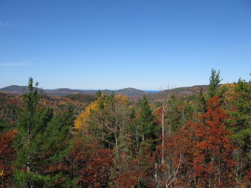
Mount Ives far to the north
After resting for a bit I headed down the western face of the mountain. I had a long hike to tackle this evening and didn't feel like tackling the northern hill just yet. This route descended sharply down to the river and I easily crossed on a downed log. After finding the logging road I headed back to the car, thinking of all the cool spots I had just seen. A repeat visit in this area would be needed to explore that northern hill in detail as well as the areas off to the east. One possible route would be a huge loop north from the Northwestern Road, hitting up the hills south of Blind 35 on one leg and the ridge I had just visited today on the other, a 7 mile loop that would encircle Snake Creek. Regardless of the exact route I knew I had to return, as this was one of the best views in the area and I definitely wanted to explore more of this area.
Comments (0)