Salmon Trout Bay
As the Lake Superior shoreline stretches north from Big Bay two named features, Black Rock and Salmon Trout Point, make a bitter stand against the pounding waves. The shore here is mostly composed of straight, towering sandstone cliffs with the exception of these two basaltic outcroppings which stick out like worn buttresses. Beyond Salmon Trout Point the land curves away to the west with the Salmon Trout River opening up into the Salmon Trout Bay, before another set of cliffs push north at Conway Point. Only glimpsed on previous hikes, this evening I headed towards the bay in hopes to explore this spot a bit more and catch a great Lake Superior sunset.
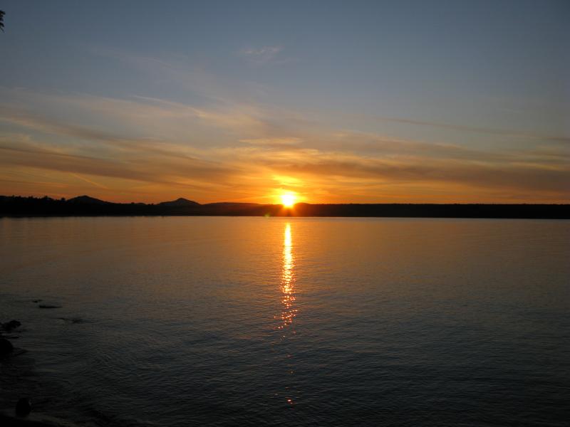
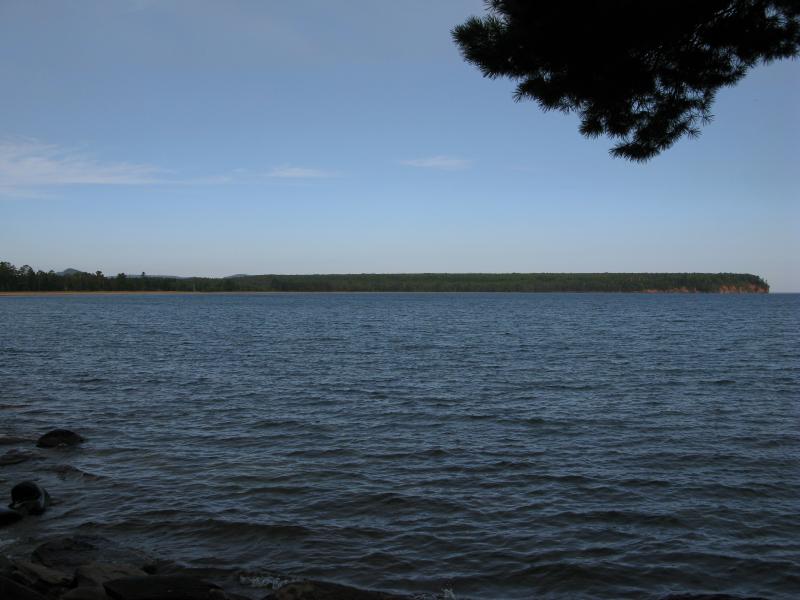
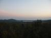
Setting sun over Salmon Trout Bay
Parking at the familar spot for Black Rock Point access I first headed north, than started cutting west through the clean forest. The woods were starting to look gloomy in the dwindling light and I pushed forward quickly, hoping not to get caught in the dark. Suddenly I bumped into a second road leading northwards. I had parked at a road that continues past a gate towards Salmon Trout Point, which I assumed led to both cabins in this area. Turns out that each cabin had their own driveway. To save some time I followed this western drive north a bit before veering west through the woods again, heading down the hill towards the water.
The sun was just starting to light up the western sky in vivid orange and pinks when I broke through the brush. Kicking back on the rocky shoreline I took some pictures and enjoyed the firey display over the Huron Mountains. While the sand from Salmon Trout Bay stretched far to each side of the river I was still at least a mile or so from it and had large, slippery rocks leading down the water. For now I relaxed and watched the sunset over the silent bay, waiting to explore the area more fully for the morning.
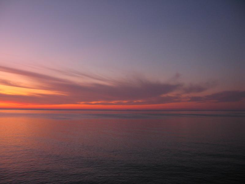
Vivid sunset colors over Superior
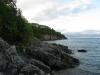
By the time I started south down the shoreline in the morning the day was beyond broken. It was easy to reach the water's edge, as the towering cliffs dwindle down to a short drop very quickly after the northern point. The rocks were large and difficult to walk on, being the right shape and size to easily roll an ankle on. The sandstone wall on the land's side was constantly shifting in and out, sometimes giving me a wide path and other times relentlessly pushing me into the water.
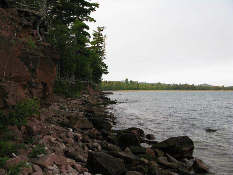
South along the rocky shoreline

Crumbling sandstone wall to the north
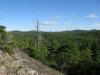
After a short hike along the shoreline that involved carefully planned footfalls, ducking around sandstone outcroppings and stooping under overhanging trees, the sandy mouth of Salmon Trout River started to open up in front of me. Similar to Huron River to the west the river lazily swings through a large, choked swamp for the last few miles before spilling out into a peaceful bay into Lake Superior. Huge trees, home to a number of eagles (or so I've heard) rose up behind the beach, and a few of the Huron Mountain Club peaks towered further behind them. I wasn't sure where their property began here, but I held a small bit of hope that I'd be able to step upon this sandy beach. Then I ran into two barriers that stopped me - a sharp drop in the shoreline that forced me back into the woods and a prominant HMC private property sign.
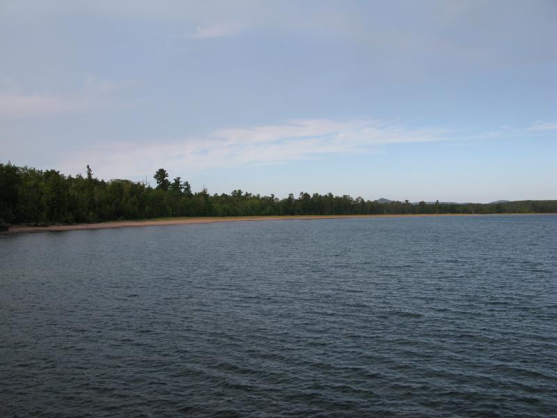
Sandy beach at the mouth of Salmon Trout River
Conway Point stretching north

Club property sign on the shoreline
Resigned, I turned away from the shore and cut east back to the roads I came upon. I was disappointed by the sign but should have known that the club would own the entire beach. Even without actually walking the sand the visit to Salmon Trout Bay was still well worth it, with last night's excellent sunset and plenty of great views of the protected cove this morning. There might be a return trip to attempt walking the bottom of the cliffs on the eastern side of the point, but for now I was rested and happy about my explorations in this area, ready to move onto a new challenge.

-
Jacob Emerick
Sep 20, '12
I was pretty surprised to see the sign... I was hoping to get at least a foot on the sand. No, haven't been on the base yet. Hoping to do that this year, but not make it out to Big Bay area again until next. You planning on trying for it this fall?
-
Joel
Sep 22, '12
Yeah, I'm hoping to give it a shot if the weather is conducive to walking the shoreline! This spring, I tried walking the base of the cliffs along Salmon Trout Bay (covering basically the same ground it looks like you did!) Hiking west, towards the mouth of the river, we were stopped when the shoreline gave way to a set of low cliffs dropping straight into the waist-deep water. Heading inland, we immediately ran into the same HMC sign that you saw-posted on the big pine with a bad trunk. We paused there, and pondered continuing through the water, but decided we didn't want to get that wet-so we headed back east along the shoreline. Traveling east, the cliffs quickly grew in height to their 100+ ft. elevation, but we were stopped again by waist deep water even before we reached the first of the big, shallow coves along this stretch of the shore. Giving up here, we headed back to Black Rock Point (actually, I limped back to Black Rock, because of a raging blister on one of my heels...)Heading down to the actual point at Black Rock, we took the "secret" path that leads over the several fingers of rock just to the immediate north (it's fun, and pretty easy, but involves 1-2 small jumps that could be disasterous if missed. The northern-most of these rock fingers is actually separated by a small cove, and is a slightly more challenging, quick bushwhack to reach. Reaching this point, I saw what looked to be a decent access point for the shoreline to the north, but my blister was too much and we stopped here...I'm hoping to hike this stretch soon, and possibly get some photos with good fall colors- I'll let you know how it goes!
-
Jacob Emerick
Sep 24, '12
Awesome information, Joel! With how difficult the cliff base is to follow I'm kinda tempted just to throw a pair of trunks and sandals on for this hike. With the recent changes in temperature I might have missed my chance by a few weeks, though :( Looking forward to hearing how this goes!
-
Joel
Oct 13, '12
Well, we didn't end up hiking the base of the cliffs this time. The previous day's hike pretty much had us beat, and the north-facing side of the rocks on the point were very wet and slippery with lichens, so we didn't attempt it! I would agree with you, though, that a summer-time hike (planning on getting wet) is going to be the reality of this one!
Add to this discussion