Rim Trail and Aztec Peak
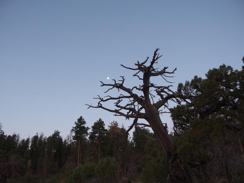
While sleep was hard to find, perched on a hammock near the Pueblo Canyon overlook, watching the moonlight play over the Sierra Ancha cliffs and Cherry Creek valley was simply breath-taking. I didn't begrudge the multiple times I woke up from a rustling branch or distant twig break much - they gave me more opportunities to gaze over an amazing vista. When my alarm went off I jumped into the morning to enjoy a cold breakfast under the slowly brightening sky. I wasn't in a big rush to hit the trails, as they were hard enough to track in the daylight, I was just done pretending to sleep.
Early start in the Sierra Ancha
I made sure to fill up both my stomach and water containers to full capacity before leaving Edward Spring. There was a good chance I wouldn't see another water source all day and I had almost twenty miles to travel over rough terrain. First I wanted to follow the Rim Trail all the way around to Parker Creek, then swing up to Aztec Peak via Abbey's Way, and finally return to the trailhead with Reynolds Creek. Some of these trails were overgrown and others were worse, and there was no dependable water along any of them.
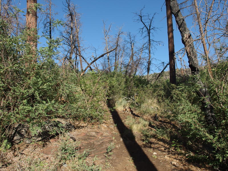
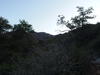
Backtracking the mile-and-a-half along Rim Trail was pretty boring. The spiky sections were still painful and the faint sections were still hard to track. I did notice more signs of what I can only describe as flood damage, which was interesting. This area was dry and had no major rain in months, yet flows of mud frequently drifted over the old trail tread. The forest fire of 2016 must still be impacting the area, as the vegetation continues to die out and lose its grip on the topsoil, and some of those flows must be months old. Thinking through this theory gave me a distraction from the backtracking until I reached Cold Spring Canyon and was greeted by an amazing sunrise scene.
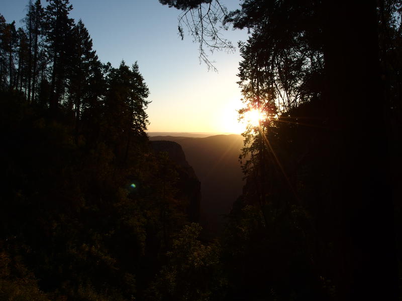
A brilliant sunrise from within Cold Spring Canyon
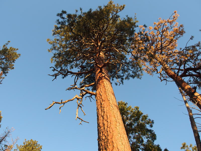
A tall pine
Man, tall pines and early sunlight always gets me. I really miss those mornings in Michigan. Or maybe I've been by burnt by too many exposed hikes in the Mazzies and Supes, where sunrise over the fire-scoured lands means little more than a relentless march of high temperatures. It wasn't that chilly up here, yet the early light was welcome and less scorching than the normal Arizona experience.
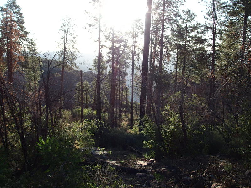
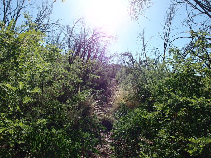
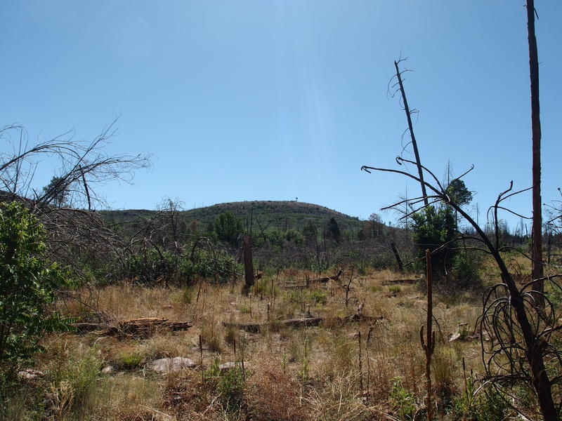
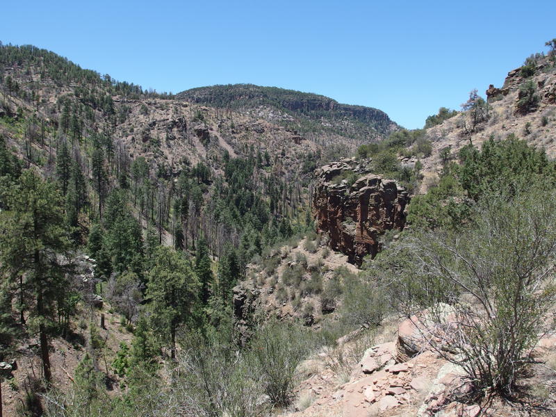
With the necessary drooling over the sunrise over I continued on, quickly passing the Murphy Trail junction, and continued south along new terrain of the Rim Trail. It was green, spiky, and bland. The 2016 fire really scorched the area and left charred trunks where tall pines once stood, opening up the ground to let all sorts of nasty low brush to grow. It didn't take long for me to glance at my GPS to get an idea of how far I had to push through thorns before I got a decent view. There was two branches of Devil's Chasm within the next two miles so I pushed faster.
Hints of epic canyons just off trail
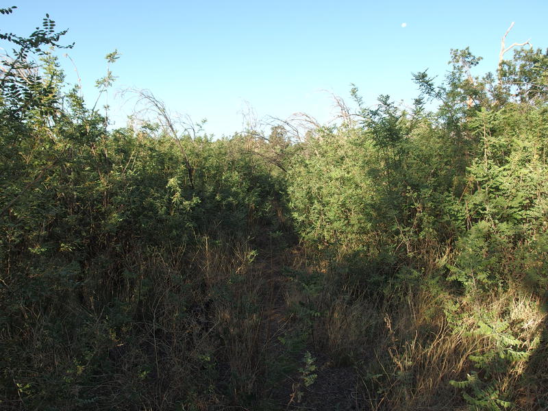
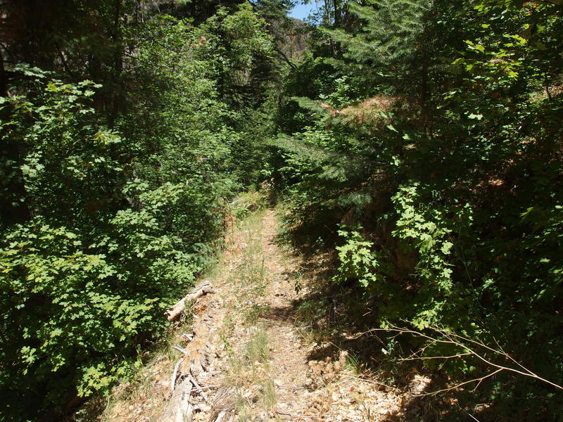
Tough, prickly going along some sections
Only hints of Devil's Chasm was visible from the trail and I wasn't terribly interested in bushwhacking to get a better view. Multiple bleeding cuts from walking on-trail takes the excitement out of going off-trail. However, I did do some mild searching for Hunt Spring near the Moody Trail junction and found nothing of note, and then enjoyed a brief section of living junipers before the burn area picked back up. Some small sections were spared.
Most of the trail was heavily damaged by fire
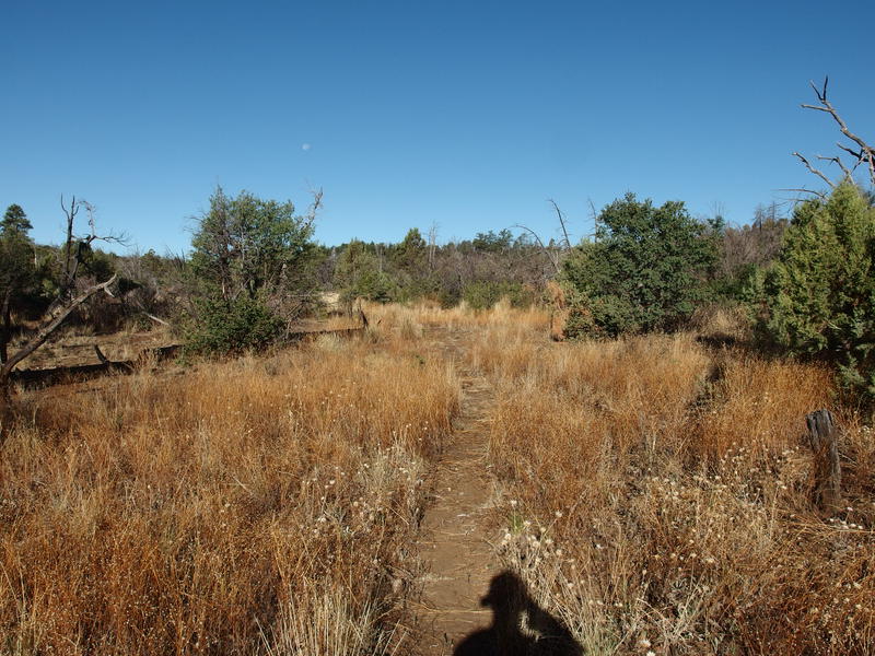
Beyond the junction with Moody Trail things start to change. There are a few canyons that head south, yet they are nowhere as dramatic as the east ones, and the Rim Trail seems to stay far above them. For the most part I was walking through fields of grass with the occasional thick section to push through. The area around Armor Corral was particularly nasty. These thick sections usually sprung from a shallow wash flowing in from right, with possible water sources above, that were choked with spiky brush as they crossed the trail before diving down into the canyons. Each one gave me new cuts to remember them by.
A heavily trafficked section
Looking down at Coon Creek
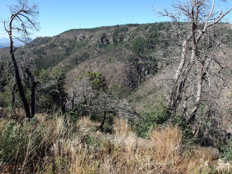
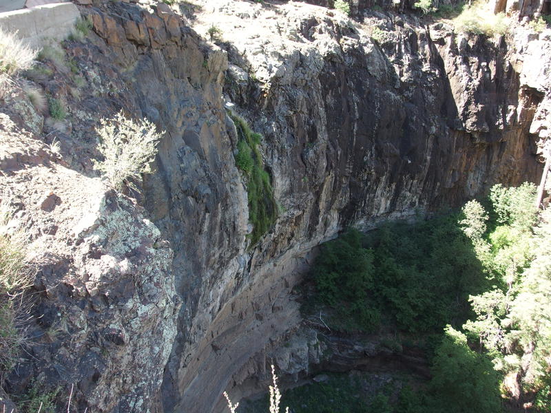
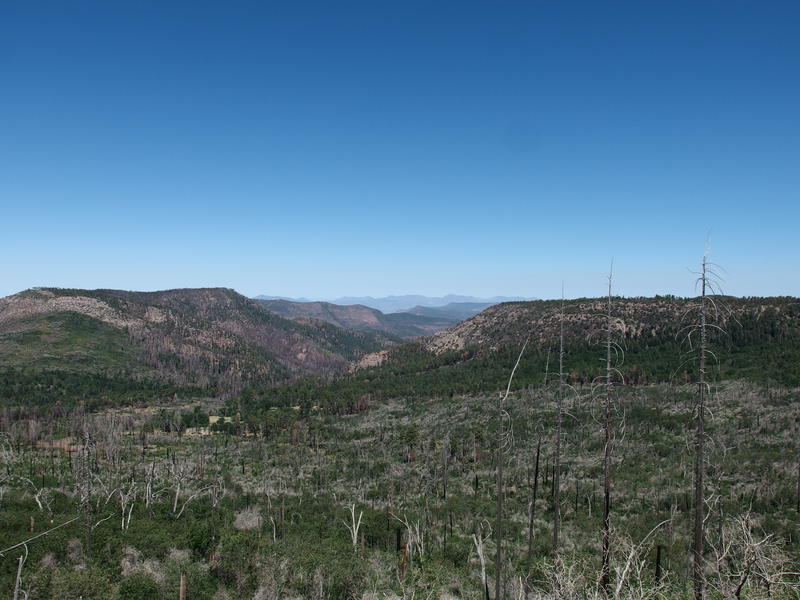
Soon I was walking alongside Coon Creek, which is a significant point for a few reason. On an immediate note, it was the end of Rim Trail and marked the boundary of my (now) westward journey. Now all I had to do was head north and get back to the Jeep, sort of. It was also the source of a horrific 2000 wildfire and I scoured the landscape, trying to understand what two decades of recovery looked like. Well, partial recovery - this area was hit a second time by that 2016 fire. Finally, there is an abandoned trail at the base of this canyon that I was hoping on utilizing some day. All I could see from up here was dead trees and lots of deadfall.
I took a quick break under a bit of shade to enjoy a second (or third) breakfast and finish up one of my waters. It was somewhat cool in the shade, still so high up in elevation and all, and I enjoyed the change in pace from the hot summer. When I got up and started a short climb up Parker Creek Trail, which would connect me with FR 487 and the next leg of this hike, I felt like the temperatures raised significantly. No breeze, hauling up 400' in direct sun, and I was quickly sweating buckets. I reached the top and basically tumbled down the other side of the saddle towards the road.
A hot climb from the rim
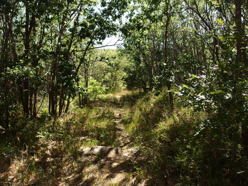
A much more pleasant section beyond the saddle
There was an option on FR 487 and I decided to take it, even though it meant adding a mile and a few hundred feet of climb to my trip. Workman Creek flows from the side of Aztec Peak, traveling along the road, and has an impressive waterfall about a mile below Peterson Trailhead. The road was easy to trot down, even with some loose dirt along the way, and it gave me a chance to catch my breath from that hot (though short) haul up Parker Creek. Plus the waterfall was pretty cool, even with the low flow dribbling over the rock edge.
Trickle at Workman Creek Falls
After a few photos and a snack I retraced my steps to Peterson Trailhead and the start of Abbey's Way, a short path that sneaks up the back of Aztec Peak. This trail was heavily damaged by the recent fires and I dreaded hacking up it. In fact, as soon as I reached the trailhead a lovely sign warned me of how rough the next two miles would be. Didn't help to know that I would be climbing an additional thousand feet along the way, much of it on the second half.
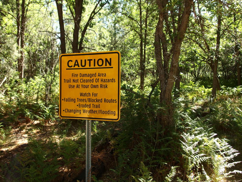
Every trail I hike these days has been fire damaged
Distant tower on Aztec Peak
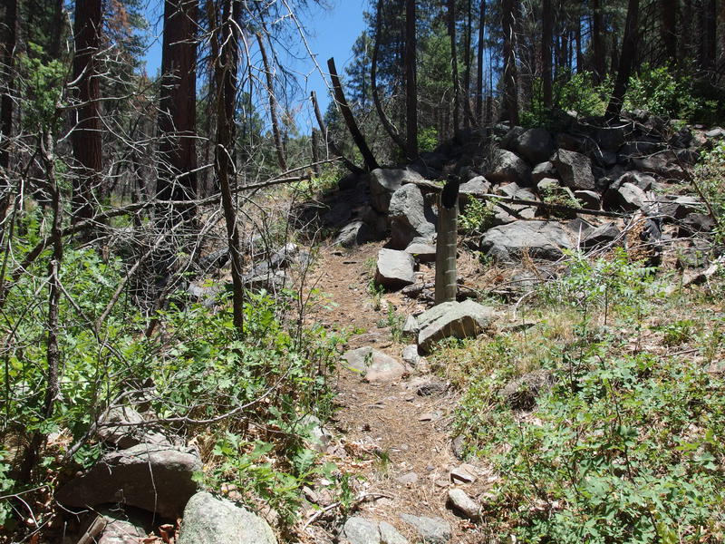
What I didn't expect was recent trail maintenance. The first mile was a gentle climb through grassy meadows, within sight of an old orchard, and then the second mile was a steeper haul along the side of the mountain with spiky plants trimmed back a comfortable amount. Even the deadfall had been cut, some of the sawdust still springy and relatively fresh. It was a hot and steep climb, sure, but overall it was much easier than it could have been.
Long view down the Workman Creek drainage
Aztec Peak is the highest point in the Sierra Anchas, a lofty 7748', and has a fire tower and some communication equipment on top. It's a bit taller than Brown's Peak and a bit shorter than Mazatzal Peak, though it feels less grand than either, with a rounded head and a road leading right to the top. Feels more like the humble Mt Ord than a wilderness peak. I took a few photos from the top before settling down for a lengthy lunch, interrupted mid-way through by a couple on a drive.
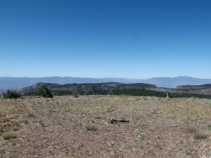
Superstitions, Roosevelt, and Four Peaks visible from peak
Six miles, mostly downhill, sat between me and my ride out. It was 11:00... Oh man, if I pushed it I could get out of here before 1pm and finish this entire trip in less than 24 hours. That was tempting. I grabbed all my gear together and rolled quickly down the road, half-racing that couple (who was probably eating a picnic on top) off of Aztec Peak.
FR 487, the same road that I took to Workman Creek Falls, is what I took off the peak, and then the 487A spur leads over to Murphy Ranch. If I wanted to, I could have continued on 487 past Workman Creek all the way to 288, which then connects up to the forest road that my Jeep was on, and it would have been a lot of extra miles along roads when I could just return to the overgrown trails instead. At least the views were neat, as I was looking down on sections of the Rim Trail that I had hiked hours earlier, and I could see just how barren the land looked from up here.
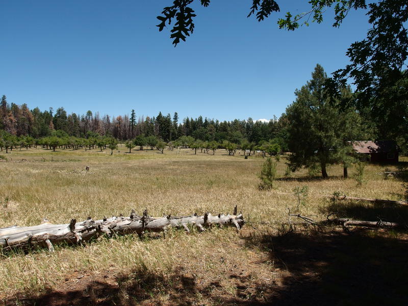
View of the old Murphy Ranch
A few quick photos of Murphy Ranch and I took the path over to Reynolds Trail, which would lead me back to my parking area. There was a mild 400' climb in the shade, which was much more enjoyable than the exposed one from earlier, and then I crested the saddle and began heading down the other side. I half-looked for Knoles Hole Spring and didn't find anything promising, then had to keep focused on the narrow footpath along the steep bank of Reynolds Creek.
The trail down the side of the creek was fairly basic. I crossed it once, then stayed on the one side until I hit the Center Mountain Trail junction from yesterday, then crossed it a few more times above some suspected falls (which were dry). Most of the going was shaded until it wasn't, and the similar terrain almost had me nodding off until some huge cliffs showed up out of nowhere. The path switched from a narrow rut along a hillside to a much more dramatic, switchbacking, artistic piece that barely clung along the sharp cliff.
Narrow, easy tread along Reynolds Creek
Rugged section of trail
A single mile was left after the cliffs and I trotted down quickly, making my way back into the shaded forest and one last creek crossing. Think I only saw a few pools of water during the multiple crossings - definitely a dry year up here. Then it was thick brush with lots of thorns and I reached the car, 24 hours after leaving it. My goal reached, I took my time shedding gear and changing clothes before heading back down the bumpy road towards Phoenix.
Partial damage at the end of Reynolds Creek
Sierra Ancha Wilderness is relatively small compared to my normal trekking areas, with no trails longer than ten miles in length, and this single trip knocked out a third of the trail mileage. Still, it's a rugged one, and the views are ridiculous. I spent much of the drive home planning future trips, parsing the different trails into various loop options that stretched the possibilities, almost forgetting that the Mazatzal Wilderness, my original mistress, was still out there waiting impatiently for my return.
Comments (0)