Return to Bald Mountain
Three years had passed since I last climbed Bald Mountain, the last significant outcropping of the Western Huron Mountains. My first visit was a significant milestone for me, as it was the first non-waterfall hike I attempted in the Upper Peninsula. This initial climb triggered a long and lasting interest in the Huron Mountains and other UP features that still drives the majority of my hikes. Today I was revisiting Bald Mountain in the winter again both to commemorate the anniversary and find something that eluded me three years ago - a clear view of Lake Superior to the north.
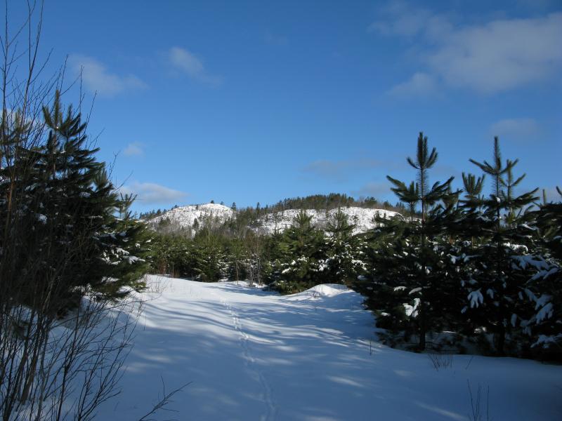
First view of Bald Mountain
Leaving my car just off of Erick's road, where snow plows had cleared some extra room at the two-track leading to the mountain, I headed north along week-old snowmobile impressions. The snow was not deep with this winter's frequent melting spells and the few times I stepped off the snowmobile tracks I only sunk down a foot or so. A few animals also used this two-track (left from the Mead forest planting just south of Bald Mountain), either because the managed pine forest ahead was growing thick or the trails exposure to the sun left the snow layer relative thin. I turned east when the route split and made my way through the forest, surprised by the tree's quick growth over the last few years.

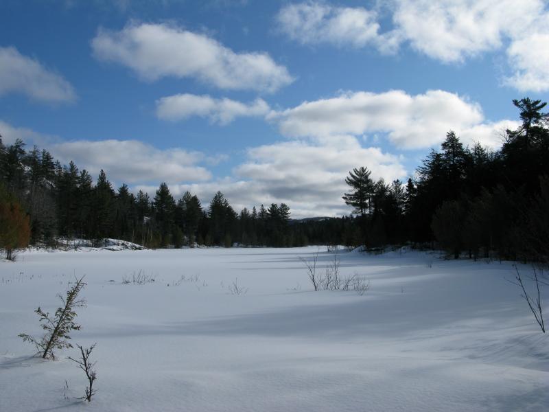
Animal tracks in the snowy Mead forest trail
While the two-track offers a few good views of the mountain, especially when it twists back north, I was eager to cut off the trail a bit early. There is a large pond or swamp directly below Bald Mountain's southeast slope that I wanted to check out. The snow deepened quickly in the woods so I followed as many deer tracks as possible (when enough of them follow the same route they make a great ground-level path) until I reached a wide open expanse of snow. The snow was surprisingly deep for the level of sun this spot received (I sunk in well past my thighs) but it offered an excellent view of the southern slope of Bald Mountain.
Looking west along the snowy swamp
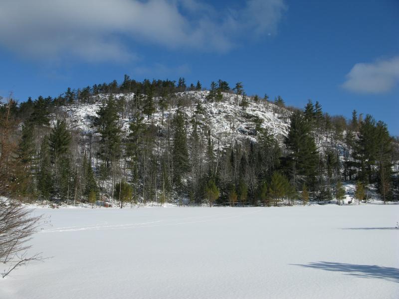
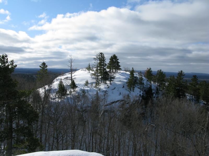
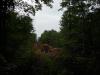
Imposing south face of Bald Mountain
As tempting as it was to cross directly to the mountain here, the lack of animal tracks and lack of knowledge of what exactly was under the snow kept me in the woods. I headed west to the tip of the clearing where a snow-covered ridge showed a possible beaver dam holding back the water. Crossing on the ridge I started climbing the mountain. There are actually three main peaks (not counting the ridges that stretch northward). This triangle points north with valleys within each of the connecting sides. I climbed up a familiar route inside the south valley, between two peaks. The snow was deep and I quickly cut up to the west, leaning towards the exposed rock outcroppings on the southwest peak. It didn't take long to reach the tallest of the three peaks.
Snowy Superior Mountain to the west
This was the point where I turned around three years ago. A thick blizzard had blocked all views and Cory, Logan and I were all cold and disheartened. Today was different, with the bright sun and clear skies inviting me further. I tumbled down the steep slope and continued north to the next peak. The valley in between the three peaks was awesome in itself. Protected and peaceful, this felt like it would make a great camping site in inclement weather. Walking through the valley I climbed up the northern peak of Bald Mountain and was greeted with the exact view of Lake Superior I was hoping for.
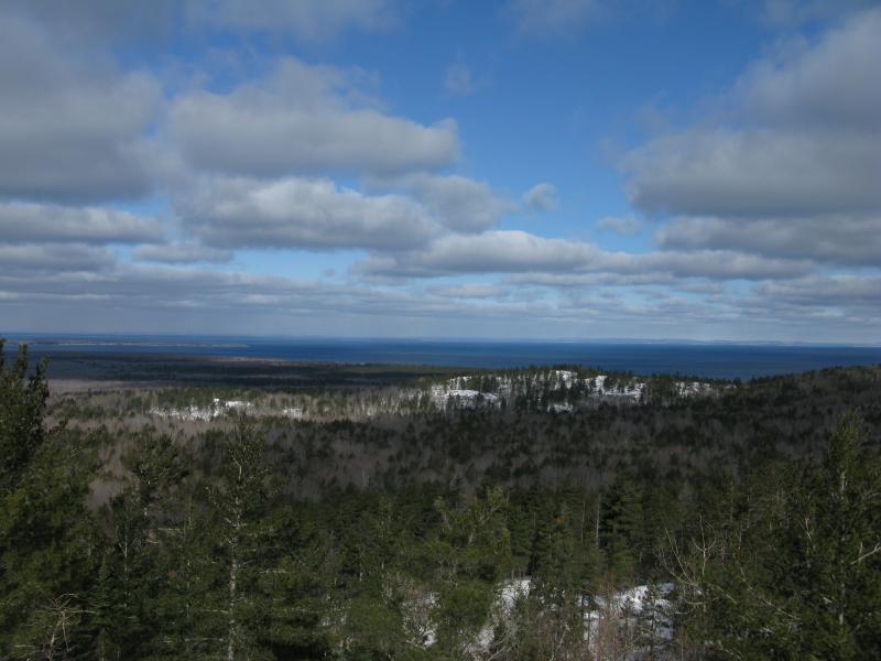
Lake Superior and north tip of Point Abbaye
Sharp southwest peak
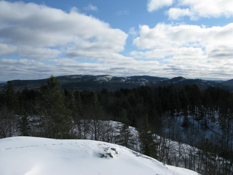
I spent a good chunk of time wandering along the northern peak enjoying the views. A ridge that stretches east to west, there was a lot of good outcroppings and spots to check out. Another similar ridge rises up just to the north, blocking all of the Huron Islands, but I could still make out Point Abbaye and the Keweenaw easily. It was tempting to continue north to try to see these islands, but I decided that could wait for a summer day and backtracked down the mountain.
The western Huron Mountains are a great place to see some great views without worrying about private property. Most of the peaks are on public commercial forest land, including Bald Mountain. The Huron Mountain Club has been buying up land near here, including pieces of Superior/Clause Mountain just to the east, so I'd recommend visiting this area sooner rather than later.

-
Jacob Emerick
May 13, '12
One of these days I need to return to this mountain again... I'd really like to make a triangle of sorts that connects Mouth of Huron, Mouth of Little Huron, and Bald Mountain. Hopefully I'd be able to catch that Old Growth and the Canyon along the way. But it might be a bit ambitious, especially if I get tired half way. I've never been down that two-track - does it go all the way to the lakeshore?
Add to this discussion-
Jacob Emerick
Apr 13, '14
Absolutely. I can't wait to explore the north side of this mountain. There is a ton of outcroppings (and those giant pines) left to hunt down!If you've been up Bald - have you tried the unnamed peak to the southeast? http://mapper.acme.com/?ll=46.86785,-88.02757&z=15&t=T It's a fairly short and quick climb with a heck of a view. That's the hike that got me hooked on the mountains to the east, Superior and Tick and such.
Add to this discussion-
Jacob Emerick
Aug 13, '15
Hi Brett - yes, absolutely! That road was a bit overgrown on my previous visits, but it's easy (and short) enough to walk down. And once you get to that swamp just skirt around the west side. The canyon opens up right by the swamp and you can take it straight up to the top.I've heard that you can also come up from the west, from the road that runs along Huron River, but I haven't tried that route yet. It'd be a bit shorter of a drive depending on the state of the road.If you have any other questions just let me know and I'll ping you at the address from the comment!
-
Brett
Oct 7, '15
My fiancee and I hiked Bald Mountain on 10/2/15. We skirted the west side of swamp and meandered up the eastern peak. Great views of the Hurons and everything south from there. We then hiked the canyon to the western peak for more amazing views. We hung out at that peak for a while just taking in the beauty of the area. The canyon was marked fairly well with pink ribbon but we missed it on the way up, but took the canyon down. Thanks so much for the detail and response on this hike! This blog is a great resource for those of us who want to try to explore the Hurons as best we can - keep it up! I have pictures to share - just email me and I'll send them to you if you like.
-
Jacob Emerick
Oct 7, '15
Glad to hear that the hike went well! Hope the colors were starting... heard that they're a bit behind schedule this year. I'll definitely be emailing you soon, Bald Mountain is one of those places that I really miss about Michigan.
Add to this discussion