Reavis Ranch Loop
Reavis Valley is located in the Eastern Superstitions and is regarded as one of the premier backpacking destinations of the wilderness, with tall pines surrounding a cool, grassy valley, and even an apple orchard thriving at an old ranch site. Thanks to the Arizona Trail traveling through it, trail conditions are rarely an issue, especially when approaching from the south. The northern approach is a different story. Between low traffic and the devastating Woodbury Fire of 2019, the network of trails surrounding Reavis Valley, which once offered a wide variety of interesting multi-day loops, is now overgrown and difficult to reach, making them all-the-more enticing for me to explore in the spring of 2021.
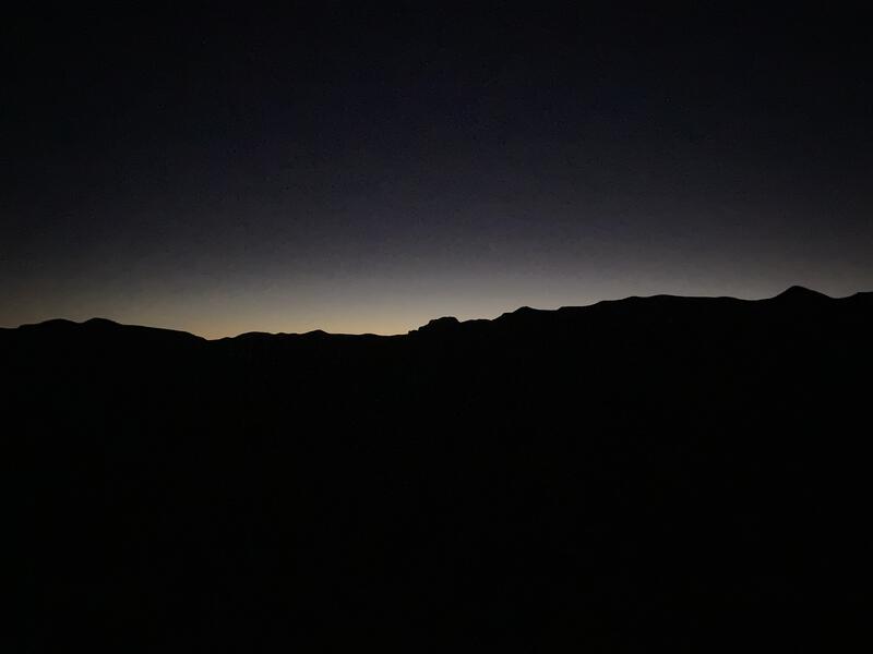
Dark was the sky above Apache Lake, and if I would have let my eyes adjust from the predawn drive, the Milky Way could have been clearly visible. I ignored the lure of star-gazing, teeth chattering in the cold morning air, and quickly donned my gear and flipped on the headlamp, leaving my Jeep parked at the lake viewpoint. The planned loop for today was already over 30 miles, and, thanks to a portion of Apache Trail (AZ-88) still being closed, my day was going to be even longer. A mile of off-trail climbing was waiting between me and the trailhead.
A few steps along AZ-88 and then I dropped down to a wash, heading east on the wide, sandy expanse, trudging over the soft ground and weaving around a few snags that collected dead limbs and spiky plants. It was slow, yet easy, travel in the dark. All I had to do was follow the wash upstream until it ended near the trailhead. As my luck would have it, I took a wrong fork along the way, and my route quickly narrowed until I was pushing through overgrowth, all resemblance to my easy morning stroll gone. Annoyed, I cut up the bank and followed the ridge uphill, assuming that any upward direction was a good direction. This was a crumbly and difficult option, frequently forcing me to reference GPS and even scramble up a few sections. When I did finally reach the closed access road to the trailhead, scratched and panting, I was already behind schedule, but at least the morning chill was gone, forgotten in the sweaty, dangerous climb. A few short minutes later and I reached the dark trailhead and could begin the true hike.
A very early start
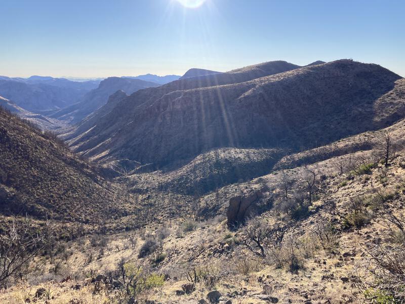
Reavis Trail was wide and easy to follow, even after a few seasons of neglect, with only a few minor washouts to hop across and downed agave stalks to step over. The grade was gentle and I cruised, happy to be done with the bushwhacking nonsense, stretching my legs, making quick work of the steady eastward trek. I could barely make out the surrounding hills in the dim light. There was a deep valley to the right and some hills on the left, hills that my trail weaved alongside and slowly traversed, though the features faded into the darkness beyond the meager reach of my headlamp. As the trail turned south the sky began to lighten, and suddenly the sun crested the horizon, casting long shadows and a burst of light on Four Peaks, and I paused for a brief rest, long enough to drink in the views and tuck away my headlamp, and then I continued towards Castle Dome.
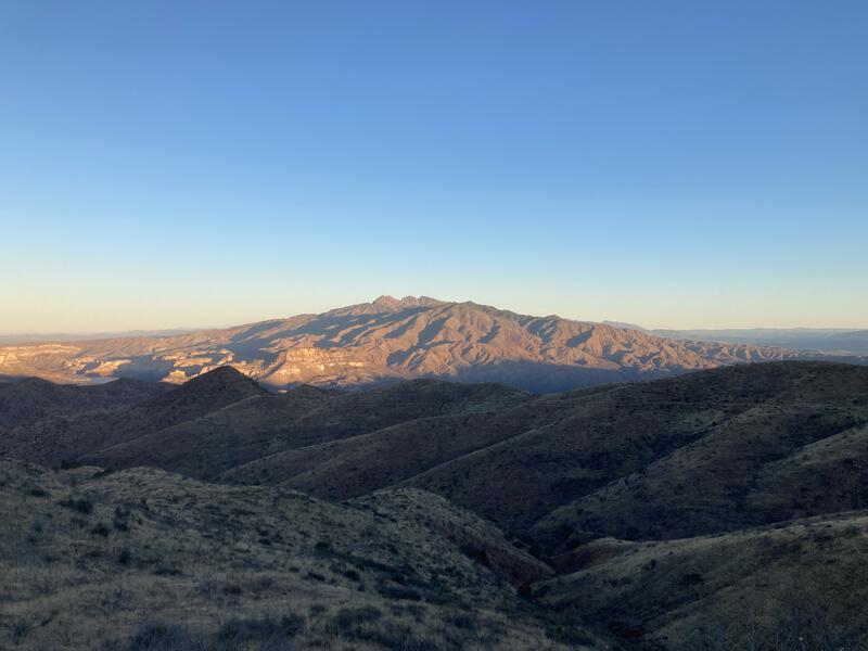
Four Peaks in the morning light
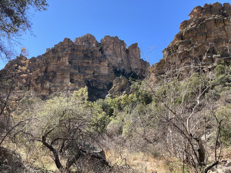
Castle Dome was a milestone for this hike. It marked where I'd finally reach 5000' elevation (I started at 2500') and the trail hops the ridgeline, leaving the west-facing hillside for a brief east-facing jaunt. It was also where I'd hoped to enjoy the sunrise. I was about a half-hour behind schedule now, due to the early morning mishaps, though I tried not to let that bug me too much.
This east-facing hillside was much steeper, and the few washouts were more difficult to traverse, entire rockslides to ease across. At least there were a few spots of snow tucked away too, nestled in shaded nooks, from a rare winter event about a week ago. Once past the Dome and its extended ridge there was one, then a second saddle (Windy Pass), and then one more (Plow Saddle). Fire damage was more apparent here, due to the higher elevation, and I was saddened to see large swaths of burned trees next to the trail. I wondered idly just how lush the juniper forests must have been a few years ago.

Fire damage showing up near Windy Pass
Plow Saddle marked the point where my loop looped, and it took some time to find the junction. Frog Tanks Trail starts at the saddle and heads down, into Paradise Canyon, and then follows Fish Creek Canyon, eventually meeting Rogers Canyon Trail, and the beginning was barely discernible compared to the well-defined Reavis Trail, a faint dent of grass meandering across an old corral. When it dropped off the saddle it was a sharp, rocky plunge, traveling over loose rocks and plagued with deadfall, and I had immediate misgivings about completing this route. Once I reached Plow Saddle Spring, which had a meager trickle and a few small pools, the path became easier to follow, even if there was rampant catclaw reaching for unwary passengers.
The trail slowly rounded 4937', continuing to drop into Paradise Canyon, and the surrounding hills and cliffs made for an impressive sight. There were so many awesome hills and canyons, most of which I did not recognize. Catclaw retreated in this open, grassy stretch, and I trotted downhill, thoughts wandering to possible adventures, trying to pick out White Mountain and Cimeron Ridge, wondering if I could visit both those and Rough Canyon in a single day. No doubt the Woodbury Fire would be a major factor in that daydream. Too soon I reached the bottom of the hill, hacking through some final obstacles, and stepped out onto the banks of a trickling creek.

Dropping down into Fish Creek
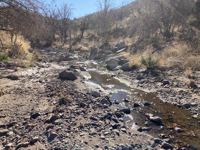
Trickle of water coming from Paradise
I lost some momentum here, daydreams of the pleasant grassy slope distracting me from route-finding. Pulling out a map, I traced the route of Paradise Canyon eastward, speculating on the source of the trickling flow in an otherwise dry land. Rock outlines of an old corral, or perhaps a large cabin, sat a few yards from the trail, and I meandered over, imagining what life could have been like a hundred years ago for the rancher who built it. When I did try to find the trail, a half-hearted attempt at best, all I found was catclaw and deadfall crowded over a narrow track, and so I dropped back into the creek. Frog Tanks Trail followed this creek anyways, so if I walked a trail or rock-hopped the creek didn't matter much.
My going was slow and I couldn't care less. Eventually the burn damage faded away and large sycamores provided a welcome shade from the late-morning sun, and between the trickling creek, deep pools, and green surroundings, it felt like I was hunting waterfalls in the Midwest, if I ignored the prickly cacti and agave hanging onto the cliffs above. Rough Canyon passed by, and then the junction with Fish Creek, and my route turned south up Roger's Canyon, a tributary of Fish Creek. I pulled one liter of dirty water from a particularly clear pool of water before continuing, which was well-timed, as the water disappeared and I was left in a dry, sandy, rocky creekbed.
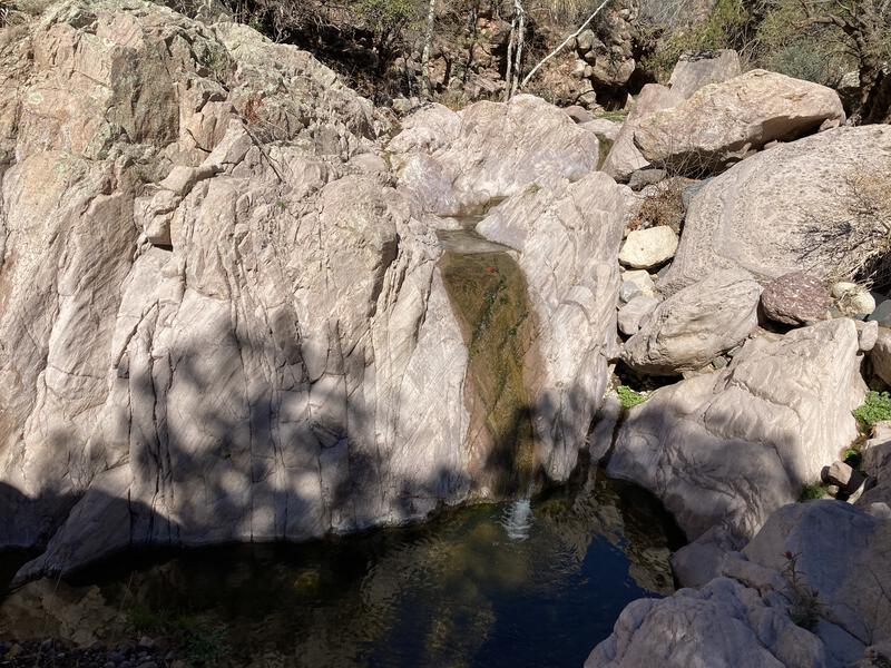
Small waterfalls along Fish Creek
Big cliffs around Roger's Canyon
The next two miles absolutely dragged. The trickling water was gone and I was walking directly into the sun, and any morning coolness dissipated under the midday light. I tried to push on, stupidly, to my planned lunch rest stop, either Angel's Basin or the ruins near it, and my legs protested loudly. When I did reach Angel's Basin, the junction with Roger's Canyon Trail and a popular overnight campsite, I was discouraged by the lack of water, so I pushed on a short distance to the ruins, where I bumped into my first hiker of the day, and, feeling especially antisocial, made little attempt at conversation and continued up the trail after only a cursory glance around. The mid-hike blues were in full affect, and even though a thirty-minute lunch break would have been a great cure, I chose to march on in misery.
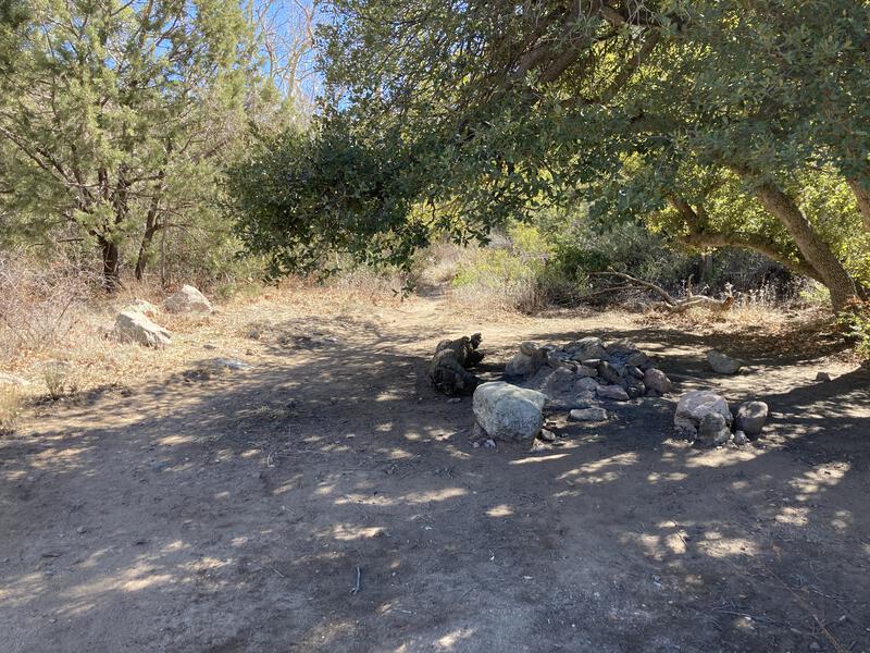
One of many campsites in Rogers
More hikers showed up beyond the ruins. Roger's Canyon Ruins is a popular destination for people with vehicles capable of reaching Roger's Trough Trailhead, of which my Jeep is not. Some of the hikers were well prepared with backpacks, others trudged past in jeans and sandals, and most of them eyed me up with suspicion, my dirty, torn shirt all sweat-stained. I finally reached the next junction and quickly turned down it, now back on Reavis Ranch Trail, and enjoyed the relative solitude.
A few hundred yards and I found a nook of shade and huddled in, desperate for a quiet break. I sipped some of my remaining clean water and got ready to filter the dirty liter I had pulled from Fish Creek, when I discovered that my water filter was almost completely plugged. Should have tested the darn thing before leaving the house. It took five times longer than normal to get a clean liter, and then the taste seemed overly suspicious, though I chalked that up to imagination. Guess this would be a dry hike out - even if I could find some water later in the day, it'd take an eternity to filter. I snacked on a few things, washed down the crumbs with meager mouthfuls of water, and tried to prepare for the 800' climb ahead.
When I got moving again, making my way up the sunny, shadeless switchbacks that climb up to Reavis Ranch proper, I felt strangely recharged, even with the short break and lack of water. I'm not sure if a short break was all I needed or if my resignation to the tough return gave me some extra fortitude. Regardless, I embraced the recharge and cruised up the trail, climbing quickly, wishing the few backpackers on their descent a cherry greeting. The second wind felt great and I soon crested the saddle.
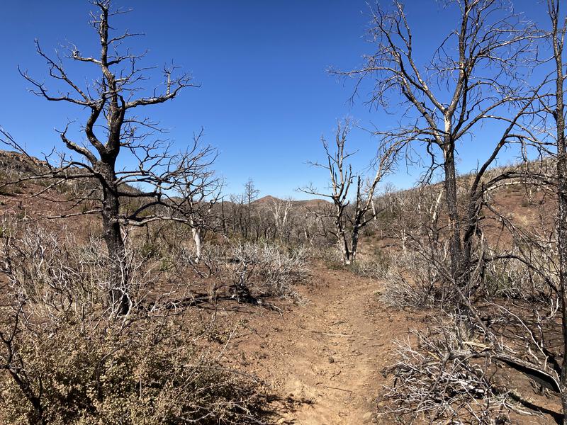
Severe damage at Reavis Saddle
Fourteen miles sat between me and the Jeep, and it was past two in the afternoon. No matter how optimistically I tried to round the numbers it was obvious that I'd be out on the trail after dark. At least it was mostly downhill, and even if I had to tackle that nasty off-trail hillside after sunset, my route was somewhat familiar. I found a small trickle of water (the upper reaches of Reavis Creek) to splash the sweat off my face and trotted north, eventually entering Reavis Valley, which was largely protected during the Woodbury Fire and had long stretches of pleasant, shaded forest to hike through.
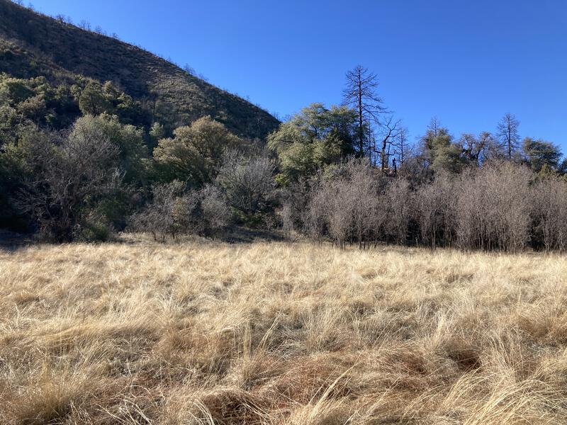
Burned hills surrounding sporadic damage in Reavis Valley
There was no one up here - all of the weekend backpackers were already most of the way back to their vehicles - and I was only vaguely familiar with the valley's sights, so I didn't dawdle much. There were fields of long grass, the Fireline Trail junction, a few creek crossings, the ancient Alligator Juniper, some stands of pines, at least one cement foundation, and then an apple orchard, spotted just off trail. When the second junction showed up, Reavis Gap Trail, which is how the Arizona Trail leaves the valley and continues towards Four Peaks, I stayed on Reavis Ranch Trail, and the conditions quickly worsened. Feeling warm and tired I stopped for a quick break, trying to convince myself that I was almost done.
The trail continues north for a little longer, gradually leaving the towering forest and re-entering the scrubbier, burnt juniper remains, and then it turns west, leaving Reavis Creek and returning towards Plow Saddle and Castle Dome. One of my crazier options for the day was to stay with Reavis Creek and head off-trail, down to Reavis Falls, and that was so far removed from the reality of what I could realistic do that I literally laughed when I reached the turn. I stuck with the trail, making my way around 5305', giving myself a short break at the saddle before hauling up to Castle Dome, getting more and more eager to finish.
A hot afternoon sun over the valley
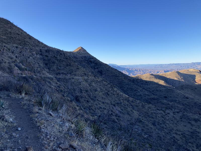
Trail winding around Castle Dome
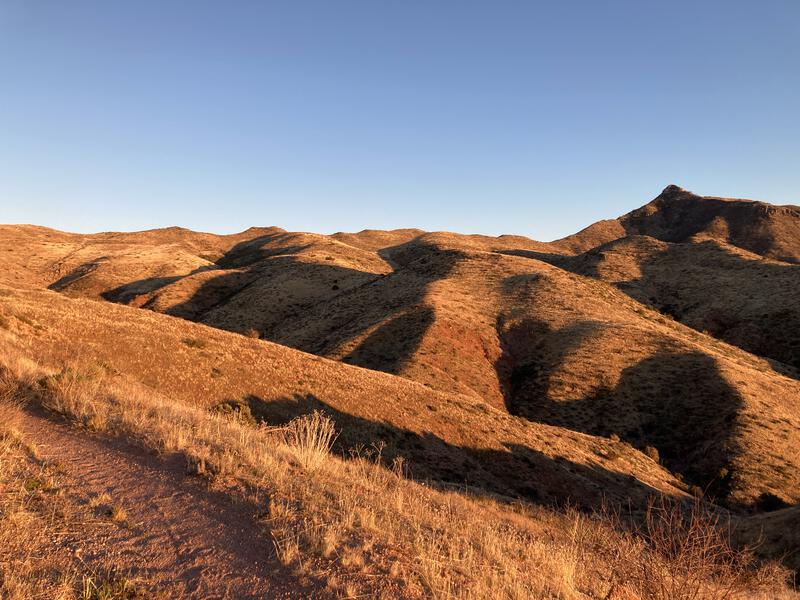
Late sun on the rolling hills
Once past Castle Dome I felt some relaxation soak in. There were still plenty of miles, and the sun was getting low, but my path was set. The trail was wide and easy and the day's heat fading, and I trotted in the cooling air, admiring the golden hills surrounding me. The hours passed quickly and before I knew it I was close to the trailhead, admiring the view of Four Peaks over Apache Lake and pulling my headlamp out.

Four Peaks in the evening light
I was in no mood to repeat the morning's crumbly hillside adventure, so I was left with two options: follow the road down to AZ-88 for an easy five miles or take the wash down for a difficult mile. The latter sounded more appealing, so I found the wash I had lost in the morning and headed down. It was quickly clogged with deadfall and I was forced up and over the banks multiple times. Eventually it widened and I had an easy, if sandy, walk down, with only a few weird branches or obstacles to work around. I reached the bottom an hour after sunset and sent the all-clear to Katie.
This was definitely one way to hike the loop, and it made for a really scenic, full day. However, as I drove away, I accepted that a multi-day approach could make for an enjoyable adventure. Slowing down is not something that comes easily to me, yet having some more time to explore the ruins and Reavis Ranch would be nice, and there's so many side treks that could be tacked on. The two hour drive back home was filled with dreams of taking the kids out here, of turning the single day into a long weekend, and of spending extra time enjoying the area more fully.


Comments (0)