Nankoweap Trail
Wind roared off the Kaibab Plateau, tumbling over gullies and canyons and thrashing through pines, plummeting into the fire-scorched forests of Saddle Mountain Wilderness to slam in the side of my Jeep. Huddled behind the tiny vehicle, curled under a strapped-down sleeping bag, I made a feeble attempt to catch a few hours of sleep. I was nerve-wracked and tired, having made the long six-plus hour drive to the North Rim of the Grand Canyon after a tough day at work, and the thought of my planned hike was already stressing me, even without the constant clatter of dead trees around me, each threatening to topple down on me with each gust. When my alarm went off at 3AM I leapt up eagerly, more than ready to get started on the day.
With my gear shoved in the back of the Jeep (even the pillow, which was seized by the wind the moment my head lifted and made it twenty feet down the road before being snagged by a helpful branch) and a rushed breakfast of fruit cups, juice, and granola, I made the short jaunt over to the trailhead and started the climb. Today was another Grand Canyon adventure, and my route would be a unique one. First I had to hike through Saddle Mountain Wilderness and gain 1500' in elevation to reach the North Rim, then make a sharp drop down to Nankoweap Creek at the bottom of the Canyon and follow it down to the Colorado River, and then turn around and hike back out. Due to the remote nature and exposure of sections this trail is one of the most difficult in the park, often traveled as a multi-day backpack, so of course I wanted to tackle it in a single day.
The first mile passed quickly in the dark, a well-defined meadow path with a slight uphill grade, and then there was a quick set of switchbacks that lowered me down to Saddle Mountain Canyon. The second mile followed the canyon upstream and was a sandy slog choked with deadfall, the few options along the banks overgrown by cat claw. The final mile hauled up a ridge with a mean steepness and, while the track was easy to make out by headlamp, I paused multiple times, pretending to look for the route and actually just catching my breath. Wind never let up, even in the thicker forest that was spared from the worst of the fire, and the inconsistent drone combined with the significant elevation gain was exhausting.
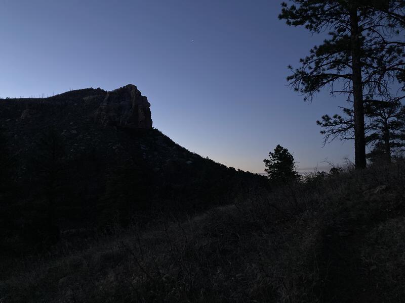
Silhouette of Saddle Mountain in the waking sky
Dim light filtered from the east as I dallied on the rim, looking for the end of the wilderness and the start of the Grand Canyon portion of Nankoweap Trail. When I found the large sign I paused, not to look at words and warnings, but to peer up at the nearby Saddle Mountain and ponder an option. It seemed close enough, and I might be able to find a defined path to the summit, and the sunrise views would be epic... but I was concerned with just finishing the basic route today. I decided to wait until my exit to contemplate tagging the mountain.
Focusing back to the immediate task I circled around the right of the sign and found the break in the rim, a narrow chute that seemed to drop straight into the canyon. After the dark, yet consistent, path this morning, it took some time to adjust to a more scrambling-esque type of travel. I slowly lowered down and then half-slid, half-dropped over tilted slabs of rock, ramping up my caution level to a crawling pace, prickling at the steep walls, narrow path, and ever-present loud winds ripping through the canyon.
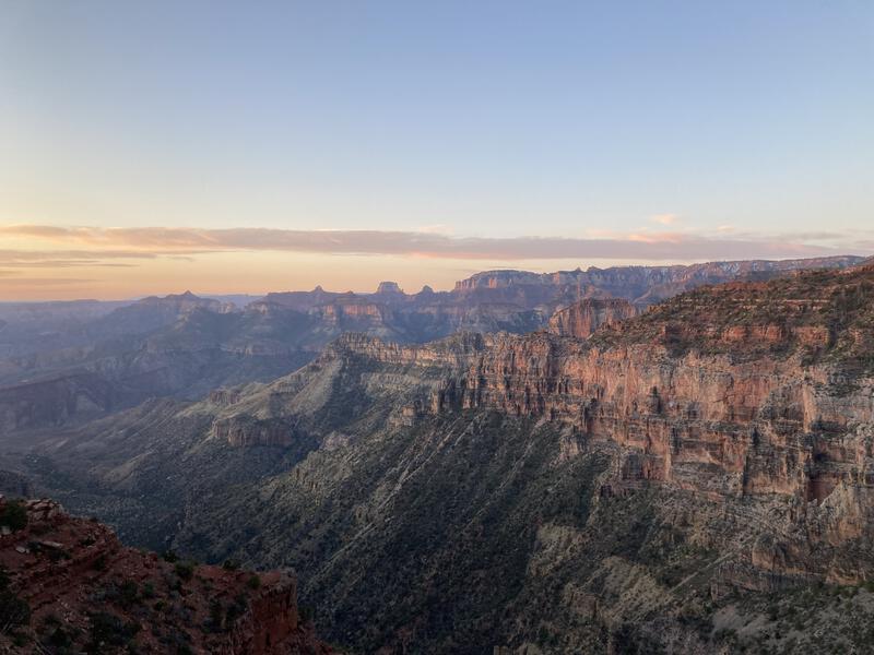
Good morning in the Grand Canyon
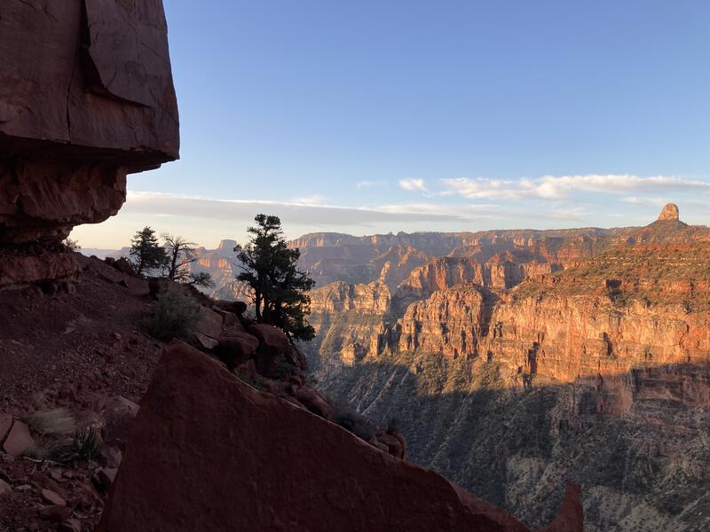
Narrow trail along a big drop
The next three miles dances along the Supai layer of the canyon and is aptly nicknamed "the Supai traverse". There is some descent here, about a thousand feet or so, though it sneaks in with random little drops here and there and is barely noticeable. I sure didn't notice it. The trail hugs the rock wall closely, frequently cutting beneath overhangs, and I felt like an awkward goat, scurrying along the angled ground and defying gravity by more luck than skill. Part of me was enamored by the incredible views and natural trail, while the rest of me was absolutely terrified.
Not only had the wind not let up, continuing its bluster within the canyon and physically shoving me around the treacherous route, but I had also forgotten my trekking poles at home. Poles have been a constant companion on my longer hikes and backpacks since Isle Royale some years back. I use them for balance, speed, and weight distribution, and they have quickly become a natural part of my adventuring, even if that meant carrying them for miles on end and tossing them over a scramble section. Now, when I had miles to hike and difficult terrain to cover and lots of elevation to drop (ouch knees) and ridiculous winds to contend with, I had no poles, and I wasn't sure if I could safely complete this hike without them.
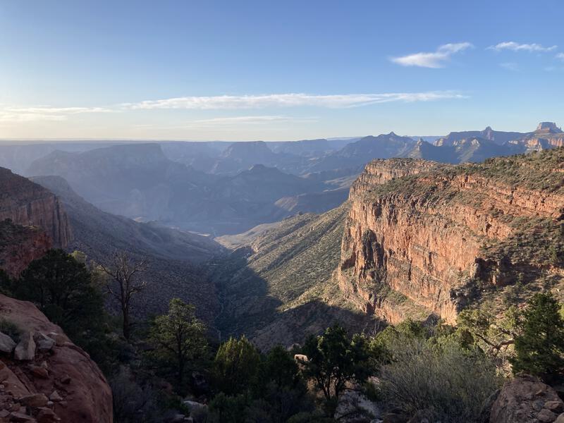
Big drops down into Nankoweap Creek
Without the extra support of my poles I was left with two gangly legs on this sloped, rugged, and gravely trail, and the wind conspired to upset what little balance my tall frame possessed. I began to listen carefully for the gusts and, when the distant roar began to approach, would brace myself, either leaning against the rock wall or crouching down, sometimes even grabbing onto a nearby boulder in hopes to stay grounded. Moving forward along the Supai Traverse was a combination of hurried trots, careful steps, and petrified braces. Turning around seemed too cautious after such a long drive and all, so I kept telling myself that the going would get easier further down the trail.
There were a few intercessions. When the trail sweeps in after passing Marion Point there was some calm, limited protection from the worst of it, and as the sun rose there were longer breaks between gusts. Parts of the trail were more secluded from the canyon drop while others more exposed. The hours passed slowly with my stuttering pace and, gradually, inevitably, I approached the next part of the route. As beautiful as the views and trail are I was thankful to finally leave the Supai layer and make a sudden drop down towards Tilted Mesa, where most of the elevation loss happens.
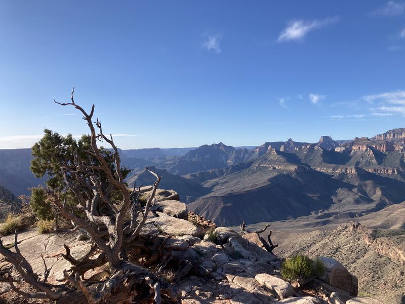
Rugged landscape
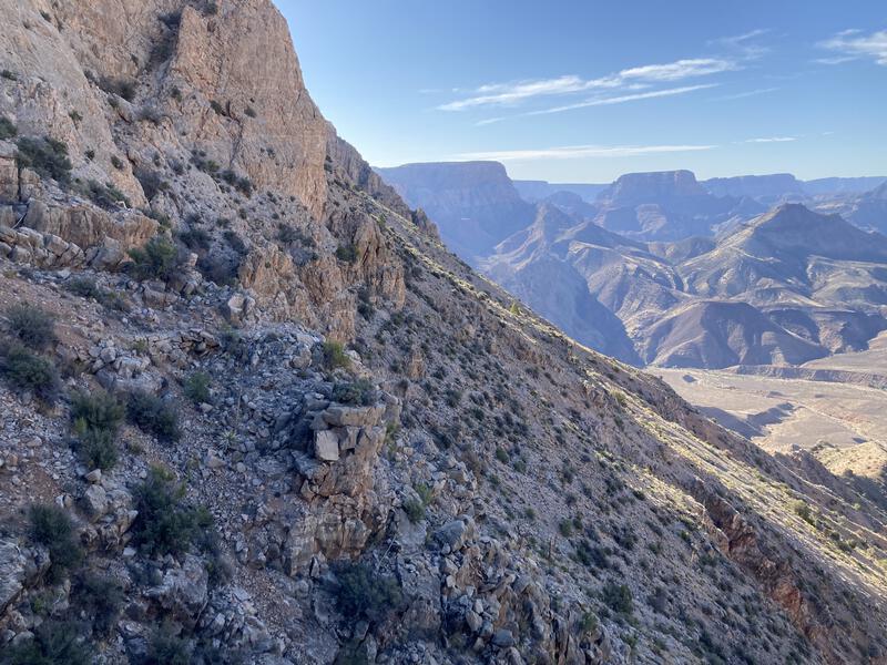
Crumbly trail along the side of Tilted Mesa
2500' of drop over the next two miles was... ridiculous. I've been on tough trails before in the Mazzies, though nothing out there is this consistently steep over such a length. As I peered over the edge of the mesa I realized two things about this section of trail: most of it would be in the shade (yay) and the steepness meant that it would be a loose, crumbly scramble (boo). I missed my trekking poles.
There were a few cairns to help travel the crumbly, eroded backside of Tilted Mesa, which was helpful, even if all the rock out here was the same yellow-grey, sandy hue. I think I was able to keep on the right path, or at least a path, as I never cliffed out and sometimes (very rarely) was able to make out a print from past travelers. The landscape was a treat, especially as staying on route took most of my attention, and it was only when I paused to look around that I was able to see how much my surroundings were changing. Time slowly passed as I dropped down towards the creek, leaving the cliffs and mesa behind and wandering across the wide valley that surrounded the narrow waterway.
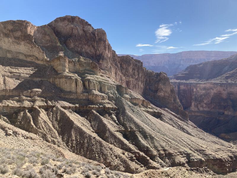
A striking, dynamic landscape
It was nine when I reached Nankoweap Creek, lowering over a few boulders into the cottonwood shade oasis, and I immediately began looking for the nearest trickle to water up. I had four liters of capacity and, while I hadn't drank it all, wanted an excuse to sit out of the wind and do something that wasn't hiking. There were four tents and a small group of women relaxing next to the creek. We had a pleasant chat, talking about the weather (the wind was vicious down here as well, they had to weigh their tents down with rocks) and trail conditions, and then I excused myself and pressed on, following the creek downstream. I enjoyed the trail chat, just needed some quiet time to relax by myself.
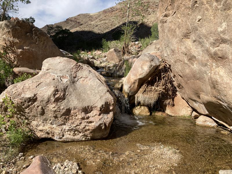
Trickling flow of water within the creek
Once I start moving its hard to stop. Three relatively flat miles stood between me and the Colorado River, and the combination of shade, boulder-hopping, route-finding, and pleasant little creek kept me quite happy, so I walked most of the way before realizing that drinking water is important. Also, I was quite behind schedule at this point. Schedules are silly, scheduling recreation time even sillier, though I didn't want to be stuck in the canyon overnight (which technically requires a permit). Paused long enough to drink a liter and fill two more and then continued moving.
My main goal today was to hike the length of the trail, which meant hiking to the river, and then there were a few options on top of that. I had already passed one (for now) - the summit of Saddle Mountain. Another one was down by the river, the Nankoweap Granaries, a famous ruin with incredible views down Marble Canyon (a nickname for this section of the Grand Canyon). In fact, much of the trail I was following was used by indigenous people to access the river and granaries, and was only recently repurposed for other, less vital, reasons. As soon as I reached the river I turned around, looking for the easiest way to climb up to the ruins.
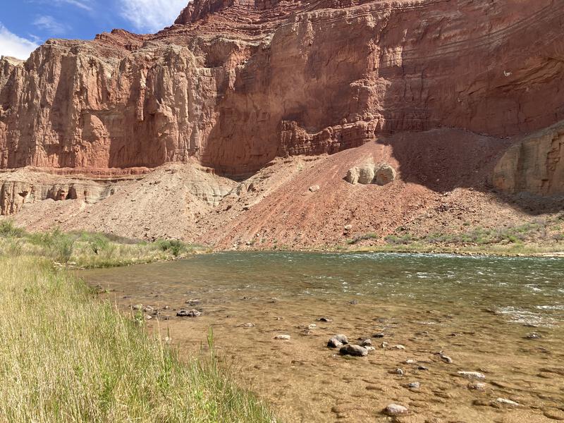
Next to the Colorado River
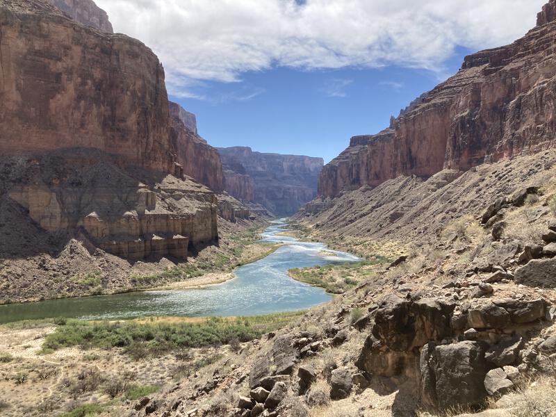
Powerful scene of Marble Canyon
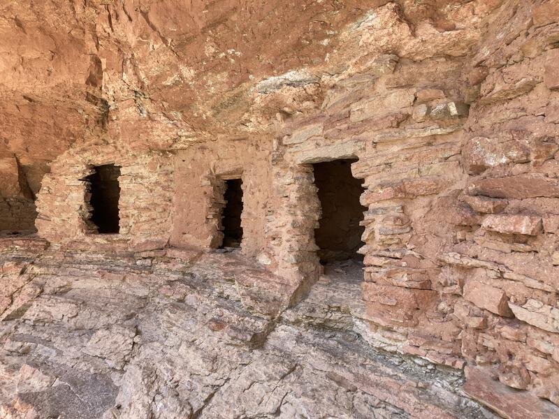
Ancient granaries along the river
This turned out to be an annoying time-burner. The last half-mile to the river was all slow boulder-hopping, with no good trail; following the river downstream led to a few tough bushwhacks; heading up towards the granaries was a sandy, brushy slog; and the final climb was unexpectedly steep. The mid-day sun was hot and, when I finally reached the top, I plopped down on a nearby step, soaked in sweat and feeling quite frustrated. The views were good, ruins were really cool, and I was exhausted, and couldn't help fretting about the long climb between me and the trailhead.
I pushed some water and tried my best to eat lunch. There was no shortage of food in my pack or water around me, only a lack of appetite. If anything, I felt a little sick, possibly from too many sugary treats or the stressful going, and it was difficult to force the much-needed calories in. After a half-hearted attempt I repacked my bag, took one last look around, and headed back down to the creek.
Noontime in the canyon is a real cooker. The lower elevation down here meant that the temperatures were high and one can practically feel the heat bouncing off the walls. While the cliffs along Nankoweap Creek provide some shade, and there are scattered cottonwood groves, much of my walk was toasty, and I couldn't help but feel annoyance at the rock-hopping and route-finding. What protection from the wind I had previously felt was gone now, and the wind funneled perfectly through the small canyon, kicking up eye-stinging sand and upsetting my balance. Before I reached the group of campers I stopped to filter up to full capacity and almost lost some of my gear, so strong the gusts were.
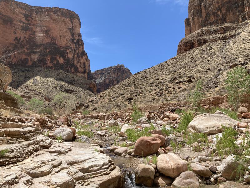
Cooking in the furnace along Nankoweap Creek
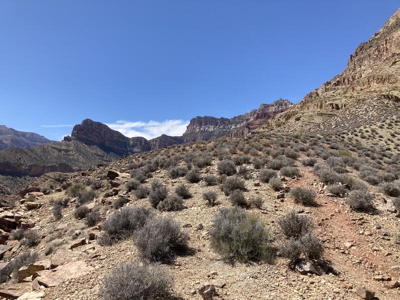
Looking up at an impossible climb back to the Rim
With no small amount of regret I left the creek and started the climb up Tilted Mesa. If I could complete this and the Supai Traverse before sunset I'd be in the clear, though I really wanted to reach the trailhead before nightfall, which could allow me to drive home this evening and escape the relentless wind. Probably shouldn't tackle a six-hour drive after an all-day hike like this... suppose I could get a hotel in Flagstaff if I started to nod off.
Walking down Tilted Mesa this morning was shaded - walking up in the afternoon meant full sun exposure. I put my ego to the side and slowed my pace, one foot in front of the other, taking frequent breaks, ignoring how long each stretch or pause was. It was easy to follow the trail this time. Always easier to track a tough route when you're heading uphill, able to scan the hillside above instead of guessing what's below. With the afternoon heat, long climb, and my exhausted legs, it took quite awhile to reach the top of Tilted Mesa, and then the quick slope above that, and it was close to 5PM when I returned to the Supai Traverse.
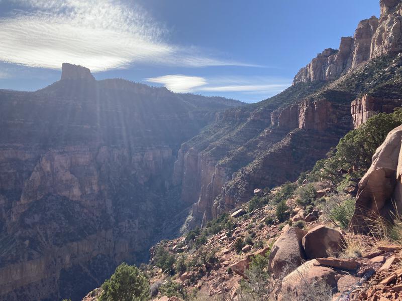
Afternoon light over the Nankoweap Trail
Now, with the relatively flat ground and shaded sections, I felt some degree of relief. Sure, there was still the rugged path and strong wind, but reaching the trailhead before sunset seemed achievable, and I knew I had enough food and water to keep me going. There was a new issue to deal with. The lack of appetite I had felt earlier, down by the ruins, had only increased since, and was now full-on nausea, and I began to wonder if I would end up throwing up. I really didn't want to, not with the limited water and general unpleasantness of the experience, so I decided to allow more frequent pauses and avoid sugary treats for saltier, baser snacks.
The next few miles were strenuous. The uphill grade was slow and steady, wind continued to blast, afternoon sun toasty, and bouts of sickness tiring. At least the views were spectacular. The North Rim of the Grand Canyon is always phenomenal, and this trail was exceptional, with how steep and rugged the terrain is and how lengthy the traverse played. A little less wind and some trekking poles, and perhaps a more balanced diet, would have made the adventure less arduous, yet I had a hard time staying crabby with the vistas. Late-day sun played wonderfully against the dramatic summits and cliffs for a true visual feast.
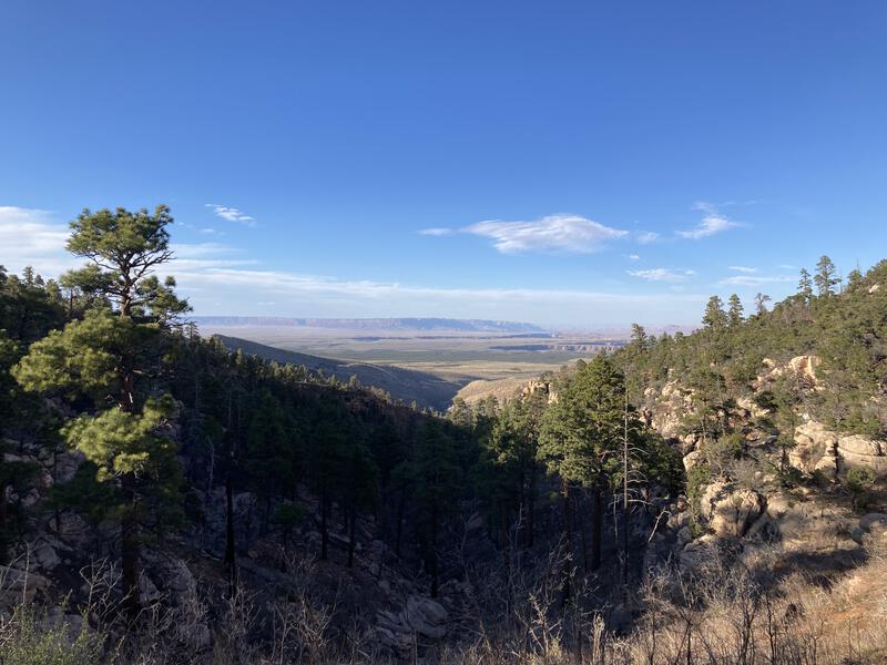
Looking down to the Saddle Mountain Wilderness
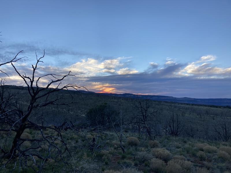
Evening colors on the Kaibab Plateau
With a final burst of energy I reached the rim and leaned heavily against the wilderness sign. Three miles of downhill was all that was left, and any sort of enthusiasm that kept me going quickly drained out as I re-entered the burned Saddle Mountain Wilderness. Nausea came back with a vengeance, forcing me to double over multiple times and breath with wide-mouth gasps, though there was no vomit satisfaction to be had. The sandy wash had filled with swarming gnats throughout the day, seeking out my nose and eyes with surprising accuracy. And then there was that stupid climb out of the wash, the short, mean switchbacks, just when I had promised my legs that I was done with the uphill. I tottered past the trailhead and to my Jeep with weak legs, threw my gear in the back, gulped down several liters of ice water, and started the long drive home. Nankoweap Trail had absolutely tested my limits and I barely passed. It'll be awhile before I try something like this again, especially with the ridiculous winds that the Canyon often promises.


Comments (0)