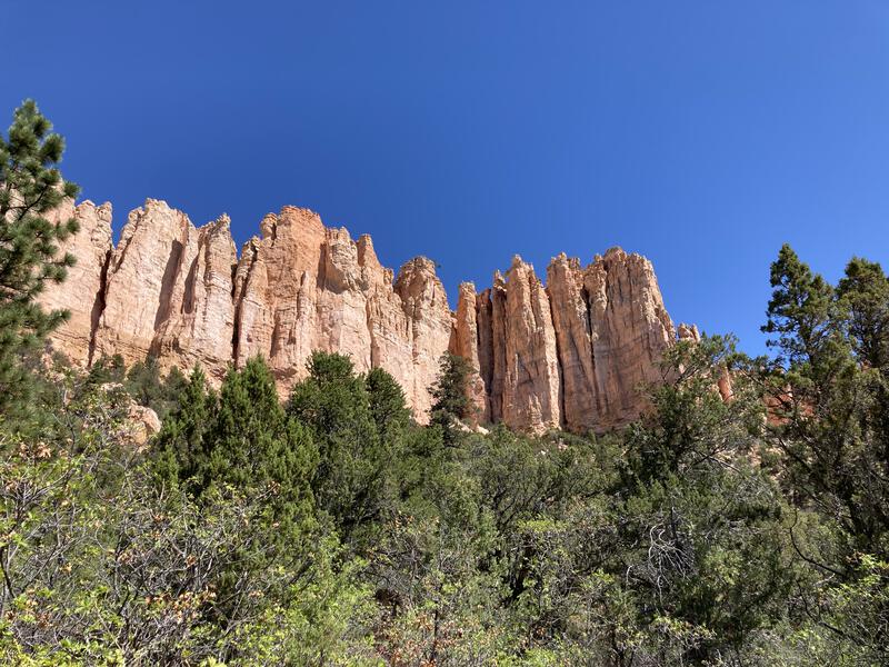
Under-the-Rim at Bryce Canyon
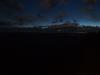
Summer of 2021 was a weird time. Work was hectic and I wanted to get out and do long, epic adventures, yet few destinations in Arizona seemed appealing. The challenge of exploring a remote and damaged area, like the Mazatzal and Galiuro Wilderness, in the summer heat was less than ideal, and my experience on the Nankoweap Trail in the spring scared me away from the Grand Canyon. So I cast my gaze beyond Arizona and was quickly drawn to Bryce Canyon in Utah. With a loose plan and a few words of wisdom from Chris, who had done a winter overnight there a few years ago, I drove up on a Friday afternoon, caught a few hours of sleep in a hammock, and prepared for an unreasonable 3AM start.
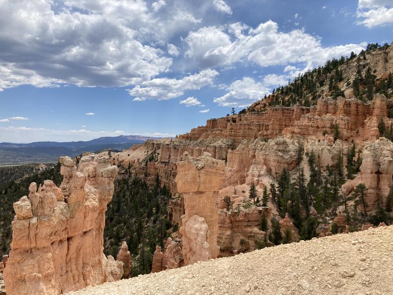
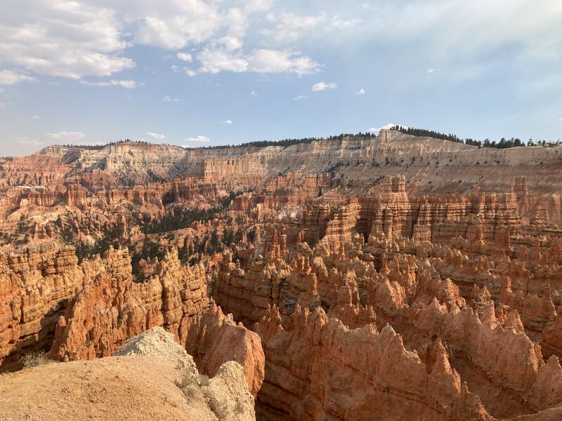
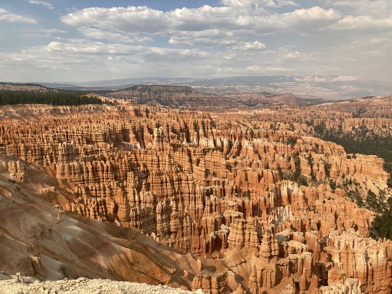
Bryce Canyon isn't much of a canyon -- its more of a rim, a sudden plunge from pine-covered "flats" down to a rugged landscape that eventually leads to the Escalante. The main appeal are the hoodoos, which are spectacular, especially at the north end of the park. There's a trail, aptly called Under-the-Rim, that follows the bottom of the rim from the southern side up to the more popular north. By including the access road I could make a long, long loop, and to avoid too much boredom at once I split the road walk in half. So yeah, at 3AM I parked at Farview Point and started my walk along a dark road, enjoying the dim light of the partial moon and expansive starry sky above. There were no cars on the road to disturb the silence and I enjoyed the 7.5 miles of asphalt more than expected. When I reached Rainbow Point to the south the sun was only beginning to pierce the darkness.
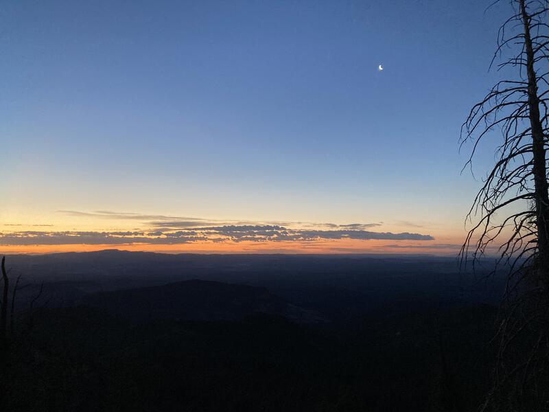
Early morning light over the Escalante
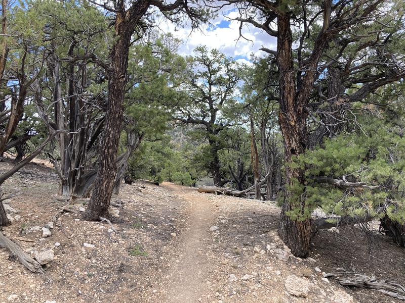
A quick breakfast and it was time to tumble off the rim. The trail quickly dropped through the trees and over sandy escarpments, briefly going through a burn area before entering a lush pine forest. Between the waking sky and the views opening up I was absolutely wowed to the point of exhaustion... or, perhaps, that was the early morning start. When the trail flattened and the sun began to filter through the trees I stopped for a second breakfast, this time coupled with a brief nap.
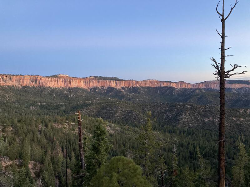
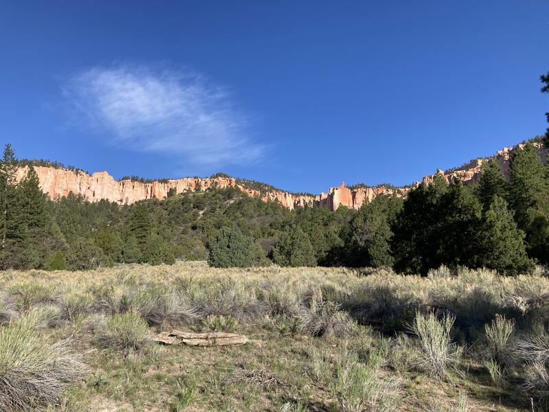
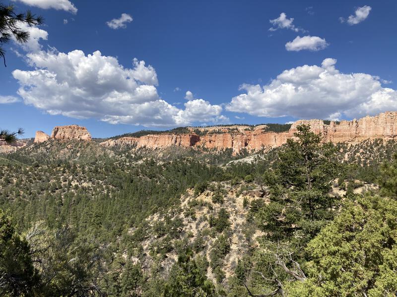
Looking along the southern rim
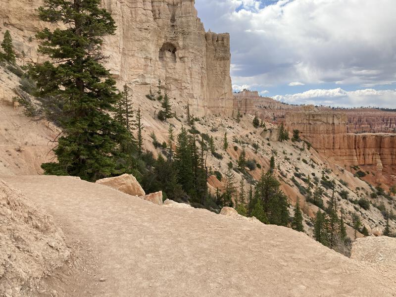
Sand, trees, and rocks
Off-putting sludge around Iron Spring
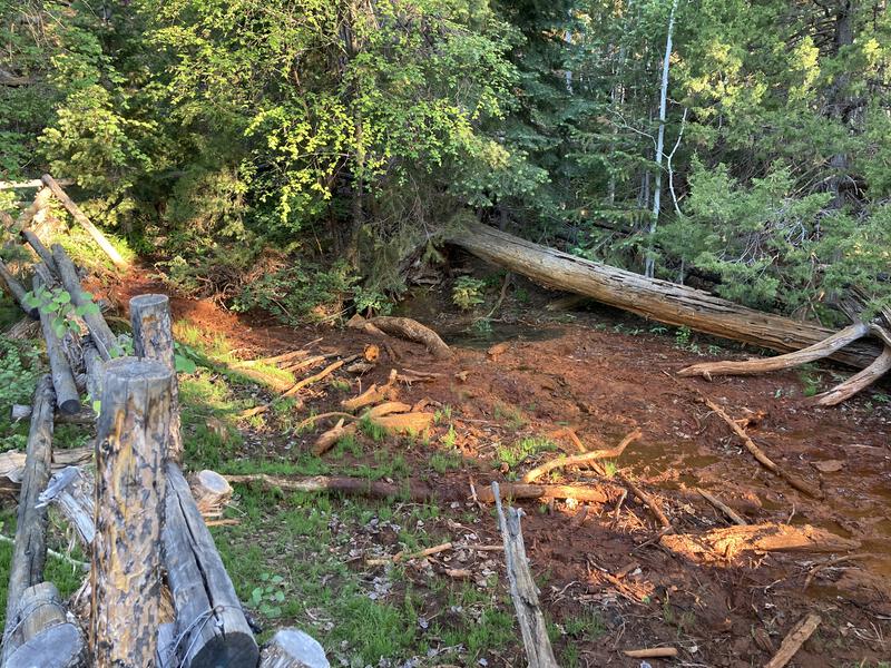
Nap helped with my mood, and I was back in motion with a lighter step. Made a quick stop at Iron Spring to scout it out - water was there and it smelled foul. There are a few dependable water sources down here and, just like the ones in the Grand Canyon, they often have caveats. Sometimes the taste is questionable, or they are radioactive enough to be worried, or they need to have special treatment. Had plenty of water in my pack yet so I kept on moving.
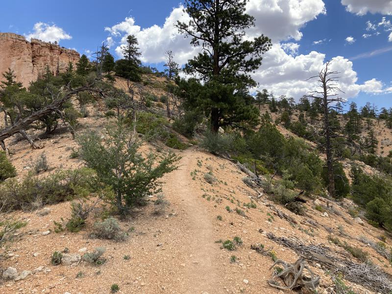
Miles passed steadily under my feet. There were a few trail washouts to hop over, and deadfall to navigate. There were also small, annoying climbs, no more than a couple hundred feet, and often composed of loose sand that sucked the life out of my legs. The trees provided pleasant shade and made the views, when they arrived, all the more welcome. As the morning warmed up I began to see more people on the trail. Most of them were backpackers, moving from one of the many campsites to the next one, and only a handful of dayhikers doing short loops. Rainbow Point wasn't the only easy access to Under-the-Rim. Before I knew it I was looking at Noon Canyon Butte, which just happened to be near where my Jeep was parked.
Grassy meadow along the trail
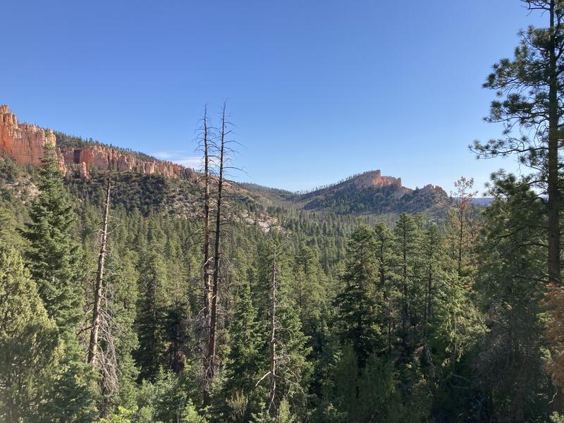
Looking north at Noon Canyon Butte
The hike up to Noon / Mud Canyon was not enjoyable. There must have been a hot fire here recently, leaving no shade to ease the hot morning sun. Trail climbed steadily through low brush, sometimes pokey, other times hiding deadfall until it snagged my feet. A trail runner passed me at an annoyingly fast pace. All this, and the knowledge that a connecting trail could take me back to my Jeep within an hour. I slogged up stubbornly, looked at the connector, and pushed on. The view back at Noon Canyon Butte was immediately rewarding.
Stretch of fire damage
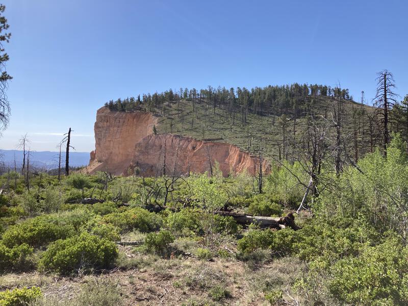
Noon Canyon Butte
Unfortunately, the fire damage continued north, and following Swamp Canyon meant hopping over numerous deadfall and pushing through encroaching brush. Miles 18, 19, and 20 ticked by slowly, a gradual downhill drop into a hot kettle. Forested campsites came back at the bottom, a welcome reprieve, and then there was a short haul up to leave Swamp Canyon behind. I left the third, and final, connecting trail to the top behind, committing myself to the full length of Under-the-Rim.
It was only 11AM, and the views were outstanding, and I was keeping on schedule, and I was unfathomably tired. My shins and calves ached from the sandy sections and the heat felt oppressive. It could have been the sun reflecting off the cliffs above, or the elevation (it is a good 6000' above Phoenix), or I had pushed too hard with my early morning start. I tried again to get my head in the game, taking a long break in the shade and changing out some of my gear. There was at least 10, probably 20 more miles ahead of me, and it was only going to get warmer as the day progressed.
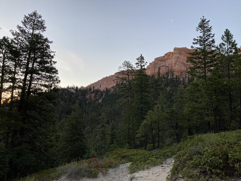
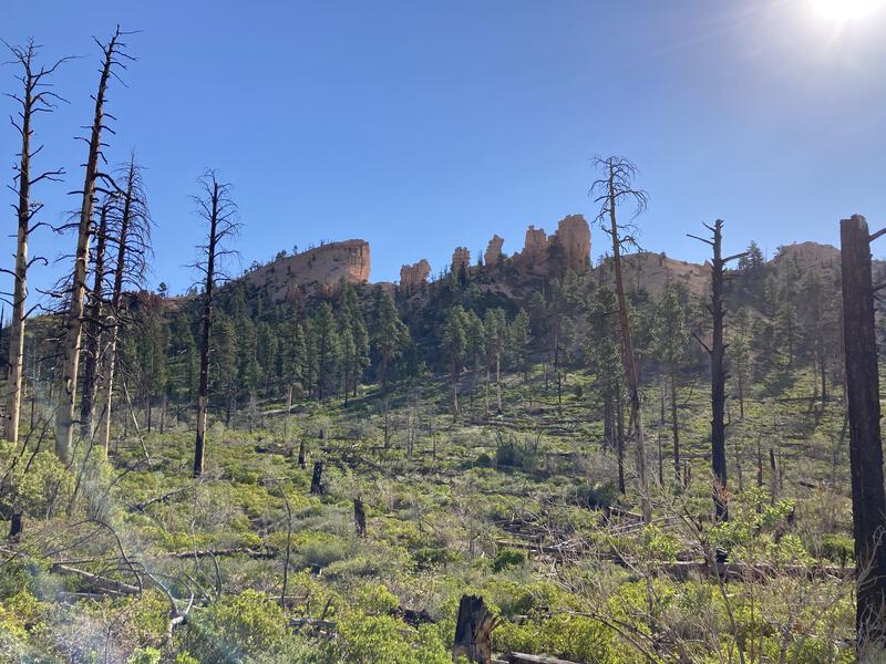
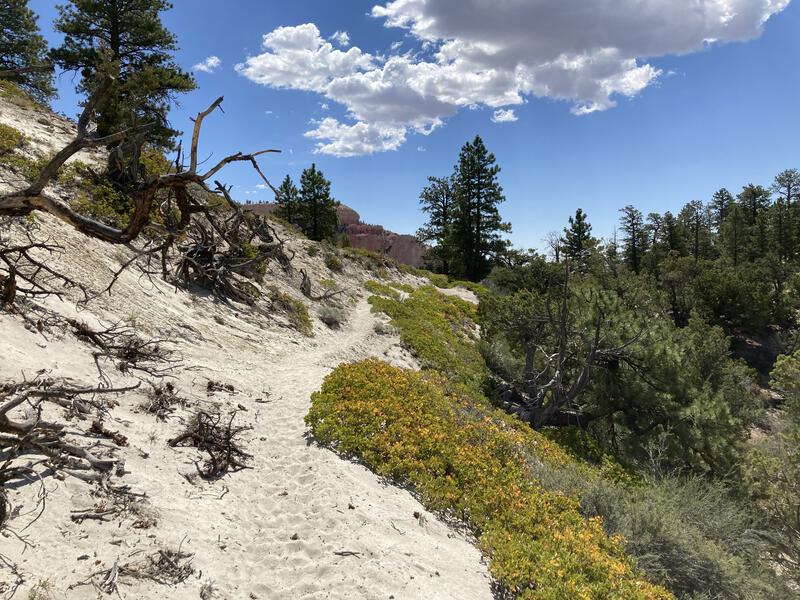
Hint of hoodoos to come
Looking back at the Swamp Canyon area
Slogging through the sand
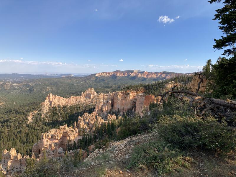
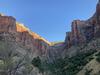
A quick drop into Pasture Creek before another climb, and another drop before another climb, and soon I was at Yellow Creek. This was someplace I had really looked forward to. Not only was it relatively clear water, necessary as my supply was severely depleted, but Chris had told me great things about this area. And it was really cool. The campsites were close to the creek and nestled under bristlecone pines, with fantastical views up to epic pink-hued cliffs above. Somewhere up there was Bryce Point, where the Under-the-Rim trail climbed to the rim. I filtered water under a partly-cloudy sky, thankful for the intermittent shade and enjoying the views around me.
Clouds providing more shade than the forest
Walking between the old trees
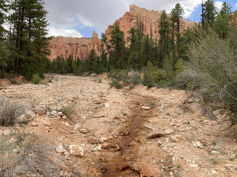
Lovely trickle down Yellow Creek
Water tasted fine, even if it was warm in the exposed creekbed, and I filtered up to full capacity. There was no water at Bryce Point and it was gonna be a few more hot miles before a tap showed up. Warm water would have to do. While I was there I chatted intermittently with some of the backpackers who were already done for the day. Envious. They had slept in this morning, hiked down from the rim, and would spend the afternoon relaxing at their campsite. Not for the first time I wondered if I was doing this hiking thing the wrong way.
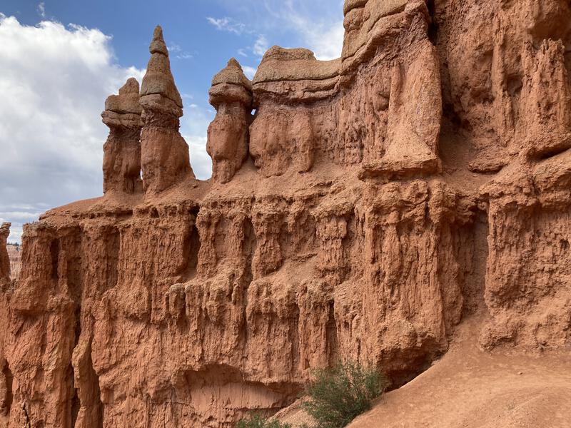
Back to the grind. The trail followed Yellow Creek for a short time before starting a lazy loop around an inconvenient ridge, following a trickling tributary up under welcome shade, and then there was a sharp, sudden climb up to the Hat Shop. This was cool - rocks were balanced precariously on top of hoodoos, looking like it would take nothing but a stiff breeze to knock them over.
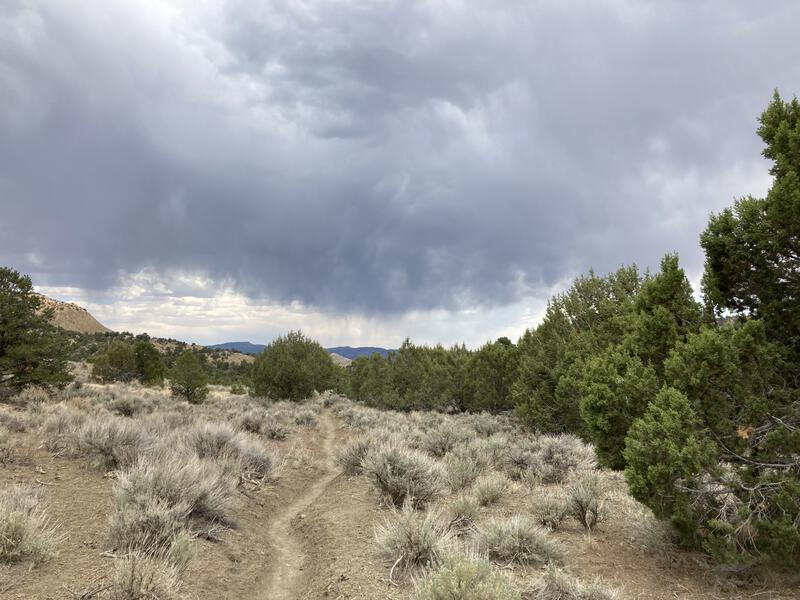
Nearby storms
Approaching Hat Shop, along the big climb
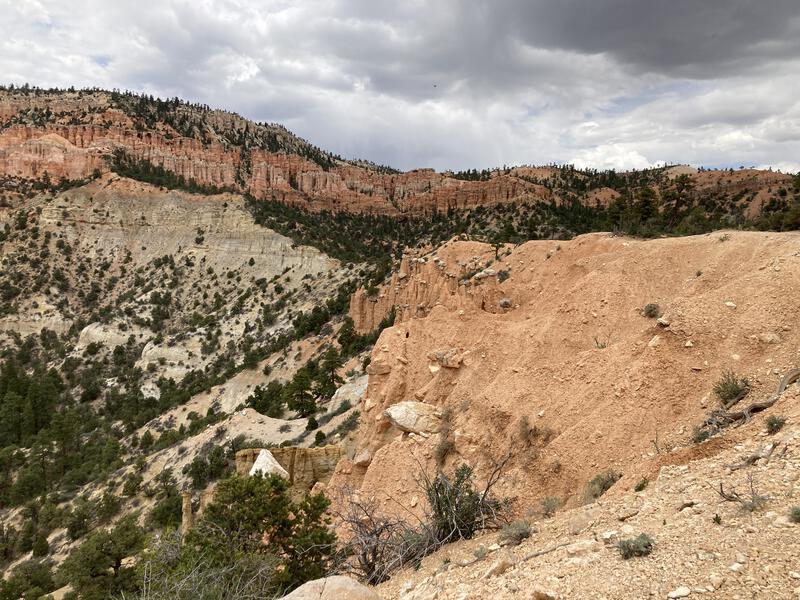
Once past Hat Shop the trail continued to haul up, and up, and up. The hoodoos and cliffs looked unreal so close, like they belonged on a different planet. This climb, while steep, was on solid rock, and I was able to build up a pleasant momentum that soon had me huffing along. There were a few more people here, brave and unprepared tourists who came down for the rim, looking uncertainly uphill at their distant start. Having little patience for such things, I pushed past them, reached the flatter ground, and found a quiet spot in the shade to regroup.
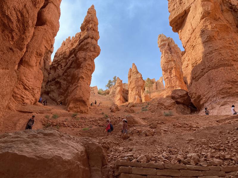
Fantastical formations near Bryce Point
I sat in the shade, legs sprawled out, leaning against the rock, sore and tired and accomplished. I had reached Bryce Point and was done with Under-the-Rim. From here I could start the road back to the jeep, about eight miles to the south or... the trails to the north called to me. It was early afternoon and there were hours of daylight left. The hoodoos that makes this park so famous were right around the corner. And there was a water spigot at Sunset Point, a trail that started where I sat to lead me there, and it would go right through the cool hoodoos and fine, I wasn't done exploring yet. Polishing off another liter of water, paired with caffeine and ibuprofen, and it was time to continue.
On to Peekaboo Trail. It was wide and smooth, a jarring change to the longer trail I had spent most of my day on, and there was plenty of people on it, though it never felt crowded. Sure, there was some annoyance with people playing music or goofing off or complaining about the lack of water fountains, but I had expected some of this with the more popular trails and mostly ignored it. They were probably equally annoyed with me, sweaty from a full day of hiking and clanking quickly along with my trekking poles. Anyways, the surroundings were amazing. The south side of the park was pretty, remote, and quiet, and was a poor mimic of just how cool Bryce Canyon actually is. My jaw practically dragged on the ground as I gaped at the arches and pillars and cliffs surrounding the trail.
A wide, easy walk down Peekaboo
Erosion made this look like more sand than rock
Steep haul up Navajo Trail
Compared to the thirty miles behind me, these few passed in a blink, and before I knew it I was at the bottom of rim again and preparing to take Navajo Trail back up. There is a small maze of trails here and plenty of different loops I could have done, and I just picked a few that would get me to Sunset Point in quick order. I'll be back someday with the kids for more of this end of the park. Navajo has a steep climb through pillars of rock, called Wall Street in some sort of callback to New York's skyscrapers, and this was when the crowds of people became annoying. Switchbacks are steep, annoying, and I prefer to power up them, while a few hundred other visitors decided to stop and gawk and plug up the trail. At least it didn't take long. Made it back to the rim, headed to the water, and drank from the cool tap until my stomach sloshed.
Now, now I was done. There was just too many people here and my body was too tired to add any more loops, even though I could hear Fairyland calling to me. I filled up my pack to capacity and planned my return. There's a Rim Trail that headed south for about a mile, and then it was all road. I didn't like this. The road didn't have much of a shoulder or bike path, and with all the people out this afternoon there was a fair amount of traffic. I could cut out a few bends by cutting through the forest, and maybe utilize a few of those connector trails I saw before to dart under the rim for a short time. Either way, I had a few more hours of hiking before I was done.
Sun-dappled spires
Hoodoos on top of hoodoos
I enjoyed the mile along the rim quite a bit. The viewpoints were solid and it is always fun to see the tiny ants walking on the trails so far below and realize that, yes, you were also an ant, and we're all just tiny ants walking around. Rim trail circled around and kissed Inspiration Point, which is just another overlook between Sunset and Bryce, and I guess it continues even further. It was time to hit the road, though.
Rough way to close the loop
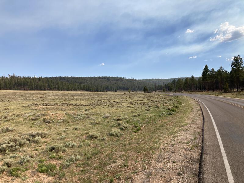
Road walking was worse than I had feared. There were a few sections, hundreds of feet long, where the shoulder was wide enough to walk, and many more that it was too narrow. Cars were frequent enough that I had to hop off the road, stand in the ditch like a misplaced scarecrow, every few minutes. What had looked like an open field ready for easy crossing was a bunch of grassy hillocks that had signs warning people to stay off due to sensitive vegetation and animals. I should have parked the jeep this far back and done the entire road in the morning, before anyone else was up and exploring.
A mile in and a ranger pulled up next to me, asking exactly what I was trying to do. Once I explained she scoffed and told me to hop in the back. Sheepishly, and thankful for the ride, I got in and she drove me the rest of the way. We chatted a bit about dogs and the park and whatnot, though it was predictably awkward. I was thankful to see my car and wave her goodbye.
Reviewing my route from Farview Point
That was a surprising ending. I had decided to skip out on the Fairyland trails due to time and energy constraints, conserving both for the final walk, and now I had both thanks to the free ride. Briefly I considered driving over and doing another hike, or... I started the jeep and began my drive home. The extra time would give me just enough daylight to reach Page at sunset and home before midnight, and I missed the family. Bryce Canyon had been fun, and a real visual treat, and a good out-of-Arizona adventure overall, but I was ready to be done and sleep in my own bed tonight.
Comments (0)